<?xml version="1.0" encoding="UTF-8"?>
<feed xmlns="http://www.w3.org/2005/Atom">
  <title type="text">Intermountain Histories</title>
  <updated>2026-08-18T15:52:41+00:00</updated>
  <generator uri="http://framework.zend.com" version="1.12.20">Zend_Feed_Writer</generator>
  <link rel="alternate" type="text/html" href="https://www.intermountainhistories.org/"/>
  <link rel="self" type="application/atom+xml" href="https://www.intermountainhistories.org/items/browse?output=rss2"/>
  <id>https://www.intermountainhistories.org/</id>
  <author>
    <name>Intermountain Histories</name>
    <uri>https://www.intermountainhistories.org</uri>
  </author>
  <link rel="hub" href="https://pubsubhubbub.appspot.com/"/>
  <entry>
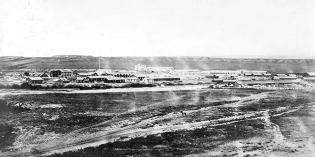
    <title type="html"><![CDATA[Fort Bridger and the Donner Party]]></title>
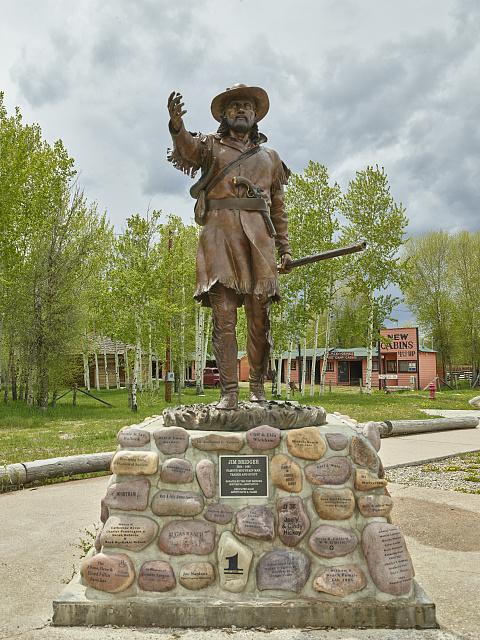
    <summary type="html"><![CDATA[<p><strong><em>On July 20th, 1846, a group of families on an emigrant train in present-day Wyoming separated from the main party to take a supposed shortcut that would expedite their journey to the Mexican territory of Alta California. This group known as the Donner Party started their journey on the cutoff with the goal of reaching Fort Bridger, which would be the point of no return on their ill-fated journey. </em></strong></p><img src="https://www.intermountainhistories.org/files/fullsize/e6c5db8e3d5e018d3b0a52d9335af3ff.jpg" alt="Statue of Jim Bridger at the Fort Bridger Historic Site" /><br/><p>Mountain men and adventurers Jim Bridger and Louis Vasquez established this fort in modern-day southwest Wyoming in 1842. Originally built as a trading post to service and profit off the rush of the trappers heading West, it found purpose as a resupply point for emigrant parties heading to California. While the word “fort” brings to mind high stone walls, a California-bound party led by Edwin Bryant in early 1846 described Fort Bridger as <i>“two or three miserable log cabins, rudely constructed, and bearing but a faint resemblance to habitable houses.”</i> The Donner Party reached Fort Bridger on July 27th, 1846. Earlier on the trail, the party had received letters from Lansford Hastings, the author of the cutoff. He advertised it as an alternative and shorter route, and said that if they met him at Fort Bridger, he would guide them through it. Despite James Clyman’s warnings of the cutoff to James Reed, a father of 6 and leader of the party, the allure of time and distance saved proved seductive. According to survivor reports, James Reed believed that the route would save them <i>“350 or 400 miles” </i>and relayed that Bridger had described it as ”<i>a fine, level road with plenty of water and grass.”</i> It is theorized that Bridger, a seasoned mountain man, knew of the danger of the cutoff but goaded them on regardless to increase emigrant traffic through his fort. After repairs, restocking, and rest, the Donner party left Fort Bridger on July 31st. Growing from around 60 members to 74 because of the addition of the McCutchen family and several teamsters. They proceeded towards the Wasatch Mountains in modern-day Utah. Emigrant parties continued to utilize Fort Bridger for the following decade, but the Donner party remains one of the most influential to do so. The fort remained operational until Bridger's run-ins with the law caught up to him, including an arrest warrant issued from Salt Lake City, Utah for <i>“furnishing the Indians with powder and lead to kill Mormons.”</i> The fort was sold to the Church of Jesus Christ of Latter-Day Saints (or Mormons) in 1855, with the church having documents of its sale from Vasquez representing both him and Bridger. The Saints held onto this fort until November of 1857. President James Buchanan sent an army commanded by General Albert S. Johnston to suppress a supposed Mormon rebellion. In preparation the saints burned several buildings before retreating to Echo Pass in Utah. Following its abandonment by the Saints, the fort was seized by the United States military, where it saw its commanders switch hands for decades. It found use as a staging area for military exercises against Native Americans and general military travel during the mid 19th century. As the years passed, the land under Fort Bridger’s jurisdiction became smaller as the threat of attacks from Native Americans subsided. It was abandoned on October 1st, 1890. This trading post, fort, and military depot served as a landmark for Western history as emigrants, natives, and mountain men all crossed its path. For the Donners, it served as their final resupply point, and for many the last semblance of civilization they would ever see. For the next 760 miles, the Donners would travel through rough mountain passes and barren salt deserts with minimal rest and resupply. The ill-intentioned words of Hastings and Bridger would prove to be a death sentence.</p><p><em><strong><a href="https://www.intermountainhistories.org/items/show/940">For more (including 6 images) view the original article</a></strong></em></p>]]></summary>
    <published>2026-02-02T17:23:00+00:00</published>
    <updated>2026-04-17T19:32:21+00:00</updated>
    <link rel="alternate" type="text/html" href="https://www.intermountainhistories.org/items/show/940"/>
    <id>https://www.intermountainhistories.org/items/show/940</id>
    <author>
      <name>Samuel Watson, Brigham Young University</name>
    </author>
  </entry>
  <entry>
    <title type="html"><![CDATA[London Bridge in Arizona]]></title>
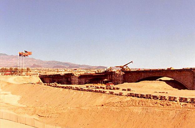
    <summary type="html"><![CDATA[<p><strong><em>While traveling the highways and rural paths of the American Southwest, it’s common to run into historical markers or monuments. In Lake Havasu City, Arizona, you can walk and drive along one that surprisingly originates from Great Britain.</em></strong></p><img src="https://www.intermountainhistories.org/files/fullsize/eb4a00dec8faaa2863b7452eb68fb4ca.jpg" alt="Construction of the London Bridge before a man-made canal was run along under it, Lake Havasu City, Arizona." /><br/><p>In 1958, entrepreneur and city planner Robert P. McCulloch envisioned a city in Western Arizona that would attract retirees and tourists. He purchased several thousand acres of land on the east side of Lake Havasu, a reservoir behind the Parker Dam along the Colorado River. The recreational aspect for his city was set, a dazzling blue and green lake set in contrast with the hot and red desert was sure to attract retirees. However, further appeal was needed to attract tourists and full time residents who would call the city home. A prospective attraction appeared in 1967, when it was found that one of the historic “London Bridges” along the Thames River in London, England was not structurally stable and would need to be replaced.
John Rennie of Scotland was the designer of the bridge, and completed its construction in August of 1831, replacing the original bridge constructed in 1209. When the officials found it structurally unsound in 1967, instead of demolishing it, they tried selling it. McCulloch’s oil company brokered a deal and bought the bridge’s exterior masonry for 2.46 million dollars at the end of 1967 (a sum worth almost 23 million dollars today when adjusted for inflation). Local newspaper <em>The Arizona Republic</em> reported the sale on April 19, 1968, writing that the bridge would “<em>serve as a centerpiece for the city’s leisure industry and an attraction to entice travelers to Lake Havasu City from transcontinental highways.”</em> The bridge that now exists only contains this exterior masonry. When shipment and construction began in 1968, they used a base concrete skeleton on which the veneer of the original stone masonwork was placed. The five arched bridge was built over a dip in the sandy earth of a peninsula jutting into Lake Havasu, through which a man-made canal was created. This made it so that the structure bridged together the newly created ‘Pittsburgh Point Island’ and mainland Lake Havasu City.
The bridge opened up with much fanfare and excitement in 1971. The opening ceremony featured a parade of flag-bearing boy scouts, fireworks, and the mayor of London who placed the foundation stone in 1968. Following construction, Lake Havasu City grew steadily because of efforts from McCulloch. He would fly in potential homebuyers, build hotels and stores on his own dime, plant palm trees to add greenery, and yes, even construct one of London’s famous bridges in the middle of the desert. What started as a dream in the desert has since turned into a city of over 57,000 people. Whether the London Bridge serves as a monument to foreign lands or a tourist trap is dependent on the visitor. But for those that live in this desert city, the bridge is one of the many attributes that makes them call Lake Havasu City home.</p><p><em><strong><a href="https://www.intermountainhistories.org/items/show/939">For more (including 5 images) view the original article</a></strong></em></p>]]></summary>
    <published>2026-02-02T17:22:18+00:00</published>
    <updated>2026-04-17T19:32:21+00:00</updated>
    <link rel="alternate" type="text/html" href="https://www.intermountainhistories.org/items/show/939"/>
    <id>https://www.intermountainhistories.org/items/show/939</id>
    <author>
      <name>Samuel Watson, Brigham Young University</name>
    </author>
  </entry>
  <entry>
    <title type="html"><![CDATA[The Standoff at Ruby Ridge]]></title>
    <summary type="html"><![CDATA[<p><strong><em>On August 21, 1992, Randy Weaver entered into a 10-day standoff with federal authorities in remote northern Idaho. By the time he surrendered himself into custody, his wife, son, and Deputy U.S. Marshall W. F. Degan had been killed. This conflict changed the way which federal authorities responded to domestic crises and ignited controversies in the American militia movement.</em></strong></p><img src="https://www.intermountainhistories.org/files/fullsize/6284097f050e49b0fccf37ce0438262b.jpg" alt="Anti-Government activists supporting the Weavers at Ruby Ridge" /><br/><p>The Weavers lived in Ruby Ridge, an area in Northern Idaho which featured a prominent “militia culture.” Randy, a military veteran, had connections with militias and extremist groups in the area which brought the attention of federal authorities. In 1989, at the prompting of an undercover Bureau of Alcohol, Tobacco, Firearms and Explosives (ATF) agent, Randy began selling shotguns with illegally shortened barrels, a felony. Randy was summoned to appear in court the following year on February 19, but having been told the incorrect date, never showed up. Now with the added charge of failure to appear in court, U.S. Marshals prepared to arrest Randy Weaver on his property.
            Randy, his wife Vicki, and their 3 children were deeply religious. They believed in certain survivalist and doomsday principles taught by right-wing Christian extremist groups. They lived alone on their rural Idaho property, paranoid of outsiders and liable to engage in any means of self defense. Believing Randy to be dangerous and working off an exaggerated file they had built on him, U.S. Marshals began surveillance on his property to ascertain how to arrest him.
Having found hidden cameras placed by the Marshals, the Weavers grew increasingly paranoid and carried guns with them at all times leading up to August 21, 1992. A team of Marshals was conducting surveillance when the Weavers’ dog, Striker, ran out barking.  Randy followed with his son Samuel and family friend Kevin Harris. One Marshal shot Striker and Kevin returned fire, killing Deputy U.S. Marshal W. F. Degan. As the Weavers retreated, the Marshals returned fire, injuring Kevin and killing Samuel.
The death of a federal official meant the FBI would take over the Weaver case. The most controversial aspect of this takeover was the rules of engagement of the FBI. Using its Hostage Rescue Team, the agents were instructed that any armed male standing outside of the family’s cabin “could and should” be shot. On August 22, FBI sniper Lori Horiuchi followed these rules of engagement and fired at Randy as he walked outside. Randy retreated into the cabin as Horiuchi took a second shot. Unknown to federal authorities, this bullet flew through the open door and killed Vicki Weaver inside.
Thereafter the Weavers dared not go outside of the house and crawled on their hands and knees inside to avoid walking past windows. Government protestors formed outside of the property as the FBI sought to de-escalate. On August 30, military veteran and celebrity Bo Gritz walked up to the surrounded cabin and convinced Randy to surrender quietly. The FBI did not know that Vicki and Samuel had died and protestors outside were enraged at the announcement of the deaths. Randy and Kevin were apprehended and received medical care, and the surviving children went to their grandparents as the standoff ended.
The FBI and ATF were heavily scrutinized once details of the standoff were released. The Department of Justice created the “Ruby Ridge Taskforce” to investigate federal agents in the standoff. The FBI dropped their rules of engagement and expanded the capabilities and training of SWAT and hostage-retrieval units. Randy and Kevin were awarded for damages and cleared of all charges, except one. Randy was still sentenced for his failure to appear in court for the charge of illegally selling short-barreled shotguns.
Further, the public support for the Weavers and anti-government sentiment propped up a country-wide “militia culture”. The perpetrator of the Oklahoma City bombing listed Ruby Ridge and the massacre of the Branch Davidians in Waco, Texas as reasons for carrying out his atrocity. Militias cited <em>“Waco and Ruby Ridge-style Government attacks on Christian Americans”</em> as grievances which warranted their existence. Extremist groups like the local Aryan Nations of Northern Idaho were galvanized in anti-government sentiment. The Weavers were endorsed by white supremacists who had previous run-ins with federal authorities. The intensity of militia culture would dwindle following the OKC bombing, but this era of American vigilante culture would see its roots based on the events of Ruby Ridge.</p><p><em><strong><a href="https://www.intermountainhistories.org/items/show/938">For more (including 5 images) view the original article</a></strong></em></p>]]></summary>
    <published>2026-02-02T17:22:17+00:00</published>
    <updated>2026-04-17T19:32:21+00:00</updated>
    <link rel="alternate" type="text/html" href="https://www.intermountainhistories.org/items/show/938"/>
    <id>https://www.intermountainhistories.org/items/show/938</id>
    <author>
      <name>Samuel Watson, Brigham Young University</name>
    </author>
  </entry>
  <entry>
    <title type="html"><![CDATA[Sutter&#039;s Fort: The Donner Party&#039;s Last Chapter]]></title>
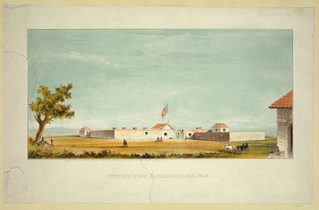
    <summary type="html"><![CDATA[<p><strong><em>This fort, which began construction in 1840, served as one of the last stops for emigrant trains bound for Alta-California, and marks the end of the Donner Party’s expedition. Slave labor, the gold rush, and the rescue of the Donner Party all contribute to the legacy of both the fort and its creator.</em></strong></p><img src="https://www.intermountainhistories.org/files/fullsize/ceb063cfc2de1ed51df924710d33fc04.jpg" alt="Artist rendition of Sutter’s Fort" /><br/><p>John Sutter constructed this fort, which is located in modern-day Sacramento, California. Originally from Switzerland, Sutter left his wife and children under the threat of arrest for unpaid debts, and after traveling the United States and Mexico settled in the Mexican province of Alta-California in 1839. An aspiring businessman, he constructed his fort to serve trappers, migrants, and mountain men representing the Swiss, American, and Russian citizens prevalent in the region. One of the most controversial aspects of Sutter’s character became apparent as construction of the fort began: slavery. Sutter, having purchased a Native slave boy in 1838, was keen to implement the labor of enslaved Native Americans at his fort, using it to his advantage in constructing and maintaining the fort. It is even theorized that a pair of Native guides he sent to the Donner Party were originally his slaves.
Sutter first came into contact with the Donner party in early Autumn of 1846, when Charles Stanton and William McCutchen reached the fort to retrieve supplies for the ailing party. McCutchen stayed at the fort due to ill health, and Stanton returned to the Donner party along the Humboldt River with supplies and the two aforementioned Native American guides, Luis and Salvador. An emaciated and freshly banished James Reed, a principal leader of the Donner Party, arrived soon thereafter on October 28th. Two days later, Reed and a recuperated McCutchen left to attempt to reach the party, but like their families on the other side of the mountain, deep snow blocked their way. For the next 4 months, Reed and McCutchen had to wait knowing that their families were snowed-in on the other side of the mountain, unable to do anything. In early February of 1847, Sutter offered $3 a day to any man willing to join a rescue party into the mountains, which some accepted and formed the first relief party which left on February 7th. Daniel Rhoads, one of the men in the first relief party to reach Truckee Lake on February 19th said that when they arrived Mrs. Murphy popped up from the deep snow and hoarsely said, “<em>Are you men from California or do you come from heaven?</em>” Over the next months, the relief parties employed and sent by John Sutter would be instrumental in saving lives. He even employed several rescued members of the party after their recuperation.
Sutter attempted to profit off the gold rush after his assistance to the Donner Party but again ran into problems with paying his debts. Eventually losing his land grant, he attempted to receive restitution from the United States with little success. Sutter later moved east to Pennsylvania, and died of kidney failure on June 18th, 1880. His history is complicated. He enslaved and abused Native Americans in the pursuit of wealth and was seen as a swindler by some who did business with him. At the same time, without his aid towards the Donners, many more lives would have been lost in the Sierra Nevadas.
Lewis Keseberg was the last survivor of the Donner Party to arrive at Sutter’s Fort in late April of 1847. The survivors attempted to settle in California with varying levels of success. Some made a fortune in the gold rush, others remarried or were taken in by other families, or some carried their burdens for the rest of their lives, suffering rejection and disgust if they admitted to or were rumored to have engaged in cannibalism. Their journey may have ended at Sutter’s Fort, but their stories and legacies have endured for much longer. They remain the most infamous emigrant group of westward migration, showcasing the dangers of crossing the untamed West.</p><p><em><strong><a href="https://www.intermountainhistories.org/items/show/937">For more (including 5 images) view the original article</a></strong></em></p>]]></summary>
    <published>2026-02-02T17:22:17+00:00</published>
    <updated>2026-04-17T19:32:21+00:00</updated>
    <link rel="alternate" type="text/html" href="https://www.intermountainhistories.org/items/show/937"/>
    <id>https://www.intermountainhistories.org/items/show/937</id>
    <author>
      <name>Samuel Watson, Brigham Young University</name>
    </author>
  </entry>
  <entry>
    <title type="html"><![CDATA[Johnson’s Ranch and the Donner Party’s Forlorn Hope]]></title>
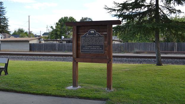
    <summary type="html"><![CDATA[<p><strong><em>This ranch on the Western slope of the Sierra Nevada Mountain Range in modern-day California was owned by trader William Johnson. In early 1847, its inhabitants first witnessed the horrible state of the Donner Party, sounding the alarm of the plight of the trapped emigrant party.</em></strong></p><img src="https://www.intermountainhistories.org/files/fullsize/363f9cc274dbaab6d01390452739c6a4.jpg" alt="California State Parks Johnson’s Ranch Historical Marker" /><br/><p>In January, two Native Americans brought in a straggler from the Donner Party, William Eddy. He was frostbitten, emaciated, and delirious from over a month-long trek through the snow-capped mountains. He and others were sent off by the desperate Donner Party who were entrapped at Truckee Lake on the other side of the mountains. This group, known as the “Forlorn Hope”, featured fourteen of the strongest survivors from the Donner Party. On December 16th, 1846, they fashioned themselves snowshoes and moseyed up the mountains to reach the nearest settlement. Snow blindness and starvation quickly slowed their progress. Charles Stanton, the man who had already been to Sutter’s Fort to retrieve supplies in 1846 and only returned to help his family, was too exhausted to move and was left by the group after several days of hiking.
Snow impeded their progress further and desperation quickly set in. Some suggested drawing lots or a fight to the death to decide who should be cannibalized for survival. They chose instead to eat whoever perished first. On Christmas Eve, a Mexican named Antonio perished first. On Christmas Day, he was followed by Franklin Graves, then Patrick Dolan, and finally Lemuel Murphy, all dying from hypothermia induced delirium. These deaths all occurred in a violent blizzard where it was impossible to light a fire. When the storm broke, they lit a fire and began the process of cutting and eating their dead, <em>“averting their faces from each other, and weeping” </em>as they ate. They refrained from eating their kin, and William Eddy only ate when he could go no further.
The gauntly starved and frostbitten emigrants trekked on, their tracks stained red with blood. Within a few days the human flesh they had preserved was gone. Eddy stopped William Foster from killing the two Native guides previously sent by Sutter, Luis and Salvador. Fearing for their lives, the duo left the camp. The white emigrants followed their bloodied tracks the next day. The group found the exhausted hobbles of Luis and Salvador several days later, laid out in a creek. William Foster shot and cannibalized them both. The group stumbled along, hobbling into Indian villages but not able to recuperate off the natives' skimpy diet of nuts and cooked acorns. Eventually Eddy pressed on while the women sat at the side of the trail, unable to continue. For miles Eddy walked with the assistance of a Native American guide. For the last few miles, he was hoisted along, his energy completely spent. Reaching Johnson’s Ranch, 150 miles away from Truckee Lake, he only asked for bread as he collapsed. As he recuperated, riders were sent up the trail to retrieve the women and Foster. Of the 14 who left Truckee Lake, only 7 arrived at Johnson’s Ranch, all deaths being male.
The Forlorn Hope succeeded, at great cost. The alarm sounded as supplies and relief parties were organized at Sutter’s Fort, the main staging area for relief efforts. The first relief party reached the entrapped Donner Party on February 19th, and the parties that followed would save countless lives. Johnson’s Ranch did not have the facilities to stage the relief effort, but it did bring the Forlorn Hope back from the dead. The group recuperated with the settlers’ assistance, and they settled in California in the Summer of 1847. Unfortunately, many family members, including William Eddy’s wife and children died back at the camp. Eddy even threatened to kill Lewis Keseberg, a German immigrant who cannibalized his three-year-old son. The Forlorn Hope is a story that encapsulates the moral highs and lows of westward migration. To reach Johnson’s Ranch they endured blizzards, walked for days on end, and cannibalized each other on the chance that their families would survive. Johnson’s Ranch and the trail they foraged may be houses and recreational land now, but it remains the site of one of the most infamous and intriguing stories of westward migration.</p><p><em><strong><a href="https://www.intermountainhistories.org/items/show/936">For more (including 4 images) view the original article</a></strong></em></p>]]></summary>
    <published>2026-02-02T17:22:16+00:00</published>
    <updated>2026-04-17T19:32:21+00:00</updated>
    <link rel="alternate" type="text/html" href="https://www.intermountainhistories.org/items/show/936"/>
    <id>https://www.intermountainhistories.org/items/show/936</id>
    <author>
      <name>Samuel Watson, Brigham Young University</name>
    </author>
  </entry>
  <entry>
    <title type="html"><![CDATA[Truckee Lake: The Infamous Demise of the Donner Party]]></title>
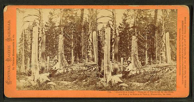
    <summary type="html"><![CDATA[<p><strong><em>Truckee Lake (now known as Donner Lake) is nestled on the eastern slope of the Sierra Nevada Mountains of modern-day California. On the western side of the Lake there is an opening in the mountains where the Stephens-Townsend-Murphy party passed through in 1844 and set the primary route that westward emigrants would use to enter the Sierra Nevadas. For the Donners, this pass would become an unsurpassable wall of snow that stopped them from reaching salvation at Sutter’s Fort.</em></strong></p><img src="https://www.intermountainhistories.org/files/fullsize/643f19dc38f76998d08475484f96c8e5.jpg" alt="Trees that were cut by the Donner Party at Truckee Lake" /><br/><p>When the Donner Party arrived at Truckee Lake on October 31, 1846, they hoped to push through the mountains and descend into California before winter. However, due to their delayed arrival and an early mountain storm the day prior, the now snowed-in passes repelled their multiple attempts to do so. Though only 150 miles away from their planned destination, Sutter’s Fort, they were forced to establish an unplanned winter encampment at the lake, nearly 6,000 ft. above sea level. The best recounting of the Donner Party’s winter encampment at Truckee Lake comes from Patrick Breen, one of the only migrants to keep a consistent journal throughout their ordeal there. Ominously, Breen recorded that during their first week at camp <em>“it snowed during the space of eight days with little intermission.” </em>Having already killed most of their cattle, prospects of survival were grim.
They established two camps. Most of the party was at Truckee Lake, with the Donner families and a few others having been stopped by a broken wagon six miles before reaching the lake and camping at Alder Creek. However unprepared, the party planned to wait until relief parties arrived when snows let up or later in the Winter. Such hopes were dashed by abnormally heavy and continuous snow storms. The current Donner Memorial State Park Monument commemorates the snow depth that stranded them that winter, standing at 22 feet. As time passed, Breen cataloged the diminishing resources and hope of rescue.<em> “November 9th… took in Augustus Spitzer yesterday so weak that he cannot live without help caused by starvation.”</em>
The families at the lake had run out of meat and were eating animal hides for sustenance by January of 1847. In the face of starvation, social bonds and group cooperation further deteriorated. Earlier debts unpaid or trespasses unpunished from the trail were used as grounds to hoard supplies. For example, Mrs. Graves reneged on a promise to Mrs. Reed and took back borrowed animal hides which Mrs. Reed had received to feed her family. On February 9th Breen states, <em>“pikes child all but dead… Murphys not able to get out of bed Keyburg </em>[Keseburg]<em> never gets up says he is not able. John went down to day </em>[today] <em>to bury Mrs. Eddy & child…”</em> The first relief group sent from Sutter’s Fort in California arrived on February 19, 1847, and the scene they described testifies to the horrific conditions the families had suffered through for months at Truckee Lake and Alder Creek. Most shocking was the evidence of cannibalism: the mutilated corpses of two children, Isaac Donner and Franklin Graves, and the remains of Elizabeth Graves with several organs removed, presumably eaten. The relief party gave what provisions they could and took some emigrants with them, but the situation remained dire for those left behind. On February 26, Breen wrote, <em>“The Donnos </em>[Donners]<em> told the California </em>[Californians]<em> that they </em>[would] <em>Commence to eat the dead people… if they did not succeed that day or next in finding their cattle.”</em> Those left behind at Truckee Lake and Alder Creek continued to suffer, facing imminent death and potential desecration of their corpses by fellow starving party members. Numbers dwindled up until the last emigrant trapped on the Eastern side of the mountains, Lewis Keseberg, was rescued in April of 1847.
Although not a complete representation of the overland emigrant experience, the Donner Party’s demise is a cautionary tale in the frontier histories of the American West. Many others suffered from delays, poor decision-making, Native conflicts, and inclement weather, but few ended in such horrific circumstances as those at Truckee Lake and Alder Creek over the winter of 1846-47. The survivors would go on to live their lives in California, but their ordeal and rescue would be a constant reminder of the worst-case scenario for future emigrants on the overland trail.</p><p><em><strong><a href="https://www.intermountainhistories.org/items/show/935">For more (including 5 images) view the original article</a></strong></em></p>]]></summary>
    <published>2026-02-02T17:22:16+00:00</published>
    <updated>2026-04-17T19:32:21+00:00</updated>
    <link rel="alternate" type="text/html" href="https://www.intermountainhistories.org/items/show/935"/>
    <id>https://www.intermountainhistories.org/items/show/935</id>
    <author>
      <name>Samuel Watson, Brigham Young University</name>
    </author>
  </entry>
  <entry>
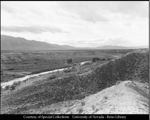
    <title type="html"><![CDATA[The Donners along the Humboldt River]]></title>
    <summary type="html"><![CDATA[<p><strong><em>The Humboldt River resides in modern-day central Nevada and marks the spot where the Hastings Cutoff reunites with the traditional California trail. It was along this river that distrust overcame the Donner Party, with its party members being attacked, banished, and murdered.</em></strong></p><img src="https://www.intermountainhistories.org/files/fullsize/cd9914b416dc039e95030e789f0a9067.jpg" alt="The Humboldt River" /><br/><p>The Humboldt River was named after German intellectual and explorer Alexander von Humboldt. His name can be found on things such as the Humboldt Ocean Current off the Western coast of South America and Humboldt County in present-day California. The river was used for centuries by Native Americans and became known to non-indigenous populations when Peter Ogden of the British owned Hudson’s Bay Company discovered it on one of his expeditions in 1829. Trappers and mountain men utilized it extensively, and it became a major navigational tool and watering spot for westward migrants in the 1840s. When the late-season and already weakened Donner Party reached the river in mid-September, 1846, drought had lowered the water level and withered adjacent greenery. Their travel along the Hastings Cutoff, which diverged south to skirt around the Ruby Mountains before returning north to the Humboldt River trail intersection, had added 100 miles to what they would have traveled had they stayed on the traditional trail.
Their troubles after the Great Salt Lake Desert were far from over. As they began their journey down the river, progress and supplies were stressed by Paiute depredations on their livestock. Then, on October 5th, as the Murphy family’s wagon led by teamster John Snyder attempted to pass James Reed’s wagon, the two trains became entangled and Snyder whipped Reed’s oxen in anger. Reed retaliated, and in the ensuing scuffle Snyder struck Reed’s wife and Reed stabbed Snyder, killing him. The Graves and Murphy families banished Reed from the group, sending him to the party’s desired destination of Sutter's Fort in California on his horse and promised to care for Mrs. Reed and their young children. Paiute altercations and interpersonal conflicts further escalated problems. An elderly Belgian emigrant, known only as Hardkoop, repeatedly went missing after being kicked out of Lewis Keseberg’s wagon.  An eyewitness said they had seen him sitting alone on the side of the trail unable to continue as <em>“his feet had swollen until the skin had split.”</em> William Eddy attempted to spend resources that night to find him, but was refused by other members of the party. As they progressed alongside the Humboldt River as many as 18 oxen were stolen, one wounded, and 21 killed by Paiutes. Making good progress regardless, they reached Humboldt Sink close to the end of the river, on October 13th. On this day a German emigrant, known only as Wolfinger, stayed behind with two other Germans to cache, or store, his wagon. The two Germans rejoined the party several days later, but Wolfinger was absent. The other Germans claimed Natives had killed him, but one later confessed to murdering Wolfinger, leaving his body to be devoured by vultures and coyotes in the Humboldt Sink.
The party reached the Truckee River which led up into the Sierra Nevada Mountains in eastern California, on the 16th of October. The roughly three week journey along the Humboldt River had strained their relationships and caused them to lose trust in each other. Hardkoop’s abandonment, Reed’s banishment, and Wolfinger’s murder reveal unraveling social cohesion. Losing Reed as a steady leader was especially damaging. The Humboldt served as a refuge from the Great Basin Desert for most emigrant groups heading towards California, but for the Donners it marked exponentially increasing troubles which would remain with them for the rest of their journey. The culmination of all their mistakes, from Forts Laramie and Bridger, the Wasatch Mountain range, the Great Salt Lake Desert, and the Humboldt River, would lead to great suffering for the party in the Sierra Nevadas.</p><p><em><strong><a href="https://www.intermountainhistories.org/items/show/934">For more (including 5 images) view the original article</a></strong></em></p>]]></summary>
    <published>2026-02-02T17:22:15+00:00</published>
    <updated>2026-04-17T19:32:21+00:00</updated>
    <link rel="alternate" type="text/html" href="https://www.intermountainhistories.org/items/show/934"/>
    <id>https://www.intermountainhistories.org/items/show/934</id>
    <author>
      <name>Samuel Watson, Brigham Young University</name>
    </author>
  </entry>
  <entry>
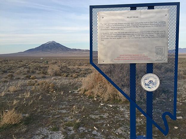
    <title type="html"><![CDATA[Pilot Peak: Looking back at the Great Salt Lake Desert]]></title>
    <summary type="html"><![CDATA[<p><strong><em>Emigrant parties and explorers used this mountain peak on the southern end of Pilot Mountain Range, which straddles the modern Utah-Nevada border west of the Bonneville Salt Flats, as a landmark to track their progress out of the Great Salt Lake Desert. For the Donner Party, the most infamous group of pioneers in American history, it was a place where fatal lost time and resources became realized, and an aura of frantic urgency imbued the party.</em></strong></p><img src="https://www.intermountainhistories.org/files/fullsize/2130a6174f419bcc9a9374aa16511896.jpg" alt="State Historic Marker, Pilot Peak" /><br/><p>By the time the Donners reached Pilot Peak on September 8th, 1846, they had just endured a disastrous eight days of travel from Redlum Spring in Western Utah. It was the last source of freshwater before crossing the salt flats. Lansford Hastings’ directions had insisted it was only <em>“thirty-five miles, or of forty at most”</em> from Redlum Springs to water sources near Pilot Peak. It was, in fact, 80 miles, and Hastings’ promised 2-day itinerary across the parched landscape took the Donner Party eight days in hot, arid conditions.
As they began their trek, Luke Hallaron died of Tuberculosis on August 25th, followed by Franklin Graves having a <em>“fine mare”</em> stolen by the Native Americans, a threat that persisted for the rest of their journey. After cresting an early hill they were greeted by <em>“a perfectly flat plain unbroken even by sage, and dazzling white, like frost, with the glitter of salt.” </em>The hellish landscape’s oppressive heat and lack of shelter drove party members to heat exhaustion. On the second day the hard salt eventually turned into a slushy marshland, where <em>“the wagons broke through the thin crust and sank several inches into sandy slush oozing with salt water”. </em>With the party’s condition quickly deteriorating from dehydration, James Reed rode ahead on the third day and located the springs at the base of Pilot Peak 30 miles away, and returned with what water he could carry. Nine oxen went missing while Reed was gone, having stampeded into the desert at night in search of water, <em>“frenzied and half-blind with thirst.”</em> After returning to his family farther down the trail, they spent a frigid night’s encampment before being awakened by a frenzied ox that charged Reed’s family. Startled, the family pressed forward along Reed’s path in the middle of the night, pushing towards Pilot Peak for the next five days, meeting up with the rest of the party on September 8th.
Like their delay in the Wasatch Mountains, the importance of this slowed pace cannot be understated. The arid desert turned salt marsh entrapped wagons, slowed oxen, and exhausted the already frustrated and delayed emigrants. In addition to adding five days to their planned itinerary, they lost 36 cattle, four wagons, and incalculable energy they crucially needed later. The trail was so difficult that research expeditions in 1929 and 1986 had difficulty and got stuck while re-tracing the party's steps. The delays from crossing the Wasatch Mountains and Great Salt Lake Desert, and the subsequent week-long recuperation at Pilot Peak, put the group over a month behind schedule. Many emigrant parties heading West saw Pilot Peak as a landmark on which to base their progress and pace, but for the Donners’ it represented the beginning of the end. They desperately needed to make up time from their disastrous navigation through the Wasatch Mountains, but the time and resources lost on the Great Salt Lake Desert would prove fatal for almost half of the group.</p><p><em><strong><a href="https://www.intermountainhistories.org/items/show/933">For more (including 6 images) view the original article</a></strong></em></p>]]></summary>
    <published>2026-02-02T17:22:15+00:00</published>
    <updated>2026-04-17T19:32:21+00:00</updated>
    <link rel="alternate" type="text/html" href="https://www.intermountainhistories.org/items/show/933"/>
    <id>https://www.intermountainhistories.org/items/show/933</id>
    <author>
      <name>Samuel Watson, Brigham Young University</name>
    </author>
  </entry>
  <entry>
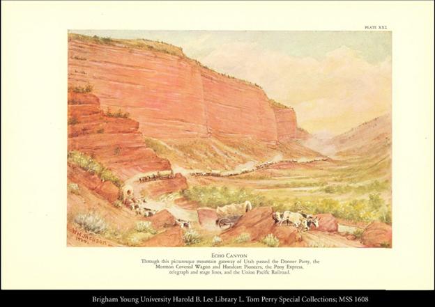
    <title type="html"><![CDATA[The Donners in Echo Pass and Weber Canyon]]></title>
    <summary type="html"><![CDATA[<p><strong><em>Having separated from the main Oregon/California trail after the Continental Divide, the Donner Party reached the mouth of Echo Canyon in Eastern Utah in early August, 1846. This marked the beginning of uncharted territory and an arduous journey through the Wasatch mountain range in present-day Utah. Invaluable time was wasted cutting brush and trees, passing through thin crevices, or crossing mountain rivers and streams.</em></strong></p><img src="https://www.intermountainhistories.org/files/fullsize/ed935523348f738fe9a49853a294f593.jpg" alt="Pioneer Wagons in Echo Canyon" /><br/><p>Traveling through the narrow ravines and steep peaks was not a challenge for the traditional route to California or Oregon Country. Lansford Hastings, a frontier explorer and creator of this cutoff through the Wasatch Mountains and Great Basin desert, had taken smaller groups of emigrants through the cutoff earlier in the season, but their smaller size required less assistance than the Donner Party needed. One arduous landmark in Weber Canyon featured a creek with jagged boulders enclosed by steep canyon walls as the only passable route. The party had to hoist wagons over each individual boulder to continue. Aware of these challenges, Hastings had left the party a note instructing them to send someone ahead to get alternate route directions from him once they reached the Weber River. Leader James Reed and others left on August 6th, and returned August 10th with Hiram Miller’s diary recording<em>“Reed having examined the new rout </em>[route]<em> entirely an </em>[and]<em> reported in favour, which induced the company to proceed.”</em>
Pace slowed as the party wound its way through the mountain range. The trail was rocky and overgrown, necessitating bushwhacking and the clearing of trees and other debris. Virginia Reed said, <em>“There was absolutely no road, not even a trail. The cañon </em>[canyon]<em> wound around among the hills. Heavy underbrush had to be cut away and used for making a roadbed.” </em>They might criss-cross a stream up to 13 times in a single day just to proceed, or spend multiple days clearing debris only to make no forward progress. In a cruel twist of irony, the large migration of Latter-Day Saints from Nauvoo, Illinois used the same path the Donners had blazed to swiftly reach the Salt Lake Valley one year later in 1847. The Saints advance party recorded that they <em>“followed the gouges of the Donner wheels to the top”</em> of what is known as Donner Hill, which is <em>“as near vertical as wagons have ever managed.”</em> The Donners only summited this steep hill because they failed to clear the last gorge of debris after several days of trying. The Saints cleared the gorge in the span of a day. The gorge is now the proud ‘Emigration Canyon’, from which the migration of Latter-day Saints made their main path to reach the Salt Lake Valley.
Three weeks after their arrival at Echo Pass, the party looked back from the floor of the Salt Lake Valley and saw they had traveled only 35 miles. At the same time, parties who had left earlier in the year were already leaving the Great Salt Lake Desert, moseying along the Humboldt River in modern-day Northern Nevada, and descending into Sacramento. Compounded by a markedly late-season start to begin with, the Donner Party’s delay threatened their ability to reach and cross the Sierra Nevada Mountains before Winter. It was well-known that this last mountain range before central-California would be impassable once snow began to fall. If they could not make up for lost time, it would certainly result in the parties entrapment in the mountains.</p><p><em><strong><a href="https://www.intermountainhistories.org/items/show/932">For more (including 4 images) view the original article</a></strong></em></p>]]></summary>
    <published>2026-02-02T17:22:14+00:00</published>
    <updated>2026-04-17T19:32:21+00:00</updated>
    <link rel="alternate" type="text/html" href="https://www.intermountainhistories.org/items/show/932"/>
    <id>https://www.intermountainhistories.org/items/show/932</id>
    <author>
      <name>Samuel Watson, Brigham Young University</name>
    </author>
  </entry>
  <entry>
    <title type="html"><![CDATA[The Donner Party at Fort Laramie]]></title>
    <summary type="html"><![CDATA[<p><strong><em>	On June 27th, 1846, George Donner led a group of westward-bound emigrants from Illinois into Fort Laramie in what is now eastern Wyoming, but then unorganized territory. Fort Laramie was considered the doorway to the Intermountain West for travelers on the Overland Trail. For the Donners it would be considered the doorway to the first of many errors which made them the most infamous pioneers in American history.</em></strong></p><img src="https://www.intermountainhistories.org/files/fullsize/ff3f6be2d77dcfcaf49158dc57b9c4cc.jpg" alt="The Fort Laramie property photographed in 1877" /><br/><p>Fur trapper and trader William Sublette originally constructed the Fort in 1834. Emigrant trains and trappers used it as a stopping point and resupply station between the West and the East. It was here that the Donner party made a disastrous route decision to take an untested trail which would lead to their downfall and infamy.
The Donner family was from Illinois, and like other emigrant parties, knew little of the Western terrain outside of maps and journals. Before the Donners’ arrival, mountain men, fur trappers, and explorers had been devising routes westward out of Fort Laramie for emigrants to quickly and ‘safely’ travel to Oregon Country (which the U.S. co-managed with Great Britain) or the present-day areas of California that were then part of the larger Mexican territory of Alta California. The decision to stray from the traditional route was based on Lanford Hastings’ 1845 <em>The Emigrants guide to Oregon and California. </em>An explorer and eventual confederate soldier, Hastings described a westward route variation that would become known as the “Hastings Cutoff.” He wrote that the traditional route to get to central California could be hastened if one were to cut through the deserts of present-day western Utah and Nevada (then part of Mexican Alta California) instead of going north through present-day Idaho (then part of Oregon Country). They relied on the words of explorers like Hastings while planning their journey, even if the validity of these claims were yet untested.
Fearing the viability of Hastings Cutoff, famed mountain man James Clyman told one of the leaders of the party at Fort Laramie, James Reed, to “<em>take the regular wagon track and never leave it–it is barely possible to get through if you follow it–and it may be impossible if you don’t.</em>” Clyman’s warning fell on deaf ears. After leaving Fort Laramie in early July, many families decided to take the Hastings Cutoff. This decision proved fatal, eventually resulting in the death of 40 emigrants by the Spring of 1847. With George Donner chosen as the group’s captain, the collection of families that followed his lead to the Hastings Cutoff bear his name. The families that chose to take the Hastings Cutoff elected George Donner as its leader, with the group bearing his name. At Fort Bridger, in present-day southwestern Wyoming, they diverted southwest on the cutoff whereas the main company led by Lilburn W. Boggs continued on the traditional route which turned northwest from Fort Bridger towards Fort Hall in present-day southeastern Idaho. The Boggs party arrived safely in California in November 1846. The Donner Party did not.
The fort continued to play a role in migration, trading, and military activities in the years to come. Notable groups to pass through were the Latter-Day Saint migration of 1847, the gold rush of 1849, and the establishment of a military post in July of 1849. It became the site of several treaties signed between the federal government and Native Americans designed to reduce violence against emigrant trains. The Donner Party had not had conflicts with Native Americans on the plains, even though it was a concern for emigrants leading up to Fort Laramie. The Donners didn’t know it yet, but the decisions made here would lead to massive time loss, conflicts with Native Americans, and a heavy toll on their emotional health.</p><p><em><strong><a href="https://www.intermountainhistories.org/items/show/931">For more (including 7 images) view the original article</a></strong></em></p>]]></summary>
    <published>2026-02-02T17:19:19+00:00</published>
    <updated>2026-04-17T19:32:21+00:00</updated>
    <link rel="alternate" type="text/html" href="https://www.intermountainhistories.org/items/show/931"/>
    <id>https://www.intermountainhistories.org/items/show/931</id>
    <author>
      <name>Samuel Watson, Brigham Young University</name>
    </author>
  </entry>
  <entry>
    <title type="html"><![CDATA[Queen of Heaven Orphanage]]></title>
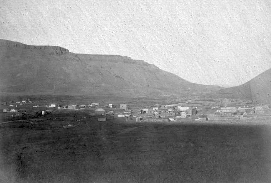
    <summary type="html"><![CDATA[<p><strong><em>In the aftermath of her traumatic childhood, Mother Cabrini devoted her life to bettering the lives of young girls and orphans, especially in immigrant communities. Golden, Colorado is home to an orphanage and summer camp she built entirely from local donations and volunteer work. </em></strong></p><img src="https://www.intermountainhistories.org/files/fullsize/a7c79f026746a5cd893f7140b702d5fd.jpg" alt="Golden, Colorado 1868" /><br/><p><span style="font-weight:400;">In the aftermath of the Mexican American War, the Southern Rocky mountains became a new frontier of U.S. westward expansion. The region gained lots of traction during the Pike’s Peak gold rush, beginning in 1859. By 1861 Colorado was organized as an official U.S. territory. In the following decade the first Italian immigrants arrived in the territory. </span>
<span style="font-weight:400;"></span><span style="font-weight:400;">Living for the hope of a better life, immigrants who arrived in Colorado were subject to dangerous and unfair work conditions, discrimination, and little opportunity to rise above their station. As adults worked tirelessly up until their premature deaths either in the mines or railroad construction, their children were often left orphaned and utterly alone. With a language barrier and lack of education opportunities, the future did not look bright for the children of immigrants.</span>
<span style="font-weight:400;"></span><span style="font-weight:400;">Maria Francesca Cabrini, born just outside of Milan, Italy in 1850, would spend the latter part of her life in America where she came to be known as the patron saint of immigration. Her childhood was fraught with illness and a near death experience, giving her the conviction that she had been preserved by God for a special purpose. After graduating with cum laude for her religious education, Mother Cabrini devoted her life to serving underprivileged communities and children. Her first major project was the revitalization of a run-down orphanage in Northern Italy. In 1889 she came to America where she founded several orphanages that pushed the boundaries for a typical institution of the era. Mother Cabrini was renowned for her compassion. While other orphanages kicked children out onto the streets as young as fourteen, she extended the age of asylum by several years. </span>
<span style="font-weight:400;"></span><span style="font-weight:400;">In 1904 Mother Cabrini, who had taken on the name Frances Xavier Cabrini, established the Queen of Heaven Orphanage in Golden, Colorado. The project was funded from bits of spare change donated from children and adults throughout the state. After purchasing the land, Mother Cabrini recruited sisters from the Missionary Sisters of the Sacred Heart of Jesus to help both in constructing the buildings and caring for the children. The Queen of Heaven Orphanage served as a temporary home to primarily immigrants and first-generation children, who had been orphaned or abandoned due to the gruelling conditions of life on the frontier. </span>
<span style="font-weight:400;"></span><span style="font-weight:400;">In the summer months the orphanage doubled as a camp for all of the children in the community. The small dairy farm on the property, run by both the nuns and the children, provided an abundance of ice cream for their consumption. The orphanage and summer camp were closed down in the late 1960s. In 2000 the Queen of Heaven Orphanage was added to the National Register of Historic Places. </span>
<span style="font-weight:400;"></span><span style="font-weight:400;">Mother Cabrini continued her mission in devotion until her death in 1917. She was canonized as a saint by Pope Pius XII. Her legacy is well reflected in her statement, “What we as women cannot do on a large scale to help solve grave social ills is being done in our small sphere of influence in every state and city where we have opened houses. In them we shelter and care for orphans, the sick and the poor.”</span></p><p><em><strong><a href="https://www.intermountainhistories.org/items/show/930">For more (including 4 images) view the original article</a></strong></em></p>]]></summary>
    <published>2025-12-09T17:24:33+00:00</published>
    <updated>2026-04-17T19:32:21+00:00</updated>
    <link rel="alternate" type="text/html" href="https://www.intermountainhistories.org/items/show/930"/>
    <id>https://www.intermountainhistories.org/items/show/930</id>
    <author>
      <name>Megan Bailey, Brigham Young University</name>
    </author>
  </entry>
  <entry>
    <title type="html"><![CDATA[Pearl Hart: The Bandit Queen]]></title>
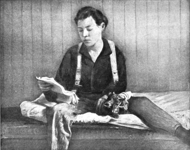
    <summary type="html"><![CDATA[<p><strong><em>Best remembered for committing a stagecoach robbery, and her rare identity as a “Lady Outlaw” of the Wild West, the life of Pearl Hart might not have been as adventurous or romantic as it appears on the surface. </em></strong></p><img src="https://www.intermountainhistories.org/files/fullsize/22b8112b8583aaa5d0d96bbc1c1ccaca.jpg" alt="Pearl Hart reading a paper in her jail cell" /><br/><p><span style="font-weight:400;">Lillie Naomi Davy, later known as “Pearl Hart,” was born into a violence that she would spend the rest of her life attempting to escape. Born in 1871, she was the third of at least eight children and spent most of her childhood in rural Lindsay, Ontario. Her father was relentlessly abusive, and her mother had little power over the situation. Lillie and her siblings were often left to fend for themselves, turning to mischief and even crime. In her youth she was described as, “livesome, blythe, and witty.” At eleven-years-old Lillie and her thirteen-year-old brother William stole a cow from a neighboring farm and re-sold it before they were caught. Lillie and her sisters Catherine and Saphronia frequently ran away from home, usually to the western United States. They cut their hair short and dressed in men's clothes, which helped them fly under the radar. Once they’d been discovered, which they always were, the sisters were usually sent back to New York, where their mother had moved prior to their father’s imprisonment for violent crime. </span>
<span style="font-weight:400;">Lillie was only fifteen when she started seeing Charles Dean, who became her first husband only a year later, although he was thirty-five and had been married to another woman when they had initially met. When he grew increasingly violent towards her, Lillie ran away with her sister Catherine once again. In the next several years Lillie remarried, or at least claimed to be re-married, for there was no legal documentation of divorce from Charles, to a man named Dan Bandman. She admired him for his college education and musical talents, though it did not take long for his charm to wear thin and the violence that so haunted young Lillie’s life to once again threaten her. </span>
<span style="font-weight:400;"></span><span style="font-weight:400;">The western frontier beckoned hope to anyone looking for an escape. There was a promise of freedom, opportunity, and prosperity for those who had the guts and grit to make it on their own. Work in the west was mostly limited to hard labor for men in fields such as mining, logging, and construction. Women, especially the unmarried, had far fewer options. The most profitable by far being prostitution. Lillie and Catherine worked for a time in a brothel run by the mistress Pearl Hart, someone they both likely admired, for Catherine began referring to herself as “Minnie Hart,” and in the following years Lillie took on the alias of “Pearl Hart” herself. Like her contemporaries “Butch Cassidy” and “Billy the Kid,” this new title was more than just a new name, it was an attempt to reinvent her persona and conceal her past identity. </span>
<span style="font-weight:400;">From late adolescence to early adulthood, Pearl never stayed anywhere long and did whatever she could to survive––which often meant working in dangerous conditions or returning to an equally dangerous life with an abusive husband. </span>
<span style="font-weight:400;"></span><span style="font-weight:400;">In 1899 Pearl became desperate to make a decent sum of money, and quick, presumably because she had just discovered her mother was dying and wanted to get back east to say goodbye. After a brief, and fruitless, stint working in the mines of Globe, Arizona Pearl teamed up with a man known as “Joe Boot.” It is unclear what kind of relationship they had, or who the mastermind behind the operation was, but most signs point to Pearl as the instigator. After they had been taken into custody, Pearl described Joe as cowardly, stating that his hands were “shaking like leaves” the whole time. Although they had been somewhat kind to the victims of their heist, giving them back half of the money so that the travelers would not be left completely destitute, Pearl was sentenced to five years at Yuma Territorial Prison. </span>
<span style="font-weight:400;"></span><span style="font-weight:400;">Following her stint in prison, Pearl became more elusive and there are not many records of her exploits––criminal or otherwise. While her incarceration kept her from ever reuniting with her mother, she did reconnect with some of her siblings. One of her sisters wrote a play based on the exploits of “Pearl Hart,” the legendary character she had become. She acted in the play as herself, fulfilling a dream she had once had of becoming an actress. </span>
<span style="font-weight:400;">Pearl spent much of her life in seemingly hopeless and tumultuous circumstances, but she might have found joy in stage performance. Or in time spent reminiscing with her sisters about their adolescent larks––dressing in boys clothes and hopping trains to unexplored cities––before they had to face the reality of their stations in life. </span></p><p><em><strong><a href="https://www.intermountainhistories.org/items/show/929">For more (including 3 images) view the original article</a></strong></em></p>]]></summary>
    <published>2025-12-09T17:24:32+00:00</published>
    <updated>2026-04-17T19:32:21+00:00</updated>
    <link rel="alternate" type="text/html" href="https://www.intermountainhistories.org/items/show/929"/>
    <id>https://www.intermountainhistories.org/items/show/929</id>
    <author>
      <name>Megan Bailey, Brigham Young University</name>
    </author>
  </entry>
  <entry>
    <title type="html"><![CDATA[Girl Scouts of Utah]]></title>
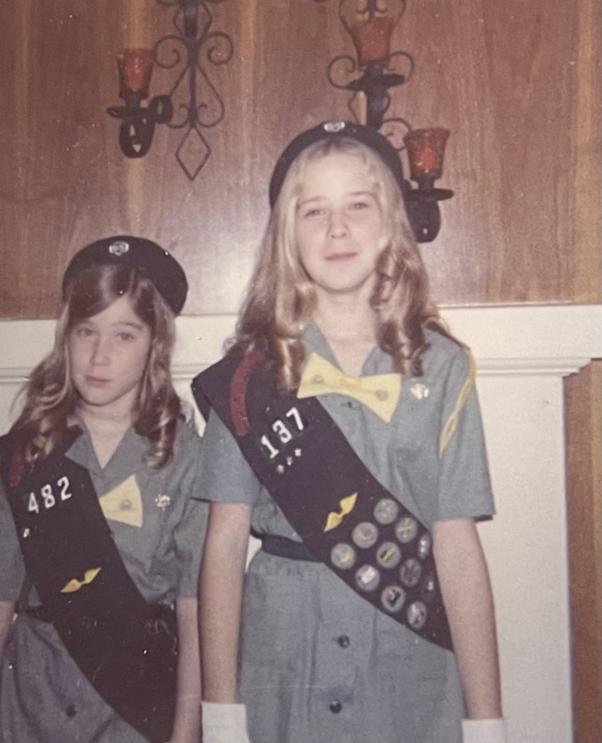
    <summary type="html"><![CDATA[<p><strong><em>Barbara Schmidt, a scout of 65 years, recalls her fondest memories growing up as a girl scout in mid-twentieth century Utah. </em></strong></p><img src="https://www.intermountainhistories.org/files/fullsize/0d86281475893b6bdc8c122102bc6d41.jpg" alt="Sisters posing in their Girl Scout uniforms circa 1970" /><br/><p><span style="font-weight:400;">The first Girl Scout troop was founded in Virginia in 1912, and it wasn’t long before troops sprouted up throughout the nation. Founded by Juliette Gordon Low, the organization was modeled to build “courage, confidence, and character,” as their mission statement declares. Becoming a Girl Scout also provided young girls with leadership opportunities and outdoor experiences, not unlike their male peers in the Boy Scouts program. </span>
<span style="font-weight:400;"></span><span style="font-weight:400;">In 1920, a group of mothers in Ogden, Utah united to find a positive community for their daughters. They initially looked into Campfire Girls, but ultimately discovered that the Girl Scouts were more suited to their needs. Advertising the opportunity in local schools, they soon had enough willing participants to create Utah’s first ever Girl Scout troop. Just a year later, another troop formed in Salt Lake City. </span>
<span style="font-weight:400;"></span><span style="font-weight:400;">In the late 1940s Barbara Schmidt, a student at Hawthorne Elementary School in Salt Lake City, was thrilled at the prospect of becoming a Girl Scout. She saw an announcement at her school for a new local troop and ran home that afternoon excitedly to ask her mom if she could go. Barbara became a Brownie which was, at the time, the group for girls aged eight to ten years old. The troop met at first in the home of the troop leader, a mother of her classmate, but as the troop grew they began meeting in the basement of Zion Lutheran Church.</span>
<span style="font-weight:400;"></span><span style="font-weight:400;">Some of Barbara’s fondest memories are from her summers at camp––and all of the months spent selling cookies in preparation. Each scout who wished to attend a camp had a quota to meet, so they had to be both diligent and creative to meet their goals. In her years of motherhood Barbara always followed her own cookie-selling scouts at a safe distance in her mini van, back in her day Barbara and her fellow scouts were often allowed out on their own––so long as they stuck with a buddy at all times. She spent countless afternoons pulling a red wagon full of cookies, twenty-five cents each, up and down the neighborhoods of Salt Lake. Her troop also received permission from the local Catholic church to sell cookies in the parking lot after mass, which drummed up a fair amount of business. When their work was done, the girls boarded an old rickety school bus that trudged wearily up the mountain to camp. Once they had finally arrived the girls spent their days developing outdoorsmanship skills and making friendships that would last a lifetime. </span>
<span style="font-weight:400;"></span><span style="font-weight:400;">Besides selling cookies and camping, Barbara recalls participating in service projects and feeling that she was “making a real difference in the community.” Though she states that she is not quite “going strong” in her volunteering today as she once did, she continues to volunteer regularly at the Heritage Museum in the Girl Scouts of Utah Council Resource Center. She continues to advocate for the girl scout program because it helps young girls to “embrace a perspective beyond their own.</span></p><p><em><strong><a href="https://www.intermountainhistories.org/items/show/928">For more (including 6 images) view the original article</a></strong></em></p>]]></summary>
    <published>2025-12-09T17:24:32+00:00</published>
    <updated>2026-04-17T19:32:21+00:00</updated>
    <link rel="alternate" type="text/html" href="https://www.intermountainhistories.org/items/show/928"/>
    <id>https://www.intermountainhistories.org/items/show/928</id>
    <author>
      <name>Megan Bailey, Brigham Young University</name>
    </author>
  </entry>
  <entry>
    <title type="html"><![CDATA[Carol Ryrie Brink and the Real Caddie Woodlawn]]></title>
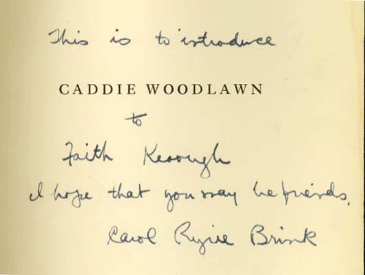
    <summary type="html"><![CDATA[<p><strong><em><span style="font-weight:400;">As an only child in rural Idaho Carol found amusement in her grandmother’s stories of an adventurous childhood in a homestead bustling with children and mischief. Later in life Carol would immortalize her grandmother through the titular character in the beloved children’s novel </span><i><span style="font-weight:400;">Caddie Woodlawn. </span></i></em></strong></p><img src="https://www.intermountainhistories.org/files/fullsize/0410429e7156474d165a3e74fc36171e.jpg" alt="Cover page of Caddie Woodlawn signed by author Carol Ryrie Brink" /><br/><p><span style="font-weight:400;">In 1895 Carol Ryrie Brink was born “Caroline Sybil Ryrie” in Moscow, Idaho. Her father died when she only five-years-old and her mother, stricken with grief and depression, died by suicide four years later. Orphaned, Brink went to live with her widowed grandmother “Gram” and an unmarried aunt who raised her for the remainder of her childhood.</span>
<span style="font-weight:400;"></span><span style="font-weight:400;">In her youth Brink’s favorite activity was listening to Gram's tales of mischief and adventure growing up with six siblings on the Wisconsin frontier. Such a large family was a novelty to Brink, who had no siblings and had only the company of her guardians. She described Gram as “a naturally gifted storyteller” who did not feel “at home with pen and paper.” Of </span><i><span style="font-weight:400;">Caddie Woodlawn</span></i><span style="font-weight:400;">, Brink remarked, “The adventures of Caddie would probably have remained unwritten if I had not been a lonely little girl who adored stories.” </span>
<span style="font-weight:400;">While Brink eventually outgrew her loneliness, she never abandoned her passion for storytelling. In high school and throughout college she dedicated her talent to the school papers. She graduated from University of California, Berkeley in 1917 and was married the following summer Raymond W. Brink, an old friend she had met in Moscow nearly a decade prior. The Brinks had two children, David Ryrie and Nora Caroline, were raised on their mother’s stories and often spent their summers in the Wisconsin woods or the Scottish countryside. </span>
<span style="font-weight:400;"></span><span style="font-weight:400;">Brink wrote several manuscripts before she began the semi-biographical tale of </span><i><span style="font-weight:400;">Caddie Woodlawn</span></i><span style="font-weight:400;">. She dabbled in playwriting for a time, though she was primarily interested in writing novels, often for children. The collection of stories and characters who would eventually come to life in </span><i><span style="font-weight:400;">Caddie Woodlawn </span></i><span style="font-weight:400;">had been in the back of her mind since her childhood declaration, “When I grow up, I am going to write books.”</span><i></i><span style="font-weight:400;">The project took several years, as Brink wanted to make sure she got all of the historical and cultural details right and truly did it justice. </span>
<span style="font-weight:400;">The woman who inspired Caddie was eighty-two-years-old when the book was published in 1935. She was thrilled to read the story and astounded by her granddaughter’s memory, stating “there are things I told her when she was eight years old which are perfectly remembered!” </span>
<i><span style="font-weight:400;">Caddie Woodlawn </span></i><span style="font-weight:400;">received a Newbery Medal in 1936, beloved by both critics and children alike. Young girls living through the Great Depression found escape in the exciting tale of Caddie, just as Brink had during her gloomy childhood. </span></p><p><em><strong><a href="https://www.intermountainhistories.org/items/show/927">For more (including 3 images) view the original article</a></strong></em></p>]]></summary>
    <published>2025-12-09T17:24:31+00:00</published>
    <updated>2026-04-17T19:32:21+00:00</updated>
    <link rel="alternate" type="text/html" href="https://www.intermountainhistories.org/items/show/927"/>
    <id>https://www.intermountainhistories.org/items/show/927</id>
    <author>
      <name>Megan Bailey, Brigham Young University</name>
    </author>
  </entry>
  <entry>
    <title type="html"><![CDATA[Camp Cloud Rim]]></title>
    <summary type="html"><![CDATA[<p><strong><em>Nestled in the mountains of northeast Utah, Camp Cloud Rim has been a place of refuge, belonging, and adventure to Girl Scouts for nearly a hundred years. Rising like a phoenix from its ashes at the turn of the century, the camp stands as a testament to the strength and kindness of its community. </em></strong></p><img src="https://www.intermountainhistories.org/files/fullsize/86286387e18e803da26bda97432f9ba9.jpg" alt="Two girl scouts posing in front of Lake Brimhall and the Wasatch Mountain Range." /><br/><p><span style="font-weight:400;">Camp Cloud Rim, originally called “Camp Pinar,” was constructed in 1934 with funding and labor provided by Franklin Roosevelt’s New Deal program. In 1937 the camp was officially dedicated to the Girl Scouts of America and renamed Camp Cloud Rim. While the camp is still up and running nearly a century later, its survival has been no easy feat. Following several catastrophic events the camp continues to be revived by the driven community which surrounds it. </span>
<span style="font-weight:400;"></span><span style="font-weight:400;">Located in the Wasatch Mountain Range, just outside of Park City, much of the community surrounding Camp Cloud Rim in the early days came from local mining camps. Barbara Schmidt, a lifelong scout, remembers attending the camp in the late 1940s. She has fond memories of her summers at camp which were spent swimming in Lake Brimhall, making pull taffy, developing wilderness survival skills, and forming some of the most meaningful friendships she’s ever had. One of Barbara’s first and dearest friends at the camp was a local girl whose father had died in the mines. As she returned each year she made more friends from around the state, many of whom were from mining communities, and some of which she kept in touch with by exchanging letters over the winter and even after they had aged out of camp. </span>
<span style="font-weight:400;">The trips up to camp each summer were infamous for their chaos. The road up the mountain was winding and bumpy, a journey not made any more pleasant by the old bus that carried them. Barbara recalls frequent transmission issues that sometimes stranded them on the mountain for long periods of time. </span>
<span style="font-weight:400;"></span><span style="font-weight:400;">While camp transportation has improved over the years, many aspects of camp culture from the early years live on today. Choosing a new name to go by at camp has been a common practice across the United States for decades, a tradition upheld by both the leaders and campers of all ages at Camp Cloud Rim. For many girls, camp is an opportunity to be braver, bolder, and more adventurous than they usually would be. With their new aliases, often chosen from favorite cartoon characters or fairytale heroines, they have the freedom to reinvent themselves. Like Barbara and her friends in the 1940s and 50s, girl scouts today enjoy recreational lake activities, learning survival skills, and experiencing their first taste of independence. </span>
<span style="font-weight:400;"></span><span style="font-weight:400;">In late November 1992 a fire spread throughout the camp destroying the main lodge and most of the other structures on property. The winter conditions made a trek up the mountain impossible, so the county sent helicopters to extinguish the fire. In just under six years the damaged property was brought back to life through the tireless efforts of community volunteers, fundraising efforts, and a generous benefactor––Janet Quinney Lawson, a philanthropist and lover of the outdoors. Camp Cloud Rim was reopened in 1999 and it continues to cultivate meaningful relationships and experiences for girls today, just as it did for Barbara and her friends back in the 40s. </span></p><p><em><strong><a href="https://www.intermountainhistories.org/items/show/926">For more (including 5 images) view the original article</a></strong></em></p>]]></summary>
    <published>2025-12-09T17:24:31+00:00</published>
    <updated>2026-04-17T19:32:21+00:00</updated>
    <link rel="alternate" type="text/html" href="https://www.intermountainhistories.org/items/show/926"/>
    <id>https://www.intermountainhistories.org/items/show/926</id>
    <author>
      <name>Megan Bailey, Brigham Young University</name>
    </author>
  </entry>
  <entry>
    <title type="html"><![CDATA[The Boone and Crockett Club&#039;s Connection with Theodore Roosevelt: Story 8 of 8 of the President Theodore Roosevelt in the West Tour]]></title>
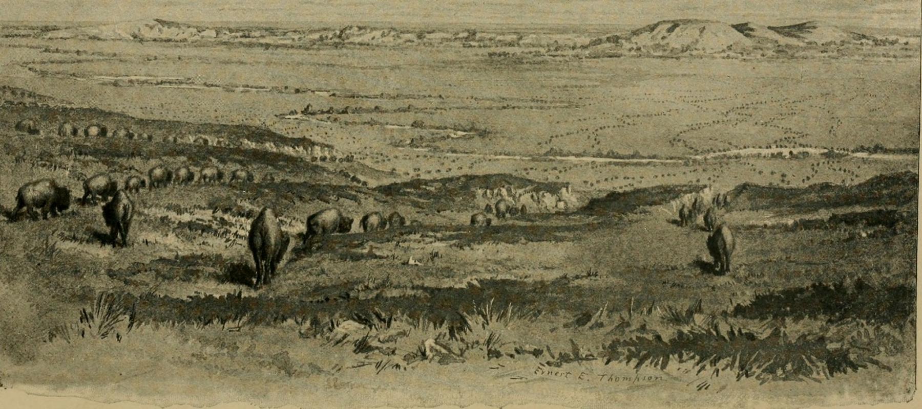
    <summary type="html"><![CDATA[<p><strong><em>By the late 1800s, Western sportsmen and settlers were hunting wildlife at such a rapid pace that many species risked extinction. Theodore Roosevelt recognized this and founded a club dedicated to conserving the land, resources, and wildlife for future generations.  </em></strong></p><img src="https://www.intermountainhistories.org/files/fullsize/31a977bb0a49566874be31d932edb7f7.jpg" alt="Artist’s depiction of big game in the American West in the late 19th century" /><br/><p>At the end of the 19th century, big game hunting became so popular that many wildlife populations faced extinction. Western railways increased access to previously remote regions, accelerating settlement. This Westward expansion also created a surge of irresponsible hunting for food, trophies, and improper land use. In 1883, on a trip to Little Cannonball Creek in Montana, Roosevelt enthusiastically hunted his first buffalo. Amid the thrill of this first-time accomplishment, he also reflected on the animal’s scarcity in his journal, “I watched the great beasts as they grazed...mixed with the eager excitement of the hunter was a certain half-melancholy feeling as I gazed on these bison, themselves part of the last remnant of a doomed and nearly vanished race.”
Like Roosevelt, many other sportsmen noticed how quickly wildlife in the West was disappearing. Determined to preserve his hobby and the land he loved, Roosevelt gathered fellow hunters to form the Boone and Crockett Club. Named after Daniel Boone and Davy Crockett, two famous frontiersmen and heroes of American expansion, the club advocated for the conservation and management of wildlife and habitat in the nation’s newest territories.
Founded on December 7, 1887, with the help of visionaries like George Bird Grinnell, Madison Grant, Gifford Pinchot, and 20 others, the club helped enact many legislative acts to protect and manage public lands. With their great influence, they initiated management regulations in the nation's first National Parks like Yellowstone, Glacier, and the Grand Canyon. They lobbied for federal laws that passed, including the 1891 General Revision Act (also known as the Forest Reserve Act), which enabled the President to withdraw forested lands from the public domain and offer them protections not guaranteed under previous legislation like the 1873 Timber Culture Act. This led to millions of acres being designated as “forest reserves” in the following two decades.
Roosevelt continued his efforts and spoke out about conservation when he was president with his annual address to Congress in 1907, saying, "Optimism is a good characteristic, but if carried to an excess, it becomes foolishness. We are prone to speak of the resources of this country as inexhaustible; this is not so." Educating the public, one of the club's biggest successes was the “Fair Chase” hunting ethic. This philosophy influenced game laws in the United States and created a system of data collection to monitor North American habitat health and big game populations today. Dedicated hunters and naturalists in the Boone and Crockett Club continually play a key role in balancing the well-being of the wild and the enjoyment of future generations. Roosevelt emphasized the importance in his book, My Life as a Naturalist, in 1918, “While my interest in natural history has added very little to my sum of achievement, it has added immeasurably to my sum of enjoyment of life.” He speaks for the wildlife as it cannot speak for itself.</p><p><em><strong><a href="https://www.intermountainhistories.org/items/show/925">For more (including 3 images) view the original article</a></strong></em></p>]]></summary>
    <published>2025-10-24T15:03:20+00:00</published>
    <updated>2026-08-18T15:52:41+00:00</updated>
    <link rel="alternate" type="text/html" href="https://www.intermountainhistories.org/items/show/925"/>
    <id>https://www.intermountainhistories.org/items/show/925</id>
    <author>
      <name>Jessika Cole, Brigham Young University</name>
    </author>
  </entry>
  <entry>
    <title type="html"><![CDATA[Theodore Roosevelt and the Havasupai in the Grand Canyon: Story 2 of 8 of the President Theodore Roosevelt in the West Tour]]></title>
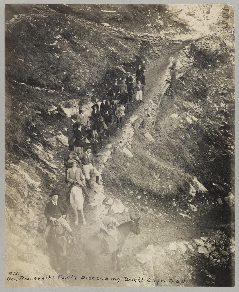
    <summary type="html"><![CDATA[<p><strong><em>President Theodore Roosevelt visits the Grand Canyon meeting the Havasupai Tribe. His efforts are making this landmark a National Park.</em></strong></p><img src="https://www.intermountainhistories.org/files/fullsize/81adde6a6a5c04daf97ec29b93d422ee.jpg" alt="Down a winding pathway, Theodore Roosevelt and others ride mules down Bright Angel Trail in the Grand Canyon" /><br/><p>Theodore Roosevelt traveled over 14,000 miles, visiting over 25 states, in the span of nine weeks in the early summer of 1903. His western tour was filled with speeches, commemorations, and his favorite thing to do: exploring the outdoors. His tours of Yosemite and Yellowstone are widely known, but in between them, he visited the Grand Canyon on May 6, 1903. He said, giving a speech, “In the Grand Canyon, Arizona has a natural wonder which, so far as I know, is absolutely unparalleled throughout the rest of the world.” Astounded, he said, “I shall not attempt to describe it, because I cannot. I could not choose words that would convey or that could convey to any outsider what that canyon is.” The majesty of Earth’s beauty there led him to explore more.
Riding a mule down Bright Angel Trail, he met two natives from the Havasupai tribe who lived in the Indian Garden with their families. For 1,000 years, the tribe lived in this region without outside contact, until Spanish priest Francisco Garces explored the area in 1776. As a result of the Santa Fe Railroad in the early 18th century, the Havasupai had increasingly more contact with other explorers and settlers. When Roosevelt and his regiment visited, he asked them to leave to make the canyon a National Park. To gain the status of a national park, all private development on the land would be illegal according to Congress. This resulted in the Havasupi’s relocation to a 518-acre reservation in Havasu Canyon instead.
Roosevelt was also concerned about the commercialization and exploitation of the land due to encroaching mining and timber interests. On June 8th, 1906, he signed the Antiquities Act, which authorized the president to “declare by public proclamation historic landmarks, historic and prehistoric structures, and other objects of historic or scientific interest that are situated upon the lands owned or controlled by the Government of the United States to be national monuments.” Subsequently, this act was used to establish the Grand Canyon National Monument on January 11th, 1908. It was made a National Park in 1919. Roosevelt Point and Trail were named in the President’s honor for the efforts he provided. A placard at Roosevelt Point reads another part from his speech advocating one request, “Leave it as it is. You can not improve on it. The ages have been at work on it, and man can only mar it. What you can do is to keep it for your children, your children's children, and for all who come after you, as one of the great sights which every American, if he can travel at all, should see.” Poetically, he wrote a letter to John Hay, former Secretary of State, summing up his experience on his Western tour and paying special attention to the Grand Canyon, “To me the most impressive piece of scenery I have ever looked at. I don’t exactly know what words to use in describing it. It is beautiful and terrible and unearthly. It made me feel as if I were gazing at a sunset of strange and awful splendor.” Today, almost 5 million tourists continue to explore this canyon that Roosevelt cared so profoundly to preserve.</p><p><em><strong><a href="https://www.intermountainhistories.org/items/show/924">For more (including 4 images) view the original article</a></strong></em></p>]]></summary>
    <published>2025-10-24T15:03:19+00:00</published>
    <updated>2026-08-18T15:52:34+00:00</updated>
    <link rel="alternate" type="text/html" href="https://www.intermountainhistories.org/items/show/924"/>
    <id>https://www.intermountainhistories.org/items/show/924</id>
    <author>
      <name>Jessika Cole, Brigham Young University</name>
    </author>
  </entry>
  <entry>
    <title type="html"><![CDATA[Theodore Roosevelt and Roosevelt Dam: Story 6 of 8 of the President Theodore Roosevelt in the West Tour]]></title>
    <summary type="html"><![CDATA[<p><strong><em>President Theodore Roosevelt dedicated the Roosevelt Dam. At the time, it was the largest artificial lake and the largest masonry dam in the United States. </em></strong></p><img src="https://www.intermountainhistories.org/files/fullsize/a6393024b0add557182e524e08d64ac1.jpg" alt="Apache Indian men working on Roosevelt Dam" /><br/><p>The signing of the Newlands Reclamation Act by President Theodore Roosevelt in 1902 began “the construction of irrigation works for the reclamation of arid lands.” One of the first projects authorized under this act was the world’s largest masonry dam, the Roosevelt Dam. The first stone was placed on September 20, 1906. Benjamin Austin Fowler, a former lawyer from New York City, was central to the dam’s construction. Having left the city scene, Fowler moved to the West in 1899, where he purchased 400 acres in Glendale, Arizona, to become a farmer. With the dry climate and high temperatures, water was scarce, and his farming would be greatly aided if a reservoir could provide steady irrigation water access. Fowler lobbied for 17 years for a dam and reservoir to be constructed northeast of Phoenix, in a narrow canyon of the Salt River. The Roosevelt Dam was built to provide flood control, municipal and irrigation water, and hydropower for central Arizona. This project involved over 3,000 diverse workers. There was a shortage of workers in the summer because of the intense heat, and one of the engineers remarked, “White men won’t stay on this job because they cannot spend their money fast enough.” In turn, they hired Apache Indians who had already long dwelt in the area, and who had excellent labor skills. They completed the dam on February 5, 1911. Roosevelt Lake was the largest artificial lake in the world when it held over 1 million acres of water.
One month later, on March 18th, former President Theodore Roosevelt came with a wagon parade to dedicate the dam. As most of the previous roads were then under the waters of the new reservoir, they took a route up the Apache Trail. Roosevelt reflected on the beauty of the wildflowers and landscapes in his dedicatory speech. At 5:48 pm and with about 1,000 spectators, he flipped the electric switch and opened the gate to begin Arizona’s new era of water control. This contributed to many settlements and a growing community that would not have existed otherwise. Serving communities with sustainable water and energy, Fowler’s and Roosevelt’s efforts paid off as the Scientific American newspaper publicized on the dam’s dedication day, “With the completion of the irrigation system which is being constructed by the federal government, we may safely predict for this valley an era of progress and substantial growth which will place it in the forefront of the most up-to-date agricultural districts in the world.”
The Salt River Project has monitored Roosevelt Dam since 1911, and the site has changed in many ways. In 1992, overflowing problems necessitated renovations. The road to drive across it was removed, the dam was raised 23.5 meters, and a bridge was suspended over Roosevelt Lake. Today, many make the trek to enjoy the water and view the architectural feat that the Roosevelt Dam is.</p><p><em><strong><a href="https://www.intermountainhistories.org/items/show/923">For more (including 4 images) view the original article</a></strong></em></p>]]></summary>
    <published>2025-10-24T15:03:19+00:00</published>
    <updated>2026-08-18T15:52:26+00:00</updated>
    <link rel="alternate" type="text/html" href="https://www.intermountainhistories.org/items/show/923"/>
    <id>https://www.intermountainhistories.org/items/show/923</id>
    <author>
      <name>Jessika Cole, Brigham Young University</name>
    </author>
  </entry>
  <entry>
    <title type="html"><![CDATA[Theodore Roosevelt&#039;s Ride Through the Cowboy State: Story 5 of 8 of the President Theodore Roosevelt in the West Tour]]></title>
    <summary type="html"><![CDATA[<p><strong><em>President Theodore Roosevelt's iconic horseback ride from Laramie to Cheyenne to greet the veterans and citizens of Wyoming.</em></strong></p><img src="https://www.intermountainhistories.org/files/fullsize/60adc8f5c3838543347d6d16506e64cc.jpg" alt="President Roosevelt mounted on Ragalon, a horse who could count, bow, roll over, and distinguish colors. It was a “fine galloper and a speedy trotter.” " /><br/><p>President Theodore Roosevelt had a penchant for the dramatic in his public persona. His 1903 visit to Wyoming and May 31 speech commemorating Decoration Day (Memorial Day) was no exception.
Upon arrival in Evanston, Wyoming, via train from the west, President Theodore Roosevelt was greeted by a crowd of 7,000 peoplegathered from Wyoming and surrounding states to see the Commander in Chief. After a short visit, he continued east to Laramie, Wyoming. From there, he rode the remaining 65 miles to Cheyenne, Wyoming, on horseback. Along the way, he changed horses four times with prominent citizens like Senator Francis E. Warren and famous lawman and Black Hills Forest Reserve Supervisor Seth Bullock.Senator Warren, in a telegram, said it would be a “long, hard ride,”and indeed it was. Familiar with risk and discomfort, and always eager to make a dramatic scene, Roosevelt’s party emerged from a mountain valley near Telephone Canyon and was greeted by a crowd in Cheyenne. The Cheyenne Daily Leader later wrote, "The West was written in every line of his frame," alluding to Roosevelt’s strong connection with the land and spirit of the West. The stunt exemplified his well-known advocacy for the “strenuous life” and love of the West. Having “waved all possible objections” to overcome the difficulties he might have encountered, Roosevelt felt the West as a very restorative place. At the lowest point in his life, when his mother and wife died the same day, he had “lost the light” in his life but found it again in the American West.
Nearly 20,000 citizens gathered in Cheyenne to hear the President speak on May 31, 1903. Reflecting on his horseback arrival, he stated his desire “not to strive to find out the things that are easiest to do, but the things that are best worth doing.” The crowd included Civil War veterans in both Confederate gray and Union blue uniforms. With them in view, he emphasised the importance of national unity. Referring to the their wartime service, he declared “You don’t care where that man’s birthplace has been; you don't care a snap of your fingers how he worshiped his Maker; you don't care whether he was a banker, bricklayer, lawyer, mechanic, or farmer” Perhaps hoping to point to bridging divides between former enemies, he continued, “It is the same thing now in civil life.”His message was well-received, and the citizens reflected that sense of community with a frontier twist. A handsome cowpony, Ragalon, was gifted to Roosevelt with a specially made saddle, bridle, and blanket. Roosevelt was also entertained with an impromptu frontier show and many barbecues during his stay. 
This time in Wyoming marked the value Roosevelt had for veterans and small towns in America. His personability with common Americans, honored veterans included, helped boost his popularity in the subsequent 1904 election. Roosevelt loved the West, and the West loved him back.</p><p><em><strong><a href="https://www.intermountainhistories.org/items/show/922">For more (including 4 images) view the original article</a></strong></em></p>]]></summary>
    <published>2025-10-24T15:03:18+00:00</published>
    <updated>2026-08-18T15:52:16+00:00</updated>
    <link rel="alternate" type="text/html" href="https://www.intermountainhistories.org/items/show/922"/>
    <id>https://www.intermountainhistories.org/items/show/922</id>
    <author>
      <name>Jessika Cole, Brigham Young University</name>
    </author>
  </entry>
  <entry>
    <title type="html"><![CDATA[Teddy Roosevelt and John Muir Adventures in Yosemite: Story 3 of 8 of the President Theodore Roosevelt in the West Tour]]></title>
    <summary type="html"><![CDATA[<p><strong><em>President Theodore Roosevelt and his guide John Muir explored California’s beautiful National Park, Yellowstone, resulting in a nationwide conservation effort. </em></strong></p><img src="https://www.intermountainhistories.org/files/fullsize/091739d27efed8fc403fa07e54012ffd.jpg" alt="Theodore Roosevelt and John Muir pose in front of Glacier Point at Yosemite" /><br/><p>With a fondness for adventure, the outdoors, and the American West, President Theodore Roosevelt itched to experience the natural landscapes in California he’d heard so much about. Yosemite was one of only two national parks at the turn of the century, and he felt it fitting to include that stop in his 1903 Western tour. Roosevelt wrote a letter to John Muir, a Scottish botanist and conservationist who caught the President’s attention with his non-fiction novel “Our National Parks,” and asked him to be his guide. “I do not want anyone with me but you, and I want to drop politics absolutely for four days and just be out in the open with you.” Muir had an overseas journey planned in Europe and Asia at that time that he didn’t think he could cancel. After explaining the situation to the President of the University of California, Benjamin Ide Wheeler, he got an appeal and joined Roosevelt in the mountains, “I might be able to do some forest good in freely talking around the campfire,” Muir mused. As per Roosevelt’s request, politics were not discussed, but Muir’s agenda was nonetheless accomplished: to advocate for the land in the American West.
Roosevelt and his contingent arrived at Yosemite’s Wawona Hotel on May 15, 1903. With others remaining there, Muir, Roosevelt, a cook, two packers, and four mules left for the trees. They traveled through the giant sequoias, wandered through Mariposa Grove in the valley, and one night after camping at Glacier Point, they woke up to a blanket of snow, five inches atop them. If Roosevelt didn’t have forty wool blankets his men laid down for him and a warm fire by his side, he would have froze! Nonetheless, the men had great conversations. Charles Leidig was the cook and documented that “they talked a great deal about the conservation of forests in general and Yosemite in particular.” He also said, “he heard them discussing the setting aside of other areas in the United States for park purposes.” Muir had, indeed, done the “forest good.”
This trip jump-started Roosevelt's efforts to preserve public lands and natural resources across the nation. He was impressed to immediately go to Congress when returning to Washington and implement some of Muir’s ideas. He pushed for wildlife reserves, and on June 8, 1906, he signed the Antiquities Act which allowed the President to “declare by public proclamation historic landmarks” to be “national monuments, and may reserve as a part thereof parcels of land, the limits of which in all cases shall be confined to the smallest area compatible with proper care and management of the objects to be protected.” Roosevelt famously said in a speech in Sacramento after his experience in Yosemite, “We are not building this country for a day. It is to last through the ages.” Yosemite laid the groundwork for protecting other national forests in California and across the nation.</p><p><em><strong><a href="https://www.intermountainhistories.org/items/show/921">For more (including 3 images) view the original article</a></strong></em></p>]]></summary>
    <published>2025-10-24T15:03:18+00:00</published>
    <updated>2026-08-18T15:52:06+00:00</updated>
    <link rel="alternate" type="text/html" href="https://www.intermountainhistories.org/items/show/921"/>
    <id>https://www.intermountainhistories.org/items/show/921</id>
    <author>
      <name>Jessika Cole, Brigham Young University</name>
    </author>
  </entry>
  <entry>
    <title type="html"><![CDATA[The Big Stick: Teddy Roosevelt Speaks at Idaho University: Story 7 of 8 of the President Theodore Roosevelt in the West Tour]]></title>
    <summary type="html"><![CDATA[<p><strong><em>“Ex-President Theodore Roosevelt visits the University of Idaho to give a speech and plant a tree,” read an article from Moscow, Idaho’s Daily Argonaut in anticipation of his April 9, 1911, visit to town.</em></strong></p><img src="https://www.intermountainhistories.org/files/fullsize/c5ffffacc9410315cdef74f37b166af9.jpg" alt="Theodore Roosevelt address Idaho citizens atop a stack of wheat sacks. This is a nod to his time as a Rough Rider and agricultural advancements in Idaho" /><br/><p>Even though he had visited Idaho twice before, President Theodore Roosevelt’s spring 1911 visit to the state was no less elaborate and momentous. His escort through Moscow, Idaho, could barely get to his hotel as the streets were so packed full of excited spectators. After arriving at his hotel and indulging in an informal Sunday dinner with “a small party of political officials,” Roosevelt appeared grandly at the University of Idaho the following morning, April 9, 1911. From breakfast in Ridenbaugh Hall with about 80 of the school’s finest, “university faculty, several prominent citizens and government officials, and the presidents and secretaries of the various classes of the university” Roosevelt was “escorted by the Grand Army Corps, carrying the American flag, and by a company of the University cadets” and saluted by the students until he arrived in front of the administrative building. A crowd Roosevelt estimated to be about 20,000 gathered to hear his address.
The setup for Roosevelt’s speech was unusual. The Administration building’s front doors were stacked with what seemed to be sandbags but were in fact sacks of wheat. This was a nod to northern Idaho’s agricultural industry. It made for a striking image as the adventurous former president climbed and spoke from the top of the pile. His 45-minute speech urged Idaho to “follow the rest of the West in progressive legislation.” Roosevelt was preparing to run for his 3rd term as the Progressive Party (also nicknamed the Bull Moose Party) candidate. He continued that, “true government by the people once obtained and improperly used, would work out for us, not salvation, but damnation.” After concluding, the crowd witnessed Roosevelt planting a tree on the university’s lawn. Still standing today, with a placard label, Roosevelt’s Colorado Blue Spruce is a reminder of Roosevelt’s 1911 visit and his views on forestry, the outdoors, and conservation. Speech and tree-planting concluded, Roosevelt made his way to the train station and departed Moscow by 10:30 AM.
This particular visit to the University of Idaho made a special impact through symbolism and memorabilia. Reflecting on the University’s motto, “For the training of Idaho's future citizens to their highest usefulness in private life and public service” Roosevelt said he admired the ideals that were expressed and that “the pioneer spirit is still the proper spirit, but with it we must prepare to meet new conditions.” His tree planting stunt helped those present remember the importance of the conservation of natural resources. With its presence standing tall on campus today, it serves as a reminder for the current generations to be good farmers and good citizens.
 </p><p><em><strong><a href="https://www.intermountainhistories.org/items/show/920">For more (including 3 images) view the original article</a></strong></em></p>]]></summary>
    <published>2025-10-24T15:03:17+00:00</published>
    <updated>2026-08-18T15:51:59+00:00</updated>
    <link rel="alternate" type="text/html" href="https://www.intermountainhistories.org/items/show/920"/>
    <id>https://www.intermountainhistories.org/items/show/920</id>
    <author>
      <name>Jessika Cole, Brigham Young University</name>
    </author>
  </entry>
  <entry>
    <title type="html"><![CDATA[Yellowstone’s Favorite President’s Monument: Roosevelt Arch: Story 1 of 8 of the President Theodore Roosevelt in the West Tour]]></title>
    <summary type="html"><![CDATA[<p><strong><em>Yellowstone receives an upgraded welcome with the Roosevelt Arch and gets a surprise visitor, Theodore Roosevelt, to dedicate it. </em></strong></p><img src="https://www.intermountainhistories.org/files/fullsize/f5ae52940338461ed18d1b83497abbb0.jpg" alt="President Roosevelt addresses a crowd at the dedication of Roosevelt Arch" /><br/><p>“Dedicated and set apart as a public park or pleasuring-ground for the benefit and enjoyment of the people.” Roosevelt Arch is a hearty welcome on the North entrance side of Yellowstone National Park. Standing at 52 feet, this monument is a symbol ofthe cultural and natural significance of the Park. Erected in 1903, the arch spanned what was at the time the park’s only entrance. Visitors passed under the arch from Gardiner, Montana, taking stagecoaches into Yellowstone. Army Co Engineer, Hiram M. Chittenden, the idea man, said, “...the natural features of the country at this portion of the boundary are about the least interesting of any part of the Park, and the first impression of visitors upon entering the Park was very unfavorable.” Accordingly, he proposed the arch as a beautiful park entry. Construction began on February 19, 1903 and a dedication ceremony was planned for April 24, 1903 to coincide with Roosevelt's planned visit to the park.</p><p>Yellowstone Park officials asked Roosevelt to participate in the event. This was a perfect opportunity for his conservation efforts and love for the park. With great fanfare, Roosevelt shared, “The geysers, the extraordinary hot springs, the lakes, the mountains, the canyons, and cataracts unite to make this region something not wholly to be paralleled elsewhere on the globe.” His love for the land was shared with the visitors there. They added a time capsule in the arch containing local newspapers, a bible, Masonic documents, a picture of President Roosevelt, and U.S. coins, among other items.
Roosevelt Arch still stands as a ceremonial welcoming committee to Yellowstone. Although not as popular as it was in the 20th century because of changing traffic patterns, automobiles couldn’t take the route like stagecoaches had, it is still a valuable spot to visit when exploring the park. Multiple entrances being added make this an out-of-the-way stop for those accessing the park from the more popular southern and western entrances. Yellowstone is visited by approximately 4 million people annually, and the arch continues to be a popular destination, especially for those visiting the Mammoth area or arriving from points north. It was added to the National Register of Historic Places in 2002 and is a potent symbol and reminder that National parks are “For the benefit and enjoyment of the people” as Theodore Roosevelt referenced the Act Congress passed in 1872 making Yellowstone a public park in his speech, and is not engraved on a place at the top of the arch itself.</p><p><em><strong><a href="https://www.intermountainhistories.org/items/show/919">For more (including 4 images) view the original article</a></strong></em></p>]]></summary>
    <published>2025-10-24T15:03:17+00:00</published>
    <updated>2026-08-18T15:51:51+00:00</updated>
    <link rel="alternate" type="text/html" href="https://www.intermountainhistories.org/items/show/919"/>
    <id>https://www.intermountainhistories.org/items/show/919</id>
    <author>
      <name>Jessika Cole, Brigham Young University</name>
    </author>
  </entry>
  <entry>
    <title type="html"><![CDATA[Teddy Roosevelt&#039;s Welcome in the Beehive State: Story 4 of 8 of the President Theodore Roosevelt in the West Tour]]></title>
    <summary type="html"><![CDATA[<p><strong><em>President Teddy Roosevelt's Welcome in the Beehive State and his patriotic parade. He addresses Utah citizens and their advancements in irrigation and economics. </em></strong></p><img src="https://www.intermountainhistories.org/files/fullsize/a7ca3d8cfd35ec2ca4a058b9d4af50b2.jpg" alt="President Roosevelt speaks to Ogden citizens on his way to Salt Lake City" /><br/><p>Incoming from Ogden, Utah, pulled by the Union Pacific Engine No. 659, President Theodore Roosevelt steps onto the Oregon Short Line Depot on May 29th, 1903, at 8:30 am, greeted by thousands waiting for his arrival since 6 am. The Salt Lake Tribune newspaper covers the day as the itinerary is published, highlighting, “Today Salt Lake and Utah have the distinguished honor of entertaining the Chief Magistrate of the United States. An enthusiastic welcome is accorded, and our only regret is the briefness of the visit.” On his whistle-stop tour of the West, Roosevelt is adorned with cheers and taken through a parade around Salt Lake City with a route lined with 50,000 people, flags, ribbons, and all manner of decorations along the street. Stores closed, and the city practically shut down other than essentials to welcome in the 26th president. Roosevelt delighted seeing a “little tot of the kindergarten…” and was impressed to say, “I am very glad to see you. I believe in work and I believe in play. Play hard while you play; and when you work, don’t play at all. That is good advice for children, and it is good advice for grown folks too. It is a great pleasure to see you.” With a big, burly grin, Roosevelt paraded Eastward from West South Temple Street to Main Street, passing by school children and mounted soldiers until he arrived at his destination, the Tabernacle.
The Salt Lake City Tabernacle was also decorated with banners, greenery, flags, and ribbons. It was a common congregating location for members of the Church of Jesus Christ of Latter-day Saints and was used to host Roosevelt’s address to the citizens of Utah. The Salt Lake Herald reported the next day that the, “Historic old building could not accommodate the throngs that gathered there” it was so packed. Roosevelt was accompanied by Senator Thomas Kearns, members of the influential Alta Club and Lester Club, LDS Church President Joseph F. Smith, Mayor Ezra Thompson, Governor Heber Manning Wells, and singer Emma Ramsey (also known as “The Utah Nightingale.”) Ramsey opened the event by singing “Rent the Air,” according to the Deseret News. Roosevelt covered many topics he was known for, including his love of the wilderness and respect for the land<b>. </b>His point about conservation was made, “while citizens die, the government and the nation do not die, and we are bound in dealing with the forests to exercise the foresight necessary to use them now, but to use them in such way as will also keep them for those who are to come after us.” This was a great feat, particularly in Utah, as he emphasized the hard work of the citizens, “You took territory which at the outset was called after the desert, and you literally—not figuratively—you literally made the wilderness blossom as the rose.” Utah’s happy reaction was reflected in the evening newspaper, “It is not often that Salt Lake gets to look upon the actual person of a president of the United States, but when it does it enjoys it thoroughly. The appreciation it felt today of the honor of the visit was manifest in every possible manner. Its citizens turned out with pride and turned her children out with still greater pride.”
After his short visit, Roosevelt was back on the train at 1:00 p.m. Utah citizens celebrated his visit with great remembrance. It strengthened the state’s relationship with the federal government and aided Roosevelt’s success in gaining Utah’s vote for the 1904 presidential election. For the rest of his Western tour, he created a precedent of energy and patriotism that Theodore Roosevelt was known for sharing.</p><p><em><strong><a href="https://www.intermountainhistories.org/items/show/918">For more (including 5 images) view the original article</a></strong></em></p>]]></summary>
    <published>2025-10-24T15:03:16+00:00</published>
    <updated>2026-08-18T15:51:43+00:00</updated>
    <link rel="alternate" type="text/html" href="https://www.intermountainhistories.org/items/show/918"/>
    <id>https://www.intermountainhistories.org/items/show/918</id>
    <author>
      <name>Jessika Cole, Brigham Young University</name>
    </author>
  </entry>
  <entry>
    <title type="html"><![CDATA[1988 Fire Season, Yellowstone National Park]]></title>
    <summary type="html"><![CDATA[<p><strong><em>Starting in the 1970s, Yellowstone National Park experimented with a policy that allowed natural fires to burn within park boundaries. In 1988, a series of highly destructive wildfires put this policy to the test, leading to a comprehensive review of the National Park Service’s fire management procedures. </em></strong></p><img src="https://www.intermountainhistories.org/files/fullsize/cbe39d48527aa1fc2d28fe58044f461b.jpg" alt="Wildfire smoke behind Old Faithful Lodge, 1988" /><br/><p>In 1972, the United States National Park Service (NPS) adopted Yellowstone National Park’s first fire management plan, which allowed natural fires to burn in designated parts of the park. In 1976, a revised plan expanded this controversial approach, called prescribed natural fire or the “let-burn” policy, to impact the entire park. Historically, fires played a key role in thinning forests and clearing dry, dead plants from the landscape, and species like lodgepole pine trees rely on extreme heat from fires to release their seeds and reproduce. In theory, prescribed natural burning maintained these conditions and controlled the damage fires caused. While smoke pollution from let-burn events caused controversy throughout the 1970s, they scorched only 34,175 of Yellowstone's 2,221,800 acres between 1977 and 1988. The Park Service extinguished any fires that threatened people, buildings, or roads.
In the summer of 1988, dry weather and high winds created dangerous conditions in Yellowstone. On June 14, 1988, lightning sparked the Storm Creek Fire just north of the park near Cooke City, Montana, and it gradually made its way into Yellowstone’s boundaries. Initially, NPS allowed about twenty lightning-caused fires, including Storm Creek, to burn in every corner of Yellowstone. Without rainfall to dampen their impact, wind spread the fires rapidly. By July 15, the Park Service suspended the let-burn policy and fought every fire that threatened the park.
The public idolized Yellowstone as the first national park and a crown jewel of the park system, so the 1988 fires rapidly generated a significant media presence in Yellowstone and caused public backlash. By August, the Cable News Network (CNN) and National Broadcasting Company (NBC) sent reporters to the park and presented daily fire updates. When the largest blaze in the park, the North Fork Fire, threatened the historic Old Faithful Inn on September 7, reporters and their viewers blamed NPS officials and the let-burn policy for allowing the fires to spread out of control. A week later, presidential candidate Michael Dukakis visited the park to generate publicity for his campaign, symbolizing the fires’ grip on national media.
             When snow finally ended the fires in November, fifty-one total fires had burned 995,000 acres, damaging about forty-five percent of the park. They destroyed sixty-seven structures in total, including thirty-six privately owned homes, garages, and stores. The North Fork Fire alone scorched approximately 495,000 acres. After the fires, two review committees found that they represented a perfect storm of natural conditions that made them incredibly difficult to fight, but politicians and the media continued to place blame on NPS management strategies. On July 12, 1989, the Park Service began a systematic review of its fire management procedures. Its new policy, approved in 1991, set detailed limits on the prescription and containment of natural fires, rolling back much of the let-burn approach. Firefighters still use prescribed burns and let-burn management to maintain healthy forests in national parks today, sustaining the 1991 policy.</p><p><em><strong><a href="https://www.intermountainhistories.org/items/show/917">For more (including 4 images) view the original article</a></strong></em></p>]]></summary>
    <published>2025-09-23T15:39:30+00:00</published>
    <updated>2026-04-17T19:32:21+00:00</updated>
    <link rel="alternate" type="text/html" href="https://www.intermountainhistories.org/items/show/917"/>
    <id>https://www.intermountainhistories.org/items/show/917</id>
    <author>
      <name>Kaylen Wilson, Northern Arizona University </name>
    </author>
  </entry>
</feed>