The Donners in Echo Pass and Weber Canyon
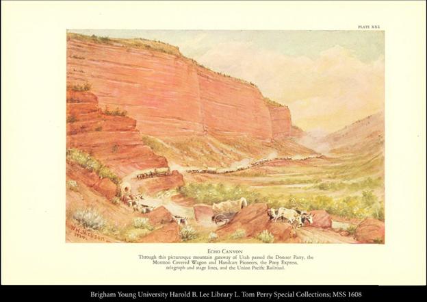
Jackson, William Henry, L. Tom Perry Special Collections, Harold B. Lee Library, Brigham Young University, William Henry Jackson Collection; Transcontinental Migration Archive, 1934.
https://cdm15999.contentdm.oclc.org/digital/collection/Jackson/id/3437
Having separated from the main Oregon/California trail after the Continental Divide, the Donner Party reached the mouth of Echo Canyon in Eastern Utah in early August, 1846. This marked the beginning of uncharted territory and an arduous journey through the Wasatch mountain range in present-day Utah. Invaluable time was wasted cutting brush and trees, passing through thin crevices, or crossing mountain rivers and streams.
Traveling through the narrow ravines and steep peaks was not a challenge for the traditional route to California or Oregon Country. Lansford Hastings, a frontier explorer and creator of this cutoff through the Wasatch Mountains and Great Basin desert, had taken smaller groups of emigrants through the cutoff earlier in the season, but their smaller size required less assistance than the Donner Party needed. One arduous landmark in Weber Canyon featured a creek with jagged boulders enclosed by steep canyon walls as the only passable route. The party had to hoist wagons over each individual boulder to continue. Aware of these challenges, Hastings had left the party a note instructing them to send someone ahead to get alternate route directions from him once they reached the Weber River. Leader James Reed and others left on August 6th, and returned August 10th with Hiram Miller’s diary recording“Reed having examined the new rout [route] entirely an [and] reported in favour, which induced the company to proceed.”
Pace slowed as the party wound its way through the mountain range. The trail was rocky and overgrown, necessitating bushwhacking and the clearing of trees and other debris. Virginia Reed said, “There was absolutely no road, not even a trail. The cañon [canyon] wound around among the hills. Heavy underbrush had to be cut away and used for making a roadbed.” They might criss-cross a stream up to 13 times in a single day just to proceed, or spend multiple days clearing debris only to make no forward progress. In a cruel twist of irony, the large migration of Latter-Day Saints from Nauvoo, Illinois used the same path the Donners had blazed to swiftly reach the Salt Lake Valley one year later in 1847. The Saints advance party recorded that they “followed the gouges of the Donner wheels to the top” of what is known as Donner Hill, which is “as near vertical as wagons have ever managed.” The Donners only summited this steep hill because they failed to clear the last gorge of debris after several days of trying. The Saints cleared the gorge in the span of a day. The gorge is now the proud ‘Emigration Canyon’, from which the migration of Latter-day Saints made their main path to reach the Salt Lake Valley.
Three weeks after their arrival at Echo Pass, the party looked back from the floor of the Salt Lake Valley and saw they had traveled only 35 miles. At the same time, parties who had left earlier in the year were already leaving the Great Salt Lake Desert, moseying along the Humboldt River in modern-day Northern Nevada, and descending into Sacramento. Compounded by a markedly late-season start to begin with, the Donner Party’s delay threatened their ability to reach and cross the Sierra Nevada Mountains before Winter. It was well-known that this last mountain range before central-California would be impassable once snow began to fall. If they could not make up for lost time, it would certainly result in the parties entrapment in the mountains.
Images
Jackson, William Henry, L. Tom Perry Special Collections, Harold B. Lee Library, Brigham Young University, William Henry Jackson Collection; Transcontinental Migration Archive, 1934.
https://cdm15999.contentdm.oclc.org/digital/collection/Jackson/id/3437
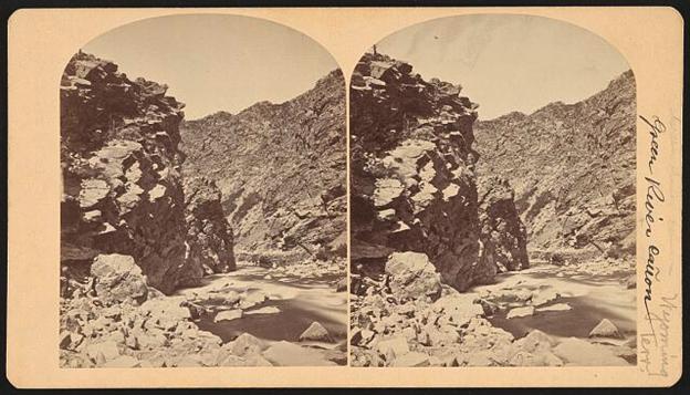
O’Sullivan, Timothy H. Photograph courtesy of and used with permission by the Library of Congress, before 1882.
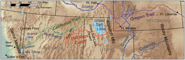
Photo retrieved from Wikimedia Commons, the free media repository, 19 March 2010.
https://commons.wikimedia.org/wiki/File:Donner_route_map.png

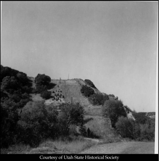
https://contentdm.lib.byu.edu/digital/collection/OTImages/id/61/rec/4