<?xml version="1.0" encoding="UTF-8"?>
<feed xmlns="http://www.w3.org/2005/Atom">
  <title type="text">Intermountain Histories</title>
  <updated>2026-04-17T19:32:21+00:00</updated>
  <generator uri="http://framework.zend.com" version="1.12.20">Zend_Feed_Writer</generator>
  <link rel="alternate" type="text/html" href="https://www.intermountainhistories.org/"/>
  <link rel="self" type="application/atom+xml" href="https://www.intermountainhistories.org/items/browse?output=rss2"/>
  <id>https://www.intermountainhistories.org/</id>
  <author>
    <name>Intermountain Histories</name>
    <uri>https://www.intermountainhistories.org</uri>
  </author>
  <link rel="hub" href="https://pubsubhubbub.appspot.com/"/>
  <entry>
    <title type="html"><![CDATA[1988 Fire Season, Yellowstone National Park]]></title>
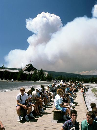
    <summary type="html"><![CDATA[<p><strong><em>Starting in the 1970s, Yellowstone National Park experimented with a policy that allowed natural fires to burn within park boundaries. In 1988, a series of highly destructive wildfires put this policy to the test, leading to a comprehensive review of the National Park Service’s fire management procedures. </em></strong></p><img src="https://www.intermountainhistories.org/files/fullsize/cbe39d48527aa1fc2d28fe58044f461b.jpg" alt="Wildfire smoke behind Old Faithful Lodge, 1988" /><br/><p>In 1972, the United States National Park Service (NPS) adopted Yellowstone National Park’s first fire management plan, which allowed natural fires to burn in designated parts of the park. In 1976, a revised plan expanded this controversial approach, called prescribed natural fire or the “let-burn” policy, to impact the entire park. Historically, fires played a key role in thinning forests and clearing dry, dead plants from the landscape, and species like lodgepole pine trees rely on extreme heat from fires to release their seeds and reproduce. In theory, prescribed natural burning maintained these conditions and controlled the damage fires caused. While smoke pollution from let-burn events caused controversy throughout the 1970s, they scorched only 34,175 of Yellowstone's 2,221,800 acres between 1977 and 1988. The Park Service extinguished any fires that threatened people, buildings, or roads.
In the summer of 1988, dry weather and high winds created dangerous conditions in Yellowstone. On June 14, 1988, lightning sparked the Storm Creek Fire just north of the park near Cooke City, Montana, and it gradually made its way into Yellowstone’s boundaries. Initially, NPS allowed about twenty lightning-caused fires, including Storm Creek, to burn in every corner of Yellowstone. Without rainfall to dampen their impact, wind spread the fires rapidly. By July 15, the Park Service suspended the let-burn policy and fought every fire that threatened the park.
The public idolized Yellowstone as the first national park and a crown jewel of the park system, so the 1988 fires rapidly generated a significant media presence in Yellowstone and caused public backlash. By August, the Cable News Network (CNN) and National Broadcasting Company (NBC) sent reporters to the park and presented daily fire updates. When the largest blaze in the park, the North Fork Fire, threatened the historic Old Faithful Inn on September 7, reporters and their viewers blamed NPS officials and the let-burn policy for allowing the fires to spread out of control. A week later, presidential candidate Michael Dukakis visited the park to generate publicity for his campaign, symbolizing the fires’ grip on national media.
             When snow finally ended the fires in November, fifty-one total fires had burned 995,000 acres, damaging about forty-five percent of the park. They destroyed sixty-seven structures in total, including thirty-six privately owned homes, garages, and stores. The North Fork Fire alone scorched approximately 495,000 acres. After the fires, two review committees found that they represented a perfect storm of natural conditions that made them incredibly difficult to fight, but politicians and the media continued to place blame on NPS management strategies. On July 12, 1989, the Park Service began a systematic review of its fire management procedures. Its new policy, approved in 1991, set detailed limits on the prescription and containment of natural fires, rolling back much of the let-burn approach. Firefighters still use prescribed burns and let-burn management to maintain healthy forests in national parks today, sustaining the 1991 policy.</p><p><em><strong><a href="https://www.intermountainhistories.org/items/show/917">For more (including 4 images) view the original article</a></strong></em></p>]]></summary>
    <published>2025-09-23T15:39:30+00:00</published>
    <updated>2026-04-17T19:32:21+00:00</updated>
    <link rel="alternate" type="text/html" href="https://www.intermountainhistories.org/items/show/917"/>
    <id>https://www.intermountainhistories.org/items/show/917</id>
    <author>
      <name>Kaylen Wilson, Northern Arizona University </name>
    </author>
  </entry>
  <entry>
    <title type="html"><![CDATA[Ouzel Fire, Rocky Mountain National Park]]></title>
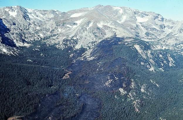
    <summary type="html"><![CDATA[<p><strong><em>In 1978, the Ouzel Fire tested Rocky Mountain National Park’s let-burn fire management policies. After park officials allowed it to burn, it escaped park boundaries and threatened the nearby community of Allenspark, Colorado, prompting backlash from residents. </em></strong></p><img src="https://www.intermountainhistories.org/files/fullsize/82b8dbf734d2ed422931bd8585e88351.jpg" alt="Aerial View of Ouzel Burn Area, September 1978" /><br/><p>In 1977, scientist David Butts composed a new management plan for Rocky Mountain National Park. This strategy, which the park quickly approved, aligned with evolving understandings of blazes within the United States National Park Service (NPS). Suppression defined NPS policy for decades, but in 1977, the nationwide NPS-18 procedure required parks to plan for let-burn fires. During these situations, park officials monitored natural burns closely, allowing them to burn in specific boundaries if they did not threaten structures or cultural resources. At Rocky Mountain, administrators followed this procedure by dividing park land into three distinct risk categories based on vegetation, elevation, and the number of structures nearby. Within low-risk areas, the Park Service allowed burning, but it suppressed any blaze that entered a moderate or high-risk area.
On August 9, 1978, the Ouzel Fire started in Rocky Mountain near Ouzel Lake. Park administrators considered the area low risk, so they allowed it to burn naturally. For a month, NPS closely monitored the flames, which stayed within a designated containment zone. However, on September 15, high winds in Wild Basin pushed Ouzel outside the Park Service’s boundaries. Firefighters immediately worked to suppress it , but the weather conditions made it difficult to contain. It quickly approached the park’s boundaries and the nearby town of Allenspark, Colorado. Ouzel became the first let-burn blaze to threaten a community outside park boundaries.
            On September 30, NPS declared Ouzel contained when heavy equipment created a barrier around it. When contained, fires end once they consume all available fuel. Firefighters halted Ouzel’s advance before it destroyed any structures in Allenspark, but the risk it posed generated significant hostility among residents. Many nearby communities also experienced air pollution during the blaze due to the smoke it released, generating further hostility. Locals argued that the let-burn policy had failed, and the Park Service irresponsibly placed its experimental management plan before the needs of residents.
To regain the trust of local communities, a local Park Service superintendent requested an official review of fire management operations during both the let-burn and suppression phases of Ouzel. Regional NPS manager Kenneth Ashley served as the board’s chair. It consisted of U.S Forest Service specialists, state foresters, and a professional fire scientist from Colorado State University. Its members met on November 8, 1978, and they found that the Park Service’s management plan was too vague to facilitate swift, decisive action during Ouzel. It recommended that Rocky Mountain should develop a new plan with public input. The board also suggested that prescribed burning, which deliberately lights blazes in controlled conditions, would be a safer and more effective way to achieve Rocky Mountain’s management goals. This suggestion marked the beginning of a national transition between the let-burn policy and prescribed burning.</p><p><em><strong><a href="https://www.intermountainhistories.org/items/show/916">For more (including 4 images) view the original article</a></strong></em></p>]]></summary>
    <published>2025-09-23T15:39:30+00:00</published>
    <updated>2026-04-17T19:32:21+00:00</updated>
    <link rel="alternate" type="text/html" href="https://www.intermountainhistories.org/items/show/916"/>
    <id>https://www.intermountainhistories.org/items/show/916</id>
    <author>
      <name>Kaylen Wilson, Northern Arizona University </name>
    </author>
  </entry>
  <entry>
    <title type="html"><![CDATA[La Mesa Fire, Bandelier National Monument]]></title>
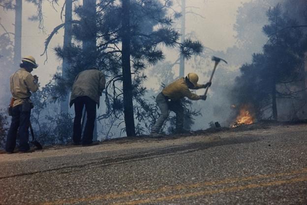
    <summary type="html"><![CDATA[<p><strong><em>In national parks and monuments, flames pose a significant threat to archaeological resources. During the 1977 La Mesa Fire, Bandelier National Monument became the first known park to conduct archaeological surveys on fire lines. </em></strong></p><img src="https://www.intermountainhistories.org/files/fullsize/c2bb9bc0b3c1876b9c14448a59827b75.jpg" alt="Firefighters battling the La Mesa Fire, c. 1977." /><br/><p>Established in 1916 to preserve Ancestral Puebloan archaeological resources near Los Alamos, New Mexico, Bandelier National Monument historically experienced few wildfires. Because the park protected cultural resources instead of natural ones, it extinguished fires to protect archaeological sites. The nearby development of the atomic bomb at Los Alamos, New Mexico, also made the Pajarito Plateau a high-risk area for federal officials, contributing to rapid suppression policies.
In 1977, the U.S National Park Service (NPS) approved NPS-18, a nationwide policy that established new protocols for fire management. Under the new “let-burn” policy, the Park Service allowed natural fires to burn and experimented with deliberate burns in controlled areas. However, the National Historic Preservation Act required archaeological surveys to approve prescribed burn areas. These policies put Bandelier in a delicate position: it had to simultaneously avoid burning cultural resources and promote the let-burn approach. As a result, park managers at Bandelier continued to suppress blazes long after most of the park system allowed them to burn.
            On June 16, 1977, the La Mesa Fire began in the Santa Fe National Forest near Bandelier’s park boundaries. Officials speculated that either a cigarette or a motorcyclist’s engine started it. Because it posed a risk to nearby communities, wildland firefighters worked to suppress La Mesa immediately. Hot, dry conditions and dense vegetation allowed it to spread quickly, threatening both residents and the national monument. By June 17, it entered Bandelier and started to advance towards Los Alamos. NPS evacuated families living in Bandelier’s Frijoles Canyon, demonstrating the immediate threat the flames posed to locals.
Below the surface of the ground, Bandelier contained numerous archaeological sites that researchers never examined. NPS used heavy equipment, including bulldozers, to construct physical barriers where flames could not access fuel. The blaze itself also threatened to destroy delicate structures. These factors meant both La Mesa and the efforts to stop it endangered the national monument. In response, Park Service scientist Millford R. Fletcher worked with cultural resource manager Cal Cummings to enlist volunteer archaeologists on fire lines who surveyed land in front of heavy equipment and recommended locations that would minimize damage to archeological sites. While they could not survey every line in the area, La Mesa damaged only forty percent of the cultural resources it threatened, demonstrating their effectiveness.
On June 21, summer rain slowed La Mesa down, allowing firefighters to contain it. It burned over 23,000 acres, becoming the largest wildfire on the Pajarito Plateau in the twentieth century. The blaze exposed gaps in NPS fire policy, which had not historically accounted for archaeological resources. While federal officials did not address the issue, park managers at Bandelier developed a new management system that ignited small, carefully monitored burns to determine whether officials could safely implement let-burn procedures near cultural resources.</p><p><em><strong><a href="https://www.intermountainhistories.org/items/show/915">For more (including 3 images) view the original article</a></strong></em></p>]]></summary>
    <published>2025-09-23T15:39:30+00:00</published>
    <updated>2026-04-17T19:32:21+00:00</updated>
    <link rel="alternate" type="text/html" href="https://www.intermountainhistories.org/items/show/915"/>
    <id>https://www.intermountainhistories.org/items/show/915</id>
    <author>
      <name>Kaylen Wilson, Northern Arizona University </name>
    </author>
  </entry>
  <entry>
    <title type="html"><![CDATA[Waterfalls Canyon Fire, Grand Teton National Park]]></title>
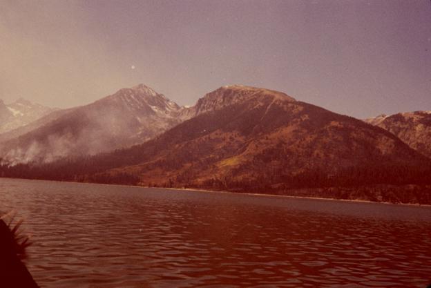
    <summary type="html"><![CDATA[<p><strong><em>The 1974 Waterfalls Canyon Fire started in a designated let-burn area near Jackson Lake in Grand Teton National Park, so the National Park Service allowed it to burn. Smoke from the blaze impacted tourists and local communities, prompting public debates about the Park Service policy that allowed natural fires to burn. </em></strong></p><img src="https://www.intermountainhistories.org/files/fullsize/218d40ecfabb4d0268fec6ef7807fcd7.jpg" alt="Smoke in the mountains at Grand Teton National Park during a fire." /><br/><p>In 1968, the National Park Service (NPS) officially revised its approach to wildfires, stating that they played a key role in maintaining the health of forests. According to Department of the Interior reports, natural burns cleared dead timber and dense clusters of young trees that prevented new growth. In the wake of the decision, park managers experimented with different approaches to maintain healthy forests without causing severe damage. During prescribed burns, the Park Service started fires within strictly defined boundaries and weather conditions to control their severity. During let-burn situations, the agency monitored natural blazes and allowed them to burn. Grand Teton National Park experimented with both approaches.
On August 28, 1973, NPS officials ignited  the Uhl Hill Fire in a dense grove of sagebrush and aspen near the Grand Teton’s eastern edge. One of two prescribed fire experiments that year, NPS expected Uhl Hill to burn one-hundred acres. Cool, wet conditions made it easier to control, but fifty-six firefighters stood by to suppress it if it escaped approved boundaries. While snow and high wind quickly ended the project, which only burned thirty acres of brush, it showed that the Park Service could control blazes within park boundaries. This experiment proved useful on July 17, 1974, when lightning sparked the Waterfalls Canyon Fire near Jackson Lake. It started in the same area that a five-acre let-burn blaze impacted in 1973. Because of its location, park officials allowed it to burn. The Park Service closely monitored the flames, noting that they spread slowly unless high winds or heavy fuels stimulated them.
While NPS perceived Waterfalls Canyon as a successful test of let-burn management, decades of suppression had pushed the public to fear fire, generating controversy. By September 18, the blaze burned 1,900 acres, and smoke from it reached the nearby town of Jackson, Wyoming. The Park Service estimated that about 100,000 tourists observed the smoke, and it incensed Jackson’s citizens, many of whom relied on tourist traffic from Grand Teton to make a living. Residents complained that the let-burn policy ignored the needs of local communities, drawing increased attention to the flames. The National Broadcasting Company (NBC), the Columbia Broadcasting System (CBS), and <em>Time </em>magazine reported on Waterfalls Canyon in September, bringing it to national attention. In response to the controversy, the Park Service’s Rocky Mountain regional office issued a press release that explained the let-burn approach.
Despite public backlash, Park Service officials never suppressed Waterfalls Canyon. Snow finally extinguished it in November 1974, and it only burned 3,500 acres. However, the negative publicity pushed NPS to educate the public about the let-burn approach. In 1974, the Park Service issued a press release that argued that natural fires maintained a healthy landscape in parks. Three years later, a Park Service policy known as NPS-18 approved let-burn management nationwide.</p><p><em><strong><a href="https://www.intermountainhistories.org/items/show/914">For more (including 3 images) view the original article</a></strong></em></p>]]></summary>
    <published>2025-09-23T15:39:29+00:00</published>
    <updated>2026-04-17T19:32:21+00:00</updated>
    <link rel="alternate" type="text/html" href="https://www.intermountainhistories.org/items/show/914"/>
    <id>https://www.intermountainhistories.org/items/show/914</id>
    <author>
      <name>Kaylen Wilson, Northern Arizona University </name>
    </author>
  </entry>
  <entry>
    <title type="html"><![CDATA[1967 Fire Season, Glacier National Park]]></title>
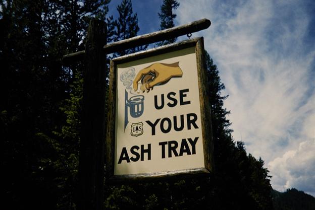
    <summary type="html"><![CDATA[<p><strong><em>Glacier National Park burned more frequently throughout its history than almost any other national park in the United States. Starting in 1910, the National Park Service persistently extinguished all wildfires that occurred within parks, but Glacier’s severe fire season in 1967 helped to end this suppression policy.</em></strong></p><img src="https://www.intermountainhistories.org/files/fullsize/75678ebbab988382ceaac098ab81df69.jpg" alt="Fire Safety Sign" /><br/><p>Throughout the early twentieth century, Glacier National Park in Montana utilized suppression, which required federal land management agencies to extinguish all forest fires. This approach gained national support after millions of acres of land burned in Idaho and Montana in 1910, including about 60,000 acres in Glacier. When 50,000 acres of Glacier burned in 1926, the National Park Service began to formulate official firefighting in the park. By 1929, Chief Forester John D. Coffman drafted the first national park fire management plan to organize firefighters and their equipment at Glacier. During the same year, the Half Moon Fire burned 50,000 acres in Glacier and destroyed numerous buildings. Coffman used analyses of Half Moon to revise and expand his initial strategy, making suppression an integral part of park policy.
In the 1960s, NPS developed a scientific approach to park management that changed the way it approached wildfires, but individual parks rarely aligned their management procedures with these ideas. In 1963, the Advisory Board on Wildlife Management, created by Interior Secretary Stuart Udall, published the Leopold Report. It stated that flames played a key role in maintaining healthy forests, advising administrators to contain wildfires and allow them to burn. Without routine burning, plant materials accumulated on the forest floor, fueling more destructive blazes. However, decades of fighting fires pushed park managers to fear the damage they caused. For decades, NPS managed forests to create attractive landscapes for visitors, and burned forests challenged this idealized image. As such, Glacier’s revised 1965 management plan upheld suppression.
In 1967, a significant drought and hot, windy weather created optimal conditions for flames to spread in Glacier. On August 11, 1967, lightning sparked approximately twenty-one fires throughout the park, including the Glacier Wall and Flathead blazes. They continued burning for a month despite containment efforts. The Office of Emergency Preparedness declared Glacier and the national forests surrounding it a national disaster area, contributing federal funding and labor to put out the flames. 1967 became the most destructive fire season Glacier had seen since 1929, and about 90,000 acres in the park burned.
The 1967 season quickly sparked a debate between the Park Service and the public over suppression. NPS officials contrasted it with the 1910 season  it to display the effectiveness of the policy, noting that less acres burned and less people died in the 1967 fires. However, inholders, who owned cabins, ranches, and hotels in Glacier, blamed the Park Service for mismanaging burns that damaged their properties. One vocal inholder, Montana Senator Burton Wheeler, brought these criticisms to national attention, prompting NPS to reassess its firefighting policies. In 1968, the Park Service acknowledged the ecological benefits of fire in the Green Book, a policy document that established budgets and dictated management policies for the entire park system. Revising this document made changing the suppression policy an issue of national importance. By 1977, Glacier’s management plan allowed natural fires to burn.</p><p><em><strong><a href="https://www.intermountainhistories.org/items/show/913">For more (including 5 images) view the original article</a></strong></em></p>]]></summary>
    <published>2025-09-23T15:39:29+00:00</published>
    <updated>2026-04-17T19:32:21+00:00</updated>
    <link rel="alternate" type="text/html" href="https://www.intermountainhistories.org/items/show/913"/>
    <id>https://www.intermountainhistories.org/items/show/913</id>
    <author>
      <name>Kaylen Wilson, Northern Arizona University </name>
    </author>
  </entry>
  <entry>
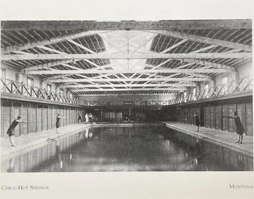
    <title type="html"><![CDATA[Chico Hot Springs — Montana]]></title>
    <summary type="html"><![CDATA[<p><strong><em>Euro-American settlers converted these natural hot springs into a resort in the early 20th century, inviting travelers en route to Yellowstone National Park for a comfortable rest stop. After WWII, the site's ownership changed hands and converted Chico Hot Springs into a dude ranch, but the site's historic value and entertainment opportunities remained. </em></strong></p><img src="https://www.intermountainhistories.org/files/fullsize/35eaa6dfe7334e9b11c96e81dc2119ec.jpg" alt="Montana’s Hot Springs - Chico Hot Springs" /><br/><p><span>Chico Hot Springs sits within the Paradise Valley, where gold prospectors began mining in the 1860s. A gold miner wrote “went out to the hot springs and washed my dirty ‘duds” in a diary entry he dated to January 16, 1865, marking the first written record of these hot springs. As the Chico settlement developed in the 1880s, an investor named Walter Matheson announced his plans to construct a bathhouse in which locals and tourists could plunge into the spring’s steamy mineral waters. Matheson recognized that the Northern Pacific Railway’s completion would bring larger crowds through Montana, especially with the newly constructed Park Branch that ran through Paradise Valley and connected Livingston to Yellowstone National Park in 1883. He capitalized on this increased traffic by advertising to locals and railroad travelers of the relaxing and healthy qualities that dipping into the Chico Hot Springs offered. An 1893 article in <em>The Daily Enterprise, </em>Livingston, MT, noted that the facility became a popular tourist attraction, with visitors camping overnight near the springs. </span>
<span>Matheson passed his ownership of Chico Hot Springs down to his daughter, Percie, and her husband, William Knowles, before his death in 1893. With increasing patronage at the hot springs, Knowles recognized a lucrative opportunity in adding lodging and a dining room to the facility. Locals celebrated Chico Warm Springs Hotel’s grand opening in 1900, which unveiled the addition of hotel rooms, a hot plunge pool, gender-separated bathhouses, and a dance hall and saloon for evening social gatherings. Following Knowles’ death in 1910, Percie continued to manage Chico Hot Springs. She promoted the site’s medical services by closing the saloon and hiring an on-site physician to prescribe warm plunges in the springs to patients suffering from various ailments.</span>
<span>In 1948, Percie sold the Chico Warm Springs Hotel to Oneita Behnke, shifted the business’ focus toward entertainment in the following twenty years. Alongside swimming, visitors could participate in gambling, barbecues, rodeos, and square dancing. With the addition of livestock barns and corrals, Behnke renamed the business to “Chico Ranch” and began advertising the site as a dude ranch. The tourist appeal of Chico Hot Springs shifted once more when investors Mike Art and his wife Eve bought Chico Ranch in 1967 with intentions of restoring the business to its former purpose as a site of relaxation and recreation. He and his wife achieved this by remodeling the hotel, dining room, and pools, and renaming the business to “Chico Hot Springs Resort.” As a result, Chico Hot Springs became a modern, high-class getaway while retaining its historic architectural elements. </span>
<span>Chico Hot Springs Resort continues to be a popular Montana vacation site, offering hiking, horseback trail rides, outdoor garden walks, swimming, and a restorative plunge in the site’s natural hot springs. Its convenient location along Highway 89 continually draws automobile tourists to the site year-round. </span></p><p><em><strong><a href="https://www.intermountainhistories.org/items/show/912">For more (including 4 images) view the original article</a></strong></em></p>]]></summary>
    <published>2025-09-23T15:38:25+00:00</published>
    <updated>2026-04-17T19:32:21+00:00</updated>
    <link rel="alternate" type="text/html" href="https://www.intermountainhistories.org/items/show/912"/>
    <id>https://www.intermountainhistories.org/items/show/912</id>
    <author>
      <name>Alexandra Williams, Northern Arizona University</name>
    </author>
  </entry>
  <entry>
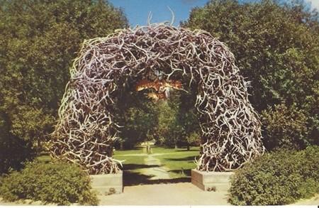
    <title type="html"><![CDATA[Antler Arch — Wyoming]]></title>
    <summary type="html"><![CDATA[<p><strong><em>Members of the Jackson Hole Rotary Club constructed the antler arch in 1953 as an installation that would capture the essence of the American West. Community members built the arch in the Jackson Hole Town Square, which is adjacent to Highway 89. </em></strong></p><img src="https://www.intermountainhistories.org/files/fullsize/012bb102c748391c0dd61daa10d08cf0.jpg" alt="Jackson WY-Wyoming, Elk Horn Arch, Scenic View" /><br/><p><span>Since its creation in 1953, the antler arch in Jackson Hole, Wyoming, has attracted countless Highway 89 travelers. Regardless of whether the destination is Jackson Hole itself or Grand Teton National Park further north, tourists often include a visit to the antler arch on their trip itinerary. The Jackson Hole Rotary Club developed an idea for a beautifying sculpture project in the Town Square in 1953. They agreed that the concept should capture the most iconic qualities of Jackson Hole, and that the sculpture itself may become a town icon. The same year, members of the Rotary Club asked locals to donate antlers for the construction of an arch made entirely of antlers. The Rotary Club initially planned to build one arch in Town Square, until the finished structure proved to be immensely popular, attracting large crowds of admiring people and individuals wanting to take photos beneath the arch. With such positive reception, the Jackson Hole Rotary Club began raising funds to build four more arches in the Town Square.</span>
<span> Due to the limited lifespan of natural elk antlers, the Jackson Hole community adopted the tradition of reconstructing the arch every 40-50 years. The Rotary Club developed this tradition to collaborate more with the community by partnering with local organizations. With the support of the U.S. Fish & Wildlife Service, local Boy Scouts began hiking into the National Elk Refuge annually in late April to acquire fresh antlers. The Rocky Mountain Elk Foundation then auctioned these antlers off at the Jackson Elkfest each year to raise funds for wildlife conservation. Individuals who purchased antlers at this auction typically donated them to the Rotary Club to help construct new arches or repair damaged ones in Town Square.</span>
<span>Both admiring and maintaining the Jackson antler arches are ongoing traditions in this town. With the National Elk Refuge, a home to one of the world’s largest elk herds, located just north of the town of Jackson, elk antlers are a fitting medium for an installation that aims to illustrate the town’s identity. Since their creation, the arches have been the site of various community events, including auctions, Christmas decorating, competitive winter sports registrations, Easter egg hunts, staged cowboy shoot-outs, and Wyoming Statehood Day celebrations. For tourists visiting Jackson or passing through on their way to a National Park, they are sure to catch a glimpse of the arches as they pass by the Town Square off of Highway 89. Automobile tourists often make a stop to take photos beneath the arches, capturing a symbol of the American West and Wyoming’s natural landscape.</span></p><p><em><strong><a href="https://www.intermountainhistories.org/items/show/911">For more (including 3 images) view the original article</a></strong></em></p>]]></summary>
    <published>2025-09-23T15:38:25+00:00</published>
    <updated>2026-04-17T19:32:21+00:00</updated>
    <link rel="alternate" type="text/html" href="https://www.intermountainhistories.org/items/show/911"/>
    <id>https://www.intermountainhistories.org/items/show/911</id>
    <author>
      <name>Alexandra Williams, Northern Arizona University</name>
    </author>
  </entry>
  <entry>
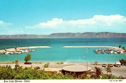
    <title type="html"><![CDATA[Bear Lake — Idaho-Utah]]></title>
    <summary type="html"><![CDATA[<p><strong><em>Along Idaho’s forty-five-mile portion of Highway 89, travelers pass Bear Lake, a natural freshwater body that spans the Utah and Idaho state lines. The lake’s vibrant blue waters have attracted travelers and locals to enjoy its outdoor recreation opportunities since the arrival of Euro-American settlers. Regular visitors have referred to Bear Lake as the “Caribbean of the Rockies,” due to its bright blue color. </em></strong></p><img src="https://www.intermountainhistories.org/files/fullsize/a2052eb33acb8a79b958725076cfb96f.jpg" alt="Bear Lake Marina Idaho Vintage Postcard Collectible Scenic View" /><br/><p><span>Long before Euro-American settlers found Bear Lake, the Bannock, Shoshone, and Ute tribes frequented the surrounding landscape for hunting. U.S. military officers John Fremont and Benjamin Bonneville surveyed this area in 1842. Their findings paved the way for Oregon Trail travelers, who later traversed around the lake en route to Oregon. During the late 19th century, Bear Lake was an informal outdoor recreation site, attracting tourists from across the American West to enjoy boating, camping, fishing, hunting, and swimming at the lake’s bright blue waters. </span>
<span>Multiple ambitious locals recognized the site’s popularity and chose to open resorts with lodging and dining. By 1926, several private resorts operated on Bear Lake’s shores, including Bear Lake Hot Springs, Fish Haven, Ideal Beach, Lakota, and Logan Canyon. In the following decades, some of these facilities expanded to offer indoor entertainment, such as rollerskating at Lakota Resort and dancing at Fish Haven Resort. Alongside outdoor recreation, Bear Lake’s various resorts became popular sites for large gatherings like family reunions and school field trips. During the early-mid 20th century, the Bear Lake resorts received higher volumes of tourists between June and August, leaving their lodging facilities with no vacancies. The Bear Lake resorts would experience increased patronage following the extension of Highway 89 from St. Charles, Utah, to Paris, Idaho, in 1956. These businesses advertised the lake’s accessibility to Salt Lake City residents who could reach their summer getaway via the highway without being too far from home.</span>
<span>Recognizing the site’s popularity, the Utah Bureau of Land Management declared Utah’s portion of Bear Lake a state park in 1962 with plans to expand the marina and harbor that year. In 1963, the Idaho State Land Board designated the lake’s northern shore as a state park. It was not uncommon for travelers en route to Yellowstone National Park to stop and behold the unexpected beauty of Bear Lake. The site grew to such popularity in the 1970s that the two state parks closed temporarily and considered ways to control the expanding crowds. Members of the Bear Lake County Commission and the State Parks Commission in each state considered charging overnight campers additional fees, enforcing a maximum capacity, and enforcing boat speed limits. While the state park directors strove to allow the maximum number of visitors to enjoy the beaches, they agreed that certain regulations were necessary to promote a quality experience for all.</span>
<span>Bear Lake continues to be a popular outdoor tourist destination along Highway 89 throughout the year. Spring and summer visitors can enjoy biking, bird-watching, boating, camping, swimming, and water skiing, while winter visitors enjoy ice fishing for the native Bonneville Cisco whitefish. This unique fishing opportunity has made the lake a popular attraction for such an activity, especially when the fish spawn near the lake’s icy shores in late January each year. Even if highway travelers do not plan to stop at Bear Lake, its vibrant blue waters offer a uniquely scenic view as they cruise by on Highway 89.</span></p><p><em><strong><a href="https://www.intermountainhistories.org/items/show/910">For more (including 5 images) view the original article</a></strong></em></p>]]></summary>
    <published>2025-09-23T15:38:24+00:00</published>
    <updated>2026-04-17T19:32:21+00:00</updated>
    <link rel="alternate" type="text/html" href="https://www.intermountainhistories.org/items/show/910"/>
    <id>https://www.intermountainhistories.org/items/show/910</id>
    <author>
      <name>Alexandra Williams, Northern Arizona University</name>
    </author>
  </entry>
  <entry>
    <title type="html"><![CDATA[Big Rock Candy Mountain — Utah]]></title>
    <summary type="html"><![CDATA[<p><strong><em>After Harry McClintock released the song “Big Rock Candy Mountain” in 1928, Utah locals placed a sign at the base of a yellow mountain outside of Richfield, labelling it as the song’s namesake because they believed the scenic area matched McClintock’s lyrical description. After the song’s popularization in the 1950s, tourists along Highway 89 considered Utah’s Big Rock Candy Mountain an attraction itself. </em></strong></p><img src="https://www.intermountainhistories.org/files/fullsize/354f372af4646cdc53dcb45586facacb.jpg" alt="Big Rock Candy Mountain UT-Utah, Lemonade Springs, Antique, Vintage Postcard" /><br/><p><span>In his 1928 song, “Big Rock Candy Mountain,” the American folk singer Harry McClintock (1882-1957) sang of a fabled paradise that he described as being bathed in perpetual sunshine, free of danger and common stressors, and flowing endlessly with delicious food and drink. The song quickly gained national popularity, leading some Utah locals to place a sign at the foot of a colorful mountain outside of Richfield, which they believed resembled the one McClintock described in the song. For the mountain’s scenic views and association with the popular song, Big Rock Candy Mountain became a local tourist attraction. Two ambitious locals, Ben Dieringer and Pratt Seegmiller, capitalized on the site’s popularity by opening a resort, including a motel, café, gift shop, and fuel station at the foot of the mountain in 1933. </span>
<span>Utah locals recognized this mountain as one of Utah’s greatest natural wonders. The mountain’s vibrant colors resulted from mineralization that occurred after layers of hot magma covered the mountain’s volcanic rock and deposited an oxidized mineral, limonite, over twenty million years ago. Today, the mountain presents a combination of multiple vibrant colors, including orange, red, white, and yellow. Locals suggest that these bright colors make the mountain look as if it is made entirely of candy and is therefore deserving of its name.</span>
<span>Throughout the mid-20th century, the Big Rock Candy Mountain Resort became a popular roadside attraction along Highway 89 and a valued community center for the residents of Piute County. Travelers could fuel vehicles, enjoy a meal at the café, rest overnight, and purchase bottled mineral water and colorful rock candy from the curio shop. Beginning in the 1950s, Dieringer brought live animals to the resort, including coyotes, deer, mountain lions, porcupines, and lynxes, and allowed visitors to pet them. He believed these encounters could help people cultivate compassion for animals. Dieringer began hosting an annual Easter egg hunt. Advertisements in the <em>Richfield Reaper</em> invited families from the nearby town to spend their Sunday at the Big Rock Candy Mountain Resort, where children could search for Easter eggs he had hidden throughout the hills behind the resort. The 1950s and 1960s were Dierringer and Seegmiller’s prime years as business owners before they retired.</span>
<span>Dieringer and Seegmiller sold the Big Rock Candy Mountain Resort to Richfield resident John Gledhill in 1974. Two years later, a fuel pump ignited a fire, destroying the service station and motel. Gledhill rebuilt the resort in 1978 despite this setback. He owned the business for twenty years in total before he filed for bankruptcy in 1994 and offered the resort for auction. Dissatisfied with the auction’s turnout, Gledhill listed the property on the real estate market for $535,000.000 in 1995. Utah locals Michael and Anne Morrey purchased the property in 1997 and advertised the site as an ideal place for family reunions, where visitors could stay at the resort’s cabins, camp, hike, or ride ATVs on the surrounding outdoor trails.</span></p><p><em><strong><a href="https://www.intermountainhistories.org/items/show/909">For more (including 4 images) view the original article</a></strong></em></p>]]></summary>
    <published>2025-09-23T15:38:24+00:00</published>
    <updated>2026-04-17T19:32:20+00:00</updated>
    <link rel="alternate" type="text/html" href="https://www.intermountainhistories.org/items/show/909"/>
    <id>https://www.intermountainhistories.org/items/show/909</id>
    <author>
      <name>Alexandra Williams, Northern Arizona University</name>
    </author>
  </entry>
  <entry>
    <title type="html"><![CDATA[Cameron Trading Post — Arizona]]></title>
    <summary type="html"><![CDATA[<p><strong><em>Two businessmen founded this motel and curio shop in 1916 with tourists in mind, aiming to provide travelers with an “authentic” Southwestern experience. The trading post invited tourists to rest, indulge in a Southwestern-style cuisine, and browse a selection of authentic Navajo and Hopi arts and crafts. For these novelties, it remained a popular tourist attraction throughout the 20th century.</em></strong></p><img src="https://www.intermountainhistories.org/files/fullsize/e27f684a26c452aea3fbf91b29cbac3e.jpg" alt="Ariz. - Bridge at Cameron" /><br/><p><span>The Kansas City Midland Bridge Company constructed the steel suspension bridge over the Little Colorado River in 1911, making travel across the gorge more convenient. Brothers C.D. and Hubert Richardson saw an opportunity as they anticipated that this road would see more traffic following the bridge’s completion. In 1916, the Richardson brothers purchased 112 acres south of the bridge and built a wooden cabin as the center of their trading business. They served local Navajo and Hopi communities by trading livestock, rugs, skins, and wool in the company’s early years. As a public business in a remote area, increasing numbers of long-distance travelers visited Cameron Trading Post looking for a place to rest.</span>
<span>Cameron Trading Post became a convenient rest stop for travelers within the Four Corners region. As the site saw more patronage in the 1920s, the Richardson brothers constructed fuel pumps, a hotel, and a dining room adjacent to the trading post. Toward the mid-century, the Richardson family reported an influx of wealthy automobile tourists making stops at the Cameron Trading Post when traveling to and from the Grand Canyon. This adventurous class of automobile tourists traversing the Southwest sought the “authentic” regional experience at the trading post. Recognizing this site’s popularity, the Fred Harvey Company began including Cameron Trading Post as a stop along their Indian Detours, where guides drove tourists along rugged dirt roads to visit sights like the Painted Desert and the Grand Canyon. Cameron Trading Post was a routine stop along these tours. To cater to these travelers’ interests, the Richardson brothers filled the gift shop with cowboy hats and Native American arts and crafts. Tourists could browse from various Navajo and Hopi baskets, blankets, concho belts, pottery, and turquoise and silver jewelry.</span>
<span>Cameron Trading Post’s convenient location near the Little Colorado Bridge continued to attract droves of tourists when the federal government began regulating highways in 1925. The U.S. Bureau of Public Roads established the first stretch of Highway 89 that year, a route between Thistle, Utah, and Flagstaff, Arizona. This route provided travelers with convenient access to multiple national parks, including the Grand Canyon, Zion, and Bryce Canyon. Cameron Trading Post became a popular secondary tourist attraction along this route, offering travelers lodging, dining, and shopping with a uniquely Southwestern flair.</span>
<span>The Cameron Trading Post changed hands in 1966 when Hubert Richardson sold the business’s lease to Standard Oil and subleased the hotel, restaurant, and gift shop to the Fred Harvey Company. The trading post remained an international hub for trading Native American arts and crafts. Toward the end of the 20th century, Cameron Trading Post continued to add uniquely Southwestern elements to their business, including a fine art gallery displaying works of local artists, Navajo weavers demonstrating their craft while seated in the gift shop, and the option of ordering a Navajo taco in the dining room. Cameron Trading Post continues to offer an entertaining rest stop experience for travelers along Highway 89.</span></p><p><em><strong><a href="https://www.intermountainhistories.org/items/show/908">For more (including 4 images) view the original article</a></strong></em></p>]]></summary>
    <published>2025-09-23T15:38:23+00:00</published>
    <updated>2026-04-17T19:32:20+00:00</updated>
    <link rel="alternate" type="text/html" href="https://www.intermountainhistories.org/items/show/908"/>
    <id>https://www.intermountainhistories.org/items/show/908</id>
    <author>
      <name>Alexandra Williams, Northern Arizona University</name>
    </author>
  </entry>
  <entry>
    <title type="html"><![CDATA[Phil’s World, Cortez, CO: Follow Me, the Trails are Great]]></title>
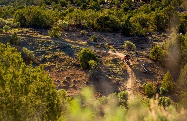
    <summary type="html"><![CDATA[<p><strong><em>Phil Vigil wanted little more than to explore. After relocating from Fairbanks, AK, to Cortez, CO, in the late 1980’s he found himself mountain biking on deer tracks and game trails across a seldom frequented patch of federal and state trust land five miles east of town. Despite his unexpected passing in 2020, his proclivity for route finding and engagement with the mountain biking community in Cortez have seen him remembered as the pioneer of one of the most renowned mountain bike trail networks on the Colorado Plateau. </em></strong></p><img src="https://www.intermountainhistories.org/files/fullsize/ef3252717c0ac23a2d1deb65ecc0bab9.jpg" alt="Mountain Biker Navigates Sweeping Right Turn, Sunset" /><br/><p>The state and federal trust land east of Cortez, CO, on which Phil’s World lies saw infrequent use into the late 1980’s with a small portion on the western half leased by a shooting range and the rest exploited or polluted through livestock grazing, firewood gathering, and illegal waste disposal. The sparse use and proximity to town did however offer enough seclusion for recent transplant Phil Vigil to trace deer tracks on his mountain bike across the undulating terrain. As the paths grew broader and more distinct, Vigil marked them with animal skulls and in-so-doing laid the groundwork for the trail system that came to bear his name.
In 1994, friends Jimbo Farley and Morgan Bell moved west from Alabama and opened Cortez’s only bike shop, Kokopelli Bike and Board. Vigil quickly became a regular. Phil’s tales of the paths near the shooting range prompted staff to nickname the area Phil’s World. Cortez local Scott Darling, then a teenager employed at the shop, was introduced to the trail system by Phil. Inspired, he and a small group of riders began to develop the network. While Phil had moved on to more remote country in the four corners region, builders like Bob Wright, Stephan Barnes, Sam Dayzie, and Shawn Gregory saw potential in the terrain and further established an engaging network unlike any other in the Southwest. Wright, Barnes, and Gregory prioritized ease, fun, and speed in their design and were advised by Dayzie, an indigenous amateur archaeologist, of conflicts in route finding with remnants of Ancestral Puebloan sites.
In the late 1990’s electricity supplier Tri-State Generation expressed interest in developing the land for coal production. While Tri-State pursued extractive access, the shooting range expanded its lease in October of 2003. Safety concerns citing repeated conflict between cyclists and target shooters and a lack of legal authority to build and maintain trail on the land placed Phil’s World in jeopardy. Advocacy groups Kokopelli Bike Club (now Southwest Colorado Cycling Association) and Greater Dolores Action filed a motion to lease 500 acres of state trust land and use adjacent Bureau of Land Management holdings to avoid conflict with gun enthusiasts with dual-members of the bike club and Four Corners Rifle and Pistol Club acting as mediating liaisons. By 2005, Tri-State Generation had shifted interest and the lease and funding for Phil’s World had been secured, mountain bikers were formally guaranteed land and resources.
To maintain the feeling of solitude for riders in the spirit of Phil’s original design, organizers established a directional loop system to minimize rider interaction and traffic. The clever layout, fast and fun trail building approach, and nearness to Cortez distinguished Phil’s as a prototype of the BLM’s Backyard to Backcountry project. The network’s revenue generating ability for Cortez and nearby Dolores, accessibility for all ability levels, and protection of sensitive resources made it a valuable asset to the BLM and encouraging example in cooperative land management for other Plateau communities.</p><p><em><strong><a href="https://www.intermountainhistories.org/items/show/907">For more (including 4 images) view the original article</a></strong></em></p>]]></summary>
    <published>2025-09-23T15:36:56+00:00</published>
    <updated>2026-04-17T19:32:20+00:00</updated>
    <link rel="alternate" type="text/html" href="https://www.intermountainhistories.org/items/show/907"/>
    <id>https://www.intermountainhistories.org/items/show/907</id>
    <author>
      <name>Nicholas Nation, Northern Arizona University </name>
    </author>
  </entry>
  <entry>
    <title type="html"><![CDATA[MEDL, Flagstaff, AZ: The People Want Trails]]></title>
    <summary type="html"><![CDATA[<p><strong><em>The Mount Elden Dry Lake Hills trail system north of Flagstaff, AZ, traces its legacy of use closely with the history of the city. Dedicated in 1987, the network has steadily grown through community initiatives in cooperation with the Forest Service in Coconino National Forest to over 100 miles of trail. The proximity to town and rugged terrain give the illusion of a backcountry experience in an accessible frontcountry setting while the repurposing of game trails, sheepherding trails, fire breaks, and transportation lines maintains a connection to Flagstaff’s past.</em></strong></p><img src="https://www.intermountainhistories.org/files/fullsize/48b5ffa5c2b75a1821ff98ce917ee2a7.jpg" alt="Sunset Trail No. 23, Mount Elden" /><br/><p>As mountain biking developed around Marin County, CA, from the outfitting of WWII era “balloon tire” bikes with knobby tires and better brakes to more specialized equipment, two-wheeled recreation also began to take hold in the mountains and forests near Flagstaff, AZ. A local motorcycle club, the Coconino Motorcycle Trail Riders, connected remnants of the original Schultz Pass Road into a unified trail running up Schultz Creek in the 1970’s. When bicycle manufacturers began bringing bespoke mountain bikes to the market in the early 1980’s, Flagstaff’s existing cycling culture made for a quick uptake of the new machines. Mechanic Steve Garro of local shop Cosmic Cycles and the counterculture mountain bike racing team The Mutants joined other hobbyists to set about exploring the higher elevations accessible by Schultz Pass and Elden Lookout roads.
A series of disused wagon routes from the early 1900’s, old communications lines servicing the first lookout towers, fire breaks from the 1977 Radio Fire, and the plethora of livestock and game trails on the slopes were connected to unify the upper elevations of Mount Elden with the lower Dry Lake Hills to the west. As the trail network grew and diversified, so did the user base and rate of conflict. Many trails were closed to mountain bike access after unfavorable interactions with hikers and equestrians. After the forest service officially dedicated the Mount Elden Dry Lake Hills trail system in 1987, local advocacy groups successfully lobbied to restore mountain bike access and employed a code of conduct wherein cyclists were to yield to hikers or equestrians. 
As mountain bikes modernized into the 2000’s and usage expanded, MEDL supervisors recognized that mitigation of environmental damage induced by increased traffic was necessary. In 2006, the Flagstaff Bicycle Organization began advocating for directional downhill trails in the MEDL network to minimize hiker-biker interactions. Following the Schultz Fire in 2010, the forest service advanced a comprehensive trail planning scheme accounting for fire risk, endangered species protection, reduced user conflict, and local quality of life improvement. The proposed MEDL trail plan specifically focused on environmental protection and improved recreational access for residents over tourism.
Though delayed by thoughtful debate with groups like the Sierra Club, and the Museum Fire in 2019 that burned existing paths and planned expansion, the realignment of several traverses on erosive slopes in 2020 proved the venture worthwhile. The subsequent effort between the forest service and volunteer mountain bike, trail running, and motorcycle groups to professionally mark and build sustainable routes across the MEDL network garnered community support. The ongoing project has improved or created over twenty-five miles of trail since 2022 including the first sanctioned, directional mountain bike trails in Flagstaff – called Meteoride and Full Sail. The city’s assets in the sciences and passionate volunteer advocacy groups have allowed for thorough planning in current and future trail building that is as mindful of the protection of the mountain’s fragile ecology as it is of the improved quality of life that outdoor recreation can bring the community.  </p><p><em><strong><a href="https://www.intermountainhistories.org/items/show/906">For more (including 4 images) view the original article</a></strong></em></p>]]></summary>
    <published>2025-09-23T15:36:55+00:00</published>
    <updated>2026-04-17T19:32:20+00:00</updated>
    <link rel="alternate" type="text/html" href="https://www.intermountainhistories.org/items/show/906"/>
    <id>https://www.intermountainhistories.org/items/show/906</id>
    <author>
      <name>Nicholas Nation, Northern Arizona University </name>
    </author>
  </entry>
  <entry>
    <title type="html"><![CDATA[Kokopelli’s Trail, Loma, CO: In Pursuit of Solitude]]></title>
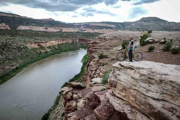
    <summary type="html"><![CDATA[<p><strong><em>Stretching 142 miles between Loma, CO, and Moab, UT, Kokopelli’s Trail is one of the earliest publicized examples of a backcountry mountain biking route. The unification of Kokopelli’s in 1989 by the Colorado Plateau Mountain Bike Trail Association helped popularize a new brand of distance cycling – bikepacking - and inadvertently made the American Southwest one of the best-known bikepacking destinations in the world. </em></strong></p><img src="https://www.intermountainhistories.org/files/fullsize/ec7c7c9ba0710082ba17aaf9f08f0443.jpg" alt="View of Kokopelli Trail Grand Junction" /><br/><p>When mountain bikes became commercially available in the early 1980’s, wealthy baby boomers from coastal California began to explore the west on their new machines enticed by the vast landscapes and inexpensive accommodation. Moabites recognized the economic opportunity afforded by mountain bike tourism and by the late 1980’s Moab, UT, had become a premier cycling destination. While the highly publicized Slickrock Trail was leveraged to draw visitors in, the vast network of 4x4 roads surrounding the town, relics of a defunct uranium industry, began to see increased use among cyclists. Nearby Grand Junction, CO, was experiencing similar backcountry traffic in the late 1980’s. Grand Junction Bureau of Land Management officials observed illegal mountain bike use in the Black Ridges Wilderness Study Area threatening to undermine ecological research. BLM area manager John Singlaub sought to protect the wilderness without alienating cyclists and proposed BLM recreation planner Carlos Sauvage build a cycling route on non-wilderness lands along the Colorado River. Lacking funding, the BLM turned to mountain biker and Grand Junction lawyer Timms Fowler to help plan and coordinate the effort. Long dreaming of a unified route across the remote region, Fowler jumped at the opportunity to aid in the construction.
Beginning in November of 1988, Sauvage and other BLM personnel began driving and mapping the dozens of dirt roads abandoned by the uranium industry between the route’s planned start point in Loma, CO, and terminus in Moab, UT. Meanwhile, Fowler set up meetings with bike shops in Grand Junction and Moab to secure volunteer support for the project. After identifying a course on 4wd tracks, BLM workers planned ten additional miles of singletrack trail to access scenic vistas and ensure an engaging riding experience. A volunteer building effort commenced in the spring of 1989 under the newly formed Colorado Plateau Mountain Bike Trail Association and after six weekends of construction, the 142 mile long Kokopelli’s Trail was completed. On May 6<sup>th</sup>, 1989, the Hopi Flute Clan for whom the trail was named held a ceremony under elder Ebin Leslie in Cisco, UT, the halfway point, to officially open Kokopelli’s to the public.  
Kokopelli’s quickly generated interest among mountain bikers. The high level of community engagement guaranteed considerable public awareness of the project and increased ridership. Proximity to major throughfares like Interstate 70 and Highway 191 made for easy access to the trail. The federal officiating in route creation and surveying resulted in an abundance of maps and backcountry planning resources for prospective users. The trail’s position on BLM land made it popular among bikepackers, backcountry cyclists who pursue multi-day, self-supported rides, because of the relaxed camping regulations imposed on remote public lands. The vastness of the landscape Kokopelli’s Trail traverses and the solitude afforded by its 142 miles in length made for an experience difficult to capture elsewhere and secured the Southwest as a stronghold for backcountry mountain biking.</p><p><em><strong><a href="https://www.intermountainhistories.org/items/show/905">For more (including 3 images) view the original article</a></strong></em></p>]]></summary>
    <published>2025-09-23T15:36:54+00:00</published>
    <updated>2026-04-17T19:32:20+00:00</updated>
    <link rel="alternate" type="text/html" href="https://www.intermountainhistories.org/items/show/905"/>
    <id>https://www.intermountainhistories.org/items/show/905</id>
    <author>
      <name>Nicholas Nation, Northern Arizona University </name>
    </author>
  </entry>
  <entry>
    <title type="html"><![CDATA[Gooseberry Mesa National Recreation Trail, Hurricane, UT: We Can Ride Too]]></title>
    <summary type="html"><![CDATA[<p><strong><em>After Mike and Morgan Harris started building the trail system now called Gooseberry Mesa National Recreation Trail in the early 1990’s, they had no idea it would become such a significant attraction to the mountain biking community. Situated eight and a half miles from Hurricane, Utah, and twenty miles southwest of Zion National Park, “The Goose” as it’s affectionately known is one of the most scenic riding centers on the Colorado Plateau.  </em></strong></p><img src="https://www.intermountainhistories.org/files/fullsize/7071445632eb7a04a4404768333d12d1.jpg" alt="Harris Secret Trail" /><br/><p>When Mike and Morgan Harris relocated to Hurricane, UT, in the early 1960’s, Gooseberry Mesa was a seldom frequented parcel allocated to the Bureau of Land Management that remained unused on account of the tight, maze-like topography. The water holding capacity of the rock that caps the mesa, Shinarump conglomerate, enables an ecology with pockets of lush vegetation frequented by game populations. The Harris’ early exploration of the mesa was as a hunting ground. Their use of motorcycles and frequent hikes through the formation gave them an intimate knowledge of the landscape and route-finding abilities that others lacked.
While the Harris’s were hunting the mesa, mountain biking had slowly been moving into the rural West. The fledgling sport originated in the late 1960’s in Marin County, CA, when a group of teens started riding single-speed “balloon tire” bikes up and down Mt. Tamalpais. After noticing cycling clubs optimizing old bikes for offroad races in the 1970’s, major manufacturers developed consumer market bicycles for the harsher settings mountain bikers were riding in the early 1980’s. Enticed by the new trend and cheap, rural accommodation, wealthy baby-boomers bought in and began to explore the Colorado Plateau. Moab’s Slickrock Trail came to be the pinnacle mountain biking destination in the late 1980’s and after a visit in 1993, Mike and Morgan realized their secluded hunting ground would be an ideal venue to develop deliberate mountain bike paths.
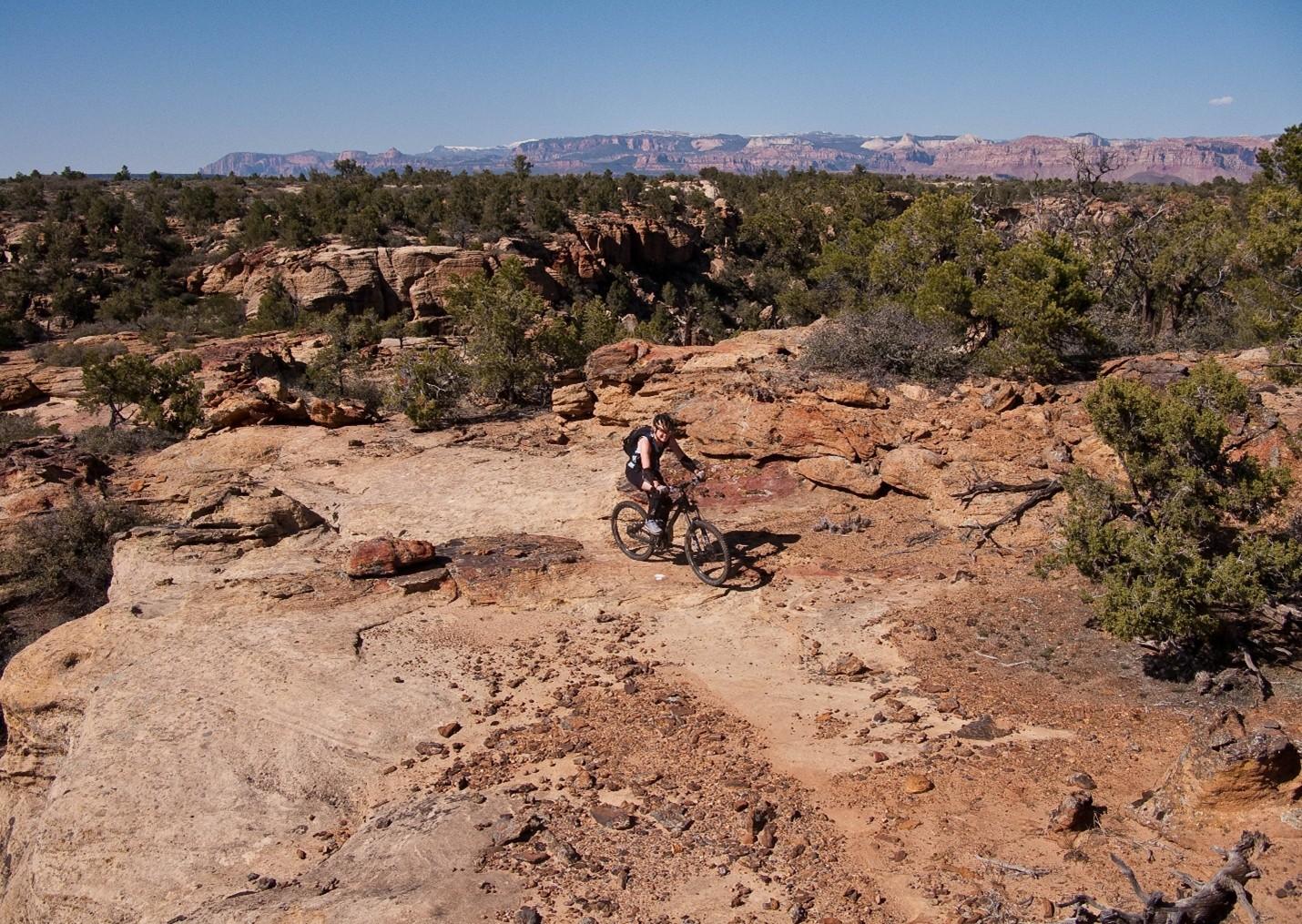
Upon returning from Moab, the Harris’ scouted and marked a primitive trail network across the twenty-four square miles of Gooseberry Mesa. Their approach attempted to fully immerse riders in the terrain by utilizing the entirety of the landscape. Though both were inexperienced riders and still honing their skills, their recognition that mountain biking equipment was consistently improving lead them to pursue increasingly challenging obstacles. They offered the spectacular scenery afforded by the mesa’s 2000 feet of prominence over the badlands below as a reward for each completed section. While their Gooseberry trails lacked the elevation gain and loss of Slickrock in Moab, they engaged mountain bikers by keeping difficult trail features like near vertical ascents and descents hidden around corners or behind foliage affording little time to prepare for each challenge. The construction style they helped popularize made riding acumen more important than quality of gear earning popularity among hobbyists and professionals alike.
After hearing that other builders were fined for similar unsanctioned work, the brothers turned themselves in to the BLM and facilitated a visit with federal officials to the mesa. To their surprise, BLM personnel were so impressed with the work that measures were taken to officially adopt the tracks resulting in their designation as the first official mountain biking trails in Washington County, Utah, on October 26<sup>th</sup>, 1999. Seven years later in 2006 the routes were upgraded to National Recreation Trail status by the BLM, an accolade that demonstrates a commitment to continued use, sustainable environmental practice, and an anticipated increase in tourism for the surrounding communities.</p><p><em><strong><a href="https://www.intermountainhistories.org/items/show/904">For more (including 3 images) view the original article</a></strong></em></p>]]></summary>
    <published>2025-09-23T15:36:54+00:00</published>
    <updated>2026-04-17T19:32:20+00:00</updated>
    <link rel="alternate" type="text/html" href="https://www.intermountainhistories.org/items/show/904"/>
    <id>https://www.intermountainhistories.org/items/show/904</id>
    <author>
      <name>Nicholas Nation, Northern Arizona University </name>
    </author>
  </entry>
  <entry>
    <title type="html"><![CDATA[Americana Motor Hotel, Flagstaff, AZ]]></title>
    <summary type="html"><![CDATA[<p><strong><em>The Americana Motor Hotels is a cheerful example of retro-futurism alive in the present day. Flagstaff’s Americana Motor Hotel was built in 1962 and has since been refurbished in a way that elevates its original googie style.</em></strong></p><img src="https://www.intermountainhistories.org/files/fullsize/699dd2f0b3b197001f35f600c1c499cb.jpg" alt="The sign of the Americana Motor Hotel is the embodiment of the googie aesthetic" /><br/><p>The Americana Motor Hotel in Flagstaff, Arizona is a brightly colored testament to the survivability of the Googie aesthetic in the modern day. The Americana Motor Hotel was built on the outskirts of in 1962. Located at 2650 East Route 66, the Americana has provided accommodations for tired motorists for the past sixty-three years. Its technicolor colors and avante garde shapes are a textbook example of the googie aesthetic.
     The colors, starbursts, aesthetics and origin of the American Motor Hotel situate firmly as an example of Googie architecture. The first thing a traveler to the Americana Motel Hotel sees is its striking sign that exemplifies the googie look. Vibrant pinks, greens, tangerine orange, and banana yellow come together in the sign’s neon starbursts and a stylized outline of the mountains that ensconce the city. The porte-cochère at the lobby of the motel is emblazoned with neon yellow and orange stripes that wrap around the dark blue paint of the roof. Oranges, blues, and nearly every other color of the rainbow collide in a cacophony of geometric shapes and lines on the walls and carpet of the lobby. Outside of the lobby on the far side of the porte-cochère there is an installation of aluminum wind art sculptures that whirl happily in the Arizona breeze. The two levels of hotel rooms that stretch out behind are similarly adorned in the vibrant colors that make up the themes of the hotel and all eighty-eight suites face towards a central recreation area with a large pool with the logo of the motel painted at the bottom.
     Googie architecture rose to prominence in the mid-century and is characterized by a commitment to futuristic designs, geometric shapes, neon and bright colors. This style of architecture is most commonly found in the Southwestern United States and often coincides with the arterial mother road of Route 66. Googie designs often feature the same bright colors, futuristic starbursts, and aluminum details that decorate the Americana and the hotel leans heavily into its mid-century themes.
     The Americana Motor Hotel was once Flagstaff’s largest motel and had provided a respite to the stars who passed through on Route 66 in the mid-century. The motel originally had a large dining room and 24 hour coffee bar during its heyday, but as the years wore on the facade of the hotel began to exhibit wear and tear. In 2021 the property was bought by Americana Hotel Ventures for $7.37 million dollars. After extensive renovation efforts the motel re-opened with a fresh redesign that honored the original design and spirit of the motel. Since its re-opening the Americana has become a well loved traveler’s retreat on Route 66 once again. Bright colors, atomic starbursts, and neon details all hearken back to the motel’s beginning while drawing in a new generation of travelers. The motor hotel connects visitors with a nostalgic space-age future and helps to keep googie and mid-century architecture from belonging to an ephemeral past.</p><p><em><strong><a href="https://www.intermountainhistories.org/items/show/903">For more (including 5 images) view the original article</a></strong></em></p>]]></summary>
    <published>2025-09-23T15:36:02+00:00</published>
    <updated>2026-04-17T19:32:20+00:00</updated>
    <link rel="alternate" type="text/html" href="https://www.intermountainhistories.org/items/show/903"/>
    <id>https://www.intermountainhistories.org/items/show/903</id>
    <author>
      <name>Emily MacDonell, Northern Arizona University</name>
    </author>
  </entry>
  <entry>
    <title type="html"><![CDATA[Monterey Motel, Albuquerque, NM]]></title>
    <summary type="html"><![CDATA[<p><strong><em>In continuous use since its construction in 1937, Albuquerque’s Monterey Motel on 2402 Central Avenue is a rare gem of googie architecture preserved in form and function.</em></strong></p><img src="https://www.intermountainhistories.org/files/fullsize/f25d46bc57c66cd0d6574c9ba1c0df99.jpg" alt="The Monterey Motel as seen from the sidewalk on Central Avenue" /><br/><p>The Monterey Motel is a stellar example of googie architecture along Albuquerque’s stretch of Route 66. Googie architecture became poplar in the western United States in the mid-twentieth century and the style is characterized by a futuristic and slightly industrial appearance. The building oozes a functional and futuristic aesthetic. The original steeply pitched roof of the motel was a hallmark of the type of commercial road-side buildings that make up the bulk of examples in googie architecture. A decorative aluminum band wraps around the entire structure and contributes to the futuristic styling that demarcates it as googie. The Monterey is especially interesting since its construction predicates the googie design as a cognizant genre. The most iconic attribute of the Monterey is its original neon sign, drawing travelers in for generations with its saturated colors and mod font, easily read from the road. The design motif of sharp acute angles is carried over to the sign, with the large sans serif letters being illuminated with the glow of the hand blown neon tubes.
     The motel was the brainchild of an Albuquerque businessman named Norman Bugg. In 1937, Bugg was one of the first to realize the economic promise that Route 66 held for those who would invest in it. The site he picked for the Monterey is directly across Route 66 from Albuquerque’s Old Town district, a hot spot for tourists as they traveled down the Mother Road. The structure has managed to retain its original status of a mid-century modern traveler’s paradise and was restored in 2018 as part of larger efforts to reinvigorate Albuquerque’s historic stretch of the Mother Road.
     The Monterey Motel and its many sibling motor courts across the Duke City were thrown into flux with the construction of I40 in the late nineteen fifties. The coming of the highway created a marked difference in how vehicle tourism would function in Albuquerque. Motels gave way to budget hotels as the accommodation of choice for most travelers across the U.S. and the construction of googie motor courts like the Monterey gradually dropped off. Interestingly, the Albuquerque’s numerous motels fared decently well throughout the years despite the dip in tourism along the Mother Road. Many of the courts still operate today in some capacity, either as accommodations or as new boutiques and eateries, with the stylistic charm that once drew tourists in being re-packaged as retro flair along historic Route 66.
     Similarly, in July of 2024 the Monterey participated in an event held for fans of the <em>Borderlands</em> games. The staff of the Monterey covered the updated facilities with decrepit neon signs and rusted metal siding to provide photo-ops and entertainment for fans at the event. This sort of community engagement highlights the public’s interest in the liminal spaces and aesthetics that googie structures like the Monterey represent. The hotel has come into a new era via a greater public interest and nostalgia for what Route 66 and its historic architecture, commercial or not, represent to the American public.</p><p><em><strong><a href="https://www.intermountainhistories.org/items/show/902">For more (including 4 images) view the original article</a></strong></em></p>]]></summary>
    <published>2025-09-23T15:36:01+00:00</published>
    <updated>2026-04-17T19:32:20+00:00</updated>
    <link rel="alternate" type="text/html" href="https://www.intermountainhistories.org/items/show/902"/>
    <id>https://www.intermountainhistories.org/items/show/902</id>
    <author>
      <name>Emily MacDonell, Northern Arizona University</name>
    </author>
  </entry>
  <entry>
    <title type="html"><![CDATA[United States Air Force Academy Chapel, Colorado Springs, CO]]></title>
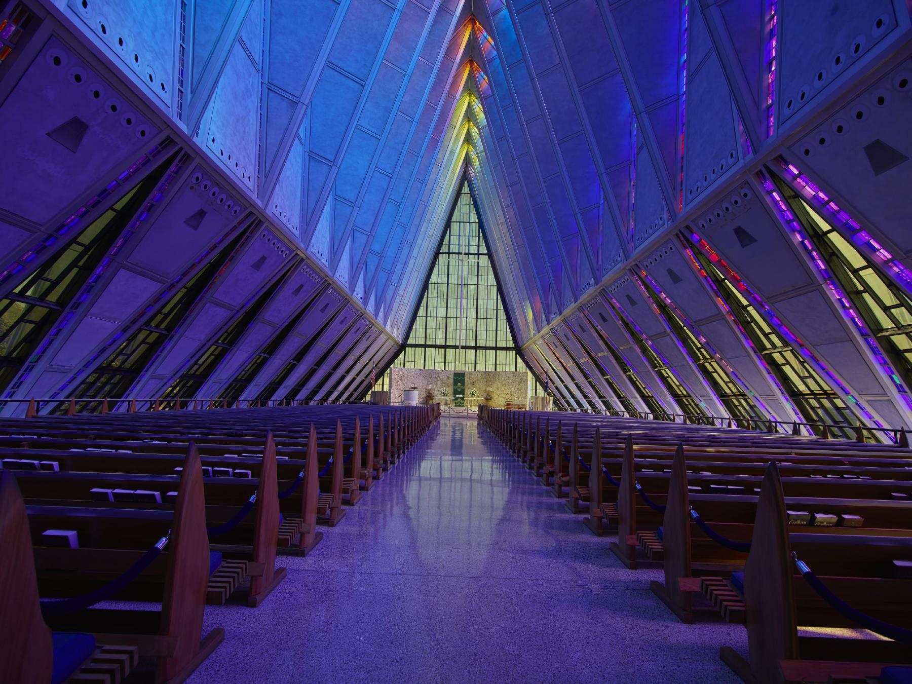
    <summary type="html"><![CDATA[<p><strong><em>An architectural triumph, the United States Air Force Academy Chapel in Colorado Springs is a futuristic vision of spirituality and light.</em></strong></p><img src="https://www.intermountainhistories.org/files/fullsize/6fa877fa8a8572d3d403698d65fbe97e.jpg" alt="Interior of the main atrium in the Cadet Chapel" /><br/><p>     Outside of Colorado Springs on the front Rampart Range of the Rocky Mountains the soaring spires of the United States Air Force Academy Chapel stand as a shining example of modernist architecture. Composed of seventeen spires that rise 150 feet into the air, the profile of the chapel mimics the mountains behind it. Each individual spire is is made up of 100 polygon shapes with the crisp edges giving the chapel a strikingly futuristic feel. The main floor houses the nine-hundred seat Protestant service area directly underneath the striking spires. Between the spires are one-foot-wide panels of colored glass, arrayed with cubes of every color of the rainbow. The panels bounce light off the faceted interior of the chapel during the day as the sun streams in. At night, interior illumination sends their color pouring over the outside of the aluminum spires, highlighting the materials reflective qualities. Underneath the main level is the area devoted to holding Catholic services. This level is demarcated by low sweeping stonework and large mosaic of stone angels behind the altar. Also on the terrace level is the Jewish service section. A circular screen of Israeli cypress panels ensconces the prayer area and the floor is made of Jerusalem Brownstone tiling donated by the Israeli Defense force in 1960.
     It was these three faiths that architect Walter Netsch was tasked with designing the building around in 1954 when the firm Skidmore Owings & Merrill received the contract to design the Air Force Academy Campus. The rest of the campus is made up of lower profile, modernist structures that seem to hover above the earth. The Cadet Chapel has remained the crown gem of the campus since its completion in 1962.
     The sub-genre of googie architecture experienced peak popularity in the mid-century and left its largest marks upon commercial structures in the West. Diners and motels are the most common manifestations of this style. However, while many googie structures are commercial that is not a requirement for the classification. Perhaps the most important aspect of googie architecture is that the structures appear to exist out of time. Materials like aluminum, neon, and concrete are utilized to give the buildings a futuristic and industrial touch, as if they were designed in the 22<sup>nd</sup> century instead of the 21<sup>st.</sup>. The Cadet Chapel epitomizes the idealistic futurism of the googie genre, brought out of the realm of the commercial and into the spiritual.
     In 2019 renovations began with the initial goal of fixing water leakage problems that had been persistent since the building was completed. Restoration has been ongoing due to the delicate nature of the historic structure and is projected to be completed in 2027. In 2012, fifty years after the completion of the Cadet Chapel, SOM returned to the campus to create a new event center called Polaris Hall. The glass prism tower of Polaris Hall is a testament to the lasting appeal of strikingly modernist architecture like that of the Cadet Chapel that inspired it.</p><p><em><strong><a href="https://www.intermountainhistories.org/items/show/901">For more (including 3 images) view the original article</a></strong></em></p>]]></summary>
    <published>2025-09-23T15:36:00+00:00</published>
    <updated>2026-04-17T19:32:20+00:00</updated>
    <link rel="alternate" type="text/html" href="https://www.intermountainhistories.org/items/show/901"/>
    <id>https://www.intermountainhistories.org/items/show/901</id>
    <author>
      <name>Emily MacDonell, Northern Arizona University</name>
    </author>
  </entry>
  <entry>
    <title type="html"><![CDATA[La Concha Lobby/Neon Museum, NV]]></title>
    <summary type="html"><![CDATA[<p><strong><em>A seashell in the Las Vegas sands, the La Concha Hotel is an iconic instance of googie design from the boundary breaking African American Architect Paul Revere Williams</em></strong></p><img src="https://www.intermountainhistories.org/files/fullsize/d7c5abe361196ea8b952fa403af98440.jpg" alt="The La Concha in its original location (Photo between 1980-2006)" /><br/><p>The La Concha Lobby located at 770 Las Vegas Blvd is a striking sight. With its undulating roof swinging in dramatic arches from the ground to delicate apexes and large parabola shaped window panels underneath, the structure resembles more of an organic entity than something fabricated by human hands. Comprised entirely of glass and thin shell concrete, the La Concha embodies its seashell namesake in both color and form. The interior of the lobby is akin to the inside of a dome or a big top tent. The curves of the roof fly high into dome of the interior space and the arched windows fill the white space with light during the day. Hanging lamps illuminate the lobby that now serves as the entry to Las Vegas’ Neon Museum. The space still contains a circular front desk and behind it sits a large decorative plaque of the motel’s distinctive logo and name rendered in sparkling Formica and glass. Originally, the motel had a dramatic neon sign with the same logo posted out front. The sign’s sparkling colors and dramatic neon shapes were right at home with the once plentiful instances of googie design along the Las Vegas strip. Now a multitude of signs are housed behind the La Concha lobby in Las Vegas’ Neon Museum, an archive of the art of hand-blown neon signs that hum their harmonic tone above Sin City.
     Googie architecture is defined by a commitment to futuristic stylism, bright colors, and the highlighting of materials like concrete and neon. Las Vegas became the home of a multitude of googie commercial structures in the mid-century. The famous “Welcome to Fabulous Las Vegas” sign is a piece of googie design, featuring atomic starbursts rendered in bright neon with modern sans serif fonts. The La Concha is a perfect example of googie with its funky shape, bright interior colors, undulating wave forms, and commitment to eye-catching design.
     The man who designed the La Concha Motel was even more remarkable than this striking structure. Paul Revere Williams had been educated at the Los Angeles location of the Beaux Arts Institute and went on to contribute his largest body of work to the American West. He served as architect to the stars of his age, designing houses for Frank Sinatra, Cary Grant, and Desi Arnaz among others. He penned many designs for the Las Vegas cityscape in the mid-century, designing the El Morocco Motel and the Royal Nevada Hotel and Casino, and the Guardian Angel Cathedral. Born in 1894, Williams’ was the first African American man to be admitted into the American Institute of Architects. Its been said that he refined the art of sketching upside down so as to not alienate his white customers by sitting on the same side of the table as them. This speaks to his immense skill as a draftsman and the racial prejudice he lived under. Williams spent his life achieving runaway success in his field while advocating for equality for African Americans.</p><p><em><strong><a href="https://www.intermountainhistories.org/items/show/900">For more (including 3 images) view the original article</a></strong></em></p>]]></summary>
    <published>2025-09-23T15:36:00+00:00</published>
    <updated>2026-04-17T19:32:20+00:00</updated>
    <link rel="alternate" type="text/html" href="https://www.intermountainhistories.org/items/show/900"/>
    <id>https://www.intermountainhistories.org/items/show/900</id>
    <author>
      <name>Emily MacDonell, Northern Arizona University</name>
    </author>
  </entry>
  <entry>
    <title type="html"><![CDATA[Charles Deaton’s “Spaceship” Bank, Englewood, CO]]></title>
    <summary type="html"><![CDATA[<p><strong><em>The strikingly organic shape of Charles Deaton’s “Spaceship” Bank singles it out as it hovers above the streets of Englewood</em></strong></p><img src="https://www.intermountainhistories.org/files/fullsize/e85774a5787c488c4ff51a51a82a1450.jpg" alt="A view of the Key Savings and Loan Association from the street" /><br/><p>   There are very few structures like Charles Deaton’s “Spaceship” bank in Englewood Colorado. Located at 3501 S. Broadway, the Key Savings Loan Association building’s dramatic curves loom over the street. On the south side of the outer rim, the asymmetrical and round smooth outer shell gives way to an inset oval window whose porthole shape helps to reinforce the appearance of an alien craft hovering in Englewood. The smoothly applied concrete exterior gives the building a cohesive and organic look. When viewed from the top the bank resembles a nautilus shell with its tight curl inward. The opening to the structure holds an inner courtyard bordered by multi level walls of windows. The interior of the “Spaceship” is equally captivating; the rooms on each of the two stories are situated equidistant around a circular common. The large internal facing windows let in a surprising amount of light for a structure that curves in on itself so dramatically. A twisting staircase connects the two floors and the interior space is illuminated with carefully placed pendant lights. The greenery in the courtyard, only separated from the interior by the waterfall of window walls, give the place a sense of belonging to some lush future.
     While the Deaton’s bank is usually lauded for what it contributes to the sculptural expressionist architecture movement, its intense retro-futuristic qualities are very comfortable fits for the googie aesthetic. Googie architecture experienced its heyday during the mid-century and is most succinctly described as the aesthetic of the retro future. Dramatic curves and geometric shapes, the utilization of materials like Formica, neon and concrete, and a commitment to striking stylism are all demarcations of googie. The hand painted backgrounds of the <em>Jetsons </em>cartoon are a perfect example of exaggerated googie stylism with their domes and boomerang motifs and Deaton’s bank would look right at home if painted into one of them. The “Spaceship” moniker granted to it by the people of Englewood highlights how the structure embodies public imagination of how a building from the future might look. The building was completed in 1967 and is now fifty-eight years old. Continued public interest from the people of Englewood over the years culminated in the building making it onto the national registry of historic places in 2016.
     Deaton designed two of the more recognizable structures in the larger Denver metropolitan area. The bank has a close sibling in the Sculptured House, situated on Interstate 70 just west of Denver. The Sculptured House bears a marked resemblance to its sibling with sweeping concrete wing shapes being situated around a central column of floor to ceiling windows. Commonly referred to as “The Sleeper House” for its role in the Woody Allen movie about a man who is cryogenically frozen in 1973 and awakens in 2173 to a strange future.  Deaton’s application of futuristic design elements to his commercial and residential projects in Colorado have allowed his designs to retain the interest of the public and capture a lasting vision of the future.</p><p><em><strong><a href="https://www.intermountainhistories.org/items/show/899">For more (including 3 images) view the original article</a></strong></em></p>]]></summary>
    <published>2025-09-23T15:35:59+00:00</published>
    <updated>2026-04-17T19:32:20+00:00</updated>
    <link rel="alternate" type="text/html" href="https://www.intermountainhistories.org/items/show/899"/>
    <id>https://www.intermountainhistories.org/items/show/899</id>
    <author>
      <name>Emily MacDonell, Northern Arizona University</name>
    </author>
  </entry>
  <entry>
    <title type="html"><![CDATA[The Brown Palace Hotel – Denver, Colorado]]></title>
    <summary type="html"><![CDATA[<p><strong><em>When Colorado enacted Prohibition in 1916, the Brown Palace Hotel quickly revealed how wealth evades discipline. Behind its European elegance, the hotel hosted bootleggers, celebrities, and politicians who drank with impunity. Its story offers a glimpse into how the elite can often sidestep laws supported and followed by the broader public.</em></strong></p><img src="https://www.intermountainhistories.org/files/fullsize/72d73fe3024bb85dbf7955365a8a338b.jpg" alt="The Brown Palace Hotel in 1916, the year Colorado passed its Prohibition laws" /><br/><p>In 1860, Henry Cordes Brown arrived in Denver and purchased several plots of land. In 1888, Brown began constructing the Brown Palace Hotel. He was determined to make it one of the best hotels in Colorado and spared no expense. Its central atrium, fireproof blocks of terracotta, and gold and European import detailing make the building stand out. The construction cost about $1.6 million, $50 million today, and featured Arizona sandstone.
In 1916, Colorado became one of the first states to pass Prohibition laws. Temperance was popular among the large population of progressive residents. The general population here did not desire or accept alcohol as readily as people in other Intermountain West states. This is one of the reasons the Brown Palace Hotel felt no need to cater to the middle class. The hotel’s prominence made it a prime location for celebrities, politicians, and social leaders to grab an illegal drink. Due to its prestigious reputation and clientele, authorities never shut the establishment down, despite raiding it multiple times for alcohol.
The 18 February 1930 issue of the <em>Rocky Mountain News (Daily) </em>described a large-scale raid conducted by police on the Brown Palace Hotel. Officers stormed room 929 on a tip about liquor distribution at a war veterans' convention. Law enforcement found approximately 116 cases of beer and fifty pints of whisky in the hotel room and arrested five hotel employees for conspiracy to violate Prohibition laws. With a bust this large, the courts threatened to padlock room 929, meaning it would be a “forbidden room,” a place “which none should enter.”
The 22 April 1930 issue of the same paper updated the room 929 story. Authorities indicted those arrested during the raid and fined them $300 ($5,700 today). While those associated with the Brown Palace Hotel typically earned higher salaries, this fine was no slap on the wrist. Intense repercussions like these aligned with Colorado’s strong temperance attitude and deterred Prohibition violations.
This story also shows how the elite used the Brown Palace Hotel to escape prosecution for alcohol-related crimes. The article indicates that the volume of alcohol found in room 929 suggests someone “higher up” knew about the stash. A key witness testified that former state senator and convention chairman Rice Means rented room 929 and knew “what this room was to be used for.” Despite this, officials never arrested Means. This case shows that large-scale alcohol consumption occurred at the Brown Palace Hotel and how those in power hid behind the establishment’s high-end reputation to evade Prohibition laws.
The Brown Palace Hotel’s Prohibition-era history highlights the intersection of wealth, power, and privilege. Despite multiple raids, its prestigious reputation and elite clientele allowed it to maintain alcohol sales. Its role during Prohibition demonstrates how the powerful navigated around the law. Today, the Brown Palace Hotel remains a cornerstone of Denver’s heritage and a symbol of the city’s transnational significance as a hub of influence.</p><p><em><strong><a href="https://www.intermountainhistories.org/items/show/898">For more (including 3 images) view the original article</a></strong></em></p>]]></summary>
    <published>2025-09-23T15:34:53+00:00</published>
    <updated>2026-04-17T19:32:20+00:00</updated>
    <link rel="alternate" type="text/html" href="https://www.intermountainhistories.org/items/show/898"/>
    <id>https://www.intermountainhistories.org/items/show/898</id>
    <author>
      <name>Scarlett Kluge, Northern Arizona University </name>
    </author>
  </entry>
  <entry>
    <title type="html"><![CDATA[Two-Bit Street – Ogden, Utah]]></title>
    <summary type="html"><![CDATA[<p><strong><em>Over the years, Ogden, Utah built its reputation as a countercultural hub, steadfastly resisting religious and political authority and conformity. During Prohibition, the city’s infamous Two-Bit Street flirted with illegality by housing speakeasies, stills, and brothels hidden behind innocent storefronts.</em></strong></p><img src="https://www.intermountainhistories.org/files/fullsize/6ab53cfbcdd11113ac6b62738af2d528.jpg" alt="A photo taken of Ogden’s 25th Street sometime between 1892-1904 shows the area before Prohibition began in 1917" /><br/><p>In early twentieth-century Utah, temperance was popular among many members of the Church of Jesus Christ of Latter-day Saints (LDS). The church’s temperance beliefs stemmed from an 1833 doctrine called the “Word of Wisdom,” which church leaders initially treated as guidance for moderate alcohol use. In 1902, Joseph Fielding Smith urged members to view the doctrine instead as a strong suggestion against alcohol. In 1909, this position began influencing state law when Governor William Spry and the legislature passed a local option bill allowing towns to vote on banning alcohol. Many smaller towns voted in favor, while more diverse cities like Ogden and Salt Lake City did not. Despite urban opposition, Utah ratified statewide Prohibition in 1917. In 1921, church president Heber J. Grant aligned church doctrine with state law by declaring alcohol abstinence a requirement. While many LDS members adopted the policy and supported enforcement, an underground drinking culture emerged among other Utahns, especially in Ogden’s 25th Street, also known as Two-Bit Street.
In the late nineteenth century, the completion of the continental railroad brought Chinese and Irish rail workers to Utah. By the turn of the century, LDS members still owned most businesses in smaller towns, but Italian, Chinese, Jewish, and Japanese immigrants owned much of Ogden’s commercial district. This demographic shift made Ogden a culturally distinct city, less influenced by the church’s temperance stance. When Prohibition began, Two-Bit Street became known for alcohol stills, speakeasies, and brothels. Business owners often ran legal operations on the ground floor—ice cream, clothing, and soda shops—while concealing illegal activities on the floors above. A notable example of this was the Davenport Saloon, which was located above various short-lived legal businesses like the Night Hawk Café.
On 03 January 1922, the <em>Ogden Standard-Examiner</em> reported that police raided an ice cream parlor at 170 25th Street. They found two quarter-full bottles of moonshine whisky and arrested the owner, William Pranthel, who pleaded guilty to possession. He claimed the liquor was for personal use, not for sale, but could not explain why it was at the parlor instead of home. He received a sentence of a $299 fine or 180 days in jail. A month later, the same paper reported that police discovered remnants of a recently abandoned still in the same neighborhood, along with several bottles of homemade wine—but no bootleggers.
Prohibition in Utah was more than a legal change—it was a struggle between religious authority and cultural resistance. In Ogden, immigrant families turned Two-Bit Street into a quiet act of defiance, building their own economy behind legal storefronts. It was as much about autonomy as alcohol. While the LDS Church shaped much of the state, Ogden pushed back. Today, Two-Bit Street remains a space where Utah residents challenge law and societal norms.</p><p><em><strong><a href="https://www.intermountainhistories.org/items/show/897">For more (including 4 images) view the original article</a></strong></em></p>]]></summary>
    <published>2025-09-23T15:34:48+00:00</published>
    <updated>2026-04-17T19:32:20+00:00</updated>
    <link rel="alternate" type="text/html" href="https://www.intermountainhistories.org/items/show/897"/>
    <id>https://www.intermountainhistories.org/items/show/897</id>
    <author>
      <name>Scarlett Kluge, Northern Arizona University </name>
    </author>
  </entry>
  <entry>
    <title type="html"><![CDATA[The Rockwood Speakeasy – Butte, Montana: When Montana lawmakers passed alcohol bans in 1918, Butte’s nightlife went underground. Business owners concealed their speakeasies, brothels, and gambling halls in basements under the city’s sidewalks. During Prohibition, Rockwood (Rookwood) Speakeasy earned its fame hidden behind coats and code words.]]></title>
    <summary type="html"><![CDATA[<img src="https://www.intermountainhistories.org/files/fullsize/51321426bb9e095b46c0551d1ba7b90f.jpg" alt="The cross section of Butte’s Broadway and Main Street in the 1920s" /><br/><p>James Pratt, proprietor of the Red Boot and Shoe Company, built the Rockwood (also called the Rookwood), in Butte, Montana in 1912. The ground level housed the shoe company’s shop, and the floors above functioned as a hotel. Pratt designed the building to attract attention and business with décor like Tudor-arching, green tile, a copper-clad cornice, a wrought iron staircase, and marble wainscoting and floors. The Rockwood’s unique ambiance and railroad access attracted elite and traveling patrons alike.
Before Prohibition, Butte, Montana, boomed as a mining town and gained notoriety for its lively bar and entertainment scene. When the Montana government banned alcohol distribution and consumption in December of 1918, Butte bars moved underground—into basements and tunnels beneath storefronts—and continued to sell alcohol. During this time, over one hundred underground speakeasies, including the Rockwood, operated in the city. In 1918, Pratt converted the building’s basement into a speakeasy. This underground area matched the hotel’s elegance above, attracted numerous clients, and became one of Butte’s more famous drinking spots.
In 1923, one of Rockwood’s moonshine clients, Mae Holberg, died by suicide after overconsuming alcohol. The 29 January 1923 issue of <em>The Butte Daily Post </em>describes the harrowing story. Holberg attended an all-night party at the Rockwood. Witnesses and police confirmed this party involved large quantities of illegal liquor. Around 7:00 A.M., Holberg drank one and a half ounces of Lysol, a fatal dose that ended her life within hours. A friend at the party told officers he believed Holberg took her own life because “she was despondent,” he said, “one or two drinks always made her despondent and downhearted.” Tragic stories like this made the Rockwood notorious in the illegal drinking world.
After Prohibition ended, Butte’s underground scene lost its appeal. Shop owners no longer needed to hide their liquor, so they moved alcohol sales to street levels, and many permanently sealed off their speakeasies. Rockwood’s basement became one of these buried speakeasies, while the rest operated as a hotel and retail space. In 2004, workers renovating the Rockwood Hotel discovered a closet filled with untouched coats from decades past. Behind the coats, they uncovered a two-way mirror which concealed a hole that opened into the Rockwood Speakeasy—frozen in time since the Prohibition era.
This discovery highlights the secretive and exclusive nature of the Rockwood Speakeasy and explains how it remained hidden and operational throughout Prohibition. It is a modern-day time capsule, offering visitors a glimpse into the past. Visitors can imagine stepping into the shoes of a 1920s client—looking into the mirror, giving the bouncer the code, and feeling the thrill of defying Montana’s dry laws.</p><p><em><strong><a href="https://www.intermountainhistories.org/items/show/896">For more (including 5 images) view the original article</a></strong></em></p>]]></summary>
    <published>2025-09-23T15:34:47+00:00</published>
    <updated>2026-04-17T19:32:20+00:00</updated>
    <link rel="alternate" type="text/html" href="https://www.intermountainhistories.org/items/show/896"/>
    <id>https://www.intermountainhistories.org/items/show/896</id>
    <author>
      <name>Scarlett Kluge, Northern Arizona University </name>
    </author>
  </entry>
  <entry>
    <title type="html"><![CDATA[Kemmerer, Wyoming Alcohol Culture during Prohibition]]></title>
    <summary type="html"><![CDATA[<p><strong><em>Kemmerer, Wyoming emerged in the late nineteenth century when Patrick J. Quealy founded a coal company and a town to go with it. Kemmerer was popular among immigrant business owners who set up shops seeking financial and personal freedom. Their diverse cultures contributed to Kemmerer becoming a bootlegger’s haven when Prohibition began a few decades later.</em></strong></p><img src="https://www.intermountainhistories.org/files/fullsize/bc57fb9731bf760db28ae4ec4796ab05.jpg" alt="The original Southern Hotel building" /><br/><p>In 1897, Patrick J. Quealy founded a town and coal company, naming them “Kemmerer” after his financial backer, Mahlon S. Kemmerer of Pennsylvania. Quealy made Kemmerer an “independent town,” meaning that the coal company sold land to businesses and residents. This attracted immigrant miners and business owners, including those from southern and eastern Europe. Drinking was integral to many of the immigrants’ cultures, which included Italian, Polish, Slovak, and Scottish. This influenced Kemmerer’s freedom-focused Prohibition culture. In 1919, Wyoming passed laws banning alcohol. Kemmerer and its neighboring communities of Diamondville and Frontier formed a triangle network for illegal bootlegging and drinking.
During Prohibition, many Kemmerer residents made little effort to hide their drinking, as it was a southern and eastern European cultural norm and popular with the white men who worked the area’s mines. Isabel Burns migrated to Kemmerer in the 1880s and later established the brothel she named the Southern Hotel, which catered to illegal activities like prostitution and drinking. Burns and her successors operated the Southern Hotel for seven decades, throughout all of Prohibition, and continuously offered drinking and prostitution, regardless of legality. For its size, Kemmerer hosted a disproportionately large number of saloons and brothels like the Southern Hotel, which testified to local positive sentiment toward alcohol and cultural autonomy.
In addition to establishments like the Southern Hotel, well-documented arrests for alcohol possession and public intoxication highlight the prominence of drinking in Kemmerer during Prohibition. While police were generally tolerant of illegal alcohol consumption—acknowledging the town’s large immigrant population—the widespread nature of drinking still led to arrests, often for disrupting the peace. The <em>Kemmerer Gazette</em> reports indicate that authorities arrested people on alcohol-related charges, typically for public intoxication, operating stills, or alcohol distribution.
For example, the 20 April 1927 issue of the paper reported two separate intoxication cases from earlier that month. Both men paid $25 in fines (around $450 today). According to the paper, the first man, E. L. Mitchell, “made his rounds, proceeding to hit the high spots,” and caused a “rucus” at the Kemmerer hotel, thanks to “the potency of Kemmerer’s supply of moonshine, which will give a jackrabbit enough nerve to defy a bulldog.” The second man, a railroad worker from Mexico, “got all corned up on moonshine [then] ran a muck on the streets of Kemmerer.” Authorities incarcerated both men not merely for drinking, but for disorderly public conduct.
Kemmerer’s Prohibition history tells not a story of law, but a tale of western mining culture. As immigrants arrived for railroad and mining jobs, they brought customs wherein drinking was a way of life. When Prohibition criminalized that lifestyle, the law did not erase people’s culture. Places like the Southern Hotel thrived not because people wanted to rebel, but because they wanted to keep living as they always had. Kemmerer’s Prohibition history is one of colliding international and mining cultures withstanding the force of national reform.</p><p><em><strong><a href="https://www.intermountainhistories.org/items/show/895">For more (including 3 images) view the original article</a></strong></em></p>]]></summary>
    <published>2025-09-23T15:34:47+00:00</published>
    <updated>2026-04-17T19:32:20+00:00</updated>
    <link rel="alternate" type="text/html" href="https://www.intermountainhistories.org/items/show/895"/>
    <id>https://www.intermountainhistories.org/items/show/895</id>
    <author>
      <name>Scarlett Kluge, Northern Arizona University </name>
    </author>
  </entry>
  <entry>
    <title type="html"><![CDATA[The Mint Bar – Sheridan, Wyoming]]></title>
    <summary type="html"><![CDATA[<p><strong><em>In 1907 Charles “Dick” Marlow founded the Mint Saloon in Sheridan, WY. When Wyoming Prohibition laws banned alcohol in 1919, Marlow rebranded “the Mint” as legal storefronts but continued illegal alcohol sales. In 1935, post-Prohibition, the Mint Bar reopened its storefront as a bar. Today, the Mint Bar is still a staple of entertainment in Sheridan, Wyoming.</em></strong></p><img src="https://www.intermountainhistories.org/files/fullsize/634d0740f89c76472de8ecde2b526e01.jpg" alt="The Mint Bar in 1907, shortly after opening. " /><br/><p>In 1907 Charles “Dick” Marlow bought the building that would later become the Mint Bar from a barber and transformed it into the “Mint Saloon,” which locals often referred to as “the Mint.” In 1919, Wyoming passed laws banning the sale and consumption of alcohol unless for prescribed medicinal purposes. At this time, Marlow changed the Mint’s front into a dress shop, then a real estate office, while continuing alcohol sales in the back. In 1923, Oran Moore purchased the Mint, turning it into the “Mint Cigar Company and Soda Shop.” Between 1923 and 1930, Moore operated the Mint’s legal front while maintaining one of Sheridan’s more notorious speakeasies and gambling halls in the back.
During this time, law enforcement suspected the Mint of alcohol sales and conducted multiple raids on the location. On 23 June 1925, the <em>Sheridan Post Enterprise</em> published an article describing a moonshine bust at the Mint. Sheridan town sheriffs and a Wyoming state officer raided the Mint at four o’clock in the afternoon. Police discovered one gallon of moonshine whiskey hidden in a coffee pot by employees. The officers arrested Moore and several other employees. The court fined Moore $500.
On Tuesday, 23 June 1925, an article appeared in the <em>Sheridan Post Enterprise</em> about the officer’s raid at the Mint. A month later, the paper published a follow-up article on Tuesday, 07 July 1925, which mentioned that the court judge postponed the Mint employees’ trial. Lax police and judicial enforcement meant that raids, arrests, and trials like this never prevented the Mint from selling illegal alcohol. The establishment continued its bootlegging and alcohol sales until the stock market crash of 1929 forced Moore to close its doors. In 1933, the United States’ Twenty-first Amendment ended Prohibition, and Wyoming dissolved its alcohol ban.
In 1934, Archie Milson and Robert Thirlwell purchased the establishment and reopened the space as “the Mint Bar.” In 1948, the owner at the time, Lauren L. McVean, renovated the Mint Bar, giving the location its warm rustic style and now iconic bucking horse and cowboy neon sign. Cowboys, locals, travelers, and even celebrities like Ernest Hemingway once again made the bar a popular stop because of its historic charm, great beer, and gambling.
The Mint Bar’s story shows how Prohibition reshaped Sheridan without breaking its spirit. The hidden bar was a gathering place for cowboys and townsfolk alike. Raids and fines were a constant threat, but the establishment’s patrons remained loyal. After Prohibition, the Mint Bar never lost its notoriety. Today, “Meet me at the Mint” is now a signature phrase shared between Sheridan locals. The Mint Bar’s history is a nod to Western independence and resilience.</p><p><em><strong><a href="https://www.intermountainhistories.org/items/show/894">For more (including 4 images) view the original article</a></strong></em></p>]]></summary>
    <published>2025-09-23T15:34:46+00:00</published>
    <updated>2026-04-17T19:32:20+00:00</updated>
    <link rel="alternate" type="text/html" href="https://www.intermountainhistories.org/items/show/894"/>
    <id>https://www.intermountainhistories.org/items/show/894</id>
    <author>
      <name>Scarlett Kluge, Northern Arizona University </name>
    </author>
  </entry>
</feed>