<?xml version="1.0" encoding="UTF-8"?>
<feed xmlns="http://www.w3.org/2005/Atom">
  <title type="text">Intermountain Histories</title>
  <updated>2026-08-18T15:52:34+00:00</updated>
  <generator uri="http://framework.zend.com" version="1.12.20">Zend_Feed_Writer</generator>
  <link rel="alternate" type="text/html" href="https://www.intermountainhistories.org/"/>
  <link rel="self" type="application/atom+xml" href="https://www.intermountainhistories.org/items/browse?output=rss2"/>
  <id>https://www.intermountainhistories.org/</id>
  <author>
    <name>Intermountain Histories</name>
    <uri>https://www.intermountainhistories.org</uri>
  </author>
  <link rel="hub" href="https://pubsubhubbub.appspot.com/"/>
  <entry>
    <title type="html"><![CDATA[London Bridge in Arizona]]></title>
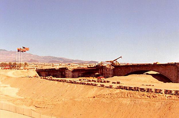
    <summary type="html"><![CDATA[<p><strong><em>While traveling the highways and rural paths of the American Southwest, it’s common to run into historical markers or monuments. In Lake Havasu City, Arizona, you can walk and drive along one that surprisingly originates from Great Britain.</em></strong></p><img src="https://www.intermountainhistories.org/files/fullsize/eb4a00dec8faaa2863b7452eb68fb4ca.jpg" alt="Construction of the London Bridge before a man-made canal was run along under it, Lake Havasu City, Arizona." /><br/><p>In 1958, entrepreneur and city planner Robert P. McCulloch envisioned a city in Western Arizona that would attract retirees and tourists. He purchased several thousand acres of land on the east side of Lake Havasu, a reservoir behind the Parker Dam along the Colorado River. The recreational aspect for his city was set, a dazzling blue and green lake set in contrast with the hot and red desert was sure to attract retirees. However, further appeal was needed to attract tourists and full time residents who would call the city home. A prospective attraction appeared in 1967, when it was found that one of the historic “London Bridges” along the Thames River in London, England was not structurally stable and would need to be replaced.
John Rennie of Scotland was the designer of the bridge, and completed its construction in August of 1831, replacing the original bridge constructed in 1209. When the officials found it structurally unsound in 1967, instead of demolishing it, they tried selling it. McCulloch’s oil company brokered a deal and bought the bridge’s exterior masonry for 2.46 million dollars at the end of 1967 (a sum worth almost 23 million dollars today when adjusted for inflation). Local newspaper <em>The Arizona Republic</em> reported the sale on April 19, 1968, writing that the bridge would “<em>serve as a centerpiece for the city’s leisure industry and an attraction to entice travelers to Lake Havasu City from transcontinental highways.”</em> The bridge that now exists only contains this exterior masonry. When shipment and construction began in 1968, they used a base concrete skeleton on which the veneer of the original stone masonwork was placed. The five arched bridge was built over a dip in the sandy earth of a peninsula jutting into Lake Havasu, through which a man-made canal was created. This made it so that the structure bridged together the newly created ‘Pittsburgh Point Island’ and mainland Lake Havasu City.
The bridge opened up with much fanfare and excitement in 1971. The opening ceremony featured a parade of flag-bearing boy scouts, fireworks, and the mayor of London who placed the foundation stone in 1968. Following construction, Lake Havasu City grew steadily because of efforts from McCulloch. He would fly in potential homebuyers, build hotels and stores on his own dime, plant palm trees to add greenery, and yes, even construct one of London’s famous bridges in the middle of the desert. What started as a dream in the desert has since turned into a city of over 57,000 people. Whether the London Bridge serves as a monument to foreign lands or a tourist trap is dependent on the visitor. But for those that live in this desert city, the bridge is one of the many attributes that makes them call Lake Havasu City home.</p><p><em><strong><a href="https://www.intermountainhistories.org/items/show/939">For more (including 5 images) view the original article</a></strong></em></p>]]></summary>
    <published>2026-02-02T17:22:18+00:00</published>
    <updated>2026-04-17T19:32:21+00:00</updated>
    <link rel="alternate" type="text/html" href="https://www.intermountainhistories.org/items/show/939"/>
    <id>https://www.intermountainhistories.org/items/show/939</id>
    <author>
      <name>Samuel Watson, Brigham Young University</name>
    </author>
  </entry>
  <entry>
    <title type="html"><![CDATA[Theodore Roosevelt and the Havasupai in the Grand Canyon: Story 2 of 8 of the President Theodore Roosevelt in the West Tour]]></title>
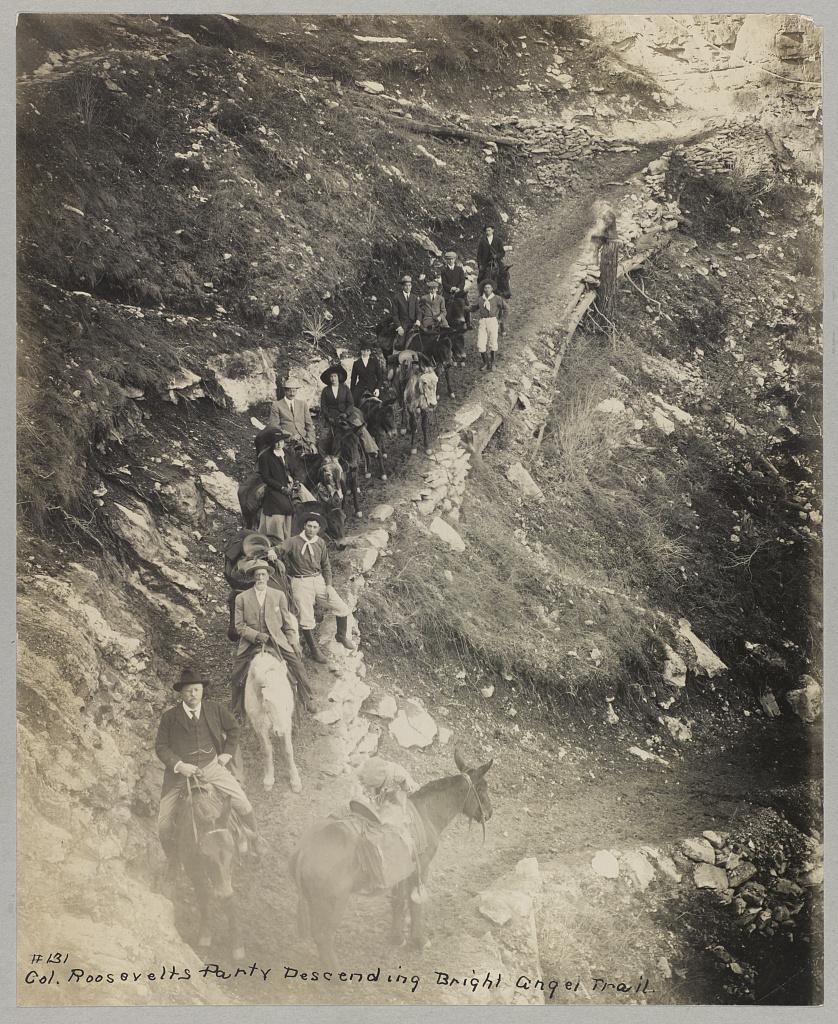
    <summary type="html"><![CDATA[<p><strong><em>President Theodore Roosevelt visits the Grand Canyon meeting the Havasupai Tribe. His efforts are making this landmark a National Park.</em></strong></p><img src="https://www.intermountainhistories.org/files/fullsize/81adde6a6a5c04daf97ec29b93d422ee.jpg" alt="Down a winding pathway, Theodore Roosevelt and others ride mules down Bright Angel Trail in the Grand Canyon" /><br/><p>Theodore Roosevelt traveled over 14,000 miles, visiting over 25 states, in the span of nine weeks in the early summer of 1903. His western tour was filled with speeches, commemorations, and his favorite thing to do: exploring the outdoors. His tours of Yosemite and Yellowstone are widely known, but in between them, he visited the Grand Canyon on May 6, 1903. He said, giving a speech, “In the Grand Canyon, Arizona has a natural wonder which, so far as I know, is absolutely unparalleled throughout the rest of the world.” Astounded, he said, “I shall not attempt to describe it, because I cannot. I could not choose words that would convey or that could convey to any outsider what that canyon is.” The majesty of Earth’s beauty there led him to explore more.
Riding a mule down Bright Angel Trail, he met two natives from the Havasupai tribe who lived in the Indian Garden with their families. For 1,000 years, the tribe lived in this region without outside contact, until Spanish priest Francisco Garces explored the area in 1776. As a result of the Santa Fe Railroad in the early 18th century, the Havasupai had increasingly more contact with other explorers and settlers. When Roosevelt and his regiment visited, he asked them to leave to make the canyon a National Park. To gain the status of a national park, all private development on the land would be illegal according to Congress. This resulted in the Havasupi’s relocation to a 518-acre reservation in Havasu Canyon instead.
Roosevelt was also concerned about the commercialization and exploitation of the land due to encroaching mining and timber interests. On June 8th, 1906, he signed the Antiquities Act, which authorized the president to “declare by public proclamation historic landmarks, historic and prehistoric structures, and other objects of historic or scientific interest that are situated upon the lands owned or controlled by the Government of the United States to be national monuments.” Subsequently, this act was used to establish the Grand Canyon National Monument on January 11th, 1908. It was made a National Park in 1919. Roosevelt Point and Trail were named in the President’s honor for the efforts he provided. A placard at Roosevelt Point reads another part from his speech advocating one request, “Leave it as it is. You can not improve on it. The ages have been at work on it, and man can only mar it. What you can do is to keep it for your children, your children's children, and for all who come after you, as one of the great sights which every American, if he can travel at all, should see.” Poetically, he wrote a letter to John Hay, former Secretary of State, summing up his experience on his Western tour and paying special attention to the Grand Canyon, “To me the most impressive piece of scenery I have ever looked at. I don’t exactly know what words to use in describing it. It is beautiful and terrible and unearthly. It made me feel as if I were gazing at a sunset of strange and awful splendor.” Today, almost 5 million tourists continue to explore this canyon that Roosevelt cared so profoundly to preserve.</p><p><em><strong><a href="https://www.intermountainhistories.org/items/show/924">For more (including 4 images) view the original article</a></strong></em></p>]]></summary>
    <published>2025-10-24T15:03:19+00:00</published>
    <updated>2026-08-18T15:52:34+00:00</updated>
    <link rel="alternate" type="text/html" href="https://www.intermountainhistories.org/items/show/924"/>
    <id>https://www.intermountainhistories.org/items/show/924</id>
    <author>
      <name>Jessika Cole, Brigham Young University</name>
    </author>
  </entry>
  <entry>
    <title type="html"><![CDATA[Theodore Roosevelt and Roosevelt Dam: Story 6 of 8 of the President Theodore Roosevelt in the West Tour]]></title>
    <summary type="html"><![CDATA[<p><strong><em>President Theodore Roosevelt dedicated the Roosevelt Dam. At the time, it was the largest artificial lake and the largest masonry dam in the United States. </em></strong></p><img src="https://www.intermountainhistories.org/files/fullsize/a6393024b0add557182e524e08d64ac1.jpg" alt="Apache Indian men working on Roosevelt Dam" /><br/><p>The signing of the Newlands Reclamation Act by President Theodore Roosevelt in 1902 began “the construction of irrigation works for the reclamation of arid lands.” One of the first projects authorized under this act was the world’s largest masonry dam, the Roosevelt Dam. The first stone was placed on September 20, 1906. Benjamin Austin Fowler, a former lawyer from New York City, was central to the dam’s construction. Having left the city scene, Fowler moved to the West in 1899, where he purchased 400 acres in Glendale, Arizona, to become a farmer. With the dry climate and high temperatures, water was scarce, and his farming would be greatly aided if a reservoir could provide steady irrigation water access. Fowler lobbied for 17 years for a dam and reservoir to be constructed northeast of Phoenix, in a narrow canyon of the Salt River. The Roosevelt Dam was built to provide flood control, municipal and irrigation water, and hydropower for central Arizona. This project involved over 3,000 diverse workers. There was a shortage of workers in the summer because of the intense heat, and one of the engineers remarked, “White men won’t stay on this job because they cannot spend their money fast enough.” In turn, they hired Apache Indians who had already long dwelt in the area, and who had excellent labor skills. They completed the dam on February 5, 1911. Roosevelt Lake was the largest artificial lake in the world when it held over 1 million acres of water.
One month later, on March 18th, former President Theodore Roosevelt came with a wagon parade to dedicate the dam. As most of the previous roads were then under the waters of the new reservoir, they took a route up the Apache Trail. Roosevelt reflected on the beauty of the wildflowers and landscapes in his dedicatory speech. At 5:48 pm and with about 1,000 spectators, he flipped the electric switch and opened the gate to begin Arizona’s new era of water control. This contributed to many settlements and a growing community that would not have existed otherwise. Serving communities with sustainable water and energy, Fowler’s and Roosevelt’s efforts paid off as the Scientific American newspaper publicized on the dam’s dedication day, “With the completion of the irrigation system which is being constructed by the federal government, we may safely predict for this valley an era of progress and substantial growth which will place it in the forefront of the most up-to-date agricultural districts in the world.”
The Salt River Project has monitored Roosevelt Dam since 1911, and the site has changed in many ways. In 1992, overflowing problems necessitated renovations. The road to drive across it was removed, the dam was raised 23.5 meters, and a bridge was suspended over Roosevelt Lake. Today, many make the trek to enjoy the water and view the architectural feat that the Roosevelt Dam is.</p><p><em><strong><a href="https://www.intermountainhistories.org/items/show/923">For more (including 4 images) view the original article</a></strong></em></p>]]></summary>
    <published>2025-10-24T15:03:19+00:00</published>
    <updated>2026-08-18T15:52:26+00:00</updated>
    <link rel="alternate" type="text/html" href="https://www.intermountainhistories.org/items/show/923"/>
    <id>https://www.intermountainhistories.org/items/show/923</id>
    <author>
      <name>Jessika Cole, Brigham Young University</name>
    </author>
  </entry>
  <entry>
    <title type="html"><![CDATA[Cameron Trading Post — Arizona]]></title>
    <summary type="html"><![CDATA[<p><strong><em>Two businessmen founded this motel and curio shop in 1916 with tourists in mind, aiming to provide travelers with an “authentic” Southwestern experience. The trading post invited tourists to rest, indulge in a Southwestern-style cuisine, and browse a selection of authentic Navajo and Hopi arts and crafts. For these novelties, it remained a popular tourist attraction throughout the 20th century.</em></strong></p><img src="https://www.intermountainhistories.org/files/fullsize/e27f684a26c452aea3fbf91b29cbac3e.jpg" alt="Ariz. - Bridge at Cameron" /><br/><p><span>The Kansas City Midland Bridge Company constructed the steel suspension bridge over the Little Colorado River in 1911, making travel across the gorge more convenient. Brothers C.D. and Hubert Richardson saw an opportunity as they anticipated that this road would see more traffic following the bridge’s completion. In 1916, the Richardson brothers purchased 112 acres south of the bridge and built a wooden cabin as the center of their trading business. They served local Navajo and Hopi communities by trading livestock, rugs, skins, and wool in the company’s early years. As a public business in a remote area, increasing numbers of long-distance travelers visited Cameron Trading Post looking for a place to rest.</span>
<span>Cameron Trading Post became a convenient rest stop for travelers within the Four Corners region. As the site saw more patronage in the 1920s, the Richardson brothers constructed fuel pumps, a hotel, and a dining room adjacent to the trading post. Toward the mid-century, the Richardson family reported an influx of wealthy automobile tourists making stops at the Cameron Trading Post when traveling to and from the Grand Canyon. This adventurous class of automobile tourists traversing the Southwest sought the “authentic” regional experience at the trading post. Recognizing this site’s popularity, the Fred Harvey Company began including Cameron Trading Post as a stop along their Indian Detours, where guides drove tourists along rugged dirt roads to visit sights like the Painted Desert and the Grand Canyon. Cameron Trading Post was a routine stop along these tours. To cater to these travelers’ interests, the Richardson brothers filled the gift shop with cowboy hats and Native American arts and crafts. Tourists could browse from various Navajo and Hopi baskets, blankets, concho belts, pottery, and turquoise and silver jewelry.</span>
<span>Cameron Trading Post’s convenient location near the Little Colorado Bridge continued to attract droves of tourists when the federal government began regulating highways in 1925. The U.S. Bureau of Public Roads established the first stretch of Highway 89 that year, a route between Thistle, Utah, and Flagstaff, Arizona. This route provided travelers with convenient access to multiple national parks, including the Grand Canyon, Zion, and Bryce Canyon. Cameron Trading Post became a popular secondary tourist attraction along this route, offering travelers lodging, dining, and shopping with a uniquely Southwestern flair.</span>
<span>The Cameron Trading Post changed hands in 1966 when Hubert Richardson sold the business’s lease to Standard Oil and subleased the hotel, restaurant, and gift shop to the Fred Harvey Company. The trading post remained an international hub for trading Native American arts and crafts. Toward the end of the 20th century, Cameron Trading Post continued to add uniquely Southwestern elements to their business, including a fine art gallery displaying works of local artists, Navajo weavers demonstrating their craft while seated in the gift shop, and the option of ordering a Navajo taco in the dining room. Cameron Trading Post continues to offer an entertaining rest stop experience for travelers along Highway 89.</span></p><p><em><strong><a href="https://www.intermountainhistories.org/items/show/908">For more (including 4 images) view the original article</a></strong></em></p>]]></summary>
    <published>2025-09-23T15:38:23+00:00</published>
    <updated>2026-04-17T19:32:20+00:00</updated>
    <link rel="alternate" type="text/html" href="https://www.intermountainhistories.org/items/show/908"/>
    <id>https://www.intermountainhistories.org/items/show/908</id>
    <author>
      <name>Alexandra Williams, Northern Arizona University</name>
    </author>
  </entry>
  <entry>
    <title type="html"><![CDATA[MEDL, Flagstaff, AZ: The People Want Trails]]></title>
    <summary type="html"><![CDATA[<p><strong><em>The Mount Elden Dry Lake Hills trail system north of Flagstaff, AZ, traces its legacy of use closely with the history of the city. Dedicated in 1987, the network has steadily grown through community initiatives in cooperation with the Forest Service in Coconino National Forest to over 100 miles of trail. The proximity to town and rugged terrain give the illusion of a backcountry experience in an accessible frontcountry setting while the repurposing of game trails, sheepherding trails, fire breaks, and transportation lines maintains a connection to Flagstaff’s past.</em></strong></p><img src="https://www.intermountainhistories.org/files/fullsize/48b5ffa5c2b75a1821ff98ce917ee2a7.jpg" alt="Sunset Trail No. 23, Mount Elden" /><br/><p>As mountain biking developed around Marin County, CA, from the outfitting of WWII era “balloon tire” bikes with knobby tires and better brakes to more specialized equipment, two-wheeled recreation also began to take hold in the mountains and forests near Flagstaff, AZ. A local motorcycle club, the Coconino Motorcycle Trail Riders, connected remnants of the original Schultz Pass Road into a unified trail running up Schultz Creek in the 1970’s. When bicycle manufacturers began bringing bespoke mountain bikes to the market in the early 1980’s, Flagstaff’s existing cycling culture made for a quick uptake of the new machines. Mechanic Steve Garro of local shop Cosmic Cycles and the counterculture mountain bike racing team The Mutants joined other hobbyists to set about exploring the higher elevations accessible by Schultz Pass and Elden Lookout roads.
A series of disused wagon routes from the early 1900’s, old communications lines servicing the first lookout towers, fire breaks from the 1977 Radio Fire, and the plethora of livestock and game trails on the slopes were connected to unify the upper elevations of Mount Elden with the lower Dry Lake Hills to the west. As the trail network grew and diversified, so did the user base and rate of conflict. Many trails were closed to mountain bike access after unfavorable interactions with hikers and equestrians. After the forest service officially dedicated the Mount Elden Dry Lake Hills trail system in 1987, local advocacy groups successfully lobbied to restore mountain bike access and employed a code of conduct wherein cyclists were to yield to hikers or equestrians. 
As mountain bikes modernized into the 2000’s and usage expanded, MEDL supervisors recognized that mitigation of environmental damage induced by increased traffic was necessary. In 2006, the Flagstaff Bicycle Organization began advocating for directional downhill trails in the MEDL network to minimize hiker-biker interactions. Following the Schultz Fire in 2010, the forest service advanced a comprehensive trail planning scheme accounting for fire risk, endangered species protection, reduced user conflict, and local quality of life improvement. The proposed MEDL trail plan specifically focused on environmental protection and improved recreational access for residents over tourism.
Though delayed by thoughtful debate with groups like the Sierra Club, and the Museum Fire in 2019 that burned existing paths and planned expansion, the realignment of several traverses on erosive slopes in 2020 proved the venture worthwhile. The subsequent effort between the forest service and volunteer mountain bike, trail running, and motorcycle groups to professionally mark and build sustainable routes across the MEDL network garnered community support. The ongoing project has improved or created over twenty-five miles of trail since 2022 including the first sanctioned, directional mountain bike trails in Flagstaff – called Meteoride and Full Sail. The city’s assets in the sciences and passionate volunteer advocacy groups have allowed for thorough planning in current and future trail building that is as mindful of the protection of the mountain’s fragile ecology as it is of the improved quality of life that outdoor recreation can bring the community.  </p><p><em><strong><a href="https://www.intermountainhistories.org/items/show/906">For more (including 4 images) view the original article</a></strong></em></p>]]></summary>
    <published>2025-09-23T15:36:55+00:00</published>
    <updated>2026-04-17T19:32:20+00:00</updated>
    <link rel="alternate" type="text/html" href="https://www.intermountainhistories.org/items/show/906"/>
    <id>https://www.intermountainhistories.org/items/show/906</id>
    <author>
      <name>Nicholas Nation, Northern Arizona University </name>
    </author>
  </entry>
  <entry>
    <title type="html"><![CDATA[Americana Motor Hotel, Flagstaff, AZ]]></title>
    <summary type="html"><![CDATA[<p><strong><em>The Americana Motor Hotels is a cheerful example of retro-futurism alive in the present day. Flagstaff’s Americana Motor Hotel was built in 1962 and has since been refurbished in a way that elevates its original googie style.</em></strong></p><img src="https://www.intermountainhistories.org/files/fullsize/699dd2f0b3b197001f35f600c1c499cb.jpg" alt="The sign of the Americana Motor Hotel is the embodiment of the googie aesthetic" /><br/><p>The Americana Motor Hotel in Flagstaff, Arizona is a brightly colored testament to the survivability of the Googie aesthetic in the modern day. The Americana Motor Hotel was built on the outskirts of in 1962. Located at 2650 East Route 66, the Americana has provided accommodations for tired motorists for the past sixty-three years. Its technicolor colors and avante garde shapes are a textbook example of the googie aesthetic.
     The colors, starbursts, aesthetics and origin of the American Motor Hotel situate firmly as an example of Googie architecture. The first thing a traveler to the Americana Motel Hotel sees is its striking sign that exemplifies the googie look. Vibrant pinks, greens, tangerine orange, and banana yellow come together in the sign’s neon starbursts and a stylized outline of the mountains that ensconce the city. The porte-cochère at the lobby of the motel is emblazoned with neon yellow and orange stripes that wrap around the dark blue paint of the roof. Oranges, blues, and nearly every other color of the rainbow collide in a cacophony of geometric shapes and lines on the walls and carpet of the lobby. Outside of the lobby on the far side of the porte-cochère there is an installation of aluminum wind art sculptures that whirl happily in the Arizona breeze. The two levels of hotel rooms that stretch out behind are similarly adorned in the vibrant colors that make up the themes of the hotel and all eighty-eight suites face towards a central recreation area with a large pool with the logo of the motel painted at the bottom.
     Googie architecture rose to prominence in the mid-century and is characterized by a commitment to futuristic designs, geometric shapes, neon and bright colors. This style of architecture is most commonly found in the Southwestern United States and often coincides with the arterial mother road of Route 66. Googie designs often feature the same bright colors, futuristic starbursts, and aluminum details that decorate the Americana and the hotel leans heavily into its mid-century themes.
     The Americana Motor Hotel was once Flagstaff’s largest motel and had provided a respite to the stars who passed through on Route 66 in the mid-century. The motel originally had a large dining room and 24 hour coffee bar during its heyday, but as the years wore on the facade of the hotel began to exhibit wear and tear. In 2021 the property was bought by Americana Hotel Ventures for $7.37 million dollars. After extensive renovation efforts the motel re-opened with a fresh redesign that honored the original design and spirit of the motel. Since its re-opening the Americana has become a well loved traveler’s retreat on Route 66 once again. Bright colors, atomic starbursts, and neon details all hearken back to the motel’s beginning while drawing in a new generation of travelers. The motor hotel connects visitors with a nostalgic space-age future and helps to keep googie and mid-century architecture from belonging to an ephemeral past.</p><p><em><strong><a href="https://www.intermountainhistories.org/items/show/903">For more (including 5 images) view the original article</a></strong></em></p>]]></summary>
    <published>2025-09-23T15:36:02+00:00</published>
    <updated>2026-04-17T19:32:20+00:00</updated>
    <link rel="alternate" type="text/html" href="https://www.intermountainhistories.org/items/show/903"/>
    <id>https://www.intermountainhistories.org/items/show/903</id>
    <author>
      <name>Emily MacDonell, Northern Arizona University</name>
    </author>
  </entry>
  <entry>
    <title type="html"><![CDATA[Oraibi, Arizona: A Resilient Hopi Community ]]></title>
    <summary type="html"><![CDATA[<p><strong><em>Discovered in 1540 by the Spanish explorer Pedro de Tovar, Oraibi, a Hopi residence, is regarded as one of the longest continuously inhabited settlements in the United States. Its people have endured centuries of drought, colonial pressures, and internal and external conflict. Oraibi remains a visible reminder of the resilient spirit of the Hopis.</em></strong></p><img src="https://www.intermountainhistories.org/files/fullsize/fb072444d0994c36619ad1169908c110.jpg" alt="Low oblique view from above the Hopi village of Oraibi, showing terraced houses, Arizona, 1898" /><br/><p>Oraibi has existed since at least 1100 AD, but due to the paucity of archaeological research, it may have been occupied much earlier. Located in Northern Arizona and situated atop the 3rd Mesa of the Hopi Nation. Spanish explorer Francisco Vázquez de Coronado sent Pedro de Tovar and 20 men to make contact in 1540. The Spanish built the San Francisco mission in 1629, but the Hopis destroyed the mission in 1680 during the Pueblo revolt. Oraibi represented one of the central Hopi village sites until the turn of the twentieth century, when some of its population relocated in 1906.</p><p>Throughout Oraibi’s history, the city has not only undergone population fluctuations but also architectural reformation. An examination of thousands of photographs, prints, and detailed maps dating back to the 1800s reveal the first houses in Oraibi were one room wide and often four stories tall. The town was structured so houses were built in long, linear room blocks, with adjacent houses sharing walls. There were 25 room blocks that most faced southeast. Toward the end of the 19th century, when Navajo raids became less common, many upper stories of the shelters were dismantled, as living on lower stories became preferred. European materials such as glass windows, milled lumber, and woodburning stoves were added within Oraibi architecture. The introduction of stoves led to an increase in room size, allowing for the heating of larger spaces. After 1906 many room blocks were abandoned as people consolidated into the west part of the village near the main plaza.</p><p>Oraibi remains a vibrant testament to the Hopi spirit of resilience. The peaceful people of Oraibi have endured centuries of drought, colonial pressures, and conflicts with other Indigenous peoples. The current residents of Oraibi are private, and while they are welcoming to visitors, they ask them to refrain from taking pictures or videos. The remarkable settlement of Oraibi offers unique insight into Indigenous America and contributes profoundly to Hopi history.</p><p><em><strong><a href="https://www.intermountainhistories.org/items/show/852">For more (including 4 images) view the original article</a></strong></em></p>]]></summary>
    <published>2024-09-25T02:44:44+00:00</published>
    <updated>2026-04-17T19:32:19+00:00</updated>
    <link rel="alternate" type="text/html" href="https://www.intermountainhistories.org/items/show/852"/>
    <id>https://www.intermountainhistories.org/items/show/852</id>
    <author>
      <name>Samuel Fuller, Brigham Young University</name>
    </author>
  </entry>
  <entry>
    <title type="html"><![CDATA[Geronimo Surrender Monument]]></title>
    <summary type="html"><![CDATA[<p><strong><em>For many years, the ferocity and war tactics of the Chiricahua Apaches deterred the American military from taking their land in Arizona. General William T. Sherman became so frustrated by the Apache that he suggested Arizona should be abandoned to the American Indians. Despite these resilient efforts in maintaining their land, the Chiricahua surrendered to preserve their people from a “bitter end.” The Geronimo Surrender Monument stands as a stark reminder in Skeleton Canyon of southern Arizona. </em></strong></p><img src="https://www.intermountainhistories.org/files/fullsize/ab99b990d9a8de68c67dae2ffd6fa20b.jpg" alt="Apache Gaan dancers " /><br/><p>The Chiricahua Apaches settled in southeastern Arizona, southwestern New Mexico, and northern Mexico in the Sonoran and Chihuahuan Deserts. They fielded fierce warriors with agile, athletic builds that proved a formidable fighting force in the desert Southwest. Apaches constructed easily built dome-shaped wickiup dwellings made of thatch and poles and covered with animal skins.</p><p>Few Americans entered Chiricahua territory before the gold rush. The 1851 discovery of gold in the Pinos Altos region of New Mexico, which lay at the Southern end of the Black Mountains, homeland of the Warm Springs Band of Chiricahua, was an early source of conflict. Apaches did not understand the allure of this metal to Americans. The endeavor to mine for gold was purposeless and sacrilegious to their nation. Nonetheless, miners were determined to invade their territory and take its resources and the Chiricahua successfully resisted those efforts for several decades. The federal government attempted to create peace through several treaties, but both sides had difficulty adhering to the terms.</p><p>Many battles ensued between the Chiricahua, settlers, and American troops. While the Americans had better developed equipment and weapons, the Apache knew the land better and had more experience fighting to defend their homeland. They evaded and defeated military forces hundreds of times their size. Despite their best efforts to protect their sovereignty, the Chiricahuas knew they could not continue to thwart the efforts of the American militia indefinitely. The Apache wars brought great hardships to their people, so Apache leaders Geronimo and Nachiz, met with Lieutenant Gatewood to discuss the future of their people. The Lieutenant explained that if they surrendered, their families would be sent to Florida to await the final decision of the President. If they did not surrender, they would have to fight to the bitter end. After some discussion, Nachiz and Geronimo decided to surrender in order to preserve their people. Despite many years of successfully resisting American encroachment, the Chiricahua Apaches capitulated to the government’s demands in Skeleton Canyon on September 4, 1886, a location now known as the Last Stand of the Chiricahua Apaches. The Chiricahua Apaches were evicted from their ancestral homeland, temporarily assigned to Florida and Alabama, before being the last Indigenous nation the U.S. Congress relocated into present-day Oklahoma in 1894.</p><p><em><strong><a href="https://www.intermountainhistories.org/items/show/848">For more (including 4 images) view the original article</a></strong></em></p>]]></summary>
    <published>2024-09-24T04:49:59+00:00</published>
    <updated>2026-04-17T19:32:19+00:00</updated>
    <link rel="alternate" type="text/html" href="https://www.intermountainhistories.org/items/show/848"/>
    <id>https://www.intermountainhistories.org/items/show/848</id>
    <author>
      <name>Leah T. Smith, Brigham Young University</name>
    </author>
  </entry>
  <entry>
    <title type="html"><![CDATA[Dookó’oslííd: San Francisco Peaks]]></title>
    <summary type="html"><![CDATA[<p><strong><em>The San Francisco Mountains have been sacred to many Indigenous peoples for centuries. Competing land-use approaches have resulted in conflict and court battles.</em></strong></p><img src="https://www.intermountainhistories.org/files/fullsize/2d0a9632ef2c9302b5c371c74f1cca0d.jpg" alt="Ski Lift at the Arizona Snowbowl. " /><br/><p>The San Francisco Mountains are located ten miles north of present-day Flagstaff, Arizona and include Humphreys Peak, the tallest in the state. Formed as a stratovolcano from 2.8 million to 200,000 years ago, erosion eventually carved the eastern side of the rim away, leaving a semi-circular ridge line of peaks that rise above the timberline. The range includes the San Francisco Volcanic Field, which covers about 1,800 square miles in northern Arizona. </p><p>The mountain peaks hold sacred significance for thirteen Indigenous nations in the Southwest, including the Diné (Navajo), Hualapai, Hopi, Southern Paiute, Havasupai, Yavapai, Zuni, Acoma, and several Apache tribes. The Diné regard the San Francisco peaks (Dookó’oslííd in Diné) as the western boundary of Dinetah, or Navajo homeland. For the Diné, the sacred peaks connect cosmology to the physical world and spiritual power to their people. In traditional Diné culture, the peaks were created by First Man and imbued with an inner spiritual form known as bii’istiin. Each of the sacred boundary mountains has an associated color full of history and significance, such as yellow for the San Francisco mountains.</p><p>The peaks not only occupy a central place in cosmological narratives, they also play a vital role in medicinal and ceremonial practices in daily life. The mountains’ spiritual nature requires that they can only be ascended in a respectful way that includes prayer and song. Healers visit the mountains to collect soil and materials for medicine bundles, and to renew spiritual powers. Diné spiritual leaders regularly invoke the powers of the mountains in ceremonies across Dinetah.</p><p>The spiritual significance that the San Francisco mountains have for the Diné and other Indigenous peoples collide with Euro-American approaches to the land. In the 1800s American settlers began grazing livestock on the mountains’ slopes, including the Mormon-run cattle company at Fort Moroni. In 1908, Theodore Roosevelt designated the peaks as National Forest land and, in 1920, a Flagstaff entrepreneur began building a road to the top of the peaks for tourists. In 1938, the Forest Service leased land to entrepreneurs who created a ski resort called the Arizona Snowbowl, which has been in operation ever since. </p><p>An ongoing controversy began in 2002 when the Snowbowl announced plans to expand the resort and create artificial snow using reclaimed wastewater. After years of pushback, a 2007 court of appeals ruled in favor of the Diné who sued the Forest Service over using reclaimed water. The court reversed their religious rights decision a year later. In 2012, an appeals court ruled in favor of the resort against the wishes of the Hopis, and artificial snowmaking commenced. In 2022, after years of snowmaking, a proposed 60 millionaire dollar expansion led to increased tribal resistance that is presently ongoing. </p><p><em><strong><a href="https://www.intermountainhistories.org/items/show/847">For more (including 2 images) view the original article</a></strong></em></p>]]></summary>
    <published>2024-09-21T06:01:37+00:00</published>
    <updated>2026-04-17T19:32:19+00:00</updated>
    <link rel="alternate" type="text/html" href="https://www.intermountainhistories.org/items/show/847"/>
    <id>https://www.intermountainhistories.org/items/show/847</id>
    <author>
      <name>George Smith, Brigham Young University</name>
    </author>
  </entry>
  <entry>
    <title type="html"><![CDATA[Sabotage at the Arizona Snow Bowl, 1987]]></title>
    <summary type="html"><![CDATA[<p><strong><em><span style="font-weight:400;">After an eco terrorist fringe organization orchestrated attacks on an Arizona ski resort and power plants throughout the Southwest, FBI undercover agents spent years infiltrating the group.</span></em></strong></p><img src="https://www.intermountainhistories.org/files/fullsize/69a4f22b3aed687abecaee3f9b6eceb4.jpg" alt="Fall Color Scenic Skyride at the Arizona Snowbowl" /><br/><p><span style="font-weight:400;">On the morning of November 7, 1987, members of the eco terrorist group EMETIC carried out an attack on the Fairfield Snow Bowl Ski Resort north of Flagstaff, Arizona. Using propane torches, they cut through cables that supported the main ski lift. The resort was closed in preparation for its winter opening, and the sabotage resulted in no casualties. Snow Bowl officials estimated damages at $26,0000 with an additional $30,000 spent on added security measures. Employees at the Snow Bowl received a computer-generated letter from EMETIC taking credit for the attack. The letter warned to either discontinue ski operations and allow trees to grow back or suffer another sabotage, also referencing that development encroached on sacred indigenous land. On October 25, 1988, a similar attempt occurred. An EMETIC member used a torch to cut through a main support for the cable lift, then called into a local radio station claiming responsibility.</span>
<span style="font-weight:400;">EMETIC (Evan Mecham Eco Terrorist International Conspiracy) was a group comprised of individuals from Prescott, Arizona associated with the </span><span style="font-weight:400;">Earth First!</span><span style="font-weight:400;"> environmental group. The group's name served as a sarcastic reference to right-wing then-governor of Arizona Evan Mecham. Although they had participated in </span><span style="font-weight:400;">EF</span><span style="font-weight:400;">! activities, members of EMETIC believed much more radical direct action was necessary to protect the planet. In 1989, the group plotted to cut electrical transmission lines to nuclear power stations in Arizona, Colorado, and California. On the night of May 30, the FBI arrested three members of EMETIC while they were doing a test run of cutting down a power line tower of the Central Arizona Project canal. Early the next morning, agents arrested </span><span style="font-weight:400;">EF</span><span style="font-weight:400;">! co-founder Dave Foreman in connection to the conspiracy. The FBI indicted a fourth EMETIC member six months later. In 1991, federal courts convicted the ecoterrorists of the attack on the Snow Bowl and planned attacks on the nuclear power plants. Foreman’s charges were separated and later dropped to a misdemeanor, as it was apparent that he was not connected to the ecoterrorist activities.</span>
<span style="font-weight:400;">After the 1987 Snow Bowl incident, the Federal Bureau of Investigation launched THERMCON, an operation to investigate </span><span style="font-weight:400;">Earth First</span><span style="font-weight:400;">! in Arizona. Between 1987 and 1989, undercover agents infiltrated EMETIC and monitored ecoterrorist activity. Ron Fraizer, a friend of the group, worked as a paid informant for the FBI in that time. Agents secretly recorded hundreds of hours of conversations with activists. Following the arrests, </span><span style="font-weight:400;">Earth First</span><span style="font-weight:400;">! members accused the FBI of attempting to undermine their organization by connecting their leaders to extremist activity. </span><span style="font-weight:400;">EF</span><span style="font-weight:400;">! leader Judi Bari alleged that the FBI undercover agents entrapped the members of EMETIC and unsuccessfully tried to convince them to use explosives in sabotage, which agents repeatedly offered to supply. Michael Fain, the undercover agent who infiltrated the group, was allegedly caught on tape saying they needed to bust Dave Foreman to send a message. However, the federal government continued to emphasize the danger of eco terrorist groups and the necessity of operations like THERMCON for national safety.</span></p><p><em><strong><a href="https://www.intermountainhistories.org/items/show/836">For more (including 3 images) view the original article</a></strong></em></p>]]></summary>
    <published>2024-05-27T15:58:41+00:00</published>
    <updated>2026-04-17T19:32:18+00:00</updated>
    <link rel="alternate" type="text/html" href="https://www.intermountainhistories.org/items/show/836"/>
    <id>https://www.intermountainhistories.org/items/show/836</id>
    <author>
      <name>Emily Roth, Northern Arizona University</name>
    </author>
  </entry>
  <entry>
    <title type="html"><![CDATA[The Crack at Glen Canyon, 1981 ]]></title>
    <summary type="html"><![CDATA[<p><strong><em><span style="font-weight:400;">In 1981, </span><span style="font-weight:400;">Earth First!</span><span style="font-weight:400;"> staged a demonstration at Glen Canyon Dam, giving the appearance of an attack. The incident placed the group on the national radar, with some calling this the birth of the radical environmental movement.</span></em></strong></p><img src="https://www.intermountainhistories.org/files/fullsize/483deaf10dd730edfd0ff19ddb60c859.jpg" alt="Glen Canyon, circa 1898" /><br/><p><span style="font-weight:400;">Earth First</span><span style="font-weight:400;">! members gathered on March 21, 1981 to protest the Glen Canyon Dam. Completed in 1966, the dam was the subject of much political controversy and protest by environmentalists. The dam flooded Pueblo cliff dwellings containing ancient artifacts; damaged the Colorado River ecosystem and endangered native species; and submerged the Cathedral in the Desert, a beautiful natural monument within the canyon. In the </span><i><span style="font-weight:400;">Earth First! Journal</span></i><span style="font-weight:400;">, the group described the dam as having “drowned the most magical place on the continent.” They claimed the dam as a symbol for humanity’s destruction of the planet, and invited members to join in protest. The demonstration was the focal point of a Spring Solstice and full moon celebration by the group.</span>
<span style="font-weight:400;">Seventy-five members of </span><span style="font-weight:400;">Earth First</span><span style="font-weight:400;">! lined up on the Colorado River bridge at Glen Canyon, carrying protest signs calling for the destruction of the dam and freeing of the river. Several members carried 300-feet of black plastic, then unfurled it over the dam to give the appearance of a large crack. These actions were inspired by </span><i><span style="font-weight:400;">The Monkey Wrench Gang</span></i><span style="font-weight:400;">, in which a group plans to blow up the Glen Canyon Dam. The author of the influential novel, Edward Abbey, attended the 1981 demonstration and gave a speech while standing on the back of a pickup truck. Abbey referred to Glen Canyon as a treasure stolen from the people by greedy developers and politicians, and the dam as an invasion. He urged the protestors to oppose the destruction of the Earth, and resort to sabotage and subversion when political action failed. </span>
<span style="font-weight:400;">As Abbey completed his speech, National Park Service police and Coconino County Sheriff’s deputies arrived. Law enforcement officers questioned protestors and attempted to disperse the crowd. According to </span><span style="font-weight:400;">Earth First</span><span style="font-weight:400;">! founder Dave Foreman, the FBI also investigated the incident and dusted the plastic “crack” for fingerprints. Media attention on the demonstration led to a sudden rise in </span><span style="font-weight:400;">Earth First</span><span style="font-weight:400;">! membership, with new members from across the country expressing interest in the movement. The “cracking” of Glen Canyon Dam is often cited as the first moment of radical direct action within the environmental movement. </span><span style="font-weight:400;">Earth First</span><span style="font-weight:400;">! was suddenly on the national radar as a radical alternative to mainstream environmental groups.</span>
<span style="font-weight:400;">Decades later, Glen Canyon remains a site of controversy. Environmental activists continue to argue for the decommissioning of the dam and restoration of the canyon. Despite growing interest in dam removal, the federal government views Glen Canyon and its reservoir, Lake Powell, as a necessity. Glen Canyon generates electricity for millions of homes, and Lake Powell is used for water storage for the Upper Basin states in the Colorado River Compact.</span></p><p><em><strong><a href="https://www.intermountainhistories.org/items/show/835">For more (including 4 images) view the original article</a></strong></em></p>]]></summary>
    <published>2024-05-27T15:31:48+00:00</published>
    <updated>2026-04-17T19:32:18+00:00</updated>
    <link rel="alternate" type="text/html" href="https://www.intermountainhistories.org/items/show/835"/>
    <id>https://www.intermountainhistories.org/items/show/835</id>
    <author>
      <name>Emily Roth, Northern Arizona University </name>
    </author>
  </entry>
  <entry>
    <title type="html"><![CDATA[The Beginning of the End: Kayenta, Arizona and Everett Ruess]]></title>
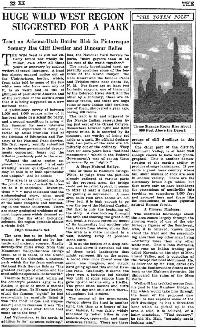
    <summary type="html"><![CDATA[<p><strong><em>On April 12th, 1934 Everett and his brother Waldo Ruess made the journey from southern California through the night. They stopped in Flagstaff for supplies, then headed north to Kayenta, Arizona, where Waldo dropped Everett off. It was the last time he was seen by anyone in his family.</em></strong></p><img src="https://www.intermountainhistories.org/files/fullsize/5132afc33e165a712d7a4a3391423c75.jpg" alt="New York Times, 1934" /><br/><p><span style="font-weight:400;">Known as the gateway to Monument Valley Navajo Tribal Park, Kayenta, Arizona lies in the Navajo Nation just south of the Arizona-Utah border. Kayenta was founded in 1909 by John Wetherill first as a trading post and eventually was established as a township by the Navajo Nation in 1962.</span>
<span style="font-weight:400;">After spending a semester at the University of California Los Angeles (UCLA) Everett traversed the Sierras in 1933. He made it clear to his brother, Waldo, that this journey in 1934 would be his last. After Waldo dropped him off, Everett spent the next two months exploring the region surrounding Kayenta. In a letter to Waldo, he wrote about his journey consisting of “Chin Lee [</span><i><span style="font-weight:400;">sic</span></i><span style="font-weight:400;">], Canyon de Chelly, the Luckachukais, and the Carrizos.” During this time Everett enjoyed the wilderness country, and experienced solitude, which he eventually achieved. During his third time in Canyon de Chelly, Everett foreshadowed his own fate when he wrote “I have been flirting pretty heavily with death” in a letter to a friend. Everett also stayed with Navajo families during this time, where he ate and hunted, making an impression that lasted generations.</span>
<span style="font-weight:400;">As the summer months approached, Everett recalled the crew of the Rainbow Bridge – Monument Valley archeological expedition near Kayenta. The expedition, funded by Ford Motor Company, aimed to provide field experience for explorers and survey the land for an attempted national park. He headed to the expedition’s camp near Skeleton Mesa, just west of Kayenta, and was hired by expedition leader Lyndon Hargrave of the Museum of Northern Arizona (MNA) in Flagstaff. He began working in exchange for meals, rather than the $3.50 a day that the other explorers received. He thoroughly enjoyed this experience because he could work alongside intelligent individuals, discuss the Navajo culture, draw and paint, climb any rock desired, and enjoy the wonders of nature with a sense of companionship for the first time.</span>
<span style="font-weight:400;">Hargrave recalled Everett’s skill from when they met briefly in 1931 at Mesa Ranch Schools’ summer camp. He assigned Everett to work under the crew of Clay Lockett, Flagstaff resident and ethnologist at MNA. The crew spent their time excavating Skeleton Mesa, specifically Woodchuck Cave, which contained archeological remains and objects from as far back as 200 C.E. During the expedition, Everett and  Lockett bonded over their love for art and nature. After his disappearance, Lockett later wrote, “I had an excellent chance to really know Everett,” demonstrating Everetts's lasting impression. It seemed that Everett made an impression on everyone he met, especially on this expedition.</span>
<span style="font-weight:400;">Everett displayed his love for adventure again when a storm approached the canyon, which encouraged him to capture the rolling clouds in watercolor as they encroached. The young vagabond displayed his risky personality while perched at the edge of the slick cliff, hunched over to protect the precious watercolor of Mother Nature in action. Everett soon finished the expedition, paused in Kayenta, and headed south to attend the Hopi snake dance one last time.</span></p><p><em><strong><a href="https://www.intermountainhistories.org/items/show/831">For more (including 4 images) view the original article</a></strong></em></p>]]></summary>
    <published>2024-05-25T04:12:43+00:00</published>
    <updated>2026-04-17T19:32:18+00:00</updated>
    <link rel="alternate" type="text/html" href="https://www.intermountainhistories.org/items/show/831"/>
    <id>https://www.intermountainhistories.org/items/show/831</id>
    <author>
      <name>Matthew T. Lankton, Northern Arizona University</name>
    </author>
  </entry>
  <entry>
    <title type="html"><![CDATA[Everett Ruess in Navajo Country and Canyon de Chelly National Monument ]]></title>
    <summary type="html"><![CDATA[<p><strong><em>In 1932 Everett Ruess set out to central Arizona where he enjoyed the mountainous desert, and later began his journey to his beloved northern Arizona wilderness.</em></strong></p><img src="https://www.intermountainhistories.org/files/fullsize/0dcf36256a9e8c5f10ae900bf7f4e951.jpg" alt="Everett and his horses, 1932" /><br/><p><span style="font-weight:400;">Canyon de Chelly (d’`SHAY) is located in the Navajo Nation and contains the architecture, artifacts, and culture of the communities that have lived there for millennia. Archeologists believe the canyon first had residents roughly 5,000 years ago with the Archaic people. The canyon contains the iconic Spider Rock, White House Ruins, and petroglyphs, and was established as a national monument in 1931 by former President Herbert Hoover. A tributary of Canyon de Chelly is Canyon del Muerto (</span><i><span style="font-weight:400;">Canyon of Death</span></i><span style="font-weight:400;">), named after prehistoric native burials found by the Smithsonian in the canyon in the late nineteenth century. The canyon serves as a monument of the native population, as well as their resilience in defending their sacred land from European settlers.</span>
<span style="font-weight:400;">Everett began his 1932 journey in central Arizona, making his way up to the Mogollon Rim, and eventually Chinle, Arizona, just west of Canyon de Chelly National Monument. Everett had been here just one year prior, before he eventually stayed in Flagstaff and the Grand Canyon, then headed back to southern California. On July 12th, the day before entering Canyon de Chelly, he wrote a lengthy letter to his brother Waldo expressing his appreciation for the outdoors and his belief that “there can be no other life for me but that of the lone wilderness wanderer.” </span>
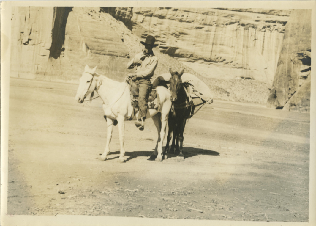
<span style="font-weight:400;">The next morning, Everett wrote that he went “over the hill to Canyon de Chelly, their [Navajo] homeland.” The canyon welcomed Everett with powerful winds, stalling his progress. As he made his way East through Canyon del Muerto, he passed by the White House Ruin and noted the “tall monument” of Spider Rock in his journal. Everett made the journey back from the belly of de Chelly to Canyon del Muerto, where he noted the lack of water. As he had been in the canyon before in 1931, the towering walls of the canyon and the winds that del Muerto presented were very familiar. In roughly four days Everett made his way up through Canyon del Muerto with his horses Nulfo and Jonathan. The trail out of the canyon was not easy for them. He noted that Jonathan was hobbling in circles before eventually collapsing to the ground beneath him, and noting that the place really was the Canyon of Death for “gentle old Jonathan.”</span>
<span style="font-weight:400;">Everett emerged from Canyon de Chelly National Monument with Nulfo by his side, heading toward their next journey to Mesa Verde in Colorado. He remained here for about another month until hitchhiking his way back to Los Angeles where he began a semester at the University of California Los Angeles (UCLA). Despite the remarkable characteristics of his journey, he was still a human who experienced indecision like any other eighteen-year-old. While at UCLA, Everett reminisced on his time at Canyon de Chelly and the rest of the region which provoked him to write a letter explaining that he did not belong in college, but rather in the wilderness which he returned to a few months later.</span></p><p><em><strong><a href="https://www.intermountainhistories.org/items/show/830">For more (including 5 images) view the original article</a></strong></em></p>]]></summary>
    <published>2024-05-25T03:51:26+00:00</published>
    <updated>2026-04-17T19:32:18+00:00</updated>
    <link rel="alternate" type="text/html" href="https://www.intermountainhistories.org/items/show/830"/>
    <id>https://www.intermountainhistories.org/items/show/830</id>
    <author>
      <name>Matthew T. Lankton</name>
    </author>
  </entry>
  <entry>
    <title type="html"><![CDATA[Everett Ruess at Veit Springs near Flagstaff, Arizona]]></title>
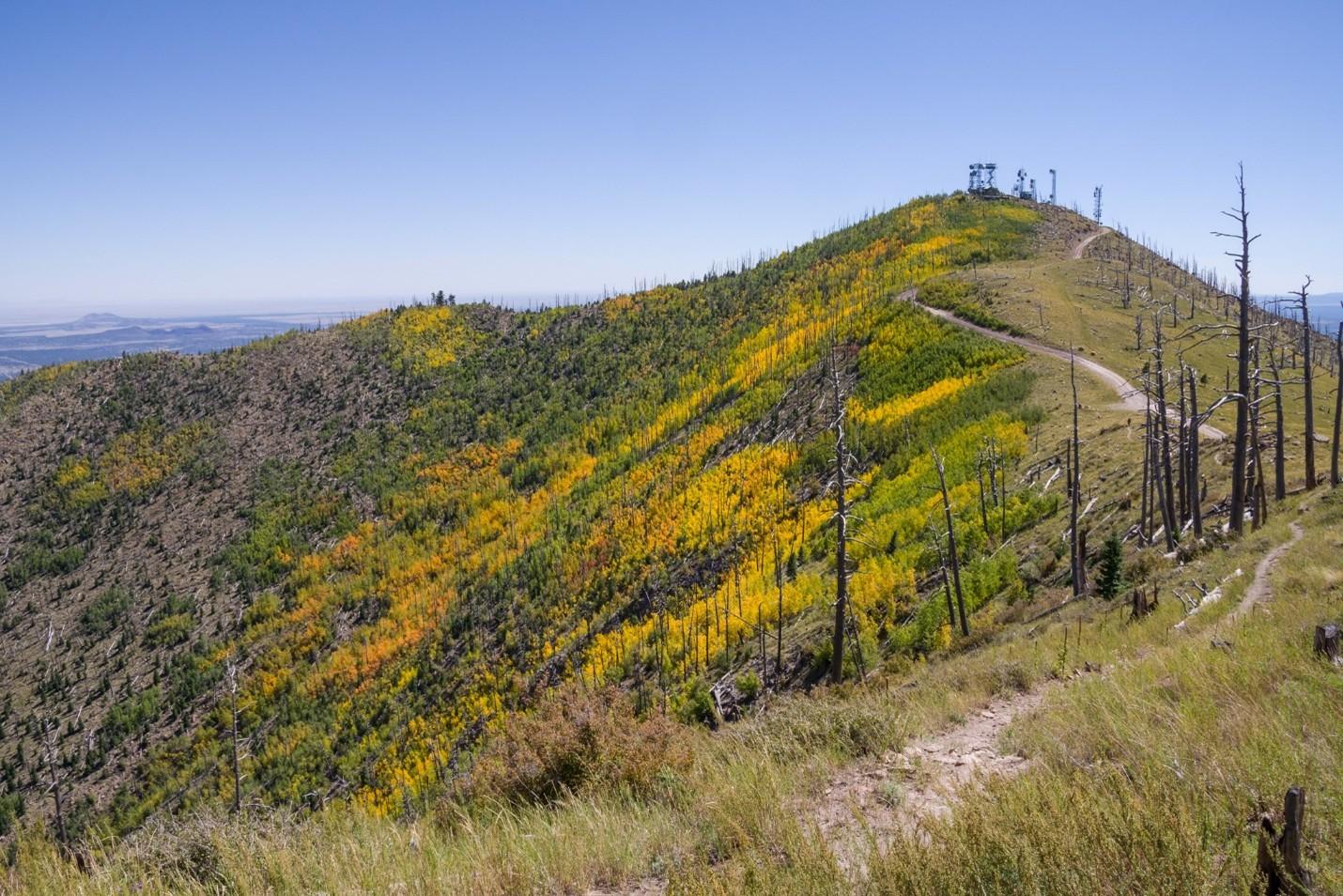
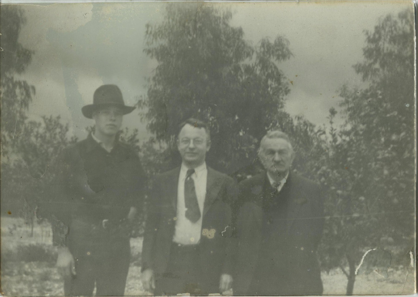
    <summary type="html"><![CDATA[<p><strong><em>Serving as a homestead and a later rest stop for Everett Ruess' introduction to the Intermountain West as a solo traveler, Veit Springs rests on the side of Arizona's highest mountain, the San Francisco Peaks.</em></strong></p><img src="https://www.intermountainhistories.org/files/fullsize/010f42c0309f906e6329d5c5d348784e.jpg" alt="Everett Ruess with his father and grandfather" /><br/><p>Just north of Flagstaff, Arizona sits in the San Francisco Peaks, or "Dook'o'oosłííd," <em>The Summit that Never Melts</em>, to the Navajo Nationa. In the year 1891, German immigrant Ludwig Veit received a patent for a 160-acre homestead where he and his family constructed a cabin and other structures at what came to be called Veit Springs. Randolph (Pat) Jenks, a student at the Evans Ranch School, a boys preparatory school in Mesa, Arizona, purchased the property from Veit’s relatives in 1930. Jenks, and his classmate Tad Nichols, enjoyed their summers in Flagstaff when the school summered up North. In 1931 the two boys encountered Everett Ruess on his journey through northern Arizona, inviting him to join them back on the homestead. </p><p>Everett Ruess was seventeen when he was picked up near Cameron, Arizona, by Jenks and Nichols. Everett was in bad shape, suffering from his history of anemia and other physical degradation from the desert environment. Tad Nichols, famous photographer of the Colorado Plateau, snapped a photo of Everett and Pat loading his gear, his dog Curly, and Burro Pegasus, into Jenks’ truck before they all set on their way to Jenks’ Deerwater Ranch on the San Francisco Peaks. While Everett was at Veit Springs, he bonded with Jenks over his love for ornithology, the study of birds, and their mutual love for art and the Southwest. Everett created a block print painting and described Jenks’ fascination with his art in a letter home. In fact, Jenks was intrigued enough to purchase one of Everett’s block prints of some native Cliff Dwellings. He enjoyed his new friends and wrote a letter about his “idyllic days” at Deerwater Ranch. Here, Everett escaped the traditional aridness of the Intermountain West and described the environment of the ranch as “cool and bracing” in a letter to his family on June 8th, 1931. Among Everett’s belongings in Davis Gulch was an unsent letter that expressed his “true spirit of delight, exaltation, [and] sense of being more than a man” that he experienced at Veit Springs. </p><p>Everett later traversed the Grand Canyon and resided throughout northeast Arizona, returning home later that year. He set off again to the region in 1932, one of the only years his journey was successfully documented. </p><p>In the 1970s, The United States Forest Service aimed to demolish the cabin Veit hand-built, but the Flagstaff community successfully advocated for its relocation just west of the city's downtown. The Veit Cabin relocation by the Arizona National Guard moved the cabin to its current position within Thorpe Park in Flagstaff, Arizona, just South of Francis Short Pond. Since 1988, the new cabin location has facilitated educational events regarding natural and cultural studies of the landscape. Meanwhile, the cabin’s former site at Veit Springs remains a beautiful spot among the tall aspens on the Veit Springs Hiking Trail where tourists can experience the bracing environment that Everett described, as well as Indigenous petroglyphs and abandoned pumphouses from its early days in history.</p><p><em><strong><a href="https://www.intermountainhistories.org/items/show/829">For more (including 5 images) view the original article</a></strong></em></p>]]></summary>
    <published>2024-05-24T22:33:19+00:00</published>
    <updated>2026-04-17T19:32:18+00:00</updated>
    <link rel="alternate" type="text/html" href="https://www.intermountainhistories.org/items/show/829"/>
    <id>https://www.intermountainhistories.org/items/show/829</id>
    <author>
      <name>Matthew T. Lankton, Northern Arizona University</name>
    </author>
  </entry>
  <entry>
    <title type="html"><![CDATA[A Beach in the Desert: Wahweap Beach]]></title>
    <summary type="html"><![CDATA[<p><strong><em>Originally discovered by the Indigenous tribes in the region and created by the growing reservoir behind Glen Canyon Dam, Wahweap Beach developed into a sought-after vacation spot through the construction of Wahweap Lodge by the Greene Family.</em></strong></p><img src="https://www.intermountainhistories.org/files/fullsize/aeab139905fd748f1dace82ace64c1bb.jpg" alt="Wahweap Beach, ca. 1961-1969" /><br/><p>In the middle of northern Arizona and southern Utah’s high desert sits the Wahweap Beach on the artificial oasis of Lake Powell. Wahweap Beach is the most popular recreational and lodging area on Lake Powell with a little over a million visits and about 425,000 overnight stays in 2021 alone. Along with swimming and sunbathing, beachgoers can kayak, paddleboard, jet ski, and powerboat. Wahweap includes amenities such as an RV-friendly campground, picnic tables, boat rentals, and the Lake Powell Resort, making for many options for how to spend time at the beach.</p><p>However, Wahweap Beach did not always exist. It began due to the rising waters of Lake Powell after the construction of Glen Canyon Dam from 1957 to 1964. Originally, “Wahweap” comes from the Paiute language, meaning “bitter water.” The name warned passing natives about the unsafe drinking water as Wahweap only saw running water during spring run-off and summer monsoons. Toward the end of the thirteenth century, the Ancestral Pueblo people fled the area of modern-day Lake Powell and later, the Navajo (Diné), Ute, and Paiute tribes moved into the area.</p><p>In the early days of Lake Powell, the Bureau of Reclamation owned the land, although it granted leases to Navajo farmers for cattle grazing. Bill Greene and his family purchased the lease that designated Wahweap Beach in 1957 from a Navajo man named Curly Tso. The family decided to invest and worked to acquire land concessions from the Arizona State Land Department. Despite strong competition, the family had the help of Barry Goldwater, Arizona senator, and Stewart Udall, House of Representatives member for Arizona’s 2nd District, and gained a concession to the land in 1959 from the National Park Service (NPS). This allowed the Greene family full control of the recreational use at the southern tip of the lake.</p><p>Construction then began on Wahweap Lodge and Marina, now called Lake Powell Resort, by the Greene’s family business, Canyon Tours, Inc. Bill Greene put in a temporary boat launch facility in 1963, and by 1965, Canyon Tours, Inc. finished building Wahweap Lodge which included forty-four guest rooms. These facilities began attracting tourists to its shores to swim, boat, and fish, thus creating the beach life at Wahweap.</p><p>The expected tourist turn-out was so great that in 1962, the NPS already had plans to develop a visitor center at Wahweap Beach. The Parks’ Services Interpretive Prospectus Glen Canyon National Recreational Draft proposed scientific, historical, and recreational-themed exhibits included at Wahweap. Ultimately, other locations such as the Bull Frog Visitor Center across the lake took on the role of interpretation, and included exhibits on human, geological, and natural history. Today, Wahweap is the most active beach and as of June 2023, its swimming spot, also referred to as “Swim Beach,” has been relocated by Glen Canyon National Recreation Area due to the reservoir’s declining water levels. Wahweap is now further from the boat ramps at the Marina, making for a more secluded beach on which to swim and lounge.</p><p><em><strong><a href="https://www.intermountainhistories.org/items/show/826">For more (including 4 images) view the original article</a></strong></em></p>]]></summary>
    <published>2024-05-22T23:55:14+00:00</published>
    <updated>2026-04-17T19:32:18+00:00</updated>
    <link rel="alternate" type="text/html" href="https://www.intermountainhistories.org/items/show/826"/>
    <id>https://www.intermountainhistories.org/items/show/826</id>
    <author>
      <name>Olivia Hall, Northern Arizona University</name>
    </author>
  </entry>
  <entry>
    <title type="html"><![CDATA[Holbrook Hauntings]]></title>
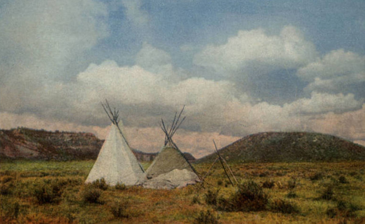
    <summary type="html"><![CDATA[<p><strong><em><span style="font-weight:400;">Once a dangerous and gritty “Wild West” town, Holbrook has survived against all odds and exists as a remnant of old roadside Americana.</span></em></strong></p><img src="https://www.intermountainhistories.org/files/fullsize/a24896a4baf9a1bbccb5cc8faa456ec3.jpg" alt="Wigwam Motel in Holbrook, Arizona" /><br/><p><span style="font-weight:400;">Located in the Painted Desert badlands of Arizona, Holbrook is one of the most famous towns along Route 66. While the town holds fast to its historic roots, it is still very much alive with a population of 4,854 in 2022. One of the biggest draws to Holbrook is its position as the gateway to the Petrified Forest National Park. Another popular attraction is the Wigwam Motel, sometimes referred to as “The Wigwam Village,” which opened in 1950. The motel consists of fifteen concrete dwellings, designed in the style of traditional Native American huts. Old diners, “Wild West” style saloons, and a historical society museum also point visitors to the storied past. The town was named after Henry Holbrook, who, as the chief engineer for the Atlantic Pacific Railroad, played a crucial role in Westward Expansion.</span>
<span style="font-weight:400;">Holbrook once described the town as, “too tough for women and churches.” In the early years, around its founding in 1888, there was little order or consequence to breaking the law. Outlaws from Texas and other surrounding territories often started new lives in Holbrook and surrounding towns, finding freedom from past charges and wreaking havoc on less developed and surveyed communities. Violent crime was common in Holbrook, especially gun-fights and theft, as people decided to take justice into their own hands. One of the most famous feuds in the region, the Pleasant Valley War, involved the Hashknife Cowboys of Holbrook–a group of men who worked for the Aztec Land and Cattle Company. In response to all of the disorder, the Navajo County Courthouse–which included a basement prison–was built in 1899. Some people claim that the old prison cells and Sheriff’s office in the basement are haunted, which is not the first claim of a supernatural element to the area. </span>
<span style="font-weight:400;">As the only national park encompassing a part of Route 66, the Petrified Forest has its fair share of lore. The land has long attracted visitors, curious about and entranced by the abundance of petrified wood. This natural phenomena occurs when minerals, like quartz,  invade the cavities in a piece of wood–the reaction giving the wood a colorful marble-like appearance. In the mid-1800s travelers would pile as many pieces of petrified wood as would fit in their wagons and automobiles. It became common practice for anyone who passed through to take home a piece of petrified wood. The Petrified Forest was declared a national monument in 1906 and then a national park in 1962, both of which made it illegal to take anything from the land. Still, many disregarded the law and continued to steal chunks of petrified wood. Several accounts of freak accidents and misfortune falling upon the thieves fueled the legend that the forest was cursed. The park began to receive packages and letters of confession, apologizing and begging park rangers to return what they had stolen in an attempt to “undo the curse.” </span>
<span style="font-weight:400;">One of the last Route 66 towns to get bypassed by Interstate 40, the community of Holbrook is nothing if not resilient. There were a decent amount of stubborn business owners and residents who stayed despite the rapid decline in population and tourism. Nothing if not resilient, Holbrook survived the gas shortage of the World War II years and rose from the ashes once again after Route 66 was stripped of its status as the great American highway. Holbrook carries on as a popular stop for its old school charm and novelty. </span></p><p><em><strong><a href="https://www.intermountainhistories.org/items/show/807">For more (including 5 images) view the original article</a></strong></em></p>]]></summary>
    <published>2024-05-16T02:20:42+00:00</published>
    <updated>2026-04-17T19:32:18+00:00</updated>
    <link rel="alternate" type="text/html" href="https://www.intermountainhistories.org/items/show/807"/>
    <id>https://www.intermountainhistories.org/items/show/807</id>
    <author>
      <name>Megan Bailey, Brigham Young University</name>
    </author>
  </entry>
  <entry>
    <title type="html"><![CDATA[The Captivity of Olive Oatman]]></title>
    <summary type="html"><![CDATA[<p><strong><em><span style="font-weight:400;">In the wake of a massacre, an orphaned girl is taken captive and raised by Native Americans on the Western Frontier. She returns to Euro-American society in adulthood, becoming a shrouded mystery through each conflicting narrative she spins.</span></em></strong></p><img src="https://www.intermountainhistories.org/files/fullsize/3ed4a32f7a4e886223523110e2babe43.jpg" alt="Portrait of Olive Oatman, 1863." /><br/><p><span style="font-weight:400;">A town in the Black Mountains of Mohave County formerly called “Vivian” after a mining company was renamed “Oatman” in 1909 to honor Olive Oatman, the victim of an infamous kidnapping. The Oatmans were Mormon pioneers who left their home in Illinois to build a new life in the Salt Lake Valley of what is now Utah. They were traveling through Arizona in February 1851 when they were ambushed by a tribe, believed to have been Western Yavapai. They killed Royce Oatman and his pregnant wife as well as four of their seven children. One son, Lorenzo, was able to escape. Sisters Olive and Mary Ann, who were about thirteen and eight-years-old, were taken captive. Neither of them had shoes and Olive was terrified that they would kill her little sister because she had a hard time keeping up with the pace of their travel. They were kept as slaves for about a year until they were sold to Mojaves for an assortment of horses, blankets, vegetables, and beads.</span>
<span style="font-weight:400;">Life with the Mojaves was more comfortable for Olive and Mary Ann as they were adopted by a tribe leader and his wife and were treated as members of the family rather than servants. In Olive’s earliest interview post-captivity she recalls that the Mojaves treated her and her sister “very well.” Members of their tribe made shoes for the girls and did their best to protect them–which included giving them tribal chin tattoos which were believed to grant access to the afterlife. Despite their best efforts, Mary Ann and several members of the tribe died of starvation during a drought in 1858. White settlers in surrounding communities began to notice Olive’s presence in the Mojave tribe, and they grew increasingly concerned. She became something of a legend before she was willfully released by the tribe to re-enter American society in 1856. </span>
<span style="font-weight:400;">Now nineteen-years-old, this transition was jarring for Olive. She had lived with the Yavapais and Mojaves for five years and was a stranger to her old way of life. She struggled to overcome culture shock and grew increasingly homesick for her Mojave family. One bright spot for Olive during these years was reuniting with her brother Lorenzo, who had been searching for her and Mary Ann for years. As she worked to readapt and relearn to dress, speak, and behave–her accounts of her time with the Western Yavapai and Mojave tribes blurred together and turned sour. A reverend, R. B. Stratton, quickly took interest in Olive’s story. He wrote a book, published a year after her return, called </span><i><span style="font-weight:400;">Captivity of the Oatman Girls</span></i><span style="font-weight:400;">. It was riddled with misinformation and prejudice, and the twisted narrative seemed to become a story Olive herself believed. Stratton arranged speaking tours for Olive all over the country, where she shocked people with this crafted version of her life. </span>
<span style="font-weight:400;">At a lecture she gave in Michigan, Olive met a man named John Fairchild, and he seemed to give her the peace she yearned for after so many years of trauma. When they married in 1865 Olive retired from touring and everything to do with Stratton, refusing to perform ever again. John never spoke publicly about her past, and they did their best to live a quiet life in Sherman, Texas. Still she was plagued by her past and mental illnesses, likely PTSD and depression, for the rest of her life. She died in 1903, at the age of 65, leaving behind John and their daughter, Mary Elizabeth. </span>
<span style="font-weight:400;">The scraps of information we have from Olive’s fateful childhood could never do her story justice. Regardless of all the hearsay and sensationalism that grew with her fame, even her earliest interviews are difficult to make sense out of. She was solemn and even glum in nearly every account we have of her, yet she laughed in that first interview while talking about her time with the Mojaves. Olive’s story is as compelling today as it was to those who once gathered in crowds around the country to hear her speak, and the true circumstances of her life remain largely as mysterious.</span></p><p><em><strong><a href="https://www.intermountainhistories.org/items/show/803">For more (including 4 images) view the original article</a></strong></em></p>]]></summary>
    <published>2024-05-16T01:11:43+00:00</published>
    <updated>2026-04-17T19:32:17+00:00</updated>
    <link rel="alternate" type="text/html" href="https://www.intermountainhistories.org/items/show/803"/>
    <id>https://www.intermountainhistories.org/items/show/803</id>
    <author>
      <name>Megan Bailey, Brigham Young University</name>
    </author>
  </entry>
  <entry>
    <title type="html"><![CDATA[ Mountains, Mining, and Massacre: The History of Oatman, Arizona]]></title>
    <summary type="html"><![CDATA[<p><strong><em><span style="font-weight:400;">Free-roaming donkeys, an old mining district, a stop on Route 66, and ties to a famous kidnapping make up the storied past of this semi-abandoned town.</span></em></strong></p><img src="https://www.intermountainhistories.org/files/fullsize/d34d919e9df93dc8bb5d0f3e2ba0cc1d.jpg" alt="Oatman, Arizona circa 1930." /><br/><p><span style="font-weight:400;">Tucked away in the Black Mountains of Mohave County, Arizona is a community rich with legend. The town was named for Olive Oatman and her family who were victims of the Oatman Massacre in 1851, and it came to life in the following decades as prospectors discovered gold, ore, and other valuable resources in the land. Oatman is home to the three most prosperous gold mines in Arizona: the Gold Road, the Tom Reed, and the United Eastern. </span>
<span style="font-weight:400;">A gold prospector named John Moss was one of the first to discover gold in the area in the early 1860s, but it wasn’t until the 1900s that Oatman really boomed. A hotel and post office were built in 1902 and 1906 respectively, securing Oatman’s status as an official town. The mines brought riches and rapid growth to the community, with Tom Reed mine’s total profit reaching over nine-million by 1922 and the town’s population growing to 10,000 in the same decade.</span>
<span style="font-weight:400;">One of the oddities of Oatman is the population of wild burros (undomesticated donkeys). They were brought in by miners who used teams of them to haul supplies from out of town. Burro labor was a big part of the mining industry, but unlike the prospectors, they never picked up and left town. Billie Jo Moore, long time proprietor of the Oatman Hotel, said in an interview that, “the burros stayed behind and adapted to the desert. Now they are all over these mountains…They wander through the streets, turning over garbage cans and messing in people’s yards.” While they are little more than a nuisance to locals, tourists entertain them with attention, alfalfa pellets, and lots of pictures–burros have become iconic to the town. </span>
<span style="font-weight:400;">Oatman stitched itself into another legend of America when it became a part of Route 66. It was 1926, still bringing in plenty of spoils from the mines, and now gaining further revenue from the new highway. These were the glory days in Oatman; crime was low, employment was high, and people were optimistic about the future. While there was an occasional murder and a tendency for drunkenness in Oatman, it didn’t fall into the expected stereotype of the “wild west.” The isolation of the town, so far away from any other civilization at that time, created a tight-knit group that made new traditions together–like the annual three day long Fourth of July celebrations. When the Great Depression hit in the 1930s, the prosperity and liveliness of the community began to dwindle, and by the time Route 66 went out of commission in the 1950s it was well on its way to becoming a ghost town. Oatman has never been fully abandoned though, and it has been given new life through its performers and curious travelers. </span></p><p><em><strong><a href="https://www.intermountainhistories.org/items/show/802">For more (including 5 images) view the original article</a></strong></em></p>]]></summary>
    <published>2024-05-16T00:49:23+00:00</published>
    <updated>2026-04-17T19:32:17+00:00</updated>
    <link rel="alternate" type="text/html" href="https://www.intermountainhistories.org/items/show/802"/>
    <id>https://www.intermountainhistories.org/items/show/802</id>
    <author>
      <name>Megan Bailey, Brigham Young University</name>
    </author>
  </entry>
  <entry>
    <title type="html"><![CDATA[Pleasant Valley War]]></title>
    <summary type="html"><![CDATA[<p><strong><em><span style="font-weight:400;">Desperation, betrayal, and revenge accompany one of the bloodiest feuds in U.S. history.</span></em></strong></p><img src="https://www.intermountainhistories.org/files/fullsize/61d94e75d33185cc1728da42902375f5.jpg" alt="Unidentified member of Sheriff Munvenon’s Posse that came to investigate the violent occurrences of Pleasant Valley in 1887" /><br/><p><span style="font-weight:400;">The Pleasant Valley War was a feud between two ranching families on the Arizona frontier: The Grahams and the Tewksburys. About three decades before Arizona became a U.S. state, Gila County–and the rest of the territory–was being overrun by American cowboys. They had their own vendettas, loyalties, and codes for living. In 1882 Samuel Graham, his wife Jane, and their five children were invited to Pleasant Valley by their friend Edwin Tewksbury. The Grahams were Irish immigrants who lived in Oklahoma before they ventured west to try ranching. The head of the Tewksbury family, James, had been a miner in San Francisco before establishing a settlement in Arizona with his family. He got married and he and his wife also had five children. The first signs of bad blood between the families began to show about two years later. </span>
<span style="font-weight:400;">There were several incidents that have been claimed as the catalyst for the war, but each of them stemmed from organized theft–which had been rampant in the area long before cattle had. In the early days, when the Grahams and Tewksburys were on friendly terms, they shared a common enemy: the Stinsons. It was primarily the Tewksburys who they had it out for, and the Grahams made the first crack in the glass when they entered a shady contract with the Stinsons. Arrangements were made for the Grahams to be paid in cattle in exchange for spreading false claims about the Tewksburys. The feud escalated through acts of revenge until nobody in the territory was safe to claim neutrality. Baseless accusations turned to gunfights, cold-blooded murder, and organized theft. </span>
<span style="font-weight:400;">In an essentially lawless land with little order, few natural resources, and no shortage of desperation, it was not uncommon for ranchers to wake up and find that their cattle had been stolen. As the population grew Pleasant Valley became increasingly treacherous and unwelcoming. G.W. Shute, the District Attorney of Gila County, warned, “Strangers entering the Pleasant Valley disappeared completely. Horse thieves infested the whole of the country. A cattleman or farmer, when he turned his horses upon the range, never knew whether or not he would see them again.” In one case, the Daggs brothers–who were in cahoots with the Grahams–drove a herd of sheep, belonging to the Tewksburys, off a cliff. </span>
<span style="font-weight:400;">The Grahams instigated and perpetrated so many of these heinous acts that they were labeled “thieves” and untrustworthy by the Tewksburys, but this didn’t stop them from gaining some powerful allies. James Houck, deputy sheriff of a nearby county, as well as many popular cattle suppliers of the territory sided with the Graham family. The Tewksbury sons, who were half-Native American, were called a variety of racist slurs by their enemies. At one point there was a fifty-dollar reward offered to anyone who would bring in a “Tewksbury Scalp.”</span>
<span style="font-weight:400;">There would be no peace or goodwill to end the war. One of the last and most brutal events of this fateful vendetta took place on Tewksbury Ranch in 1887. The Grahams and some of their associates murdered John Tewkbsury and one of his sons. Their bodies were guarded outside by their killers, so that their bodies would be mutilated before a proper burial. Of this twisted act, Jim Tewksbury stated, “No damned man can kill a brother of mine and stand guard over him for the hogs to eat him, and live within a mile and a half of me.” By the time it was all over, every member of the Graham family and their faction had been killed. </span></p><p><em><strong><a href="https://www.intermountainhistories.org/items/show/801">For more (including 5 images) view the original article</a></strong></em></p>]]></summary>
    <published>2024-05-16T00:32:09+00:00</published>
    <updated>2026-04-17T19:32:17+00:00</updated>
    <link rel="alternate" type="text/html" href="https://www.intermountainhistories.org/items/show/801"/>
    <id>https://www.intermountainhistories.org/items/show/801</id>
    <author>
      <name>Megan Bailey, Brigham Young University</name>
    </author>
  </entry>
  <entry>
    <title type="html"><![CDATA[Apache County on Route 66]]></title>
    <summary type="html"><![CDATA[<p><strong><em><span style="font-weight:400;">The land on the Arizona-New Mexico border has a storied past–from Spanish trading routes and gutsy American cowboys to railroad tracks and the boom of a brand-new highway.</span></em></strong></p><img src="https://www.intermountainhistories.org/files/fullsize/c94d71a364203dd0571092e6433d1afa.jpg" alt="In Apache Land, Arizona" /><br/><p><span style="font-weight:400;">Apache County, which makes up the northeast region of Arizona, has been occupied since at least 800 A.D. by Ancestral Puebloans (formerly known as “Anasazi”). The first of many Spanish expeditions to the Arizona/New Mexico region lasted from 1540-1542, and began a tumultuous relationship with the indigenous population. In the following years Spanish colonists introduced new cattle to the region, and sheepherding became a popular practice for the next several hundred years. In 1864 the U.S. government issued a forced displacement of the Navajo people known as the “Long Walk.” It was a harsh and unforgiving journey that resulted in at least 500 deaths. One region exiled during the Long Walk later became known as Lupton, one of several unincorporated communities along Route 66. </span>
<span style="font-weight:400;">Famous for its scenic “painted cliffs,” brightly colored roadside shops, and appearance in the 1940 film adaptation of </span><i><span style="font-weight:400;">Grapes of Wrath</span></i><span style="font-weight:400;">, Lupton was built from a railroad settlement in 1905. The community's namesake, G.W. Lupton, was a trainmaster and owner of the first trading post in the area. In the post-war tourism boom of the early 1950s, the Yellowhorse family of the Navajo Reservation opened their own trading post. The building was painted a striking yellow with red and black painted signage advertising “The Indian Market Place: Deal with the Friendly Navajo.” Although Route 66 had given the area a new life after the railroad revolution, the construction plans for Interstate 40 bypassed Lupton. Like so many other little towns that survived only from the tourist revenue, Lupton soon slipped into obscurity. The shop fronts have not been well-preserved, and there is not much charm left to draw people in, but the sight of the painted cliffs when the sun hits them just right remains as breathtaking as it always was.</span>
<span style="font-weight:400;">Twelve miles west of Lupton and the New Mexico border another now deserted town called Houck has its own storied past. In 1877 James Houck, a horseback-riding mail carrier, established a trading post along his route which ran from Prescott, Arizona to Fort Wingate, New Mexico. The post, which was called “Houck’s Tank,” expanded into a small community which adopted Houck’s name. He lived a fairly successful life, but had a hard time staying out of trouble. He was no stranger to shoot-outs or plots of revenge–and his friendship with the Tewksbury family put him in the middle of a major feud between two ranching families. Known as the Pleasant Valley War or the Graham-Tewksbury Feud, it resulted in somewhere between thirty-five to fifty deaths. His career beyond mail delivery included sheepherding, mining, trading, and a position as the Apache County Deputy Sheriff. Yet he is memorialized now as the namesake for the once lively ghost town of Houck, Arizona.</span>
<span style="font-weight:400;">In late 1926, Route 66 made its way through Houck, attracting new visitors to what had once been nothing more than a trading post. Although becoming a part of Route 66 helped bring a more steady flow of business and traffic, Houck never quite blossomed the way other towns along the highway did. A gas station, a grocery store, a “Pancake House,” and a few other small establishments popped up, but much of it has since gone out of business and become overgrown. In 1998, long after the excitement died down, the Native American Bahá'í Institute opened as a place of worship, training, and gathering place for the Navajo reservation and surrounding communities. </span></p><p><em><strong><a href="https://www.intermountainhistories.org/items/show/800">For more (including 5 images) view the original article</a></strong></em></p>]]></summary>
    <published>2024-05-15T20:15:34+00:00</published>
    <updated>2026-04-17T19:32:17+00:00</updated>
    <link rel="alternate" type="text/html" href="https://www.intermountainhistories.org/items/show/800"/>
    <id>https://www.intermountainhistories.org/items/show/800</id>
    <author>
      <name>Megan Bailey, Brigham Young University</name>
    </author>
  </entry>
  <entry>
    <title type="html"><![CDATA[Snowflake: Zion on the Little Colorado]]></title>
    <summary type="html"><![CDATA[<p><strong><em>Snowflake, Arizona is a small town located in the eastern portion of the state along a tributary of the Little Colorado River known as Silver Creek. It was founded in 1878 by William Jordan Flake and a group of Mormon pioneers who had been directed by Brigham Young to colonize Arizona. The town was officially incorporated in 1919.</em></strong></p><img src="https://www.intermountainhistories.org/files/fullsize/37e4b095306e0664935a3b27b26d576d.jpg" alt="The Snowflake Monument" /><br/><p><span style="font-weight:400;">After finally arriving in the Salt Lake Valley in the late 1840s, early converts of the Church of Jesus Christ of Latter-day Saints deserved a rest. After gathering from across the nation and overseas and fleeing persecution in their flight across the Great Plains, the Saints finally arrived in Salt Lake. They began to make the desert “blossom as a rose” and settled themselves into the comfort of their new home. However, Church President Brigham Young’s ambitions for this fledgling “Zion” extended far beyond the confines of the Salt Lake Valley. His envisioned state of “Deseret” was much larger, and he soon began sending Church members to make new settlements across the Intermountain West.</span>
<span style="font-weight:400;">Church leaders called one such group to settle the Little Colorado River in present-day Arizona in 1876. Among them was William Jordan Flake, a rancher from Beaver who had been orphaned as a child due to the dangers of pioneering. Initially horrified with the idea of leaving all he had worked for to make for the Arizona desert, William asked President Young if he might just go for a year or two and then return to Beaver. Young’s reply was unequivocal: “Sell all that you have, that you cannot take with you. Take your family and go there to settle the Saints. Leave nothing to come back to.” William and his pioneer companions obeyed the command and, upon arriving in the Little Colorado Valley, they established the settlements of Ballinger’s Camp, Sunset, Old Taylor, and Allen’s Camp. The early settlements initially struggled against the hostile environment and the difficulty of living the standards set by the “United Order,” a Church movement which called for collectivist, communal living. William Flake, troubled by these </span><span style="font-weight:400;">problems, decided to look for a place to build a new settlement. He rode out to meet James Stinson, a rancher who had acquired and irrigated 300 acres on Silver Creek, a tributary of the Little Colorado. Stinson said he would sell his land for $12,000, which William raised by convincing Church leaders to procure the sale of cattle from their Utah ranches.</span>
<span style="font-weight:400;">On July 21, 1878, Flake and other pioneer families moved onto the ranch. Soon more followed. On September 24th of the same year, Church Apostle Erastus Snow visited the townsite, and they decided to name the settlement Snowflake, a combination of the two men’s names. The town grew steadily. In 1892, tragedy struck when William’s son Charles was killed in a shootout while attempting to arrest a suspected bank robber (the outlaw was also killed in the gunfight). Nevertheless, Snowflake became one of the more successful of the Little Colorado Valley settlements, and the town was eventually incorporated in 1919. Snowflake now stands as a monument to the legacy of faith left by the early Mormon pioneers.</span></p><p><em><strong><a href="https://www.intermountainhistories.org/items/show/742">For more (including 4 images) view the original article</a></strong></em></p>]]></summary>
    <published>2023-04-10T19:01:01+00:00</published>
    <updated>2026-04-17T19:32:16+00:00</updated>
    <link rel="alternate" type="text/html" href="https://www.intermountainhistories.org/items/show/742"/>
    <id>https://www.intermountainhistories.org/items/show/742</id>
    <author>
      <name>Joseph Flake, Brigham Young University</name>
    </author>
  </entry>
  <entry>
    <title type="html"><![CDATA[North Rim Lookout Tower]]></title>
    <summary type="html"><![CDATA[<p><strong><em>The North Rim Lookout Tower helped to protect the area of the Grand Canyon. One can still appreciate immaculate views of the Grand Canyon from high above northern Arizona’s ponderosa forests at the North Rim Lookout Tower which is available to hikers. </em></strong></p><img src="https://www.intermountainhistories.org/files/fullsize/163624658f254fa48626545cb65fa694.jpg" alt="Fire Lookout in the Grand Canyon" /><br/><p><p style="font-weight:400;">Following the Great Fire of 1910, which devastated much of the northern Rocky Mountains, the Forest Service prioritized wildfire suppression. By the mid-1910s, it constructed three small platforms along the Canyon’s edge to spot fires. The North Rim platform, constructed at Bright Angel Point, provided forest rangers and tourists with impeccable views of the forests which lined the Canyon.</p><p>As one of the natural wonders of the world, the Grand Canyon is widely considered one of America’s environmental gems. Federal attempts to preserve the Canyon date all the way back to the late nineteenth century, when the then Indiana Senator, Benjamin Harrison, proposed three bills in the 1880s to set aside the canyon as a national park.<span> </span>Though each of the bills failed, President Harrison eventually granted the Grand Canyon status as a Forest Reserve in the waning days of his presidency in 1893. After President Theodore Roosevelt visited the area in 1903, he granted the site status as a National Monument in 1908, <span>replacing Harrison’s reserve</span><span> </span>. The National Park Service wouldn’t be founded for another eight years, so the Monument fell under control of the fledgling US Forest Service.
<p style="font-weight:400;">The Grand Canyon gained status as a National Park in 1919. The Park Service continued the Forest Service’s policy of fire suppression, and in 1928, it replaced the platform with a seventy five-foot tall steel tower. Topped with a tiny observation cab, fire lookouts lived in a small cabin beneath the structure. Under contract, the Aeromotor Company constructed the Bright Angel Lookout Tower. Aerometer also designed and produced the iconic windmill water pumps which became a symbol of the American West during the late nineteenth and early twentieth centuries.
<p style="font-weight:400;">During the 1930s, the Civilian Conservation Corps (CCC) updated much of the North Rim’s infrastructure. This included moving the Bright Angel Lookout roughly fourteen miles away to the Park’s northern entrance. In 1933, the CCC renamed the structure the North Rim Lookout Tower.
<p style="font-weight:400;">From the late 1960s to the early 1970s, writer and environmentalist Edward Abbey spent four seasons working in the tower. Abbey’s time in the station inspired his book <em>Black Sun, </em>a novel which tells the story of a fire lookout in the Grand Canyon who falls in love with a tourist. When she goes missing, the lookout is blamed for her mysterious disappearance. In his book <em>Fire on the Rim</em>, Stephen Pyne references Abbey as the reason the Park ceased lookout tower operations. “Whether [Abbey] was even in the tower, no one could say. He was a writer, and the only smokes he reported were the ones in his novels… he was absent so often that he demonstrated that we did not need a lookout, because having [Abbey] in the tower was the same as having no one.” Ultimately, the Park opted for aerial fire spotting instead.
<p style="font-weight:400;">Though abandoned, North Rim Lookout Tower is still accessible. Hikers can reach the site via a short hike from the Park’s northern entrance toll booth.</p><p><em><strong><a href="https://www.intermountainhistories.org/items/show/709">For more (including 5 images) view the original article</a></strong></em></p>]]></summary>
    <published>2023-02-23T00:36:16+00:00</published>
    <updated>2026-04-17T19:32:15+00:00</updated>
    <link rel="alternate" type="text/html" href="https://www.intermountainhistories.org/items/show/709"/>
    <id>https://www.intermountainhistories.org/items/show/709</id>
    <author>
      <name>Tanner Hammarstrom, Northern Arizona University</name>
    </author>
  </entry>
  <entry>
    <title type="html"><![CDATA[Suffrage at the Coconino County Courthouse in Flagstaff, Arizona]]></title>
    <summary type="html"><![CDATA[<p><strong><em>In 1912, the Arizona Territory became a state, and the Arizona Equal Suffrage Association invited prominent suffragette Anna Howard Shaw to visit the Coconino County Courthouse in Flagstaff to speak about women’s rights. Shaw, from Massachusetts, was a doctor, minister, and president of the National Women’s Suffrage League.</em></strong></p><img src="https://www.intermountainhistories.org/files/fullsize/6a7936a403c1c0c6baed9163ac721c1f.jpg" alt="Coconino Courthouse" /><br/><p>The United States created Arizona Territory by splitting New Mexico Territory in half in February 1863. Unlike some other western territories, Arizona forestalled legally granting women the right to vote or hold office, despite efforts by suffragists in 1881, 1883, and 1885. In 1891, after President Benjamin Harrison denied Arizona statehood and included equal suffrage law included in its proposed state constitution territorial suffragettes founded the Arizona Equal Suffrage Association, combining the fight for women’s rights with the continued fight for statehood. In February 1912, Arizona finally became a state under President William Taft; though the new state constituion did not immediately afford women the right to vote, the women of the Arizona Equal Suffrage Association saw the constitution’s initiative laws as an opportunity to continue the fight for women’s votes.
On October 18, 1912, the Arizona Equal Suffrage Association invited Dr. Anna Howard Shaw, president of the National Women’s Suffrage League, to visit Arizona and speak on the steps of the Coconino County Courthouse in Flagstaff. A month later, the initiative to introduce women’s suffrage to the ballot passed the legislature. On November 5, 1912, the state’s voters cast their ballots on the initiative, and the women’s suffrage initiative passed with a seventy percent majority victory, even with all of Arizona’s voters being men. This made the Arizona the tenth state to allow women to vote.
In April 2021, Coconino County unveiled a marker at the Flagstaff County Courthouse with the National Collaborative for Women’s History Site and Pomeroy Foundation to commemorate the centennial of women’s voting rights, marking the courthouse as a significant place for the history of women’s suffrage. Speakers that day included County Supervisors Matt Ryan and Patrice Hortsman as well as County Recorder Patty Hansen.</p><p><em><strong><a href="https://www.intermountainhistories.org/items/show/618">For more (including 3 images) view the original article</a></strong></em></p>]]></summary>
    <published>2022-06-23T08:45:45+00:00</published>
    <updated>2026-04-17T19:32:13+00:00</updated>
    <link rel="alternate" type="text/html" href="https://www.intermountainhistories.org/items/show/618"/>
    <id>https://www.intermountainhistories.org/items/show/618</id>
    <author>
      <name>Megan Salinas, Northern Arizona University</name>
    </author>
  </entry>
  <entry>
    <title type="html"><![CDATA[Grand Canyon Depot]]></title>
    <summary type="html"><![CDATA[<p><strong><em>Take the Grand Canyon Railway to the historic train depot in Grand Canyon National Park and experience the unique architectural design of the only operating log depot in the United States.</em></strong></p><img src="https://www.intermountainhistories.org/files/fullsize/f9bfc58de0278251fc6045574c950f38.jpg" alt="The depot in 1975" /><br/><p>Designed by architect and Santa Barbara, California native Francis W. Wilson, the Grand Canyon Train Depot is one of fourteen log depots ever constructed in the United States and is now one of only three remaining. Out of these, the Grand Canyon Depot is the only one built mainly from logs and the only one still operating today. The building features a central two-story section and a wing on each side one-story in height. The unique design of the wood—three flat sides and one rounded—allowed the building to give off a frontier appearance while keeping out moisture and maintaining structural integrity. The original copper lettering on the front spelled out “Grand Canon,” but workers replaced it in 1911 to spell “Grand Canyon.” Between the late-1920s and mid-1950s the depot underwent structural and functional renovations which added office space and upgraded lighting.
Before 1901, a trip to the Grand Canyon required a bumpy, sixty-five-mile stagecoach ride on dirt roads to reach the South Rim. To rectify this—and simultaneously capitalize on interest to the park—in 1901, the Santa Fe Railway built a line of tracks connecting their depot in Williams, Arizona to what would become Grand Canyon Village. Instead of going by stagecoach, visitors to the Grand Canyon could ride the train and relax while enjoying the view on the way to one of the greatest natural wonders in the world.
The arrival of the railroad in 1901 shifted the tourist experience to what became the Grand Canyon Village. In 1905, the Santa Fe Railroad completed the El Tovar Hotel between the track and the canyon. Santa Fe then partnered with the Fred Harvey Company and the National Park Service to add more buildings to accommodate the growing number of tourists, including Hopi House, Bright Angel Lodge, and the Red Horse Cabin. Architect Mary Jane Colter designed many of these structures.
Popularity for the railroad dwindled as the automobile industry grew, however; in 1968, the Grand Canyon Railway made its final passenger run, and the Santa Fe Railway left the buildings it owned to the National Park Service. Freight transportation continued on the line, but soon after, in 1972, the railway discontinued passenger services to the Grand Canyon. In 1989 the formation of the Grand Canyon Railway revived the route when entrepreneurs Max and Thelma Biegert funded the restoration of the Grand Canyon Line: tourists once again could travel to the park by train. For visitors today, the station represents the idea of western national parks as rustic and scenic. Often the first experience guests have when they step off the train, the depot remains one of the best structures from the National Park’s rustic period.</p><p><em><strong><a href="https://www.intermountainhistories.org/items/show/603">For more (including 4 images) view the original article</a></strong></em></p>]]></summary>
    <published>2022-06-09T22:59:59+00:00</published>
    <updated>2026-04-17T19:32:13+00:00</updated>
    <link rel="alternate" type="text/html" href="https://www.intermountainhistories.org/items/show/603"/>
    <id>https://www.intermountainhistories.org/items/show/603</id>
    <author>
      <name>Jennifer John, Northern Arizona University</name>
    </author>
  </entry>
</feed>