<?xml version="1.0" encoding="UTF-8"?>
<feed xmlns="http://www.w3.org/2005/Atom">
  <title type="text">Intermountain Histories</title>
  <updated>2026-04-17T19:32:18+00:00</updated>
  <generator uri="http://framework.zend.com" version="1.12.20">Zend_Feed_Writer</generator>
  <link rel="alternate" type="text/html" href="https://www.intermountainhistories.org/"/>
  <link rel="self" type="application/atom+xml" href="https://www.intermountainhistories.org/items/browse?output=rss2"/>
  <id>https://www.intermountainhistories.org/</id>
  <author>
    <name>Intermountain Histories</name>
    <uri>https://www.intermountainhistories.org</uri>
  </author>
  <link rel="hub" href="https://pubsubhubbub.appspot.com/"/>
  <entry>
    <title type="html"><![CDATA[The S. L. Welsh Herbarium]]></title>
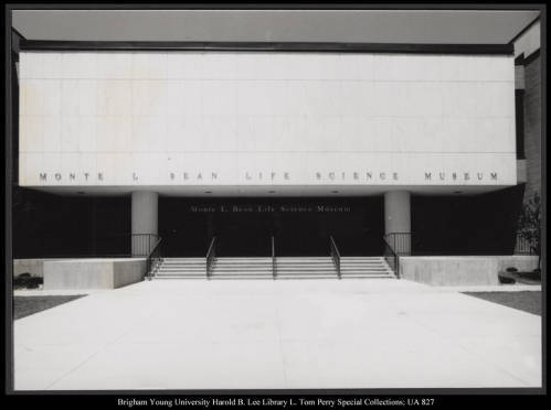
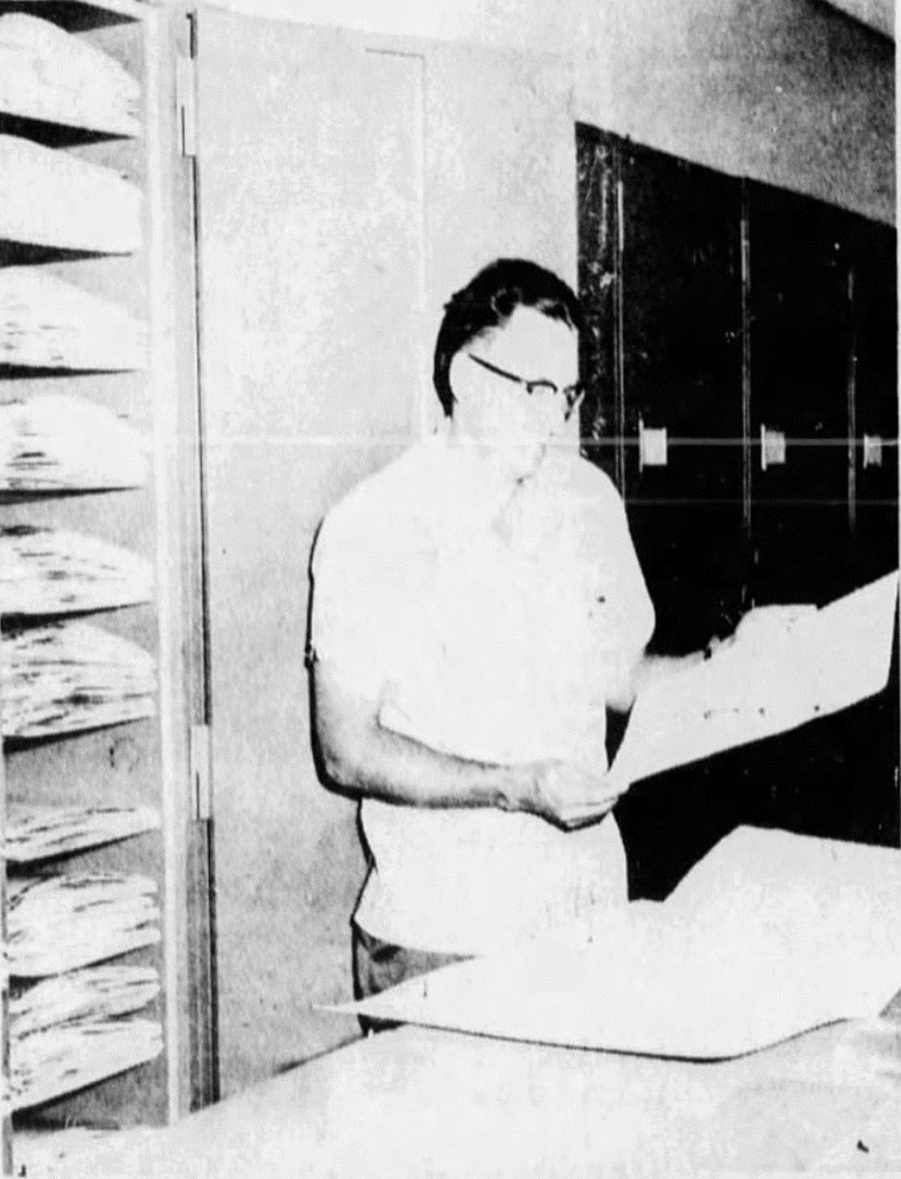
    <summary type="html"><![CDATA[<p><strong><em>Walter P. Cottam, one of the first to receive a master's degree from Brigham Young University, established the S.L. Welsh in 1923. In 1980, the school named the herbarium after Stanley L. Welsh, who served as a curator in the 1960s. The S.L. Welsh Herbarium's collection size is ranked 20th out of 646 nationwide and 65th out of 3,001 herbariums worldwide.</em></strong></p><img src="https://www.intermountainhistories.org/files/fullsize/21fcf6beb8d44646e2e2c531332bf08d.jpg" alt="Dr. Stanley L. Welsh, in the archives of the Stanley L. Welsh herbarium" /><br/><p><span style="font-weight:400;">The S.L. Welsh Herbarium is at Brigham Young University (BYU) in Provo, Utah. The story of its establishment begins in 1874 when  Orson W. Howard created the first herbarium in Utah. Then, in 1923, the university hired Walter P. Cottam, a former master's student and one of the first two individuals to receive a master's degree from BYU, as a botany professor. Upon joining the staff, Cottam received a portion of Howard's herbarium collection to form the Brigham Young University herbarium. However, before adding additional specimens, Cottam had to register the existing collection to choose a permanent acronym, and he selected BRY for Brigham Young. He served as the curator for seven years before passing the role to Dr. Bertrand Harrison in 1930, another BYU former student and Professor of Botany, who held the curator position for the next thirty years. During Harrison's tenure, the herbarium collection grew to 26,000 samples.</p><span style="font-weight:400;">In 1960, Harrison passed the job down to Dr. Stanley L. Welsh. Welsh taught biology at the school and became a well-known curator due to his work developing a program to exchange specimens with numerous universities. By 1971, the herbarium had established connections with Iowa State, North Carolina, Alaska, and international university herbariums. That same year, the collection reached a milestone of 96,000 specimens sourced from Western America, Northern Europe, and the Middle East. The oldest specimen in the archives dates to 1850 and came from Europe, while the oldest native Utah specimen collected was a gift from the University of Utah that dates to the 1880s. Over forty years, Welsh added 150 sheets of pressed and preserved specimens annually, expanding the collection from 25,000 to 450,000. In 1980, the university renamed the herbarium to honor Welsh's contributions. As the collection grew, the herbarium changed locations, moving from the university's Brimhall Building to the Grant Building, then to the Biolab, and finally to its current location under the Bean Museum when it opened in 1978. The school named the museum after Monte Lafayette Bean, a naturalist who funded its construction. The herbarium collection continues to sit under the Bean Museum and currently holds specimens collected globally but emphasizing the Great Basin and Intermountain West.</span></p><p><em><strong><a href="https://www.intermountainhistories.org/items/show/825">For more (including 3 images) view the original article</a></strong></em></p>]]></summary>
    <published>2024-05-22T20:16:59+00:00</published>
    <updated>2026-04-17T19:32:18+00:00</updated>
    <link rel="alternate" type="text/html" href="https://www.intermountainhistories.org/items/show/825"/>
    <id>https://www.intermountainhistories.org/items/show/825</id>
    <author>
      <name>Cristal A. DeSantiago, Northern Arizona University</name>
    </author>
  </entry>
  <entry>
    <title type="html"><![CDATA[Intermountain Herbarium]]></title>
    <summary type="html"><![CDATA[<p><strong><em>In the 1930s, Bassett Maguire began a personal project of gathering local plants and publishing the findings. Maguire brought the collection to Utah State University in 1939 and created the Intermountain Herbarium. His collection grew to be the second-largest herbarium in the Intermountain Region and the largest public herbarium in the region. </p></strong></p><img src="https://www.intermountainhistories.org/files/fullsize/28eb59623097df251d744081d5e0c68f.jpg" alt="A sample of Castilleja alkoensis Edwin, also known as Prairie-Fire" /><br/><p><span style="font-weight:400;">The Intermountain Herbarium is at Utah State University (USU) in Logan, Utah. It began with Dr. Bassett Maguire, a botanist, who initiated a project exploring the local flora in the early 1930s. He recorded and published his findings as the Intermountain Flora project, eventually publishing seven volumes. In 1939, Maguire joined USU as a Professor of Botany and used his project findings to establish the Intermountain Herbarium that same year, becoming its first collector and curator. Maguire remained active in his project and curator role,  often working on both simultaneously. He would travel to various locations to continue his studies and enlarge the herbarium collections, often accompanied by a selection of students and USU Professor of Biology Arthur H. Holmgren. However, in 1942, he left to become the New York Botanical Garden curator.</span></p><p><span style="font-weight:400;">Upon Maguire's departure, Professor Arthur H. Holmgren assumed the role of curator and remained in that position until 1978. Over the thirty-plus years, the herbarium flourished under Holmgren's leadership.</span><span style="font-weight:400;"> T</span><span style="font-weight:400;">hen, by 1963, he had collected over 110,000 specimens. Years later, in 1976, he had grown the herbarium to 150,000 specimens, and it became a popular research source for academic students and government agencies. International organizations also requested samples from the Intermountain Herbarium to study the Utah flora. International organizations also requested samples from the Intermountain Herbarium to study the Utah flora. Most of the collection originated from the West, including Utah, southern Idaho, most of Nevada, a small portion of California (including the Great Basin), and southwest Oregon. The rest of the collection resulted from exchange transactions with global institutions.</span>
<span style="font-weight:400;">After Holmgren's retirement, Dr. Mary Barkworth assumed the role of herbarium director until 2012. When she took over in 1979, the herbarium collection included 172,000 specimen samples and additional folders that were not officially part of the herbarium due to being unidentifiable plant samples. Under her leadership, the herbarium became part of a loaning system that allowed the Intermountain Herbarium to borrow files from other herbariums when specific information was unavailable at USU. The loan could last as long as someone needed the information or until they published their paper. Additionally, the herbarium had a policy that if it achieved new flora identification and had extra samples of the new specimen, it would send the additional specimen to other collection centers. In 1986, Barkworth moved the herbarium to the fourth floor of the Utah State University Plant Industry building. The work of the curators and collectors to grow the collection and researchers began to recognize the Intermountain Herbarium as a major regional herbarium.</span></p><p><em><strong><a href="https://www.intermountainhistories.org/items/show/824">For more (including 3 images) view the original article</a></strong></em></p>]]></summary>
    <published>2024-05-22T19:56:08+00:00</published>
    <updated>2026-04-17T19:32:18+00:00</updated>
    <link rel="alternate" type="text/html" href="https://www.intermountainhistories.org/items/show/824"/>
    <id>https://www.intermountainhistories.org/items/show/824</id>
    <author>
      <name>Cristal A. DeSantiago, Northern Arizona University</name>
    </author>
  </entry>
  <entry>
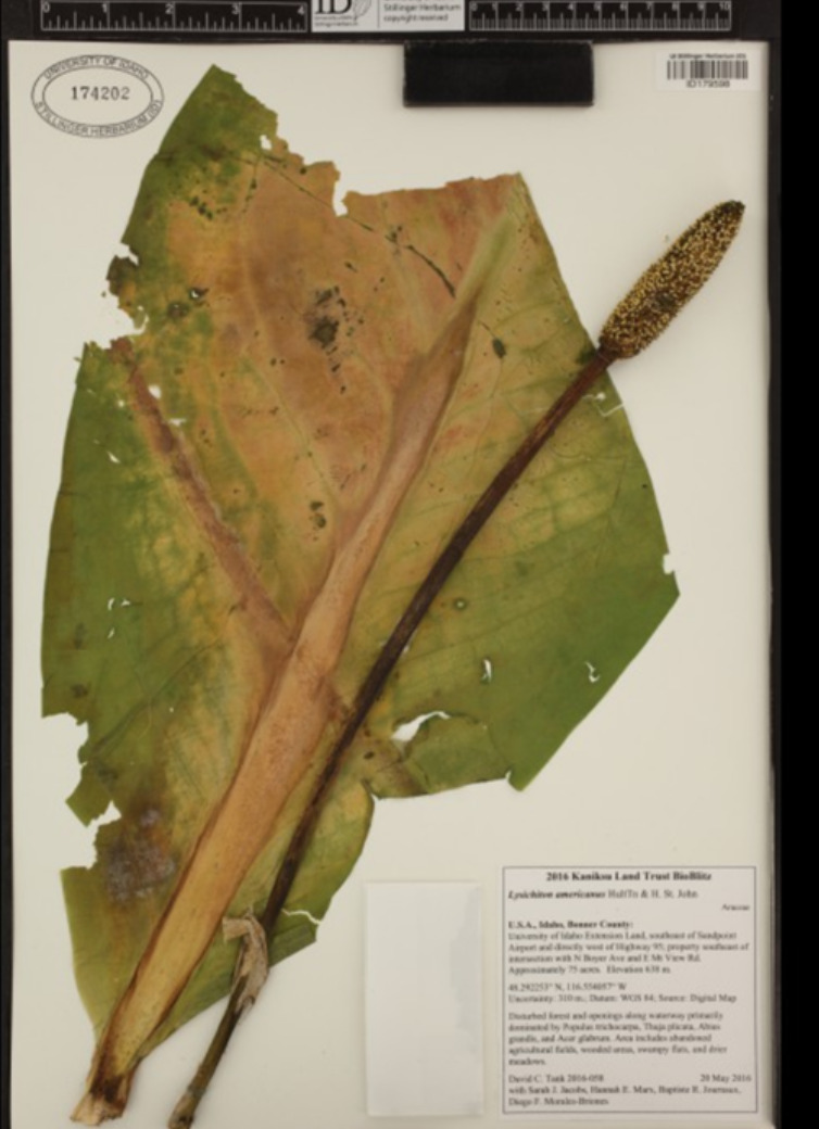
    <title type="html"><![CDATA[Stillinger Herbarium]]></title>
    <summary type="html"><![CDATA[<p><strong><em>Louis F. Henderson established The Stillinger Herbarium at the University of Idaho when he became the school's first botanist. Then, a fire destroyed half of the herbarium collection and slowed the institution's growth. Despite this setback, the herbarium recovered and continued to thrive, becoming the largest herbarium in Idaho and the seventh largest in the Pacific Northwest.</em></strong></p><img src="https://www.intermountainhistories.org/files/fullsize/9963e7472cf392bb249fbc1e385bb4eb.jpg" alt="Lysichiton americanus, also known as a Western Skunk Cabbage" /><br/><p><span style="font-weight:400;">In 1893, the University of Idaho in Moscow hired Louis F. Henderson as its first botanist. Henderson gave the school a collection of local plants he gathered for personal study, and in 1893, it became the foundation of the herbarium. Henderson became the herbarium's first director and retired in 1906. During this time, Henderson accumulated over 10,000 specimens from various locations in Idaho, storing the herbarium archives in the University of Idaho Administration building. However, a fire destroyed 85,000 specimens from the herbarium collection and Henderson's files, such as notebooks and letters, when the Administration building burned down on March 30, 1906. After 1908, when Henderson retired as director, the herbarium's growth was gradual but not forgotten. Botanists William H. Baker and J.H. Christ continued their exploration of the local plants and were significant contributors to the regrowth of the herbarium. By the mid-1900s, the collection had increased to about 50,000 specimens. The herbarium received additional aid to its development when Charles Roy and Nettie May Stillinger created the Stillinger Trust in 1957. Charles was a former university student and afterward became a teacher in botany and science. Charles and his wife dedicated their trust to the University of Idaho, with most of its income to the school herbarium and twenty percent to the Nettie May Stillinger Memorial Scholarship Fund. Their trust funded the development of the herbarium collection for the past sixty-six years and continues to do so to this day.</p>The herbarium saw a range of new directors that aided the collection's growth—starting with Douglass M. Henderson. He was in charge from 1972 to 1996 and doubled the plant archives' size. However, after his sudden death in 1996, Dr. Pamela Brunsfeld took over in 2001 until 2008. Brunsfeld was an Instructor of Systematic Botany at the university. After the resignation of Brunsfeld, the current director, Dr. David Tank, began. Tank is a biologist and leads active collection-based research programs involving students, staff, and professional hobbyists to aid in the growth and development of the Stillinger Herbarium. Tank's program has led to the current collection of 215,000 specimens, making it a major resource for studying the plants of Idaho and the Pacific Northwest.</p><p><em><strong><a href="https://www.intermountainhistories.org/items/show/823">For more (including 4 images) view the original article</a></strong></em></p>]]></summary>
    <published>2024-05-22T18:57:14+00:00</published>
    <updated>2026-04-17T19:32:18+00:00</updated>
    <link rel="alternate" type="text/html" href="https://www.intermountainhistories.org/items/show/823"/>
    <id>https://www.intermountainhistories.org/items/show/823</id>
    <author>
      <name>Cristal A. DeSantiago, Northern Arizona University</name>
    </author>
  </entry>
  <entry>
    <title type="html"><![CDATA[MONTU Herbarium]]></title>
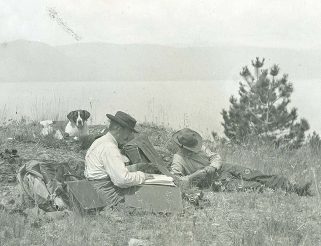
    <summary type="html"><![CDATA[<p><strong><em>        The University of Montana Herbarium has faced challenges since Dr. Morton Elrod created it in 1897. They confronted the consequences of the draining effects of World War II and fought to maintain their space. It overcame these problems and became the largest collection in Montana, with over 136,000 vegetation samples.</em></strong></p><img src="https://www.intermountainhistories.org/files/fullsize/5c40edf93fd8d4344ab1b4458e671ca5.jpg" alt="Dr. Morton Elrod in 1911 on a trip to Wildhorse Island State Park in Kalispell, Montan" /><br/><p><span style="font-weight:400;">The University of Montana Herbarium (MONTU) in Missoula, Montana, traces its origins back to 1897 when the university hired its first Professor of Biology, Dr. Morton Elrod. His employment marked the establishment of the herbarium, as Dr. Elrod brought a personal collection of local plants, providing precise details for each sample discovery. This collection laid the foundation for the first University of Montana Herbarium collection. Upon Dr. Elrod's retirement in 1928, the herbarium experienced a series of curator changes over the next sixty years. The first of these curators was Charles Leo Hitchcock, who gained the responsibility in 1932. Under Hitchcock's leadership, the herbarium underwent significant developments. He relocated the collection to the second floor of the Natural Science building and initiated a program to create multiple copies of all plant specimens for exchange with other universities. By the mid-1930s, Hitchcock's efforts had expanded the herbarium to tens of thousands of specimens.</p>In 1937, Hitchcock left, and Dr. Fred Barkley succeeded him as the curator and became the botany instructor. During his first three years, Barkley acquired 4,000 sheets of pressed plant specimens for the herbarium and sent out 6,000 specimens to exchange with other herbariums. He resigned in 1945, leading to the selection of Dr. LeRoy Harvey as a Professor of Botany and the herbarium curator in 1946. World War II disturbed the early years of Harvey's tenure due to the university’s resources and time going towards the war, which temporarily slowed the herbarium's growth. With limited resources for research, Harvey focused on maintaining the herbarium space. Over his thirty-year tenure, Harvey made notable advancements, including replacing old wooden cabinets with steel storage to protect samples from insects better. He also discarded specimens that had  incomplete labeling and added 10,000 to 12,000 new specimens, many of which were from Glacier National Park. </p><p><span style="font-weight:400;">Following Harvey's resignation in 1977, the herbarium underwent various short-term caretakers until 1981, when Dr. Kathleen Peterson assumed the role of a long-term curator. During her seven-year leadership, the herbarium reached a milestone by gaining its 100,000th specimen.</span> <span style="font-weight:400;">After Peterson left in 1988, the university merged the herbarium with the Division of Biological Sciences in 1990, and collection managers took on curatorial responsibilities. Then, in 1994, a group of scientists received a grant and sought to use the herbarium space for their research, but there was limited faculty support in saving it. A group of individuals outside of the herbarium recognized its value and led a campaign to protect it. They wrote to the university's president in support and raised $10,000 to purchase additional cabinets, ultimately saving the herbarium from being displaced. The gathering of individuals led to the formation of the Friends of the UM Herbarium group in 1996. They played a vital role in maintaining the herbarium's attraction and supporting its growth. Since its founding, the herbarium has transformed Elrod's original collection into an archive housing over 136,000 plant specimens.</span></p><p><em><strong><a href="https://www.intermountainhistories.org/items/show/822">For more (including 4 images) view the original article</a></strong></em></p>]]></summary>
    <published>2024-05-22T18:17:32+00:00</published>
    <updated>2026-04-17T19:32:18+00:00</updated>
    <link rel="alternate" type="text/html" href="https://www.intermountainhistories.org/items/show/822"/>
    <id>https://www.intermountainhistories.org/items/show/822</id>
    <author>
      <name>Cristal A. DeSantiago, Northern Arizona University</name>
    </author>
  </entry>
  <entry>
    <title type="html"><![CDATA[Rocky Mountain Herbarium]]></title>
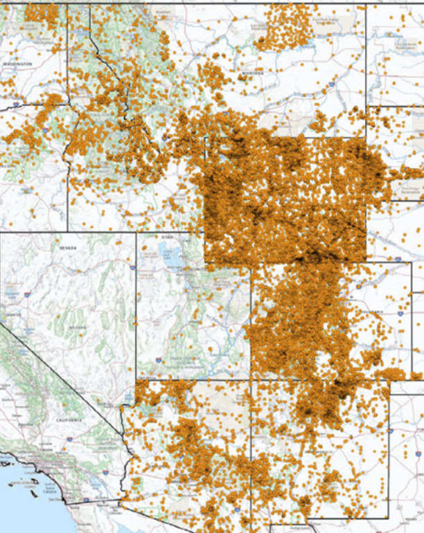
    <summary type="html"><![CDATA[<p><strong><em>Aven Nelson was originally an English professor but was unexpectedly thrust into the world of botany after being hired at the University of Wyoming in 1893. He discovered a passion for the subject, eventually leading to the creation of the Rocky Mountain Herbarium. Over the years, the herbarium has assembled a collection of 1.3 million specimens through extensive collection efforts and collaborations.</em></strong></p><img src="https://www.intermountainhistories.org/files/fullsize/a9b0acfa38d3d30d1c75600955782178.jpg" alt="Rocky Mountain Herbarium collection sites" /><br/><p><span style="font-weight:400;">The Rocky Mountain Herbarium is at the University of Wyoming in Laramie, Wyoming. Aven Nelson, one of the original faculty members,  established the herbarium in 1893. The university initially hired Nelson as an English professor, but the board of directors made him the biology professor when the school mistakenly employed two English professors. This position led to Nelson discovering his passion for botany. His interest in botany grew as he assisted the university's resident plant expert, Burt Buffum, in identifying plant samples for the Chicago World's Fair in 1893. Nelson's journey in botany continued with his exploration into the Yellowstone National Park in 1899. His journey gained him respect within the botany field, leading to the official establishment of the herbarium as part of the University of Wyoming, with Nelson as its curator. He named it </span><i><span style="font-weight:400;">The Rocky Mountain Herbarium.</span></i><span style="font-weight:400;"> Nelson later became the president of the American Society of Plant Taxonomists and Botanical Society of America and the president of the University of Wyoming from 1918 to 1922.</span></p><p><span style="font-weight:400;">       Following Nelson's resignation in 1930, the herbarium experienced additional growth with the installation of the W. G. Solheim Mycological Herbarium. Added to the herbarium by the head of the university botany department, Dr. Wilhelm G. Solheim, it was Solheim's personal collection of fungi. With 48,000 fungi specimens, it is the largest collection of fungi globally. In 1960, the herbarium collection, comprising around 265,000 samples, moved to the Aven Nelson Memorial Building. Initially constructed as the university's first library in 1923, the building provided a new home for the expanding herbarium. The herbarium collection further grew in 1982 when the US Forest Service National Herbarium (USFS), founded in Washington, D.C., granted an indefinite loan of 120,000 plant specimens. Between the Rocky Mountain Herbarium's personal collection, W. G. Solheim Mycological Herbarium, and the collaboration with the USFS, the herbarium archives now contain over 1.3 million plant samples. This collection has earned the reputation of being one of the largest herbariums between St. Louis and the West Coast.</span></p><p><em><strong><a href="https://www.intermountainhistories.org/items/show/821">For more (including 4 images) view the original article</a></strong></em></p>]]></summary>
    <published>2024-05-21T21:49:59+00:00</published>
    <updated>2026-04-17T19:32:18+00:00</updated>
    <link rel="alternate" type="text/html" href="https://www.intermountainhistories.org/items/show/821"/>
    <id>https://www.intermountainhistories.org/items/show/821</id>
    <author>
      <name>Cristal A. DeSantiago, Northern Arizona University</name>
    </author>
  </entry>
  <entry>
    <title type="html"><![CDATA[Daniel Thomas and Orem&#039;s Mammoth]]></title>
    <summary type="html"><![CDATA[<p><strong><em>While digging to connect his home to city water, Orem resident Daniel Thomas made a fascinating discovery. First finding a “large ancient tooth” himself, Thomas later invited excavators from the University of Utah to his property. They unearthed a complete Columbian mammoth skull and skeleton. Today, this mammoth discovery continues to shape Orem city’s identity.</p></strong></p><img src="https://www.intermountainhistories.org/files/fullsize/46e5de08e7ca215c800c29b66ca73be6.jpg" alt="Cast of the Huntington Mammoth" /><br/><p><span style="font-weight:400;">Utah is home to rich fossil deposits that describe the greater natural history of the region. Lake Bonneville and its shoreline were home to a wide variety of plant and animal species, many now extinct. Columbian mammoths were a large species of mammoth and are cousins with the modern-day African elephant. These beasts roamed throughout Utah along the ever-changing Bonneville shoreline until their extinction thousands of years ago.</span>
<span style="font-weight:400;">Daniel Thomas, an Orem resident who lived in what is now known as the Cherry Hill neighborhood, began digging an irrigation trench in his yard in 1937. Thomas’s goal was to connect his home to the city’s new municipal water supply system. What he was not expecting to find, however, was a remnant of a Columbian mammoth. Thomas himself found “a large ancient tooth,” and soon after invited excavators from the University of Utah. They recovered a full skull and skeleton, and the remains are currently owned by the University of Utah and housed in the Utah Museum of Natural History collection. A city marker is displayed at the original excavation site, in front of The Paper Store and More, where the Thomas home used to be.</span>
<span style="font-weight:400;">Today, mammoths and this particular mammoth find are still celebrated in Orem city. The Orem City “All Together Playground,” which opened in 2016, features a mammoth skeleton painted onto one of its prominent play structures. More recently, in the fall of 2021, Orem city unveiled their mascot, Mero the Mammoth. Mero, whose name is Orem spelled backwards, is described as “Orem’s first resident,” hallmarking the unique natural history of the area. Mero makes appearances at city and community events. He also appears on a variety of city marketing, signage, and web pages. The use of a mammoth as Orem’s mascot today (named Mero) shows the city’s desire to remember their home’s natural history.</span></p><p><em><strong><a href="https://www.intermountainhistories.org/items/show/774">For more (including 4 images) view the original article</a></strong></em></p>]]></summary>
    <published>2024-01-22T03:14:13+00:00</published>
    <updated>2026-04-17T19:32:17+00:00</updated>
    <link rel="alternate" type="text/html" href="https://www.intermountainhistories.org/items/show/774"/>
    <id>https://www.intermountainhistories.org/items/show/774</id>
    <author>
      <name>Edward Patterson, Brigham Young University</name>
    </author>
  </entry>
  <entry>
    <title type="html"><![CDATA[ Women in Los Alamos during the Manhattan Project <br />
]]></title>
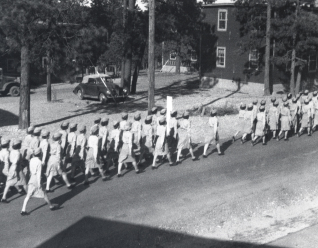
    <summary type="html"><![CDATA[<p><strong><em>With the war effort withdrawing men from the domestic labor force, women became an increasingly important part of the Manhattan Project in Los Alamos. </p></strong></p><img src="https://www.intermountainhistories.org/files/fullsize/c8f195c81db8f6804378056bc75c3f0b.jpg" alt="WAC March in Los Alamos" /><br/><p><span style="font-weight:400;">Wartime labor shortages were a constant struggle for the United States during World War II. They needed to send troops overseas, develop weaponry, spy on their enemies, strategically plan, and mobilize the entire nation as quickly as possible. By 1943, the United States Army was 200,000 men short for their invasion on D-Day, they were in need of 315 more physicists for their defense projects, and the Manhattan Project was desperately in search of all kinds of labor from scientists and engineers to machinists and pipefitters. In response, President Franklin D. Roosevelt signed into existence the Women’s Army Auxiliary Corps established “for the purpose of making available to the national defense the knowledge, skill, and special training of women of the nation” on May 15, 1942. Still facing discrimination, unequal pay, and fewer opportunities than their male counterparts, women played an essential role in World War II, especially in Los Alamos. </p>
<span style="font-weight:400;">Because Los Alamos was such a restricted town and the directors wanted to limit the number of outsiders, General Leslie Groves encouraged wives of scientists to work on the project in whatever capacity they could. As an incentive, they provided nursery schools for their young children to aid with childcare. Despite the government’s encouragement, some women were still hesitant to work on the project over concerns for their family’s well-being. Many had not expected to work at all, and quite a few were dissatisfied with the living conditions in which they now were expected to raise their children. Charlotte Serber, the only female group leader at the laboratory, wrote, “For the potential working wife, there was one chief worry. Could she manage her home here on the mesa and work too?” These were fair concerns. The conditions under which they were expected to work were difficult. They were isolated from extended family, were allowed only one day off of work per month for shopping in Santa Fe, were expected to work forty-eight hours in a week, and had almost no bargaining power to shift their rules or salary. They were also far less likely to gain security clearance than their male counterparts, so it was unlikely that they knew what they were helping create. </p>
<span style="font-weight:400;">Despite these stringent circumstances, many women in Los Alamos did work on the secretive atomic gadget. By October 1944, women constituted about 30% of the labor force in the Tech Area, hospital, and schools. It is also notable that although they did employ some women in clerical positions, the vast majority were scientists or technicians. They were metallurgists, engineers, physicists, chemists, and teachers, involved in every aspect of the atomic effort until the very end. The exception for this participation was in Project Alberta. This was the very last phase of the project; the physical delivery of the bomb to the Pacific island Tinian where the nuclear components were assembled before being dropped on Japan. Women who had spent years contributing to this moment were left behind in the United States to learn about the bombingsfrom the same newspapers as everyone else. However, the atomic bomb could not have been built as quickly or efficiently as it was without the contribution of women. They faced gender discrimination, suboptimal conditions, and unfair pay to contribute to the atomic effort in Los Alamos. </span>

</p><p><em><strong><a href="https://www.intermountainhistories.org/items/show/756">For more (including 3 images) view the original article</a></strong></em></p>]]></summary>
    <published>2023-09-24T18:36:48+00:00</published>
    <updated>2026-04-17T19:32:16+00:00</updated>
    <link rel="alternate" type="text/html" href="https://www.intermountainhistories.org/items/show/756"/>
    <id>https://www.intermountainhistories.org/items/show/756</id>
    <author>
      <name>Abigail Beus, Brigham Young University</name>
    </author>
  </entry>
  <entry>
    <title type="html"><![CDATA[The Trinity Site and the First Atomic Bomb<br />
]]></title>
    <summary type="html"><![CDATA[<p><strong><em>The first successful detonation of an atomic weapon on July 16, 1945 in a remote New Mexican desert had global and historic consequences. “A new thing had been born; a new control; a new understanding of man, which man had acquired over nature” (Isidore I. Rabi). </p></strong></p><img src="https://www.intermountainhistories.org/files/fullsize/bde97f62bde69872a28b0c4c3d01417d.jpg" alt="The Gadget Aerial View" /><br/><p><span style="font-weight:400;">Even after the United States and its World War II allies accepted Germany’s surrender on May 8, 1945, the conflict still raged in the Pacific with Japan. Japanese resistance was fierce as the United States painstakingly advanced toward Tokyo. As the allied forces moved island by island, fighting in sweltering jungle, both sides suffered heavy losses. It was at this crucial moment that the scientists of the secret American Manhattan Project began planning for a test that would not only change the course of the war, but also the future of international relations. </p>
<span style="font-weight:400;">The United States, in collaboration with allied Great Britain, had been developing an experimental master weapon since August 1942. Code-named “The Manhattan Project,” this highly secret endeavor largely took place in Los Alamos, New Mexico although there were participating teams at Oak Ridge, Tennessee and Hanford, Washington. In this inaccessible New Mexican desert, hundreds of physicists, chemists, engineers, and military personnel gathered in secret to theorize and create the deadliest weapon known to man. </p>
<span style="font-weight:400;">By the end of 1944, there were two designs and two bombs, Little Boy and Fat Man. Little Boy used a gun-type fission design which shot uranium 235 at itself to reach supercritical mass, resulting in the single largest explosion of its time. The Los Alamos scientists were confident that this design would work and did not want to waste any precious material on a test. Little Boy had used all available U235, so any test would deplete the United States’ supply and would require too much time for the project to regenerate at its Oak Ridge site. Little Boy would go on to be dropped on Hiroshima on August 6th, 1945 and become the first nuclear bomb used in warfare.  </p>
<span style="font-weight:400;">On the other hand, Fat Man utilized an implosion design with explosives surrounding the highly reactive plutonium core. The idea was that the inward-facing explosives would trigger an explosive reaction of the plutonium and result in a larger blast than its Little Boy uranium counterpart. The scientists were less confident in this design. Plutonium had only been discovered at the end of 1940, and the implosion method was difficult to master. If each explosive was not uniform in strength and distance, the correct reaction would not begin, and the overall impact would decrease. Due to these doubts and the easier access to plutonium, the Los Alamos scientists decided to test “The Gadget.” </p>
<span style="font-weight:400;">The first step was finding somewhere to detonate a 10,000 ton bomb without alerting the international community. They decided on a stretch of high desert between New Mexico and Texas called Jornada del Muerto, translated as “Journey of Death.” It was later named the Trinity Site, likely inspired by Robert J. Oppenheimer’s interest in the Hindu concept of the three gods of preservation, destruction, and creation. On May 31, 1945, the requisite shipment of plutonium arrived in Los Alamos from the Hanford facility and scientists began to assemble Fat Man. Up to this point, Los Alamos had not housed a significant supply of plutonium, so all work on Fat Man was done speculatively or at miniscule scales. Working at a harried pace, scientists and engineers readied and transported a plutonium core to Trinity by July 13. Harry Truman, newly inaugurated President of the United States, wanted the test completed before the Potsdam conference with Churchill and Stalin on July 17, but weather conditions made it difficult for the scientists to comply. Finally, at 5:30 am on July 16, “The Gadget” detonated. </p>
<span style="font-weight:400;">Many reactions have been recorded describing the physical experience as well as moral and philosophical implications of the detonation. The light was so powerful that Georgia Green, a blind student miles away at the University of New Mexico asked “What’s that?” Physicist Isidore I. Rabi, who observed from ten miles away at base camp wrote, “Suddenly, there was an enormous flash of light, the brightest light I have ever seen or that I think anyone has ever seen. It blasted; it pounced; it bored its way right through you. It was a vision which was seen with more than the eye. It was seen to last forever.” Rabi also acknowledged the historic and philosophical weight of the moment, “A new thing had been born; a new control; a new understanding of man, which man had acquired over nature.” Alongside confusion and fear expressed by some locals and trepidation expressed by some Los Alamos scientists, there was also great enthusiasm and excitement. Project officials immediately sent a coded telegram announcing the “satisfactory operation” to Truman, just before his meeting with Churchill and Stalin.</p>
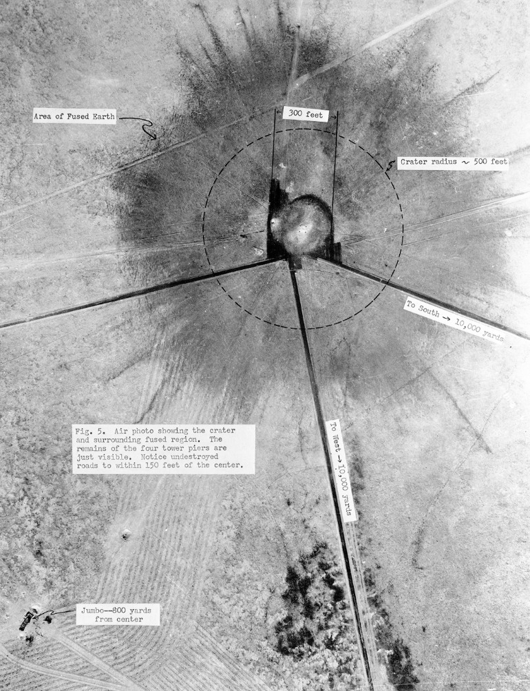
<span style="font-weight:400;">Back at the Trinity site, the scientists emerged from their safe havens and inspected the damage. The Gadget had destroyed every living thing within 1,200 feet of ground zero and disintegrated the steel tower on top of which it had been placed. It was, in the words of General Groves, “successful beyond the most optimistic expectations of anyone” and even larger than Little Boy. Because of its success at the Trinity Site, the Fat Man model would later be dropped on Nagasaki on August 9th, three days after Little Boy obliterated Hiroshima. </p>
<span style="font-weight:400;">Today, Trinity remains a highly radioactive site. Visitors are only allowed to visit two days a year. There are replicas of the bomb casing and the tower. Part of the original crater remains and reveals pockets of Trinitite, a green residue of highly radioactive sand particles melted by incredible temperatures into a glass-like substance. It can only be found at the Trinity Site and is illegal to collect for health concerns. Here, the first man-made atomic weapon detonated which aided in ending WWII and ushering in the age of atomic weaponry and mutually assured destruction. This continues to define international relations today. </span>


</p><p><em><strong><a href="https://www.intermountainhistories.org/items/show/755">For more (including 10 images) view the original article</a></strong></em></p>]]></summary>
    <published>2023-09-20T20:26:47+00:00</published>
    <updated>2026-04-17T19:32:16+00:00</updated>
    <link rel="alternate" type="text/html" href="https://www.intermountainhistories.org/items/show/755"/>
    <id>https://www.intermountainhistories.org/items/show/755</id>
    <author>
      <name>Abigail Beus, Brigham Young University</name>
    </author>
  </entry>
  <entry>
    <title type="html"><![CDATA[Life in Los Alamos: Linking the Past and Present <br />
]]></title>
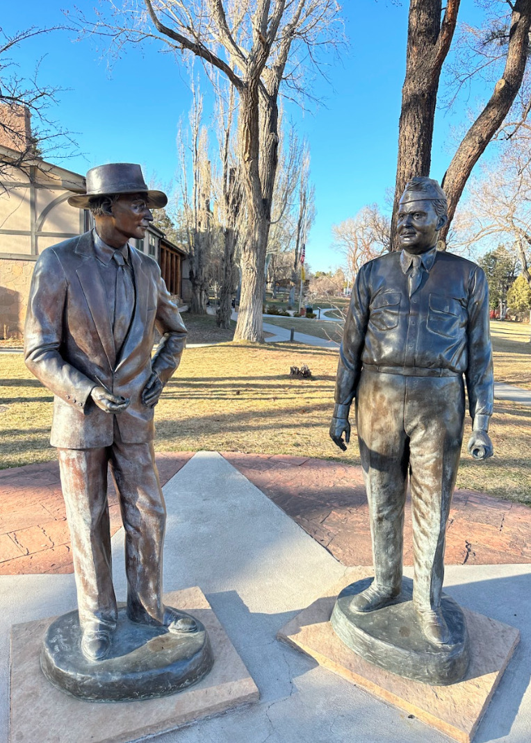
    <summary type="html"><![CDATA[<p><strong><em>Los Alamos residents in the 1940s found themselves in unusual circumstances. John von Neumann explained that, “At great expense we have gathered on this mesa the largest collection of crackpots ever seen.” Yet these people continued life under the cover of secrecy and created a community which has lasted until this day. 	</p></strong></p><img src="https://www.intermountainhistories.org/files/fullsize/a56ce2e0f40dcd7d1a6e2fe9af1ddcf0.jpg" alt="Statue of Oppenheimer and Groves" /><br/><p><span style="font-weight:400;">As the scientists and military personnel worked furiously to create an atomic weapon during the latter years of WWII, many moved to the classified town of Los Alamos, New Mexico. Because their project was shrouded in such secrecy, they were required to move themselves and their family without knowing many of the details of their new job or location. Although the civilian and academic director, J. Robert Oppenheimer, tried to make it as much of a collaborative and normal operation as possible, the nature of their assignment meant that living in Los Alamos was unique. </p>
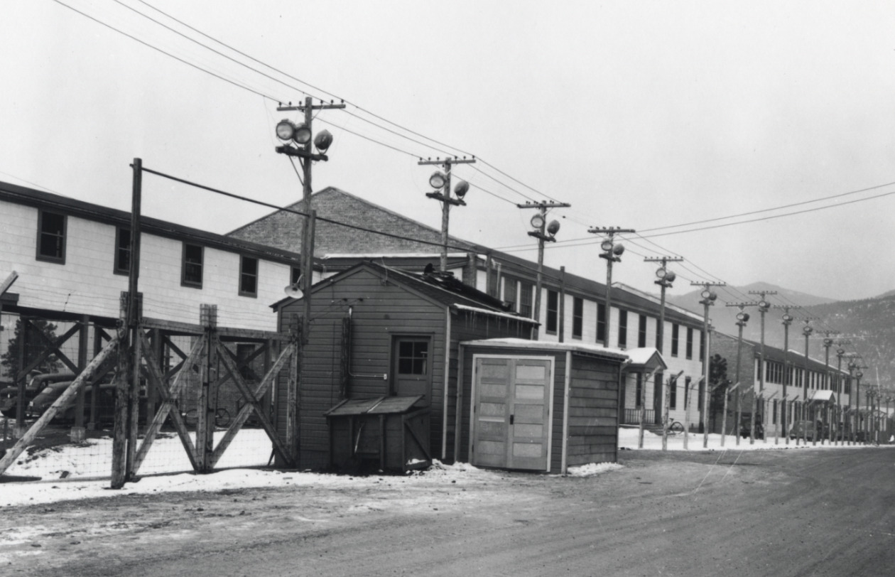
<span style="font-weight:400;">Many scientists arrived without knowing exactly where they would be working or what they would be doing. They were not even allowed to tell their spouses what their work in the restricted laboratories entailed. Secrecy was of the utmost importance. Oppenheimer spread disinformation to nearby cities, such as Santa Fe, that they were working on an electric rocket. Mail for all scientists was addressed to Box 1663, Sandoval County, Rural. It was liable to searches and some outgoing mail was redacted for security concerns. Even phone calls were monitored—army intelligence agents were obvious in listening in on people’s private conversations. Barbed wire covered the scenic landscape and made some workers feel as though they were the ones imprisoned rather than the liberators of those in European prison camps. </p>
<span style="font-weight:400;">Despite the secrecy and sometimes oppressive security, many familiar aspects of daily life continued in Los Alamos. Many women were given clerical jobs such as secretaries or computer operators to keep them occupied while their husbands worked. Children continued to attend school and babies continued to be born. In regards to the baby boom, the military official General Leslie Groves grumbled that they were simply taking advantage of the free healthcare awarded to those in the army effort. The few movies which were allowed to play were quite popular. In a move for additional entertainment, engineers and scientists threw amateur theatricals which even featured the eminent Oppenheimer in the role of “corpse.” </p>
<span style="font-weight:400;">The setting of Los Alamos itself served as a diversion for employees and their families. Oppenheimer had picked the site of Los Alamos for its beauty and openness. He thought that it could give the scientists a sense of freedom amidst all of their restrictions. Placed on top of towering mesas flanked by green mountains and overlooking fantastic natural features, there were many opportunities for outdoor recreation. During the winter, avid skiers trekked up the nearby Jemez Mountains and skied back down to their homes. The outdoor ice rink, built in 1936, became an unofficial youth center for local children to spend their winters with friends. The warmer months brought camping, horseback riding, fishing, and hiking. Curious children and adults also explored the many nearby Ancestral Puebloan archaeological sites and ruins. </p>
<span style="font-weight:400;">Even though Los Alamos was a unique environment of brilliant scientists sequestered in the wilderness, life found a way to continue in relative normalcy. It grew out of a wartime necessity into a long-lasting community with unusual origins. Today, Los Alamos is home to around 13,000 people and a National Laboratory specializing in weapon-making for the United States government. The community maintains their engagement in many of the recreational activities that their predecessors did. The Pajarito Ski Hill and the ice rink continue to gather youth and adults during the winter months. Warmer times of the year bring outdoor sports, especially running and hiking, among the abundant natural landscape. Summer is also the ideal time for weapons testing. For seasoned Los Alamos citizens, a large explosion miles away that rattles windows and door frames is unsurprising—rarely do they suspect an earthquake.  The work and life of Los Alamos persists nearly a century after it was settled. </span>


</p><p><em><strong><a href="https://www.intermountainhistories.org/items/show/754">For more (including 5 images) view the original article</a></strong></em></p>]]></summary>
    <published>2023-09-20T19:36:59+00:00</published>
    <updated>2026-04-17T19:32:16+00:00</updated>
    <link rel="alternate" type="text/html" href="https://www.intermountainhistories.org/items/show/754"/>
    <id>https://www.intermountainhistories.org/items/show/754</id>
    <author>
      <name>Abigail Beus, Brigham Young University</name>
    </author>
  </entry>
  <entry>
    <title type="html"><![CDATA[Jewish Contribution to the Manhattan Project ]]></title>
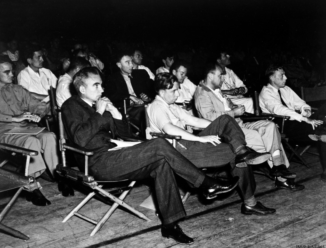
    <summary type="html"><![CDATA[<p><strong><em>Jewish participation in the Manhattan Project, particularly in Los Alamos, was an essential part of the operation's success. They continued to support their country despite local discrimination and the tragedy of World War II occurring abroad. </em></strong></p><img src="https://www.intermountainhistories.org/files/fullsize/89d79d7a997cf1681e9e7681568b097e.jpg" alt="Manhattan Project Scientists" /><br/><p>The United States’ development of the first atomic bomb would not have been possible without the contribution of Jewish Americans and Jewish refugees who fled Nazi Germany and war-torn Europe throughout the Manhattan Project. In August of 1939, Albert Einstein, Leo Szilard, and Enrico Fermi drafted and sent a letter to President Roosevelt via Alexander Sachs, warning the President of the potential use of atomic power in weaponry. This, in addition to another letter sent by British-Jewish scientists, led Roosevelt to form an advisory committee on uranium and, eventually, create the Manhattan Project.</p><p>Significantly, every person involved in the drafting and deliverance of this letter were Jewish or had close Jewish family members. Of the four involved, three were European refugees. Einstein was from a family of German Ashkenazi Jews and fled to the United States in 1933. Szilard was from a Hungarian Jewish family and fled to England in 1933 and then the United States in 1938. Fermi, while himself not Jewish nor German, was married to a Jewish woman which required him and his family to flee his home of Italy in 1938. Sachs was American-Jewish and an important advisor to President Roosevelt. All were impacted by the anti-Semitism of Germany and were respected and prominent enough to sway the President of the United States into forming a committee. Subsequent letters and information, much of which was provided by Jewish scientists, followed and increased the breadth of the project. </p><p>Jewish involvement in the Manhattan Project burgeoned as the war continued. J. Robert Oppenheimer, a young American Jew, was placed as the head of the Los Alamos branch of the Manhattan Project. He created four divisions in the Los Alamos lab, with the T-division, the theoretical division, being the most important. Of the 86 members in this division, 18 were Jewish—almost 21%. Even more impressive, of the eight groups in 1945, five were led by Jewish scientists such as Richard Feynman, Hans Bethe, and John von Neumann. Although Jews only constituted around .05% of the US population at the time, they made up a significant portion of the scientists at Los Alamos National Laboratory. </p><p>Jewish involvement in the Manhattan Project, as well as the project itself, were not known by the American public, and antisemitic prejudice was commonplace. In the 1920s, before J. Robert Oppenheimer attended, the president of Harvard, A. Lawrence Lowell, called for a quota of Jews to keep their presence sparse in the university. Even in Los Alamos, where Jewish scientists were important pioneers of the Manhattan Project, General Leslie Groves, the project’s military leader, stated, “I don’t like certain Jews, and I don’t like certain well-known characteristics of theirs.” Some Jewish scientists, such as Leo Szilard, were tailed by the FBI and noted for their “Jewish extraction” and “foreign tongue.”</p><p>At the same time, Los Alamos was a relative haven for these Jews. They were allowed in the upper echelons of decision-making and they were not stripped of titles or rewards because of their background. Ellen Bradbury Reid, an Anglo child in Los Alamos recalled, “I would not say [it was] a utopian situation, but. . . now I realize there were a lot of Jewish people, the European Jewish community who were there. I had no idea. . . [we] were all sort of in the same soup.” Despite prejudice, Jewish scientists were largely able to find footing in Los Alamos and thrive in the project. Jewish scientists in the Manhattan Project made a substantial and powerful impact in crafting the bombs which would end the war that, in total, killed over six million Jews. </p><p><em><strong><a href="https://www.intermountainhistories.org/items/show/753">For more (including 7 images) view the original article</a></strong></em></p>]]></summary>
    <published>2023-09-13T00:46:14+00:00</published>
    <updated>2026-04-17T19:32:16+00:00</updated>
    <link rel="alternate" type="text/html" href="https://www.intermountainhistories.org/items/show/753"/>
    <id>https://www.intermountainhistories.org/items/show/753</id>
    <author>
      <name>Abigail Beus, Brigham Young University</name>
    </author>
  </entry>
  <entry>
    <title type="html"><![CDATA[Dorothy McKibbins: The Gatekeeper of Los Alamos ]]></title>
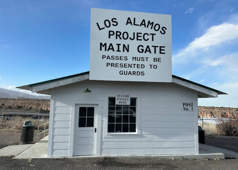
    <summary type="html"><![CDATA[<p><strong><em>The Manhattan Project would not have been possible without the efforts of Dorothy McKibbin, the Gatekeeper of Los Alamos. From attaining marriage licenses to transferring phone calls, Dorothy McKibbin was an integral and diversely skilled cog in the large machine of building the first nuclear weapons. </p></strong></p><img src="https://www.intermountainhistories.org/files/fullsize/5c401996b7cfdc416ba17d96a788fbec.jpg" alt="Los Alamos Project Main Gate Replica" /><br/><p><span style="font-weight:400;">Once General Leslie Groves and Dr. J. Robert Oppenheimer chose Los Alamos, New Mexico as the place to build the atomic bomb; hundreds of bewildered employees streamed into the nearby town of Santa Fe. Due to the confidentiality of the Manhattan Project, recruitment was difficult and details provided to the new hires were vague because of the classified nature of their work. They were told that their work would helpe war effort and be located in the scenic mesas of New Mexico, but little else. After a long train ride to the nearby town of Lamy, scientists and their families hauled their luggage through the winding streets of Santa Fe, looking for 109 East Palace Avenue—the only address they had been given. There, they were met by a simple red and blue sign reading “United States Engineer Office No. 3” and the welcoming presence of Dorothy McKibbin. </p>
<span style="font-weight:400;">In 1932, recently-widowed Dorothy McKibbin moved to Santa Fe from Kansas with her son, hoping for a new life. When she met Dr. J. Robert Oppenheimer in 1943, she found one. Oppenheimer recognized her comforting, calming, and competent presence and asked her to be a War Department secretary with unspecified duties. Like the other personnel, she only knew that her job concerned an essential war project. As she discovered after accepting the position, duties encompassed everything from disciplining Nobel laureates, receiving classified mail, enforcing security, helping lost families find the way to their new homes, and more. She was there for some of the most important moments of the project, even observing the Trinity Test from a car parked near Albuquerque. To Dorothy McKibbin, “Working at 109 was more than just a job. It was an exciting experience. Our office served as the entrance to one of the most significant undertakings of the war or, indeed, of the twentieth century.” </p>
<span style="font-weight:400;">For the entirety of the Manhattan Project she was the point of contact between the secret city and the rest of the world, earning herself the nickname of  the “Gatekeeper of Los Alamos.” After the Manhattan Project concluded, the site was renamed the Los Alamos National Laboratory, and McKibbin continued to work there until her retirement in 1963. She spent her retirement organizing community programs in Los Alamos and Santa Fe until her death in 1985. Today, a room in the Los Alamos History Museum is named in her honor, and although her office at 109 East Palace currently houses a gift shop, its original iron gate which once welcomed thousands to the secret city is on display at the Los Alamos History Museum. </span>
</p><p><em><strong><a href="https://www.intermountainhistories.org/items/show/752">For more (including 4 images) view the original article</a></strong></em></p>]]></summary>
    <published>2023-09-08T01:24:19+00:00</published>
    <updated>2026-04-17T19:32:16+00:00</updated>
    <link rel="alternate" type="text/html" href="https://www.intermountainhistories.org/items/show/752"/>
    <id>https://www.intermountainhistories.org/items/show/752</id>
    <author>
      <name>Abigail Beus, Brigham Young University</name>
    </author>
  </entry>
  <entry>
    <title type="html"><![CDATA[Bathtub Row ]]></title>
    <summary type="html"><![CDATA[<p><strong><em>As scientists raced to build the first atomic weapon during WWII, they were required to sacrifice their time, academic careers, energy, bathtubs, and more in the remote desert highlands of New Mexico. </p></strong></p><img src="https://www.intermountainhistories.org/files/fullsize/81238fa6d58203850c43f89b67708cda.jpg" alt="Los Alamos Infrastructure " /><br/><p>As World War II raged into the 1940s, each country in the war was an avid participant in the race for scientific advancement. With such high stakes, the United States invested two billion dollars—over $33 billion today—in the creation of the atomic bomb. This massive project was dubbed the Manhattan Project, after its headquarters in New York, despite largely taking place in the remote highlands of New Mexico.</p><p><span style="font-weight:400;">While the United States had fiscal resources to invest in the project, they did not have much time. Both the Germans and the Soviets were developing their own nuclear weapons, and it seemed that whoever discovered how to harness the power of the atom first would win the war. The speed and urgency of the venture inevitably meant that some details were overlooked. Construction teams were tasked with building housing for thousands of men, women, and children in the remote deserts of New Mexico in total secrecy. The workmanship of many of these early houses was shoddy at best. Project builders were not only short on time, but materials. In particular, iron was a scarce resource and largely reserved for the war effort. Understandably, it could hardly be used for iron bathtubs. Due to these factors, the majority of scientists, military personnel, and their families lived in small, relatively iron-less, hastily built homes with only a few variations of bathroom fixtures—none of which included bathtubs. </span>
<span style="font-weight:400;">Only a single row of houses had the luxury of bathtubs because they were built before the war and had originally belonged to teachers of a secondary boys’ ranch school. These “master cottages” were some of the only buildings already built when the government bought the land and were a coveted luxury. Reserved for men such as Nobel-Prize winning Englishman Sir James Chadwick, explosives expert George Kistiakowsky, bomb designer Max Roy, ordnance director William S. “Deak” Parsons, and head scientist Robert J. Oppenheimer, bathtubs were a sign of prestige in this secret New Mexico town. According to local legend, Alice Kimball Smith, wife of scientist Cyril Smith, coined the term “bathtub row.” This effectively differentiated between the comfortable ranch school homes with bathtubs and those of government construction with showers.</p>
<span style="font-weight:400;">Despite the obvious disparity, many on Bathtub Row were willing to share their good fortune. Robert Oppenheimer was reportedly a generous host who invited many in the community into his home for classified discussions, drinks, and dinner parties. Ordnance director William S. Parsons’ home was fortunate enough to have two bathtubs. He often allowed military men to use them if they were injured and unable to stand for long periods of time under a shower. These bathtubs were also used to entice babysitters who would be rewarded with a relaxing soak in their neighbor’s home in exchange for an afternoon taking care of the owners’ children.</p>
<span style="font-weight:400;">Today, these houses are privately owned, but remain part of the Los Alamos National Historical Landmark District. In 2007, the Los Alamos population petitioned to change the street name from 20th to Bathtub Row. The community has continued to embrace this humorous anecdote from WWII through naming the local brewing co-op after the iconic row of houses. It stands as a reminder of the simple luxuries many relinquished in favor of supporting the American effort during WWII. </span>

</p><p><em><strong><a href="https://www.intermountainhistories.org/items/show/751">For more (including 10 images) view the original article</a></strong></em></p>]]></summary>
    <published>2023-09-08T00:39:58+00:00</published>
    <updated>2026-04-17T19:32:16+00:00</updated>
    <link rel="alternate" type="text/html" href="https://www.intermountainhistories.org/items/show/751"/>
    <id>https://www.intermountainhistories.org/items/show/751</id>
    <author>
      <name>Abigail Beus, Brigham Young University</name>
    </author>
  </entry>
  <entry>
    <title type="html"><![CDATA[Ashley Pond]]></title>
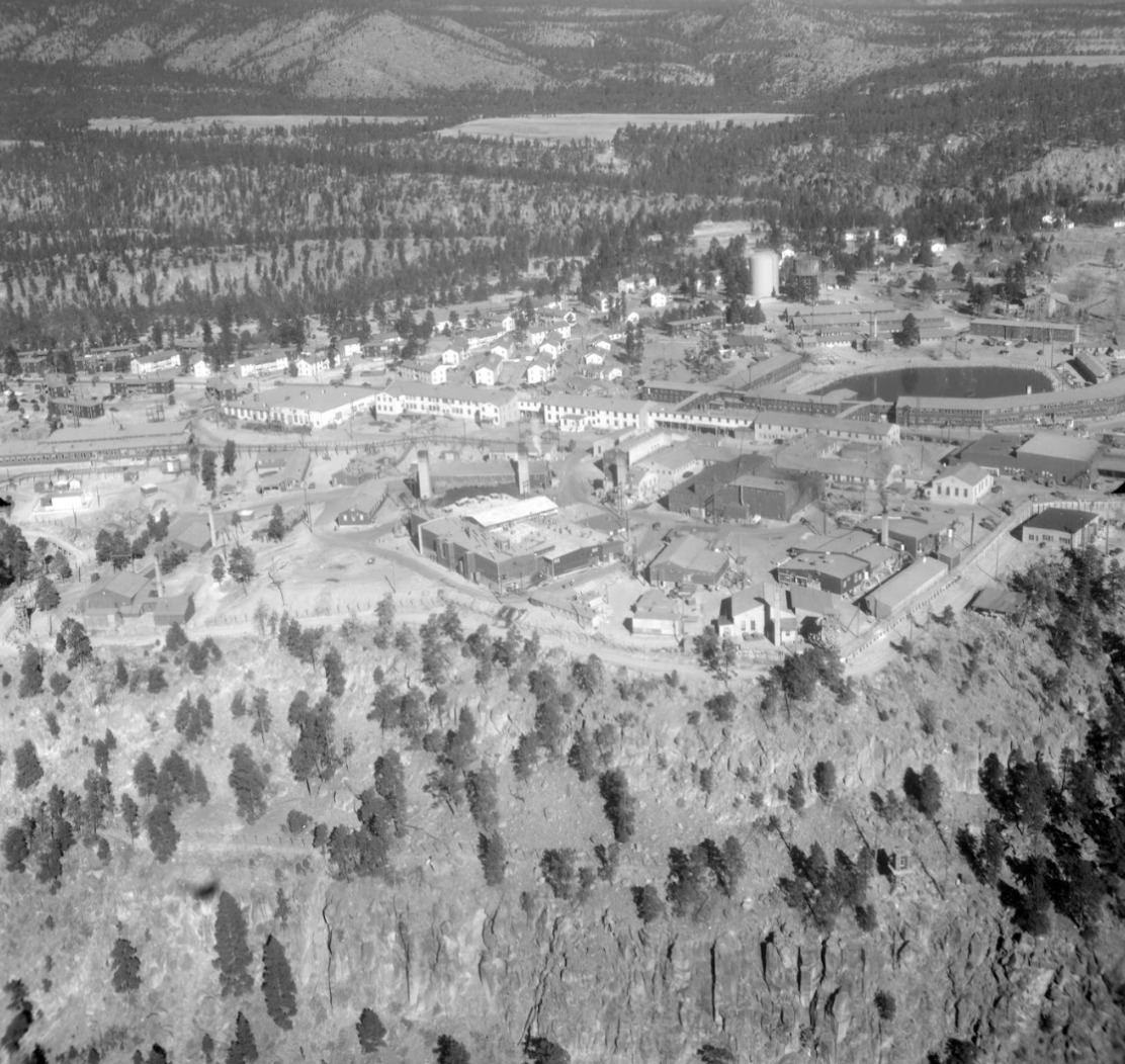
    <summary type="html"><![CDATA[<p><strong><em>From a soggy bog to a beloved community gathering place, the change and continuity of Ashley Pond illustrates the many eras of Los Alamos from homestead to Ranch School to government laboratory to the vibrant community of today.</em></strong></p><img src="https://www.intermountainhistories.org/files/fullsize/474ae326a19e2d428271b8e7a2ab5485.jpg" alt="1946 Aerial View of Los Alamos" /><br/><p><span style="font-weight:400;">Although Ashley Pond is now a prominent green space in the center of Los Alamos, it had a less majestic beginning. In 1908, it was a soggy depression used by homesteader H. H. Brook for watering his stock. Later, the Los Alamos Ranch School used it for the same purpose. Its applicable, albeit unimaginative, first name was the Stock Watering Tank. This was later switched to the Duck Pond in honor of its most popular visitors. The waterhole continued to remain a relatively unimpressive morass until the Ranch School built a dam in Los Alamos Canyon in 1923. This created a small reservoir which fed a pipeline to provide the school with water. The overflow from the pipeline was then dispersed into a puddle which progressively grew into a pond and then a small lake. </p>
<span style="font-weight:400;">The all-boys Los Alamos Ranch School was founded in 1917 by Detroit native, Ashley Pond Jr., who created it to generate tough, intelligent, well-rounded, and experienced outdoorsmen. As such, the students were encouraged to utilize the beautiful landscape for recreation and exercise. The pond provided an ideal place to put their learning into practice. Although never deep enough for true diving, the pond was perfect for canoeing and an excellent place to practice swimming. In the winter, the boys skated across its frozen surface playing hockey and harvesting the ice for the coming year. Ice blocks were stored in a nearby stone ice house and they were known to have collected enough ice to sustain them for up to two years. Once sufficiently filled, school faculty member—and notorious lover of puns—William Mills, provided the name of Ashley Pond in honor of the founder. The official title for the pond is Ashley Pond, not Ashley Pond Pond, but today Los Alamos natives enjoy the humorous anecdote. </p>
<span style="font-weight:400;">When the United States government acquired the land for the Manhattan Project, they allowed the school two months to make other arrangements. The boys went through a hurried graduation and left their beloved mountains, mesas, and pond in the hands of scientists. Manhattan Project staff built the Technical Area, also called TA 1, around the south side of Ashley Pond as a safeguard against fire. They repurposed the ice house as well, using it in 1945 to assemble nuclear components of the “gadget” which would be tested at Trinity. As such, Ashley Pond became restricted under laboratory security and very few outsiders were able to enjoy it. </p>
<span style="font-weight:400;">Today, Ashley Pond is a pleasant downtown landmark of Los Alamos. Situated near the center of town, it is used for picnics, walks, and outdoor concerts in the summer. Los Alamos natives attentively watch the ducks and geese who live at the pond, especially during chick season. During the winter, surrounding trees are decorated with colorful Christmas lights. The local winter parade currently ends at the pond, the same place where the Ranch School boys canoed and harvested ice nearly a century ago. </span>


</p><p><em><strong><a href="https://www.intermountainhistories.org/items/show/750">For more (including 6 images) view the original article</a></strong></em></p>]]></summary>
    <published>2023-09-07T23:39:58+00:00</published>
    <updated>2026-04-17T19:32:16+00:00</updated>
    <link rel="alternate" type="text/html" href="https://www.intermountainhistories.org/items/show/750"/>
    <id>https://www.intermountainhistories.org/items/show/750</id>
    <author>
      <name>Abigail Beus, Brigham Young University</name>
    </author>
  </entry>
  <entry>
    <title type="html"><![CDATA[Big Horn Medicine Wheel]]></title>
    <summary type="html"><![CDATA[<p><strong><em>In a picturesque and seemingly significant location, the Big Horn Medicine Wheel may reveal indigenous knowledge of astronomy.</em></strong></p><img src="https://www.intermountainhistories.org/files/fullsize/e3c611b4ff4e6359f87c4c7f5dede281.jpg" alt="Big Horn Medicine Wheel" /><br/><p>At the top of the Big Horn Mountains, 9,642 feet above sea level, on the west ridge of Medicine Mountain, lies the Big Horn Medicine Wheel. The wheel sits about twenty yards away from a limestone cliff face, where visitors can look down upon the Big Horn Basin, the Wind River, and the Pryor Mountains of Montana. Using a piece of wood found built into the structure, archaeologists dated the Medicine Wheel itself to around 1760 AD. Other archaeological research carbon-dated charcoal and wood fragments found near the Medicine Wheel to 4,529 BCE.
The wheel is made of hundreds of white limestone rocks arranged in roughly in the circular shape of a wheel. Spanning eighty feet in diameter, the wheel is a true marvel, as most rocks used as material for the massive wheel originate from the bottom of the mountain, meaning the builders carried them to the top. At the center of the wheel lies another smaller circle, and 28 “spokes” radiate from this smaller center circle, connecting the center to the perimeter of the wheel. Small hollow cairns surround the wheel.
Although much research has been done on the wheel, archaeologists, astronomers, and other scholars have been unable to determine its origin and function. One astronomer suggests the indigenous builders might have designed the wheel to track celestial bodies, having found the cairns are in astronomical alignment with the summer solstice sunset and sunrise as well as the rise of the stars Alderbaran, Serius, and Rigel. Another astronomer disagrees, saying that had the medicine wheel’s purpose been to track the solstice and stars, the structure’s design would have been more precise and astronomical alignments with the wheel would be more obvious and practical. An archaeologist suggests that the cairns could have been small shelters for vision quest participants while another archaeologist believes the wheel is a model of a Cheyenne medicine lodge. A Crow legend tells the story of a boy that was able to find healing and tribal acceptance through the power connected to the wheel. The Cheyenne believe that the Legend of Sweet Medicine inspired the Big Horn Medicine Wheel. Many theories have been proposed and disputed, but no theory has provided irrefutable evidence for a single explanation.
The Big Horn Medicine Wheel is a national historical landmark and is still used by tribes for religious purposes. Visitors are allowed to view the Big Horn Medicine Wheel but are asked to respect the ancient site as it holds both religious and historical significance to many Native Americans.</p><p><em><strong><a href="https://www.intermountainhistories.org/items/show/582">For more (including 5 images) view the original article</a></strong></em></p>]]></summary>
    <published>2022-03-19T10:04:39+00:00</published>
    <updated>2026-04-17T19:32:12+00:00</updated>
    <link rel="alternate" type="text/html" href="https://www.intermountainhistories.org/items/show/582"/>
    <id>https://www.intermountainhistories.org/items/show/582</id>
    <author>
      <name>Kelli Holiday, Brigham Young University</name>
    </author>
  </entry>
  <entry>
    <title type="html"><![CDATA[Thomas L. Martin Classroom Building (MARB)]]></title>
    <summary type="html"><![CDATA[<p><strong><em>Although today it is notorious for its windowless walls and congested design, the MARB was once part of a commodious two-building complex for BYU’s life sciences. Its namesake is Thomas L. Martin, dean of BYU’s College of Applied Sciences in the early twentieth century.</em></strong></p><img src="https://www.intermountainhistories.org/files/fullsize/79cd9a96474fd910eae5833e94dbf3da.jpg" alt="The MARB" /><br/><p><span style="font-weight:400;">As enrollment for programs in BYU’s College of Biological and Agricultural Sciences swelled in the mid-1960s, the college was strapped for classrooms. Dean Rudger H. Walker called on the university to provide a new building designed with life science in mind, and the Board of Trustees drew up plans during the 1966 to 1967 academic year.</span>
<span style="font-weight:400;">Around the same time, six BYU stakes reached out to the First Presidency of The Church of Jesus Christ of Latter-day Saints requesting that BYU design the new building to accommodate eight wards (original plans made the building large enough for four). In order to meet this request, BYU administration decided to split the planned building into two: one for laboratories and faculty offices, the other for lecture halls suitable for both classroom instruction and Sunday worship. Walkways at multiple levels connected the buildings. The laboratory building became the </span><a href="https://www.intermountainhistories.org/items/show/571"><span style="font-weight:400;">Widtsoe Building</span></a><span style="font-weight:400;">, and the other was named the Thomas L. Martin Classroom Building.</span>
<span style="font-weight:400;">The name was a happy triumph for Walker. Thomas L. Martin was an English immigrant and internationally-renowned agronomist, and he was an agricultural science professor at BYU from 1921 to 1958. During that period he also served for a time as dean of the College of Applied Sciences, later renamed the College of Agricultural and Biological Sciences, making him a predecessor to Walker. However, their connection was even more personal: Martin had taught Walker while at BYU, and Walker was Martin’s first student to enroll in a PhD program. In total, about 110 of Martin’s students went on to earn PhDs, for which the American Society of Agronomy cited him as “teacher of the year” in 1950.</span>
<span style="font-weight:400;">Central Utah Architects designed the edifice, and BYU contracted Tolboe Construction for building. Tolboe began construction in July 1968 and finished in 1969.</span>
<span style="font-weight:400;">Throughout the Martin Classroom Building’s three stories (one underground, two aboveground), there are about 40,000 square feet of floor, twenty-four lecture rooms, and enough seating for over 2,000 students. Because the university planned to use the building for science lectures with slide projections, the classrooms have no windows, ensuring sunlight never interferes with projection visibility.</span>
<span style="font-weight:400;">BYU remodeled the Martin Building in 2000, and in 2014 it added an elevator. (Previously, the only elevator access was through the Widtsoe, which BYU razed in 2015.)</span>
<span style="font-weight:400;">In the twenty-first century, the Martin Classroom Building—typically nicknamed the MARB for its building code—hosts classes in many subjects, not just life science. Unfortunately, the MARB is not as beloved as its namesake was. Students often lament the windowless rooms, originally designed as a feature, for being dispiriting. And without the old walkways into the Widtsoe Building, the MARB’s single stairwell is frequently crowded. A satirical website declared the MARB one of the “BYU buildings no one cares about” and suggested “the highest priority” for any campus improvement should “be to fix the MARB so it is not absolutely terrible to get in and out” by adding “entrances for each level,” unwittingly hearkening back to the days when the Martin Classroom Building </span><i><span style="font-weight:400;">did</span></i><span style="font-weight:400;"> have exits at multiple levels into the Widtsoe Building.</span>
<span style="font-weight:400;">Students may not appreciate the MARB as much as their forebears admired Dr. Martin, but with so many lectures assigned to his Classroom Building, it will continue affecting their lives.</span></p><p><em><strong><a href="https://www.intermountainhistories.org/items/show/572">For more (including 10 images) view the original article</a></strong></em></p>]]></summary>
    <published>2022-02-27T09:50:40+00:00</published>
    <updated>2026-04-17T19:32:12+00:00</updated>
    <link rel="alternate" type="text/html" href="https://www.intermountainhistories.org/items/show/572"/>
    <id>https://www.intermountainhistories.org/items/show/572</id>
    <author>
      <name>Makoto Hunter, Brigham Young University</name>
    </author>
  </entry>
  <entry>
    <title type="html"><![CDATA[John A. Widtsoe Life Sciences Laboratory Building (WIDB)]]></title>
    <summary type="html"><![CDATA[<p><strong><em>Named for the famous apostle-scientist, the John A. Widtsoe Building provided much-needed laboratory and office space for BYU’s life science programs for forty years.</em></strong></p><img src="https://www.intermountainhistories.org/files/fullsize/c7140dc1efc9eba0e61ff169ec35ed99.jpg" alt="The Widtsoe Building" /><br/><p><span style="font-weight:400;">In the 1960s, BYU’s life sciences were flourishing as enrollment rose. However, with so many students, the College of Biological and Agricultural Sciences was hard-pressed for sufficient classroom space. Life science coursework required both lectures and hands-on labs, but most BYU classrooms at the time had not been designed with laboratory use in mind. As Ephraim Hatch explains in his </span><i><span style="font-weight:400;">Brigham Young University: A Pictorial History</span></i><span style="font-weight:400;">, “practically all [BYU] laboratories [at the time] were remodeled spaces originally built for other purposes.” Students and faculty called for a new building to accommodate the growing program, and Dean Rudger H. Walker was especially vocal. After deliberations, BYU administrators decided to build two new buildings: <a href="https://www.intermountainhistories.org/items/show/572">one for classrooms</a> and another for laboratories and faculty offices.</span>
<span style="font-weight:400;">Administration dubbed the latter the John A. Widtsoe Life Sciences Laboratory Building, naming it after the Norwegian immigrant, agricultural scientist, and apostle of The Church of Jesus Christ of Latter-day Saints. As a scientist, Widtsoe had been famous for innovations in dry farming; the International Dry-Farming Congress elected him as their president in 1912. Among Latter-day Saints and BYU’s community, Elder Widtsoe was beloved for his conviction in the harmony of science and religion as complementary means for learning truth. Widtsoe was also a BYU educator, having founded the agricultural science program in the early 1900s.</span>
<span style="font-weight:400;">Building the Widtsoe Life Sciences Laboratory Building (later called the Widtsoe Building) was a significant endeavor. Sam Brewster and Ephraim Hatch of BYU’s Physical Plant Department prepared a building program describing every room needed for the building, and members of a building committee traveled to study laboratory buildings at twelve different universities, compiling their findings in a trip report. BYU hired Utah Central Architects to design the building and contracted Tolboe Construction Company to build it.</span>
<span style="font-weight:400;">Tolboe began construction in 1968 and finished in 1970. The resulting building was a nine-story tower (two floors underground; the rest above) spanning over 180,000 square feet of floor. Faculty offices and general laboratories filled much of the structure, but it also housed an electron microscope, animals for experimentation and study, and aquaria (both fresh and saltwater) in the basement.</span>
<span style="font-weight:400;">The Widtsoe Building became, in the words of BYU’s </span><i><span style="font-weight:400;">University Communications</span></i><span style="font-weight:400;">, a “campus icon.” However, as time passed, the building aged and societal safety standards expanded. In 2011, BYU announced plans to replace the Widtsoe with a new Life Science Building and raze the Widtsoe following the new structure’s completion. Administrators considered the Widtsoe Building too old: walls contained asbestos, old lights had mercury, and the building lacked modern earthquake-proofing. At a deeper level, despite Widtsoe’s life as an educator, the building did not suit modern pedagogies emphasizing mentorship and collaboration. Dean James Porter of the College of Life Sciences (successor to the College of Biological and Agricultural Sciences) said, </span>
<span style="font-weight:400;">The Widtsoe Building was not designed with a lot of space for student interactions or collaborations… [in] the new Life Sciences Building, there’s lots of couches, chairs and whiteboards and you’ll see students sitting around doing homework, studying, talking together—there’s nothing like that in the Widtsoe Building.</span>
<span style="font-weight:400;">The Life Sciences Building was completed in 2014, and the Widtsoe came down in 2015. During the spring, Oakland Construction spent over a month removing hazardous substances like asbestos and mercury. Then, starting on May 21, Okland spent two weeks tearing down the Widtsoe and gathering its scrap for sorting, since they estimated about 70% could be recycled.</span>
<span style="font-weight:400;">The Widtsoe’s former place has been landscaped to provide a clear line of sight to the new Life Sciences Building, the College of Life Sciences’ home ever since.</span></p><p><em><strong><a href="https://www.intermountainhistories.org/items/show/571">For more (including 9 images) view the original article</a></strong></em></p>]]></summary>
    <published>2022-02-27T09:17:16+00:00</published>
    <updated>2026-04-17T19:32:12+00:00</updated>
    <link rel="alternate" type="text/html" href="https://www.intermountainhistories.org/items/show/571"/>
    <id>https://www.intermountainhistories.org/items/show/571</id>
    <author>
      <name>Makoto Hunter, Brigham Young University</name>
    </author>
  </entry>
  <entry>
    <title type="html"><![CDATA[Dark Sky over Bryce Canyon National Park]]></title>
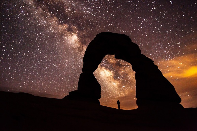
    <summary type="html"><![CDATA[<p><strong><em>A national park filled with crimson rock formations known as hoodoos, Bryce Canyon also has one of the best-sustained public astronomical programs, and it has been running for over fifty years.</em></strong></p><img src="https://www.intermountainhistories.org/files/fullsize/2988e0f433f61569bc6c5beafc753df2.jpg" alt="Milky Way over Bryce Canyon" /><br/><p>In addition to hosting the longest active program for astronomy in the National Park Service, Byce Canyon National Park also holds the honor of being a Gold Tier International Dark Sky Park, so designed by the International Dark-Sky Association in 2019. Gold Tier is a rare classification, as it denotes a place with natural nighttime conditions, little to no light pollution, and over 10,000 stars visible on a clear night.</p><p>President Warren G. Harding made Bryce Canyon a National Monument on June 8, 1923, but after a review, Congress made it a national park on February 25, 1928. Educational programs in Bryce Canyon National Park in Utah to teach visitors about astronomy began in 1969 when the Chief of Interpretation was inspired by the Abrams Planetarium to create a night sky interpretation program for Bryce Canyon. In 1972, an astronomer named Von Del Chamberlain wrote and designed a manual for sky interpretation for distribution and use at Bryce Canyon National Park. Chamberlain’s manual included cartoons about why natural skies were culturally important, a list of seven reasons for the park to include sky interpretation, and several program ideas focusing on campfires and storytelling.  Interpretative rangers and volunteers have run educational lectures, stargazing parties, and constellation tours since then, and its reputation was such that interpreters from other parks came to Bryce Canyon to train for night sky and astronomy interpretation in 2005. Patrick Wiggins, Utah’s NASA Solar System Ambassador, has been an annual speaker at Bryce Canyon National Park and involved in program creations from 1984 to 2014.</p><p>The Dark Ranger program for park rangers, sometimes referred to as the Astronomy Rangers, was also created for Bryce Canyon National Park with a mission to cultivate understanding and wonder for the vastness of the universe that has grown harder to recognize with the expansion of lights and cities. Since 2013, the Astronomy Rangers have joined with the work of volunteers and other interpretive rangers for educational programs. Astronomical festivals have also joined Bryce Canyon’s list of public programs.</p><p>For Bryce Canyon’s dedication to over fifty years of defending an intangible but culturally crucial resource, the International Astronomical Union named an asteroid after Bryce Canyon National Park.  Minor planet 49272 was discovered in 1998 by Roy Tucker, and it received the name “Bryce Canyon” in 2007 in appreciation for the park’s public astronomy programs. Orbiting the Sun between Mars and Jupiter, the asteroid has about the same length as its namesake on Earth, being three to five miles across. Bryce Canyon National Park is the second National Park to have an asteroid named after it. Though the small telescopes in Bryce Canyon National Park cannot see the dim minor planet in the sky, the park is very proud of its long record of promoting dark sky conservation. Having an asteroid named after the national park is an international honor.</p><p><em><strong><a href="https://www.intermountainhistories.org/items/show/544">For more (including 3 images) view the original article</a></strong></em></p>]]></summary>
    <published>2021-11-14T05:39:05+00:00</published>
    <updated>2026-04-17T19:32:11+00:00</updated>
    <link rel="alternate" type="text/html" href="https://www.intermountainhistories.org/items/show/544"/>
    <id>https://www.intermountainhistories.org/items/show/544</id>
    <author>
      <name>Emma Svenson, Northern Arizona University</name>
    </author>
  </entry>
  <entry>
    <title type="html"><![CDATA[Dark Sky over Hovenweep National Monument]]></title>
    <summary type="html"><![CDATA[<p><strong><em>Hovenweep National Monument has been inhabited for over ten thousand years. Its long history of celestial observation culminated in Hovenweep’s 2014 designation as an International Dark Sky Park.</em></strong></p><img src="https://www.intermountainhistories.org/files/fullsize/447ea0e1f4175ff2d0eb928d5ecc8b6e.jpg" alt="Milky Way over Hovenweep" /><br/><p>A little over half-a-century after a Latter-day Saint missionary discovered 800-year-old Ancestral Puebloan ruins on the Colorado–Utah border in 1856, Jesse Walter Fewkes of the Smithsonian Institution led a survey of the sites in 1917–1918. Fewkes concluded such a historic site needed to be preserve, and on March 2, 1923, President Warren G. Harding declared Hovenweep a National Monument in the National Park System. Its name means “deserted valley” in the Ute language.
Archaeologists have found evidence of early hunter gatherers in the area dating back to 8000 BCE, but the ruins themselves were used by the Ancestral Pueblo people, who lived in Hovenweep from 900 to 1300 CE. These Ancestral Puebloans practiced celestial observation. Hovenweep National Monument has six clusters of ancient ruins, and within the Holly ruin group there are spiral petroglyphs on a rock wall that are believed to act as markers for equinoxes and solstices.  For the Ancestral Pueblo people, spiral symbols often reresent the sun or sky. On the day of a solstice or equinox, a beam of sunlight hits the spiral and bisects the spiral petroglyph. When sunlight perfectly hit the spiral petroglyph, it would signify passage into the next season for practical purposes like expecting weather for farming but potentially also for ceremonial purposes and rituals in kivas.
Over in Hovenweep Castle of the Square Tower cluster, holes in the walls allow beams of light to enter the interior and serve as a solar calendar. Ancestral Pueblo farmers would have used the changing positions of the sunbeams to track the solar cycle and help guide planting and harvesting. Anthropologists and archaeologists continue hypothesizing potential uses for other buildings in the ruins, such as the large stone masonry towers. Further celestial observation and defensive fortification are the two likely purposes for the towers. Large structures have been used for millennia for celestial observation and ritual, such as the ziggurats of the Middle East and Latin America, and the long history of celestial observation in Hovenweep makes it a possibility.
The International Dark-Sky Association designated Hovenweep National Monument an International Dark Sky Park in July of 2014 at the Gold Tier after it accepted the National Park Service’s application for the designation.  A Gold Tier Dark Sky Park is a rare designation given to places with the highest quality dark skies, the smallest amount of light pollution, and the potential to see 15,000 stars in the sky.  For comparison, typically only 500 stars are visible from a city. An International Dark Sky Park designation is not legally binding, but rather commemorates Hovenweep’s dedication to preserving its clear night sky, an increasingly rare resource.</p><p><em><strong><a href="https://www.intermountainhistories.org/items/show/543">For more (including 3 images) view the original article</a></strong></em></p>]]></summary>
    <published>2021-11-14T05:20:32+00:00</published>
    <updated>2026-04-17T19:32:11+00:00</updated>
    <link rel="alternate" type="text/html" href="https://www.intermountainhistories.org/items/show/543"/>
    <id>https://www.intermountainhistories.org/items/show/543</id>
    <author>
      <name>Emma Svenson, Northern Arizona University</name>
    </author>
  </entry>
  <entry>
    <title type="html"><![CDATA[Dark Sky over Thunder Mountain Pootseev Nightsky]]></title>
    <summary type="html"><![CDATA[<p><strong><em>Named the first “Dark Sky Nation,” Thunder Mountain Pootseev Nightsky, on the Kaibab Paiute Reservation, is the first ethnically and culturally homogenous community to unanimously adopt practices for preserving the natural sky.</em></strong></p><img src="https://www.intermountainhistories.org/files/fullsize/25e28682944c04542490c757c80e7f2d.jpg" alt="Night sky over Kaibab" /><br/><p>In 2015, the International Dark Sky Association accepted the Kaibab Paiutes’s application to acknowledge their reservation on the borderlands of Utah and Arizona as a Dark Sky Community. International Dark Sky Community’s official name, Thunder Mountain Pootseev Nightsky, uses the Southern Paiute language to recognize the importance Kaibab Paiute culture places on Thunder Mountain and the night sky.
The Kaibab Paiutes’ recognized history in Utah and Arizona began when they entered the Colorado Plateau around 1150 CE, living off the land by hunting and foraging. Since then, the Kaibab Paiutes’ culture has emphasized being responsible for protecting and sustainably managing natural resources due to a history of conflict over resources. members of The Church of Jesus Christ of Latter-day Saints—sometimes nicknamed “Mormons” in that time—began forming settlements on the Colorado Plateau in the 1860s. Despite generous efforts by indigenous peoples elsewhere in the Intermountain West to accommodate and live peacefully with the overwhelmingly Euro-American newcomers, who had initially arrived in the Salt Lake Valley in 1847, by the 1860s the Latter-day Saints’ growing population of new arrivals and extractive agricultural practices were increasingly incompatible with indigenous ways of life, including those of the Kaibab Band of Paiutes. The Latter-day Saints who settled the Colorado Plateau cut down trees and other flora which grew on the of the Kaibab Paiutes’ homeland, and they took control of springs and wells for farm irrigation. No evidence exists of this group of Mormons attempting to purchase any plots or use rights, and they apparently simply seized the land without offering any compensation.
Within a few years, the Mormons’ terraforming destroyed the Kaibab Paiutes’ farmland and degraded the landscape so much it could no longer support wildlife. To make way for farms and pastures, they had also cut down the Kaibab Paiutes’ piñon pine trees, whose edible nuts were a major food source that might have otherwise helped them stave off starvation. Having lost the natural world which once supported them, to survive, many of the Kaibab Paiutes had to relocate to camps near Mormon settlements and take jobs.  About 90% of the Kaibab Paiute population died from starvation and other difficult changes stemming from the relocation.
The local Mormons justified their conquest of the land and people with the common Euro-American settler-colonial myth that the indigenous Paiutes were not properly utilizing the land. Though manifestly untrue—nineteenth-century Euro-Americans simply did not recognize the Kaibab Paiutes’ foodways and agricultural and hunting practices—the sting of that myth has not been forgotten. After the U.S. government created the Kaibab Paiute reservation on May 28, 1909, the people resolved to never let their natural resources be wasted or depleted now that they had land designated specifically for Kaibab Paiutes. Minerals and wildlife were the natural resources originally focused on for preservation and compensation when harmed or exploited by outside parties. This conservationist attitude extended to the night sky when the Kaibab Paiute become aware of how light pollution threatened their natural skies, and by 2015, every light in the 250-person community was modified to be night sky friendly.
Celestial observation was a part of many Great Basin mythologies, and the Kaibab Paiutes were no exception. One myth, called Mountain Sheep in the Sky, is about how the three large stars that may make up Orion’s belt are three mountain sheep being chased westward by a Sheep Trailer who shoots the middle sheep.  Other versions of the myth exist with a blind man named Puiat as the hunter, different animals such as antelopes, and even a tale of conflict between beings like Coyote and Mountain Lion. Another tale about the same constellation describes a wife perpetually chasing after her baby and two husbands who left her since she did not work hard enough to satisfy the family. Roland Maldonado, Tribal Chairperson, and Daniel Bulletts, Environmental Program Director, in 2015 spoke of how preserving their night skies would restore value to the traditions of celestial observance.  The night skies provide a backdrop for teaching younger generations stories about culture or lessons in morality, and Thunder Mountain Pootseev Nightsky has chosen to defend that educational tradition for their heritage and ecological conservation.</p><p><em><strong><a href="https://www.intermountainhistories.org/items/show/542">For more (including 3 images) view the original article</a></strong></em></p>]]></summary>
    <published>2021-11-14T04:38:53+00:00</published>
    <updated>2026-04-17T19:32:11+00:00</updated>
    <link rel="alternate" type="text/html" href="https://www.intermountainhistories.org/items/show/542"/>
    <id>https://www.intermountainhistories.org/items/show/542</id>
    <author>
      <name>Emma Svenson, Northern Arizona University</name>
    </author>
  </entry>
  <entry>
    <title type="html"><![CDATA[Dark Sky over Arches National Park]]></title>
    <summary type="html"><![CDATA[<p><strong><em>Home to over 2,000 natural sandstone arches in Utah, Arches National Park applied for recognition from the International Dark-Sky Association and received the association’s “Silver Tier” designation in 2019 thanks to its commitment to preserving the natural sky and educating the public about the benefits of reducing light pollution.</em></strong></p><img src="https://www.intermountainhistories.org/files/fullsize/94128d7b834b011c0b21f969610c1bc6.jpg" alt="Milky Way over Arches" /><br/><p>First designated a national monument in 1929, Congress declared Arches a national park on November 12, 1971. Arches National Park is one of the “Mighty 5” national parks of Utah, and in 2019, the International Dark-Sky Associated recognized the park’s work toward reducing light pollution within and outside of the park with its Silver Tier designation. (The Silver Tier is given when light glow is present along the horizon to a degree that wildlife and astronomy are impacted, but the Milky Way Galaxy can still be seen in summer and winter with over six thousand stars visible to the naked eye.)
In 1999, a study of 376 parks discovered that half of all National Parks, 189 in total, were threatened by light pollution from encroaching cities. The National Park Service responded by forming the Night Sky Team to document the negative effects of light pollution with 104 photos taken in a short duration. Every photo was stitched together to form a wider picture, and then the Night Sky Team erased the light generated by stars to focus on how artificial lighting impacted the park. Arches National Park in 2003 had significant light pollution from Moab, Utah, and Grand Junction, Colorado, so the park created outdoor lighting codes with training workshops to reduce light pollution, intending to keep visitors safe while minimizing harm to wildlife.
Arches National Park’s lighting codes implement several strategies for reducing light pollution and preserving a clear night sky as a culture heritage. First, Arches’ lights use motion sensors to provide visitors with light when they need it without leaving any running constantly. Second, Arches’ outdoor light fixtures are shielded with hoods and point toward the ground. Third, Arches National Park uses warm-colored light, as blue-colored light negatively impacts insects while amber lighting minimizes sky brightness while still providing visibility to guests. Fourth, Arches encourages nearby cities and households to plan outdoor lighting efficiently and use high quality lights. This includes striving to minimize nighttime lighting and only using what is strictly necessary for public safety.  Close to 100% of all exterior lights throughout the 119-square-mile park are night-sky friendly in accordance with Arches’ principles.
The value Arches National Park places on its dark skies is not limited to lighting codes and stargazing within the park. Educational outreach programs have been created, like the Night Sky Ranger booklet that teaches children about astronomy and light pollution through stargazing and moon phase observation activities. Preservation can maintain the dark skies, but education about the value of dark skies is what will break through the night blindness created by brightly lit societies.</p><p><em><strong><a href="https://www.intermountainhistories.org/items/show/541">For more (including 5 images) view the original article</a></strong></em></p>]]></summary>
    <published>2021-11-14T03:31:12+00:00</published>
    <updated>2026-04-17T19:32:11+00:00</updated>
    <link rel="alternate" type="text/html" href="https://www.intermountainhistories.org/items/show/541"/>
    <id>https://www.intermountainhistories.org/items/show/541</id>
    <author>
      <name>Emma Svenson, Northern Arizona University</name>
    </author>
  </entry>
  <entry>
    <title type="html"><![CDATA[Dark Sky over Flagstaff]]></title>
    <summary type="html"><![CDATA[<p><strong><em>In 2001, Flagstaff, Arizona, became the first International Dark Sky City because of its long-term commitment to reducing outdoor light pollution without compromising safety.  The Colorado Plateau’s clear, dry air, cloudless nights, and distance from major cities has made Flagstaff a significant location for astronomy.</em></strong></p><img src="https://www.intermountainhistories.org/files/fullsize/ac2b6faa24e41544e57d8b18d3228661.jpg" alt="Night sky in Flagstaff" /><br/><p>Flagstaff’s history of dark sky conservation began even before the International Dark Sky City designation in 2001 when it issued the world’s first outdoor lighting ordinance in 1958. Lowell Observatory, founded in 1894 by Percival Lowell to study the surface of Mars, was concerned about how light pollution would limit the capacity of a reflecting telescope transferred from the Ohio Perkins Observatory. To protect astronomy, the Anti-Searchlight Law of 1958 passed to forbid the use of searchlights, common in advertising, within city limits.
However, light pollution levels kept rising in Flagstaff, even with the passing of a second lighting ordinance in 1972 requiring all outdoor lights be properly shielded and pointed downwards.  A shielded outdoor light has a surface or hood built in to prevent any light from escaping upwards or horizontally so the beam is directed at the ground. Fourteen years later, Tucson and Pima County updated their ordinances from 1973, and Lowell Observatory partnered with Flagstaff city planners to maintain Flagstaff’s status as an important site for astronomy.  In conjunction with the Arizona Public Service in 1987, Dr. Arthur Hoag from Lowell Observatory tested low-pressure sodium lights on Santa Fe Avenue in downtown Flagstaff as a method to reduce light pollution. With 90% approval from the public and evidence proving the new lights reduced the city’s light pollution, Flagstaff updated its lighting codes to mandate low-pressure sodium lights and ban mercury vapor light common in old streetlamps.  The amber hue of low-pressure sodium lights causes the least amount of sky glow, uses the least amount of energy to operate, and has the least impact on the natural rhythms of humans and nocturnal animals.  For astronomy, Christian Luginbuhl of the U.S. Naval Observatory documented that low-pressure sodium lights take up only two bands of the visible light spectrum, allowing astronomers to research within every other area of the light spectrum.
But in 1988, pressure from the Yellow Freight Company to allow higher levels of light pollution for a trucking yard near Lowell Observatory and the U.S. Naval Observatory Flagstaff Station split Flagstaff’s residents with arguments over economic and scientific interests.  The conflict ended in favor of continuing to reduce light pollution, and on September 26, 1989, the Flagstaff City Council enacted strict lighting codes for protecting Flagstaff’s unique natural. Yellow Freight withdrew from the city three years later.
The <em>Daily Sun</em> newspaper framed the clash over light pollution in Flagstaff as pitting money and jobs against scientific innovation and potential in the <em>Daily Sun</em> newspaper, but as time passed, the light ordinances did not harm Flagstaff’s economy.  In fact, the exceptional environmental conditions in Flagstaff grew the astronomical community with organizations such as the U.S. Naval Observatory and the U.S. Geological Survey contributing to a major tourism draw.  Residents and tourists alike interact with Flagstaff’s dark skies in different ways.  For example, the Flagstaff Star Party organizes every year with the help of astronomers Christian Luginbuhl and Jeff Hall from Lowell Observatory and helps residents and tourists learn how to observe the city’s dark skies  Another organization, the Flagstaff Dark Skies Coalition under Christian Luginbuhl, promotes music, art, and theater about Flagstaff’s skies in partnership with the Coconino Center for the Arts.
Flagstaff’s popular culture has grown to include the dark sky it is deeply proud of. In 2001, Flagstaff received an International Dark Sky City designation thanks to its conservation efforts and appreciation for a rare natural resource in the age of urban expansion.</p><p><em><strong><a href="https://www.intermountainhistories.org/items/show/540">For more (including 4 images) view the original article</a></strong></em></p>]]></summary>
    <published>2021-11-14T01:29:49+00:00</published>
    <updated>2026-04-17T19:32:11+00:00</updated>
    <link rel="alternate" type="text/html" href="https://www.intermountainhistories.org/items/show/540"/>
    <id>https://www.intermountainhistories.org/items/show/540</id>
    <author>
      <name>Emma Svenson, Northern Arizona University</name>
    </author>
  </entry>
  <entry>
    <title type="html"><![CDATA[Camelops Hesternus at Fillmore]]></title>
    <summary type="html"><![CDATA[<p><strong><em>With the help of a camel skull found by a local denizen of Fillmore, Utah, paleontologists drastically revised the extinction date for Camelops hesternus, an ancient camel of the Americas.</em></strong></p><img src="https://www.intermountainhistories.org/files/fullsize/c3a488c9a8c769c3f10043833583de37.jpg" alt="Camel skull" /><br/><p>Along with two of his friends, Hector Lee, a student from Fillmore, Utah, discovered a camel skull in a cave in the lava beds of nearby Meadow Hot Springs in 1928. He passed it along to professor A.L. Matthews of the University of Utah, who then sent it to the paleontologist Alfred Romer at the University of Chicago. The skull apparently had muscle tissue still attached to it, indicating a relatively recent provenance. Romer noted “the most obvious explanation” was that the skull was a remnant of the 1856–1866 US Camel Corps, a government experiment in using camels to service military forts and survey expeditions. Comparison with contemporary Bactrian and dromedary skulls, however, revealed this specimen was of an entirely different species: the <em>Camelops hesternus</em>, which had been thought to have gone extinct half a million years ago.
Romer determined this find refuted the theory of such an early period of extinction for two reasons. First, the persistence of muscle on the bone could only be credible after several thousand years at the most, not half a million. Second, he drew on an 1890 geological study by G.K. Gilbert to determine that the cave in which the skull was found formed only after the fourth glaciation period, around 15,000 years ago. Romer excitedly suggested the timeline for extinction needed revision.
Dr. Oliver P. Hay, who had established the previously-held early Pleistocene extinction date for <em>C. hesternus</em>, witheringly denounced Romer’s suggestions in an article published six months later. He contended ancient fossils could maintain muscle tissue for more than a few thousand years given the right conditions. He furthermore argued G.K. Gilbert was not aware of the multiple glacial stages that subsequent science had identified, and thus was not credible. He sardonically requested geologists, paleontologists, and anthropologists present more cogent arguments against his original theory.
The question of the dating of this camel skull did, in fact, involve the anthropological field. When species such as the <em>Camelops</em> had been confined to the early Pleistocene, the incidence of human remains in association with them had indicated to scientists that humans must have existed at the same early time. To find that this species and others like it could have existed far later would deprive anthropology of one argument for a quite early date for human existence on the continent. Other articles in the <em>Science</em> journal where this debate played out confirm that other geologists, paleontologists, and anthropologists did take up Hay’s challenge and Romer’s invitation to determine whether previously-held extinction dates remained legitimate for dating the human record. The May 9, 1930 edition of Park City’s <em>Park Record</em> noted Hector Lee, the original skull-discoverer, helped to establish the <em>Camelops hesternus</em> extinction date to 25,000 years ago.
Eventually, in the late 1970s, paleontologists at the University of Utah used radiocarbon technology to date the skull to about 11,000 years ago, redeeming both Romer and his revised extinction date for <em>Camelops hesternus</em>.</p><p><em><strong><a href="https://www.intermountainhistories.org/items/show/529">For more (including 3 images) view the original article</a></strong></em></p>]]></summary>
    <published>2021-10-22T22:19:54+00:00</published>
    <updated>2026-04-17T19:32:11+00:00</updated>
    <link rel="alternate" type="text/html" href="https://www.intermountainhistories.org/items/show/529"/>
    <id>https://www.intermountainhistories.org/items/show/529</id>
    <author>
      <name>Emily Moore, Northern Arizona University</name>
    </author>
  </entry>
  <entry>
    <title type="html"><![CDATA[Monte L. Bean Life Science Museum (MLBM)]]></title>
    <summary type="html"><![CDATA[<p><strong><em>The Bean Life Science Museum is home to the university’s collection of over two million life science specimens used by researchers and students alike. It accomplishes its mission to “inspire wonder and reverence for our living planet” through educational programs and exhibits available to families and students of all ages.</em></strong></p><img src="https://www.intermountainhistories.org/files/fullsize/f426c122c69687f3dfa9987718699b3a.jpg" alt="Old Entrance of the Bean Life Science Museum" /><br/><p>The Monte L. Bean Life Science Museum was opened in 1978. It is named for naturalist and businessman Monte L. Bean, who funded the construction of the building and donated some of his own collection to the museum. Brigham Young University acquired property for the Lytle Ranch Preserve, a six-hundred-acre property in Southwestern Utah, from the Nature Conservancy in 1986. The Preserve functions as a desert laboratory for students and scientists and is considered an extension of the museum. </p><p>Brigham Young University inherited a life science collection from the Deseret Museum at LDS College in 1927. The collection was originally housed in the Grant and Brimhall buildings, but university leaders hoped to find a more permanent home for the items. In the 1970s, BYU President Dallin H. Oaks approached Monte L. Bean to ask if he and his family would be interested in funding a museum on campus, and he and his wife agreed. The museum was designed by architect Bob Fowler and built by Layton Construction Company, opening to the public in 1978. The museum underwent extensive renovations from 2012-2014, suffering a minor fire in 2013 that did not damage the collection. The renovation added 30,000 square feet to the museum and introduced new exhibits. </p><p>The museum includes a collection of artworks created by Boyd K. Packer, a former apostle of the Church of Jesus Christ of Latter-day Saints. It features over 1,000 of his nature and wildlife paintings, drawings, and woodcarvings. </p><p>At the building’s groundbreaking ceremony, President Oaks said, “There probably are not better collections of life science exhibits between the Mississippi River and west coast than we have at BYU.” Today, the museum’s collection of 2.8 million specimens has an estimated value of $55 million. Students, scientists, and other researchers have access to the collections, and about 60,000 school-age children visit the museum ever year. Entry is free, and the museum has a gift shop that helps fund the museum’s upkeep and mission. The museum is accredited by the American Association of Museums and is a member of the Natural Science Collections Alliance.</p><p>The Bean Museum’s mission is to “inspire wonder and reverence for our living planet.” President Oaks said that while the museum would be a “vital teaching laboratory for students at BYU and a vital scholarly resource for our scholars, it will also make a landmark in the western United States and indeed for tourists and individuals who are interested in learning more about the world we live in.” Some of the museum’s goals include becoming the leading university-based life science museum in the U.S., to be central to the community, and to promote understanding, appreciation, and stewardship of the earth. </p><p><em><strong><a href="https://www.intermountainhistories.org/items/show/415">For more (including 5 images) view the original article</a></strong></em></p>]]></summary>
    <published>2020-04-03T04:23:05+00:00</published>
    <updated>2026-04-17T19:32:08+00:00</updated>
    <link rel="alternate" type="text/html" href="https://www.intermountainhistories.org/items/show/415"/>
    <id>https://www.intermountainhistories.org/items/show/415</id>
    <author>
      <name>Allie Patterson, Brigham Young University</name>
    </author>
  </entry>
  <entry>
    <title type="html"><![CDATA[The Rocky Mountain Biological Laboratory]]></title>
    <summary type="html"><![CDATA[<p><strong><em>Transformed from the abandoned ruins of a silver boomtown, the Rocky Mountain Biological Laboratory is internationally known for its research in high-altitude ecology.</em></strong></p><img src="https://www.intermountainhistories.org/files/fullsize/1008e06045b644f886c16b31b9bd793e.jpg" alt="[Untitled]" /><br/><p>The home of the Rocky Mountain Laboratory lies in the abandoned silver mining town of Gothic in the Elk Mountains of the Colorado Rockies. John C. Johnson, a founding member of the Colorado State Normal School (later known as Western State College) discovered the town when he first visited the area in 1911. He was struck by the beauty of the untouched scenery, the diversity of biological life there, and its potential as an educational resource for a research field station. In 1922, Johnson leased 160 acres of land from the Forest Service, where he and his students conducted research on the high-altitude ecosystem for six years and established the Rocky Mountain Biological Station there. After Western State College decided to no longer finance the project, Johnson used his own capital to move the station to land purchased in Gothic, where it became the Rocky Mountain Biological Laboratory in 1928. </p><p>Johnson and his team repaired and rebuilt the town over the next twenty-five years to fit the needs of the Laboratory and its members as abandoned cabins became living quarters and they converted the historic Gothic Hotel into a laboratory, library, and office space. However, it would not be until the end of the century that the Laboratory modernized with hot and cold running water in resident cabins, community shower facilities, electricity, telephones, and insulation. It also built a new community center, complete with a dining hall and seminar room.</p><p>Finances were limited during the first few decades. Johnson and his colleagues often worked without payment, but summer courses were very successful, progressive, and attendance continued to grow. The laboratory notably offered women more opportunities than most institutions at that time by actively encouraging them to research, publish, and teach courses. Through the 1930s and 1940s, it focused on recording and observing the environmental conditions of Gothic while collecting and cataloging plant and animal specimens. However, by the mid-1950s, the scientific field began changing as the next generation of scientists moved more towards methods of hypothesis and experimentation. The laboratory responded by recruiting more young scientists from elite schools and invested in long term studies in genetic adaptations, and the behavior characteristics of animals, plants, and insects, such as marmots, salamanders, and butterflies. </p><p>Since the 1980s, the laboratory has centered its core research on climate change and its impact on the region’s wildlife. Scientists monitor changes in snow and rain falls while analyzing how acidity in the precipitation affects nutrients in the soil, pH in ponds, and salamander populations. In fact, Congress consulted this research during its revision of the 1990 Clean Air Act. Laboratory scientists also focus on pollination patterns by studying changes to wildflower blooming schedules and the behavior and lifespans of bees, hummingbirds, and butterflies. Undergraduate and graduate students of botany and zoology still come to Gothic to study the characteristics of Rocky Mountain wildlife every summer, contributing to make the Rocky Mountain Biological Laboratory one of the top high-altitude research and education institutions in the world.</p><p><em><strong><a href="https://www.intermountainhistories.org/items/show/323">For more (including 5 images) view the original article</a></strong></em></p>]]></summary>
    <published>2019-09-11T19:55:13+00:00</published>
    <updated>2026-04-17T19:32:05+00:00</updated>
    <link rel="alternate" type="text/html" href="https://www.intermountainhistories.org/items/show/323"/>
    <id>https://www.intermountainhistories.org/items/show/323</id>
    <author>
      <name>Abbey Buckham, Northern Arizona University</name>
    </author>
  </entry>
</feed>