<?xml version="1.0" encoding="UTF-8"?>
<feed xmlns="http://www.w3.org/2005/Atom">
  <title type="text">Intermountain Histories</title>
  <updated>2026-08-18T15:51:43+00:00</updated>
  <generator uri="http://framework.zend.com" version="1.12.20">Zend_Feed_Writer</generator>
  <link rel="alternate" type="text/html" href="https://www.intermountainhistories.org/"/>
  <link rel="self" type="application/atom+xml" href="https://www.intermountainhistories.org/items/browse?output=rss2"/>
  <id>https://www.intermountainhistories.org/</id>
  <author>
    <name>Intermountain Histories</name>
    <uri>https://www.intermountainhistories.org</uri>
  </author>
  <link rel="hub" href="https://pubsubhubbub.appspot.com/"/>
  <entry>
    <title type="html"><![CDATA[The Donners in Echo Pass and Weber Canyon]]></title>
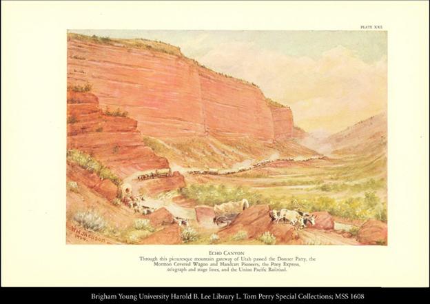
    <summary type="html"><![CDATA[<p><strong><em>Having separated from the main Oregon/California trail after the Continental Divide, the Donner Party reached the mouth of Echo Canyon in Eastern Utah in early August, 1846. This marked the beginning of uncharted territory and an arduous journey through the Wasatch mountain range in present-day Utah. Invaluable time was wasted cutting brush and trees, passing through thin crevices, or crossing mountain rivers and streams.</em></strong></p><img src="https://www.intermountainhistories.org/files/fullsize/ed935523348f738fe9a49853a294f593.jpg" alt="Pioneer Wagons in Echo Canyon" /><br/><p>Traveling through the narrow ravines and steep peaks was not a challenge for the traditional route to California or Oregon Country. Lansford Hastings, a frontier explorer and creator of this cutoff through the Wasatch Mountains and Great Basin desert, had taken smaller groups of emigrants through the cutoff earlier in the season, but their smaller size required less assistance than the Donner Party needed. One arduous landmark in Weber Canyon featured a creek with jagged boulders enclosed by steep canyon walls as the only passable route. The party had to hoist wagons over each individual boulder to continue. Aware of these challenges, Hastings had left the party a note instructing them to send someone ahead to get alternate route directions from him once they reached the Weber River. Leader James Reed and others left on August 6th, and returned August 10th with Hiram Miller’s diary recording<em>“Reed having examined the new rout </em>[route]<em> entirely an </em>[and]<em> reported in favour, which induced the company to proceed.”</em>
Pace slowed as the party wound its way through the mountain range. The trail was rocky and overgrown, necessitating bushwhacking and the clearing of trees and other debris. Virginia Reed said, <em>“There was absolutely no road, not even a trail. The cañon </em>[canyon]<em> wound around among the hills. Heavy underbrush had to be cut away and used for making a roadbed.” </em>They might criss-cross a stream up to 13 times in a single day just to proceed, or spend multiple days clearing debris only to make no forward progress. In a cruel twist of irony, the large migration of Latter-Day Saints from Nauvoo, Illinois used the same path the Donners had blazed to swiftly reach the Salt Lake Valley one year later in 1847. The Saints advance party recorded that they <em>“followed the gouges of the Donner wheels to the top”</em> of what is known as Donner Hill, which is <em>“as near vertical as wagons have ever managed.”</em> The Donners only summited this steep hill because they failed to clear the last gorge of debris after several days of trying. The Saints cleared the gorge in the span of a day. The gorge is now the proud ‘Emigration Canyon’, from which the migration of Latter-day Saints made their main path to reach the Salt Lake Valley.
Three weeks after their arrival at Echo Pass, the party looked back from the floor of the Salt Lake Valley and saw they had traveled only 35 miles. At the same time, parties who had left earlier in the year were already leaving the Great Salt Lake Desert, moseying along the Humboldt River in modern-day Northern Nevada, and descending into Sacramento. Compounded by a markedly late-season start to begin with, the Donner Party’s delay threatened their ability to reach and cross the Sierra Nevada Mountains before Winter. It was well-known that this last mountain range before central-California would be impassable once snow began to fall. If they could not make up for lost time, it would certainly result in the parties entrapment in the mountains.</p><p><em><strong><a href="https://www.intermountainhistories.org/items/show/932">For more (including 4 images) view the original article</a></strong></em></p>]]></summary>
    <published>2026-02-02T17:22:14+00:00</published>
    <updated>2026-04-17T19:32:21+00:00</updated>
    <link rel="alternate" type="text/html" href="https://www.intermountainhistories.org/items/show/932"/>
    <id>https://www.intermountainhistories.org/items/show/932</id>
    <author>
      <name>Samuel Watson, Brigham Young University</name>
    </author>
  </entry>
  <entry>
    <title type="html"><![CDATA[Girl Scouts of Utah]]></title>
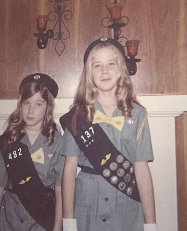
    <summary type="html"><![CDATA[<p><strong><em>Barbara Schmidt, a scout of 65 years, recalls her fondest memories growing up as a girl scout in mid-twentieth century Utah. </em></strong></p><img src="https://www.intermountainhistories.org/files/fullsize/0d86281475893b6bdc8c122102bc6d41.jpg" alt="Sisters posing in their Girl Scout uniforms circa 1970" /><br/><p><span style="font-weight:400;">The first Girl Scout troop was founded in Virginia in 1912, and it wasn’t long before troops sprouted up throughout the nation. Founded by Juliette Gordon Low, the organization was modeled to build “courage, confidence, and character,” as their mission statement declares. Becoming a Girl Scout also provided young girls with leadership opportunities and outdoor experiences, not unlike their male peers in the Boy Scouts program. </span>
<span style="font-weight:400;"></span><span style="font-weight:400;">In 1920, a group of mothers in Ogden, Utah united to find a positive community for their daughters. They initially looked into Campfire Girls, but ultimately discovered that the Girl Scouts were more suited to their needs. Advertising the opportunity in local schools, they soon had enough willing participants to create Utah’s first ever Girl Scout troop. Just a year later, another troop formed in Salt Lake City. </span>
<span style="font-weight:400;"></span><span style="font-weight:400;">In the late 1940s Barbara Schmidt, a student at Hawthorne Elementary School in Salt Lake City, was thrilled at the prospect of becoming a Girl Scout. She saw an announcement at her school for a new local troop and ran home that afternoon excitedly to ask her mom if she could go. Barbara became a Brownie which was, at the time, the group for girls aged eight to ten years old. The troop met at first in the home of the troop leader, a mother of her classmate, but as the troop grew they began meeting in the basement of Zion Lutheran Church.</span>
<span style="font-weight:400;"></span><span style="font-weight:400;">Some of Barbara’s fondest memories are from her summers at camp––and all of the months spent selling cookies in preparation. Each scout who wished to attend a camp had a quota to meet, so they had to be both diligent and creative to meet their goals. In her years of motherhood Barbara always followed her own cookie-selling scouts at a safe distance in her mini van, back in her day Barbara and her fellow scouts were often allowed out on their own––so long as they stuck with a buddy at all times. She spent countless afternoons pulling a red wagon full of cookies, twenty-five cents each, up and down the neighborhoods of Salt Lake. Her troop also received permission from the local Catholic church to sell cookies in the parking lot after mass, which drummed up a fair amount of business. When their work was done, the girls boarded an old rickety school bus that trudged wearily up the mountain to camp. Once they had finally arrived the girls spent their days developing outdoorsmanship skills and making friendships that would last a lifetime. </span>
<span style="font-weight:400;"></span><span style="font-weight:400;">Besides selling cookies and camping, Barbara recalls participating in service projects and feeling that she was “making a real difference in the community.” Though she states that she is not quite “going strong” in her volunteering today as she once did, she continues to volunteer regularly at the Heritage Museum in the Girl Scouts of Utah Council Resource Center. She continues to advocate for the girl scout program because it helps young girls to “embrace a perspective beyond their own.</span></p><p><em><strong><a href="https://www.intermountainhistories.org/items/show/928">For more (including 6 images) view the original article</a></strong></em></p>]]></summary>
    <published>2025-12-09T17:24:32+00:00</published>
    <updated>2026-04-17T19:32:21+00:00</updated>
    <link rel="alternate" type="text/html" href="https://www.intermountainhistories.org/items/show/928"/>
    <id>https://www.intermountainhistories.org/items/show/928</id>
    <author>
      <name>Megan Bailey, Brigham Young University</name>
    </author>
  </entry>
  <entry>
    <title type="html"><![CDATA[Camp Cloud Rim]]></title>
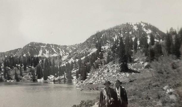
    <summary type="html"><![CDATA[<p><strong><em>Nestled in the mountains of northeast Utah, Camp Cloud Rim has been a place of refuge, belonging, and adventure to Girl Scouts for nearly a hundred years. Rising like a phoenix from its ashes at the turn of the century, the camp stands as a testament to the strength and kindness of its community. </em></strong></p><img src="https://www.intermountainhistories.org/files/fullsize/86286387e18e803da26bda97432f9ba9.jpg" alt="Two girl scouts posing in front of Lake Brimhall and the Wasatch Mountain Range." /><br/><p><span style="font-weight:400;">Camp Cloud Rim, originally called “Camp Pinar,” was constructed in 1934 with funding and labor provided by Franklin Roosevelt’s New Deal program. In 1937 the camp was officially dedicated to the Girl Scouts of America and renamed Camp Cloud Rim. While the camp is still up and running nearly a century later, its survival has been no easy feat. Following several catastrophic events the camp continues to be revived by the driven community which surrounds it. </span>
<span style="font-weight:400;"></span><span style="font-weight:400;">Located in the Wasatch Mountain Range, just outside of Park City, much of the community surrounding Camp Cloud Rim in the early days came from local mining camps. Barbara Schmidt, a lifelong scout, remembers attending the camp in the late 1940s. She has fond memories of her summers at camp which were spent swimming in Lake Brimhall, making pull taffy, developing wilderness survival skills, and forming some of the most meaningful friendships she’s ever had. One of Barbara’s first and dearest friends at the camp was a local girl whose father had died in the mines. As she returned each year she made more friends from around the state, many of whom were from mining communities, and some of which she kept in touch with by exchanging letters over the winter and even after they had aged out of camp. </span>
<span style="font-weight:400;">The trips up to camp each summer were infamous for their chaos. The road up the mountain was winding and bumpy, a journey not made any more pleasant by the old bus that carried them. Barbara recalls frequent transmission issues that sometimes stranded them on the mountain for long periods of time. </span>
<span style="font-weight:400;"></span><span style="font-weight:400;">While camp transportation has improved over the years, many aspects of camp culture from the early years live on today. Choosing a new name to go by at camp has been a common practice across the United States for decades, a tradition upheld by both the leaders and campers of all ages at Camp Cloud Rim. For many girls, camp is an opportunity to be braver, bolder, and more adventurous than they usually would be. With their new aliases, often chosen from favorite cartoon characters or fairytale heroines, they have the freedom to reinvent themselves. Like Barbara and her friends in the 1940s and 50s, girl scouts today enjoy recreational lake activities, learning survival skills, and experiencing their first taste of independence. </span>
<span style="font-weight:400;"></span><span style="font-weight:400;">In late November 1992 a fire spread throughout the camp destroying the main lodge and most of the other structures on property. The winter conditions made a trek up the mountain impossible, so the county sent helicopters to extinguish the fire. In just under six years the damaged property was brought back to life through the tireless efforts of community volunteers, fundraising efforts, and a generous benefactor––Janet Quinney Lawson, a philanthropist and lover of the outdoors. Camp Cloud Rim was reopened in 1999 and it continues to cultivate meaningful relationships and experiences for girls today, just as it did for Barbara and her friends back in the 40s. </span></p><p><em><strong><a href="https://www.intermountainhistories.org/items/show/926">For more (including 5 images) view the original article</a></strong></em></p>]]></summary>
    <published>2025-12-09T17:24:31+00:00</published>
    <updated>2026-04-17T19:32:21+00:00</updated>
    <link rel="alternate" type="text/html" href="https://www.intermountainhistories.org/items/show/926"/>
    <id>https://www.intermountainhistories.org/items/show/926</id>
    <author>
      <name>Megan Bailey, Brigham Young University</name>
    </author>
  </entry>
  <entry>
    <title type="html"><![CDATA[Teddy Roosevelt&#039;s Welcome in the Beehive State: Story 4 of 8 of the President Theodore Roosevelt in the West Tour]]></title>
    <summary type="html"><![CDATA[<p><strong><em>President Teddy Roosevelt's Welcome in the Beehive State and his patriotic parade. He addresses Utah citizens and their advancements in irrigation and economics. </em></strong></p><img src="https://www.intermountainhistories.org/files/fullsize/a7ca3d8cfd35ec2ca4a058b9d4af50b2.jpg" alt="President Roosevelt speaks to Ogden citizens on his way to Salt Lake City" /><br/><p>Incoming from Ogden, Utah, pulled by the Union Pacific Engine No. 659, President Theodore Roosevelt steps onto the Oregon Short Line Depot on May 29th, 1903, at 8:30 am, greeted by thousands waiting for his arrival since 6 am. The Salt Lake Tribune newspaper covers the day as the itinerary is published, highlighting, “Today Salt Lake and Utah have the distinguished honor of entertaining the Chief Magistrate of the United States. An enthusiastic welcome is accorded, and our only regret is the briefness of the visit.” On his whistle-stop tour of the West, Roosevelt is adorned with cheers and taken through a parade around Salt Lake City with a route lined with 50,000 people, flags, ribbons, and all manner of decorations along the street. Stores closed, and the city practically shut down other than essentials to welcome in the 26th president. Roosevelt delighted seeing a “little tot of the kindergarten…” and was impressed to say, “I am very glad to see you. I believe in work and I believe in play. Play hard while you play; and when you work, don’t play at all. That is good advice for children, and it is good advice for grown folks too. It is a great pleasure to see you.” With a big, burly grin, Roosevelt paraded Eastward from West South Temple Street to Main Street, passing by school children and mounted soldiers until he arrived at his destination, the Tabernacle.
The Salt Lake City Tabernacle was also decorated with banners, greenery, flags, and ribbons. It was a common congregating location for members of the Church of Jesus Christ of Latter-day Saints and was used to host Roosevelt’s address to the citizens of Utah. The Salt Lake Herald reported the next day that the, “Historic old building could not accommodate the throngs that gathered there” it was so packed. Roosevelt was accompanied by Senator Thomas Kearns, members of the influential Alta Club and Lester Club, LDS Church President Joseph F. Smith, Mayor Ezra Thompson, Governor Heber Manning Wells, and singer Emma Ramsey (also known as “The Utah Nightingale.”) Ramsey opened the event by singing “Rent the Air,” according to the Deseret News. Roosevelt covered many topics he was known for, including his love of the wilderness and respect for the land<b>. </b>His point about conservation was made, “while citizens die, the government and the nation do not die, and we are bound in dealing with the forests to exercise the foresight necessary to use them now, but to use them in such way as will also keep them for those who are to come after us.” This was a great feat, particularly in Utah, as he emphasized the hard work of the citizens, “You took territory which at the outset was called after the desert, and you literally—not figuratively—you literally made the wilderness blossom as the rose.” Utah’s happy reaction was reflected in the evening newspaper, “It is not often that Salt Lake gets to look upon the actual person of a president of the United States, but when it does it enjoys it thoroughly. The appreciation it felt today of the honor of the visit was manifest in every possible manner. Its citizens turned out with pride and turned her children out with still greater pride.”
After his short visit, Roosevelt was back on the train at 1:00 p.m. Utah citizens celebrated his visit with great remembrance. It strengthened the state’s relationship with the federal government and aided Roosevelt’s success in gaining Utah’s vote for the 1904 presidential election. For the rest of his Western tour, he created a precedent of energy and patriotism that Theodore Roosevelt was known for sharing.</p><p><em><strong><a href="https://www.intermountainhistories.org/items/show/918">For more (including 5 images) view the original article</a></strong></em></p>]]></summary>
    <published>2025-10-24T15:03:16+00:00</published>
    <updated>2026-08-18T15:51:43+00:00</updated>
    <link rel="alternate" type="text/html" href="https://www.intermountainhistories.org/items/show/918"/>
    <id>https://www.intermountainhistories.org/items/show/918</id>
    <author>
      <name>Jessika Cole, Brigham Young University</name>
    </author>
  </entry>
  <entry>
    <title type="html"><![CDATA[Bear Lake — Idaho-Utah]]></title>
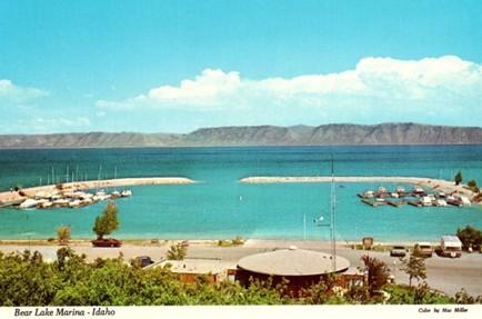
    <summary type="html"><![CDATA[<p><strong><em>Along Idaho’s forty-five-mile portion of Highway 89, travelers pass Bear Lake, a natural freshwater body that spans the Utah and Idaho state lines. The lake’s vibrant blue waters have attracted travelers and locals to enjoy its outdoor recreation opportunities since the arrival of Euro-American settlers. Regular visitors have referred to Bear Lake as the “Caribbean of the Rockies,” due to its bright blue color. </em></strong></p><img src="https://www.intermountainhistories.org/files/fullsize/a2052eb33acb8a79b958725076cfb96f.jpg" alt="Bear Lake Marina Idaho Vintage Postcard Collectible Scenic View" /><br/><p><span>Long before Euro-American settlers found Bear Lake, the Bannock, Shoshone, and Ute tribes frequented the surrounding landscape for hunting. U.S. military officers John Fremont and Benjamin Bonneville surveyed this area in 1842. Their findings paved the way for Oregon Trail travelers, who later traversed around the lake en route to Oregon. During the late 19th century, Bear Lake was an informal outdoor recreation site, attracting tourists from across the American West to enjoy boating, camping, fishing, hunting, and swimming at the lake’s bright blue waters. </span>
<span>Multiple ambitious locals recognized the site’s popularity and chose to open resorts with lodging and dining. By 1926, several private resorts operated on Bear Lake’s shores, including Bear Lake Hot Springs, Fish Haven, Ideal Beach, Lakota, and Logan Canyon. In the following decades, some of these facilities expanded to offer indoor entertainment, such as rollerskating at Lakota Resort and dancing at Fish Haven Resort. Alongside outdoor recreation, Bear Lake’s various resorts became popular sites for large gatherings like family reunions and school field trips. During the early-mid 20th century, the Bear Lake resorts received higher volumes of tourists between June and August, leaving their lodging facilities with no vacancies. The Bear Lake resorts would experience increased patronage following the extension of Highway 89 from St. Charles, Utah, to Paris, Idaho, in 1956. These businesses advertised the lake’s accessibility to Salt Lake City residents who could reach their summer getaway via the highway without being too far from home.</span>
<span>Recognizing the site’s popularity, the Utah Bureau of Land Management declared Utah’s portion of Bear Lake a state park in 1962 with plans to expand the marina and harbor that year. In 1963, the Idaho State Land Board designated the lake’s northern shore as a state park. It was not uncommon for travelers en route to Yellowstone National Park to stop and behold the unexpected beauty of Bear Lake. The site grew to such popularity in the 1970s that the two state parks closed temporarily and considered ways to control the expanding crowds. Members of the Bear Lake County Commission and the State Parks Commission in each state considered charging overnight campers additional fees, enforcing a maximum capacity, and enforcing boat speed limits. While the state park directors strove to allow the maximum number of visitors to enjoy the beaches, they agreed that certain regulations were necessary to promote a quality experience for all.</span>
<span>Bear Lake continues to be a popular outdoor tourist destination along Highway 89 throughout the year. Spring and summer visitors can enjoy biking, bird-watching, boating, camping, swimming, and water skiing, while winter visitors enjoy ice fishing for the native Bonneville Cisco whitefish. This unique fishing opportunity has made the lake a popular attraction for such an activity, especially when the fish spawn near the lake’s icy shores in late January each year. Even if highway travelers do not plan to stop at Bear Lake, its vibrant blue waters offer a uniquely scenic view as they cruise by on Highway 89.</span></p><p><em><strong><a href="https://www.intermountainhistories.org/items/show/910">For more (including 5 images) view the original article</a></strong></em></p>]]></summary>
    <published>2025-09-23T15:38:24+00:00</published>
    <updated>2026-04-17T19:32:21+00:00</updated>
    <link rel="alternate" type="text/html" href="https://www.intermountainhistories.org/items/show/910"/>
    <id>https://www.intermountainhistories.org/items/show/910</id>
    <author>
      <name>Alexandra Williams, Northern Arizona University</name>
    </author>
  </entry>
  <entry>
    <title type="html"><![CDATA[Big Rock Candy Mountain — Utah]]></title>
    <summary type="html"><![CDATA[<p><strong><em>After Harry McClintock released the song “Big Rock Candy Mountain” in 1928, Utah locals placed a sign at the base of a yellow mountain outside of Richfield, labelling it as the song’s namesake because they believed the scenic area matched McClintock’s lyrical description. After the song’s popularization in the 1950s, tourists along Highway 89 considered Utah’s Big Rock Candy Mountain an attraction itself. </em></strong></p><img src="https://www.intermountainhistories.org/files/fullsize/354f372af4646cdc53dcb45586facacb.jpg" alt="Big Rock Candy Mountain UT-Utah, Lemonade Springs, Antique, Vintage Postcard" /><br/><p><span>In his 1928 song, “Big Rock Candy Mountain,” the American folk singer Harry McClintock (1882-1957) sang of a fabled paradise that he described as being bathed in perpetual sunshine, free of danger and common stressors, and flowing endlessly with delicious food and drink. The song quickly gained national popularity, leading some Utah locals to place a sign at the foot of a colorful mountain outside of Richfield, which they believed resembled the one McClintock described in the song. For the mountain’s scenic views and association with the popular song, Big Rock Candy Mountain became a local tourist attraction. Two ambitious locals, Ben Dieringer and Pratt Seegmiller, capitalized on the site’s popularity by opening a resort, including a motel, café, gift shop, and fuel station at the foot of the mountain in 1933. </span>
<span>Utah locals recognized this mountain as one of Utah’s greatest natural wonders. The mountain’s vibrant colors resulted from mineralization that occurred after layers of hot magma covered the mountain’s volcanic rock and deposited an oxidized mineral, limonite, over twenty million years ago. Today, the mountain presents a combination of multiple vibrant colors, including orange, red, white, and yellow. Locals suggest that these bright colors make the mountain look as if it is made entirely of candy and is therefore deserving of its name.</span>
<span>Throughout the mid-20th century, the Big Rock Candy Mountain Resort became a popular roadside attraction along Highway 89 and a valued community center for the residents of Piute County. Travelers could fuel vehicles, enjoy a meal at the café, rest overnight, and purchase bottled mineral water and colorful rock candy from the curio shop. Beginning in the 1950s, Dieringer brought live animals to the resort, including coyotes, deer, mountain lions, porcupines, and lynxes, and allowed visitors to pet them. He believed these encounters could help people cultivate compassion for animals. Dieringer began hosting an annual Easter egg hunt. Advertisements in the <em>Richfield Reaper</em> invited families from the nearby town to spend their Sunday at the Big Rock Candy Mountain Resort, where children could search for Easter eggs he had hidden throughout the hills behind the resort. The 1950s and 1960s were Dierringer and Seegmiller’s prime years as business owners before they retired.</span>
<span>Dieringer and Seegmiller sold the Big Rock Candy Mountain Resort to Richfield resident John Gledhill in 1974. Two years later, a fuel pump ignited a fire, destroying the service station and motel. Gledhill rebuilt the resort in 1978 despite this setback. He owned the business for twenty years in total before he filed for bankruptcy in 1994 and offered the resort for auction. Dissatisfied with the auction’s turnout, Gledhill listed the property on the real estate market for $535,000.000 in 1995. Utah locals Michael and Anne Morrey purchased the property in 1997 and advertised the site as an ideal place for family reunions, where visitors could stay at the resort’s cabins, camp, hike, or ride ATVs on the surrounding outdoor trails.</span></p><p><em><strong><a href="https://www.intermountainhistories.org/items/show/909">For more (including 4 images) view the original article</a></strong></em></p>]]></summary>
    <published>2025-09-23T15:38:24+00:00</published>
    <updated>2026-04-17T19:32:20+00:00</updated>
    <link rel="alternate" type="text/html" href="https://www.intermountainhistories.org/items/show/909"/>
    <id>https://www.intermountainhistories.org/items/show/909</id>
    <author>
      <name>Alexandra Williams, Northern Arizona University</name>
    </author>
  </entry>
  <entry>
    <title type="html"><![CDATA[Gooseberry Mesa National Recreation Trail, Hurricane, UT: We Can Ride Too]]></title>
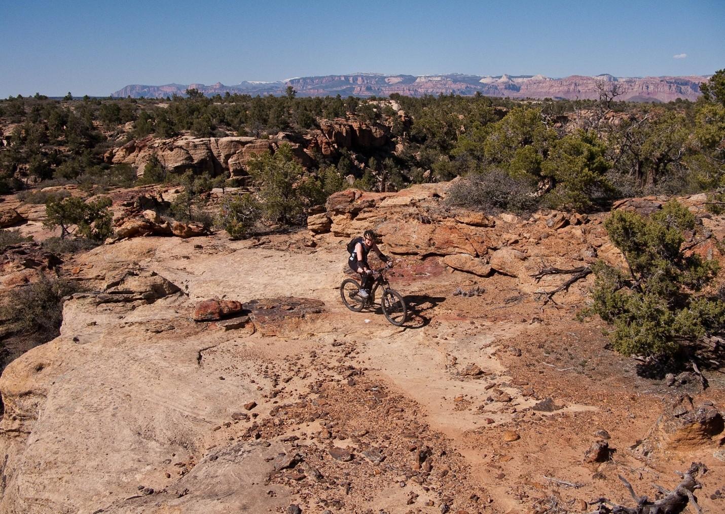
    <summary type="html"><![CDATA[<p><strong><em>After Mike and Morgan Harris started building the trail system now called Gooseberry Mesa National Recreation Trail in the early 1990’s, they had no idea it would become such a significant attraction to the mountain biking community. Situated eight and a half miles from Hurricane, Utah, and twenty miles southwest of Zion National Park, “The Goose” as it’s affectionately known is one of the most scenic riding centers on the Colorado Plateau.  </em></strong></p><img src="https://www.intermountainhistories.org/files/fullsize/7071445632eb7a04a4404768333d12d1.jpg" alt="Harris Secret Trail" /><br/><p>When Mike and Morgan Harris relocated to Hurricane, UT, in the early 1960’s, Gooseberry Mesa was a seldom frequented parcel allocated to the Bureau of Land Management that remained unused on account of the tight, maze-like topography. The water holding capacity of the rock that caps the mesa, Shinarump conglomerate, enables an ecology with pockets of lush vegetation frequented by game populations. The Harris’ early exploration of the mesa was as a hunting ground. Their use of motorcycles and frequent hikes through the formation gave them an intimate knowledge of the landscape and route-finding abilities that others lacked.
While the Harris’s were hunting the mesa, mountain biking had slowly been moving into the rural West. The fledgling sport originated in the late 1960’s in Marin County, CA, when a group of teens started riding single-speed “balloon tire” bikes up and down Mt. Tamalpais. After noticing cycling clubs optimizing old bikes for offroad races in the 1970’s, major manufacturers developed consumer market bicycles for the harsher settings mountain bikers were riding in the early 1980’s. Enticed by the new trend and cheap, rural accommodation, wealthy baby-boomers bought in and began to explore the Colorado Plateau. Moab’s Slickrock Trail came to be the pinnacle mountain biking destination in the late 1980’s and after a visit in 1993, Mike and Morgan realized their secluded hunting ground would be an ideal venue to develop deliberate mountain bike paths.
Upon returning from Moab, the Harris’ scouted and marked a primitive trail network across the twenty-four square miles of Gooseberry Mesa. Their approach attempted to fully immerse riders in the terrain by utilizing the entirety of the landscape. Though both were inexperienced riders and still honing their skills, their recognition that mountain biking equipment was consistently improving lead them to pursue increasingly challenging obstacles. They offered the spectacular scenery afforded by the mesa’s 2000 feet of prominence over the badlands below as a reward for each completed section. While their Gooseberry trails lacked the elevation gain and loss of Slickrock in Moab, they engaged mountain bikers by keeping difficult trail features like near vertical ascents and descents hidden around corners or behind foliage affording little time to prepare for each challenge. The construction style they helped popularize made riding acumen more important than quality of gear earning popularity among hobbyists and professionals alike.
After hearing that other builders were fined for similar unsanctioned work, the brothers turned themselves in to the BLM and facilitated a visit with federal officials to the mesa. To their surprise, BLM personnel were so impressed with the work that measures were taken to officially adopt the tracks resulting in their designation as the first official mountain biking trails in Washington County, Utah, on October 26<sup>th</sup>, 1999. Seven years later in 2006 the routes were upgraded to National Recreation Trail status by the BLM, an accolade that demonstrates a commitment to continued use, sustainable environmental practice, and an anticipated increase in tourism for the surrounding communities.</p><p><em><strong><a href="https://www.intermountainhistories.org/items/show/904">For more (including 3 images) view the original article</a></strong></em></p>]]></summary>
    <published>2025-09-23T15:36:54+00:00</published>
    <updated>2026-04-17T19:32:20+00:00</updated>
    <link rel="alternate" type="text/html" href="https://www.intermountainhistories.org/items/show/904"/>
    <id>https://www.intermountainhistories.org/items/show/904</id>
    <author>
      <name>Nicholas Nation, Northern Arizona University </name>
    </author>
  </entry>
  <entry>
    <title type="html"><![CDATA[Two-Bit Street – Ogden, Utah]]></title>
    <summary type="html"><![CDATA[<p><strong><em>Over the years, Ogden, Utah built its reputation as a countercultural hub, steadfastly resisting religious and political authority and conformity. During Prohibition, the city’s infamous Two-Bit Street flirted with illegality by housing speakeasies, stills, and brothels hidden behind innocent storefronts.</em></strong></p><img src="https://www.intermountainhistories.org/files/fullsize/6ab53cfbcdd11113ac6b62738af2d528.jpg" alt="A photo taken of Ogden’s 25th Street sometime between 1892-1904 shows the area before Prohibition began in 1917" /><br/><p>In early twentieth-century Utah, temperance was popular among many members of the Church of Jesus Christ of Latter-day Saints (LDS). The church’s temperance beliefs stemmed from an 1833 doctrine called the “Word of Wisdom,” which church leaders initially treated as guidance for moderate alcohol use. In 1902, Joseph Fielding Smith urged members to view the doctrine instead as a strong suggestion against alcohol. In 1909, this position began influencing state law when Governor William Spry and the legislature passed a local option bill allowing towns to vote on banning alcohol. Many smaller towns voted in favor, while more diverse cities like Ogden and Salt Lake City did not. Despite urban opposition, Utah ratified statewide Prohibition in 1917. In 1921, church president Heber J. Grant aligned church doctrine with state law by declaring alcohol abstinence a requirement. While many LDS members adopted the policy and supported enforcement, an underground drinking culture emerged among other Utahns, especially in Ogden’s 25th Street, also known as Two-Bit Street.
In the late nineteenth century, the completion of the continental railroad brought Chinese and Irish rail workers to Utah. By the turn of the century, LDS members still owned most businesses in smaller towns, but Italian, Chinese, Jewish, and Japanese immigrants owned much of Ogden’s commercial district. This demographic shift made Ogden a culturally distinct city, less influenced by the church’s temperance stance. When Prohibition began, Two-Bit Street became known for alcohol stills, speakeasies, and brothels. Business owners often ran legal operations on the ground floor—ice cream, clothing, and soda shops—while concealing illegal activities on the floors above. A notable example of this was the Davenport Saloon, which was located above various short-lived legal businesses like the Night Hawk Café.
On 03 January 1922, the <em>Ogden Standard-Examiner</em> reported that police raided an ice cream parlor at 170 25th Street. They found two quarter-full bottles of moonshine whisky and arrested the owner, William Pranthel, who pleaded guilty to possession. He claimed the liquor was for personal use, not for sale, but could not explain why it was at the parlor instead of home. He received a sentence of a $299 fine or 180 days in jail. A month later, the same paper reported that police discovered remnants of a recently abandoned still in the same neighborhood, along with several bottles of homemade wine—but no bootleggers.
Prohibition in Utah was more than a legal change—it was a struggle between religious authority and cultural resistance. In Ogden, immigrant families turned Two-Bit Street into a quiet act of defiance, building their own economy behind legal storefronts. It was as much about autonomy as alcohol. While the LDS Church shaped much of the state, Ogden pushed back. Today, Two-Bit Street remains a space where Utah residents challenge law and societal norms.</p><p><em><strong><a href="https://www.intermountainhistories.org/items/show/897">For more (including 4 images) view the original article</a></strong></em></p>]]></summary>
    <published>2025-09-23T15:34:48+00:00</published>
    <updated>2026-04-17T19:32:20+00:00</updated>
    <link rel="alternate" type="text/html" href="https://www.intermountainhistories.org/items/show/897"/>
    <id>https://www.intermountainhistories.org/items/show/897</id>
    <author>
      <name>Scarlett Kluge, Northern Arizona University </name>
    </author>
  </entry>
  <entry>
    <title type="html"><![CDATA[Ferron, Emery County, Utah: A History of Early Settlement]]></title>
    <summary type="html"><![CDATA[<p><strong><em><span style="font-weight:400;">Ferron, Utah, fixed east of the Wasatch Plateau and west of the San Rafael Swell, in Emery County, was the last major area Brigham Young had called people to settle before he passed away in August 1877. The letter came to Saints in Sanpete County to go east over the Wasatch Mountains and settle in Castle Valley.</span></em></strong></p><img src="https://www.intermountainhistories.org/files/fullsize/aae7faea418932abc510d9073c3d522c.jpg" alt="[Untitled]" /><br/><p><span style="font-weight:400;">The need for expansion into Castle Valley came from Utah’s population rise in the late 19</span><span style="font-weight:400;">th</span><span style="font-weight:400;"> century. Every inch of habitable land needed to be used to ease the rapidly increasing population. Brigham Young called settlers in Sanpete County to move to Castle Valley.  This area was explored as early as 1776 when Domingues and Escalante traveled into Utah; they passed through modern day Castle Dale, ten miles north of Ferron on the Old Spanish Trail. Today I-70 follows parts of the Old Spanish Trail that cuts through the San Rafael Swell.</span>
<span style="font-weight:400;">As Edward Geary has written, “Few places on earth could have looked less promising for settlement than Castle Valley in 1877.” Three years after Brigham Young’s letter to the residents of Sanpete Valley, Ferron’s population had grown to 90 in 1880. On coming to the Castle Valley, Mary Ann Rowbury Brown said, “We endured willingly many hardships and cheerfully made sacrifices in order to carry on what we sincerely believed to be God’s works in subduing a desert and advancing civilization.”</span>
<span style="font-weight:400;">The state and federal governments created incentives to help cultivate land across the nation and encourage westward expansion. In 1862, the Homestead Act gave settlers 160 acres for a small registration fee if they developed the land and improved it. In 1878, the amended Timber Culture Act also gave a way to get more land if one would plant 10 acres of trees on their given acreage. The Timber Culture Act was the way one Ferron settler, John Lemon, obtained his land. Homesteading and farming was the norm in the beginnings of Ferron. Lowry Nelson, an early resident of Ferron, said, “Precipitation was so scant that plant life was limited, except along the creek bottoms.” </span>
<span style="font-weight:400;">In the late 1870’s mining began to boom in Emery County and Carbon County. This boom created jobs for people in the area, not just in the coal mines, but created a market that was not there before for farming, creating a demand for produce. Coal mining also boosted the erection of the Hunter and Huntington Power Plants in the 1970s and 1980s.</span>
<span style="font-weight:400;">Aside from farming, livestock was a fruitful business. The unique geography of Castle Valley made raising livestock a minimal expense. In the summers one could free range cattle, horses, or sheep up in the mountains and in the winter bring them down from the mountain and leave them on the desert range. Fruit farming in Ferron also began early. The growing season was tough in Emery County for fruit trees, but Ferron’s southern exposure, and deep, well-drained soil made it the best place to grow fruit in Castle Valley.” The tradition of raising livestock and planting peach orchards has continued today and is a big part of the culture in the area today. Each summer Ferron holds The Southeastern Utah Junior Livestock Show and has an annual Peach Days celebration held at the beginning of September during prime peach season. </span></p><p><em><strong><a href="https://www.intermountainhistories.org/items/show/886">For more (including 3 images) view the original article</a></strong></em></p>]]></summary>
    <published>2025-01-29T02:01:48+00:00</published>
    <updated>2026-04-17T19:32:20+00:00</updated>
    <link rel="alternate" type="text/html" href="https://www.intermountainhistories.org/items/show/886"/>
    <id>https://www.intermountainhistories.org/items/show/886</id>
    <author>
      <name>Mason Saili Faimalo, Brigham Young University</name>
    </author>
  </entry>
  <entry>
    <title type="html"><![CDATA[The Bonneville Salt Flats: A Natural Wonder and Culture Icon ]]></title>
    <summary type="html"><![CDATA[<p><strong><em><span style="font-weight:400;">The Bonneville Salt Flats are a historical wonder. Not just for the state of Utah or the United States, but for the world as well. The history of the founding, to a national speedway, and the protection of environmentalists help keep the flats to their glory and help keep people seeing the ecological wonder for generations to come. </span></em></strong></p><img src="https://www.intermountainhistories.org/files/fullsize/bf7017251a1d00dbbe0345cc056829dc.jpg" alt="Unique Hexagonal Leading Lines to the Mountains on the Horizon, Bonneville Salt Flats, Utah" /><br/><p><span style="font-weight:400;">The Bonneville Salt Flats, 12 miles long and 5 miles wide, packed in salt and located in Northwestern Utah, stands as one of the most famous natural landmarks in the United States of America. This special geological formation has attracted the attention of scientists, filmmakers, racers, and adventurers. The flats have also become a center for land speed records (racing and strip driving), ecological studies on the salt and cinematic landscapes. </span>
<span style="font-weight:400;">The salt flats are the remains of Lake Bonneville, a massive prehistoric lake that covered much of the Great Basin during the Pleistocene Epoch, which was approximately 32,000 to 14,000 years ago. Over time, climate changes caused the lake to evaporate, Which left behind a very thick layer of raw material, predominantly salt, which ultimately formed the salt flats. </span>
<span style="font-weight:400;">The Bonneville Salt Flats are named after a French-born U.S army officer who explored and mapped most of the American West in the early 19th century, Benjamin Louis Eulalie de Bonneville. During the modern era, the Bonneville Salt Flats have become identical with speed records and innovation. In the beginning of the 1910s, the flats were used for some automobile speed trials due to the endless, flat surface and the hard salt crust. This was turned into the Bonneville Speedway that was officially established in the 1930s. There are still many races that happen at the speedway today. </span>
<span style="font-weight:400;">Beyond the racetrack and the race cars, the flats have found their way into nowadays popular culture. Their appealing and otherworldly appearance have made them a big location for filmmakers and photographers. Iconic scenes from films like Independence Day and Pirates of the Caribbean: At World's End were shot in flats that set this as a cinematic symbol of the extraordinary beauty of the salt flats. </span>
<span style="font-weight:400;">Efforts to preserve and restore the Bonneville Salt Flats have gained popularity in recent years. The Save the Salt Coalition is a group of racing organizations, scientists and local stakeholders that have been advocating for increased awareness and action to help the flats. Some collaborative projects with the Bureau of Land Management (BLM) have been focused on the brine pumping programs. This aims to return salt to the flats by reintroducing the brine that was removed during mining operations. </span>
<span style="font-weight:400;">The Bonneville Salt Flats are way more than just a geological formation: they are a witness to the connection between nature and history. From their founding as a prehistoric lake to their status as a global symbol of speed and beauty, the flats embody the spirit of human </span><span style="font-weight:400;">explorations and innovations. The survival of the salt flats is not guaranteed. As the pressures from human activity and climate changes continue to go up, the responsibility to preserve the beautiful landscape lies with all who value the flats. Through future collaborative efforts and the commitment to sustaining the salt flats, we can ensure they continue to inspire and amaze generations to come. </span></p><p><em><strong><a href="https://www.intermountainhistories.org/items/show/885">For more (including 3 images) view the original article</a></strong></em></p>]]></summary>
    <published>2025-01-29T00:46:50+00:00</published>
    <updated>2026-04-17T19:32:20+00:00</updated>
    <link rel="alternate" type="text/html" href="https://www.intermountainhistories.org/items/show/885"/>
    <id>https://www.intermountainhistories.org/items/show/885</id>
    <author>
      <name>Madison A. Fountain, Brigham Young University </name>
    </author>
  </entry>
  <entry>
    <title type="html"><![CDATA[The Logan Temple]]></title>
    <summary type="html"><![CDATA[<p><strong><em><span style="font-weight:400;">Those descending out of Sardine Canyon are welcomed into Cache Valley by the Logan Temple. Perched atop the east bench of the valley, it stands 170 feet tall. For nearly a century and a half, the temple has been an icon of the valley and a testament to the diligence of the pioneers who built it.</span></em></strong></p><img src="https://www.intermountainhistories.org/files/fullsize/61cf1188f0d820b0bea3b8f3c5a1bb52.jpg" alt="Aerial view of the Logan  UtahTemple" /><br/><p><span style="font-weight:400;">The first settlement attempt of Cache Valley occurred in 1856. Having endured the brutal winter, more Latter-day Saints migrated north, and Cache Valley became an established community. But even before the area was well established, prophecies were given by church leaders on the future construction of a temple.</span>
<span style="font-weight:400;">In an 1863 meeting, Wilford Woodruff of the church’s Quorum of the Twelve Apostles said that the day would come when great cities would fall but that Logan and its temple would outlast them. Ground was finally broken on the temple in 1877, beginning a seven-year construction process. Financing the temple was a challenge for these pioneers, but they rose to the occasion. The total expenses for the temple amounted to just over $600,000, with half consisting of labor costs. Through various programs and 100% volunteer labor, the Saints were able to complete the temple and have it ready for dedication exactly seven years after breaking ground.</span>
<span style="font-weight:400;">The dedication services were held from May 17th to 19th, 1884. Church president John Taylor presided and offered the dedicatory prayer. As part of that prayer, he said, “We feel, O Lord God, our weakness and unworthiness before Thee, and our inability to do anything without Thy guidance and assistance; but as Thou hast given us a commandment…we have built this house, and present it to Thee, and pray that Thou wilt accept it in the name of Thy Son Jesus Christ.” This prayer reflects the attitudes of those that built the temple, who believed their total reliance was on God and saw the majestic building as a humble offering.</p><p>As part of the Golden Jubilee celebration of the Logan Temple in 1934, poet Harrison R. Merrill wrote of the temple:</p><p><i>“Against the turquoise Utah skies</i><i>Two solemn temple towers rise,</i><i>Twin beacons marking well the place</i><i>Where children of a mighty race</i><i>Of Pioneers assemble. They came from far</i><i>The temple gleams – A guiding star.”</i></p>
<span style="font-weight:400;">The temple has since undergone major renovations, including a complete gutting of the interior in 1976. The renovation aimed to improve efficiency in temple ordinance work but came at the expense of historic pioneer craftsmanship. Many lament the loss of pioneer heritage, but plans are in place to restore some of the original style. In 2019, church president Russell M. Nelson stated, “Ours is a sacred responsibility to care for [pioneer-era temples]. Therefore, these pioneer temples will soon undergo a period of renewal and refreshing and, for some, a major restoration. Efforts will be made to preserve the unique historicity of each temple wherever possible.” As of December 2024, no additional plans for renovations have been announced.</span></p><p><em><strong><a href="https://www.intermountainhistories.org/items/show/884">For more (including 3 images) view the original article</a></strong></em></p>]]></summary>
    <published>2025-01-29T00:24:55+00:00</published>
    <updated>2026-04-17T19:32:20+00:00</updated>
    <link rel="alternate" type="text/html" href="https://www.intermountainhistories.org/items/show/884"/>
    <id>https://www.intermountainhistories.org/items/show/884</id>
    <author>
      <name>Cameron Carlson, Brigham Young University</name>
    </author>
  </entry>
  <entry>
    <title type="html"><![CDATA[Deserter’s Point: Hudson’s Bay Company Mohawk and Metis Freemen <br />
Part Ways with the British<br />
]]></title>
    <summary type="html"><![CDATA[<p><strong><em><span style="font-weight:400;">In May 1825 a confrontation between rival fur trappers, including Peter Skene Ogden and Johnson Gardner, took place at Mountain Green, also called Deserter’s Point.</span></em></strong></p><img src="https://www.intermountainhistories.org/files/fullsize/715e634007162c21590430309039ef55.jpg" alt="John Grey, sketched by Father Nicholas Point" /><br/><p><span style="font-weight:400;">On May 23, 1825, Peter Skene Ogden led a Snake River Expedition for the Hudson’s Bay Company from Flathead Post to the Bear River, thence into Cache Valley and Ogden’s Hole. Ogden was camped along the Weber River near present-day Mountain Green, Utah, when an American fur brigade leader Johnson Gardner approached him. Ogden wrote of the scene: “This morning Gardner came to my Tent & after a few words of no import, he questioned me as follows[:] Do you know in whose Country you are? To which I answer that I did not as it was not determined between Great Britain and America to whom it belonged, to which he made answer that it had been ceded to the latter & as I had no licence to trap or trade to return from whence I came.” </span>
<span style="font-weight:400;">Ironically, neither Ogden nor Gardner had proper claim to the territory they were trapping in, as at the time it was Shoshone land claimed by Mexico, being south of the 42nd parallel. Gardner nevertheless told Ogden, “remain at your peril,” and then went to see the Iroquois (Mohawk/Metis) Freemen trapper John Grey.</p><span style="font-weight:400;">John Grey had been trapping with the Hudson’s Bay Company since at least 1818 and owed a considerable debt to the company. In 1824, Grey was able to negotiate his debt from 4,000 livres down to 400, worth about twenty beavers. He was one of the HBC’s trappers who worked for wages but he quickly realized how much more economic and personal freedom he would have as a “free trapper” selling beaver pelts to the highest bidder.</span>
<span style="font-weight:400;">Grey, also known by his Indian name Ignace Hatchiorauquasha, was convinced to join the American trappers, as they offered a way to make more money by getting paid more per pelt and thus eliminate his debt. Gardner promised to pay more for furs, 3 dollars and 50 cents per beaver pelt to be exact, and to supply the trappers at a lower cost than the HBC company. Ogden records Grey as having said the following: “I must now tell you that all the Iroquois as well as myself have long wished for an opportunity to join the Americans & if we did not Sooner it was owing to our bad luck in not meeting with them, but now we go & all you Can Say Cannot prevent us.” </span>
<span style="font-weight:400;">He continued, saying that “we are now in free Country & have Friends here to Support us & if every man in the Camp does not leave you they do not Seek their own interest." About a dozen of Grey’s fellow freemen left Ogden and joined Gardner. Ogden records that the following day, four British trappers also left to join Gardner. Facing armed men and potential conflict, Ogden broke camp and left on May 25th. The Mohawk/Metis trappers were active throughout the rendezvous era, repaid their HBC debts, and played an influential role in the Rocky Mountain Fur Trade. </span></p><p><em><strong><a href="https://www.intermountainhistories.org/items/show/883">For more (including 4 images) view the original article</a></strong></em></p>]]></summary>
    <published>2025-01-27T06:09:05+00:00</published>
    <updated>2026-04-17T19:32:20+00:00</updated>
    <link rel="alternate" type="text/html" href="https://www.intermountainhistories.org/items/show/883"/>
    <id>https://www.intermountainhistories.org/items/show/883</id>
    <author>
      <name>Calder Allen, Brigham Young University</name>
    </author>
  </entry>
  <entry>
    <title type="html"><![CDATA[Jacob Hamblin Home]]></title>
    <summary type="html"><![CDATA[<p><strong><em><span style="font-weight:400;">The Jacob Hamblin home rests atop a small hill in the southern Utah pioneer town of Santa Clara. It stands as a monument to the man who played an important role as an Indian agent to the Paiutes and a community leader in southern Utah during the Latter-day settlement period.</span></em></strong></p><img src="https://www.intermountainhistories.org/files/fullsize/046e4adca37e858735e09524a06f24d0.jpg" alt="Jacob Hamblin Home" /><br/><p><span style="font-weight:400;">The Jacob Hamblin home has its stone foundation buried deep in the history of southern Utah. As a teenager, Jacob Hamblin had a spiritual experience wherein he felt called to work as an intermediary between the Latter-day Saints and Natives, which he felt was a lifetime calling. In 1854, Brigham Young called Hamblin and two dozen men to serve in the Southern Utah Indian Mission to work among the Paiutes. Hamblin founded the town of Santa Clara that same year, naming it after the nearby Santa Clara River. Hamblin and other Latter-day Saint newcomers recruited local Paiutes to assist them in the construction of Fort Clara. Hamblin and his family lived there until a great flood destroyed the fort and much of the settlement in 1862. </span>
<span style="font-weight:400;">With Fort Clara destroyed, leaders of The Church of Jesus Christ of Latter-day Saints sent skilled stone mason to build Hamblin a home for Hamblin and his family, consisting of wives Rachel Judd, Sara Priscilla Leavitt, and their respective children in 1863. After Rachel passed away he married Louisa Bonelli in 1865. The Hamblin home operated as the mission home, yet his important duties as president of the Southern Utah Indian Mission and as an Indian agent kept Hamblin from being home on many occasions. Yet, his endeavors in the region proved influential and significant for the Church and to Utah Territory. In 1868 the families moved to Kanab, where he continued his missionary labors among the Hopis and Navajos. Hamblin’s wife Priscilla fondly recalled, “With regrets, we left the big rock house in Santa Clara [in 1868]. This had been our first real home.”</span>
<span style="font-weight:400;">Jacob Hamblin’s work took him throughout Utah, Nevada, New Mexico, and Arizona. Between 1858 and 1863 he circumnavigated the Grand Canyon by boat. Later, in 1867, Hamblin floated down the Colorado River from the mouth of the Grand Wash to the Virgin River. In addition to his exploration ventures, Hamblin worked hard to establish peaceful relations with the neighboring tribes. In one such instance, local Paiutes worked with Latter-day Saints to build a dam to hold water for irrigating land around Santa Clara. In 1856, little rain fell and the crops wilted. Some Paiutes blamed Hamblin. </span>
<span style="font-weight:400;">The next morning Hamblin prayed, asking God for rain so that the settlers and Paiutes might maintain good relations. Having received an answer, Hamblin reported to all that they would indeed have the water they needed. The following day it began to rain, and that year the settlers and Paiutes grew record crops. From that time on, Hamblin held great standing among the Paiutes. Hamblin also brokered a peace between the Latter-day Saints and the Navajos at Fort Defiance, Arizona. Hamblin’s life is replete with moments like these—miracles, treaties, and the development of great relations with Natives. While Jacob Hamblin and his family only lived in the Jacob Hamblin home for several years, it stands as a lasting testament to the man who proved so instrumental in the development of southern Utah.</span></p><p><em><strong><a href="https://www.intermountainhistories.org/items/show/882">For more (including 5 images) view the original article</a></strong></em></p>]]></summary>
    <published>2025-01-27T05:47:00+00:00</published>
    <updated>2026-04-17T19:32:20+00:00</updated>
    <link rel="alternate" type="text/html" href="https://www.intermountainhistories.org/items/show/882"/>
    <id>https://www.intermountainhistories.org/items/show/882</id>
    <author>
      <name>Hayden Cottle, Brigham Young University</name>
    </author>
  </entry>
  <entry>
    <title type="html"><![CDATA[Ute Chief Wakara]]></title>
    <summary type="html"><![CDATA[<p><strong><em><span style="font-weight:400;">Known as “Hawk of the Mountains” and “Napoleon of the Desert,” Chief Wakara played a significant role in the early conflict between Mormon settlers and the Western Utes.</span></em></strong></p><img src="https://www.intermountainhistories.org/files/fullsize/54ecf1aa8254a5faa4fc3376ef51cbea.jpg" alt="Portrait of Wakara" /><br/><p><span style="font-weight:400;">In 1946, Charles Kelly and friend Frank Beckwith visited Chief Wakara’s burial site in Dry Canyon, near Meadow, Utah. Unfortunately, the grave had been robbed and emptied in 1909. Kelly and Beckwith confirmed this, finding the hole Wakara had once rested in and the stones and poles that once covered it. The monument built in 1973 does not mark Wakara’s exact burial place.</span>
<span style="font-weight:400;">Chief Wakara was born in the Utah Valley in the early nineteenth century. According to historian Gustive O. Larson, he was seen as “subtle, vain, and cruel.” According to others, he was “looked upon generally as unpredictable, clever, and savage.” When his father the chief died, he and his siblings entered a bloody succession struggle from which he wrested tribal leadership. Not many details exist of Wakara’s childhood, so historians looking at his life often cite the general history of the Western Utes. Very important to the Utes’ migration patterns and economic activities were horses. Horses made hunting and combat more efficient and allowed the Utes to expand the area (and people) they extracted resources from. To ensure that horses had plentiful grass, the Utes migrated back and forth between California and Utah along the Old Spanish Trail. The Utes raided more horses from California missions and also traded Paiute and Goshute enslaved persons along this trail as well. </span>
<span style="font-weight:400;">In 1847, the Mormon pioneers arrived in the Great Salt Lake valley. This was the beginning of a near-complete disruption of Wakara and the Utes’ way of life. Trade was a central tenet of Wakara and Brigham Young’s initial friendship. Brigham Young’s policy towards Indians was to establish peace through trade and gift-giving. For Wakara, he saw the arrival of the Mormons as the start of a convenient and profitable trading relationship. </span>
<span style="font-weight:400;">While peaceful at first, their relationship soured as resources that Wakara’s Utes had once relied on were exhausted and as Mormons interrupted the highly profitable Indigenous slave trade. In July 1853, the Ivie Incident served as the catalyst for the Walker War, which lasted into the spring of 1854. Interestingly, Wakara spent most of the war outside the territory on the Old Spanish Trail. In 1855, Wakara died of pneumonia, and with his death, Ute territory became gradually incorporated into Utah Territory. </span></p><p><em><strong><a href="https://www.intermountainhistories.org/items/show/881">For more (including 3 images) view the original article</a></strong></em></p>]]></summary>
    <published>2025-01-27T05:33:30+00:00</published>
    <updated>2026-04-17T19:32:20+00:00</updated>
    <link rel="alternate" type="text/html" href="https://www.intermountainhistories.org/items/show/881"/>
    <id>https://www.intermountainhistories.org/items/show/881</id>
    <author>
      <name>Sara Davis, Brigham Young University</name>
    </author>
  </entry>
  <entry>
    <title type="html"><![CDATA[Thomas Rhoads, The Forgotten Mormon<br />
]]></title>
    <summary type="html"><![CDATA[<img src="https://www.intermountainhistories.org/files/fullsize/8270cbc2aff28b5cd485285278466bee.jpg" alt="Map demonstrating the “Old Spanish Trail” initially used by Colonial Spanish in the late sixteenth century." /><br/><p><span style="font-weight:400;">Born in 1796 in Kentucky, Thomas Rhoads fought for the U.S. Army in the War of 1812. Marrying his first wife Elizabeth Forter in 1817, having sixteen children together, he then converted to The Church of Jesus Christ of Latter-day Saints in Nauvoo, Illinois, in 1835. Rhoads belonged to the Danites and to the Nauvoo Legion as Lieutenant. He moved his family from Illinois to Missouri and finally to California. Rhoads led the first LDS pioneers into future Utah Territory in 1846, before continuing west into California, where he struck gold. After Samuel Brannon refused church leaders’ call to return to Great Salt Lake City, Brigham Young wrote to Rhoads asking him to lead members and tithes back to Salt Lake.</p> <span style="font-weight:400;">Arriving in 1849 at the head of a wagon train, the Saints hailed Rhoads as a hero in a parade wherein Young spoke of Rhoads’ vital contributions of gold to the territory. Submitting four thousand dollars’ worth of gold members had sent as tithing, Rhoads then gave his own seventeen thousand dollars of gold. In exchange Rhoads was given an exceptional plot of land near the temple in Salt Lake and credited with over ten thousand dollars in the church bank ledger, the only man to receive his own dedicated page in the ledger aside from Brigham Young himself.</p> <span style="font-weight:400;">Rhoads served Brigham Young in many ways to help establish Utah Territory’s economic footing over the coming years. Young handpicked Rhoads multiple times to accompany him on scouting parties around the state to determine future settlements. Furthermore, Rhoads continued to provide a steady supply of gold each year to the Mormon mint. Multiple primary sources describe his deliveries in person; however, the church ledgers do not record the deposits, and scholars debate the amounts. Ultimately, the income was crucial to the young community facing extreme opposition as minted gold coins contributed to the perpetual immigration fund as well as construction of the temple.</p> <span style="font-weight:400;">Just as the amount is contested, so are the various sources. Accounts detail how Rhoads knew about a multitude of old mines in the mountains, abandoned by the Spanish. Several of these mines have been located and confirmed, others were claimed to have been found but were not accessible, while others still are lost. Most controversial amongst these is “Carre Shin Ob” located near White Rocks Canyon in the Wasatch Forests of Eastern Utah. As the story goes, in 1852 Brigham Young and Utes Chief Walker entered an arrangement thanks to Isaac Morely, wherein Rhoads would be permitted to travel alone deep into Indian territory to retrieve gold for the Mormon church. Walker was a convert and believed in the church, giving three simple rules: only Rhoads may know the location, he only takes the specified amount, and no Ute Indians would transport gold.</p> <span style="font-weight:400;">Dozens of accounts detail Rhoads’ travels; and the days absent compared to confirmed distance traveled proves wherever Rhoads retrieved gold from, he did not have to mine it himself. Scientific analysis of remaining Mormon mint coins matches the chemical makeup of old Spanish gold mined in the era. There are critiques that doubt the stories of Rhoads’ lost mine; regardless, Rhoads gathered gold from somewhere and this gold was immensely important to the foundation of Salt Lake City and eventually Utah.</span></p><p><em><strong><a href="https://www.intermountainhistories.org/items/show/877">For more (including 4 images) view the original article</a></strong></em></p>]]></summary>
    <published>2025-01-25T03:15:14+00:00</published>
    <updated>2026-04-17T19:32:20+00:00</updated>
    <link rel="alternate" type="text/html" href="https://www.intermountainhistories.org/items/show/877"/>
    <id>https://www.intermountainhistories.org/items/show/877</id>
    <author>
      <name>Travis Sorensen, Brigham Young University</name>
    </author>
  </entry>
  <entry>
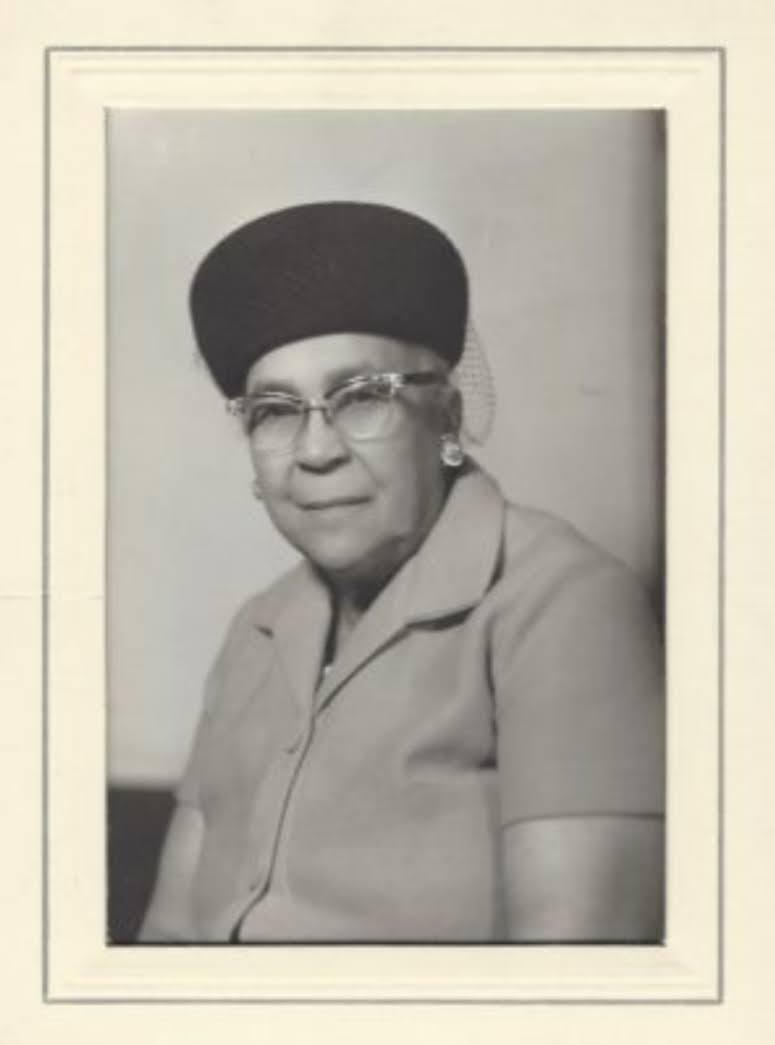
    <title type="html"><![CDATA[Mignon Richmond: First Black Woman College Graduate in Utah]]></title>
    <summary type="html"><![CDATA[<p><strong><em><span style="font-weight:400;">In 1921 Mignon Barker Richmond became the first African American woman to graduate from college in Utah and went on to become a community organizer and civil rights activist.</span></em></strong></p><img src="https://www.intermountainhistories.org/files/fullsize/8b40389c2ee054bc94fe17722f9e1b3b.jpg" alt="Mignon Barker Richmond" /><br/><p><span style="font-weight:400;">Mignon Barker Richmond was born on April 1, 1897 in Salt Lake City to William Barker and Mary Alice Reagan Barker. She attended Utah Agricultural College, now known as Utah State University, in Logan, Utah, graduating in 1921 with a degree in home economics. She persisted in spite of gross racism from her professors and peers, and participated in the Empyrean Club, a group of women that discussed contemporary problems and events, becoming its secretary-treasurer in her senior year. Following graduation, she faced difficulties finding a job in her field of study due to racial discrimination, and only after 27 years was she able to obtain work in her field of study, working first as a laboratory technician, and later as a school lunch supervisor at the University of Utah Stewart School from 1948 to 1953, and was afterwards hired to start home-living classes for the Utah State Industrial School. </span>
<span style="font-weight:400;">During this period she was active in the National Association for the Advancement of Colored People (NAACP) and the Young Women’s Christian Association (YWCA), and in 1957 she became the YWCA Food Services Director in Salt Lake City, where she stayed until her retirement in 1962 at the age of 65. Later, during president Lyndon Johnson’s administration, she became the head of the Women’s Job Corps and chairwoman of Project Medicare Alert. During her work with the Salt Lake chapter of the NAACP, she co founded the Nettie Gregory Center, a venue for minority youth to be involved in recreation in Salt Lake City, as well as on boards for the Utah Community Service Council and the Women’s Legislative Council, where she helped create legislation to fight poverty. After receiving several awards for her community service and commitment to education and civil rights, she died at the age of 86 on March 10, 1984. Many organizations including the Salt Lake Branch NAACP, Trinity AME Church, and Calvary Baptist Church came together to dedicate Richmond Park in Salt Lake City in 1984, and commissioned a plaque describing Mignon Barker Richmond as an educator, civil leader, and humanitarian.</span></p><p><em><strong><a href="https://www.intermountainhistories.org/items/show/874">For more (including 3 images) view the original article</a></strong></em></p>]]></summary>
    <published>2024-11-02T22:24:37+00:00</published>
    <updated>2026-04-17T19:32:20+00:00</updated>
    <link rel="alternate" type="text/html" href="https://www.intermountainhistories.org/items/show/874"/>
    <id>https://www.intermountainhistories.org/items/show/874</id>
    <author>
      <name>Morgon George, Utah State University</name>
    </author>
  </entry>
  <entry>
    <title type="html"><![CDATA[Title IX and Women’s Athletics at Utah State University]]></title>
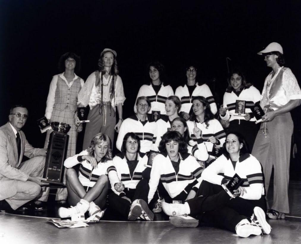
    <summary type="html"><![CDATA[<p><strong><em>Women’s athletics at Utah State University have come a long way since the passing of Title IX in 1972. Athletic Director Marilyn Weiss worked hard to gain more resources for female athletes. During her time at Utah State, three women’s athletic teams won national championship titles. She helped to lay the foundation for the long-term success of women’s athletics at USU.</em></strong></p><img src="https://www.intermountainhistories.org/files/fullsize/db7904d3f034ebce2d2e9c00c65de8d7.jpg" alt="1978 Women&#039;s Volleyball Team at Utah State University" /><br/><p><span style="font-weight:400;">Women have been involved in athletics since the early days of Utah State University. As early as 1901, USU boasted an organized softball team and hosted basketball tournaments. Due to a lack of funding, however, women’s athletics stayed local and small. This began to change after Title IX became law on June 23, 1972. The law prohibited sex-based discrimination in any institution that receives federal funding. Initially created to encourage more women to pursue higher education, today the law is mostly associated with college and high school athletics and promoting equality between men’s and women's sports. </span></p><p><span style="font-weight:400;">Title IX changed the college landscape, in the classroom and on the court. Schools were required to give women more support and resources. Before Title IX, women’s athletics didn’t offer athletic scholarships. As of 2021, there are 74,173 athletic scholarships available to women compared to 77,784 available to men.</span>
<span style="font-weight:400;">Marilyn Weiss was the USU Athletics Director for Women’s sports from 1975 to 1981. Under her leadership, Utah State formed its first volleyball team in 1976. Weiss served as the USU’s women’s basketball coach, volleyball coach, and track coach during her tenure with the university, and knew that not much had changed at USU after the passage of Title IX. She was determined to change that. In 1976, Weiss hired Mary Jo Peppler and Marilyn McReavy, both former Olympians, as co-head coaches of the volleyball team. They recruited strongly from across the country to bring great talent to USU. </span>
<span style="font-weight:400;">Weiss knew that the women’s programs would have to operate under a very tight budget, but she was determined to succeed. If the Aggies wanted to compete against the top teams in the country, they had to get to the West Coast. In the off-season, the team traveled in a fifth-wheel trailer to southern California to challenge powerhouse teams like USC and UCLA. Although the budget was small, the coaches and athletic director made it work and their efforts paid off. The USU Volleyball team became National Champions in 1978, winning the Association for Intercollegiate Athletics for Women (AIAW) volleyball championship. They were runner-up the following season. During Weiss’s time at USU, the softball team also won two national titles in 1980 and 1981. </span>
<span style="font-weight:400;">Weiss filed a Title IX complaint against the university a few years before she left. Although USU saw success while she was here, she knew womens’ athletics were still being underfunded. Marilyn Weiss and the coaches and players laid a foundation to move women’s athletics forward at Utah State University. As of 2024, USU has 8 women's varsity teams and over 180 women rostered. USU offered $3,106,721.54 in scholarships to female athletes in 2024, among 149 athletes.</span></p><p><em><strong><a href="https://www.intermountainhistories.org/items/show/873">For more (including 5 images) view the original article</a></strong></em></p>]]></summary>
    <published>2024-11-02T17:31:25+00:00</published>
    <updated>2026-04-17T19:32:19+00:00</updated>
    <link rel="alternate" type="text/html" href="https://www.intermountainhistories.org/items/show/873"/>
    <id>https://www.intermountainhistories.org/items/show/873</id>
    <author>
      <name>Hadli Lords, Utah State University</name>
    </author>
  </entry>
  <entry>
    <title type="html"><![CDATA[Bessie Morehead: The Fight for a Spot ]]></title>
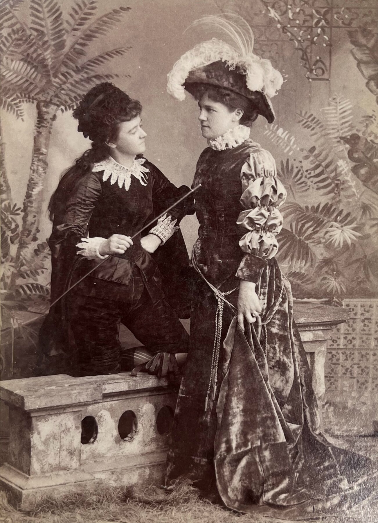
    <summary type="html"><![CDATA[<p><strong><em>Bessie Morehead, a well-known singer in Cache Valley, defeated her opponent Charles Hyde to become the first female County Recorder in Cache County, Utah.</em></strong></p><img src="https://www.intermountainhistories.org/files/fullsize/a689c8c32b896bc5645f616e6b0df0a9.jpg" alt="Actresses Bessie Morehead and Maggie Sloan in theatrical costume for &quot;The Three Mantles&quot;" /><br/><p>In 1896 Utah became a state and women were allowed to run for public office. In that year 14 women won public office in Utah: one to the U.S. Senate, two to the state House of Representatives, and eleven to county offices, including Bessie Morehead. Morehead was born in Smithfield, Utah in 1867 and became a well known Logan citizen. She was a talented singer and performed in the Logan Opera Company. She was seen as one of Utah’s “best and favorite vocalists.” </p><p>She decided to run for the Cache County Recorder in 1896. This was a highly respected and honorable position to hold. Democrats nominated Morehead instead of the incumbent Charles Hyde. Many Democrats at the time were excited for women to participate in public office and wanted to give Morehead a chance. Hyde decided to switch to the Republican party to run against her. When Hyde came to the Democratic Convention, Morehead kicked him out. He then came at her with a knife but luckily nothing happened. </p><p>The fight didn’t stop there. Her LDS stake president casted doubt on Morehead as a candidate. He implied that Charles Hyde was a more religious member than she was. One editor for the Logan Journal defended her and said she was just as faithful. Amongst all this opposition. Morehead still won the election. She received 3,174 votes and Hyde received 1,840. After the election Hyde said the “Democratic party of Cache County is corrupt”. Only to receive backlash from the newspaper asking why he sought the Democratic nomination for recorder in the first place if it was corrupt. </p><p>Bessie Morehead served two terms from 1897-98 and 1899-1900. Morehead and 13 other Women in Utah made history. Bessie Morehead became the first woman in Cache County to hold public office. </p><p><em><strong><a href="https://www.intermountainhistories.org/items/show/861">For more (including 4 images) view the original article</a></strong></em></p>]]></summary>
    <published>2024-10-18T05:49:35+00:00</published>
    <updated>2026-04-17T19:32:19+00:00</updated>
    <link rel="alternate" type="text/html" href="https://www.intermountainhistories.org/items/show/861"/>
    <id>https://www.intermountainhistories.org/items/show/861</id>
    <author>
      <name> Samantha H. Crockett, Utah State University</name>
    </author>
  </entry>
  <entry>
    <title type="html"><![CDATA[The Logan Pride House]]></title>
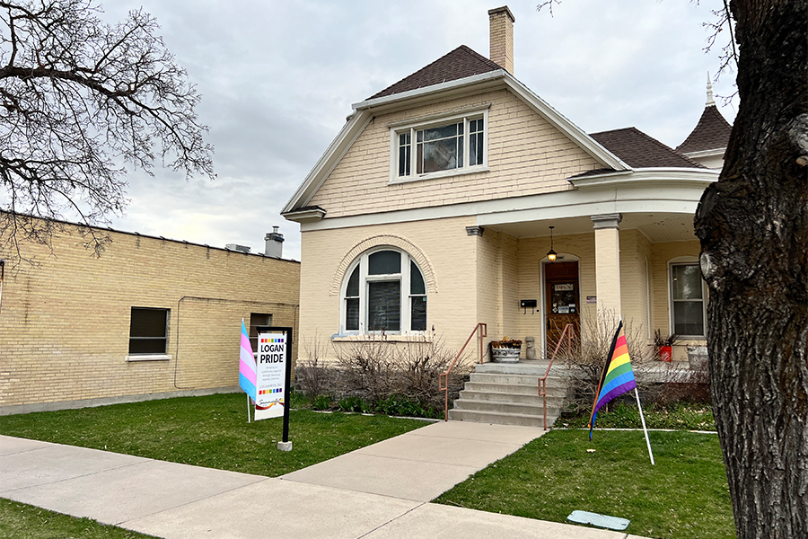
    <summary type="html"><![CDATA[<p><strong><em>Logan Pride serves as a resource and safe space for LGBTQ+ individuals in Cache, Box Elder, and Rich counties. Logan Pride operates out of a pride house in Downtown Logan, UT.</em></strong></p><img src="https://www.intermountainhistories.org/files/fullsize/5ca0800f25493c527cc973cb2f94eb22.jpg" alt="The Logan Pride House" /><br/><p><span style="font-weight:400;">The Logan Pride House is the home of Logan Pride–a foundation focused on serving adults in Cache, Box Elder, and Rich counties. Logan Pride is a safe space for LGBTQ+ individuals and allies located in downtown Logan, UT.</span>
<span style="font-weight:400;">Logan Pride operates off a board of volunteers who are passionate about fostering a safe, queer space in Cache Valley. The organization holds events almost every day. These events range from coffee and cocoa to support groups for various sexuality and gender identities. Logan Pride strives to serve as a safe space for queer people and allies to gather and become friends. Logan Pride also has shelves upon shelves of queer literature, both fiction and non-fiction that is available for community members to borrow and read.</span>
<span style="font-weight:400;">Not only does Logan Pride do activities several nights a week, they also host the annual Logan Pride Festival. The event has been running since 2016 and has grown bigger and bigger each year. In 2023, the pride festival had over 3,000 attendees and more than 85 vendors. It started as a way to show community and raise awareness that there is a space for queer people in Cache Valley. The Logan Pride festival is only possible because of the donations and volunteer hours given to Logan Pride. </span>
<span style="font-weight:400;">President of the Logan Pride Foundation, Mel Payne, stated “Whenever I hear these sad stories in the house, majority of the time it is because they haven’t had anybody show up for them… They haven’t had anybody reach out a hand when they’re feeling a certain way.” Logan Pride stands to be a support system for these individuals the most. Individuals who need friends that have similar experiences. Logan Pride serves as a safe space for people to be their authentic selves. </span>
<span style="font-weight:400;">For more information about Logan Pride, and a schedule of their events – visit their website: </span><a href="https://www.loganpride.org/"><span style="font-weight:400;">https://www.loganpride.org/</span></a><span style="font-weight:400;">. </span></p><p><em><strong><a href="https://www.intermountainhistories.org/items/show/859">For more (including 3 images) view the original article</a></strong></em></p>]]></summary>
    <published>2024-10-16T20:50:54+00:00</published>
    <updated>2026-04-17T19:32:19+00:00</updated>
    <link rel="alternate" type="text/html" href="https://www.intermountainhistories.org/items/show/859"/>
    <id>https://www.intermountainhistories.org/items/show/859</id>
    <author>
      <name>Cooper Sanders, Utah State University</name>
    </author>
  </entry>
  <entry>
    <title type="html"><![CDATA[Parowan Gap Petroglyphs]]></title>
    <summary type="html"><![CDATA[<img src="https://www.intermountainhistories.org/files/fullsize/ae788130d6314850832eb9fc11464fb9.jpg" alt="Ancient carvings were made by Natives passing through Parowan Gap" /><br/><p>Over a thousand years ago, Fremont Indians inhabited southern Utah in an area known as the Parowan Gap. Once a flowing river, the Parowan Gap dried out over time. Erosion by wind and rain have further shaped this 600 foot deep notch or pass used by Natives and newcomers to traverse the Red Hills, a low range of mountains that forms the western border of the Parowan Valley. Hopis, Utes, and Paiutes used this area to travel back and forth to obtain resources and mingle with one another. </p><p>About 13 miles west of Parowan are the famous petroglyphs, carved or pecked into the sedimentary rock walls of this historic landmark. Petroglyphs depict images of people, animals and different lines and shapes, although the meaning of some of the depictions remains a mystery. Images of humans, snakes, mountain sheep, and lizards fill the wall panels. Archaeologists believe the gallery represents rock art extending over a thousand years. Some researchers postulate the wall was used for religious purposes and others contend the engravings represent a hunting ritual. One petroglyph depicts a calendrical system indicating when to plant and harvest crops. Zipper Glyph, the most famous petroglyph, depicts the route Paiutes traveled and indicates how long their journey through the gap might take. </p><p>The petroglyphs at Parowan Gap are fragile and can be ruined by human touch or by trying to chalk over them. Enjoy them at a distance by taking a photo or sketching them yourself. Everyone shares a responsibility to help preserve archaeological and historically significant sites.</p><p><em><strong><a href="https://www.intermountainhistories.org/items/show/857">For more (including 3 images) view the original article</a></strong></em></p>]]></summary>
    <published>2024-09-25T20:44:31+00:00</published>
    <updated>2026-04-17T19:32:19+00:00</updated>
    <link rel="alternate" type="text/html" href="https://www.intermountainhistories.org/items/show/857"/>
    <id>https://www.intermountainhistories.org/items/show/857</id>
    <author>
      <name>Samantha Worthington, Brigham Young University</name>
    </author>
  </entry>
  <entry>
    <title type="html"><![CDATA[The Nephi Massacre during Wakara’s War<br />
]]></title>
    <summary type="html"><![CDATA[<p><strong><em>During Wakara’s War in 1853-54 a group of Utes killed four Mormons at Fountain Green.  The next day, Mormons killed eight Utes or Goshutes seeking peace with LDS settlers in Nephi, Utah. The discovery of their remains in Nephi’s Old Hallow in 2006 highlighted the brutality of Wakara’s War, a series of conflicts during 1853 between settlers and Indigenous residents in central Utah Territory.</em></strong></p><img src="https://www.intermountainhistories.org/files/fullsize/fafd241883d271d8b9793e3097ca8da1.jpg" alt="Nephi, Utah" /><br/><p>In 2006, an archaeological discovery in Nephi, Utah, shed light on a tragic event that occurred in 1853 during the Walker War, also known as the Wakara War. The excavation revealed a mass grave containing the remains of seven Goshutes, including a young boy. The bodies were found piled on top of each other. Forensic analysis discovered gunshot wounds, shattered bones, and evidence of blunt force trauma.</p><p>The Wakara War between settlers and Utes was infuriated by the encroachment of additional LDS settlements in Utah and Sanpete counties in Utah Territory. The incident in Nephi occurred on October 2, 1853, when a group of Utes or Goshutes came to the fort. The account reported in the Deseret News portrayed the Natives as aggressors in a tussle they initiated with the militia. Recent research, including the discovery of journals of witnesses Adelia Wilcox and Martha Spence Heywood, however, contradict this narrative.</p><p>The forensic evidence from the mass grave suggests that the Native men, ranging in ages from 16 to 25, were not killed in a skirmish but were executed. Gunshot wounds in the back of the head and traumatic injuries indicate a cold-blooded killing, challenging the original historical account. The discovery of the mass grave by construction workers laying a foundation for a home in 2006 provided an opportunity to combine scientific discovery, archaeology and forensic analysis, and historical records to correct and update the historical narrative and include the perspectives of those killed. The story of the Nephi mass grave is a significant reminder of the complexities surrounding historical narratives and how archaeological revelations can amend those stories.</p><p><em><strong><a href="https://www.intermountainhistories.org/items/show/856">For more (including 3 images) view the original article</a></strong></em></p>]]></summary>
    <published>2024-09-25T15:00:26+00:00</published>
    <updated>2026-04-17T19:32:19+00:00</updated>
    <link rel="alternate" type="text/html" href="https://www.intermountainhistories.org/items/show/856"/>
    <id>https://www.intermountainhistories.org/items/show/856</id>
    <author>
      <name>Chelsea Woodruff, Brigham Young University</name>
    </author>
  </entry>
  <entry>
    <title type="html"><![CDATA[Indigenous Inhabitants of Antelope Island ]]></title>
    <summary type="html"><![CDATA[<p><strong><em>The history of Indigenous interactions with Antelope Island, as documented through oral histories, artifacts, and written accounts, reveals a rich and diverse relationship over thousands of years.</em></strong></p><img src="https://www.intermountainhistories.org/files/fullsize/9ab62dc8307a1a682b90b16c59114809.jpg" alt="Antelope Island Great Salt Lake State Park " /><br/><p>Antelope Island holds great historical and geographical significance to the current and previous inhabitants of the Great Salt Lake, whose water levels rose and fell repeatedly. The interactions and ties between Natives and the Island are deeply embedded in the island’s history, encompassing exploration, resource utilization, cultural exchanges, and adaptation over millennia. </p><p><strong>Paleo, Archaic, and Fremont Peoples:</strong> </p><p>The earliest residents of Antelope Island, Paleo peoples, are estimated to have arrived in the region over 12,000 years ago. Like more recent Indigenous peoples, First peoples found the area accommodating for hunting, gathering, fishing, and insect roasting. These shoreline populations resided in caves, bush dwellings, or shelters constructed with nearby natural resources. Shoreline peoples hunted geese and rabbits and gathered berries, roots, and seeds along the Great Salt Lake’s shoreline. As climate changes occurred, island inhabitants adapted. The transition from Paleo-Indians to Archaic peoples (roughly 8000 B.C.E.) and later to the Fremont (300 B.C.E.) is evident, with each group utilizing the island’s resources differently. Archaic peoples used fine-pointed spears to hunt megafauna, big game, smaller mammals, rodents, and birds. About 2,000 years ago, the Fremont practiced many of the same food gathering techniques as their predecessors, but also farmed corn and traded with the southern Ancestral Puebloans. Around 1100 A.D., immigrants from southern California entered the scene and marked the end of the Salt Lake Fremont era, transitioning into occupation by the Numic speaking peoples including the Shoshones, Utes, and Goshutes. </p><p><strong>Nineteenth century:</p> </p><p>Explorers John C. Fremont and Kit Carson arrived at Antelope Island in 1845 and recorded some of their first impressions of the island and its wildlife. One of their most notable discoveries was Native encampments on the island. Numic-speaking peoples frequented the island. According to one account, Fremont consulted Utes residing in the area regarding the nature of the island before he and Carson explored it. The Utes said the party could easily reach the island on horseback. The explorers described their trip across the shallows to the island. The water never rose above their saddle girths. They described the lake floor as a sheet of salt resembling softening ice, into which the horses’ feet sank to their fetlocks. A variety of wildlife species lives on Antelope Island, including antelope. Fremont and his men killed an antelope for sustenance in the 18. After returning from the island, a Native man informed Fremont’s party that the antelope they had killed was one from his herd of antelope. To avoid any tension or conflict, Fremont gave the man cloth, tobacco, and a knife in exchange for their venison dinner. Ongoing Research and </p><p><strong>Conservation:</strong> </p><p>Contemporary archaeological efforts continue to survey and excavate Antelope Island, aiming to uncover prehistoric cultural sites. Discoveries, such as ancient spear points and metates, contribute to our understanding of the island’s long Indigenous occupation. Biologists monitor archaeological findings to identify native species for potential reintroduction to the island. The water level of the Great Salt Lake surrounding Antelope Island fluctuates up and down. On September 30, 2023, Native representatives from various tribes came together to offer a ceremonial blessing of healing. Former tribal chairman of the Northwest Band of Shoshones Darren Parry, Paiute Tribe of Utah Chairwoman Corrina Bow, and members of the Kanosh band participated in the event.</p><p><em><strong><a href="https://www.intermountainhistories.org/items/show/854">For more (including 4 images) view the original article</a></strong></em></p>]]></summary>
    <published>2024-09-25T03:39:42+00:00</published>
    <updated>2026-04-17T19:32:19+00:00</updated>
    <link rel="alternate" type="text/html" href="https://www.intermountainhistories.org/items/show/854"/>
    <id>https://www.intermountainhistories.org/items/show/854</id>
    <author>
      <name>Ethan Cornelius, Brigham Young University</name>
    </author>
  </entry>
  <entry>
    <title type="html"><![CDATA[Bryce Canyon Lodge and Deluxe Cabins - Bryce Canyon National Park]]></title>
    <summary type="html"><![CDATA[<p><strong><em><span style="font-weight:400;">In 1923, the Union Pacific Railroad created the Utah Parks Company, which connected its rail line to attractions such as Zion National Park and the North Rim of Grand Canyon National Park. The Bryce Canyon Lodge and Deluxe Cabins linked Bryce Canyon State Park to this system of resorts in 1925. </span></em></strong></p><img src="https://www.intermountainhistories.org/files/fullsize/2d65ab73bf5bf337b81a40dba1d6d45e.jpg" alt="Bryce Canyon Lodge, c. 1929" /><br/><p><span style="font-weight:400;">In 1874, Bryce Canyon became part of a cattle ranch owned by Ebenezer Bryce. His ranch was unsuccessful, but automobile tourism revitalized the area when passable roads reached what is now Zion National Park in 1917. In 1921, Utah’s state legislature accepted a proposition from Park Service director Stephen Mather that protected Bryce Canyon as a state park. Utah made no attempt to develop the area for public use, but the Union Pacific Railroad spurred development in Bryce Canyon by creating the Utah Parks Company in 1923. This connected the Union Pacific’s Cedar City spur line to Bryce Canyon, the North Rim of Grand Canyon National Park, and Zion via bus lines. By establishing a network of parks and resorts, the Union Pacific aimed to compete with other successful railroad companies such as the Northern Pacific, Atchison-Topeka Santa Fe, and Great Northern. These companies had established successful tourist attractions at the South Rim of Grand Canyon, Yellowstone National Park, and Glacier National Park. As tourism brought in profit, road construction improved access to rural points of interest like Bryce Canyon. In 1924, Congress established Utah National Park, and the Utah Parks Company constructed Bryce Canyon Lodge and Deluxe Cabins in the same year to provide visitors with accommodations. Congress enlarged Utah National Park and renamed it Bryce Canyon in 1928. </span>
<span style="font-weight:400;">The Utah Parks Company enlisted Gilbert Stanley Underwood, one of the Union Pacific’s consulting architects, to design Bryce Canyon Lodge. Underwood’s designs are notable for their commitment to rustic architecture, which used natural materials and textures to blend a building with its natural surroundings. He utilized locally quarried stone and large, exposed wooden details throughout the structure, figuratively connecting the building to its location. After the company completed the original building in 1925, it added two new wings in 1926 to make room for an increasing number of visitors. The Utah Parks Company constructed fifteen deluxe guest cabins the following year in a pine grove near the main structure. Their design used rough stone and natural wood to imitate the design of Bryce Canyon Lodge. </span>
<span style="font-weight:400;">During the 1950s, the National Park Service renovated Bryce Canyon Lodge to make room for updated amenities. The hotel originally housed a barber shop, but the Park Service replaced it with a soda fountain. The Park Service also enlarged a road at the hotel’s front entrance to make room for larger vehicles, but the Park service expanded a plaza outside Bryce Canyon Lodge’s front entrance by removing the original bus lane in 1989. In 1985, the Park Service removed sixty-one of the lodge’s original sixty-seven standard cabins. The Sunrise Motel and Sunset Motel replaced them. In 1995, the National Register of Historic Places officially listed forty-two buildings in Bryce Canyon, including Bryce Canyon Lodge. This restricted future renovations, allowing the complex to retain most of its architectural significance. Today, Bryce Canyon Lodge operates as a historic hotel alongside five standard cabins and fifteen deluxe cabins. </span></p><p><em><strong><a href="https://www.intermountainhistories.org/items/show/843">For more (including 5 images) view the original article</a></strong></em></p>]]></summary>
    <published>2024-05-29T21:42:39+00:00</published>
    <updated>2026-04-17T19:32:19+00:00</updated>
    <link rel="alternate" type="text/html" href="https://www.intermountainhistories.org/items/show/843"/>
    <id>https://www.intermountainhistories.org/items/show/843</id>
    <author>
      <name>Kaylen Wilson, Northern Arizona University </name>
    </author>
  </entry>
  <entry>
    <title type="html"><![CDATA[The Round River Rendezvous in Moab 1980]]></title>
    <summary type="html"><![CDATA[<p><strong><em><span style="font-weight:400;">A newly formed environmental group, </span><span style="font-weight:400;">Earth First</span><span style="font-weight:400;">!, gathered for an annual rendezvous to celebrate and discuss action. Over the decades, the rendezvous became a source of political contention and factionalism.</span></em></strong></p><img src="https://www.intermountainhistories.org/files/fullsize/292b61ee5e90862f570d244c7c58b800.jpg" alt="Earth First logo" /><br/><p><span style="font-weight:400;">In 1980, environmental activists in the Southwest founded Earth First! as a form of radical activism. The group emerged in part as a reaction to dissatisfaction with efforts by mainstream environmental groups, such as the Sierra Club. Earth First! cofounder Dave Foreman emerged as a spokesperson. Foreman had previously worked as an environmental lobbyist, but became disillusioned with what he saw as an ineffective approach. In the </span><span style="font-weight:400;">Earth First</span><span style="font-weight:400;">! Statement of Principles, Foreman wrote that there could be no political compromise in defense of Earth and that all decisions should put Earth first before humankind. The group argued that illegal tactics were warranted, since they viewed democratic processes as having been corrupted by corporate interests. Earth First! prioritized direct action over formal political doctrine, which contributed to a diverse membership with often conflicting ideologies. Direct action entailed taking environmental protection into their own hands, rather than relying on political processes. They took inspiration from Edward Abbey’s writing in </span><i><span style="font-weight:400;">The Monkey Wrench Gang, </span></i><span style="font-weight:400;">in which a fictional group sabotages environmental development that they considered destruction of the Southwest. Ecosabotage and “monkeywrenching” are referenced throughout Earth First! literature.</span>
<span style="font-weight:400;">Earth First! began hosting the Round River Rendezvous in 1980, an annual meeting for members. The name of the meeting, according to urban legend, comes from an Ojibwe myth about a continuous river of life. They held the first rendezvous near Moab, Utah. Each year, the location of the annual meeting shifts to different locations throughout the West. According to the </span><i><span style="font-weight:400;">Earth First! Journal</span></i><span style="font-weight:400;">, the rendezvous sites are chosen based on remoteness, natural beauty, and proximity to a site being threatened with development. In 1980, the rendezvous coincided with plans by Utah’s Grand County Commission to send a bulldozer into a Bureau of Land Management Wilderness Study Area near Moab.</span>
<span style="font-weight:400;">The rendezvous served as an opportunity for community and celebration, as well as a site to discuss conservation issues and plan direct action. The rendezvous featured activist workshops, music and poetry, and demonstrations. The </span><i><span style="font-weight:400;">EF Journal</span></i><span style="font-weight:400;"> also encouraged wilderness exploration, such as hiking in the area. By the end of the decade, the togetherness of the Round River Rendezvous shifted into a venue for intense factionalism. The group became divided on a number of issues, most significantly regarding the push towards increasingly extremist direct action including using illegal and violent means to protect the environment.  Other debates focused on racism, sexism within the group, and advocacy for animals. The 1987 rendezvous at the Grand Canyon was marked by especially harsh division between new leftist or anarchist members and older members of the group, including intense criticism of attendee Edward Abbey. By this point, Dave Foreman and other co-founders began to distance themselves from the group, as they became concerned with the new trajectory. </span>
<span style="font-weight:400;">The Round River Rendezvous today still serves as an opportunity for environmentalists to gather in celebration. </span><span style="font-weight:400;">The Earth First</span><span style="font-weight:400;">! agenda has become more inclusive and diversified since the early years, and no longer focused on the environment as their sole issue.</span></p><p><em><strong><a href="https://www.intermountainhistories.org/items/show/834">For more (including 3 images) view the original article</a></strong></em></p>]]></summary>
    <published>2024-05-27T14:58:20+00:00</published>
    <updated>2026-04-17T19:32:18+00:00</updated>
    <link rel="alternate" type="text/html" href="https://www.intermountainhistories.org/items/show/834"/>
    <id>https://www.intermountainhistories.org/items/show/834</id>
    <author>
      <name>Emily Roth, Northern Arizona University</name>
    </author>
  </entry>
</feed>