<?xml version="1.0" encoding="UTF-8"?>
<feed xmlns="http://www.w3.org/2005/Atom">
  <title type="text">Intermountain Histories</title>
  <updated>2026-04-17T19:32:18+00:00</updated>
  <generator uri="http://framework.zend.com" version="1.12.20">Zend_Feed_Writer</generator>
  <link rel="alternate" type="text/html" href="https://www.intermountainhistories.org/"/>
  <link rel="self" type="application/atom+xml" href="https://www.intermountainhistories.org/items/browse?output=rss2"/>
  <id>https://www.intermountainhistories.org/</id>
  <author>
    <name>Intermountain Histories</name>
    <uri>https://www.intermountainhistories.org</uri>
  </author>
  <link rel="hub" href="https://pubsubhubbub.appspot.com/"/>
  <entry>
    <title type="html"><![CDATA[Holbrook Hauntings]]></title>
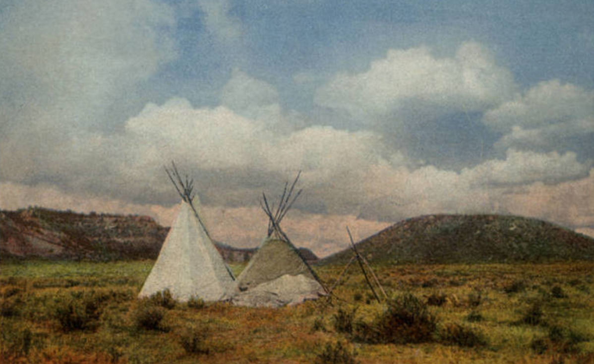
    <summary type="html"><![CDATA[<p><strong><em><span style="font-weight:400;">Once a dangerous and gritty “Wild West” town, Holbrook has survived against all odds and exists as a remnant of old roadside Americana.</span></em></strong></p><img src="https://www.intermountainhistories.org/files/fullsize/a24896a4baf9a1bbccb5cc8faa456ec3.jpg" alt="Wigwam Motel in Holbrook, Arizona" /><br/><p><span style="font-weight:400;">Located in the Painted Desert badlands of Arizona, Holbrook is one of the most famous towns along Route 66. While the town holds fast to its historic roots, it is still very much alive with a population of 4,854 in 2022. One of the biggest draws to Holbrook is its position as the gateway to the Petrified Forest National Park. Another popular attraction is the Wigwam Motel, sometimes referred to as “The Wigwam Village,” which opened in 1950. The motel consists of fifteen concrete dwellings, designed in the style of traditional Native American huts. Old diners, “Wild West” style saloons, and a historical society museum also point visitors to the storied past. The town was named after Henry Holbrook, who, as the chief engineer for the Atlantic Pacific Railroad, played a crucial role in Westward Expansion.</span>
<span style="font-weight:400;">Holbrook once described the town as, “too tough for women and churches.” In the early years, around its founding in 1888, there was little order or consequence to breaking the law. Outlaws from Texas and other surrounding territories often started new lives in Holbrook and surrounding towns, finding freedom from past charges and wreaking havoc on less developed and surveyed communities. Violent crime was common in Holbrook, especially gun-fights and theft, as people decided to take justice into their own hands. One of the most famous feuds in the region, the Pleasant Valley War, involved the Hashknife Cowboys of Holbrook–a group of men who worked for the Aztec Land and Cattle Company. In response to all of the disorder, the Navajo County Courthouse–which included a basement prison–was built in 1899. Some people claim that the old prison cells and Sheriff’s office in the basement are haunted, which is not the first claim of a supernatural element to the area. </span>
<span style="font-weight:400;">As the only national park encompassing a part of Route 66, the Petrified Forest has its fair share of lore. The land has long attracted visitors, curious about and entranced by the abundance of petrified wood. This natural phenomena occurs when minerals, like quartz,  invade the cavities in a piece of wood–the reaction giving the wood a colorful marble-like appearance. In the mid-1800s travelers would pile as many pieces of petrified wood as would fit in their wagons and automobiles. It became common practice for anyone who passed through to take home a piece of petrified wood. The Petrified Forest was declared a national monument in 1906 and then a national park in 1962, both of which made it illegal to take anything from the land. Still, many disregarded the law and continued to steal chunks of petrified wood. Several accounts of freak accidents and misfortune falling upon the thieves fueled the legend that the forest was cursed. The park began to receive packages and letters of confession, apologizing and begging park rangers to return what they had stolen in an attempt to “undo the curse.” </span>
<span style="font-weight:400;">One of the last Route 66 towns to get bypassed by Interstate 40, the community of Holbrook is nothing if not resilient. There were a decent amount of stubborn business owners and residents who stayed despite the rapid decline in population and tourism. Nothing if not resilient, Holbrook survived the gas shortage of the World War II years and rose from the ashes once again after Route 66 was stripped of its status as the great American highway. Holbrook carries on as a popular stop for its old school charm and novelty. </span></p><p><em><strong><a href="https://www.intermountainhistories.org/items/show/807">For more (including 5 images) view the original article</a></strong></em></p>]]></summary>
    <published>2024-05-16T02:20:42+00:00</published>
    <updated>2026-04-17T19:32:18+00:00</updated>
    <link rel="alternate" type="text/html" href="https://www.intermountainhistories.org/items/show/807"/>
    <id>https://www.intermountainhistories.org/items/show/807</id>
    <author>
      <name>Megan Bailey, Brigham Young University</name>
    </author>
  </entry>
  <entry>
    <title type="html"><![CDATA[Boom and Bust in Bodie, CA]]></title>
    <summary type="html"><![CDATA[<p><strong><em><span style="font-weight:400;">Once among the largest and most prosperous towns in California, Bodie is now defined by the ghost of its past in the form of abandoned objects, peeling wallpaper, and half-destroyed buildings. </span></em></strong></p><img src="https://www.intermountainhistories.org/files/fullsize/24dc4420a11bbf404db7f58bf5daf143.jpg" alt="Old buildings in Bodie, California" /><br/><p><span style="font-weight:400;">In the summer of 1859, W. Bodey found rich gold deposits in California, seven miles west of the Nevada border. He had traveled from Poughkeepsie, New York, in pursuit of an adventure, and his discovery would lead to the town of Bodie and surrounding hills being named in his honor. His name is something of a mystery today; there are reports that refer to him as William, Waterman, and Wakeman, his second initial as either “T” or “S,” and his last name occasionally spelled as Body rather than Bodey. As for the spelling of the town’s name, the “ie” ending was initially the result of a confused sign painter, and it just stuck. </span>
<span style="font-weight:400;">Bodey’s ambition to find more for himself in life fueled both his success and his downfall. He was one of the first to discover gold in eastern California and managed to survive the dire circumstances of early prospecting life through the first change of seasons. It wasn't the work in the mines during the summer that killed him, but the harsh winter that followed. In November 1859 Bodey and his traveling companion left camp to get supplies. They were caught in a blizzard, and Bodey–unable to keep up with his companion–was left to die. His remains were recovered and now lie beneath two headstones: one that reads “Waterman S. Bodey” with an engraved image of miners panning gold from a stream against a backdrop of mountains; and another, much smaller with the name “William S. Bodey.”</span>
<span style="font-weight:400;">In the years following his death, the town of Bodie was brought to life by other ambitious miners and their families, bringing the town’s population to 10,000 in 1879. With so many people arriving in such a short period of time, most of them lived in tents–even after the town became more established. In 1881 the Bodie and Benton Railway was built and used to haul lumber and other goods from the Bodie mines to the saw mill by Mono Lake. Bodie was becoming a prosperous center for work. It served some twenty-two gold and silver mines in the region with a stamp mill for processing ore and plenty of businesses in town. Saloons dominated, but there was also a mercantile, several general stores, motels, gambling and dancing halls, schools, stables, and both a Catholic and a Methodist church. </span>
<span style="font-weight:400;">Like its namesake, the town is no stranger to tragedy and risk. Two accidental fires–one from a kitchen in 1892 and another started by a child in 1932–caused the destruction of several main street buildings, and led to economic hardship. Combined with the sundry difficulties of the Great Depression, the town failed to recover. It joined the arid region’s long list of ghost towns. Weather conditions in the mountains are still just as treacherous as they were in W. Bodey’s fateful last days. Travel to Bodie during winter months is only possible by way of skis, snowshoes, or snowmobiles. </span>
<span style="font-weight:400;">In an attempt to preserve the historic elements of the town, Bodie was made an official California State Park in 1962. Only five percent of what once made up the booming town of Bodie is thought to have survived, and today its ghost-like remains sit virtually untouched in tattered buildings and houses. </span></p><p><em><strong><a href="https://www.intermountainhistories.org/items/show/806">For more (including 6 images) view the original article</a></strong></em></p>]]></summary>
    <published>2024-05-16T02:01:48+00:00</published>
    <updated>2026-04-17T19:32:18+00:00</updated>
    <link rel="alternate" type="text/html" href="https://www.intermountainhistories.org/items/show/806"/>
    <id>https://www.intermountainhistories.org/items/show/806</id>
    <author>
      <name>Megan Bailey, Brigham Young University</name>
    </author>
  </entry>
  <entry>
    <title type="html"><![CDATA[ Mountains, Mining, and Massacre: The History of Oatman, Arizona]]></title>
    <summary type="html"><![CDATA[<p><strong><em><span style="font-weight:400;">Free-roaming donkeys, an old mining district, a stop on Route 66, and ties to a famous kidnapping make up the storied past of this semi-abandoned town.</span></em></strong></p><img src="https://www.intermountainhistories.org/files/fullsize/d34d919e9df93dc8bb5d0f3e2ba0cc1d.jpg" alt="Oatman, Arizona circa 1930." /><br/><p><span style="font-weight:400;">Tucked away in the Black Mountains of Mohave County, Arizona is a community rich with legend. The town was named for Olive Oatman and her family who were victims of the Oatman Massacre in 1851, and it came to life in the following decades as prospectors discovered gold, ore, and other valuable resources in the land. Oatman is home to the three most prosperous gold mines in Arizona: the Gold Road, the Tom Reed, and the United Eastern. </span>
<span style="font-weight:400;">A gold prospector named John Moss was one of the first to discover gold in the area in the early 1860s, but it wasn’t until the 1900s that Oatman really boomed. A hotel and post office were built in 1902 and 1906 respectively, securing Oatman’s status as an official town. The mines brought riches and rapid growth to the community, with Tom Reed mine’s total profit reaching over nine-million by 1922 and the town’s population growing to 10,000 in the same decade.</span>
<span style="font-weight:400;">One of the oddities of Oatman is the population of wild burros (undomesticated donkeys). They were brought in by miners who used teams of them to haul supplies from out of town. Burro labor was a big part of the mining industry, but unlike the prospectors, they never picked up and left town. Billie Jo Moore, long time proprietor of the Oatman Hotel, said in an interview that, “the burros stayed behind and adapted to the desert. Now they are all over these mountains…They wander through the streets, turning over garbage cans and messing in people’s yards.” While they are little more than a nuisance to locals, tourists entertain them with attention, alfalfa pellets, and lots of pictures–burros have become iconic to the town. </span>
<span style="font-weight:400;">Oatman stitched itself into another legend of America when it became a part of Route 66. It was 1926, still bringing in plenty of spoils from the mines, and now gaining further revenue from the new highway. These were the glory days in Oatman; crime was low, employment was high, and people were optimistic about the future. While there was an occasional murder and a tendency for drunkenness in Oatman, it didn’t fall into the expected stereotype of the “wild west.” The isolation of the town, so far away from any other civilization at that time, created a tight-knit group that made new traditions together–like the annual three day long Fourth of July celebrations. When the Great Depression hit in the 1930s, the prosperity and liveliness of the community began to dwindle, and by the time Route 66 went out of commission in the 1950s it was well on its way to becoming a ghost town. Oatman has never been fully abandoned though, and it has been given new life through its performers and curious travelers. </span></p><p><em><strong><a href="https://www.intermountainhistories.org/items/show/802">For more (including 5 images) view the original article</a></strong></em></p>]]></summary>
    <published>2024-05-16T00:49:23+00:00</published>
    <updated>2026-04-17T19:32:17+00:00</updated>
    <link rel="alternate" type="text/html" href="https://www.intermountainhistories.org/items/show/802"/>
    <id>https://www.intermountainhistories.org/items/show/802</id>
    <author>
      <name>Megan Bailey, Brigham Young University</name>
    </author>
  </entry>
  <entry>
    <title type="html"><![CDATA[Apache County on Route 66]]></title>
    <summary type="html"><![CDATA[<p><strong><em><span style="font-weight:400;">The land on the Arizona-New Mexico border has a storied past–from Spanish trading routes and gutsy American cowboys to railroad tracks and the boom of a brand-new highway.</span></em></strong></p><img src="https://www.intermountainhistories.org/files/fullsize/c94d71a364203dd0571092e6433d1afa.jpg" alt="In Apache Land, Arizona" /><br/><p><span style="font-weight:400;">Apache County, which makes up the northeast region of Arizona, has been occupied since at least 800 A.D. by Ancestral Puebloans (formerly known as “Anasazi”). The first of many Spanish expeditions to the Arizona/New Mexico region lasted from 1540-1542, and began a tumultuous relationship with the indigenous population. In the following years Spanish colonists introduced new cattle to the region, and sheepherding became a popular practice for the next several hundred years. In 1864 the U.S. government issued a forced displacement of the Navajo people known as the “Long Walk.” It was a harsh and unforgiving journey that resulted in at least 500 deaths. One region exiled during the Long Walk later became known as Lupton, one of several unincorporated communities along Route 66. </span>
<span style="font-weight:400;">Famous for its scenic “painted cliffs,” brightly colored roadside shops, and appearance in the 1940 film adaptation of </span><i><span style="font-weight:400;">Grapes of Wrath</span></i><span style="font-weight:400;">, Lupton was built from a railroad settlement in 1905. The community's namesake, G.W. Lupton, was a trainmaster and owner of the first trading post in the area. In the post-war tourism boom of the early 1950s, the Yellowhorse family of the Navajo Reservation opened their own trading post. The building was painted a striking yellow with red and black painted signage advertising “The Indian Market Place: Deal with the Friendly Navajo.” Although Route 66 had given the area a new life after the railroad revolution, the construction plans for Interstate 40 bypassed Lupton. Like so many other little towns that survived only from the tourist revenue, Lupton soon slipped into obscurity. The shop fronts have not been well-preserved, and there is not much charm left to draw people in, but the sight of the painted cliffs when the sun hits them just right remains as breathtaking as it always was.</span>
<span style="font-weight:400;">Twelve miles west of Lupton and the New Mexico border another now deserted town called Houck has its own storied past. In 1877 James Houck, a horseback-riding mail carrier, established a trading post along his route which ran from Prescott, Arizona to Fort Wingate, New Mexico. The post, which was called “Houck’s Tank,” expanded into a small community which adopted Houck’s name. He lived a fairly successful life, but had a hard time staying out of trouble. He was no stranger to shoot-outs or plots of revenge–and his friendship with the Tewksbury family put him in the middle of a major feud between two ranching families. Known as the Pleasant Valley War or the Graham-Tewksbury Feud, it resulted in somewhere between thirty-five to fifty deaths. His career beyond mail delivery included sheepherding, mining, trading, and a position as the Apache County Deputy Sheriff. Yet he is memorialized now as the namesake for the once lively ghost town of Houck, Arizona.</span>
<span style="font-weight:400;">In late 1926, Route 66 made its way through Houck, attracting new visitors to what had once been nothing more than a trading post. Although becoming a part of Route 66 helped bring a more steady flow of business and traffic, Houck never quite blossomed the way other towns along the highway did. A gas station, a grocery store, a “Pancake House,” and a few other small establishments popped up, but much of it has since gone out of business and become overgrown. In 1998, long after the excitement died down, the Native American Bahá'í Institute opened as a place of worship, training, and gathering place for the Navajo reservation and surrounding communities. </span></p><p><em><strong><a href="https://www.intermountainhistories.org/items/show/800">For more (including 5 images) view the original article</a></strong></em></p>]]></summary>
    <published>2024-05-15T20:15:34+00:00</published>
    <updated>2026-04-17T19:32:17+00:00</updated>
    <link rel="alternate" type="text/html" href="https://www.intermountainhistories.org/items/show/800"/>
    <id>https://www.intermountainhistories.org/items/show/800</id>
    <author>
      <name>Megan Bailey, Brigham Young University</name>
    </author>
  </entry>
  <entry>
    <title type="html"><![CDATA[Route 66]]></title>
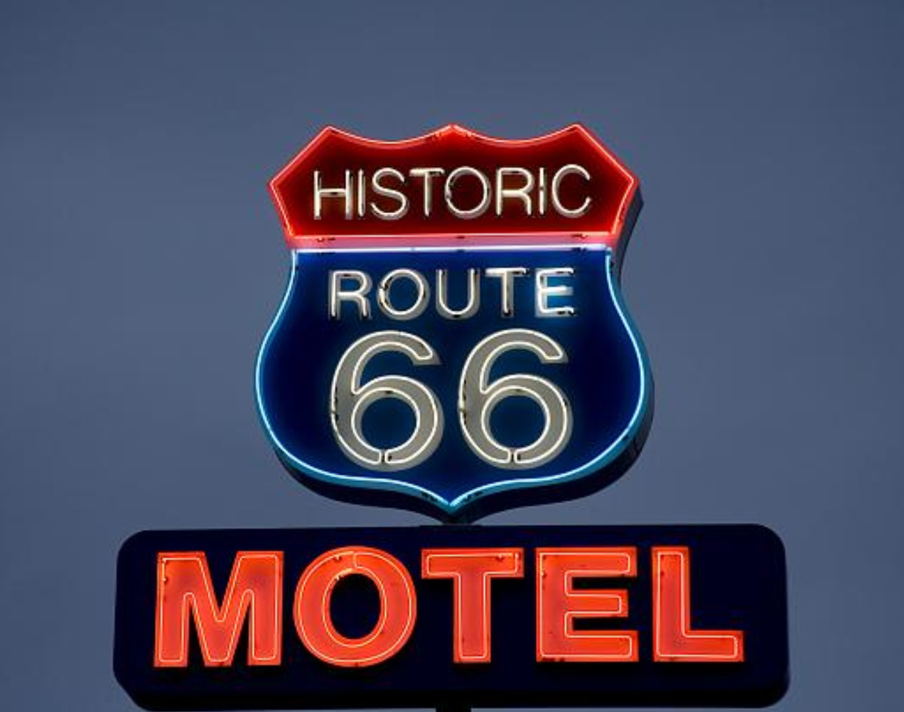
    <summary type="html"><![CDATA[<p><strong><em><span style="font-weight:400;">Route 66 is famous for its 1950s era diners and eclectic curio shops, but it was a road traveled long before it was paved and has remained iconic even after it was removed from the highway system.</span></em></strong></p><img src="https://www.intermountainhistories.org/files/fullsize/e07e210fcc5e7f610fdad382fdbd04f5.jpg" alt="Neon sign for the Historic Route 66 Motel in Seligman, Arizona." /><br/><p><span style="font-weight:400;">Route 66 revolutionized cross country travel in America. With mass auto production and transportation accessibility on the rise, the highway’s construction in 1926 was truly a product of its time. Beginning in Chicago, Illinois and ending in Santa Monica, California the new highway gave Americans a convenient way to travel west, a practice that had become increasingly popular the previous century. </span>
<span style="font-weight:400;">Route 66 was planned around several trade routes and old roads. Geographically similar paths had been used by Kiowas, Cheyennes, Comanches, and other Native peoples for centuries. In later years these paths continued to be well traversed by Euro-Americans. Many of the automobiles on the highway were occupied by migrants, but there were plenty of vacationers as well. An exciting new concept, the “road trip,” was born in the 1920s providing Americans with the opportunity to create a grand adventure of their own.</span>
<span style="font-weight:400;">As one of the original U.S. highways Route 66 was often called  “America’s Main Street” in its early days, and later, “The Mother Road,” as coined by John Steinbeck. Whole communities and businesses were established along the highway which thrived off of tourism. In the 1930s about 200,000 migrants drove cars, took trains, and even walked along Route 66, hoping for a better chance of survival and solace further west. The end goal was often California, but most of them ended up settling somewhere else along the way. America’s involvement in World War II a decade later called for the rationing of gas. This changed the demographic of highway traffic, but did not diminish it. Transportation of war supplies, military troops, and new job opportunities brought another wave of westward travelers in the mid 1940s. As the war ended, patriotism and an increased emphasis on the nuclear family led to another boom in tourism. A long drive along Route 66, a stop for dinner and photo ops, and a night or two in a roadside motel made for a relatively affordable family vacation. </span>
<span style="font-weight:400;">Beginning in 1957, Route 66 was gradually replaced by Interstate 40, whose gradual construction was mostly completed by the 1970s. Traversing similar east-west latitudes, it became the preferred route designated highway for cross country travel. Much like familiar boom-bust cycles associated with gold and other mining rushes in the West, the sudden shift of traffic away from Route 66 resulted in  an abundance of ghost towns. Now, it is the nostalgia of Route 66 and its seemingly permanent existence in the past that attracts tourists. Not everyone picked up and left town when the “rush” was over. Many of the businesses that either stayed open or have since been reopened have made a living off of nostalgia, curiosity, and the prospect of adventure. </span></p><p><em><strong><a href="https://www.intermountainhistories.org/items/show/798">For more (including 4 images) view the original article</a></strong></em></p>]]></summary>
    <published>2024-05-15T19:33:31+00:00</published>
    <updated>2026-04-17T19:32:17+00:00</updated>
    <link rel="alternate" type="text/html" href="https://www.intermountainhistories.org/items/show/798"/>
    <id>https://www.intermountainhistories.org/items/show/798</id>
    <author>
      <name>Megan Bailey, Brigham Young University</name>
    </author>
  </entry>
  <entry>
    <title type="html"><![CDATA[The CCC &amp; the Painted Desert Inn: A Pueblo Revival Building in the Petrified Forest ]]></title>
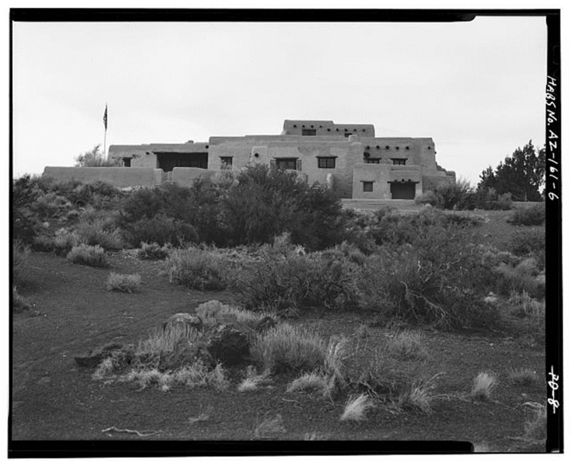
    <summary type="html"><![CDATA[<p><strong><em>Overlooking the Petrified Forest National Park, the Painted Desert Inn is widely recognized as a masterpiece in Pueblo Revival Style. The inn is significant to the Southwest, recognizable for its flat roofs and protruding beams. The Civilian Conservation Corps (CCC) reconstructed this beautiful and unusual building in 1937.</em></strong></p><img src="https://www.intermountainhistories.org/files/fullsize/aa741af9a69ca39cf5c47112e611fe4f.jpg" alt="Painted Desert Inn (westward view)" /><br/><p>A building known as ‘The Stone Treehouse’ stood in 1924 on the site where today the Painted Desert Inn stands. This building, in the style known architecturally as ‘National Park Rustic,’ looked strikingly different from what visitors to the Petrified National Park see today. In 1936 the National Park Service purchased the building and began a complete renovation, pretty much taking the building apart and beginning again on the same site. The reason for total renovation was twofold: first, many saw the building’s style as outdated, and second, the National Park Service determined the foundations of ‘The Stone Treehouse’ to be slowly sinking into the soft clay soil they had been built on.</p><p>The Painted Desert Inn was built in the years 1937-1939 by the Civilian Conservation Corps (CCC) with funds from the Public Works Administration. Its history is one of constant renovation. The adobe walls of the building are over two feet thick showing the labor-intensive work of the CCC.  However, the Inn was not operated for long by the National Park Service, who sold it to the Fred Harvey Company in 1947. It then went through a dazzling renovation, this time, centered on the interior. Fred Harvey brought in renowned designer Mary Coulter to spruce up the decade-old inn for new visitors travelling the increasingly popular Route 66. However, the inn never generated the amount of interest hoped for by the Harvey Company, and by the late 1950s had ceased to function. It then began to serve simply as a stop-off point for tourists to dine and shop as they took in the wonders of Petrified Forest National Monument (designated a National Park in 1962). </p><p>Over the next two decades the Inn began to fall into disrepair, and by the 1980s this state of disrepair had become exceedingly noticeable. Fortunately, at that point the National Park Service intervened and began both internal and external repairs to the structure. The building that visitors see today is the result of the hard work of many different sources including the CCC, Fred Harvey and most recently the National Park Service. Today the Painted Desert Inn serves as the visitor center for the Petrified Forest National Park, attracting thousands of visitors each year. </p><p><em><strong><a href="https://www.intermountainhistories.org/items/show/74">For more (including 3 images) view the original article</a></strong></em></p>]]></summary>
    <published>2017-06-13T03:56:45+00:00</published>
    <updated>2026-04-17T19:31:59+00:00</updated>
    <link rel="alternate" type="text/html" href="https://www.intermountainhistories.org/items/show/74"/>
    <id>https://www.intermountainhistories.org/items/show/74</id>
    <author>
      <name>Sarah Birt, Northern Arizona University and Hull University </name>
    </author>
  </entry>
</feed>