<?xml version="1.0" encoding="UTF-8"?>
<feed xmlns="http://www.w3.org/2005/Atom">
  <title type="text">Intermountain Histories</title>
  <updated>2026-04-17T19:32:20+00:00</updated>
  <generator uri="http://framework.zend.com" version="1.12.20">Zend_Feed_Writer</generator>
  <link rel="alternate" type="text/html" href="https://www.intermountainhistories.org/"/>
  <link rel="self" type="application/atom+xml" href="https://www.intermountainhistories.org/items/browse?output=rss2"/>
  <id>https://www.intermountainhistories.org/</id>
  <author>
    <name>Intermountain Histories</name>
    <uri>https://www.intermountainhistories.org</uri>
  </author>
  <link rel="hub" href="https://pubsubhubbub.appspot.com/"/>
  <entry>
    <title type="html"><![CDATA[The Bonneville Salt Flats: A Natural Wonder and Culture Icon ]]></title>
    <summary type="html"><![CDATA[<p><strong><em><span style="font-weight:400;">The Bonneville Salt Flats are a historical wonder. Not just for the state of Utah or the United States, but for the world as well. The history of the founding, to a national speedway, and the protection of environmentalists help keep the flats to their glory and help keep people seeing the ecological wonder for generations to come. </span></em></strong></p><img src="https://www.intermountainhistories.org/files/fullsize/bf7017251a1d00dbbe0345cc056829dc.jpg" alt="Unique Hexagonal Leading Lines to the Mountains on the Horizon, Bonneville Salt Flats, Utah" /><br/><p><span style="font-weight:400;">The Bonneville Salt Flats, 12 miles long and 5 miles wide, packed in salt and located in Northwestern Utah, stands as one of the most famous natural landmarks in the United States of America. This special geological formation has attracted the attention of scientists, filmmakers, racers, and adventurers. The flats have also become a center for land speed records (racing and strip driving), ecological studies on the salt and cinematic landscapes. </span>
<span style="font-weight:400;">The salt flats are the remains of Lake Bonneville, a massive prehistoric lake that covered much of the Great Basin during the Pleistocene Epoch, which was approximately 32,000 to 14,000 years ago. Over time, climate changes caused the lake to evaporate, Which left behind a very thick layer of raw material, predominantly salt, which ultimately formed the salt flats. </span>
<span style="font-weight:400;">The Bonneville Salt Flats are named after a French-born U.S army officer who explored and mapped most of the American West in the early 19th century, Benjamin Louis Eulalie de Bonneville. During the modern era, the Bonneville Salt Flats have become identical with speed records and innovation. In the beginning of the 1910s, the flats were used for some automobile speed trials due to the endless, flat surface and the hard salt crust. This was turned into the Bonneville Speedway that was officially established in the 1930s. There are still many races that happen at the speedway today. </span>
<span style="font-weight:400;">Beyond the racetrack and the race cars, the flats have found their way into nowadays popular culture. Their appealing and otherworldly appearance have made them a big location for filmmakers and photographers. Iconic scenes from films like Independence Day and Pirates of the Caribbean: At World's End were shot in flats that set this as a cinematic symbol of the extraordinary beauty of the salt flats. </span>
<span style="font-weight:400;">Efforts to preserve and restore the Bonneville Salt Flats have gained popularity in recent years. The Save the Salt Coalition is a group of racing organizations, scientists and local stakeholders that have been advocating for increased awareness and action to help the flats. Some collaborative projects with the Bureau of Land Management (BLM) have been focused on the brine pumping programs. This aims to return salt to the flats by reintroducing the brine that was removed during mining operations. </span>
<span style="font-weight:400;">The Bonneville Salt Flats are way more than just a geological formation: they are a witness to the connection between nature and history. From their founding as a prehistoric lake to their status as a global symbol of speed and beauty, the flats embody the spirit of human </span><span style="font-weight:400;">explorations and innovations. The survival of the salt flats is not guaranteed. As the pressures from human activity and climate changes continue to go up, the responsibility to preserve the beautiful landscape lies with all who value the flats. Through future collaborative efforts and the commitment to sustaining the salt flats, we can ensure they continue to inspire and amaze generations to come. </span></p><p><em><strong><a href="https://www.intermountainhistories.org/items/show/885">For more (including 3 images) view the original article</a></strong></em></p>]]></summary>
    <published>2025-01-29T00:46:50+00:00</published>
    <updated>2026-04-17T19:32:20+00:00</updated>
    <link rel="alternate" type="text/html" href="https://www.intermountainhistories.org/items/show/885"/>
    <id>https://www.intermountainhistories.org/items/show/885</id>
    <author>
      <name>Madison A. Fountain, Brigham Young University </name>
    </author>
  </entry>
  <entry>
    <title type="html"><![CDATA[Arson at the Vail Ski Resort, 1998]]></title>
    <summary type="html"><![CDATA[<p><strong><em><span style="font-weight:400;">In 1998, radical environmentalists targeted a ski resort in Colorado, leading to the most infamous eco-terrorist attack of all time.</span></em></strong></p><img src="https://www.intermountainhistories.org/files/fullsize/5633ebcaa19a669c5b376d439eda1ea1.jpg" alt="Vail Ski Resort in 1983" /><br/><p><span style="font-weight:400;">In the early hours of the morning on October 19, 1998, agents of the notorious eco-terrorist cell known as “the Family” ignited seven separate fires across the Vail Ski Resort in Colorado. They had traveled to Colorado from their homes in Oregon to orchestrate an attack that would send a message. By the time the fires were extinguished, eight structures had been either damaged or completely destroyed. Four ski lift towers, the ski patrol headquarters, radio towers, and the Two Elk Lodge restaurant had all been affected by the attack. No people or animals had been injured, but damages were extensive at an estimated $24 million.</span>
<span style="font-weight:400;">Later that same day, individuals from the Earth Liberation Front (ELF) and the Animal Liberation Front (ALF) called into radio stations and sent a communique to several newspapers to claim responsibility for the fires in Vail. Their motives were clear: to protect lynx habitats by preventing expansion. A coalition of environmental groups had recently lost a legal battle to halt Vail’s plans to develop 885 acres of virgin national forest, an area the environmentalists claimed to be a prime habitat for the Canadian lynx. In retaliation, radical members turned to arson, stating in their communique that “Putting profit ahead of Colorado’s wildlife will not be tolerated.” They warned skiers to find somewhere else to go.</span>
<span style="font-weight:400;">In the days following the attack, local and national newspapers began to categorize the fires as the worst eco-terrorist attack in history. News stories connected the events to Edward Abbey’s fictional work </span><i><span style="font-weight:400;">The Monkey Wrench Gang</span></i><span style="font-weight:400;">, indicating the level of influence literature had on the public imagination, even being referenced in testimonies in following years by the Federal Bureau of Investigation to the Senate Judiciary Committee. The FBI and other federal agencies categorized the Vail arson as particularly destructive compared to other eco terrorist attacks. The FBI soon identified eco-terrorist and special interest extremist groups as the number one domestic terrorist threat, and highlighted the perpetrators of the Vail attack as one of the most prolific domestic terrorism cells of all time.</span>
<span style="font-weight:400;">The federal government launched an inter-agency investigation, known as Operation Backfire, to take down the group responsible for the Vail arson and other eco-terrorist attacks. Their investigation targeted the group known as “the Family” which was a particularly radical faction branching off of the Earth Liberation Front. Between 1995 and 2001, the FBI credits the group with over forty criminal acts, with the Vail arson seen as their most notorious attack. Damages related to these crimes are estimated at $40 million. The investigation gave insight to the highly secretive inner workings of eco-terrorist groups. Operation Backfire led to the capture, indictments, and convictions of six out of the seven individuals involved in the attack on the Vail Ski Resort. Josephine Sunshine Overaker, the only uncaptured perpetrator, remains on the FBI’s Most Wanted list for crimes of domestic terrorism. Twenty-five years later, the federal government continues to seek justice.</span></p><p><em><strong><a href="https://www.intermountainhistories.org/items/show/838">For more (including 2 images) view the original article</a></strong></em></p>]]></summary>
    <published>2024-05-29T19:22:31+00:00</published>
    <updated>2026-04-17T19:32:18+00:00</updated>
    <link rel="alternate" type="text/html" href="https://www.intermountainhistories.org/items/show/838"/>
    <id>https://www.intermountainhistories.org/items/show/838</id>
    <author>
      <name>Emily Roth, Northern Arizona University</name>
    </author>
  </entry>
  <entry>
    <title type="html"><![CDATA[Tree Spiking in Idaho&#039;s Clearwater National Forest, 1989 ]]></title>
    <summary type="html"><![CDATA[<p><strong><em><span style="font-weight:400;">In 1989, a group sought to sabotage a lumber sale by spiking trees in Idaho’s Clearwater National Forest. The incident led to decades of controversy for the environmentalist movement.</span></em></strong></p><img src="https://www.intermountainhistories.org/files/fullsize/04567ad38d5a1641ca7d1bf82bced03b.jpg" alt="Nail in a Tree" /><br/><p><span style="font-weight:400;">In March 1989, the U.S. Forest Service received a letter warning that trees in the Clearwater National Forest in Idaho had been spiked, claiming that nine people spent 11 days spiking trees with 500 pounds of nails. It mentioned that the land was important to the earth, and home to wildlife and the trees. The group signed the letter under the pseudonym “George Hayduke” in reference to a protagonist in Edward Abbey’s </span><i><span style="font-weight:400;">The Monkey Wrench Gang</span></i><span style="font-weight:400;">, followed by a threat that disregarding the message could result in a lot of people getting hurt. Investigations by the Forest Service revealed that 284 trees had been spiked with 384 nails. As a result, the Plum Creek Sawmill in Montana suffered damages when a saw exploded after hitting a spike.</span>
<span style="font-weight:400;">The perpetrators were a group associated with Earth First! who had first met in Missoula, Montana in 1988. They were protesting the Post Office Creek Timber sale, which opened a northeast parcel of Clearwater National Forest to logging operations. By spiking trees in the area, they hoped to preserve old growth in the forest. Earth First! founder Dave Foreman’s environmentalist guidebook </span><i><span style="font-weight:400;">Ecodefense</span></i><span style="font-weight:400;">, published in 1985, cites tree spiking as a viable tactic to disrupt logging and deforestation. The book includes a how-to section for tree spikers, as well as instructional diagrams. Spiking trees in a visible way was seen as an immediate deterrent for loggers, while concealing spikes could be effective in destroying equipment. By the 1990s, Earth First! literature no longer supported spiking due to both danger for humans and legal repercussions. </span>
<span style="font-weight:400;">The mailing of the letter led to FBI and Forest Service investigations into the Environmental Studies Department at the University of Montana. Agents raided student housing, collecting notebooks and calendars for evidence. The FBI subpoenaed seven Missoula residents to provide handwriting and hair samples for physical evidence before an Idaho grand jury. Investigators discovered that Tracy Stone-Manning, a University of Montana graduate student associated with the group, had rented a typewriter from the library to retype the letter then mailed the letter to the Forest Service. Stone-Manning, facing charges of conspiracy, received immunity in exchange for her testimony against other members of the group. In February 1993, a grand jury indicted Jeffrey Fairchild and John Blount in connection to the tree-spiking. A federal jury in Spokane, Washington convicted the men of conspiracy and depredation against property of the United States following a June 1993 trial. Blount was sentenced to 17 months in prison and ordered to pay restitution, while Fairchild received probation. </span>
<span style="font-weight:400;">The incident at Clearwater National Forest returned to the national spotlight in 2021 when President Joe Biden nominated Tracy Stone-Manning as director of the Bureau of Land Management. Her confirmation by the Senate Committee on Energy and Natural Resources was marked by discussions on ecoterrorism and participation in radical environmentalist groups. Despite the controversy around her involvement in the 1989 tree-spiking, the Senate Committee confirmed Stone-Manning as director of the BLM.</span></p><p><em><strong><a href="https://www.intermountainhistories.org/items/show/837">For more (including 4 images) view the original article</a></strong></em></p>]]></summary>
    <published>2024-05-29T18:55:12+00:00</published>
    <updated>2026-04-17T19:32:18+00:00</updated>
    <link rel="alternate" type="text/html" href="https://www.intermountainhistories.org/items/show/837"/>
    <id>https://www.intermountainhistories.org/items/show/837</id>
    <author>
      <name>Emily Roth, Northern Arizona University</name>
    </author>
  </entry>
  <entry>
    <title type="html"><![CDATA[Sabotage at the Arizona Snow Bowl, 1987]]></title>
    <summary type="html"><![CDATA[<p><strong><em><span style="font-weight:400;">After an eco terrorist fringe organization orchestrated attacks on an Arizona ski resort and power plants throughout the Southwest, FBI undercover agents spent years infiltrating the group.</span></em></strong></p><img src="https://www.intermountainhistories.org/files/fullsize/69a4f22b3aed687abecaee3f9b6eceb4.jpg" alt="Fall Color Scenic Skyride at the Arizona Snowbowl" /><br/><p><span style="font-weight:400;">On the morning of November 7, 1987, members of the eco terrorist group EMETIC carried out an attack on the Fairfield Snow Bowl Ski Resort north of Flagstaff, Arizona. Using propane torches, they cut through cables that supported the main ski lift. The resort was closed in preparation for its winter opening, and the sabotage resulted in no casualties. Snow Bowl officials estimated damages at $26,0000 with an additional $30,000 spent on added security measures. Employees at the Snow Bowl received a computer-generated letter from EMETIC taking credit for the attack. The letter warned to either discontinue ski operations and allow trees to grow back or suffer another sabotage, also referencing that development encroached on sacred indigenous land. On October 25, 1988, a similar attempt occurred. An EMETIC member used a torch to cut through a main support for the cable lift, then called into a local radio station claiming responsibility.</span>
<span style="font-weight:400;">EMETIC (Evan Mecham Eco Terrorist International Conspiracy) was a group comprised of individuals from Prescott, Arizona associated with the </span><span style="font-weight:400;">Earth First!</span><span style="font-weight:400;"> environmental group. The group's name served as a sarcastic reference to right-wing then-governor of Arizona Evan Mecham. Although they had participated in </span><span style="font-weight:400;">EF</span><span style="font-weight:400;">! activities, members of EMETIC believed much more radical direct action was necessary to protect the planet. In 1989, the group plotted to cut electrical transmission lines to nuclear power stations in Arizona, Colorado, and California. On the night of May 30, the FBI arrested three members of EMETIC while they were doing a test run of cutting down a power line tower of the Central Arizona Project canal. Early the next morning, agents arrested </span><span style="font-weight:400;">EF</span><span style="font-weight:400;">! co-founder Dave Foreman in connection to the conspiracy. The FBI indicted a fourth EMETIC member six months later. In 1991, federal courts convicted the ecoterrorists of the attack on the Snow Bowl and planned attacks on the nuclear power plants. Foreman’s charges were separated and later dropped to a misdemeanor, as it was apparent that he was not connected to the ecoterrorist activities.</span>
<span style="font-weight:400;">After the 1987 Snow Bowl incident, the Federal Bureau of Investigation launched THERMCON, an operation to investigate </span><span style="font-weight:400;">Earth First</span><span style="font-weight:400;">! in Arizona. Between 1987 and 1989, undercover agents infiltrated EMETIC and monitored ecoterrorist activity. Ron Fraizer, a friend of the group, worked as a paid informant for the FBI in that time. Agents secretly recorded hundreds of hours of conversations with activists. Following the arrests, </span><span style="font-weight:400;">Earth First</span><span style="font-weight:400;">! members accused the FBI of attempting to undermine their organization by connecting their leaders to extremist activity. </span><span style="font-weight:400;">EF</span><span style="font-weight:400;">! leader Judi Bari alleged that the FBI undercover agents entrapped the members of EMETIC and unsuccessfully tried to convince them to use explosives in sabotage, which agents repeatedly offered to supply. Michael Fain, the undercover agent who infiltrated the group, was allegedly caught on tape saying they needed to bust Dave Foreman to send a message. However, the federal government continued to emphasize the danger of eco terrorist groups and the necessity of operations like THERMCON for national safety.</span></p><p><em><strong><a href="https://www.intermountainhistories.org/items/show/836">For more (including 3 images) view the original article</a></strong></em></p>]]></summary>
    <published>2024-05-27T15:58:41+00:00</published>
    <updated>2026-04-17T19:32:18+00:00</updated>
    <link rel="alternate" type="text/html" href="https://www.intermountainhistories.org/items/show/836"/>
    <id>https://www.intermountainhistories.org/items/show/836</id>
    <author>
      <name>Emily Roth, Northern Arizona University</name>
    </author>
  </entry>
  <entry>
    <title type="html"><![CDATA[The Crack at Glen Canyon, 1981 ]]></title>
    <summary type="html"><![CDATA[<p><strong><em><span style="font-weight:400;">In 1981, </span><span style="font-weight:400;">Earth First!</span><span style="font-weight:400;"> staged a demonstration at Glen Canyon Dam, giving the appearance of an attack. The incident placed the group on the national radar, with some calling this the birth of the radical environmental movement.</span></em></strong></p><img src="https://www.intermountainhistories.org/files/fullsize/483deaf10dd730edfd0ff19ddb60c859.jpg" alt="Glen Canyon, circa 1898" /><br/><p><span style="font-weight:400;">Earth First</span><span style="font-weight:400;">! members gathered on March 21, 1981 to protest the Glen Canyon Dam. Completed in 1966, the dam was the subject of much political controversy and protest by environmentalists. The dam flooded Pueblo cliff dwellings containing ancient artifacts; damaged the Colorado River ecosystem and endangered native species; and submerged the Cathedral in the Desert, a beautiful natural monument within the canyon. In the </span><i><span style="font-weight:400;">Earth First! Journal</span></i><span style="font-weight:400;">, the group described the dam as having “drowned the most magical place on the continent.” They claimed the dam as a symbol for humanity’s destruction of the planet, and invited members to join in protest. The demonstration was the focal point of a Spring Solstice and full moon celebration by the group.</span>
<span style="font-weight:400;">Seventy-five members of </span><span style="font-weight:400;">Earth First</span><span style="font-weight:400;">! lined up on the Colorado River bridge at Glen Canyon, carrying protest signs calling for the destruction of the dam and freeing of the river. Several members carried 300-feet of black plastic, then unfurled it over the dam to give the appearance of a large crack. These actions were inspired by </span><i><span style="font-weight:400;">The Monkey Wrench Gang</span></i><span style="font-weight:400;">, in which a group plans to blow up the Glen Canyon Dam. The author of the influential novel, Edward Abbey, attended the 1981 demonstration and gave a speech while standing on the back of a pickup truck. Abbey referred to Glen Canyon as a treasure stolen from the people by greedy developers and politicians, and the dam as an invasion. He urged the protestors to oppose the destruction of the Earth, and resort to sabotage and subversion when political action failed. </span>
<span style="font-weight:400;">As Abbey completed his speech, National Park Service police and Coconino County Sheriff’s deputies arrived. Law enforcement officers questioned protestors and attempted to disperse the crowd. According to </span><span style="font-weight:400;">Earth First</span><span style="font-weight:400;">! founder Dave Foreman, the FBI also investigated the incident and dusted the plastic “crack” for fingerprints. Media attention on the demonstration led to a sudden rise in </span><span style="font-weight:400;">Earth First</span><span style="font-weight:400;">! membership, with new members from across the country expressing interest in the movement. The “cracking” of Glen Canyon Dam is often cited as the first moment of radical direct action within the environmental movement. </span><span style="font-weight:400;">Earth First</span><span style="font-weight:400;">! was suddenly on the national radar as a radical alternative to mainstream environmental groups.</span>
<span style="font-weight:400;">Decades later, Glen Canyon remains a site of controversy. Environmental activists continue to argue for the decommissioning of the dam and restoration of the canyon. Despite growing interest in dam removal, the federal government views Glen Canyon and its reservoir, Lake Powell, as a necessity. Glen Canyon generates electricity for millions of homes, and Lake Powell is used for water storage for the Upper Basin states in the Colorado River Compact.</span></p><p><em><strong><a href="https://www.intermountainhistories.org/items/show/835">For more (including 4 images) view the original article</a></strong></em></p>]]></summary>
    <published>2024-05-27T15:31:48+00:00</published>
    <updated>2026-04-17T19:32:18+00:00</updated>
    <link rel="alternate" type="text/html" href="https://www.intermountainhistories.org/items/show/835"/>
    <id>https://www.intermountainhistories.org/items/show/835</id>
    <author>
      <name>Emily Roth, Northern Arizona University </name>
    </author>
  </entry>
  <entry>
    <title type="html"><![CDATA[The Round River Rendezvous in Moab 1980]]></title>
    <summary type="html"><![CDATA[<p><strong><em><span style="font-weight:400;">A newly formed environmental group, </span><span style="font-weight:400;">Earth First</span><span style="font-weight:400;">!, gathered for an annual rendezvous to celebrate and discuss action. Over the decades, the rendezvous became a source of political contention and factionalism.</span></em></strong></p><img src="https://www.intermountainhistories.org/files/fullsize/292b61ee5e90862f570d244c7c58b800.jpg" alt="Earth First logo" /><br/><p><span style="font-weight:400;">In 1980, environmental activists in the Southwest founded Earth First! as a form of radical activism. The group emerged in part as a reaction to dissatisfaction with efforts by mainstream environmental groups, such as the Sierra Club. Earth First! cofounder Dave Foreman emerged as a spokesperson. Foreman had previously worked as an environmental lobbyist, but became disillusioned with what he saw as an ineffective approach. In the </span><span style="font-weight:400;">Earth First</span><span style="font-weight:400;">! Statement of Principles, Foreman wrote that there could be no political compromise in defense of Earth and that all decisions should put Earth first before humankind. The group argued that illegal tactics were warranted, since they viewed democratic processes as having been corrupted by corporate interests. Earth First! prioritized direct action over formal political doctrine, which contributed to a diverse membership with often conflicting ideologies. Direct action entailed taking environmental protection into their own hands, rather than relying on political processes. They took inspiration from Edward Abbey’s writing in </span><i><span style="font-weight:400;">The Monkey Wrench Gang, </span></i><span style="font-weight:400;">in which a fictional group sabotages environmental development that they considered destruction of the Southwest. Ecosabotage and “monkeywrenching” are referenced throughout Earth First! literature.</span>
<span style="font-weight:400;">Earth First! began hosting the Round River Rendezvous in 1980, an annual meeting for members. The name of the meeting, according to urban legend, comes from an Ojibwe myth about a continuous river of life. They held the first rendezvous near Moab, Utah. Each year, the location of the annual meeting shifts to different locations throughout the West. According to the </span><i><span style="font-weight:400;">Earth First! Journal</span></i><span style="font-weight:400;">, the rendezvous sites are chosen based on remoteness, natural beauty, and proximity to a site being threatened with development. In 1980, the rendezvous coincided with plans by Utah’s Grand County Commission to send a bulldozer into a Bureau of Land Management Wilderness Study Area near Moab.</span>
<span style="font-weight:400;">The rendezvous served as an opportunity for community and celebration, as well as a site to discuss conservation issues and plan direct action. The rendezvous featured activist workshops, music and poetry, and demonstrations. The </span><i><span style="font-weight:400;">EF Journal</span></i><span style="font-weight:400;"> also encouraged wilderness exploration, such as hiking in the area. By the end of the decade, the togetherness of the Round River Rendezvous shifted into a venue for intense factionalism. The group became divided on a number of issues, most significantly regarding the push towards increasingly extremist direct action including using illegal and violent means to protect the environment.  Other debates focused on racism, sexism within the group, and advocacy for animals. The 1987 rendezvous at the Grand Canyon was marked by especially harsh division between new leftist or anarchist members and older members of the group, including intense criticism of attendee Edward Abbey. By this point, Dave Foreman and other co-founders began to distance themselves from the group, as they became concerned with the new trajectory. </span>
<span style="font-weight:400;">The Round River Rendezvous today still serves as an opportunity for environmentalists to gather in celebration. </span><span style="font-weight:400;">The Earth First</span><span style="font-weight:400;">! agenda has become more inclusive and diversified since the early years, and no longer focused on the environment as their sole issue.</span></p><p><em><strong><a href="https://www.intermountainhistories.org/items/show/834">For more (including 3 images) view the original article</a></strong></em></p>]]></summary>
    <published>2024-05-27T14:58:20+00:00</published>
    <updated>2026-04-17T19:32:18+00:00</updated>
    <link rel="alternate" type="text/html" href="https://www.intermountainhistories.org/items/show/834"/>
    <id>https://www.intermountainhistories.org/items/show/834</id>
    <author>
      <name>Emily Roth, Northern Arizona University</name>
    </author>
  </entry>
  <entry>
    <title type="html"><![CDATA[Everett Ruess at Veit Springs near Flagstaff, Arizona]]></title>
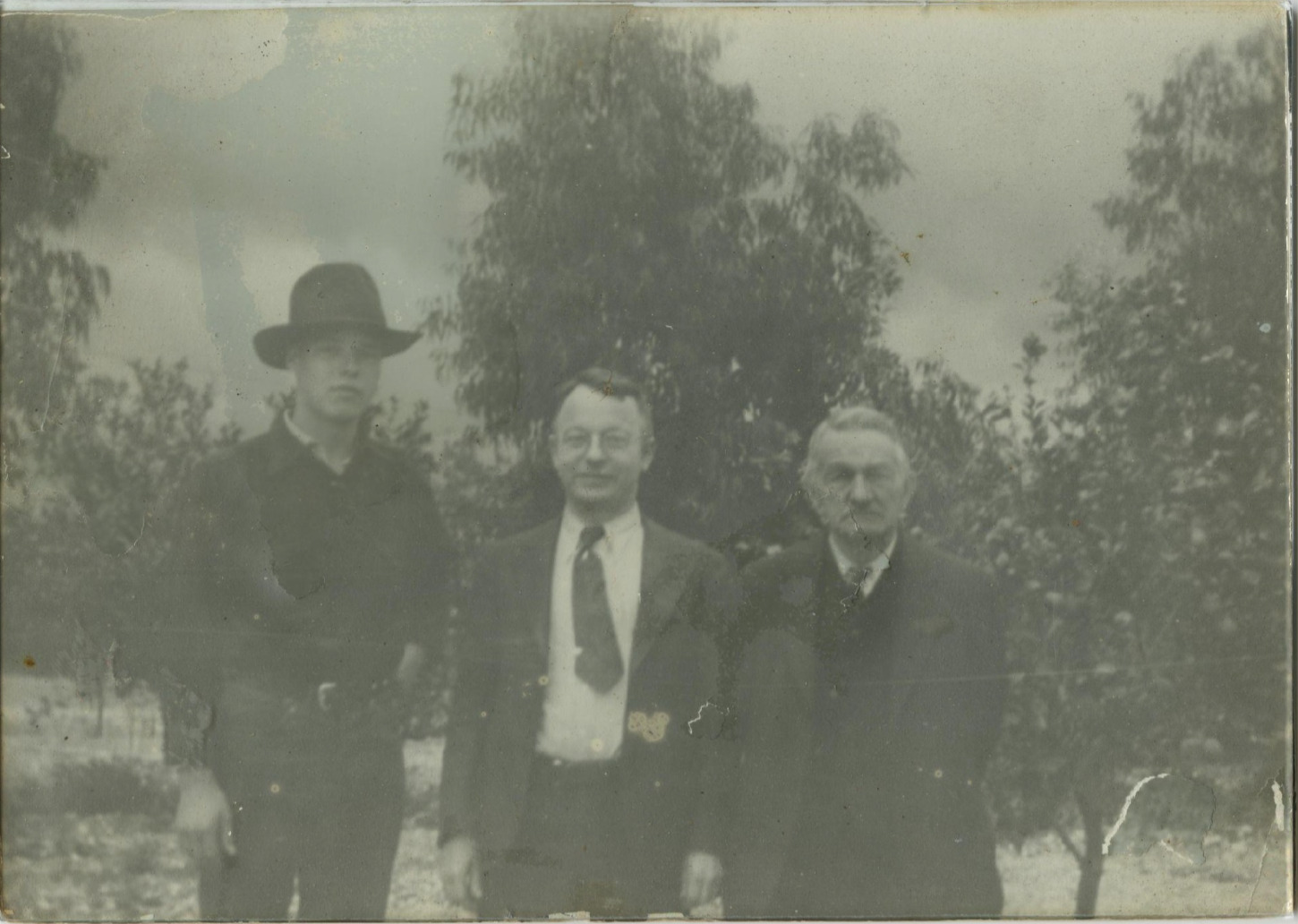
    <summary type="html"><![CDATA[<p><strong><em>Serving as a homestead and a later rest stop for Everett Ruess' introduction to the Intermountain West as a solo traveler, Veit Springs rests on the side of Arizona's highest mountain, the San Francisco Peaks.</em></strong></p><img src="https://www.intermountainhistories.org/files/fullsize/010f42c0309f906e6329d5c5d348784e.jpg" alt="Everett Ruess with his father and grandfather" /><br/><p>Just north of Flagstaff, Arizona sits in the San Francisco Peaks, or "Dook'o'oosłííd," <em>The Summit that Never Melts</em>, to the Navajo Nationa. In the year 1891, German immigrant Ludwig Veit received a patent for a 160-acre homestead where he and his family constructed a cabin and other structures at what came to be called Veit Springs. Randolph (Pat) Jenks, a student at the Evans Ranch School, a boys preparatory school in Mesa, Arizona, purchased the property from Veit’s relatives in 1930. Jenks, and his classmate Tad Nichols, enjoyed their summers in Flagstaff when the school summered up North. In 1931 the two boys encountered Everett Ruess on his journey through northern Arizona, inviting him to join them back on the homestead. </p><p>Everett Ruess was seventeen when he was picked up near Cameron, Arizona, by Jenks and Nichols. Everett was in bad shape, suffering from his history of anemia and other physical degradation from the desert environment. Tad Nichols, famous photographer of the Colorado Plateau, snapped a photo of Everett and Pat loading his gear, his dog Curly, and Burro Pegasus, into Jenks’ truck before they all set on their way to Jenks’ Deerwater Ranch on the San Francisco Peaks. While Everett was at Veit Springs, he bonded with Jenks over his love for ornithology, the study of birds, and their mutual love for art and the Southwest. Everett created a block print painting and described Jenks’ fascination with his art in a letter home. In fact, Jenks was intrigued enough to purchase one of Everett’s block prints of some native Cliff Dwellings. He enjoyed his new friends and wrote a letter about his “idyllic days” at Deerwater Ranch. Here, Everett escaped the traditional aridness of the Intermountain West and described the environment of the ranch as “cool and bracing” in a letter to his family on June 8th, 1931. Among Everett’s belongings in Davis Gulch was an unsent letter that expressed his “true spirit of delight, exaltation, [and] sense of being more than a man” that he experienced at Veit Springs. </p><p>Everett later traversed the Grand Canyon and resided throughout northeast Arizona, returning home later that year. He set off again to the region in 1932, one of the only years his journey was successfully documented. </p><p>In the 1970s, The United States Forest Service aimed to demolish the cabin Veit hand-built, but the Flagstaff community successfully advocated for its relocation just west of the city's downtown. The Veit Cabin relocation by the Arizona National Guard moved the cabin to its current position within Thorpe Park in Flagstaff, Arizona, just South of Francis Short Pond. Since 1988, the new cabin location has facilitated educational events regarding natural and cultural studies of the landscape. Meanwhile, the cabin’s former site at Veit Springs remains a beautiful spot among the tall aspens on the Veit Springs Hiking Trail where tourists can experience the bracing environment that Everett described, as well as Indigenous petroglyphs and abandoned pumphouses from its early days in history.</p><p><em><strong><a href="https://www.intermountainhistories.org/items/show/829">For more (including 5 images) view the original article</a></strong></em></p>]]></summary>
    <published>2024-05-24T22:33:19+00:00</published>
    <updated>2026-04-17T19:32:18+00:00</updated>
    <link rel="alternate" type="text/html" href="https://www.intermountainhistories.org/items/show/829"/>
    <id>https://www.intermountainhistories.org/items/show/829</id>
    <author>
      <name>Matthew T. Lankton, Northern Arizona University</name>
    </author>
  </entry>
  <entry>
    <title type="html"><![CDATA[Saltair Beach at Great Salt Lake: The &quot;Coney Island of the West&quot; ]]></title>
    <summary type="html"><![CDATA[<p><strong><em>Attracting visitors to float in its salty waters, the southern beaches at Great Salt Lake became increasingly popular with the Saltair Resort but now face environmental threats.</em></strong></p><img src="https://www.intermountainhistories.org/files/fullsize/1dca8d46b480914c5e65caf4b1a71f24.jpg" alt="[Untitled]" /><br/><p>The Great Salt Lakes' southern beach became a well-known vacation spot because of the Saltair Resort and its motto “Try to Sink” which encouraged visitors' curiosity to swim and float in the salty waters. Today, the beach has seen a drop in visitation due to receding water levels, with about 130,000 fewer visitors from 2012 to 2022. At the beach's peak visitation during the late nineteenth century and early twentieth century, beach life consisted of swimming, picnicking, and carnival rides such as a rollercoaster, merry-go-round, and Ferris wheel.</p><p>The Goshute tribe and the Skull Valley Goshutes live near and still use the resources of the southern end of Great Salt Lake. In 1847, Mormon settlers first came to Salt Lake Valley and initiated the recreational beach life on the lake. In the 1860s, Mormon settler Heber Kimball built a ranch near Black Rock Beach. Known later as “Rock House” this spot became the first well-known swimming spot on the lake. Attraction grew with the completion of the Utah Central Railroad in 1870 and the Utah-Nevada Railway in 1875 which made Black Rock and the future Saltair Beach accessible to transcontinental visitors.</p><p>In 1893, Deseret News announced the construction of a new resort called “Saltair.” The Church of Jesus Christ of Latter-day Saints invested the most money in the Saltair Beach Company and hoped to create a wholesome recreational resort that was family-oriented. Saltair opened in 1893 and soon was nicknamed “Coney Island of the West” for its many carnival and recreational attractions. The beaches were most popular on American holidays such as the Fourth of July with thousands of people visiting to swim on weekends and special occasions. In 1919 attendance reached 450,000 people and the resort's popularity peaked during the 1920s. However, on April 22, 1925, Saltair burned down for unknown reasons, and by the 25th, its manager announced rebuilding efforts with no proposed start date. With the promise to be “larger, stronger, and more beautiful” than ever by the Salt Lake Tribune, the second Saltair opened in May of 1926. Nonetheless, the resort did not live up to its predecessor and presently the third Saltair, due to another fire, serves as a concert venue.</p><p>Saltair was the center of beach life at the southern shore of Great Salt Lake, and with the decline of the resort came the decline of beach life. The latest reviews describe the beach as having great views, but decreasing water levels means a long and smelly walk to the water. In 2023 alone the lake lost two feet of water to evaporation and while Utah policymakers and environmental programs have forged a plan to save the lake, they did not include any Native tribes in the conversation. Today, people can still swim, or rather float, in the 12% average salinity levels of the Great Salt Lake compared to the Pacific Ocean's 3.5% average salinity. As well as kayak, boat, and sunbathe on the southern beach's shores and marina.</p><p><em><strong><a href="https://www.intermountainhistories.org/items/show/827">For more (including 5 images) view the original article</a></strong></em></p>]]></summary>
    <published>2024-05-23T00:29:57+00:00</published>
    <updated>2026-04-17T19:32:18+00:00</updated>
    <link rel="alternate" type="text/html" href="https://www.intermountainhistories.org/items/show/827"/>
    <id>https://www.intermountainhistories.org/items/show/827</id>
    <author>
      <name>Olivia Hall, Northern Arizona University</name>
    </author>
  </entry>
  <entry>
    <title type="html"><![CDATA[The S. L. Welsh Herbarium]]></title>
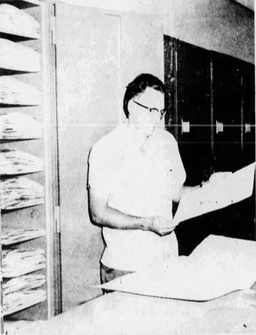
    <summary type="html"><![CDATA[<p><strong><em>Walter P. Cottam, one of the first to receive a master's degree from Brigham Young University, established the S.L. Welsh in 1923. In 1980, the school named the herbarium after Stanley L. Welsh, who served as a curator in the 1960s. The S.L. Welsh Herbarium's collection size is ranked 20th out of 646 nationwide and 65th out of 3,001 herbariums worldwide.</em></strong></p><img src="https://www.intermountainhistories.org/files/fullsize/21fcf6beb8d44646e2e2c531332bf08d.jpg" alt="Dr. Stanley L. Welsh, in the archives of the Stanley L. Welsh herbarium" /><br/><p><span style="font-weight:400;">The S.L. Welsh Herbarium is at Brigham Young University (BYU) in Provo, Utah. The story of its establishment begins in 1874 when  Orson W. Howard created the first herbarium in Utah. Then, in 1923, the university hired Walter P. Cottam, a former master's student and one of the first two individuals to receive a master's degree from BYU, as a botany professor. Upon joining the staff, Cottam received a portion of Howard's herbarium collection to form the Brigham Young University herbarium. However, before adding additional specimens, Cottam had to register the existing collection to choose a permanent acronym, and he selected BRY for Brigham Young. He served as the curator for seven years before passing the role to Dr. Bertrand Harrison in 1930, another BYU former student and Professor of Botany, who held the curator position for the next thirty years. During Harrison's tenure, the herbarium collection grew to 26,000 samples.</p><span style="font-weight:400;">In 1960, Harrison passed the job down to Dr. Stanley L. Welsh. Welsh taught biology at the school and became a well-known curator due to his work developing a program to exchange specimens with numerous universities. By 1971, the herbarium had established connections with Iowa State, North Carolina, Alaska, and international university herbariums. That same year, the collection reached a milestone of 96,000 specimens sourced from Western America, Northern Europe, and the Middle East. The oldest specimen in the archives dates to 1850 and came from Europe, while the oldest native Utah specimen collected was a gift from the University of Utah that dates to the 1880s. Over forty years, Welsh added 150 sheets of pressed and preserved specimens annually, expanding the collection from 25,000 to 450,000. In 1980, the university renamed the herbarium to honor Welsh's contributions. As the collection grew, the herbarium changed locations, moving from the university's Brimhall Building to the Grant Building, then to the Biolab, and finally to its current location under the Bean Museum when it opened in 1978. The school named the museum after Monte Lafayette Bean, a naturalist who funded its construction. The herbarium collection continues to sit under the Bean Museum and currently holds specimens collected globally but emphasizing the Great Basin and Intermountain West.</span></p><p><em><strong><a href="https://www.intermountainhistories.org/items/show/825">For more (including 3 images) view the original article</a></strong></em></p>]]></summary>
    <published>2024-05-22T20:16:59+00:00</published>
    <updated>2026-04-17T19:32:18+00:00</updated>
    <link rel="alternate" type="text/html" href="https://www.intermountainhistories.org/items/show/825"/>
    <id>https://www.intermountainhistories.org/items/show/825</id>
    <author>
      <name>Cristal A. DeSantiago, Northern Arizona University</name>
    </author>
  </entry>
  <entry>
    <title type="html"><![CDATA[Intermountain Herbarium]]></title>
    <summary type="html"><![CDATA[<p><strong><em>In the 1930s, Bassett Maguire began a personal project of gathering local plants and publishing the findings. Maguire brought the collection to Utah State University in 1939 and created the Intermountain Herbarium. His collection grew to be the second-largest herbarium in the Intermountain Region and the largest public herbarium in the region. </p></strong></p><img src="https://www.intermountainhistories.org/files/fullsize/28eb59623097df251d744081d5e0c68f.jpg" alt="A sample of Castilleja alkoensis Edwin, also known as Prairie-Fire" /><br/><p><span style="font-weight:400;">The Intermountain Herbarium is at Utah State University (USU) in Logan, Utah. It began with Dr. Bassett Maguire, a botanist, who initiated a project exploring the local flora in the early 1930s. He recorded and published his findings as the Intermountain Flora project, eventually publishing seven volumes. In 1939, Maguire joined USU as a Professor of Botany and used his project findings to establish the Intermountain Herbarium that same year, becoming its first collector and curator. Maguire remained active in his project and curator role,  often working on both simultaneously. He would travel to various locations to continue his studies and enlarge the herbarium collections, often accompanied by a selection of students and USU Professor of Biology Arthur H. Holmgren. However, in 1942, he left to become the New York Botanical Garden curator.</span></p><p><span style="font-weight:400;">Upon Maguire's departure, Professor Arthur H. Holmgren assumed the role of curator and remained in that position until 1978. Over the thirty-plus years, the herbarium flourished under Holmgren's leadership.</span><span style="font-weight:400;"> T</span><span style="font-weight:400;">hen, by 1963, he had collected over 110,000 specimens. Years later, in 1976, he had grown the herbarium to 150,000 specimens, and it became a popular research source for academic students and government agencies. International organizations also requested samples from the Intermountain Herbarium to study the Utah flora. International organizations also requested samples from the Intermountain Herbarium to study the Utah flora. Most of the collection originated from the West, including Utah, southern Idaho, most of Nevada, a small portion of California (including the Great Basin), and southwest Oregon. The rest of the collection resulted from exchange transactions with global institutions.</span>
<span style="font-weight:400;">After Holmgren's retirement, Dr. Mary Barkworth assumed the role of herbarium director until 2012. When she took over in 1979, the herbarium collection included 172,000 specimen samples and additional folders that were not officially part of the herbarium due to being unidentifiable plant samples. Under her leadership, the herbarium became part of a loaning system that allowed the Intermountain Herbarium to borrow files from other herbariums when specific information was unavailable at USU. The loan could last as long as someone needed the information or until they published their paper. Additionally, the herbarium had a policy that if it achieved new flora identification and had extra samples of the new specimen, it would send the additional specimen to other collection centers. In 1986, Barkworth moved the herbarium to the fourth floor of the Utah State University Plant Industry building. The work of the curators and collectors to grow the collection and researchers began to recognize the Intermountain Herbarium as a major regional herbarium.</span></p><p><em><strong><a href="https://www.intermountainhistories.org/items/show/824">For more (including 3 images) view the original article</a></strong></em></p>]]></summary>
    <published>2024-05-22T19:56:08+00:00</published>
    <updated>2026-04-17T19:32:18+00:00</updated>
    <link rel="alternate" type="text/html" href="https://www.intermountainhistories.org/items/show/824"/>
    <id>https://www.intermountainhistories.org/items/show/824</id>
    <author>
      <name>Cristal A. DeSantiago, Northern Arizona University</name>
    </author>
  </entry>
  <entry>
    <title type="html"><![CDATA[Stillinger Herbarium]]></title>
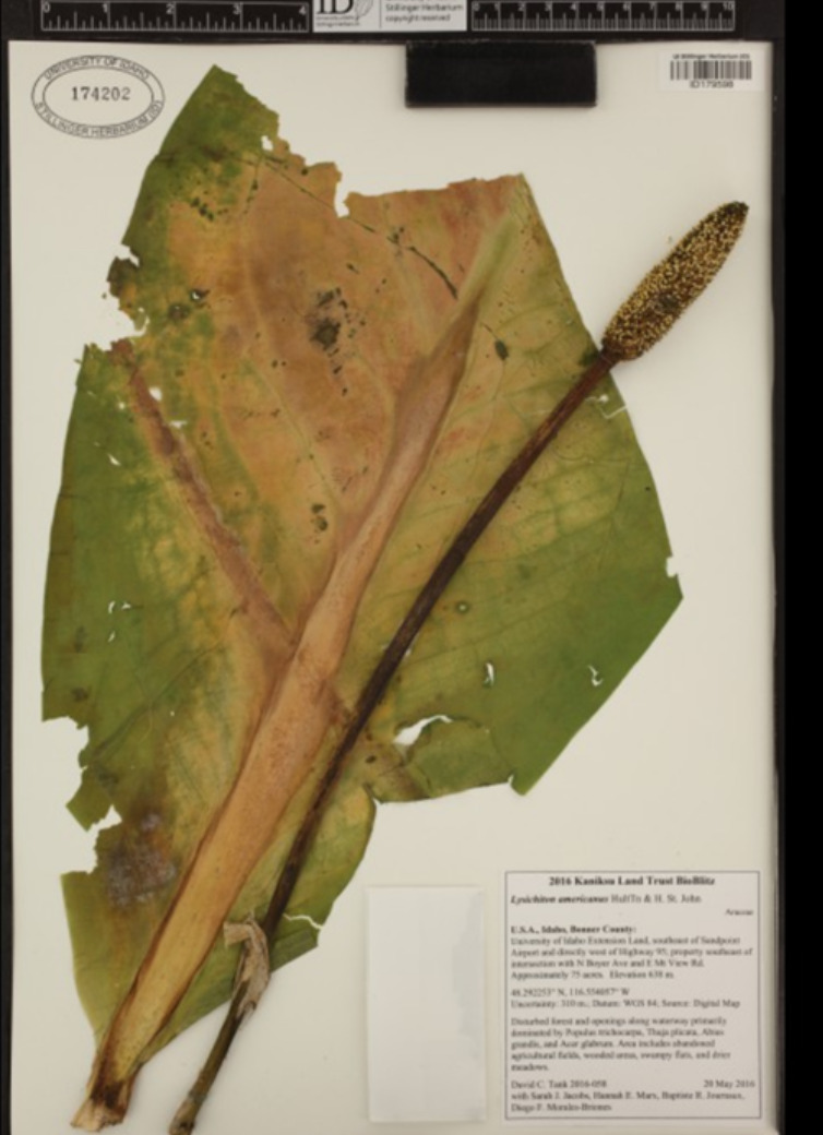
    <summary type="html"><![CDATA[<p><strong><em>Louis F. Henderson established The Stillinger Herbarium at the University of Idaho when he became the school's first botanist. Then, a fire destroyed half of the herbarium collection and slowed the institution's growth. Despite this setback, the herbarium recovered and continued to thrive, becoming the largest herbarium in Idaho and the seventh largest in the Pacific Northwest.</em></strong></p><img src="https://www.intermountainhistories.org/files/fullsize/9963e7472cf392bb249fbc1e385bb4eb.jpg" alt="Lysichiton americanus, also known as a Western Skunk Cabbage" /><br/><p><span style="font-weight:400;">In 1893, the University of Idaho in Moscow hired Louis F. Henderson as its first botanist. Henderson gave the school a collection of local plants he gathered for personal study, and in 1893, it became the foundation of the herbarium. Henderson became the herbarium's first director and retired in 1906. During this time, Henderson accumulated over 10,000 specimens from various locations in Idaho, storing the herbarium archives in the University of Idaho Administration building. However, a fire destroyed 85,000 specimens from the herbarium collection and Henderson's files, such as notebooks and letters, when the Administration building burned down on March 30, 1906. After 1908, when Henderson retired as director, the herbarium's growth was gradual but not forgotten. Botanists William H. Baker and J.H. Christ continued their exploration of the local plants and were significant contributors to the regrowth of the herbarium. By the mid-1900s, the collection had increased to about 50,000 specimens. The herbarium received additional aid to its development when Charles Roy and Nettie May Stillinger created the Stillinger Trust in 1957. Charles was a former university student and afterward became a teacher in botany and science. Charles and his wife dedicated their trust to the University of Idaho, with most of its income to the school herbarium and twenty percent to the Nettie May Stillinger Memorial Scholarship Fund. Their trust funded the development of the herbarium collection for the past sixty-six years and continues to do so to this day.</p>The herbarium saw a range of new directors that aided the collection's growth—starting with Douglass M. Henderson. He was in charge from 1972 to 1996 and doubled the plant archives' size. However, after his sudden death in 1996, Dr. Pamela Brunsfeld took over in 2001 until 2008. Brunsfeld was an Instructor of Systematic Botany at the university. After the resignation of Brunsfeld, the current director, Dr. David Tank, began. Tank is a biologist and leads active collection-based research programs involving students, staff, and professional hobbyists to aid in the growth and development of the Stillinger Herbarium. Tank's program has led to the current collection of 215,000 specimens, making it a major resource for studying the plants of Idaho and the Pacific Northwest.</p><p><em><strong><a href="https://www.intermountainhistories.org/items/show/823">For more (including 4 images) view the original article</a></strong></em></p>]]></summary>
    <published>2024-05-22T18:57:14+00:00</published>
    <updated>2026-04-17T19:32:18+00:00</updated>
    <link rel="alternate" type="text/html" href="https://www.intermountainhistories.org/items/show/823"/>
    <id>https://www.intermountainhistories.org/items/show/823</id>
    <author>
      <name>Cristal A. DeSantiago, Northern Arizona University</name>
    </author>
  </entry>
  <entry>
    <title type="html"><![CDATA[MONTU Herbarium]]></title>
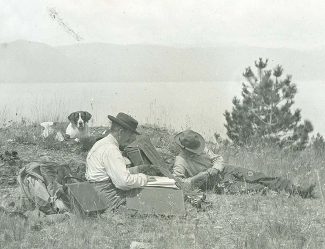
    <summary type="html"><![CDATA[<p><strong><em>        The University of Montana Herbarium has faced challenges since Dr. Morton Elrod created it in 1897. They confronted the consequences of the draining effects of World War II and fought to maintain their space. It overcame these problems and became the largest collection in Montana, with over 136,000 vegetation samples.</em></strong></p><img src="https://www.intermountainhistories.org/files/fullsize/5c40edf93fd8d4344ab1b4458e671ca5.jpg" alt="Dr. Morton Elrod in 1911 on a trip to Wildhorse Island State Park in Kalispell, Montan" /><br/><p><span style="font-weight:400;">The University of Montana Herbarium (MONTU) in Missoula, Montana, traces its origins back to 1897 when the university hired its first Professor of Biology, Dr. Morton Elrod. His employment marked the establishment of the herbarium, as Dr. Elrod brought a personal collection of local plants, providing precise details for each sample discovery. This collection laid the foundation for the first University of Montana Herbarium collection. Upon Dr. Elrod's retirement in 1928, the herbarium experienced a series of curator changes over the next sixty years. The first of these curators was Charles Leo Hitchcock, who gained the responsibility in 1932. Under Hitchcock's leadership, the herbarium underwent significant developments. He relocated the collection to the second floor of the Natural Science building and initiated a program to create multiple copies of all plant specimens for exchange with other universities. By the mid-1930s, Hitchcock's efforts had expanded the herbarium to tens of thousands of specimens.</p>In 1937, Hitchcock left, and Dr. Fred Barkley succeeded him as the curator and became the botany instructor. During his first three years, Barkley acquired 4,000 sheets of pressed plant specimens for the herbarium and sent out 6,000 specimens to exchange with other herbariums. He resigned in 1945, leading to the selection of Dr. LeRoy Harvey as a Professor of Botany and the herbarium curator in 1946. World War II disturbed the early years of Harvey's tenure due to the university’s resources and time going towards the war, which temporarily slowed the herbarium's growth. With limited resources for research, Harvey focused on maintaining the herbarium space. Over his thirty-year tenure, Harvey made notable advancements, including replacing old wooden cabinets with steel storage to protect samples from insects better. He also discarded specimens that had  incomplete labeling and added 10,000 to 12,000 new specimens, many of which were from Glacier National Park. </p><p><span style="font-weight:400;">Following Harvey's resignation in 1977, the herbarium underwent various short-term caretakers until 1981, when Dr. Kathleen Peterson assumed the role of a long-term curator. During her seven-year leadership, the herbarium reached a milestone by gaining its 100,000th specimen.</span> <span style="font-weight:400;">After Peterson left in 1988, the university merged the herbarium with the Division of Biological Sciences in 1990, and collection managers took on curatorial responsibilities. Then, in 1994, a group of scientists received a grant and sought to use the herbarium space for their research, but there was limited faculty support in saving it. A group of individuals outside of the herbarium recognized its value and led a campaign to protect it. They wrote to the university's president in support and raised $10,000 to purchase additional cabinets, ultimately saving the herbarium from being displaced. The gathering of individuals led to the formation of the Friends of the UM Herbarium group in 1996. They played a vital role in maintaining the herbarium's attraction and supporting its growth. Since its founding, the herbarium has transformed Elrod's original collection into an archive housing over 136,000 plant specimens.</span></p><p><em><strong><a href="https://www.intermountainhistories.org/items/show/822">For more (including 4 images) view the original article</a></strong></em></p>]]></summary>
    <published>2024-05-22T18:17:32+00:00</published>
    <updated>2026-04-17T19:32:18+00:00</updated>
    <link rel="alternate" type="text/html" href="https://www.intermountainhistories.org/items/show/822"/>
    <id>https://www.intermountainhistories.org/items/show/822</id>
    <author>
      <name>Cristal A. DeSantiago, Northern Arizona University</name>
    </author>
  </entry>
  <entry>
    <title type="html"><![CDATA[Rocky Mountain Herbarium]]></title>
    <summary type="html"><![CDATA[<p><strong><em>Aven Nelson was originally an English professor but was unexpectedly thrust into the world of botany after being hired at the University of Wyoming in 1893. He discovered a passion for the subject, eventually leading to the creation of the Rocky Mountain Herbarium. Over the years, the herbarium has assembled a collection of 1.3 million specimens through extensive collection efforts and collaborations.</em></strong></p><img src="https://www.intermountainhistories.org/files/fullsize/a9b0acfa38d3d30d1c75600955782178.jpg" alt="Rocky Mountain Herbarium collection sites" /><br/><p><span style="font-weight:400;">The Rocky Mountain Herbarium is at the University of Wyoming in Laramie, Wyoming. Aven Nelson, one of the original faculty members,  established the herbarium in 1893. The university initially hired Nelson as an English professor, but the board of directors made him the biology professor when the school mistakenly employed two English professors. This position led to Nelson discovering his passion for botany. His interest in botany grew as he assisted the university's resident plant expert, Burt Buffum, in identifying plant samples for the Chicago World's Fair in 1893. Nelson's journey in botany continued with his exploration into the Yellowstone National Park in 1899. His journey gained him respect within the botany field, leading to the official establishment of the herbarium as part of the University of Wyoming, with Nelson as its curator. He named it </span><i><span style="font-weight:400;">The Rocky Mountain Herbarium.</span></i><span style="font-weight:400;"> Nelson later became the president of the American Society of Plant Taxonomists and Botanical Society of America and the president of the University of Wyoming from 1918 to 1922.</span></p><p><span style="font-weight:400;">       Following Nelson's resignation in 1930, the herbarium experienced additional growth with the installation of the W. G. Solheim Mycological Herbarium. Added to the herbarium by the head of the university botany department, Dr. Wilhelm G. Solheim, it was Solheim's personal collection of fungi. With 48,000 fungi specimens, it is the largest collection of fungi globally. In 1960, the herbarium collection, comprising around 265,000 samples, moved to the Aven Nelson Memorial Building. Initially constructed as the university's first library in 1923, the building provided a new home for the expanding herbarium. The herbarium collection further grew in 1982 when the US Forest Service National Herbarium (USFS), founded in Washington, D.C., granted an indefinite loan of 120,000 plant specimens. Between the Rocky Mountain Herbarium's personal collection, W. G. Solheim Mycological Herbarium, and the collaboration with the USFS, the herbarium archives now contain over 1.3 million plant samples. This collection has earned the reputation of being one of the largest herbariums between St. Louis and the West Coast.</span></p><p><em><strong><a href="https://www.intermountainhistories.org/items/show/821">For more (including 4 images) view the original article</a></strong></em></p>]]></summary>
    <published>2024-05-21T21:49:59+00:00</published>
    <updated>2026-04-17T19:32:18+00:00</updated>
    <link rel="alternate" type="text/html" href="https://www.intermountainhistories.org/items/show/821"/>
    <id>https://www.intermountainhistories.org/items/show/821</id>
    <author>
      <name>Cristal A. DeSantiago, Northern Arizona University</name>
    </author>
  </entry>
  <entry>
    <title type="html"><![CDATA[The Great Salt Lake Shorelands Preserve]]></title>
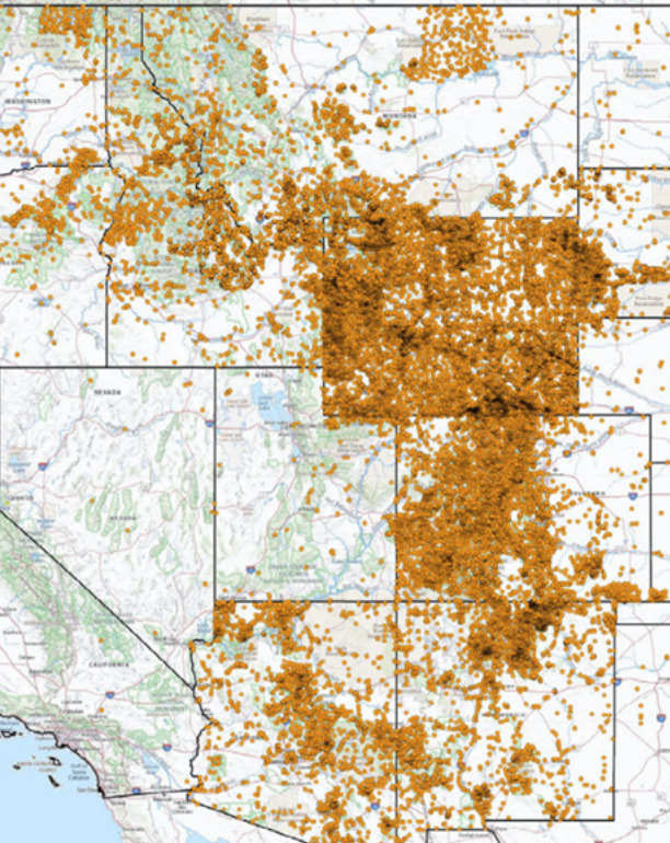
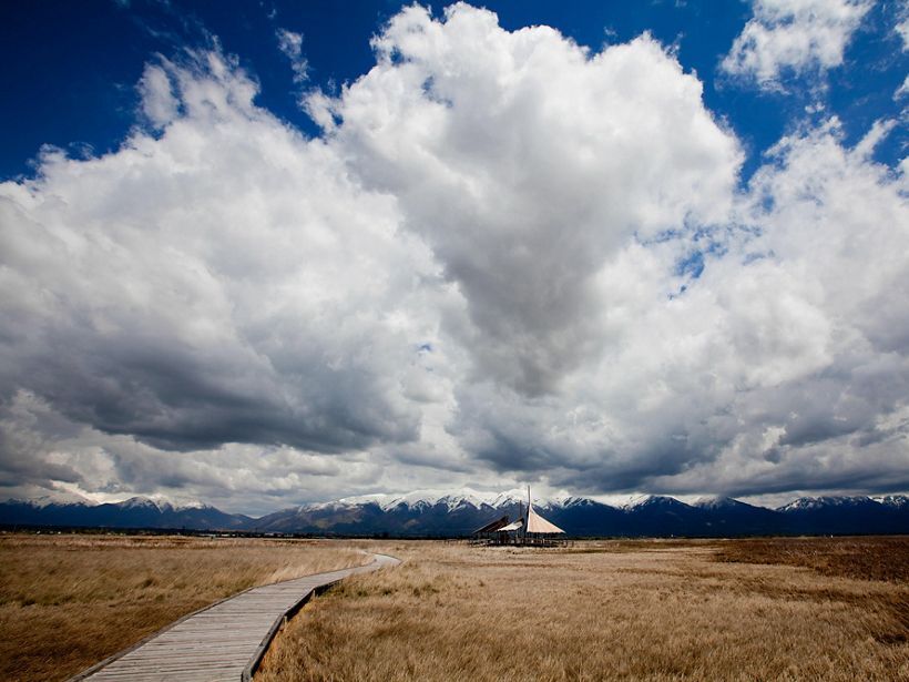
    <summary type="html"><![CDATA[<p><strong><em>Nicknamed “the Bird Refuge,” The Great Salt Lake Shorelands Preserve in Layton, Utah is a rest stop for 4-6 million birds migrating annually. The protected land has also become a recreational spot for tourists and locals to bird watch and enjoy the wetlands of the Great Salt Lake.</em></strong></p><img src="https://www.intermountainhistories.org/files/fullsize/3ea1ff3a8d741ab1d715b39c0db58c87.jpg" alt="Great Salt Lake Pavilion " /><br/><p><span style="font-weight:400;">In 2003, a group called “The Nature Conservancy” gained custody of 4,400 acres of wetlands fed by the waters of the Great Salt Lake. The wetlands lie on the eastern shore of the lake near Farmington Bay and Antelope Island State Park. Nicknamed “the Bird Refuge,” this preserve’s mission is to provide refuge to 4-6 million birds as they make their annual migrations on routes that span from the Arctic to Central and South America. Bird watchers have documented 250 species visiting the Shorelands preserve to feed or rest and 93 species that nest there. The number of birds passing through the area has increased by 25% since 2020, showing the importance of the preserve. </span>
<span style="font-weight:400;">The Shorelands Preserve includes a circular boardwalk spanning about 1 mile. Two wooden structures serve as stops along the boardwalk, one hosting a 30-foot viewing tower for visitors to better observe the surrounding area and to increase their chances of spotting birds. The other is a large wooden pavilion. Informative signs dot the boardwalk, helping visitors identify the birds that frequent the Preserve. They also provide information about the ecosystem of the area. </span>
<span style="font-weight:400;">In May 2020, the Mitigation Commission released a statement turning over ownership of The Nature Conservancy to the federal government. Giving the federal government stewardship over The Nature Conservancy was viewed as a better way to protect the lands from future development. This was crucial at a time when Utah’s Department of Transportation was considering expanding the West Davis Corridor, a road system. The drought-driven shrinking of the Great Salt Lake poses an additional risk to the region. The Nature Conservancy is in the process of developing strategies to divert water to the preserve to help the wetlands and aid the bird species that rely on it.</span></p><p><em><strong><a href="https://www.intermountainhistories.org/items/show/790">For more (including 4 images) view the original article</a></strong></em></p>]]></summary>
    <published>2024-03-03T03:57:53+00:00</published>
    <updated>2026-04-17T19:32:17+00:00</updated>
    <link rel="alternate" type="text/html" href="https://www.intermountainhistories.org/items/show/790"/>
    <id>https://www.intermountainhistories.org/items/show/790</id>
    <author>
      <name>Gabby Segura, Brigham Young University</name>
    </author>
  </entry>
  <entry>
    <title type="html"><![CDATA[The History of Sundance]]></title>
    <summary type="html"><![CDATA[<p><strong><em><span style="font-weight:400;">Sundance, Utah is a small resort in the North Fork of Provo Canyon that has a rich history, particularly within its ownership. The area was originally populated by members of the Ute nation. It then passed into the hands of the Stewart family who arrived with the Latter-day Saints. Most recently it has been the site of a ski resort owned and operated by Hollywood actor Robert Redford. </span></em></strong></p><img src="https://www.intermountainhistories.org/files/fullsize/70ba18fee03d691bf08a4bb9fb530537.jpg" alt="Sundance from Stewarts Cascades Trail, Jun 16" /><br/><p><span style="font-weight:400;">Nestled in Provo Canyon, what is known today as Sundance has a rich history that reflects the different eras of Utah settlement. The land was occupied by the Ute nation beginning in 1,400 AD. Sundance was in an area where the Utes would visit in the summer to enjoy the cool mountain temperatures and lush forests filled with game. The arrival of Latter-day Saint pioneers pushed the Utes out of the area, leaving Sundance to be settled by the Stewart family. </span>
<span style="font-weight:400;">The Stewarts were Scottish immigrants that came to Utah in the mid-1800s. Andrew Jackson Stewart Jr. and his sons surveyed land in Provo Canyon and felt particularly drawn to the area. Through the Homestead Act of 1862, the Stewarts were each able to secure 160 acres of land within the canyon. Other families joined them, and by 1911, there were 2,200 acres of settled land in the North Fork of Provo Canyon that were then known as Stewart Flats. </span>
<span style="font-weight:400;">Stewart Flats began to be recognized for its recreational draw in the 1930s and 40s. In 1944, S. Paul Stewart and his brother and sister-in-law Ray and Ava Stewart opened up Timp Haven, a small ski area that operated for 20 years. Timp Haven was greeted by a noteworthy guest in the 1950s when Hollywood actor Robert Redford accidentally stumbled on the area due to a miscalculated turn on a road trip through the West. </span>
<span style="font-weight:400;">Redford purchased a sizable portion of the Stewart family land in 1969 and renamed the area Sundance, after his character in the western film </span><i><span style="font-weight:400;">Butch Cassidy and the Sundance Kid</span></i><span style="font-weight:400;">. According to Redford, one of his major goals for Sundance was “to develop a little and preserve a great deal.” Instead of succumbing to overdevelopment with hotels and condominiums, Redford’s focus at Sundance was environmental conservation and the promotion of the arts. </span>
<span style="font-weight:400;">In 1978 Redford increased his Utah presence by founding the Sundance Film Festival, held annually in Park City, building on his Sundance legacy. In 2020, Redford sold 2,600 acres, including the Sundance Mountain Resort, to Broadreach Capital Partners and Cedar Capital Partners with an agreement that they would continue Sundance’s pursuit of environmental preservation and conscientious development. </span></p><p><em><strong><a href="https://www.intermountainhistories.org/items/show/789">For more (including 4 images) view the original article</a></strong></em></p>]]></summary>
    <published>2024-03-03T03:43:20+00:00</published>
    <updated>2026-04-17T19:32:17+00:00</updated>
    <link rel="alternate" type="text/html" href="https://www.intermountainhistories.org/items/show/789"/>
    <id>https://www.intermountainhistories.org/items/show/789</id>
    <author>
      <name>Britain Schwarz, Brigham Young University</name>
    </author>
  </entry>
  <entry>
    <title type="html"><![CDATA[Indigenous People of Bryce Canyon]]></title>
    <summary type="html"><![CDATA[<p><strong><em><span style="font-weight:400;">The place known today by millions of people as Bryce Canyon National Park has been known by different names to many other people over centuries. The history of those who have journeyed along the canyon before paths were paved there still have a deep connection to the land. And over the past century, an increasing number of people admire the beauty and appreciate such a connection.</span></em></strong></p><img src="https://www.intermountainhistories.org/files/fullsize/83f8b3ce41456cf4cf8fa80c55f1fc6d.jpg" alt="[Untitled]" /><br/><p><span style="font-weight:400;">Unka tumpee wun-nurrx tungwatsini xoopakichu ahnax, Sikyaatutukwi, Bios to chi bi kool, Angka-ku-wass-a-wits, Bryce’s Canyon. </p><p>These are the former names of the geographic marvel now known as Bryce Canyon National Park. Southern Paiutes, Hopi, Zuni, Ute, and Navajo tribes all lived in this region and enjoyed its natural beauty and wonders. Even before these nations, other ancient peoples lived here for centuries. The Indian names, meaning “place of yellow points,” “red painted faces,” and “red rock standing like a man in a hole,” come from ancient legends of the rock formations now called “hoodoos,” meaning scary or a bad omen. Some claimed that the hoodoos were once people who had been turned to stone. This incredible landscape provided a place for indigenous peoples to hunt and gather grass seeds and other foods, creating a deep connection with the land. </span>
<span style="font-weight:400;">Sadly, from 1850 to 1890, through various laws, acts, and atrocities, Native Americans were forced from Bryce Canyon, some to distant reservations. Those that were far removed from Bryce Canyon, like the Navajo, remembered its beauty through oral histories. The Paiutes were not driven out until about 1880, five years after LDS Scottish Rancher Ebenezer Bryce settled there. From the turn of the century onward, new people began coming into the area to settle or sight-see. In 1916, with help from the Union Pacific Railroad, lodges and rest stations began to be built, providing a place for visitors to stay. In 1923, Bryce Canyon became a National Monument and in 1928 it became a National Park, with the boundaries expanded in 1931 and again in 1942. In 1934 workers of the Civilian Conservation Corps created much of the infrastructure that helped make Bryce Canyon more accessible to the public. Today this beautiful National Park is visited by over 1.5 million people annually.</span>
<span style="font-weight:400;">Though this park is now accessible to many people, the indigenous nations that once lived there still have a great connection to the land through their histories and traditions. In past decades most members of those nations lack the resources needed to visit Bryce Canyon, though more indigenous people are able to visit these sacred sites today. They continue to pass on the traditions and stories to new generations. Some Paiutes have returned to the area and still live nearby. Dozens of people currently reside within Bryce Canyon's lands. Leigh Kuwanwisiwma, a member of the Hopi Tribe, teaches “This is our heaven. This is the human people’s heaven, and we need to appreciate that.” A sacred place to many tribes, and now a nationally protected park, Bryce Canyon deserves respect and reverence as visitors admire its wonders.</span></p><p><em><strong><a href="https://www.intermountainhistories.org/items/show/787">For more (including 3 images) view the original article</a></strong></em></p>]]></summary>
    <published>2024-03-01T23:35:49+00:00</published>
    <updated>2026-04-17T19:32:17+00:00</updated>
    <link rel="alternate" type="text/html" href="https://www.intermountainhistories.org/items/show/787"/>
    <id>https://www.intermountainhistories.org/items/show/787</id>
    <author>
      <name>Rachel Feilbach, Brigham Young University</name>
    </author>
  </entry>
  <entry>
    <title type="html"><![CDATA[Ashley Pond]]></title>
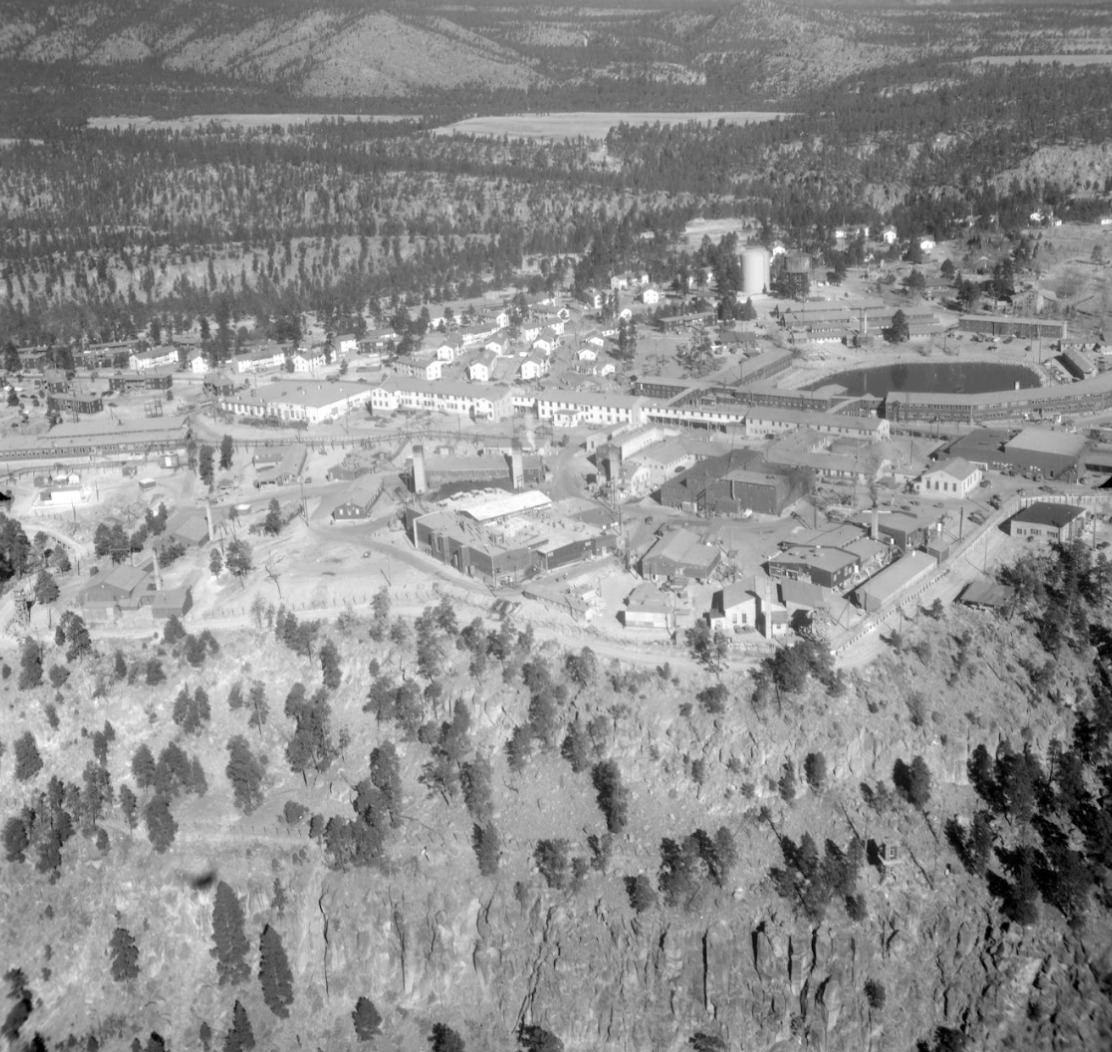
    <summary type="html"><![CDATA[<p><strong><em>From a soggy bog to a beloved community gathering place, the change and continuity of Ashley Pond illustrates the many eras of Los Alamos from homestead to Ranch School to government laboratory to the vibrant community of today.</em></strong></p><img src="https://www.intermountainhistories.org/files/fullsize/474ae326a19e2d428271b8e7a2ab5485.jpg" alt="1946 Aerial View of Los Alamos" /><br/><p><span style="font-weight:400;">Although Ashley Pond is now a prominent green space in the center of Los Alamos, it had a less majestic beginning. In 1908, it was a soggy depression used by homesteader H. H. Brook for watering his stock. Later, the Los Alamos Ranch School used it for the same purpose. Its applicable, albeit unimaginative, first name was the Stock Watering Tank. This was later switched to the Duck Pond in honor of its most popular visitors. The waterhole continued to remain a relatively unimpressive morass until the Ranch School built a dam in Los Alamos Canyon in 1923. This created a small reservoir which fed a pipeline to provide the school with water. The overflow from the pipeline was then dispersed into a puddle which progressively grew into a pond and then a small lake. </p>
<span style="font-weight:400;">The all-boys Los Alamos Ranch School was founded in 1917 by Detroit native, Ashley Pond Jr., who created it to generate tough, intelligent, well-rounded, and experienced outdoorsmen. As such, the students were encouraged to utilize the beautiful landscape for recreation and exercise. The pond provided an ideal place to put their learning into practice. Although never deep enough for true diving, the pond was perfect for canoeing and an excellent place to practice swimming. In the winter, the boys skated across its frozen surface playing hockey and harvesting the ice for the coming year. Ice blocks were stored in a nearby stone ice house and they were known to have collected enough ice to sustain them for up to two years. Once sufficiently filled, school faculty member—and notorious lover of puns—William Mills, provided the name of Ashley Pond in honor of the founder. The official title for the pond is Ashley Pond, not Ashley Pond Pond, but today Los Alamos natives enjoy the humorous anecdote. </p>
<span style="font-weight:400;">When the United States government acquired the land for the Manhattan Project, they allowed the school two months to make other arrangements. The boys went through a hurried graduation and left their beloved mountains, mesas, and pond in the hands of scientists. Manhattan Project staff built the Technical Area, also called TA 1, around the south side of Ashley Pond as a safeguard against fire. They repurposed the ice house as well, using it in 1945 to assemble nuclear components of the “gadget” which would be tested at Trinity. As such, Ashley Pond became restricted under laboratory security and very few outsiders were able to enjoy it. </p>
<span style="font-weight:400;">Today, Ashley Pond is a pleasant downtown landmark of Los Alamos. Situated near the center of town, it is used for picnics, walks, and outdoor concerts in the summer. Los Alamos natives attentively watch the ducks and geese who live at the pond, especially during chick season. During the winter, surrounding trees are decorated with colorful Christmas lights. The local winter parade currently ends at the pond, the same place where the Ranch School boys canoed and harvested ice nearly a century ago. </span>


</p><p><em><strong><a href="https://www.intermountainhistories.org/items/show/750">For more (including 6 images) view the original article</a></strong></em></p>]]></summary>
    <published>2023-09-07T23:39:58+00:00</published>
    <updated>2026-04-17T19:32:16+00:00</updated>
    <link rel="alternate" type="text/html" href="https://www.intermountainhistories.org/items/show/750"/>
    <id>https://www.intermountainhistories.org/items/show/750</id>
    <author>
      <name>Abigail Beus, Brigham Young University</name>
    </author>
  </entry>
  <entry>
    <title type="html"><![CDATA[Shadow Mountain Lookout]]></title>
    <summary type="html"><![CDATA[<p><strong><em>This prime example of “parkitecture” offers both great views and rich architectural history.</em></strong></p><img src="https://www.intermountainhistories.org/files/fullsize/3c4e4b3b2596c254063f778413d4b7ba.jpg" alt="The Shadow Mountain Fire Lookout" /><br/><p><p style="font-weight:400;">By the beginning of the twentieth century, the environment had become an increasingly contentious topic. Led by President Theodore Roosevelt and Chief of the Forest Service, Gifford Pinchot, the conservation movement put utilitarian environmental protection at the front of the American public’s collective mind. The conservationist fervor was especially present in Colorado. This encouraged Congress to grant the Mesa Verde cliff dwellings, located in southwestern Colorado, status as a National Park in 1906. One central Colorado local and avid naturalist, Enos Mills, made it his mission to advocate for park status for a pristine set of peaks along the Rocky Mountains. After Mills campaigned for years, President Woodrow Wilson signed Rocky Mountain National Park into existence in 1915.
<p style="font-weight:400;">From the park’s beginning, wildfire suppression was a top priority. During the park’s first decade, rangers used high mountain tops to monitor the surrounding forests. In 1924, one ranger established a crude and difficult trail to the top of Shadow Mountain to be used for fire surveillance. However, the trail was far too rugged, and in 1930 the Park developed a trail from a nearby lake to the peak of the mountain. The lakes surrounding the peak were popular tourist destinations, and Park visitors soon took to scaling the trail to enjoy the views from the top. This early lookout consisted of little more than a telephone wire running down the steep mountainside and a campsite. The bare site proved successful, however, and the following year the Park Service began construction on a permanent lookout.
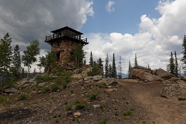
<p style="font-weight:400;">Rocky Mountain National Park completed the Shadow Mountain Lookout in 1933. Considering the number of visitors that would interact with the tower given the trail’s popularity, the Service constructed with aesthetics in mind, using the National Park Service rustic, or  “parkitecture”. This style utilized locally sourced materials that blended into the surrounding landscape. Parkitecture structures are meant to reflect rustic cabins more than bureaucratic facilities. With two lower stories consisting of unprocessed stone masonry and an upper story of evergreen frame, the Shadow Mountain Lookout is a prime example of parkitecture. Park supervisors expected lookouts manning the tower to participate in public relations just as much as fire suppression. In fact, the lower level of the structure acted as a museum, with exhibits concerning park wildlife and fire information.
<p style="font-weight:400;">Today, Shadow Mountain houses the only remaining lookout in Rocky Mountain National Park. Though the interior of the tower is currently closed to the public, the site is accessible by two trails on either side of the mountain. The peak of Shadow Mountain offers impressive views. The Park Service simply asks that hikers watch out for storms, as lightning can pose a danger on exposed mountaintops.</p><p><em><strong><a href="https://www.intermountainhistories.org/items/show/710">For more (including 4 images) view the original article</a></strong></em></p>]]></summary>
    <published>2023-02-23T19:13:08+00:00</published>
    <updated>2026-04-17T19:32:15+00:00</updated>
    <link rel="alternate" type="text/html" href="https://www.intermountainhistories.org/items/show/710"/>
    <id>https://www.intermountainhistories.org/items/show/710</id>
    <author>
      <name>Tanner Hammarstrom, Northern Arizona University</name>
    </author>
  </entry>
  <entry>
    <title type="html"><![CDATA[North Rim Lookout Tower]]></title>
    <summary type="html"><![CDATA[<p><strong><em>The North Rim Lookout Tower helped to protect the area of the Grand Canyon. One can still appreciate immaculate views of the Grand Canyon from high above northern Arizona’s ponderosa forests at the North Rim Lookout Tower which is available to hikers. </em></strong></p><img src="https://www.intermountainhistories.org/files/fullsize/163624658f254fa48626545cb65fa694.jpg" alt="Fire Lookout in the Grand Canyon" /><br/><p><p style="font-weight:400;">Following the Great Fire of 1910, which devastated much of the northern Rocky Mountains, the Forest Service prioritized wildfire suppression. By the mid-1910s, it constructed three small platforms along the Canyon’s edge to spot fires. The North Rim platform, constructed at Bright Angel Point, provided forest rangers and tourists with impeccable views of the forests which lined the Canyon.</p><p>As one of the natural wonders of the world, the Grand Canyon is widely considered one of America’s environmental gems. Federal attempts to preserve the Canyon date all the way back to the late nineteenth century, when the then Indiana Senator, Benjamin Harrison, proposed three bills in the 1880s to set aside the canyon as a national park.<span> </span>Though each of the bills failed, President Harrison eventually granted the Grand Canyon status as a Forest Reserve in the waning days of his presidency in 1893. After President Theodore Roosevelt visited the area in 1903, he granted the site status as a National Monument in 1908, <span>replacing Harrison’s reserve</span><span> </span>. The National Park Service wouldn’t be founded for another eight years, so the Monument fell under control of the fledgling US Forest Service.
<p style="font-weight:400;">The Grand Canyon gained status as a National Park in 1919. The Park Service continued the Forest Service’s policy of fire suppression, and in 1928, it replaced the platform with a seventy five-foot tall steel tower. Topped with a tiny observation cab, fire lookouts lived in a small cabin beneath the structure. Under contract, the Aeromotor Company constructed the Bright Angel Lookout Tower. Aerometer also designed and produced the iconic windmill water pumps which became a symbol of the American West during the late nineteenth and early twentieth centuries.
<p style="font-weight:400;">During the 1930s, the Civilian Conservation Corps (CCC) updated much of the North Rim’s infrastructure. This included moving the Bright Angel Lookout roughly fourteen miles away to the Park’s northern entrance. In 1933, the CCC renamed the structure the North Rim Lookout Tower.
<p style="font-weight:400;">From the late 1960s to the early 1970s, writer and environmentalist Edward Abbey spent four seasons working in the tower. Abbey’s time in the station inspired his book <em>Black Sun, </em>a novel which tells the story of a fire lookout in the Grand Canyon who falls in love with a tourist. When she goes missing, the lookout is blamed for her mysterious disappearance. In his book <em>Fire on the Rim</em>, Stephen Pyne references Abbey as the reason the Park ceased lookout tower operations. “Whether [Abbey] was even in the tower, no one could say. He was a writer, and the only smokes he reported were the ones in his novels… he was absent so often that he demonstrated that we did not need a lookout, because having [Abbey] in the tower was the same as having no one.” Ultimately, the Park opted for aerial fire spotting instead.
<p style="font-weight:400;">Though abandoned, North Rim Lookout Tower is still accessible. Hikers can reach the site via a short hike from the Park’s northern entrance toll booth.</p><p><em><strong><a href="https://www.intermountainhistories.org/items/show/709">For more (including 5 images) view the original article</a></strong></em></p>]]></summary>
    <published>2023-02-23T00:36:16+00:00</published>
    <updated>2026-04-17T19:32:15+00:00</updated>
    <link rel="alternate" type="text/html" href="https://www.intermountainhistories.org/items/show/709"/>
    <id>https://www.intermountainhistories.org/items/show/709</id>
    <author>
      <name>Tanner Hammarstrom, Northern Arizona University</name>
    </author>
  </entry>
  <entry>
    <title type="html"><![CDATA[Devils Tower National Monument]]></title>
    <summary type="html"><![CDATA[<p><strong><em>Devils Tower is a sacred site for Lakotas and Kiowas. Though designated a U.S. national monument, it still occupies a holy place in modern Indigenous beliefs.</em></strong></p><img src="https://www.intermountainhistories.org/files/fullsize/f3dff2d8b50dc270a78c54e5c3344257.jpg" alt="Devils Tower,  Bear Lodge" /><br/><p>In Wyoming’s Black Hills stands a massive geological monument called Devils Tower. To the Northern Plains tribes—the Lakotas, Arapahos, Cheyennes, Shoshones, Crows, and Kiowas—this monument is known by older names: Bear Lodge, Bear’s Tipi, Bear Peak, and Tree Rock. Like its names, the views and value of the Tower differs between U.S. American and Indigenous peoples.
Devils Tower is a magma pillar which cooled underground until erosion over geologic time exposed it. Scientists have studied the formation since the 1880s and still do not fully agree on the processes. In 1906, President Theodore Roosevelt designated Devils Tower as the first U.S. National Monument. Among its 400,000 visitors annually, rock climbers enjoy the unique challenge of scaling its large column formations.
To indigenous peoples, Bear Lodge has a rich spiritual history and significance. A Lakota elder, Johnson Holy Rock, said when asked about the region, “If a man was starving, he was poor in spirit and in body, and he went into the Black Hills, the next spring he would come out, his life and body would be renewed. So, to our grandfathers, the Black Hills was the center of life, and those areas all around it were considered sacred, and were kept in the light of reverence.”
The Lakotas and Kiowas recount the creation of the Tower by telling of a group of little girls playing in the Plains who ran as bears chased them. The Great Spirit had pity on them and made the earth beneath them rise into a large tower, protecting them from the bears as they tried to claw their way up, to no avail. Their claw marks are seen today as great columns on the sides of the mountain.
A Cheyenne warrior, Wooden Leg, once told a story of a man who fell asleep next to a buffalo head at the base of Bear Lodge. While asleep, he and the buffalo head were miraculously transported up the tower by the Great [Spirit] Medicine. When the man woke up, he feared he had no way down, so he prayed. When he woke up the next morning, the Great Spirit had transported him to the bottom of the tower, leaving the buffalo head at the top, where it has remained since then. Many important spiritual leaders have visited Bear Lodge, fasting, praying, and receiving visions and prophecies during their time there, including the Cheyenne Sweet Medicine, the Lakota Sitting Bull, and Crazy Horse.
Northern Plains tribes hold Bear Lodge in great reverence by performing prayers and ceremonies nearby. Around the monument, signs are posted which read, “Please do not disturb prayer bundles and prayer cloths.” Native peoples leave prayer offerings near the surrounding trails. Traditionally, the Lakota held a Sun Dance at Bear Lodge at the time of the summer solstice. This dance focuses on symbolic sacrifice and renewal of man and nature and is sometimes still performed at Bear Lodge.
According to the Northern Plains Native American tribes, Devils Tower is much more than a national monument, unique geological formation, or great place to rock climb. To them, Bear Lodge represents a place to worship, pray, and receive spiritual experiences.</p><p><em><strong><a href="https://www.intermountainhistories.org/items/show/578">For more (including 3 images) view the original article</a></strong></em></p>]]></summary>
    <published>2022-03-12T09:29:23+00:00</published>
    <updated>2026-04-17T19:32:12+00:00</updated>
    <link rel="alternate" type="text/html" href="https://www.intermountainhistories.org/items/show/578"/>
    <id>https://www.intermountainhistories.org/items/show/578</id>
    <author>
      <name>Leah Waldrop, Brigham Young University</name>
    </author>
  </entry>
  <entry>
    <title type="html"><![CDATA[Marigold Mall]]></title>
    <summary type="html"><![CDATA[<p><strong><em>The beautiful landscape of Marigold Mall was named in remembrance of Marigold N. Saunders. After visiting campus as a guest of Adelaide Hardy, Saunders became a patron of BYU students when she bequeathed her fortune to funding scholarships at BYU and other colleges in the West.</em></strong></p><img src="https://www.intermountainhistories.org/files/fullsize/908c44c570f96dc4eac7c77d7f83dd62.jpg" alt="Marigold Mall" /><br/><p><span style="font-weight:400;">Marigold Mall is a pedestrian mall nestled between the </span><a href="https://www.intermountainhistories.org/items/show/314?tour=12&index=10"><span style="font-weight:400;">Harold B. Lee Library</span></a><span style="font-weight:400;">, <a href="https://www.intermountainhistories.org/items/show/575">Herald R. Clark Building</a>, and </span><a href="https://www.intermountainhistories.org/items/show/572"><span style="font-weight:400;">Martin Classroom Building</span></a><span style="font-weight:400;"> on the west and the </span><a href="https://www.intermountainhistories.org/items/show/316?tour=12&index=4"><span style="font-weight:400;">Wilkinson Student Center</span></a><span style="font-weight:400;">, </span><a href="https://www.intermountainhistories.org/items/show/227?tour=12&index=12"><span style="font-weight:400;">Harvey Fletcher Building</span></a><span style="font-weight:400;">, and Clyde Engineering Building on the east. The space has been named and maintained in honor of Marigold N. Saunders and her generous gift to Brigham Young University.</span>
<span style="font-weight:400;">A resident of Oakland, California, Marigold N. Saunders was the wife—and, in her later years, the widow—of H.J. Saunders, a life insurance executive who had worked for companies such as New York Life Insurance and California–Western States Life Insurance. The couple had no children or heirs, but they took an interest in supporting the young. Personal friend and colleague Grant Taggart remembered them as “an inspiration” who mentored him from an eighteen-year-old salesman into a member of the California–Western board of directors.</span>
<span style="font-weight:400;">After contemplating how to bequeath her wealth, Saunders decided to leave it to college students in need in the form of scholarships. Saunders named Taggart executor of her estate and instructed him to take whatever remained of her wealth after other bequests and taxes and donate it to universities and colleges of his choosing.</span>
<span style="font-weight:400;">BYU was one clear choice. Saunders had visited BYU as a guest of Adelaide Hardy before Hardy’s passing in 1967. As the Provo </span><i><span style="font-weight:400;">Daily Herald</span></i><span style="font-weight:400;"> related, Saunders “was tremendously impressed by what she saw and learned about the University, what it stood for, and what it was doing with young people.”</span>
<span style="font-weight:400;">After contacting BYU administration, in May 1977 Taggart publicly announced the Saunders estate was donating $500,000 to BYU for the establishment of an endowment to fund scholarships. Dallin H. Oaks, BYU president at the time, announced that this endowment would annually finance twenty-five “Marigold N. Saunders Awards.” Each grant fully funded a student’s tuition for two semesters. In gratitude, the Board of Trustees moved to name the campus’ north-south pedestrian mall “Marigold Mall,” in Saunders’s honor, and landscape it with decorative flora, including marigolds.</span>
<span style="font-weight:400;">Today, a commemorative plaque on the east side of the Lee Library denotes Marigold Mall. The landscape stretches as far south as Campus Drive, encompassing both the concrete sidewalks between the library and Wilkinson Center and the grassy lawns between the Clyde Building and Martin Building.</span>
<span style="font-weight:400;">In addition to the sidewalks, benches, and lawns—perfect for resting between classes—the mall also hosts three distinctive art pieces. The class of 1916 established a sundial on the mall, giving the time during daylight hours. Since 1975 (just two years before the mall was named for Saunders), the south end has featured </span><i><span style="font-weight:400;">Windows of Heaven</span></i><span style="font-weight:400;">, a stained glass statue by sculptor Francis P. Riggs commissioned to celebrate BYU’s centennial year. And in 2002, BYU relocated </span><i><span style="font-weight:400;">First Born</span></i><span style="font-weight:400;">—a statue featuring a family holding hands—from the then-demolished Smith Family Living Center to the north end of the lawns on Marigold Mall.</span>
<span style="font-weight:400;">Saunders’s gift continues to finance what is now known as the Marigold N. Saunders Scholarship, which fully funds each recipient’s tuition for a year, and Marigold Mall continues to express BYU’s “grateful remembrance.”</span></p><p><em><strong><a href="https://www.intermountainhistories.org/items/show/574">For more (including 16 images) view the original article</a></strong></em></p>]]></summary>
    <published>2022-02-27T10:46:58+00:00</published>
    <updated>2026-04-17T19:32:12+00:00</updated>
    <link rel="alternate" type="text/html" href="https://www.intermountainhistories.org/items/show/574"/>
    <id>https://www.intermountainhistories.org/items/show/574</id>
    <author>
      <name>Makoto Hunter, Brigham Young University</name>
    </author>
  </entry>
  <entry>
    <title type="html"><![CDATA[Fossil Butte]]></title>
    <summary type="html"><![CDATA[<p><strong><em>Congress created Fossil Butte National Monument on October 23, 1972 to protect exceptionally rare paleontological sites and other geographical phenomena in southwestern Wyoming near Kemmerer. Fossil Butte is the site of a 50-million-year-old lakebed from the Eocene Epoch within the Green River Formation.</em></strong></p><img src="https://www.intermountainhistories.org/files/fullsize/7280e502631197b6e088eb0694915fa6.jpg" alt="Fossil Butte National Monument" /><br/><p>Dubbed “America’s Aquarium in Stone” by the National Park Service, Fossil Butte is exceptional because it has many well-preserved fossils, especially those of aquatic animals. It is considered by researchers to be one of the richest paleontology sites on earth. Paleontologists have recovered fossils of crustaceans, gars, stingrays, plankton, crocodiles, turtles, bivalves, and birds, among many others, preserved for 56 to 34 million years. Fossil Butte used to be the smallest of three prehistoric lakes from the Eocene Epoch in what is now southwest Wyoming, northeast Utah, and northwest Colorado, collectively known as the Green River Lake System. The bottom of the lake is thought to have contained hydrogen sulfide, which is poisonous, which prevented fish from scavenging off of the lake bottom. When an animal in the lake died, it sank to the bottom of the lakebed and remained undisturbed, eventually to be covered and preserved beneath the mud. Fossil Butte is also famous for fossils of mass mortalities, where many fish all died at the same time and became fossilized next to each other. This could be caused by a variety of factors like seasonal changes in water salinity or PH. It is likely as well that the hydrogen sulfide became disturbed from time to time and caused poisonings.
Though some explorers like Ferdinand V. Hayden and John C Frémont already knew about the fossil beds in this area, the full extent of Fossil Butte’s paleontological significance wasn’t understood until the late 1860s. The Union Pacific Railroad’s construction passed through the formation, and railroad workers showed fossils to paleontologists. One collector, Robert Craig, began quarrying fossils there in 1897. The site gained interest from museums around the world for its richness in high-quality fossils. As a result of this fame, Congress created the Fossil Butte National Monument in 1972 to preserve some of it for public viewing.
The visitor center of the Fossil Butte National Monument Visitor Center has over eighty fossils on display of various types of prehistoric aquatic creatures, as well as a variety of prehistoric bats, birds, plants, and insects. The center shows a thirteen-minute video to inform visitors about the discoveries paleontologists have made within the site. Visitors are allowed to make their own “fossil imprints” as souvenirs and access an educational computer program about fossils and the natural history of the monument.</p><p><em><strong><a href="https://www.intermountainhistories.org/items/show/514">For more (including 6 images) view the original article</a></strong></em></p>]]></summary>
    <published>2021-10-15T07:17:23+00:00</published>
    <updated>2026-04-17T19:32:11+00:00</updated>
    <link rel="alternate" type="text/html" href="https://www.intermountainhistories.org/items/show/514"/>
    <id>https://www.intermountainhistories.org/items/show/514</id>
    <author>
      <name>Jacob French, Northern Arizona University</name>
    </author>
  </entry>
  <entry>
    <title type="html"><![CDATA[Weippe Prairie Exploration ]]></title>
    <summary type="html"><![CDATA[<p><strong><em>Originally a major transportation and trade junction for the Nez Perce and their neighbors, Weippe Prairie became the location for a pivotal moment in US history in September 1805. The Nez Perce welcomed the Lewis and Clark expedition there and established a friendly relationship between the United States and the Nez Perce Nation that lasted into the 1850s. </em></strong></p><img src="https://www.intermountainhistories.org/files/fullsize/5bae0596c4e3ef4ffe9e5e6f4b994891.jpg" alt="Weippe Praire" /><br/><p>More than two hundred years ago, Weippe Prairie was a major transportation and trade junction for the Nez Perce Nation. The prairie was simply called Weippe by those living in the area (Weippe being derived from the Nez Perce term <em>Oyáyp</em>). Weippe Prairie was also one of the main root-gathering grounds, with American Indians from different bands making the journey to Weippe to harvest the root <em>qém’es, </em>later called the “camas” root by explorers.
On September 20, 1805, Lewis and Clark exited the Lolo Trail over the Bitterroot Mountains and entered Weippe Prairie. Clark took a scouting party and went ahead where they were met by Al-We-Yas, a Nez Perce village leader and the brother of Chief Twisted Hair. Al-We-Yas approached Clark’s group with caution. Unbeknownst to Clark, Chief Peo-Peo-Tah-Likt had strategically sent Nez Perce warriors to surround Clark’s group, waiting for any hostile movements. This is the first recorded historical meeting between Nez Perce leaders and US representatives. Al-We-Yas sent messengers to neighboring tribes announcing the coming of the Americans. This also represented a moment prophesied by American Indian spiritual leaders, which caused many chiefs and village leaders to make decisions concerning their relationship with the Americans. They debated whether to kill them or establish a peaceful and friendly relationship with them. Because Clark had made a favorable impression on Chief Twisted Hair and his son, the village leaders decided not to kill Lewis and Clark’s exploration group. This interaction was a pivotal moment in the life of Chief Twisted Hair’s son, Aleiya, who would later be known as Chief Lawyer. Chief Lawyer would go on to become one of the most influential advocates for an alliance between the US government and the Nez Perce Indians.
<span>Nez Perce were greatly generous toward Lewis and Clark’s exploration group. In addition to feeding the famished explorers, Nez Perce also provided geographical knowledge so they could navigate the Clearwater River. They also tended the expedition's horses throughout the winter while the group travelled to the coast and back.</span> On September 24, the Lewis and Clark exploration departed the Nez Perce village and continued via dugout canoes on to the Pacific. The following year on their return journey in 1806, Lewis and Clark reunited with the Nez Perce on their return journey and stayed with them for up to seven weeks while waiting for the snow to melt in the Bitterroot Mountains.</p><p><em><strong><a href="https://www.intermountainhistories.org/items/show/479">For more (including 3 images) view the original article</a></strong></em></p>]]></summary>
    <published>2021-09-11T08:44:58+00:00</published>
    <updated>2026-04-17T19:32:10+00:00</updated>
    <link rel="alternate" type="text/html" href="https://www.intermountainhistories.org/items/show/479"/>
    <id>https://www.intermountainhistories.org/items/show/479</id>
    <author>
      <name>Haley Hakala, Brigham Young University</name>
    </author>
  </entry>
  <entry>
    <title type="html"><![CDATA[Oro City: The Beginnings of Leadville]]></title>
    <summary type="html"><![CDATA[<p><strong><em>A once prosperous mining town, Oro City is not just a ghost town left behind by the Colorado gold rush. It is also an environmental hazard.</em></strong></p><img src="https://www.intermountainhistories.org/files/fullsize/128ef543b5fc00e04b72795a7bffb3a1.jpg" alt="Hydraulic mining in California Gulch" /><br/><p><span style="font-weight:400;">In early 1860, prospectors were exploring gulches and panning for gold deep in the Rocky Mountains of Colorado. One prospector, Abe Lee, produced the lucky pan with gold in late April. They named the area California Gulch, supposedly because Abe Lee exclaimed, “I’ve just got California in this here pan!” By summer of the same year, California Gulch’s population had risen from the original party of miners to five thousand individuals, including women. California Gulch was seven miles long and a city grew around it, eventually concentrated toward the northern end of the Gulch. This town came to be known as Oro City and served as the precursor to the modern-day city of Leadville.</span>
<span style="font-weight:400;">Oro City experienced waves of growth and decline as the seasons changed and as gold waned and silver and ore increased. In the beginning, the city had no official government and instead operated using the miners’ code and group meetings.  When Colorado became a territory the next year, Oro City became the county seat of Lake County and elections were held. The city’s population fluctuated seasonally, as winter conditions made mining difficult or impossible. Annual spring thaws repeatedly brought miners back until around 1865. By that point around five million dollars of gold had been extracted from three miles of the gulch, but gold-producing ore was exhausted. The population began to decline thereafter. A stamp mill named “The Printer Boy” was constructed in 1868 and helped partially sustain the local economy, but diminishing ore and continued technological troubles with requisite water pumping hindered business. The Printer Boy soon closed, along with other mills and smelters, and Oro City’s population moved elsewhere.</span>
<span style="font-weight:400;">In 1873 or 1874, a new settlement emerged near Oro City named Slabtown. Slabtown </span><span style="font-weight:400;">later became Leadville when William H. Stevens and Albinus B. Wood began the “Oro Mining Ditch and Fluming Company.” Stevens and Wood bought up large areas in the California Gulch and began producing silver and lead. Mining became concentrated in the Gulch, and the population moved down the mountain.</span>
<span style="font-weight:400;">Today, California Gulch is one of over 200 superfund sites in the state of Colorado, sites the EPA has specifically set aside for environmental recovery. For the most part, the 18 square miles of the superfund site is under control, although young children and expecting mothers should monitor their blood for heavy metals. Although the exposure is under control, the EPA will need to finish construction to seal up mines to create an area that is safe for the public to enter.</span></p><p><em><strong><a href="https://www.intermountainhistories.org/items/show/475">For more (including 3 images) view the original article</a></strong></em></p>]]></summary>
    <published>2021-09-10T23:09:03+00:00</published>
    <updated>2026-04-17T19:32:10+00:00</updated>
    <link rel="alternate" type="text/html" href="https://www.intermountainhistories.org/items/show/475"/>
    <id>https://www.intermountainhistories.org/items/show/475</id>
    <author>
      <name>Nikki Smith, Brigham Young University</name>
    </author>
  </entry>
</feed>