<?xml version="1.0" encoding="UTF-8"?>
<feed xmlns="http://www.w3.org/2005/Atom">
  <title type="text">Intermountain Histories</title>
  <updated>2026-04-17T19:32:20+00:00</updated>
  <generator uri="http://framework.zend.com" version="1.12.20">Zend_Feed_Writer</generator>
  <link rel="alternate" type="text/html" href="https://www.intermountainhistories.org/"/>
  <link rel="self" type="application/atom+xml" href="https://www.intermountainhistories.org/items/browse?output=rss2"/>
  <id>https://www.intermountainhistories.org/</id>
  <author>
    <name>Intermountain Histories</name>
    <uri>https://www.intermountainhistories.org</uri>
  </author>
  <link rel="hub" href="https://pubsubhubbub.appspot.com/"/>
  <entry>
    <title type="html"><![CDATA[Thomas Rhoads, The Forgotten Mormon<br />
]]></title>
    <summary type="html"><![CDATA[<img src="https://www.intermountainhistories.org/files/fullsize/8270cbc2aff28b5cd485285278466bee.jpg" alt="Map demonstrating the “Old Spanish Trail” initially used by Colonial Spanish in the late sixteenth century." /><br/><p><span style="font-weight:400;">Born in 1796 in Kentucky, Thomas Rhoads fought for the U.S. Army in the War of 1812. Marrying his first wife Elizabeth Forter in 1817, having sixteen children together, he then converted to The Church of Jesus Christ of Latter-day Saints in Nauvoo, Illinois, in 1835. Rhoads belonged to the Danites and to the Nauvoo Legion as Lieutenant. He moved his family from Illinois to Missouri and finally to California. Rhoads led the first LDS pioneers into future Utah Territory in 1846, before continuing west into California, where he struck gold. After Samuel Brannon refused church leaders’ call to return to Great Salt Lake City, Brigham Young wrote to Rhoads asking him to lead members and tithes back to Salt Lake.</p> <span style="font-weight:400;">Arriving in 1849 at the head of a wagon train, the Saints hailed Rhoads as a hero in a parade wherein Young spoke of Rhoads’ vital contributions of gold to the territory. Submitting four thousand dollars’ worth of gold members had sent as tithing, Rhoads then gave his own seventeen thousand dollars of gold. In exchange Rhoads was given an exceptional plot of land near the temple in Salt Lake and credited with over ten thousand dollars in the church bank ledger, the only man to receive his own dedicated page in the ledger aside from Brigham Young himself.</p> <span style="font-weight:400;">Rhoads served Brigham Young in many ways to help establish Utah Territory’s economic footing over the coming years. Young handpicked Rhoads multiple times to accompany him on scouting parties around the state to determine future settlements. Furthermore, Rhoads continued to provide a steady supply of gold each year to the Mormon mint. Multiple primary sources describe his deliveries in person; however, the church ledgers do not record the deposits, and scholars debate the amounts. Ultimately, the income was crucial to the young community facing extreme opposition as minted gold coins contributed to the perpetual immigration fund as well as construction of the temple.</p> <span style="font-weight:400;">Just as the amount is contested, so are the various sources. Accounts detail how Rhoads knew about a multitude of old mines in the mountains, abandoned by the Spanish. Several of these mines have been located and confirmed, others were claimed to have been found but were not accessible, while others still are lost. Most controversial amongst these is “Carre Shin Ob” located near White Rocks Canyon in the Wasatch Forests of Eastern Utah. As the story goes, in 1852 Brigham Young and Utes Chief Walker entered an arrangement thanks to Isaac Morely, wherein Rhoads would be permitted to travel alone deep into Indian territory to retrieve gold for the Mormon church. Walker was a convert and believed in the church, giving three simple rules: only Rhoads may know the location, he only takes the specified amount, and no Ute Indians would transport gold.</p> <span style="font-weight:400;">Dozens of accounts detail Rhoads’ travels; and the days absent compared to confirmed distance traveled proves wherever Rhoads retrieved gold from, he did not have to mine it himself. Scientific analysis of remaining Mormon mint coins matches the chemical makeup of old Spanish gold mined in the era. There are critiques that doubt the stories of Rhoads’ lost mine; regardless, Rhoads gathered gold from somewhere and this gold was immensely important to the foundation of Salt Lake City and eventually Utah.</span></p><p><em><strong><a href="https://www.intermountainhistories.org/items/show/877">For more (including 4 images) view the original article</a></strong></em></p>]]></summary>
    <published>2025-01-25T03:15:14+00:00</published>
    <updated>2026-04-17T19:32:20+00:00</updated>
    <link rel="alternate" type="text/html" href="https://www.intermountainhistories.org/items/show/877"/>
    <id>https://www.intermountainhistories.org/items/show/877</id>
    <author>
      <name>Travis Sorensen, Brigham Young University</name>
    </author>
  </entry>
  <entry>
    <title type="html"><![CDATA[Curtis Edwin Bolton, Founder of Boltonheim, Utah]]></title>
    <summary type="html"><![CDATA[<p><strong><em><span style="font-weight:400;">The winds of time swept the frontier town of Boltonheim, Utah Territory, into historical obscurity. Its founder, Curtis Edwin Bolton, served as postmaster from 1878-1880. </span></em></strong></p><img src="https://www.intermountainhistories.org/files/fullsize/3e28561583744c431a467eba45d02141.jpg" alt="Bureau of Land Management, “Survey Search” from General Land Office Records" /><br/><p><span style="font-weight:400;">Sent by his wealthy merchant father, Curtis Edwin Bolton sailed to Europe in 1832 to study French and German, leaving his fiancée </span><span style="font-weight:400;">behind in New York. At twenty-years-old Curtis Edwin Bolton was 5’9” with blue eyes and black hair. He returned stateside in the fall of 1834. As a new convert, he pilgrimaged with the diaspora of The Church of Jesus Christ of Latter-day Saints to the Great Salt Lake Valley in 1848. His first winter, he taught French in the evenings in their bedbug-infested fort. In 1849, Curtis accepted a mission call to serve in France, embarking with a small group of missionaries.</span>
<span style="font-weight:400;">While Curtis labored to translate the Book of Mormon into French in his Paris apartment in 1851, a tangible stillness fell upon the noisy bustling city as Louis-Napoléon Bonaparte’s troops flooded through the streets nearby. On signal, the soldiers leveled their weapons at the innocent bystanders watching out their windows. With an infernal roar of artillery, they bombarded thousands of men, women, and children. After hiding in his apartment for two days, Curtis stepped out, stunned by the destruction of the coup d’état. He resided in France until 1853. </span>
<span style="font-weight:400;">Life pulled him to the frontier desert areas of southern Utah Territory. He led a Fourth of July celebration in Santaquin, rode the rapids in the Muddy Mission, and taught school in Long Valley and Monroe. Popular in local elections, he served as Piute County Clerk and Justice of the Peace, in addition to merchant, miner, and sawmill owner. </span>
<span style="font-weight:400;">Proud of his robust nature, he boasted he could walk fifty miles in one day. His strength and endurance fueled many of his accomplishments. In his sixties, he homesteaded in Piute County near the Sevier River, where he built his final home, a two-room log house with a shingle roof and board floor. He also dug miles of irrigation ditches and cultivated twenty acres (SLC Land Office, Curtis Bolton homestead file). He founded a town called Boltonheim, meaning “Bolton home” in German, located five miles south of Marysvale, where he served as the postmaster from 1878 until 1880. In those days, a letter only cost three cents for postage.</span>
<span style="font-weight:400;">A stroke in 1883 prompted Curtis to transfer ownership of his homestead to Sarah Howes, in exchange for her pledge of lifelong care. After battling stiffness in his right hand for two years, he stepped down from his role as county clerk at the age of seventy-three. Curtis’s life reflects the adventurous drive that brought many pioneering individuals westward.</span></p><p><em><strong><a href="https://www.intermountainhistories.org/items/show/876">For more (including 6 images) view the original article</a></strong></em></p>]]></summary>
    <published>2025-01-25T02:32:23+00:00</published>
    <updated>2026-04-17T19:32:20+00:00</updated>
    <link rel="alternate" type="text/html" href="https://www.intermountainhistories.org/items/show/876"/>
    <id>https://www.intermountainhistories.org/items/show/876</id>
    <author>
      <name>Connie L. Vance, Brigham Young University</name>
    </author>
  </entry>
  <entry>
    <title type="html"><![CDATA[Echo Railroad Depot]]></title>
    <summary type="html"><![CDATA[<p><strong><em>The Echo Railroad Depot was moved to its present site in Coalville in 1975.</p></strong></p><img src="https://www.intermountainhistories.org/files/fullsize/d1e07ea7df89d14108a032b609935e98.jpg" alt="The Echo Railroad Depot " /><br/><p><span style="font-weight:400;">In 1861, the town of Echo, Utah was founded. When tracks were laid down in Echo, the town shifted from an agricultural community to a railway hub. By 1869, the first of many trains passed through the area and its first railway station. As was common, young men flocked to Echo for work on the railway. Once this initial depot was completed, only a small number of these men remained in the town to settle down and continue work in the area. </span>
<span style="font-weight:400;">By 1880, a second depot was completed and was used until 1913, when a third and final depot was erected. It was a popular and important place for much of northern Summit County. People came from miles around to receive the latest news, telegrams, and the results of sports games. The building also had living quarters for the acting agent and his family. A kitchen, pantry, living room and 2 bedrooms. Occasionally, extra space was used for newcomers until they found homes nearby.  </span>
<span style="font-weight:400;">The town continued to grow and thrive thanks to these depots, drawing people and resources into the town. One of the depot's employees, Mike Tsoukatos, a native of Greece, designed an elaborate garden outside the depot and named it the Park. Tsoukatos used his own money to bring in beautiful plants and flowers that were the envy of all gardeners in the area. Sadly, when Tsoukatos retired, the garden was left neglected and was eventually laid over with gravel to make a parking lot.</span>
<span style="font-weight:400;">As time passed and railways gave way to other modes of transportation, the town morphed from vital to unneccessary and unknown. In 1960, the final steam engine made its way through the Echo Railroad Depot. However, thanks to the efforts of Henry Pennybaker, Pennybaker and other volunteers moved the building to its present location just west of the Summit County Fairgrounds in Coalville. It serves as the North Summit County Senior Citizen Center.</span></p><p><em><strong><a href="https://www.intermountainhistories.org/items/show/697">For more (including 4 images) view the original article</a></strong></em></p>]]></summary>
    <published>2022-11-04T17:36:15+00:00</published>
    <updated>2026-04-17T19:32:15+00:00</updated>
    <link rel="alternate" type="text/html" href="https://www.intermountainhistories.org/items/show/697"/>
    <id>https://www.intermountainhistories.org/items/show/697</id>
    <author>
      <name>Scarlett Alexis Wilson, Weber State University</name>
    </author>
  </entry>
  <entry>
    <title type="html"><![CDATA[Tarlton Lewis, “Grand Old Man”]]></title>
    <summary type="html"><![CDATA[<p><strong><em>Tarlton Lewis, a survivor of the Hawn’s Mills Massacre in Missouri, went on to live an energetic life as he explored the West and settled new towns such as Parowan and Minersville in Iron and Beaver Counties in Utah. He lived his life helping other Latter-day Saints, farming and building on the land, and raising a family in the desert.</em></strong></p><img src="https://www.intermountainhistories.org/files/fullsize/04d4a6e7d1c614593ab9129186616d5d.jpg" alt="Tarlton Lewis" /><br/><p>Tarlton Lewis was the fourth of twelve children born to Neriah Lewis and Mary Moss on May 18, 1805 in South Carolina. Tarlton married Malinda Gimlin on March 27, 1828; over the course of their marriage, they had eight children together. While living in Illinois, Tarlton and Malinda joined The Church of Jesus Christ of Latter-day Saints (sometimes nicknamed “Mormons”) and were baptized July 25, 1836 by Tarlton’s older brother Benjamin Lewis. The brothers joined moved to Missouri to live among other Latter-day Saints, and on October 30, 1838, while living near Hawn's Mill, they were attacked by a violent mob agitating for the expulsion of all Mormons from Missouri. The mob murdered Tarlton’s older brother Benjamin, and Tarlton suffered an injury to his shoulder; their younger brother David, however, was uninjured.
After surviving this tragedy, the brothers moved with other Latter-day Saints to Nauvoo, Illinois. There, Joseph Smith, president of the Church, and his brother Hyrum set apart Tarlton as bishop of the Nauvoo Fourth Ward. Also in Tarlton and Malinda received the endowment and sealing ordinances—the Church’s highest sacraments—before joining the mass exodus of Latter-day Saints from Nauvoo, leaving behind the temple they had spent years helping build.
The Lewis family left as part of the second wave of Saints, fleeing westward across the Mississippi Rive, but Tarlton himself stayed behind to continue his service as a bishop and help the Church members under his care prepare to go West. After many weeks crossing Iowa, they settled temporarily at Council Bluffs in Pottawattamie, Iowa, 1846.
After the Latter-day Saints regrouped in Iowa, Tarlton joined the first company of pioneers departing in 1847. As part of the Vanguard Company led by Brigham Young—Smith’s successor to the Church presidency—Tarlton was captain of 50 wagons and entered the Salt Lake Valley on July 21, 1847. There, Young called Tarlton as the first bishop in Salt Lake Valley, and Tarlton remained in the valley to build cabins and plant crops for the Saints who would arrive next. After an almost two-year separation, Tarlton reunited with his family when they arrived at the Salt Lake Valley on September 21, 1848.
Two years later, in December 1850, the Church called Tarlton to travel with apostle George A. Smith and one hundred others to explore southern Utah. Tarlton again captained 50 wagons, and on January 17, 1851, the explorers officially organized Iron County. In their first election, the young county elected Tarlton Lewis as a magistrate. George Smith organized the settlement into four wards, and Tarlton became bishop of the Second Ward in Parowan. The Lewis family helped build roads, log cabins, and furniture.
After Tarlton’s brother David died in September 1855, Tarlton married two of his brother’s widows as polygamous wives. Tarlton explored the mountains of Beaver Valley for lead ore, finding a mine and becoming a director of it. They also helped found Minersville, and Tarlton was active in the community and donated a portion of his lot to finance a Relief Society building. Life in Minersville was a struggle as farming was difficult with little water from Beaver Creek.
The family managed a humble living for fourteen years until the Church assigned Tarlton to establish a United Order in Joseph, Sevier County. The most pressing issue that settlers faced was the difficulty of irrigating water for farmlands; their hard work was paid off with “diverse crops as apples, apricots, peaches, pears, grapes, and black walnuts,” but there was not enough to make Joseph prosper. The Lewises lived there a few years before moving northeast to the larger town of Richfield, and the United Order in Sevier County dissolved in November 1877. Apostle Erastus Snow then set Tarlton apart as bishop of the Richfield Second Ward on July 16, 1877. As an active citizen of Richfield, Tarlton and a hundred other citizens petitioned the Utah Territorial House to incorporate the town, and the provision passed.
Tarlton’s time as a bishop in Richfield was brief, as health complications warranted his resignation a year later, but he recovered his strength enough to serve as a stake patriarch, as listed in the Sevier Stake Conference for August 27, 1887.
Tarlton Lewis died on November 22, 1890 at Teasdale, Utah Territory, at the home of his son, Beason Lewis. He was buried in the Teasdale Cemetery. In 1987, Mount View Camp, the Daughters of Utah Pioneers, and the Lewis Family sponsored and built a marker and plaque at his burial site in 1987.</p><p><em><strong><a href="https://www.intermountainhistories.org/items/show/633">For more (including 3 images) view the original article</a></strong></em></p>]]></summary>
    <published>2022-07-01T03:06:04+00:00</published>
    <updated>2026-04-17T19:32:13+00:00</updated>
    <link rel="alternate" type="text/html" href="https://www.intermountainhistories.org/items/show/633"/>
    <id>https://www.intermountainhistories.org/items/show/633</id>
    <author>
      <name>Debra Tangren, Brigham Young University</name>
    </author>
  </entry>
  <entry>
    <title type="html"><![CDATA[Fruita Schoolhouse: Learning and Community]]></title>
    <summary type="html"><![CDATA[<p><strong><em>Capitol Reef National Park is one of the greatest hidden gems of Central Utah, home to fossils, beautiful hikes, and several historical sites. Of these historical sites, one of the most popular is the Fruita Schoolhouse, a physical memory of what life was like in humble, nineteenth-century Fruita.</em></strong></p><img src="https://www.intermountainhistories.org/files/fullsize/fdf1c72a53ae4ee8430fc91744c589cd.jpg" alt="Step into the past" /><br/><p>In 1893, historian Frederick Jackson Turner famously claimed the year 1890, three years prior, marked the closing of the American Frontier. It seemed in the 1890s that America’s expansionist spirit was shifting from the continental Wild West to locations abroad such as Cuba and the Philippines, pivoting away from consolidating a land empire and toward questing for a sea empire. Pioneers in Fruita, Utah, however, were still preoccupied in the 1890s with frontier processes. Although they had secured their isolated, red rock land, even in 1890 their community lacked important infrastructure such as education, a postal service, and a building for worship.
As they settled in and secured the land, the pioneers were able to gather sufficient time and organization to put together more of a society, beginning with an education system. Nettie Behunin, a young girl 12 years of age, became one of the first teachers.  Nettie might not have been a truly qualified teacher by twenty-first-century standards—or perhaps even by her own—but her endeavors marked the beginning of the first community project in the area: the schoolhouse.
In a collection of childhood memories of Fruita, Clay M. Robinson reflects on his experience as a young boy in the newly built Fruita schoolhouse as his mother was the teacher at the school during his childhood. He writes, “Most vivid of all in those memories, are Mama and the little one-room sawed-log Fruita school where she taught all eight grades in the years 1925–1927.” He also mentioned that the schoolhouse was used for Sunday church services and Sunday School—most of Fruita were members of The Church of Jesus Christ of Latter-day Saints, or Mormons—because there was no dedicated chapel in Fruita. Since residents could rearrange the in the schoolhouse, the small building served as a community center that could host different events like dances, box socials, knitting group meetings, and gatherings for men and young boys who enjoyed baseball. The Fruita schoolhouse evidently served as a center of the community, where the small number of settlers could gather to enjoy each other’s company.
The Fruita schoolhouse still stands today. Tourists can easily see it as they drive through the park since it is located just to the side of the highway. At times the Park Service offers tours in the old schoolhouse that allow small children to briefly roleplay pioneer school life. This schoolhouse represents the first community building of the Fruita settlement, as well as a reminder of what life was like for the small community of Latter-day Saint settlers.</p><p><em><strong><a href="https://www.intermountainhistories.org/items/show/632">For more (including 4 images) view the original article</a></strong></em></p>]]></summary>
    <published>2022-07-01T01:26:07+00:00</published>
    <updated>2026-04-17T19:32:13+00:00</updated>
    <link rel="alternate" type="text/html" href="https://www.intermountainhistories.org/items/show/632"/>
    <id>https://www.intermountainhistories.org/items/show/632</id>
    <author>
      <name>Rachelle E. Robins, Brigham Young University</name>
    </author>
  </entry>
  <entry>
    <title type="html"><![CDATA[Glen and Bessie’s Colorado River Trip, Part 1: Lee’s Ferry]]></title>
    <summary type="html"><![CDATA[<p><strong><em>Hoping for fame and wealth, Glen and Bessie Hyde began the adventure that has since then lived in infamy in Grand Canyon Lore. One of their last stops before entering the Grand Canyon was Lee’s Ferry. </em></strong></p><img src="https://www.intermountainhistories.org/files/fullsize/5ca492318f46bcb92d010b211cc24f53.jpg" alt="Ferry and ranch" /><br/><p>John D. Lee, a member of The Church of Jesus Christ of Latter-day Saints, founded Lee’s Ferry in the early 1870s to function as a link between the Latter-day Saint heartland in Utah and new settlements in Arizona. A committed polygamist, Lee built several houses for his multiple families in the following years, naming this group of buildings Lonely Dell Ranch. After the authorities arrested Lee for his role in the Mountain Meadows Massacre of 1857, Church leaders gave the title for the Ferry and Ranch to Warren Johnson and his family in 1879. The Johnson family was still living on the post when Glen and Bessie Hyde arrived on November 5, 1928, though the Ferry had permanently closed that summer.
The Hydes had started their journey from Greenriver, Utah, on October 20, well provisioned with food and other supplies. They came equipped with all the necessary tools to document their trek, including a small Kodak camera and a notebook which Bessie used to record daily events. Yet curiously they did not take any life preservers or personal floatation devices with them.
The Hydes’ trip to Lee’s Ferry was relatively uneventful, aside from Bessie falling out of the scow on October 27 in Cataract Canyon. Overall, both were in good spirits.
The inhabitants of Lee’s Ferry were aware of the hazards of the Colorado River. Glen and Bessie were just one in a series of river expeditions that came through Lee’s Ferry. Other private excursions, Latter-day Saint expeditions, and US Government Survey teams had all passed by the post through the years. Most of these groups had foundered in the rough waters south of the station, just before the entrance to the Grand Canyon. Also, three of the inhabitants had drowned when they tried to recover the outpost’s ferryboat after a summer flood washed it away in June. 
With these past events in mind, the Johnson family and the outpost’s government agent, Owen Clark, attempted to convince Glen and Bessie to abandon their trek. They warned them their scow wasn’t suited to the rapids downriver. If they continued, the size of their boat and their lack of life preservers could result in disaster. However, the Hydes did not take the resident's concerns seriously, convinced they were already through the worst the Colorado River had to offer.
After exploring the surrounding area for a few days, the Hydes left the station on November 8. They were bound for Grand Canyon Village. In an ironic twist, the last glimpse of the couple caught the station’s residents caught was of Glen nearly falling off the scow.
In the years following the Hydes’ disappearance, Lee’s Ferry became a backwater. The completion of the Navajo Bridge several miles downstream in 1929 rendered the ferry obsolete. The post became a ghost town by the early 1940s. Today, it’s a historic site maintained by the National Park Service.</p><p><em><strong><a href="https://www.intermountainhistories.org/items/show/522">For more (including 5 images) view the original article</a></strong></em></p>]]></summary>
    <published>2021-10-20T06:55:57+00:00</published>
    <updated>2026-04-17T19:32:11+00:00</updated>
    <link rel="alternate" type="text/html" href="https://www.intermountainhistories.org/items/show/522"/>
    <id>https://www.intermountainhistories.org/items/show/522</id>
    <author>
      <name>William Knapp, Northern Arizona University</name>
    </author>
  </entry>
  <entry>
    <title type="html"><![CDATA[Historic Pine Valley&#039;s Latter-day Saint Chapel]]></title>
    <summary type="html"><![CDATA[<p><strong><em>In 1856, early settlers of Southern Utah built a chapel in Pine Valley. It is the longest-operating chapel in The Church of Jesus Christ of Latter-day Saints.</em></strong></p><img src="https://www.intermountainhistories.org/files/fullsize/b7335f22f5911fdde2b2529a24866156.jpg" alt="Pine Valley Chapel today" /><br/><p>While herding cattle during the summer of 1855, members of The Church of Jesus Christ of Latter-day Saints who had been called to settle southern Utah discovered the location of beautiful Pine Valley in southwestern Utah. The following year, St. George residents went to Pine Valley to harvest timber and establish several sawmills.
As more people settled in Pine Valley, they constructed a chapel. They called upon Ebenezer Bryce, a shipbuilder from Scotland and the namesake for Bryce Canyon National Park in Utah, to design and build the structure. There is some discrepancy regarding the methods used to design the chapel. Some sources claim that because he was a shipbuilder, the roof of the building is constructed to model an upside-down ship, while other sources state that Bryce used materials appropriately common for buildings, not ships.
While the roof may look similar to a ship, the description provided by The Church of Jesus Christ of Latter-day Saints gives doubt to that claim: the building is made of pine wood, from “the finest trees in the valley, the same stand as those from which the pipe organ in the Salt Lake Tabernacle was constructed.” The foundation is made of local stone, mainly granite and red limestone. The building has three floors: a basement in which auxiliary meetings were held, a ground floor used for community purposes and as a schoolhouse, and an upper floor which contains the building’s chapel, used as the main space of worship.
Following the chapel’s original completion, Latter-day Saints in Pine Valley have since added an attic containing pictures of the original settlers and other historical artifacts. Another small building, the Tithing Office, was constructed in the corner of the lot. In 1971, the two buildings, the chapel and Tithing Office, were added to the National Register of Historic Places. Both are still in use today by Pine Valley locals as a church building and community gathering place, making it the longest-operating chapel in The Church of Jesus Christ of Latter-day Saints.</p><p><em><strong><a href="https://www.intermountainhistories.org/items/show/485">For more (including 3 images) view the original article</a></strong></em></p>]]></summary>
    <published>2021-09-15T07:33:02+00:00</published>
    <updated>2026-04-17T19:32:10+00:00</updated>
    <link rel="alternate" type="text/html" href="https://www.intermountainhistories.org/items/show/485"/>
    <id>https://www.intermountainhistories.org/items/show/485</id>
    <author>
      <name>Emily Little, Brigham Young University</name>
    </author>
  </entry>
  <entry>
    <title type="html"><![CDATA[Cove Fort<br />
: A Bulwark of Safety]]></title>
    <summary type="html"><![CDATA[<p><strong><em>Cove Fort is one of the few remaining forts built by the Latter-day Saint pioneers. Under the direction of Brigham Young, the fort was constructed in 1867 by Ira Hinckley and 40 other men near Cove Creek in today’s Millard County. Originally intended to protect travelers from attack, the fort served as a major waystation for more than a decade. After changing ownership several times, the Hinckley family purchased the fort in 1989 and later donated it to The Church of Jesus Christ of Latter-day Saints.</em></strong></p><img src="https://www.intermountainhistories.org/files/fullsize/0ef807b9607b7b3937c89b7c5f788dd3.jpg" alt="Cove Fort" /><br/><p>In the spring of 1865, Mormon settlers met with Utes of Sanpete Valley, hoping to find a resolution to years of sporadic disagreements and occasional violence between the groups. Instead of alleviating tensions, however, even greater violence erupted with the onset of the Black Hawk War. Brigham Young previously encouraged the Saints to treat Indians well, saying, “We are settled upon their lands, which materially interrupts their success in hunting, fishing, etc… For these reasons, it behooves us to exercise toward them all possible kindness, liberty, patience, and forbearance.” While his policy of kindness toward Native Nations continued, Young simultaneously recognized Mormon settlers were vulnerable to attack after dispossessing tribes of some of their settlement sites and using up the region’s finite resources.</p><p>The area around Cove Creek was a particularly dangerous resting place for travelers as 30 miles of uninhabited desert lay in both directions. On April 12, 1867, Circleville resident Ira Hinckley received a letter from Brigham Young extending a calling for him to construct a fort near Cove Creek. Its purpose was to “afford protection from the Indians to the Telegraph & Mail Stations and to travelers who are almost constantly on the road. Also to furnish feed and protection from and weather to this latter class.” Hinckley immediately told the messenger to tell Brigham Young he would accept the calling.</p><p>A few days later, Hinckley traveled to Cove Creek with his brother Arza and forty other men, and within seven months they finished building Cove Fort. While <span>most pioneer-era forts were wooden, Cove Fort was instead constructed out of volcanic rock, contributing to its structural longevity.</span></p><p></p><p>Although relatively small, measuring 100 feet by 100 feet, Hinckley and his men built an impressive fortress. The walls were 18 feet high, 4 feet thick at the base, and 2 feet at the top. Gun ports lined the walls. The fort had rooms for the Hinckley family, visitors, a kitchen and dining area, and a room for a telegraph station, which was installed in February 1867. There was also a ranch on site to provide food and a blacksmith shop to service the horses and wagons of travelers.</p><p>While the fort was initially designed for protection, it was never attacked, and the inhabitants maintained good relations with the local tribes. It did, however, serve as a refuge for all those that visited. Families, telegraph operators, mail carriers, trail workers, and even occasional Utes called upon the Fort for a place to sit or stay the night. Hinckley’s son Ira Parnell Hinckley said, “Within its then impregnable walls were safely sheltered thousands, both good and bad, the venturesome and the timid, the desperado and the saint, as they moved westward in quest of gold, or eastward in disappointment, or back and forth in their routine duty. Without it, what might have been, no one knows.”</p><p>The fort was used as a waystation from 1867 to 1882, but as the railroad became increasingly popular, fewer travelers visited the fort. The Hinckley family occupied Cove Fort until 1890, and then in 1919 the Church signed it over to William Henry Kesler. In 1989, descendants of Ira and Arza Hinckley purchased the land back from the Kesler family and subsequently donated it to The Church of Jesus Christ of Latter-day Saints. The Church restored Cove Fort to its original condition and Gordon B. Hinckley, then a member of the Church’s First Presidency and a descendant of Ira Hinckley, dedicated it as a historic monument on May 21, 1994.</p><p><em><strong><a href="https://www.intermountainhistories.org/items/show/468">For more (including 4 images) view the original article</a></strong></em></p>]]></summary>
    <published>2021-09-10T06:57:52+00:00</published>
    <updated>2026-04-17T19:32:09+00:00</updated>
    <link rel="alternate" type="text/html" href="https://www.intermountainhistories.org/items/show/468"/>
    <id>https://www.intermountainhistories.org/items/show/468</id>
    <author>
      <name>Bethany Erickson, Brigham Young University&amp;#32;&amp;amp;&amp;#32;Lindsey Conger, Brigham Young University</name>
    </author>
  </entry>
  <entry>
    <title type="html"><![CDATA[The American Fork Wall]]></title>
    <summary type="html"><![CDATA[<p><strong><em>The American Fork Wall was a wood and earthen structure meant to encompass the entirety of the American Fork settlement (then known as Lake City) for protection.</em></strong></p><img src="https://www.intermountainhistories.org/files/fullsize/b424cbe5ceb277a4cb095b6b519886f9.jpg" alt="Plaque indicating the Fort Wall" /><br/><p>When the Mormon pioneers migrated to the Great Basin to construct new settlements in July 1847, they initially settled in the Salt Lake Valley. As the population grew, the need for new settlements beyond the valley arose. This led to the establishment of Lake City, now known as American Fork. Settlers faced a reality of few supplies, harsh weather, and uncertainty amid an exposed position in Ute territory. 
General Daniel H. Wells and the Deseret Militia took the offensive about the Timpanogos Utes on March 5, 1849, killing several dozen Utes in the Battle Creek Massacre near present-day Pleasant Grove. Afterward, Wells ordered the American Fork villagers to construct a twelve-foot-tall wall surrounding the town for protection. He and other leaders feared reprisal for their hasty and violent actions against their native neighbors. Leaders like Wells were far more concerned with the need for a wall than were American Fork settlers, evidenced by the reality that they never truly finished building the wall according to its planned specifications.
To divide the labor, each family was required to build the portion of the wall connected to their plot of land. This resulted in the construction taking a longer than planned, and each section differed in dimension and construction. The city code references a tax levied on any citizen that did not nor could not complete their portion of the wall, but no record has been found documenting this bylaw’s implementation.
Eventually, in 1855, a significant enough portion of the wall was completed that it could be described as encompassing the town; however, it never reached the height of twelve feet as originally ordered. At that time 85 Latter-day Saint families lived within the fort walls. The Utes exercised tremendous restraint towards their new neighbors and never attacked the settlement before, during, nor after the wall’s construction. Whether the wall served as a reasonable deterrent to such threats or was an unnecessary product of exaggerated concerns cannot be confirmed. Today all physical remnants of the wall have been lost to time with the exception of a number of stones found in William S. Robinson park in downtown American Fork. A small plaque affixed to the base of a statue in the same park offers information about the wall.</p><p><em><strong><a href="https://www.intermountainhistories.org/items/show/467">For more (including 4 images) view the original article</a></strong></em></p>]]></summary>
    <published>2021-09-10T06:37:18+00:00</published>
    <updated>2026-04-17T19:32:09+00:00</updated>
    <link rel="alternate" type="text/html" href="https://www.intermountainhistories.org/items/show/467"/>
    <id>https://www.intermountainhistories.org/items/show/467</id>
    <author>
      <name>Collin Carroll, Brigham Young University</name>
    </author>
  </entry>
  <entry>
    <title type="html"><![CDATA[Fort Utah (Provo)]]></title>
    <summary type="html"><![CDATA[<p><strong><em>Within a year of the establishment of Fort Utah, relations between Latter-day Saint settlers and the Timpanogos Utes dissolved into violence, culminating in a two-day conflict. The original Fort Utah has since been demolished, but a replica stands in its place in Provo, Utah.</em></strong></p><img src="https://www.intermountainhistories.org/files/fullsize/0d695e51f1f5d39ac9125b391c285fc3.jpg" alt="Drawing of Fort Utah in the winter" /><br/><p>Fort Utah was first established a mile and a half east of Utah Lake by a company of one hundred and fifty Latter-day Saints. Led by John Higbee, the Saints arrived on April 1, 1849. They chose the location with the intention to farm on the fertile river soil, but when President Brigham Young visited the fort, he suggested they move to higher ground. The secondary location became the nucleus for the city of Provo. The Saints settled next to the indigenous village of the Timpanogos Utes. Initially, the Utes treated their new neighbors with kindness and generosity, and they fished and gambled together.
That winter, however, misunderstandings broke out between the Utes and Saints. It began in August with a dispute between Richard Ivie and a native known to the Latter-day Saints as Old Bishop, whom Ivie accused of stealing his shirt. When Bishop refused to give the shirt up, Ivie and his friends killed him and threw his body into the Provo River. Furious, the Timpanogos demanded the settlers hand over the murderers. When their requests were denied, they insisted the Saints provide compensation for Bishop’s death, which the Saints also refused. Considering how generous the tribe had been in sharing their prized fishing and hunting resources during the summer, the Utes felt justified in collecting rent through involuntary cattle and corn payments from their neighbors during the fall and winter. As the amicable relations began to sour, Higbee asked Brigham Young permission to declare war against the Timpanogos, whom he misrepresented to Young as hostile.
Young granted the request. Parley P. Pratt and Willard Richards agreed with him, not wanting to find themselves cut off from their southern colonies. They sent the Nauvoo Legion to assist the local Latter-day Saints in attacking the Timpanogos. After just one day, the soldiers cornered their enemies into an abandoned cabin. The next day they placed shields on sledges and attacked. Desperate, the natives fled during the second night only to be hunted down. When the fighting ended, there were more than one hundred Timpanogos casualties and one dead Latter-day Saint. This dark episode serves as a reminder that while Latter-day Saints generally had positive interactions with the Native Americans, there were certainly episodes of unwarranted and reprehensible violence.</p><p><em><strong><a href="https://www.intermountainhistories.org/items/show/465">For more (including 3 images) view the original article</a></strong></em></p>]]></summary>
    <published>2021-09-09T22:51:24+00:00</published>
    <updated>2026-04-17T19:32:09+00:00</updated>
    <link rel="alternate" type="text/html" href="https://www.intermountainhistories.org/items/show/465"/>
    <id>https://www.intermountainhistories.org/items/show/465</id>
    <author>
      <name>Andrew Burt, Brigham Young University</name>
    </author>
  </entry>
  <entry>
    <title type="html"><![CDATA[St. George Stake Academy: The Beginnings of Dixie State University]]></title>
    <summary type="html"><![CDATA[<p><strong><em>The St. George Stake Academy was first opened in 1888, but was closed only a few years later. In 1911, it was opened again as the first high school in the St. George area. Over the course of the years, the school was expanded and grew into what is now known as Dixie State University.</em></strong></p><img src="https://www.intermountainhistories.org/files/fullsize/45c8e55b5377284aab1becd25ab1277c.jpg" alt="St. George, 1903" /><br/><p>Dixie State University’s history is intertwined with the history of the Latter-day Saints in the St. George area. In October of 1861, some 300 families were called to the cotton mission and were to join the 28 families that had already established the settlement of St. George to grow cotton. This is when St. George started its growth and the need arose  for schools in the area. One of the first orders of business at a camp meeting among the recently arrived settlers in December of 1861 was to establish a school for the children. The Saints had run into several difficulties, including a flood, but were able to maintain small schools until 1864, when the first large schoolhouse was built for the First Ward.  Even with these newly erected schools, some children were taught privately in homes and still others took classes in the basement of the Tabernacle and in the social hall for many years. </p><p>Dixie State University can trace its beginnings to the 1880s. It was first opened as St. George Stake Academy, which housed elementary and immediate grade levels. Classes were held in the basement of the St. George Tabernacle. The academy was opened along with about 20 other academies by The Church of Jesus Christ of Latter-day Saints which experienced varying rates of success. The St. George Stake Academy opened its doors in 1888 and closed its doors just a few years later as public schools grew in popularity and didn’t require tuition.</p><p>Two decades later, in 1911, the St. George Stake Academy reopened as a secondary school, the first of its kind in the St. George area. Enrollment grew steadily for the first years and the school added different classes. In 1916, the academy was approved to add a teacher preparation program and the school had its name officially changed to Dixie Normal College in 1918.  The name was changed again in 1922, this time to Dixie Junior College, when the church decided to drop the high school and keep only the college courses.  The phasing out of the high school progressed slowly, but the school donned Junior College status.</p><p>Around 10 years later, the Church decided to relinquish control of their Junior Colleges as the Great Depression took its toll. Dixie Junior College was in crisis as the legislature did not assure that it would get funds. Nevertheless, the community of St. George helped keep Dixie from going under until it was able to get funding again. Dixie has since grown and gained the title of State College in 2000, followed by that of Dixie State University in 2013. </p><p><em><strong><a href="https://www.intermountainhistories.org/items/show/392">For more (including 5 images) view the original article</a></strong></em></p>]]></summary>
    <published>2020-02-19T01:09:35+00:00</published>
    <updated>2026-04-17T19:32:07+00:00</updated>
    <link rel="alternate" type="text/html" href="https://www.intermountainhistories.org/items/show/392"/>
    <id>https://www.intermountainhistories.org/items/show/392</id>
    <author>
      <name>Christina Turner, Brigham Young University</name>
    </author>
  </entry>
  <entry>
    <title type="html"><![CDATA[History of Willard, Utah]]></title>
    <summary type="html"><![CDATA[<p><strong><em>Willard has many beautiful geographical and historical features that make this town one of a kind. </em></strong></p><img src="https://www.intermountainhistories.org/files/fullsize/92bd5188fd227684fccb9e5b6eebf1f9.jpg" alt="Shadrach Jones House, 101 West Second South, Willard, Box Elder County, UT" /><br/><p><span style="font-weight:400;">The Willard area was first surveyed by Henry G. Sherwood in 1851. As a member of the 5th Company of Ten in the Brigham Young pioneer company, Henry Sherwood was one of the first Mormon settlers in Utah. The town was originally named Willow Creek due to the numerous flowers located around the creek. In 1857, it was renamed “Willard,” in honor of the Mormon apostle, Willard Richards. </span>
<span style="font-weight:400;">Willard was originally a fort used to fend off the local Native American groups like the dominant Shoshone. In fact, Willard might have had the biggest fort in any Utah town during this time period. The fort was later proved unnecessary and was torn down. The leftover stones of the fort were spread throughout the town in building homes.  </p><p>The construction of these rock homes are credited to Shadrach Jones. Jones was a stonemason from Wales who converted to Mormonism in 1849. Later he moved to Willard, Utah. He participated in the building of the Logan temple and was later sent on a mission back to Wales where he died. His home still stands today, along with several other homes constructed by Jones. </p>
<span style="font-weight:400;">Eventually a booming fruit economy was created in Willard. Local Native Americans played a key role in developing the fruit business in Willard. The natives taught the citizens of Willard how to care for service berries, haw-berries and chokecherries. Years later, a cannery was built. The newly established railroad line increased the exportation of these fruit goods and the Willard fruit industry's popularity. </span>
<span style="font-weight:400;">The flood of 1923 impacted Willard in a devastating manner. Overgrazing in the region had prevented rain water from being absorbed into the ground when the snow melted from the mountains. The property loss was enormous. The </span><i><span style="font-weight:400;">Box Elder News</span></i><span style="font-weight:400;"> reported that, “Hundreds of fine farms have been covered with rock and gravel, crops washed away, animals and poultry destroyed, and orchards ruined. The loss will run into hundreds of thousands of dollars.” In fact, it wasn't until October that the sanitary conditions in Willard met state health standards after flooding. </span><span style="font-weight:400;">This flood also impacted the Willard cemetery, as numerous pioneer graves were washed away with the waters. Only a few headstones survived the flooding.</span>
<span style="font-weight:400;">In 1964, a reservoir was built in Willard as part of the Weber Basin Project to create a reservoir to store surplus water from the Ogden and Weber Rivers.  The resulting reservoir was drained of salt water and refilled with fresh water directly from the Weber River.</span></p><p><em><strong><a href="https://www.intermountainhistories.org/items/show/368">For more (including 3 images) view the original article</a></strong></em></p>]]></summary>
    <published>2019-10-23T03:21:04+00:00</published>
    <updated>2026-04-17T19:32:07+00:00</updated>
    <link rel="alternate" type="text/html" href="https://www.intermountainhistories.org/items/show/368"/>
    <id>https://www.intermountainhistories.org/items/show/368</id>
    <author>
      <name>Jesus Monroy, Weber State University</name>
    </author>
  </entry>
  <entry>
    <title type="html"><![CDATA[The Black Hawk War]]></title>
    <summary type="html"><![CDATA[<p><strong><em>The Black Hawk War pitted the Mormon settlers against Native Americans in Utah Territory. Many raids took place, in which many lives were lost. As the war escalated, the relationship between the Mormon settlers and the Native Americans increased in separation. Finally, the war came to an end with a treaty that would start to mend the relationship between the Mormon settlers and the Native Americans.</p></strong></p><img src="https://www.intermountainhistories.org/files/fullsize/df1041ef2dbd946b88cdda14d537c2a6.jpg" alt="James Russell Ivie" /><br/><p>The Black Hawk War grew from severe tension between the Mormon settlers and the Native Americans in the Utah Territory. When the settlers arrived in the Utah Territory many drove the wild animals that the Natives hunted into the mountains, and allowed their cattle, horses and sheep to eat the grass, which was a major food source for the Native Americans. The Natives viewed the settlers as the cause for their lose of resources, and often took domesticated livestock in return.</p><p>These interactions resulted in violence, with both sides making declarations of war for many reasons, such as protecting their families and avenging the loss of their brethren. The Black Hawk War officially started the day the Civil War ended in 1865. During this war many raids took place, in which many lives were lost, with the majority of fatalities being Native Americans. </p><p>At the end of the war in the year 1868, Black Hawk offered a peace treaty to the Mormon settlers, which to some Native Americans was not welcomed, but in the end was accepted by both sides. However, the battles and the raids that took place during the Black Hawk War only made the relationship between the settlers and the Native Americans worse. This treaty seemed to be the first step that was accepted by both sides, which led to the start of the healing process of their relationship. Many saw this treaty as the official ending of the Black Hawk War, while others believed that the war ended when Black Hawk left to go to live in another part of the Utah Territory. </p><p><em><strong><a href="https://www.intermountainhistories.org/items/show/307">For more (including 2 images) view the original article</a></strong></em></p>]]></summary>
    <published>2019-02-22T07:03:57+00:00</published>
    <updated>2026-04-17T19:32:05+00:00</updated>
    <link rel="alternate" type="text/html" href="https://www.intermountainhistories.org/items/show/307"/>
    <id>https://www.intermountainhistories.org/items/show/307</id>
    <author>
      <name>Rachel Lee, Brigham Young University</name>
    </author>
  </entry>
  <entry>
    <title type="html"><![CDATA[The Settlers of Springville, UT<br />
]]></title>
    <summary type="html"><![CDATA[<p><strong><em>Pioneers of The Church of Jesus Christ of Latter-day Saints settled Springville, UT in 1850. Their hard work and lifestyles laid a foundation for the growing and cultured city it is today.</em></strong></p><img src="https://www.intermountainhistories.org/files/fullsize/def1683733306c9b9150bf465b37cc5a.jpg" alt="Plat Map of Springville City 1851" /><br/><p>Pioneers of The Church of Jesus Christ of Latter-day Saints began settling Utah in 1847 when they arrived in the Salt Lake Valley. In the following decades, church leaders sent settlers to various locations throughout Utah to form settlements, including what is now known as Springville, a small town just south of Provo. In 1849, William Miller, James Mendenhall, and 200 volunteers were among those who traveled from Salt Lake to the Provo River to relieve a fort that was under siege by a group of Utes. Afterwards, Mendenhall and Miller explored the area and fell in love with the Hobble Creek. Miller reported his findings to Brigham Young, the president of the church, who agreed to settle the area. Aaron Johnson’s pioneer company of 135 wagons arrived in the Salt Lake in September of 1850. Upon their arrival, Young sent eight of the company’s families, including Johnson, down to the Hobble Creek where they founded Springville, Utah. </p><p>The group’s first tasks included gathering hay for the teams and building a fort to house and protect them all through the winter. That fall season the women and girls gathered berries. By Christmas, several other families had joined the original eight, including James Mendenhall, who had helped discover the site with Miller. With a growing population, noteworthy events occurred more regularly. Spicer Crandall and Sophia Kellogg tied the knot in the town’s first marriage ceremony. On November 21, 1850, Franklin A. Crandall became the first child born there. Cyrus Sanford and Phoebe Miller taught school. The settlers also held dances and played games. The first court session was held on March 3, 1851, where Henry Myers was charged with stealing horses. On July 24, 1851, Springville residents gathered in celebration of the fourth anniversary of the Saints entering the Salt Lake Valley. All were dressed in their best attire. William Miller, as the master of ceremonies, was one of the best dressed. “His trousers were of white linen, fit for a Broadway swell, vest of white, beautifully figured, and a shirt with an embroidered front.” They danced and played their way through the entire day. </p><p>Springville citizens continued marrying, starting families, and celebrating as the city developed over the years. Today it is a growing city with a population of 31,000 residents. With a popular art museum and statues dotting the city, Springville claims the nickname “Art City” on its town website. The art culture and the surrounding mountains help make Springville one of the unique and beautiful cities of Utah.</p><p><em><strong><a href="https://www.intermountainhistories.org/items/show/295">For more (including 3 images) view the original article</a></strong></em></p>]]></summary>
    <published>2019-02-13T08:37:12+00:00</published>
    <updated>2026-04-17T19:32:05+00:00</updated>
    <link rel="alternate" type="text/html" href="https://www.intermountainhistories.org/items/show/295"/>
    <id>https://www.intermountainhistories.org/items/show/295</id>
    <author>
      <name>Sheridan Sylvester, Brigham Young University</name>
    </author>
  </entry>
  <entry>
    <title type="html"><![CDATA[Mission at the Las Vegas Fort<br />
]]></title>
    <summary type="html"><![CDATA[<img src="https://www.intermountainhistories.org/files/fullsize/d5b3d583fa2d5e25ba685ad6586ac9f4.jpg" alt="Depiction of the abandoned fort by T. S. Kenderdine" /><br/><p>After establishing themselves in the Salt Lake Valley, the Mormon pioneers under the leadership of Brigham Young, president of The Church of Jesus Christ of Latter-day Saints, sent missionaries across the globe to promote their version of the Kingdom of God on earth. International proselytizing efforts saw much success. Converts wishing to join themselves to their church brothers and sisters journeyed to Salt Lake after first stopping at New Orleans or California.</p><p>Latter-day Saint converts traveling from California to Salt Lake faced the trial of crossing the vast Mojave Desert of the American South West. To ensure the safety of these immigrants, Brigham Young felt it pertinent to establish a half way station at the Las Vegas Springs, as named by Spanish explorer Rafael Rivera. The springs provided a water supply for travelers and animals, was in the vicinity of lead ore deposits, and was in the midst of over a thousand Paiute Indians who the Latter-day Saints could potentially convert. </p><p>In 1855 Brigham Young called upon thirty men to travel to these springs to construct a fort to serve as a mission headquarters for the teaching of the local Paiutes and as a halfway station for saints, mail services, and other emigrants traveling from California to Salt Lake City. On June 16, 1855, the missionaries under the leadership of William Bringhurst arrived safely at the Las Vegas Springs without any loss of life. </p><p>Work began immediately on the construction of the fort and settlement of the land. The fort constructed of Spanish adobe bricks enclosed an area of one hundred and fifty square feet.  Each man received two and a half acres of land. </p><p>The missionaries had much success among the Paiutes, who expressed excitement at the prospect of settlers living among them. Within weeks, scores of Indians began to consistently attend the missionaries’ Sunday services and by the end of the two year stay, the missionaries baptized several hundred Paiutes. Missionaries such as George Bean, remarked joyously at the great faith expressed by his converts and the prayers shared by them in Sunday services. </p><p>Shortly after settling at the springs, the missionaries discovered lead deposits near the fort and sent several samples to Salt Lake City. Fearing that President Bringhurst would mine the lead for his own personal gains rather than for the betterment of the community, President Brigham Young sent Nathaniel V. Jones to assume command of the mining and gave him authority to order all available missionaries to assist in the mining efforts. </p><p>A power struggle thus ensued between Bringhurst and Jones leading to Bringhurst demotion and disfellowship from the church. Samuel Thompson was then called to fill the vacancy. In January 1857, the embittered attitude of those present at the for,t and Indians uncontrollable thievery persuaded Brigham Young to order the forts closure and the missions end. On May 7, 1857, they vacated the fort.</p><p><em><strong><a href="https://www.intermountainhistories.org/items/show/289">For more (including 3 images) view the original article</a></strong></em></p>]]></summary>
    <published>2019-02-13T01:04:37+00:00</published>
    <updated>2026-04-17T19:32:04+00:00</updated>
    <link rel="alternate" type="text/html" href="https://www.intermountainhistories.org/items/show/289"/>
    <id>https://www.intermountainhistories.org/items/show/289</id>
    <author>
      <name>Preston Keeler, Brigham Young University</name>
    </author>
  </entry>
  <entry>
    <title type="html"><![CDATA[American Settlement of Jackson Hole, Wyoming<br />
]]></title>
    <summary type="html"><![CDATA[<p><strong><em>In the late 19th century, Jackson Hole, Wyoming was home to seasonal hunters and fur trappers. When the Wilson-Cheney settling company crossed Teton Pass in 1889, they brought with them women, children, and the trappings of civilization to the valley.</p></strong></p><img src="https://www.intermountainhistories.org/files/fullsize/04ae0cedc5be58f1bf0b9a20cf1389af.jpg" alt="First Post Office" /><br/><p>In 1878, Sylvester Wilson and his family, members of The Church of Jesus Christ of Latter-day Saints (LDS), settled what became Wilsonville, UT. A decade later, in the face of a prolonged drought, Sylvester and his son-in-law, Selar Cheney, moved their families north seeking better conditions. Initially intending on settling in St. Anthony, ID, the group chanced upon Sylvester’s brother, Nick Wilson, who convinced them to settle instead in Jackson Hole, a fertile and relatively untouched valley in Wyoming.</p><p>Leaving most of their possessions in Idaho, the company crossed Teton Pass in 1889. As the first company to bring women, children, and wagons into the valley, the group enlarged an indigenous trail through the pass, cutting aside trees and other growth. After two weeks and 88 miles of rough terrain, the company reached Jackson Hole on November 11, 1889.</p><p>When the Wilson-Cheney company arrived, the valley was home to only 28 individuals. The large company more than doubled the valley’s population, and quickly began constructing various elements of American civilization. In 1891, following the deaths of Sarah and Joseph Wilson, they established the valley’s first cemetery. In 1892, they opened the first school in Sylvester Wilson’s home. In 1893, Nick Wilson opened a hotel and post office at the base of Teton Pass.</p><p>The company’s greatest impact on the valley, however, was the clearing of Teton Pass for wagon travel. The trail the Wilson-Cheney company expanded allowed more homesteaders and merchants to access the valley. From its initial population of roughly 28 in 1889, the valley grew to 638 men, women, and children by 1900. The short-lived town of Cheney, one of the company’s settlements, consisted itself of almost 150 people by 1910, and included a blacksmith, carpenter, postmaster, doctor, and taxidermist. Although the LDS settlers mostly left the valley during economic struggles in the 1920s and 1930s, their initial settlements in Jackson Hole brought civilization to the otherwise rugged, mountainous backcountry, and opened the door for countless more settlers.</p><p><em><strong><a href="https://www.intermountainhistories.org/items/show/283">For more (including 3 images) view the original article</a></strong></em></p>]]></summary>
    <published>2019-02-09T07:15:45+00:00</published>
    <updated>2026-04-17T19:32:04+00:00</updated>
    <link rel="alternate" type="text/html" href="https://www.intermountainhistories.org/items/show/283"/>
    <id>https://www.intermountainhistories.org/items/show/283</id>
    <author>
      <name>Matthew Cheney, Brigham Young University</name>
    </author>
  </entry>
  <entry>
    <title type="html"><![CDATA[Parowan’s Old Rock Church<br />
]]></title>
    <summary type="html"><![CDATA[<p><strong><em>A symbol of Pioneer accomplishment, Parowan’s Old Rock Church functioned as a Church meetinghouse, community recreation center, and schoolhouse for fifty-two years. Today it continues to preserve the history of Parowan as a Daughters of the Utah Pioneers museum.</p></strong></p><img src="https://www.intermountainhistories.org/files/fullsize/38e0de5fd8b6244ba621f7e4382f11d4.jpg" alt="Front Side of the Old Rock Church" /><br/><p>On 17 November 1861, the Parowan City Council discussed building a new meetinghouse for their community. This new meetinghouse would replace the original Log Meeting House built by the Iron County Missionaries a decade earlier. A plan was presented to the city council by community members, in which they determined that the building would be 54 by 44 feet and built of locally quarried rock. It would consist of three stories: a basement divided in half to serve as a place for school and other community activities, a middle floor for a meeting hall, and an upper story balcony. On 24 November Parowan residents were asked to make subscriptions to fund the building. Eighty-two men offered financial assistance, and they raised a total of $7, 495. The construction of the Rock Church began in December of 1861 at a site chosen in the middle of the town square. </p><p>The small settlement of Parowan in which the Old Rock Church was built had been founded on 13 January 1851 by a group of members of The Church of Jesus Christ of Latter-day Saints serving in the Iron County Mission led by Elder George A. Smith. This group worked to establish the first settlements in Southern Utah, and were joined over time by incoming settlers. Now the community, a decade after the original founding, came together to build a house of worship and a place of gathering. The varied skills and crafts possessed by these men and women came together in this large project. Some men quarried stone, plastered, did wood working, and a few molded wagon wheel shaped ceiling ornamentations. The women contributed through making rag carpet for the floors of the meetinghouse. In January of 1868 the basement was completed and meetings and dances commenced in it. Finally, in April 1870 construction on all stories finished and the first meeting was held in the upper story of the meetinghouse, which Brigham Young attended on a return trip from Southern Utah.</p><p>After its completion, the Rock Church served as a meetinghouse for members of The Church of Jesus Christ of Latter-day Saints, a town meeting place, a community recreation center, the first Latter-day Saint seminary in Parowan, a school house, a dance hall, and for a time it housed the Parowan State Academy and Parowan High School. A stage was added to the basement, and for several years the Parowan Dramatic Association put on plays there. </p><p>After fifty-two years of use, a new church building was erected nearby in 1919, causing the Old Rock Church to go out of use. Then, in 1927 the Daughters of the Utah Pioneers obtained the site. They worked to restore it to its original condition and converted it into a museum and meeting place for their organization. It remains a museum to this day, filled with photographs, clothing, household items, tools, books, and histories that preserve and tell the story of Parowan and its pioneers. </p><p><em><strong><a href="https://www.intermountainhistories.org/items/show/281">For more (including 4 images) view the original article</a></strong></em></p>]]></summary>
    <published>2019-02-09T06:40:26+00:00</published>
    <updated>2026-04-17T19:32:04+00:00</updated>
    <link rel="alternate" type="text/html" href="https://www.intermountainhistories.org/items/show/281"/>
    <id>https://www.intermountainhistories.org/items/show/281</id>
    <author>
      <name>Maren Burgess, Brigham Young University </name>
    </author>
  </entry>
  <entry>
    <title type="html"><![CDATA[Miles Goodyear Cabin<br />
]]></title>
    <summary type="html"><![CDATA[<p><strong><em>The only cabin surviving from the fort/trading post built in 1848 by Miles Goodyear is now located near and operated by the Weber County Daughters of Utah Pioneers Museum in Ogden.</p></strong></p><img src="https://www.intermountainhistories.org/files/fullsize/46210c65e00bbac537d2e7e16b7b02fe.jpg" alt="Miles Goodyear Cabin standing next to the Weber County DUP Museum" /><br/><p>Miles Goodyear (1817 - 1849), who had been many years involved in the Rocky Mountain fur trade, built a post in 1846 on the Weber River about two miles above its junction with the Ogden River.  He called it Fort Buenaventura after the mythical river flowing from the Rockies to the Pacific, which had appeared on maps of the West  since the 1776 map drawn by Miera y Pacheco on the Dominguez-Escalante expedition.</p><p>The fort consisted of about half an acre enclosed with pickets, a log house at each corner of the enclosure, and adjoining corrals for the livestock. The fort was occupied by Goodyear, his Ute wife Pomona, their children, other trappers, Indian helpers, and visitors. Goodyear hoped to use the fort as a base for trapping and trading, and of service to overland emigrants.</p><p>In July 1847, Goodyear visited with the first company of members of The Church of Jesus Christ of Latter-Day Saints traveling west on the Bear River west of Fort Bridger. He tried to entice them to settle on the Weber River. He was unsuccessful, but in November 1847 James Brown was authorized by the LDS High Council of Great Salt Lake City to purchase Fort Buenaventura. Brown and Goodyear agreed on a price of $1,950, and the fort, the outbuildings, and all of the animals except Goodyear's horses became Mormon property. The site became known as Brown's Fort, Brown's Settlement and, subsequently, Brownsville. The name Ogden was bestowed officially in 1851. Goodyear moved to California where he died.</p><p>Of the original buildings at the fort, only one of the cabins has survived to the present day -- and it has been moved seven times from its original location. In 1857, it was purchased by Amos Pease Stone and used as a blacksmith business. In 1860, Shaw moved the cabin to the banks of Mill Creek.</p><p>In 1866, it was relocated to 1342 Washington Blvd. A daughter, Minerva Pease Shaw, acquired the cabin in 1896 and  relocated it slightly south, near her residence, 1265 Washington. The cabin was then repaired and its dirt roof was replaced with a shingle roof.</p><p>The cabin made a special appearance in 1916 on a float  in the July 24th Ogden Pioneer Days Parade. Shaw donated the cabin to the city as a relic hall in 1926.  The cabin was transported to the rear of Ogden City Fire Station No. 3, 901 Washington.  The city of Ogden, determining to take steps to safeguard the oldest house in the state, built a shed over it to protect the building from storms.  </p><p>In 1928, the city returned the cabin to Shaw who then gave it to the Daughters of the Utah Pioneers. It was moved to Ogden’s Tabernacle Block, where  it resided for more than eight decades. The structure was added to the National Register of Historic Places in 1971</p><p>The cabin was refurbished in 1994-1995. It was dismantled and each of the approximate 500 pieces were numbered. The logs were treated for preservation and a solid rubber membrane was added to the roof, for weatherproofing. The cabin was then reassembled and each log was linked with an acrylic material.  Because of the underground parking garage construction for the new Ogden Temple in 2011, the cabin was again moved -- this time to its present location. </p><p><em><strong><a href="https://www.intermountainhistories.org/items/show/273">For more (including 6 images) view the original article</a></strong></em></p>]]></summary>
    <published>2019-02-07T02:22:34+00:00</published>
    <updated>2026-04-17T19:32:04+00:00</updated>
    <link rel="alternate" type="text/html" href="https://www.intermountainhistories.org/items/show/273"/>
    <id>https://www.intermountainhistories.org/items/show/273</id>
    <author>
      <name>Samantha Rager, Weber State University</name>
    </author>
  </entry>
  <entry>
    <title type="html"><![CDATA[John Moses Browning Home<br />
]]></title>
    <summary type="html"><![CDATA[<p><strong><em>This home was that of John Moses Browning who earned international prominence for his revolutionary designs of sporting and military firearms.</p></strong></p><img src="https://www.intermountainhistories.org/files/fullsize/e2e8e8fc9df8d30b9a356b39ed5ef3e7.jpg" alt="John M. Browning Home" /><br/><p>John Moses Browning (1855-1926) “was world renowned for his genius as an inventor, and took out more patents for improvements in fire-arms than any other man in the world.” A native of Ogden, Utah, John “was attached to the city and place of his birth.” Indeed, it could be said that “no one man did more to make the name of this city and state known over the world than John M. Browning.”</p><p>John was the son of Jonathan Browning and Elizabeth Caroline Clark, one of his father’s three wives. The Brownings had moved to Utah as part of the migration of members of The Church of Jesus Christ of Latter-Day Saints. Jonathan was a gunsmith; as a young boy, John spent hours in his father’s shop. He filed his first patent for the “J.M. Browning Single Shot Rifle” in 1879. (Eventually he held 128 patents.) The year before, he had co-founded with his younger brother the John Moses and Matthew Sandifer Browning Company, later renamed Browning Arms Company. The firearms they designed caught the attention of the Winchester Repeating Arms Company. From 1883, Browning worked in partnership with Winchester to produce a series of rifles and shotguns.</p><p>About 1900, Browning invented the first auto-loading shotgun and moved his family into their new home, designed by architect Sam Whittaker. The home  is two and a half stories. Its exterior is made from a combination of sandstone, smooth bricks and rippled natural looking brick. Its beautiful exterior is enhanced by big, clear, intricately shaped windows. </p><p>The home remained the residence of the family until around 1940 when it was converted into an apartment building.The building was purchased by the Y.W.C.A. in 1946 and was used as a women’s shelter until it was purchased by a law firm and used as office space. The home was listed on the National Register of Historic Places in 1973. In 2001 a family moved in and renovated the home then put it up for sale in 2011.</p><p>The home is privately owned so access is unfortunately restricted but it is a great reminder of the man who changed the history of firearms forever and left a lasting mark on the history of Ogden and of Utah. </p><p><em><strong><a href="https://www.intermountainhistories.org/items/show/268">For more (including 5 images) view the original article</a></strong></em></p>]]></summary>
    <published>2019-02-02T06:21:37+00:00</published>
    <updated>2026-04-17T19:32:04+00:00</updated>
    <link rel="alternate" type="text/html" href="https://www.intermountainhistories.org/items/show/268"/>
    <id>https://www.intermountainhistories.org/items/show/268</id>
    <author>
      <name>Brock Bergquist, Weber State University</name>
    </author>
  </entry>
  <entry>
    <title type="html"><![CDATA[The Knudsen Pioneer Cabin]]></title>
    <summary type="html"><![CDATA[<img src="https://www.intermountainhistories.org/files/fullsize/50c3662ba039719c21d11c2e1e9fbccd.jpg" alt="The Knudsen Pioneer Cabin" /><br/><p>Wilhelm and Laura Knudsen immigrated to America in the 1850’s. Wilhelm was born in Copenhagen, Denmark and he joined the LDS Church in 1851 at the age of seventeen. In 1852 he traveled to America and crossed the plains with the Eli B. Kelsey Company, arriving in Salt Lake City on October 16, 1852. He and eight other people in the company were the first Scandinavian Saints to immigrate to the Utah Territory. This was the beginning of a great wave of Scandinavian saints in which “Denmark supplied more immigrants to Utah in the nineteenth century than any other country except Great Britain”. Laura Amelia Nielsdatter Christensen was born in Rabjerg, Hjorring, Denmark. She immigrated to America in 1853 and crossed the plains with the John E. Forsgren Company, arriving in Salt Lake City on September 30, 1853. They were married in Salt Lake City on March 20, 1854, and moved to the old fort in the Box Elder settlement. Wilhelm became a farmer and traded his fruit and produce with workers in the railroad town of Corinne. Laura helped the family’s finances as a skilled seamstress. In 1855 the settlement was named Brigham City and Wilhelm and Laura had this log cabin built to move their family into. Six of their thirteen children were born in this cabin. </p><p>Wilhelm and Laura contracted with Charles Porter Squires to build this family cabin in 1855. Squires was born in Newbury, Ohio on March 22, 1827. He joined the LDS Church as a teenager and would eventually travel west in the Brigham Young Company of 1848. His older sister Charlotte was married to Lorenzo Snow. Sadly, Charlotte died on September 25, 1850. She was survived by her baby girl, Roxy Armantha, who was less than one year old. After her death Charles and Lorenzo remained lifelong friends. In a letter dated December 21, 1856, Lorenzo told Charles that “language fails to express the feelings and sincere gratitude of my heart for the interest you have manifested in the many kind and important services you have discharged in my interest since you came in my family…I have decreed in my heart that some day I shall pay you fourfold and with interest”. Charles would follow Lorenzo Snow to Brigham City when Lorenzo was called to lead the community. Charles married Sarah Peters on September 1, 1856. Charles was a skilled carpenter and was active in the Brigham City community.</p><p>The Daughters of Utah Pioneers played a major role in the preservation of the cabin. It has been moved twice with the first move occurring on April 16, 1929, when it was relocated to Rees Pioneer Park. Later the Knudsen cabin was moved to Brigham Young Park. During this move the cabin required extensive preservation repair. The Daughters of Utah Pioneers raised funds to complete this work and the cabin was dedicated on June 1, 2001.</p><p><em><strong><a href="https://www.intermountainhistories.org/items/show/50">For more (including 6 images) view the original article</a></strong></em></p>]]></summary>
    <published>2017-05-30T18:37:36+00:00</published>
    <updated>2026-04-17T19:31:58+00:00</updated>
    <link rel="alternate" type="text/html" href="https://www.intermountainhistories.org/items/show/50"/>
    <id>https://www.intermountainhistories.org/items/show/50</id>
    <author>
      <name>Bruce Daley, Brigham Young University</name>
    </author>
  </entry>
  <entry>
    <title type="html"><![CDATA[The Provo River Battle]]></title>
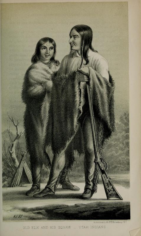
    <summary type="html"><![CDATA[<p><strong><em>While the early Mormon settlement of Utah is often described as less violent than in other places in the West, this ignores significant conflicts. One of these occurred near the current site of Brigham Young University in Provo, Utah.</em></strong></p><img src="https://www.intermountainhistories.org/files/fullsize/27d66b6af040d146480b1e6855c9a325.jpg" alt="Old Elk and his Wife" /><br/><p>Fort Utah, which would eventually become Provo, was established in April 1849. Initial interactions with the nearby Utes were strained, yet Natives visited the fort. Despite tensions over livestock and resources, an uneasy peace was kept for a few months. This came to an unfortunate end when some of the settlers reacted rashly to a minor theft.</p><p>According to settler accounts, in January 1850 a Timpanogos Ute man stole a shirt from a clothesline at the Fort. In attempting to retrieve the shirt, three settlers shot and killed him. They then disposed of the body in the river. Members of the tribe discovered corpse, were enraged by the murder, and prepared to respond in force. To prepare a defense, Peter W. Cownover traveled to Salt Lake City to request reinforcement from the Deseret Militia. The militia left Salt Lake on February 7; in the meantime, the Utes under Big Elk fortified themselves in their camp on the banks of the Provo River. After negotiations failed, a two-day battle ensued. Neither side made significant advance until a final push from the Mormon settlers routed the Utes from their fortification and up towards the mountains. From the Provo River bottoms near present-day Bulldog Blvd. and State St. in Provo, Utes were pushed back towards the mouth of Rock Canyon.</p><p>In the end, Mormon casualties amounted to 1 killed and 18 wounded; of the Utes, at least three were killed including Big Elk and one woman, with an unknown number wounded. A group of the Indians surrendered and were offered asylum inside Fort Utah; another group went South to Spanish Fork and the remainder fled up the hill towards Rock Canyon where they were pursued and shot down, raising Indian casualties to between 40 and 100. One local telling links the naming of a peak above Rock Canyon to Big Elk's widow attempting to scale the cliff and falling to her death.</p><p>In the spring, the surviving Timpanogos Utes carried out raids in the Salt Lake Valley, killed settlers in the Sanpete Valley, and threatened to attack Chief Wakara (Walker) of a rival Ute band for cooperating with the Mormon settlers. Patsowett, the leader of the hostile group, was quickly captured and executed, ending that chapter in Utah’s ongoing Indian wars.</p><p><em><strong><a href="https://www.intermountainhistories.org/items/show/44">For more (including 2 images) view the original article</a></strong></em></p>]]></summary>
    <published>2017-05-09T22:36:31+00:00</published>
    <updated>2026-04-17T19:31:58+00:00</updated>
    <link rel="alternate" type="text/html" href="https://www.intermountainhistories.org/items/show/44"/>
    <id>https://www.intermountainhistories.org/items/show/44</id>
    <author>
      <name>Joshua Bernhard, Brigham Young University</name>
    </author>
  </entry>
  <entry>
    <title type="html"><![CDATA[Pond Town Fort of Salem]]></title>
    <summary type="html"><![CDATA[<p><strong><em>Settled primarily by Mormons in 1851, Salem, Utah, is a quaint village just south of Spanish Fork. Even though it has a convenient location off of Interstate 15 with for potential development, Salem has retained a lot of its small town charm. One of its earliest landmarks was a small fort on the banks of Salem Pond, which for many years acted as the nucleus of the town. </em></strong></p><img src="https://www.intermountainhistories.org/files/fullsize/09ff65675d152834a363bfb1ed677850.jpg" alt="New Monument " /><br/><p>“Pond Town”, as Salem was originally known, was settled primary by Mormons who moved from nearby Payson, Utah, in 1851 in a search of more viable farmland. David Fairbanks and David Crocket, two of the earliest settlers, led the project by constructing a dam on a stream near Salem to help with irrigation for the crops they hoped to grow. Fortunately for them, the soil was fertile and they had a successful harvest in 1851. The Crocket and Fairbanks families, however, were discouraged from spending the winter in Salem for fear of Indian attacks. They temporarily left their fledgling community for the safety in numbers offered by Payson. </p><p>Crocket and Fairbanks returned in 1852 to continue the work of building up their community. The next year could be considered “frontier typical:” the settlers lived a simple but difficult life of planting crops, building new homes, and expanding the dam. There were little to no issues with the Indians until the Walker War started in 1853. The Walker War, a small-scale conflict between Mormon settlers and Ute Indians, caused problems in the Salem community. Indians launched raids on the nascent community and they were forced to retreat to small forts built in Payson. As a means to defend their community from the perceived threat, Salem resident began to construct their homes in a fort-like position in 1856. A mix of adobe brink and lumber, all of the eventual structures (including homes and a store) faced inward. The fort became the focus of settlement for Salem residents, and the extension of the dam turned the area near the fort extremely fertile. The fort was finished in 1858, and was used regularly until 1870. </p><p>After 1870 the fort fell into disuse as other, sturdier forms of lodging became available. In addition, as conflicts with the Indians subsided residents of Salem felt safer expanding their settlement. The constant stench of manure from the fort (which often doubled as a corral for local livestock) was also an impetus for relocation away from the fort. The home of the Durfey family, the last family to reside in the old fort complex, was left standing until well after 1900.               </p><p>The Pond Town fort was an essential edifice for Salem’s early settlement and expansion. The protection it offered and community it fostered acted as a catalyst for more settlers to reside in Salem and gave it the foundation it needed to become the town it is today. 	 </p><p><em><strong><a href="https://www.intermountainhistories.org/items/show/39">For more (including 2 images) view the original article</a></strong></em></p>]]></summary>
    <published>2017-04-03T17:22:17+00:00</published>
    <updated>2026-04-17T19:31:58+00:00</updated>
    <link rel="alternate" type="text/html" href="https://www.intermountainhistories.org/items/show/39"/>
    <id>https://www.intermountainhistories.org/items/show/39</id>
    <author>
      <name>Addison Blair, Brigham Young University </name>
    </author>
  </entry>
  <entry>
    <title type="html"><![CDATA[Founding of Fairview ]]></title>
    <summary type="html"><![CDATA[<img src="https://www.intermountainhistories.org/files/fullsize/039e4a491a0e8095313509b1e4e9ea94.jpg" alt="Monument to the Founders " /><br/><p>Determined to create colonies throughout the proposed State of Deseret, Brigham Young called hundreds of Latter-day Saints (members of The Church of Jesus Christ of Latter-day Saints) to settle valleys throughout the Intermountain West.  With daily concerns of constructing adequate shelter and securing sufficient food for family, Mormon pioneers in Utah Territory learned to balance each of the most important aspects of their lives, including their religious organization.  The religious setup and gradual alignment of unit leadership in Sanpete County provides an exceptional time and place to highlight the early evolution of ecclesiastical organization in the Utah Territory.</p><p>On October 1, 1859, Stake President (local ecclesiastical leader who oversees a number of "ward" congregations) Welcome Chapman called together a body of Latter-day Saints in Mount Pleasant to discuss the settlement of North Bend.  He selected a group to form a new settlement and chose a leader to preside over them. “Appointed brother James N. Jones to act as President, or Bishop, for the present time,” Welcome Chapman recorded. The Saints then sustained Jones “by a vote of the people.” Jones, along with fifteen other men and their families, spent the next nine months building the Fairview settlement.</p><p>After Fairview achieved sufficient population stability, on 25 June 1860 LDS Apostle Orson Hyde officially organized the settlement and ordained James N. Jones as the presiding local religious authority.  In a letter to Brigham Young, Orson Hyde reported that “James N. Jones was selected and ordained Bishop of that ward.”   Several years later, “On the morning of the 25th [of April 1863] at North Bend in San Pete County, the chiefs Anterro, Tabby, George and old Sowiett and many other chiefs and braves, visited President Young and company at the house of Bishop Jones.</p><p><em><strong><a href="https://www.intermountainhistories.org/items/show/19">For more (including 3 images) view the original article</a></strong></em></p>]]></summary>
    <published>2017-02-13T18:58:33+00:00</published>
    <updated>2026-04-17T19:31:58+00:00</updated>
    <link rel="alternate" type="text/html" href="https://www.intermountainhistories.org/items/show/19"/>
    <id>https://www.intermountainhistories.org/items/show/19</id>
    <author>
      <name>Kyle Burgess, Brigham Young University </name>
    </author>
  </entry>
  <entry>
    <title type="html"><![CDATA[Echo, Utah: Gateway to the West]]></title>
    <summary type="html"><![CDATA[<p><strong><em>Echo, Utah, once a town of significant geographical and social importance in territorial Utah has become a virtual ghost town, physically isolated from the interstates that run a short distance from its once bustling main street.  In its history, it was a key location along the Hastings Cutoff Trail, the Donner Party passed by in 1846 as well as some 75,000 Latter-day Saint emigrants between 1847 and 1869.  The Pony Express, various stage and mail lines, the Overland Telegraph, the Transcontinental Railroad, and the Lincoln Highway all utilized Echo’s location for their routes.</em></strong></p><img src="https://www.intermountainhistories.org/files/fullsize/d77510f3151bbfb69069140fd8469d07.jpg" alt="James Bromely&#039;s Stage Station" /><br/><p>Echo is located at the mouth of the steep sided Echo Canyon,, the bottleneck that directed overland travelers toward the Ogden and Salt Lake valleys.  While the Donner Party was the first major American overland group since the mountain men to pass through, the Latter-day Saints or Mormons were the first to make note of its geographical significance when their first wagon train encamp there for almost a week in July 1847. They viewed the spot as an ideal resting spot for overland travelers--a long, broad valley covered in grass and trees. James Bromely noted the location’s desirability and established a large stage station there in 1854, forming the first permanent vestige of a town.</p><p>Echo became a strategic location during the Utah War in 1857-1858 as a base of operations for the Mormon Nauvoo Legion defending the Utah Territory from the invading US Army.  U.S. military leaders recorded that the narrow canyon and dramatic geological formations made the location perfect for both fortified defense and ambush. Travelers, having heard of Echo’s militant reputation, feared passing through the town for decades.</p><p>The Transcontinental Railroad entered Echo in 1868, building its own Hell-on-wheels style town to the northwest of the existing Mormon settlement. Echo became an important junction connecting the coal mines of Summit County and the gold and silver mines in Park City with the Union Pacific Main Line until the railroad consolidated its locomotive facilities in Ogden during World War II.  After the construction of Interstate-80 in 1986, the town did not receive an interstate exit.  Cut off from easy access, and with the railroad abandonment of its branch lines in 1988, the town withered and died.</p><p><em><strong><a href="https://www.intermountainhistories.org/items/show/18">For more (including 3 images) view the original article</a></strong></em></p>]]></summary>
    <published>2017-02-13T18:43:52+00:00</published>
    <updated>2026-04-17T19:31:58+00:00</updated>
    <link rel="alternate" type="text/html" href="https://www.intermountainhistories.org/items/show/18"/>
    <id>https://www.intermountainhistories.org/items/show/18</id>
    <author>
      <name>Joshua Bernhard, Brigham Young University  </name>
    </author>
  </entry>
</feed>