<?xml version="1.0" encoding="UTF-8"?>
<feed xmlns="http://www.w3.org/2005/Atom">
  <title type="text">Intermountain Histories</title>
  <updated>2026-04-17T19:32:18+00:00</updated>
  <generator uri="http://framework.zend.com" version="1.12.20">Zend_Feed_Writer</generator>
  <link rel="alternate" type="text/html" href="https://www.intermountainhistories.org/"/>
  <link rel="self" type="application/atom+xml" href="https://www.intermountainhistories.org/items/browse?output=rss2"/>
  <id>https://www.intermountainhistories.org/</id>
  <author>
    <name>Intermountain Histories</name>
    <uri>https://www.intermountainhistories.org</uri>
  </author>
  <link rel="hub" href="https://pubsubhubbub.appspot.com/"/>
  <entry>
    <title type="html"><![CDATA[Boom and Bust in Bodie, CA]]></title>
    <summary type="html"><![CDATA[<p><strong><em><span style="font-weight:400;">Once among the largest and most prosperous towns in California, Bodie is now defined by the ghost of its past in the form of abandoned objects, peeling wallpaper, and half-destroyed buildings. </span></em></strong></p><img src="https://www.intermountainhistories.org/files/fullsize/24dc4420a11bbf404db7f58bf5daf143.jpg" alt="Old buildings in Bodie, California" /><br/><p><span style="font-weight:400;">In the summer of 1859, W. Bodey found rich gold deposits in California, seven miles west of the Nevada border. He had traveled from Poughkeepsie, New York, in pursuit of an adventure, and his discovery would lead to the town of Bodie and surrounding hills being named in his honor. His name is something of a mystery today; there are reports that refer to him as William, Waterman, and Wakeman, his second initial as either “T” or “S,” and his last name occasionally spelled as Body rather than Bodey. As for the spelling of the town’s name, the “ie” ending was initially the result of a confused sign painter, and it just stuck. </span>
<span style="font-weight:400;">Bodey’s ambition to find more for himself in life fueled both his success and his downfall. He was one of the first to discover gold in eastern California and managed to survive the dire circumstances of early prospecting life through the first change of seasons. It wasn't the work in the mines during the summer that killed him, but the harsh winter that followed. In November 1859 Bodey and his traveling companion left camp to get supplies. They were caught in a blizzard, and Bodey–unable to keep up with his companion–was left to die. His remains were recovered and now lie beneath two headstones: one that reads “Waterman S. Bodey” with an engraved image of miners panning gold from a stream against a backdrop of mountains; and another, much smaller with the name “William S. Bodey.”</span>
<span style="font-weight:400;">In the years following his death, the town of Bodie was brought to life by other ambitious miners and their families, bringing the town’s population to 10,000 in 1879. With so many people arriving in such a short period of time, most of them lived in tents–even after the town became more established. In 1881 the Bodie and Benton Railway was built and used to haul lumber and other goods from the Bodie mines to the saw mill by Mono Lake. Bodie was becoming a prosperous center for work. It served some twenty-two gold and silver mines in the region with a stamp mill for processing ore and plenty of businesses in town. Saloons dominated, but there was also a mercantile, several general stores, motels, gambling and dancing halls, schools, stables, and both a Catholic and a Methodist church. </span>
<span style="font-weight:400;">Like its namesake, the town is no stranger to tragedy and risk. Two accidental fires–one from a kitchen in 1892 and another started by a child in 1932–caused the destruction of several main street buildings, and led to economic hardship. Combined with the sundry difficulties of the Great Depression, the town failed to recover. It joined the arid region’s long list of ghost towns. Weather conditions in the mountains are still just as treacherous as they were in W. Bodey’s fateful last days. Travel to Bodie during winter months is only possible by way of skis, snowshoes, or snowmobiles. </span>
<span style="font-weight:400;">In an attempt to preserve the historic elements of the town, Bodie was made an official California State Park in 1962. Only five percent of what once made up the booming town of Bodie is thought to have survived, and today its ghost-like remains sit virtually untouched in tattered buildings and houses. </span></p><p><em><strong><a href="https://www.intermountainhistories.org/items/show/806">For more (including 6 images) view the original article</a></strong></em></p>]]></summary>
    <published>2024-05-16T02:01:48+00:00</published>
    <updated>2026-04-17T19:32:18+00:00</updated>
    <link rel="alternate" type="text/html" href="https://www.intermountainhistories.org/items/show/806"/>
    <id>https://www.intermountainhistories.org/items/show/806</id>
    <author>
      <name>Megan Bailey, Brigham Young University</name>
    </author>
  </entry>
  <entry>
    <title type="html"><![CDATA[Mining in Madrid, NM]]></title>
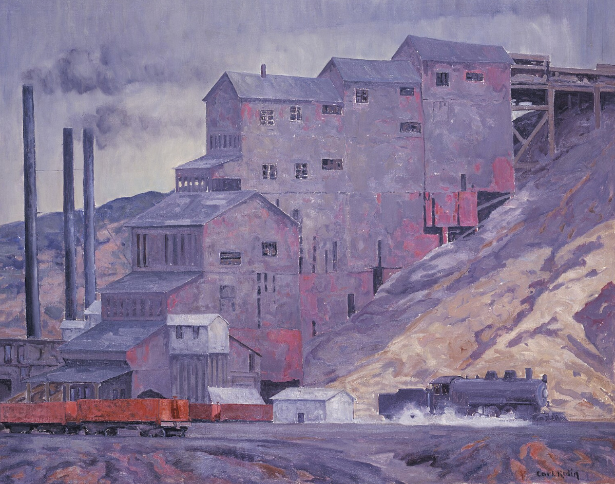
    <summary type="html"><![CDATA[<p><strong><em><span style="font-weight:400;">Once a coal mining town with mandated celebratory traditions, Madrid is kept alive today by a community of artists.</span></em></strong></p><img src="https://www.intermountainhistories.org/files/fullsize/2c557ddeacfb0b63a0565ae116711530.jpg" alt="At Madrid Coal Mine, New Mexico" /><br/><p><span style="font-weight:400;">There is a community in the mountains of Santa Fe County, New Mexico that has redeemed itself from “ghost town” status–though they still claim the title. Madrid was best known for its wealth of coal during the mining boom in the late nineteenth and early twentieth century. The town was first founded in 1869, attracting attention from its location along the Santa Fe Railroad. Traveling journalist Charles Fletcher Lummis said that there was no other railroad that “penetrated such a wonderland of the pictorial in geography and in humanity.” Trains used Madrid to refuel and stock up on coal. The prosperity of the land brought in a large enough community for businesses like the trading post, stores, schools, a diner, and a boarding house to be built and well-used in the early twentieth century. </span>
<span style="font-weight:400;">Life in mining towns is sometimes thought of as exciting–newfound wealth and communities brought together in the wake of the gilded age–but the reality was far grittier. Men, women, and children who worked in coal mines were subject to the dangers of collapsing shafts, explosions, and machinery malfunctions, as well as gas poisoning and other illnesses brought on by poor air quality. However, the corporations running the town had several initiatives that attempted to make life more enjoyable for the residents. </span>
<span style="font-weight:400;">The free electricity they provided to each home was certainly the most valuable perk, but there were also annual festivities that were required in an attempt to boost the community’s morale. As Christmas approached each year, every resident had to ornament their house with string lights, buy a Christmas tree, and make sure their house was as much of a spectacle as possible. With 3,000 residents by the 1930s, Madrid did become quite a spectacle, drawing in crowds from Albuquerque and other nearby communities in awe of the light displays. When blackouts for World War II started, the Christmas lights were put out, and shortly after the war ended, the mines were closed for good.</span>
<span style="font-weight:400;">As steam locomotives were replaced with diesel engines, coal lost its value and the mines in Madrid were shut down not long after the war ended. The population rapidly declined, and Madrid sat among other former mining towns in Santa Fe county, with the threat of complete abandonment. Yet, Madrid never quite lost its charm. It went on to be featured in several movies, from 1970 to the early 2000s, and now it is home to artists, quirky landmarks, and converted historic buildings. </span></p><p><em><strong><a href="https://www.intermountainhistories.org/items/show/805">For more (including 3 images) view the original article</a></strong></em></p>]]></summary>
    <published>2024-05-16T01:44:03+00:00</published>
    <updated>2026-04-17T19:32:18+00:00</updated>
    <link rel="alternate" type="text/html" href="https://www.intermountainhistories.org/items/show/805"/>
    <id>https://www.intermountainhistories.org/items/show/805</id>
    <author>
      <name>Megan Bailey, Brigham Young University</name>
    </author>
  </entry>
  <entry>
    <title type="html"><![CDATA[ Mountains, Mining, and Massacre: The History of Oatman, Arizona]]></title>
    <summary type="html"><![CDATA[<p><strong><em><span style="font-weight:400;">Free-roaming donkeys, an old mining district, a stop on Route 66, and ties to a famous kidnapping make up the storied past of this semi-abandoned town.</span></em></strong></p><img src="https://www.intermountainhistories.org/files/fullsize/d34d919e9df93dc8bb5d0f3e2ba0cc1d.jpg" alt="Oatman, Arizona circa 1930." /><br/><p><span style="font-weight:400;">Tucked away in the Black Mountains of Mohave County, Arizona is a community rich with legend. The town was named for Olive Oatman and her family who were victims of the Oatman Massacre in 1851, and it came to life in the following decades as prospectors discovered gold, ore, and other valuable resources in the land. Oatman is home to the three most prosperous gold mines in Arizona: the Gold Road, the Tom Reed, and the United Eastern. </span>
<span style="font-weight:400;">A gold prospector named John Moss was one of the first to discover gold in the area in the early 1860s, but it wasn’t until the 1900s that Oatman really boomed. A hotel and post office were built in 1902 and 1906 respectively, securing Oatman’s status as an official town. The mines brought riches and rapid growth to the community, with Tom Reed mine’s total profit reaching over nine-million by 1922 and the town’s population growing to 10,000 in the same decade.</span>
<span style="font-weight:400;">One of the oddities of Oatman is the population of wild burros (undomesticated donkeys). They were brought in by miners who used teams of them to haul supplies from out of town. Burro labor was a big part of the mining industry, but unlike the prospectors, they never picked up and left town. Billie Jo Moore, long time proprietor of the Oatman Hotel, said in an interview that, “the burros stayed behind and adapted to the desert. Now they are all over these mountains…They wander through the streets, turning over garbage cans and messing in people’s yards.” While they are little more than a nuisance to locals, tourists entertain them with attention, alfalfa pellets, and lots of pictures–burros have become iconic to the town. </span>
<span style="font-weight:400;">Oatman stitched itself into another legend of America when it became a part of Route 66. It was 1926, still bringing in plenty of spoils from the mines, and now gaining further revenue from the new highway. These were the glory days in Oatman; crime was low, employment was high, and people were optimistic about the future. While there was an occasional murder and a tendency for drunkenness in Oatman, it didn’t fall into the expected stereotype of the “wild west.” The isolation of the town, so far away from any other civilization at that time, created a tight-knit group that made new traditions together–like the annual three day long Fourth of July celebrations. When the Great Depression hit in the 1930s, the prosperity and liveliness of the community began to dwindle, and by the time Route 66 went out of commission in the 1950s it was well on its way to becoming a ghost town. Oatman has never been fully abandoned though, and it has been given new life through its performers and curious travelers. </span></p><p><em><strong><a href="https://www.intermountainhistories.org/items/show/802">For more (including 5 images) view the original article</a></strong></em></p>]]></summary>
    <published>2024-05-16T00:49:23+00:00</published>
    <updated>2026-04-17T19:32:17+00:00</updated>
    <link rel="alternate" type="text/html" href="https://www.intermountainhistories.org/items/show/802"/>
    <id>https://www.intermountainhistories.org/items/show/802</id>
    <author>
      <name>Megan Bailey, Brigham Young University</name>
    </author>
  </entry>
  <entry>
    <title type="html"><![CDATA[Apache County on Route 66]]></title>
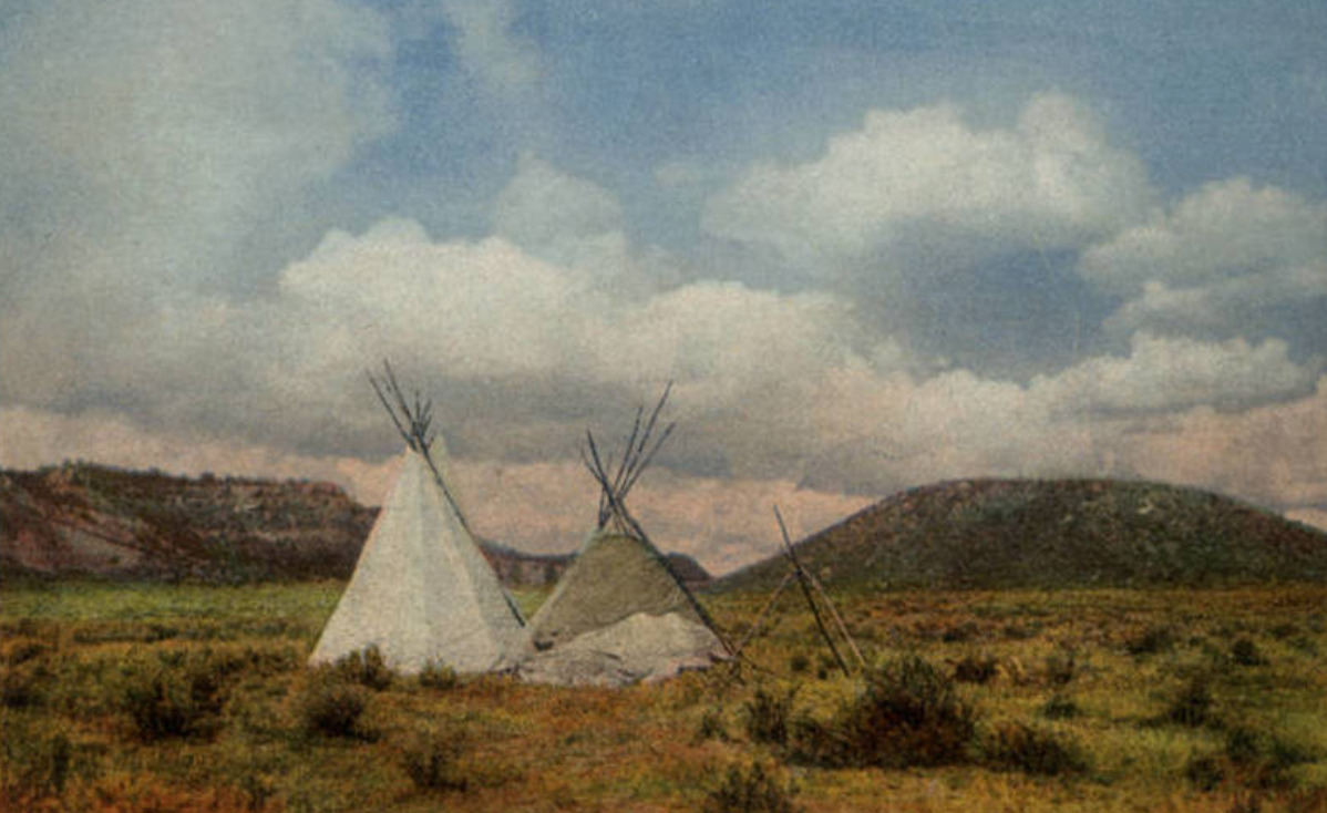
    <summary type="html"><![CDATA[<p><strong><em><span style="font-weight:400;">The land on the Arizona-New Mexico border has a storied past–from Spanish trading routes and gutsy American cowboys to railroad tracks and the boom of a brand-new highway.</span></em></strong></p><img src="https://www.intermountainhistories.org/files/fullsize/c94d71a364203dd0571092e6433d1afa.jpg" alt="In Apache Land, Arizona" /><br/><p><span style="font-weight:400;">Apache County, which makes up the northeast region of Arizona, has been occupied since at least 800 A.D. by Ancestral Puebloans (formerly known as “Anasazi”). The first of many Spanish expeditions to the Arizona/New Mexico region lasted from 1540-1542, and began a tumultuous relationship with the indigenous population. In the following years Spanish colonists introduced new cattle to the region, and sheepherding became a popular practice for the next several hundred years. In 1864 the U.S. government issued a forced displacement of the Navajo people known as the “Long Walk.” It was a harsh and unforgiving journey that resulted in at least 500 deaths. One region exiled during the Long Walk later became known as Lupton, one of several unincorporated communities along Route 66. </span>
<span style="font-weight:400;">Famous for its scenic “painted cliffs,” brightly colored roadside shops, and appearance in the 1940 film adaptation of </span><i><span style="font-weight:400;">Grapes of Wrath</span></i><span style="font-weight:400;">, Lupton was built from a railroad settlement in 1905. The community's namesake, G.W. Lupton, was a trainmaster and owner of the first trading post in the area. In the post-war tourism boom of the early 1950s, the Yellowhorse family of the Navajo Reservation opened their own trading post. The building was painted a striking yellow with red and black painted signage advertising “The Indian Market Place: Deal with the Friendly Navajo.” Although Route 66 had given the area a new life after the railroad revolution, the construction plans for Interstate 40 bypassed Lupton. Like so many other little towns that survived only from the tourist revenue, Lupton soon slipped into obscurity. The shop fronts have not been well-preserved, and there is not much charm left to draw people in, but the sight of the painted cliffs when the sun hits them just right remains as breathtaking as it always was.</span>
<span style="font-weight:400;">Twelve miles west of Lupton and the New Mexico border another now deserted town called Houck has its own storied past. In 1877 James Houck, a horseback-riding mail carrier, established a trading post along his route which ran from Prescott, Arizona to Fort Wingate, New Mexico. The post, which was called “Houck’s Tank,” expanded into a small community which adopted Houck’s name. He lived a fairly successful life, but had a hard time staying out of trouble. He was no stranger to shoot-outs or plots of revenge–and his friendship with the Tewksbury family put him in the middle of a major feud between two ranching families. Known as the Pleasant Valley War or the Graham-Tewksbury Feud, it resulted in somewhere between thirty-five to fifty deaths. His career beyond mail delivery included sheepherding, mining, trading, and a position as the Apache County Deputy Sheriff. Yet he is memorialized now as the namesake for the once lively ghost town of Houck, Arizona.</span>
<span style="font-weight:400;">In late 1926, Route 66 made its way through Houck, attracting new visitors to what had once been nothing more than a trading post. Although becoming a part of Route 66 helped bring a more steady flow of business and traffic, Houck never quite blossomed the way other towns along the highway did. A gas station, a grocery store, a “Pancake House,” and a few other small establishments popped up, but much of it has since gone out of business and become overgrown. In 1998, long after the excitement died down, the Native American Bahá'í Institute opened as a place of worship, training, and gathering place for the Navajo reservation and surrounding communities. </span></p><p><em><strong><a href="https://www.intermountainhistories.org/items/show/800">For more (including 5 images) view the original article</a></strong></em></p>]]></summary>
    <published>2024-05-15T20:15:34+00:00</published>
    <updated>2026-04-17T19:32:17+00:00</updated>
    <link rel="alternate" type="text/html" href="https://www.intermountainhistories.org/items/show/800"/>
    <id>https://www.intermountainhistories.org/items/show/800</id>
    <author>
      <name>Megan Bailey, Brigham Young University</name>
    </author>
  </entry>
  <entry>
    <title type="html"><![CDATA[Golden: A Ghost Town]]></title>
    <summary type="html"><![CDATA[<p><strong><em><span style="font-weight:400;">In an overgrown cemetery, amidst tombstones and memorabilia, a child’s white metal bed frame sits above a grave. Golden, New Mexico–population zero–is a ghost town in more ways than one. </span></em></strong></p><img src="https://www.intermountainhistories.org/files/fullsize/e67fd8700f683d9e53b557c2c957ca2f.jpg" alt="San Francisco de Asis Catholic Church" /><br/><p><span style="font-weight:400;">Today the tiny Santa Fe community of Golden is known for the gold rush that it was named for, but before the gold Navajo peoples found prosperity in turquoise. The road running from Albuquerque to Santa Fe, which is now part of New Mexico 14, is still aptly referred to as the “Turquoise Trail.” In the 14th century Spanish Conquistadors made their way to the region of Mexico that would later become New Mexico and Arizona. For several hundred years they traded goods, mined, and colonized the land. </span>
<span style="font-weight:400;">It is said that the gold rush didn’t really begin in New Mexico until it was declared an American state, but nearly one-hundred years earlier in 1825 the community of Golden had its day in the sun. When Mexico gained independence from Spain in 1821, the Santa Fe trail became open to Americans for trading purposes–creating an influx of American settlers to the area, who had been few and far between during the Spanish years. Trading opportunities, cattle herding, gold, and the exciting prospect of “new” land drew Americans in from surrounding U.S. territories and states. Gold was discovered in the land just north of the San Pedro mountains and a mining district blossomed. Within the next few decades a general store, a post office, a public school, and quite a few saloons, were built as well as a Catholic church–which is now the most photographed church along the Turquoise Trail. </span>
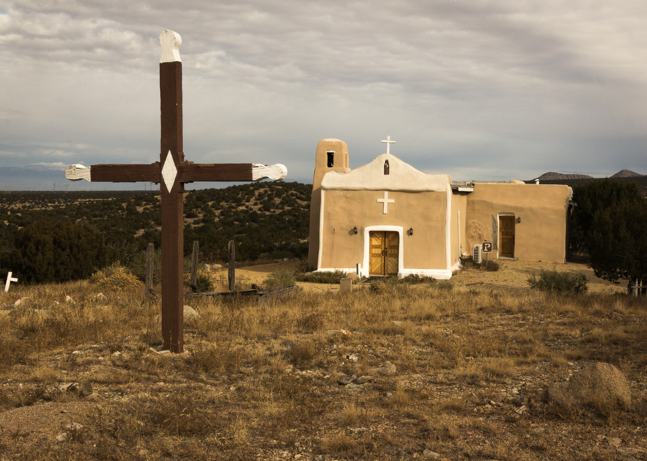
<span style="font-weight:400;">San Francisco de Asis Catholic Church, named after Saint Francis of Assisi, was built around 1830. The adobe brick plaster makeup of the church has held up well over the years, and the white painted crosses still look as bright as ever. The churchyard is home to the bodies of those who died in the fleeting time of Golden’s own “life.” Although the church provides a glimpse into the past, it isn’t completely dormant. Beloved by those who explore the grounds on their way through town, and welcoming to Sunday tourists who attend church services.</span>
<span style="font-weight:400;">The era of growth and excitement in the community was short-lived and ended almost as suddenly as it had begun. When the 1825 gold rush era ended, there was little reason to stay. The few who remained resorted primarily to agriculture to make their living. There was a dwindling and largely fruitless attempt by some remaining residents to dig up the last of the gold, but there was only so much to be found before even the most stubborn of them abandoned the pursuit. A hundred years after the initial gold rush there were so few people remaining that Golden lost its township status. In 2021 the census reported a population of zero residents of Golden, but the Turquoise Trail continues as a scenic route for road trips and the church with its overgrown cemetery stands as a monument–a living memory of all that once was. </span></p><p><em><strong><a href="https://www.intermountainhistories.org/items/show/799">For more (including 5 images) view the original article</a></strong></em></p>]]></summary>
    <published>2024-05-15T19:52:11+00:00</published>
    <updated>2026-04-17T19:32:17+00:00</updated>
    <link rel="alternate" type="text/html" href="https://www.intermountainhistories.org/items/show/799"/>
    <id>https://www.intermountainhistories.org/items/show/799</id>
    <author>
      <name>Megan Bailey, Brigham Young University</name>
    </author>
  </entry>
  <entry>
    <title type="html"><![CDATA[Frisco and the Horn Silver Mine]]></title>
    <summary type="html"><![CDATA[<p><strong><em>The city of Frisco, Utah is just a ghost town now, with most of its remains carried away by scavengers and the leftover pieces strewn across the ground. But in 1885, it was the largest settlement in the southern Utah Territory. At the peak of the mining boom it had a population of around 4,000 people, at a time when less than 1,500 people lived in St. George. During the 1880s, prospectors extracted about 1.5 million troy ounces of silver from the Horn Silver Mine on a yearly basis. It also gained a reputation as one of the wildest towns of the West, populated by desperate and violent characters and scoundrels looking to make a quick buck.</em></strong></p><img src="https://www.intermountainhistories.org/files/fullsize/c36139e82fd53abfa94296f7cb67bdff.jpg" alt="Site of Horn Silver and King David Mines" /><br/><p><span style="font-weight:400;">Frisco, named for the San Francisco mountains which it borders, saw prospectors making claims in the area as early as 1871, but it was the discovery of the Horn Silver Mine in 1876 that sparked the biggest mining rush since the discovery of the Comstock Lode. According to legend, two prospectors stopped for lunch near a limestone outcropping of Grampian Hill, and one of the men tapped on a small boulder with his pick, accidentally breaking a large chunk of rock free. To his surprise, the rock was filled with silver so soft he could cut it with his knife.</span>
<span style="font-weight:400;"><span style="font-weight:400;">The Horn Silver bonanza created a powerful draw for men looking to find a claim of their own or those that sought employment within the huge mine and its related processing works. Even though the trans-continental railroad was completed in 1869, Frisco and the Horn Silver mine remained disconnected from the railroad for their first five years, and conditions in the region were largely inhospitable. The water from the San Francisco Mountains is muddy, and streams and springs flow only seasonally, so Frisco was forced to shipp its water supply from Milford, 15 miles to the southeast.</p></span>
<span style="font-weight:400;">With limited access to coal and charcoal, investors built great charcoal smelting plants to make fuel. In addition to the five great kilns still visible from the highway, an additional 24 kilns are in various clusters northeast of town. While the remains of these kilns look like primitive, oversized stone beehives, the kilns are the surviving parts of sophisticated plants once filled with cutting-edge 1880s equipment: blowers, boilers, steam engines, and a reverberatory flue-dust slagging furnace. When the mine closed down, the investors removed and recycled the steel and iron equipment, and left only the heavier stone kilns.</span>
<span style="font-weight:400;">The need for workers to operate the mines and their supporting operations brought all kinds of characters to town, and the streets filled with saloons and brothels. The local newspaper editor, Charles King, described the town as “Dodge city, Tombstone, Sodom and Gomorrah, all rolled into one.”</span>
<span style="font-weight:400;">The most repeated story of Frisco violence concerns Sheriff Pearson, who allegedly took the job to clean up the town’s wild ways. Instead of building a jail and setting up a traditional justice system, Pearson threatened the town’s miscreants with exile or a shootout. On his first night on the job, he allegedly shot six men, and would regularly dispatch a “meat wagon” to cart those who “died with their boots on” to their unmarked graves.</p><p>The Horn Silver mine collapsed on February 12, 1885, bringing an end to the silver rush, and the town soon numbered in the hundreds rather than the thousands. Even though a new shaft was built at Horn Silver and the mine soon became productive again, the boom and the era of finding a million ounces of silver a year were over. The mining works and the town slowly faded away, and in 1928, the last Friscoians left town. The mines, including the more recent King David shaft, continued work intermittently until 1952. The Horn Silver Mines company still “explores” the area for minerals, but the mines of Frisco have remained quiet for 80 years.</p></p><p><em><strong><a href="https://www.intermountainhistories.org/items/show/744">For more (including 5 images) view the original article</a></strong></em></p>]]></summary>
    <published>2023-04-11T15:57:52+00:00</published>
    <updated>2026-04-17T19:32:16+00:00</updated>
    <link rel="alternate" type="text/html" href="https://www.intermountainhistories.org/items/show/744"/>
    <id>https://www.intermountainhistories.org/items/show/744</id>
    <author>
      <name>Andrew Durbin, Brigham Young University </name>
    </author>
  </entry>
  <entry>
    <title type="html"><![CDATA[Terrace and Kelton, Central Pacific Railroad Section Stations <br />
]]></title>
    <summary type="html"><![CDATA[<p><strong><em><span style="font-weight:400;">This original route by the Central Pacific Railroad (1869) became known as the Promontory Branch and received only sporadic use after 1904. Soon the railroad facilities were removed and the dependent towns abandoned. The rails of the Promontory Branch were finally taken down in 1942.</span></em></strong></p><img src="https://www.intermountainhistories.org/files/fullsize/b9a00f018bca845d7e9c45d7a09be3c4.jpg" alt="Terrace in 1967" /><br/><p><span style="font-weight:400;">Known as the Promontory Branch Stations, the Central Pacific Railroad maintained nearly 30 section stations along the tracks in Utah. These stations were each located roughly 10-12 miles apart and provided needed maintenance and upgrades to the rail lines. Some of the stations had permanent buildings, while others were not much more than tent cities. Typically, each was overseen by two white foremen, and housed anywhere from eleven to thirty Chinese workers. A few stops became actual towns, booming and bustling with the railroad traffic along the stretch.  </span>
<span style="font-weight:400;">Two of the major section stations along the Promontory route included Terrace and Kelton. </span><span style="font-weight:400;">Terrace was inhabited from 1869 to 1910. It was the largest station of the Promontory Branch, and provided the main source of maintenance and repair resources for the Salt Lake Division, which stretched from Wells, NV to Ogden, UT. The population estimates vary widely, but could have reached up to 1,000 residents at its peak. Nearly half of those were</span><span style="font-weight:400;"> projected to be Chinese workers for the railroad. Although, according to the 1880 census, the actual Chines population was under 100. </span>
<span style="font-weight:400;">The town, which boasted a number of establishments including a saloon, barber, general store, grocer and two hotels, also had a communal structure called the Athenaeum. The Athenaeum was funded by a small local tax and provided bath houses and a library. The Chinese settled on the east side of town, and maintained a laundry, cook house, and Joss sanctuary. Water was supplied to the town via a 12-mile aqueduct from Rosebud Creek. The aqueduct was traded out for a pipe in 1887. They later tried drilling a well in 1892, but were unsuccessful. The town was heavily affected by the completion of the Lucin cutoff in 1904 and a fire that decimated town buildings around that same time. By 1910, there was nothing but scraps of metal and building remnants left of Terrace. </span>
<span style="font-weight:400;">The section station of Kelton, also known as Indian Creek, lasted much longer, spanning from 1869 to about 1942. The town served as a major shipping and travel connection. It was the  southern terminus of the Utah, Idaho, and Oregon Stage Company and also an Overland Mail Route station. During the 1870s alone, six million pounds of goods and supplies were transferred from train to wagon from Kelton. The railroad had a depot, turntable, engine house, water tank, pump house, section house, rail spurs, and sidings. Businesses in town included a two-story hotel, saloons, general stores, a post office, and a blacksmith. The town water was piped in from the Raft River Mountains just seven miles north. The population peaked at about 150 people in the late 1800s. </span>
<span style="font-weight:400;">The town's decline happened over a period of years with one event  after another. The stage route was no longer in use by the 1880s, the Lucin Cutoff project significantly slowed train traffic down to just a few trains per week, an earthquake rocked the city in 1934, and the railroad removed the rails to donate to the war effort in 1942. The few structures that are left in the ghost town are visited only by railroad enthusiasts, local historians, and tourists.</span></p><p><em><strong><a href="https://www.intermountainhistories.org/items/show/681">For more (including 5 images) view the original article</a></strong></em></p>]]></summary>
    <published>2022-10-26T16:10:03+00:00</published>
    <updated>2026-04-17T19:32:15+00:00</updated>
    <link rel="alternate" type="text/html" href="https://www.intermountainhistories.org/items/show/681"/>
    <id>https://www.intermountainhistories.org/items/show/681</id>
    <author>
      <name>Cami R. Isle, Weber State University</name>
    </author>
  </entry>
  <entry>
    <title type="html"><![CDATA[Washakie: a Shoshone Ghost Town]]></title>
    <summary type="html"><![CDATA[<p><strong><em>The Northwestern Band of Shoshone called Washakie home for generations as they sought to rebuild their community after the tragic events of the Bear River Massacre. With land and assistance provided by the Church of Jesus Christ of Latter-day Saints, the Shoshone created a new way of life while still preserving connections to their culture and heritage.</em></strong></p><img src="https://www.intermountainhistories.org/files/fullsize/bbb86b5ba57e9f35dc5592ad66263f6b.jpg" alt="Washakie Cemetery" /><br/><p>After the tragic assault by Colonel Patrick Conner and his California Volunteers on a peaceful encampment of Shoshone at Bear River on the morning of January 29, 1863, the drastically reduced band of Shoshone spent years roaming Northern Utah without a viable means of subsistence. Eventually, over a hundred members of this small band of Shoshone, led by Chief Sagwitch, converted to The Church of Jesus Christ of Latter-day Saints. After several years on their own, Sagwitch appealed to the Church, whose members offered assistance and allowed the band to settle and farm on Church-owned land near the modern Utah–Idaho border in 1880. In addition to the farmland provided by the Church, many members of the band also appealed to the federal government and received land close by under several homesteading acts of the late-nineteenth century. The Shoshone named this community Washakie after a respected leader in the greater Shoshone community who remained an integral part of their nation for almost a century.
While at Washakie, the Northwestern Band of the Shoshone adapted to the farming lifestyle of the nearby settlers. While doing their best to preserve elements of their culture through regular cultural gatherings and celebrations, the Band also learned new skills and practices from their white neighbors, many of whom came to them from the Church. The Washakie residents learned skills such as carpentry, farming, sheepherding, and firing bricks. They built a church house in the community to use as a place of worship and gathering. The Shoshone at Washakie even used the building as a schoolhouse for a few decades, though the teachers at the Washakie school were White. During Washakie’s heyday, the community thrived as a small city.
As time drew on, however, outside pressures pushed many of the Shoshone residents of Washakie out of the community. With the onset of the Second World War, Utah became a center for supporting the war effort. For some Shoshone, better-paying jobs drew them out of residence in Washakie and into areas where they could work Utah’s booming defense industry. This exodus of residents curtailed the Washakie community life possible with the remaining Shoshone population. Because the Church of Jesus Christ still considered itself the owner of Washakie’s land, they began reclaiming it in the summer of 1960 by burning seemingly abandoned homes to the ground so they could sell the plots to nearby farmers. However, many of the homes that appeared to be abandoned were only seasonally empty, as the Shoshone residents often visited their northern relatives on a Shoshone reservation in Idaho or were away for other reasons. The home burning marked the end of the Washakie community and marked the beginning of a tense relationship between the Northwestern Band of Shoshone and the Church. The Northwestern Band of Shoshone, who had been devastated by the violent events of the Bear River Massacre in 1863, once again became victims of whites pushing them off their land and out of their homes. Today, the Washakie community is gone. Only a few structures remain, including the church building and a cemetery.</p><p><em><strong><a href="https://www.intermountainhistories.org/items/show/566">For more (including 4 images) view the original article</a></strong></em></p>]]></summary>
    <published>2021-12-18T10:35:57+00:00</published>
    <updated>2026-04-17T19:32:12+00:00</updated>
    <link rel="alternate" type="text/html" href="https://www.intermountainhistories.org/items/show/566"/>
    <id>https://www.intermountainhistories.org/items/show/566</id>
    <author>
      <name>William Handley, Brigham Young University</name>
    </author>
  </entry>
  <entry>
    <title type="html"><![CDATA[Silver Reef, Mining Ghost Town]]></title>
    <summary type="html"><![CDATA[<p><strong><em>After a rare find of silver embedded in a sandstone formation by prospector John Kemple, in the late-1800s, miners rushed to what became Silver Reef, Utah. Silver Reef was one of many towns built around the hopes of finding silver and striking it rich in the West. </em></strong></p><img src="https://www.intermountainhistories.org/files/fullsize/ffa4b5e0508bbc3589041894fe223619.jpg" alt="The streets of Silver Reef" /><br/><p>In the late 1800s, prospectors walked throughout Utah with their noses to the ground, searching for valuable minerals. Utah’s hills and mountains were rich with copper, gold, silver, lead, iron, and zinc just waiting to be discovered.
In 1866, a prospector named John Kemple combed southern Utah in the hopes of finding something that he could mine. While prospecting near what is now Leeds, Utah, Kemple found flakes of silver embedded in sandstone. Such a combination of minerals was an extremely rare discovery; silver was almost never found in sandstone. To prove the veracity of his find, Kemple sent a sample to the Smithsonian Institution, but they called it an “interesting fake.” The silver remained in the ground for nearly a decade until later surveys of the land proved Kemple had told the truth.
In 1875, William T. Barbee, a mining agent for two Salt Lake City bankers, staked several mining claims to the region and established a town called Bonanza City. Many miners and business owners moved to Bonanza City, and property values increased. Several other miners and business owners looking for cheap land set up a tent city north of Bonanza and called it Rockpile. When mines in nearby Pioche closed in 1875, many workers moved to Rockpile. The residents then changed the town’s name to Silver Reef to make it more appealing.
By 1879, about 2,000 people lived in Silver Reef, and the town had a mile-long main street home to many businesses including a cosmopolitan restaurant and a Wells Fargo building. That same year, a fire destroyed many businesses in Silver Reef, including the restaurant and a hotel. Silver Reef’s residents were resilient, and they quickly bounced back and rebuilt. However, as the worldwide value of silver declined during the 1880s, the value of endeavors in Silver Reef declined as well. Most of Silver Reef’s mines closed by 1884, and local businesses followed suit. By 1901, most business owners had either dismantled or relocated their enterprises. After the gradual decline of Silver Reef, the mining operations there traded hands between many large corporations. Eventually, after multiple failed attempts to revive silver mining there, Silver Reef was incorporated into the nearby town of Leeds.
Only a few buildings remain at the old Silver Reef site today. The old Wells Fargo building has been converted into a Silver Reef mining town museum. The cosmopolitan restaurant, dismantled in 1894, was rebuilt in 1987 as a tourist attraction serving European cuisine until it closed in 2010. The Silver Reef Jail remains standing, as well as several building foundations. Latter-day Saints living nearby dismantled other structures in Silver Reef for building materials to construct new buildings.</p><p><em><strong><a href="https://www.intermountainhistories.org/items/show/563">For more (including 4 images) view the original article</a></strong></em></p>]]></summary>
    <published>2021-12-18T08:13:40+00:00</published>
    <updated>2026-04-17T19:32:12+00:00</updated>
    <link rel="alternate" type="text/html" href="https://www.intermountainhistories.org/items/show/563"/>
    <id>https://www.intermountainhistories.org/items/show/563</id>
    <author>
      <name>Lynsie Huff, Brigham Young University</name>
    </author>
  </entry>
  <entry>
    <title type="html"><![CDATA[Eureka! Mining and Settlement in the Tintic Mountains]]></title>
    <summary type="html"><![CDATA[<p><strong><em>Eureka, Utah rests within the East Tintic Mountains in northern Juab county. Established in 1870, within the first twenty years of its existence, the Eureka population increased by 1,320.5%. It was the ninth-largest city in Utah in 1910. Though it was a bustling metropolis in the 1920s, Eureka is now one of Utah’s semi-ghost towns.</em></strong></p><img src="https://www.intermountainhistories.org/files/fullsize/c208bab5d88c9df7c90549eb004d8552.jpg" alt="Abandoned building on main street" /><br/><p><p class="Default"><span style="font-weight:400;">Eureka, Utah is a semi-ghost town located within the East Tintic Mountains in northern Juab County. Originally named Ruby Hollow, the town was renamed “Eureka” in 1870 after one of the “Big Four” mines in the area: Bullion Beck and Champion, Gemini, Centennial Eureka, and Eureka Hill. The largest town among a cluster of mining settlements, by 1910 Eureka was the ninth-largest city in Utah with a population of about 3,500 people. About a decade later, in 1922, Eureka’s Chief Consolidated Mining Company became the largest silver producer in the United States. Around the turn of the 20th century, a newspaper described it as “one of the most progressive and prosperous mining towns in this western country.” Despite its economic prosperity through World War I, the mines near Eureka became less productive during the Great Depression. Mining nearly came to an end by the 1950s. In 2019, the US Census Bureau reported that only about 107 people still lived in Eureka.</span>
<p class="Default"><span style="font-weight:400;">Eureka has connections with several illustrious figures in Utah’s history. Eureka was home to the second “Golden Rule” store built in 1909 by James Cash Penney. Expanding his business from this location, Penney developed the J.C. Penney chain of department stores. Jesse Knight, known for financially contributing to Brigham Young University where a campus building bears his name, also has ties to Eureka. Knight invested in the Humbug mine in 1886, and using the profits of his investment, Knight acquired several additional mines in the Tintic Mountains. He built a company town near Eureka called Knightsville, where he built a meetinghouse, school, and amusement building, though the settlement has since become a ghost town. Eureka is also the birthplace of Frank J. Zamboni, the inventor of the Zamboni, a vehicle used to clean and resurface the ice in ice rinks. A building which locals say was the original summer cabin of Porter Rockwell is also found along Eureka’s Main street. Eureka celebrates this history with a western diner named Porter’s Place.</span>
<p class="Default"><span style="font-weight:400;">Although people still live in Eureka, residents maintain its historic, mining town feel. In 1979, Eureka was added to the National Register of Historic Places, and several place markers provide insight into the town’s history. Main Street is full of historic, repurposed, or abandoned buildings. For example, the post office built in 1894 was purchased by the “Everybody’s” merchandising company in 1926. It currently serves as a shop today with products and souvenirs linked to Eureka’s rich history. Multiple historic churches are scattered along Eureka’s Main Street, most built in the Gothic Revival Style. The former Miner’s Union Hall has been repurposed as the Tintic Mining Museum. Some buildings, however, retain their original purposes, such as the Juab County Courthouse which still serves as the County Courthouse and City Jail.</span>
<p class="Default"><span style="font-weight:400;">Eureka is picturesque both in its architecture and in its surrounding landscape. It is a fitting home base for anyone looking to learn about Utah’s mining history, explore its nearby ghost towns such as Knightsville, Homansville, Dividend, or Silver City, or enjoy some of the outdoor scenic wonders that Juab County has to offer.</span></p><p><em><strong><a href="https://www.intermountainhistories.org/items/show/559">For more (including 4 images) view the original article</a></strong></em></p>]]></summary>
    <published>2021-12-18T04:17:31+00:00</published>
    <updated>2026-04-17T19:32:12+00:00</updated>
    <link rel="alternate" type="text/html" href="https://www.intermountainhistories.org/items/show/559"/>
    <id>https://www.intermountainhistories.org/items/show/559</id>
    <author>
      <name>Emily Sabey, Brigham Young University</name>
    </author>
  </entry>
  <entry>
    <title type="html"><![CDATA[Leesburg and Grantsville, Idaho]]></title>
    <summary type="html"><![CDATA[<p><strong><em>Only a year prior, these Civil War veterans had fought on opposing sides. But the promise of gold made for strange bedfellows.</em></strong></p><img src="https://www.intermountainhistories.org/files/fullsize/d2d3a52593bbb82ec75f0d06b6e38da4.jpg" alt="Leesburg, Idaho" /><br/><p><span style="font-weight:400;">Along with others who migrated to the Rocky Mountain West during the mid-nineteenth century, former Union and Confederate soldiers mixed in remote western locales like the mountains and valleys of Idaho. Miners settled land and panned for gold in Idaho as early as 1860, and in July 1866, a group of friends led by Frank Barney Sharkey found gold along Napias Creek, a tributary of the Salmon River.</span>
<span style="font-weight:400;">The news spread quickly, and other prospectors rushed to the region. By August, neighbors in Bannock, Idaho reported being “quite unprepared for the stampede that set in… for the Lemhi Valley.”</span>
<span style="font-weight:400;">The new community of prospectors included veterans from both sides of the Civil War, and they soon found themselves having one last “battle,” but over the name of the community. Unable to reconcile, the pioneers settled for having two names for two communities in the one town—Grantsville named for Union General Ulysses S. Grant and Leesburg for Confederate General Robert E. Lee.</span>
<span style="font-weight:400;">The Leesburg–Grantsville compromise was short-lived. Grantsville never managed to claim more than 500 residents of its own, but Leesburg’s population swelled into the thousands. On top of that, the town’s streets were continuous and provided no clear border. Eventually people used the Leesburg name to refer to the overall community, and the Grantsville name was forgotten. Two thousand miles away from Appomattox, for at least a handful of Civil War veterans, Lee managed to get in the last word. </span>
<span style="font-weight:400;">While post-Civil War Reconstruction led to extensive violence in the south, Leesburg remained fairly calm. Observers called the camp “unusually quiet for a mining camp and free from fights and disturbances.” The website Western Mining History speculates the Leesburgers may have been too busy surviving to waste time on fights. After all, a twelve-man team took a month-and-a-half to clear a path through the deep snows of the winter of 1866–1867 so that a pack train could bring food relief in March, saving Leesburg from starvation.</span>
<span style="font-weight:400;">After surviving that first winter, Leesburg’s population went through a rapid boom and bust. Thousands came in search of gold, and at the rush’s height some 3,000 people lived in Leesburg, including both white Americans and Chinese migrants from the West Coast. Leesburg hosted a one-room school and a hundred business firms, and its main street was a mile long. However, miners soon became unsatisfied with their returns, and interest declined. The population plummeted to 180 people by 1870 and less than sixty by 1895. Yet the allure of gold kept drawing interest back to Leesburg. In 1926, Idahoans built a small monument in Leesburg to commemorate Sharkey’s discovery of gold sixty years earlier. Meanwhile, industrial hydraulic mining and dragline mining intermittently extracted more gold out of the Leesburg area from 1926 to 1942, though these operations also did not last.</span>
<span style="font-weight:400;">Leesburg joined the National Register of Historic Places in 1975, and today only a few cabins still stand. Few traces remain of the ghost town’s Southern migrants and Confederate veterans except for the name—their one last victory over Grant and his Union soldiers.</span></p><p><em><strong><a href="https://www.intermountainhistories.org/items/show/492">For more (including 8 images) view the original article</a></strong></em></p>]]></summary>
    <published>2021-09-18T03:01:45+00:00</published>
    <updated>2026-04-17T19:32:10+00:00</updated>
    <link rel="alternate" type="text/html" href="https://www.intermountainhistories.org/items/show/492"/>
    <id>https://www.intermountainhistories.org/items/show/492</id>
    <author>
      <name>Makoto Hunter, Brigham Young University</name>
    </author>
  </entry>
  <entry>
    <title type="html"><![CDATA[Castle Gate Ghost Town]]></title>
    <summary type="html"><![CDATA[<p><strong><em>Castle Gate is a ghost town located in Carbon County, Utah, situated in the eastern part of the state. Although Castle Gate was once a successful mining town, it has now been abandoned, its four mines closed, and the homes dismantled.</em></strong></p><img src="https://www.intermountainhistories.org/files/fullsize/cb6af8df8c5283c63b3b69e94a2cd6ce.jpg" alt="Castle Gate" /><br/><p>Castle Gate received its name for a large rock formation featuring two sandstone walls resembling the gate of a castle, which stands near the town at the mouth of Price Canyon. The first mine opened in 1886 following the discovery of coal, initiating the establishment of a town two years later when the Denver and the Rio Grande Western Railroad built a track over the Wasatch Plateau, traveling right through the town site.
As the town grew, more mines opened, and a diverse group of people began migrating into the area. A large group of Latter-day Saints congregated to work at the mines as well as immigrants from European countries such as Italy, Greece, and Austria. Things were going well for the Castle Gate community. The Utah Fuel Company operated the Castle Gate coal mines until Kaiser Steel bought the company 1950 and built a coal-fired electric generating plant in Castle Gate.
Although Castle Gate had times of prosperity and success, it also experienced its fair share of misfortune, including several mining disasters, a flood, and the payroll robbery of 1897 by infamous outlaws Butch Cassidy and Elza Lay. While the mining payroll was being transported from the train to the town’s bank, Butch and Elza held the transporters at gunpoint and seized about $8,800. To get away, they cut telegraph and phone lines and arranged a series of horses they could relay ride at high speed for hours, enabling them to escape the area before word of the robbery could even spread.
In 1920, a flood swept the town, incurring immense damage to local property and the railroad. Unfortunately for Castle Gate, not long after this disaster an even larger one occurred: at 8:00 AM on March 8, 1924, the first of three violent explosions from coal dust and open flames erupted, causing extensive damage and collapsing tunnels. 173 people died, and it took nine days to recover all the bodies. The website <em>Legends of America</em> calls it the tenth worst mining disaster in United States history. Fiery tragedy returned seventy-six years later, in 2000, when the last mine in operation suffered another explosion, claiming two more lives and leading to the mine closing for good.
By the time this last mine shut down, Castle Gate had already been abandoned. The Kaiser Steel company razed the townsite in 1960 to make room for their electrical plant, forcing inhabitants to relocate. In 2015, the power plant closed due to its inability to meet environmental standards, and the once-productive coal mining settlement became a desolate ghost town.</p><p><em><strong><a href="https://www.intermountainhistories.org/items/show/480">For more (including 8 images) view the original article</a></strong></em></p>]]></summary>
    <published>2021-09-12T04:56:49+00:00</published>
    <updated>2026-04-17T19:32:10+00:00</updated>
    <link rel="alternate" type="text/html" href="https://www.intermountainhistories.org/items/show/480"/>
    <id>https://www.intermountainhistories.org/items/show/480</id>
    <author>
      <name>Taylor Hayden, Brigham Young University</name>
    </author>
  </entry>
  <entry>
    <title type="html"><![CDATA[Clarion’s Jewish Utopian Colony ]]></title>
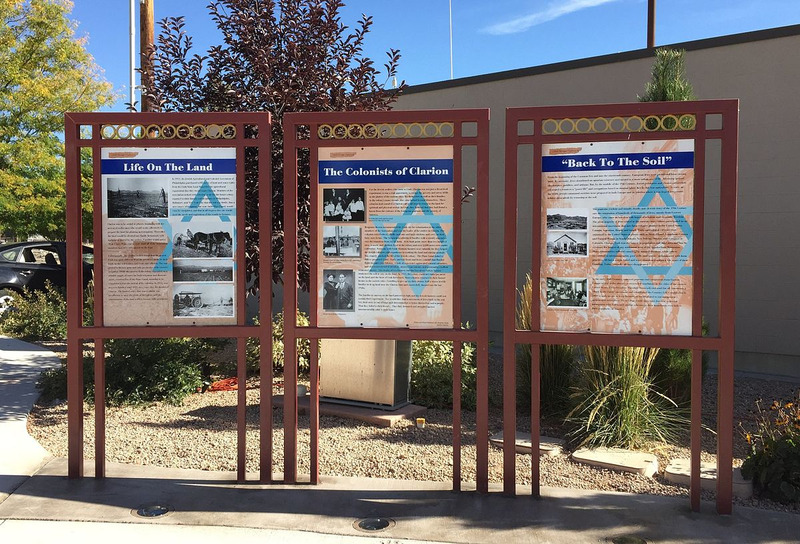
    <summary type="html"><![CDATA[<p><strong><em>In 1911, 12 Jewish immigrants all under the age of 30 started a colony in Utah. Three miles west of Centerfield and 135 miles south of Salt Lake City, the Clarion Jewish Colony was built on dreams and a lack of water. Although the colony lasted a meager 5 years, the ideas on which it was built still inspire many Jews today. </p></strong></p><img src="https://www.intermountainhistories.org/files/fullsize/40a37f08293220976a3f8bac306f5eab.jpg" alt="Kiosk in Gunnison, Utah describing the Clarion Colony." /><br/><p>The group moving west consisted of Russian Jews, all under 30, who had lived in the United States for less than five years. Poor, but not poor in spirit, these immigrants wanted to leave their economic situation behind and build a life that would bring them stability and also inspire other Jews. Led by Benjamin Brown, Clarion, Utah was part of the Jewish “Back to the Soil Movement” that founded over 40 agricultural settlements in America, Argentina, Canada, and Israel. </p><p>The “Back to the Soil Movement” was created in an effort to convince the world to move away from anti-Semitic views, build Jew’s confidence in themselves, and facilitate acceptance between Jews and Christians by establishing themselves as an agrarian society. Because of these visionary beliefs and the overt call to action for Jewish people, Utah’s settlement was named “Clarion.” </p><p>After 12 men went early to begin work on their 6,000 acre piece of land, the rest of the colony came over in waves of about fifty people. Peak population for Clarion reached about 155 residents within the first few years. But, despite the rising population, the colony faced years of continually failing crops.. Lack of water, bad weather, and no previous farming experience combined to create fruitless growing seasons and failed crops. Ultimately, only 1,500 of the 6,000 purchased acres were developed. Even today, much of the soil near Clarion is undependable and unused because of the lack of access to water. Despite these challenges, the Jewish colony’s vision pushed them on. It wasn’t until 1916 that the Clarion Colony finally fell apart. The Salt Lake City Jewish community helped stranded Jews from the colony by purchasing train tickets for those who wanted to return to the East Coast. </p><p>Clarion today is a ghost town. All that remains of Jewish utopia are some crumbling foundation stones and the headstone of Aaron Binder on whose tomb both Hebrew and English is inscribed. Benjamin Brown, the leader of the migrant party, was one of the few people that stayed in Clarion even after it’s collapse. He continued to farm and later organized the Utah Poultry Association. Although the colony failed, many of the descendants of colony members look back to those memories, journals, and stories with respect and reverence. The sacrifice of the Clarion colony members proved to many Jews that getting closer to soil helped them get closer to God. </p><p>The Clarion colony was just a small part of the Jewish history of Utah. Utah is now home to over 3,500 Jews. The Jewish legacy in Utah is over 200 years old and is widely varied. A Jewish daguerreotypist traveled with John C. Fremont in 1820 and was one of the first recorded explorers to enter Utah. Later, Simon Bamberger became the fourth governor of Utah in 1917. Clarion, despite its short life compared to the stable history of Jews in Utah, deserves to have it’s story told and it’s people celebrated for their sacrifice, faith, and vision. </p><p><em><strong><a href="https://www.intermountainhistories.org/items/show/449">For more (including 4 images) view the original article</a></strong></em></p>]]></summary>
    <published>2020-10-31T09:14:25+00:00</published>
    <updated>2026-04-17T19:32:09+00:00</updated>
    <link rel="alternate" type="text/html" href="https://www.intermountainhistories.org/items/show/449"/>
    <id>https://www.intermountainhistories.org/items/show/449</id>
    <author>
      <name>Josie Manwill, Brigham Young University</name>
    </author>
  </entry>
  <entry>
    <title type="html"><![CDATA[The Russians Who Left Northern Utah <br />
]]></title>
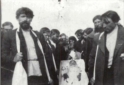
    <summary type="html"><![CDATA[<p><strong><em>In the arid northwest corner of Utah, there is a ghost town with not much left but the road that leads to it, a few decaying foundations, and a cemetery with two Russian gravestones.</em></strong></p><img src="https://www.intermountainhistories.org/files/fullsize/008a9c046a0751c6d2c3fd72ff951583.jpg" alt="Mary Kalpakoff’s family mourns her death. " /><br/><p>While there have been Russians from different religions who have settled in Utah over the years, a settlement of Molokan Russians in Park Valley is one of the only known Russian enclaves in Utah’s history. “Molokan” is a derivative from the Russian word for “milk drinker.” The Molokans inherited their name in the eighteenth century after breaking away from the Russian Orthodox Church over disagreements about the worship of icons, paying clergyman, and dietary distinctions. Specifically, they chose not to stop drinking milk during fasts such as Lent. Their additional aversion to warfare and military service forced the Molokans out of Russia and into California where the Molokans grouped together to establish themselves economically. Although they were able to provide for themselves, many Molokans felt unhappy in San Francisco--they could no longer pasture and farm and were losing vital pieces of their culture and religion. </p><p>Moving to Park Valley was a deliberate choice for this group of Russian migrants. It was their goal to protect their Molokan culture and prevent their children from adopting American habits. Thus, the Molokan Russians chose to migrate from Los Angeles to middle-of-nowhere Utah in 1914. While many stayed in California, a group of over 100 Russians, more than a dozen families, attempted to resume an agrarian way of life in Park Valley. They established a village laid out similarly to a Russian agrarian village and sought to practice their religion in peace. Sadly, after a year of joyful farming and welcoming over eight new babies to the settlement, the Molokan utopian settlement began to crumble.   </p><p>Lack of water access made living in Park Valley difficult. Their crops would not grow and their animals suffered. Then, before their first year in Utah was over, tragedy struck. In an accident during 1914, Andrew Kalpakov, the leader of the Molokan village, accidently shot his wife while cleaning his gun. A year later, the sister of Kalpakov’s wife died in childbirth. The difficult circumstances of drought and death quickly pushed the Molokans to abandon the settlement.	</p><p>Only four years later, tax documents note that there was only one Russian living in Box Elder County. While a few families chose to move east toward Logan in Cache Valley, most of the Molokans moved back to San Francisco. Even though Utah’s Russian settlement did not last very long, the Molokan people left an interesting story behind for Utahns to learn and discover.  </p><p><em><strong><a href="https://www.intermountainhistories.org/items/show/442">For more (including 3 images) view the original article</a></strong></em></p>]]></summary>
    <published>2020-10-31T04:11:17+00:00</published>
    <updated>2026-04-17T19:32:09+00:00</updated>
    <link rel="alternate" type="text/html" href="https://www.intermountainhistories.org/items/show/442"/>
    <id>https://www.intermountainhistories.org/items/show/442</id>
    <author>
      <name>Josie Manwill, Brigham Young University</name>
    </author>
  </entry>
  <entry>
    <title type="html"><![CDATA[Forest City]]></title>
    <summary type="html"><![CDATA[<p><strong><em>Several miles up a dirt road in American Fork Canyon you can find a former mining town with an interesting history.</em></strong></p><img src="https://www.intermountainhistories.org/files/fullsize/2b1227d5e01bad43bc52072888543763.jpg" alt="Sultana Smelter" /><br/><p>Soon after silver was found in Little Cottonwood Canyon, east of Salt Lake City, Utah, in the 1860s, prospectors looked to American Fork Canyon, the neighboring canyon south, for valuable ores. The American Fork Mining district was quickly formed in 1870 and the Pittsburg Mine just south of Alta and over the ridge into the American Fork Canyon drainage was the first of the many mines to come.  Among prospectors of the new American Fork mining district were Jacob and William Millar who discovered lead carbonate ore bearing some gold. They started a mining camp and later sold what would become known as the Miller Hill Mine to the Aspinwall Steamship company based in New York.  </p><p>To boost production, the Aspinwall Steamship Company built the Sultana Smelter close to the Miller mine. A mining town known as Forest City grew up around the smelter. Estimates of the population are hard to pin down. The highest estimates say that the peak population was around 2000-3000 people, but other sources limit the population to about 500 or less. Even though the exact numbers of the population are unclear, Forest City was much more than a large mining camp. There were enough children that the school district built a schoolhouse and brought in a teacher from Salt Lake. There was a sawmill that was used to produce lumber for building and an industrious farmer started a up a dairy farm to provide goods for the miners. </p><p>When the Sultana Smelter began producing more than could be transported down the mountain, the Aspinwall Steamship Company started building the American Fork Railroad to transport the ore that was produced in Forest City. The road was graded all the way up to Forest city, but due to excessively steep grades, the railroad shopped short at Deer Creek. The ore was brought by wagon from Forest City to Deer Creek and the train was able to coast down the mountain until the mouth of the Canyon.  An resulting town that grew at the Deer Creek rail terminus is now submerged under the Tibble Fork Reservoir. </p><p>A bad winter in 1872 stopped production in the mine and a diphtheria outbreak killed several Forest City residents, including children. The Miller Hill Mine slowed after that. While there were other good veins found, the rugged terrain made accessing them difficult. Decreased mining led to profit loss for the railway, so the company began offering rail services to day trip tourists in 1878. Eventually the American Fork Railroad closed, making it the first railroad in in Utah to go out of business.</p><p>Without the railway operating, Forest City collapsed and most residents left by the early-1880s. Small mining excavations occurred in American Fork canyon up until the 1950s, including Tyng’s camp and others, but none of those competed with the peak production years of 1870-1876.</p><p>The graveyard where those that died of diphtheria were buried was preserved for a long time under the new name “Graveyard Flats” but with heavy winters up American Fork Canyon with snowpack easily reaching 6 feet or more, the site has been lost. What was left of Forest City was destroyed with the actions of snowmobilers who didn’t know they were driving over a snow covered ghost town. Today all that stands of the old town are the remains of the old Sultana Smelter. </p><p><em><strong><a href="https://www.intermountainhistories.org/items/show/428">For more (including 4 images) view the original article</a></strong></em></p>]]></summary>
    <published>2020-10-09T02:45:27+00:00</published>
    <updated>2026-04-17T19:32:08+00:00</updated>
    <link rel="alternate" type="text/html" href="https://www.intermountainhistories.org/items/show/428"/>
    <id>https://www.intermountainhistories.org/items/show/428</id>
    <author>
      <name>Kristyanne Woodland, Brigham Young University</name>
    </author>
  </entry>
  <entry>
    <title type="html"><![CDATA[Nelson Nevada Ghost Town and Eldorado Canyon]]></title>
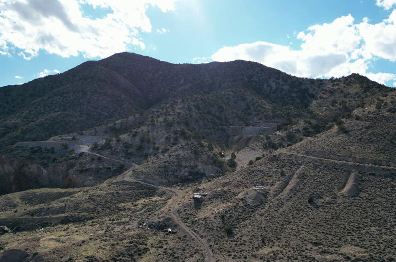
    <summary type="html"><![CDATA[<p><strong><em>The mineral mines near Nelson, Nevada provided an increase in both wealth and violence among the people near the Colorado River. The mines’ final use occurred during World War II and it has since ceased mineral excavation.</em></strong></p><img src="https://www.intermountainhistories.org/files/fullsize/63c3336c6f34781f8f1ae90c8614743d.jpg" alt="Eldorado Canyon" /><br/><p>In what is now Clark County Nevada, Spanish surveyors in 1775 discovered a canyon along the Colorado River teaming with gold, silver, and lead. Many years after the Spaniards left, United States soldiers from Fort Mojave found placer gold (loose, displaced gold such as those found in riverbeds) almost a century later in 1858. They appropriately named this area along the Colorado River the Eldorado Canyon, or the Golden Canyon. Mining efforts in the region exploded with the attempt to extract all mineral wealth.</p><p>In 1861, Mojave Chief Irataba directed a man named John Moss to a silver vein in Eldorado Canyon, who then quickly opened a mine 55 miles north of Fort Mojave near Nelson, Nevada. News spread across the Pacific coast, and the town’s population grew. This mining boom was one of the largest and most successful in Nevada’s history, with mineral wealth valuing tens of millions of dollars extracted in just the first few years.</p><p>The Eldorado Canyon quickly gained a reputation for lawlessness and villainy. Disputes over ownership of the mines, management, and hours of labor often turned bloody. A significant journey from major coastal cities in California, the relative isolation of the town further compounded the crime rate by attracting outlaws. A flat bottom river boat occasionally resupplied the town with necessary materials and manufactured goods from southern Arizona, but shipments were sporadic and unreliable. In addition, the nearest sheriffs stationed themselves in Pioche and Hiko, almost 220 miles away. The treacherous route to Eldorado Canyon, prone to Indian and robber attacks, dissuaded sheriffs from patrolling that region, causing locals to form their own posses to enforce justice.</p><p>These violent tendencies turned the canyon territory into a hub of disorder with a reputation for crime. The most prominent murder occurred in 1897 when the future namesake of the town, Charles Nelson, was killed by a Paiute Indian named Ahvote after he learned that “a couple of Nelson teamsters were after his squaw.” </p><p>In 1905, Nelson, Nevada became the center of mining operations in the canyon. With the construction of a 50-ton smelter, mining boomed more than ever. After lagging for a few decades, mining reemerged in the late 1930s to provide ore for the U.S. military during World War II. By the war’s end, increased labor costs resulted in large layoffs and the eventual closing of the mines. Today, only 35 people live in Nelson.</p><p><em><strong><a href="https://www.intermountainhistories.org/items/show/400">For more (including 3 images) view the original article</a></strong></em></p>]]></summary>
    <published>2020-03-07T03:55:37+00:00</published>
    <updated>2026-04-17T19:32:08+00:00</updated>
    <link rel="alternate" type="text/html" href="https://www.intermountainhistories.org/items/show/400"/>
    <id>https://www.intermountainhistories.org/items/show/400</id>
    <author>
      <name>Preston Keeler, Brigham Young University</name>
    </author>
  </entry>
  <entry>
    <title type="html"><![CDATA[Uranium Mining in Uravan, Colorado]]></title>
    <summary type="html"><![CDATA[<p><strong><em>The Colorado Plateau holds the richest uranium deposits in the United States. During World War II, the small uranium mining town of Uravan, Colorado helped to provide the Manhattan Project with uranium for the construction of the first atomic bombs.</em></strong></p><img src="https://www.intermountainhistories.org/files/fullsize/57eb547504641f0a8262e75aacb9e276.jpg" alt="Uranium Mill at Uravan" /><br/><p>Mining for uranium in Colorado started in the late-nineteenth century with the search for radium. Uravan started as a Standard Chemical Company mining camp named after the company chairman’s son, Joe Junior. From 1914-1923, miners at the Joe Junior Camp mined carnotite. Carnotite was a source of radium, although it required 300 tons to create a gram of radium. This material was an important ingredient in creating luminescent paint used for watches and instruments. In 1923, production of radium slowed in the United States with the discovery of rich deposits of radioactive pitchblende in the Belgian Congo. This material, pitchblende, proved much richer in radium than American carnotite. This allowed the Belgian mining companies to corner the radium market and end the American carnonite boom.</p><p>Between 1923 and 1936, the United States Vanadium (USV) Company operated the camp. In 1936, USV renamed the site after the two principle elements it intended to mine: uranium and vanadium. The company expanded the camp to house the 250 workers who moved there, many from the USV refinery at Rifle, Colorado. USV built frame houses, a mill, three power plants, along with amenities such as a swimming pool and a community hall that included a pharmacy and theater.  Men sometimes worked sixteen hours a day in the mines and mill. The residents had great pride in their town and felt appreciative of the company’s efforts to make life livable.</p><p>World War II proved a major boom to the mining of uranium and vanadium. With the outbreak of war, the United States Government started to increase purchasing of vanadium and uranium for alloy production as hardening agents in steel. During the 1940s, much of the uranium came either from the Belgian Congo or the Northwest Territories of Canada. While both of these regions proved richer than the Colorado Plateau, both were located outside of American control. The location of a uranium region in the continental United States meant that the area became vital to the war effort. With the work brought by the war, the community expanded, with the population growing to over 400 workers and their families. Under the control of the top-secret Manhattan Engineering District, the project used the uranium from Uravan in the creation of the atomic bomb, making the town a key provider. The mill at the town produced three tons of uranium sludge per day to help fuel the creation of the atomic bomb. </p><p>After the war, Uravan continued as a small mining town. Until the 1970s, the town prospered as demand for uranium remained high for Cold War defense and the growing nuclear power industry. However, changes in public attitudes to nuclear power and acceptable radiation levels affected production.  Eventually, the State of Colorado closed the town for safety reasons, residents moved away, and the town died.  In 1986, reclamation efforts began to reduce the radioactivity of the region. Today none of the buildings remain standing as reclamation efforts continue. </p><p><em><strong><a href="https://www.intermountainhistories.org/items/show/54">For more (including 4 images) view the original article</a></strong></em></p>]]></summary>
    <published>2017-06-03T15:34:16+00:00</published>
    <updated>2026-04-17T19:31:58+00:00</updated>
    <link rel="alternate" type="text/html" href="https://www.intermountainhistories.org/items/show/54"/>
    <id>https://www.intermountainhistories.org/items/show/54</id>
    <author>
      <name>Christian Flanders, Northern Arizona University</name>
    </author>
  </entry>
  <entry>
    <title type="html"><![CDATA[Thistle, Utah: Spanish Fork Canyon&#039;s Ghost Town ]]></title>
    <summary type="html"><![CDATA[<p><strong><em>Driving down US Highway 6, it’s still easy to point out the exact location of the massive landslide that led to the destruction of Thistle, a small railroad town in Spanish Fork Canyon. The landslide caused a natural dam that caused the Spanish Fork River to pool up, eventually flooding the town. While most of the town was destroyed in the flood, the skeletal structures of several buildings are still visible from US-6, a haunting reminder of nature’s awesome power. </em></strong></p><img src="https://www.intermountainhistories.org/files/fullsize/ea288ebbd8f7fa1ceb39f597f007fea2.jpg" alt="Thistle Station, Spanish Fork Canon. R.G.W.Ry. (Rio Grande Western Railway)" /><br/><p>Thistle got its start as a railroad resupply town. In fact, most of the early settlers were there on assignment from railroad companies to provide some rudimentary services to help out trains as they passed through town. Mormon settlers also made up a small part of the early population. </p><p>As rail traffic became more important in the West, Thistle’s role as a supply town grew: they provided a dining service for passing trains before the advent of dining cars, supplied helper engines for trains traveling up the mountains, and had extensive coal and water resupply facilities. The growth of the rail industry also resulted in the growth of the town. At its highest point in the late 1970s, Thistle had around 600 residents, and several other structures were built to accommodate its growing numbers, including bakeries, restaurants, saloons, and a two-floor schoolhouse. </p><p>In 1983, railway surveyors were the first to notice the changing geographical landscape. Their biggest worry was that the shifting earth would warp the rails, and they worked tirelessly with many different crews to try and keep the tracks in line. Their effort was to no avail, however, as the entire mountainside appeared to be slipping away. Rail officials eventually decided to abandon the line that ran through Thistle, and the State of Utah put out an evacuation notice to all Thistle residents to save what belongings they could and leave the town. The landslide ended up creating a natural dam that backed up the Spanish Fork River, and just a few days after the evacuation notice the flood destroyed basically the whole town. </p><p>While there weren’t any reported causalities from the landslide and flood, the economic consequences were large. Two trucking companies laid off workers, cancelled contracts, and even suspended operations. Most of the area's coal mines laid off miners, cancelled contracts, and experienced shut downs. Due to market conditions and the Thistle landslide, coal production dropped nearly 30 percent in 1983. Tourism in the area, particularly in-state tourism, was greatly reduced due to lack of access. To the south, the blockage of Highway 89 and the rail line hurt coal companies, turkey and feed operations, and gypsum, cement, and clay shipments. In total, the Thistle landslide caused total estimated capital losses of $48 million and revenue losses of $87 million.</p><p>Today, only the scattered remains of the town are visible. Half-submerged buildings, the old school house, and the occasional home are all that remains of this old railway town. It still serves as a stark symbol of nature’s power.   </p><p><em><strong><a href="https://www.intermountainhistories.org/items/show/34">For more (including 7 images) view the original article</a></strong></em></p>]]></summary>
    <published>2017-03-20T16:42:11+00:00</published>
    <updated>2026-04-17T19:31:58+00:00</updated>
    <link rel="alternate" type="text/html" href="https://www.intermountainhistories.org/items/show/34"/>
    <id>https://www.intermountainhistories.org/items/show/34</id>
    <author>
      <name>Addison Blair, Brigham Young University </name>
    </author>
  </entry>
</feed>