<?xml version="1.0" encoding="UTF-8"?>
<feed xmlns="http://www.w3.org/2005/Atom">
  <title type="text">Intermountain Histories</title>
  <updated>2026-04-17T19:32:21+00:00</updated>
  <generator uri="http://framework.zend.com" version="1.12.20">Zend_Feed_Writer</generator>
  <link rel="alternate" type="text/html" href="https://www.intermountainhistories.org/"/>
  <link rel="self" type="application/atom+xml" href="https://www.intermountainhistories.org/items/browse?output=rss2"/>
  <id>https://www.intermountainhistories.org/</id>
  <author>
    <name>Intermountain Histories</name>
    <uri>https://www.intermountainhistories.org</uri>
  </author>
  <link rel="hub" href="https://pubsubhubbub.appspot.com/"/>
  <entry>
    <title type="html"><![CDATA[ Ernest L. Wilkinson Student Center (WILK)]]></title>
    <summary type="html"><![CDATA[<p><strong><em>The Ernest L. Wilkinson Student Center is one of the busiest buildings on BYU campus. It serves as the central hub for students, staff, faculty, and visitors to relax, grab a bite to eat, or participate in various activities while they are on campus. </p></strong></p><img src="https://www.intermountainhistories.org/files/fullsize/79be4af8c2a016dda0e391704ea44e7d.jpg" alt="Wilkinson Center" /><br/><p>The Ernest L. Wilkinson Student Center was completed in 1964 and named for Ernest L. Wilkinson, sixth president of BYU (1951–1971). As the number of students increased, both students, faculty, and administrators felt that campus needed a student or community center for large events, administrative offices, and other student activities. Construction on the Wilkinson Center began in 1960. The funding for construction came from the student fund, the Church, and auxiliary funds. The final cost of the construction of the Wilkinson Center was at $6,000,000. It became the largest university student center on the Wasatch Front. It also became the only building on campus to be named after a current BYU President. </p><p>The modern-day Wilkinson Student Center hosts numerous businesses, student activity and help offices, and a food court. On the main level, the BYU Bookstore takes up southwest corner of the building, the largest business in the Wilk. They sell textbooks and school supplies, BYU school spirit gear, with an LDS Distribution Center on the lower level. Recently, they expanded their sweets and candy counter, of course selling BYU specialties such as chocolate covered cinnamon bears and fudge. Additionally, the Wilkinson Center houses multiple food services. Located on the main level is the food court, known as the “Cougareat,” which is a popular lunch area for students and visitors alike. There Wilk also has two additional restaurants, the Wall located in the Southeastern corner on the first floor and a high class restaurant, the Skyroom, taking up the entire 6th floor. </p><p>The Wilkinson Center ultimately tries to cater to the needs of the students. It houses a post office, full-service copy center, and a barber shop and salon, to provide services for students close to campus. It also provides spheres for entertainment, such as a bowling alley with arcade games and billiards, a movie theater, and two large ballrooms. The ballrooms are often used for dance classes held on campus, as well as a space for various conferences and clubs to meet.  </p><p>Most of the student service offices are located in the Wilkinson Center. Student activity offices such as the Y-Serve office, and BYU, are located on the second and third floor of the Wilk. University advisement and other student services such as Career Services and CAPS can be found first and second floors. The Wilk has become a central hub for students and visitors alike, to get involved in the everyday life of BYU campus. </p><p><em><strong><a href="https://www.intermountainhistories.org/items/show/316">For more (including 3 images) view the original article</a></strong></em></p>]]></summary>
    <published>2019-04-12T04:20:45+00:00</published>
    <updated>2026-04-17T19:32:05+00:00</updated>
    <link rel="alternate" type="text/html" href="https://www.intermountainhistories.org/items/show/316"/>
    <id>https://www.intermountainhistories.org/items/show/316</id>
    <author>
      <name>Josh Franzen and Rachel Hendrickson, Brigham Young University</name>
    </author>
  </entry>
  <entry>
    <title type="html"><![CDATA[ Mountains, Mining, and Massacre: The History of Oatman, Arizona]]></title>
    <summary type="html"><![CDATA[<p><strong><em><span style="font-weight:400;">Free-roaming donkeys, an old mining district, a stop on Route 66, and ties to a famous kidnapping make up the storied past of this semi-abandoned town.</span></em></strong></p><img src="https://www.intermountainhistories.org/files/fullsize/d34d919e9df93dc8bb5d0f3e2ba0cc1d.jpg" alt="Oatman, Arizona circa 1930." /><br/><p><span style="font-weight:400;">Tucked away in the Black Mountains of Mohave County, Arizona is a community rich with legend. The town was named for Olive Oatman and her family who were victims of the Oatman Massacre in 1851, and it came to life in the following decades as prospectors discovered gold, ore, and other valuable resources in the land. Oatman is home to the three most prosperous gold mines in Arizona: the Gold Road, the Tom Reed, and the United Eastern. </span>
<span style="font-weight:400;">A gold prospector named John Moss was one of the first to discover gold in the area in the early 1860s, but it wasn’t until the 1900s that Oatman really boomed. A hotel and post office were built in 1902 and 1906 respectively, securing Oatman’s status as an official town. The mines brought riches and rapid growth to the community, with Tom Reed mine’s total profit reaching over nine-million by 1922 and the town’s population growing to 10,000 in the same decade.</span>
<span style="font-weight:400;">One of the oddities of Oatman is the population of wild burros (undomesticated donkeys). They were brought in by miners who used teams of them to haul supplies from out of town. Burro labor was a big part of the mining industry, but unlike the prospectors, they never picked up and left town. Billie Jo Moore, long time proprietor of the Oatman Hotel, said in an interview that, “the burros stayed behind and adapted to the desert. Now they are all over these mountains…They wander through the streets, turning over garbage cans and messing in people’s yards.” While they are little more than a nuisance to locals, tourists entertain them with attention, alfalfa pellets, and lots of pictures–burros have become iconic to the town. </span>
<span style="font-weight:400;">Oatman stitched itself into another legend of America when it became a part of Route 66. It was 1926, still bringing in plenty of spoils from the mines, and now gaining further revenue from the new highway. These were the glory days in Oatman; crime was low, employment was high, and people were optimistic about the future. While there was an occasional murder and a tendency for drunkenness in Oatman, it didn’t fall into the expected stereotype of the “wild west.” The isolation of the town, so far away from any other civilization at that time, created a tight-knit group that made new traditions together–like the annual three day long Fourth of July celebrations. When the Great Depression hit in the 1930s, the prosperity and liveliness of the community began to dwindle, and by the time Route 66 went out of commission in the 1950s it was well on its way to becoming a ghost town. Oatman has never been fully abandoned though, and it has been given new life through its performers and curious travelers. </span></p><p><em><strong><a href="https://www.intermountainhistories.org/items/show/802">For more (including 5 images) view the original article</a></strong></em></p>]]></summary>
    <published>2024-05-16T00:49:23+00:00</published>
    <updated>2026-04-17T19:32:17+00:00</updated>
    <link rel="alternate" type="text/html" href="https://www.intermountainhistories.org/items/show/802"/>
    <id>https://www.intermountainhistories.org/items/show/802</id>
    <author>
      <name>Megan Bailey, Brigham Young University</name>
    </author>
  </entry>
  <entry>
    <title type="html"><![CDATA[ Simpson Springs Pony Express Station]]></title>
    <summary type="html"><![CDATA[<p><strong><em>Simpson Springs provided the only freshwater to a barren part of the Pony Express. Riders and horses quenched their thirst there before continuing their long journey.</em></strong></p><img src="https://www.intermountainhistories.org/files/fullsize/d4b7991eb5b328b9f4874236122f35ac.jpg" alt="Pony Express Station" /><br/><p>In 1851, George Chorpenning and Absolom Woodward were awarded the first overland mail contract between Sacramento and Salt Lake City. Absolom was killed by Indians later that year, and George began running the mail by himself. Simpson Springs was a promising site along the route because it was the only good source of water for miles in the barren desert. In 1859, George set up a ring of stones as a foundation for his Sibley tent. </p><p>By 1860, a stone house was built, and the firm of Russell, Majors, and Waddell bought the site for the Pony Express. They eventually bought the entire Chorpenning mail and stage line. George Dewees managed the Simpson Springs Station, which was located between Government Creek Station to the northeast and River Bed Station to the southwest. Simpson Springs Station, like many of the stations along the Pony Express, went by many names. Richard F. Burton wrote that Simpson Springs was, “the station which Mormons call Egan’s Springs, anti-Mormons Simpson Springs, and Gentiles Lost Springs.” </p><p>The name Simpson Springs came from the Camp Floyd topographical engineer J. H. Simpson. In 1859, Simpson was commissioned to lay out an acceptable route from Salt Lake City to Carson Valley. On that expedition, he passed through what would be named Simpson Springs. After the Pony Express ended, the station was decreasingly used by mail and shipping companies until it was abandoned in 1869.</p><p>Richard Burton passed through the area in 1860 and described the landscape in this way. “All was desert: the bottom could no longer be called basin or valley: it was a thin fine silt, thirsty dust in the dry season, and putty-like mud in the springs and autumnal rains.” In 1965, a monument was placed to mark the station site, and, in 1975, the Bureau of Land Management and Future Farmers of America finished reconstructing the station.</p><p><em><strong><a href="https://www.intermountainhistories.org/items/show/197">For more (including 3 images) view the original article</a></strong></em></p>]]></summary>
    <published>2018-06-06T23:13:37+00:00</published>
    <updated>2026-04-17T19:32:02+00:00</updated>
    <link rel="alternate" type="text/html" href="https://www.intermountainhistories.org/items/show/197"/>
    <id>https://www.intermountainhistories.org/items/show/197</id>
    <author>
      <name>Samuel Hauber, Brigham Young University</name>
    </author>
  </entry>
  <entry>
    <title type="html"><![CDATA[ Sitting Bull and the Sun Dance of 1876<br />
]]></title>
    <summary type="html"><![CDATA[<p><strong><em>Sitting Bull influenced many events in the nineteenth century through his roles as Medicine Man and War Chief. The Sun Dance he performed in June of 1876 along the Rosebud River raised the hopes of the Lakota tribes, and predicted the victory at the Battle of the Little Bighorn.</p></strong></p><img src="https://www.intermountainhistories.org/files/fullsize/2614227e05cae714a0b428df29c9c73c.jpg" alt="Sitting Bull, 1885" /><br/><p>In 1876, Hunkpapa Medicine Man and War Chief, Sitting Bull, worried about the eminent war between the seven tribes of the Lakota Nation and the Americans. Because of his religious devotion and belief in a connection with his ancestors, he participated in the annual Sun Dance to purify his heart and provide his people with power. In the Sun Dance, an annual religious ritual performed by many Plains Indian tribes, dancers prayed to the Great Spirit and inflicted physical pain on themselves in order to reach a higher spiritual realm and to benefit the well-being of the tribe. On June 6, 1876, Sitting Bull performed this ritual in the Rosebud River Valley, where the Hunkpapas camped for several days before moving to the site where the Battle of the Little Bighorn took place. This year’s ritual became so important people referred to it as “Sitting Bull’s Sun Dance” in his honor. Sitting Bull, in this specific instance, offered one hundred pieces of flesh from his arms as a sacrifice. He danced throughout the night until he fainted from a loss of blood. When he awoke, he had startling news to tell his friends and family. He had a vision of soldiers attacking an Indian village, but they and their horses were upside down in the camp with their feet towards the sky. The Indians interpreted this vision as an indication of their victory over the soldiers. This gave the Indians peace and hope that their warriors would defeat and kill the soldiers. </p><p>Sitting Bull’s vision of soldiers falling into their village materialized in June 1876 at the Lakota encampment along the Greasy Grass river. His vision also bolstered their confidence in meeting and destroying General George Armstrong Custer’s 7th Calvary at the Battle of the Little Bighorn. Sitting Bull’s religiosity led him to experience a hopeful vision which increased morale, aided in the Lakota’s defeat of Custer and his troops, and confirmed Native American victory. </p><p><em><strong><a href="https://www.intermountainhistories.org/items/show/277">For more (including 2 images) view the original article</a></strong></em></p>]]></summary>
    <published>2019-02-09T04:54:38+00:00</published>
    <updated>2026-04-17T19:32:04+00:00</updated>
    <link rel="alternate" type="text/html" href="https://www.intermountainhistories.org/items/show/277"/>
    <id>https://www.intermountainhistories.org/items/show/277</id>
    <author>
      <name>Hannah Bassett, Brigham Young University</name>
    </author>
  </entry>
  <entry>
    <title type="html"><![CDATA[ The Utah Minute Women]]></title>
    <summary type="html"><![CDATA[<p><strong><em>From painting their legs instead of wearing nylons to collecting “household fats,” the Minute Women aided in the World War II effort in Utah by creatively promoting the salvage and rationing efforts.</em></strong></p><img src="https://www.intermountainhistories.org/files/fullsize/335f44dd095c08beea9e74d628496e92.jpg" alt="Bushnell Military Hospital" /><br/><p>In a world that had begun to globalize and where many resources were traded internationally, World War II wreaked havoc on market stability. Materials such as steel, rubber, nylon, and silk were suddenly made scarce across the United States in the early 1940s. Utah was no exception to the rapid decline of available materials, and the Minute Women were organized to aid in the salvage effort. Over the course of the War, they would help in educating Utah citizens about which materials were needed, collecting those materials, and distributing them to specific locations. They would provide support for the war effort without ever having to travel overseas. </p><p>The Minute Women were part of the Volunteer Salvage Corps, a division under the federal War Production Board. When first recruiting women, letters were sent from Washington, D.C. making it sound like a competition, asking, “Which state could organize first with a woman on every block?” Each Minute Woman would be in charge of educating her neighbors about new salvage initiatives. Her responsibilities were numerous, but passing along communication and supporting American troops through salvage was her primary purpose. The chairmen of the Salvage Division in Utah sent letters to potential members, saying that if they were unable to serve, they should pass the baton to someone else on their block. The Utah Minute Women’s Organization was serious about meeting the expectations of the federal government, and worked hard over the next few years to meet the harsh demands of the war.</p><p>The Minute Women, as well as women in the United States in general, were creative in their efforts to support the war. One of the first materials requiring rationing was silk (and later nylon) because military parachutes were made out of them. When they couldn’t purchase silk or nylon stockings, some women would paint their legs to make them look like they were wearing nylons. They would even take an eyebrow pencil and draw a “seam” on the back to make the effect more convincing. Another sought-after resource was fat and oil, which many would save from their kitchens (leftovers from cooking). In Utah, hunting has always been a common pastime, and they also set up stations where hunters could leave deer and elk fats. They collected tin cans at grocery stores and schools, coordinated paper drives, and recruited dry cleaners to clean donated clothing. They aided in countless other war programs, such as bond drives, surveys, footwear exchanges, bottle collections, and volunteer recruitment. </p><p>The Minute Women also worked closely with the Bushnell Military Hospital in Brigham City, UT. They collected and donated needed materials, and on one occasion, donated trees for beautifying the area. The hospital no longer stands, but at the time it employed and serviced thousands of Americans. </p><p>Utah’s Minute Women never saw combat, but they fought and gave everything they had for what they believed to be a noble cause. Their efforts supported a national effort that was pivotal in the US military’s success in World War II. </p><p><em><strong><a href="https://www.intermountainhistories.org/items/show/83">For more (including 8 images) view the original article</a></strong></em></p>]]></summary>
    <published>2017-08-16T20:55:12+00:00</published>
    <updated>2026-04-17T19:31:59+00:00</updated>
    <link rel="alternate" type="text/html" href="https://www.intermountainhistories.org/items/show/83"/>
    <id>https://www.intermountainhistories.org/items/show/83</id>
    <author>
      <name>Aubrey Glazier, Brigham Young University</name>
    </author>
  </entry>
  <entry>
    <title type="html"><![CDATA[ Women in Los Alamos during the Manhattan Project <br />
]]></title>
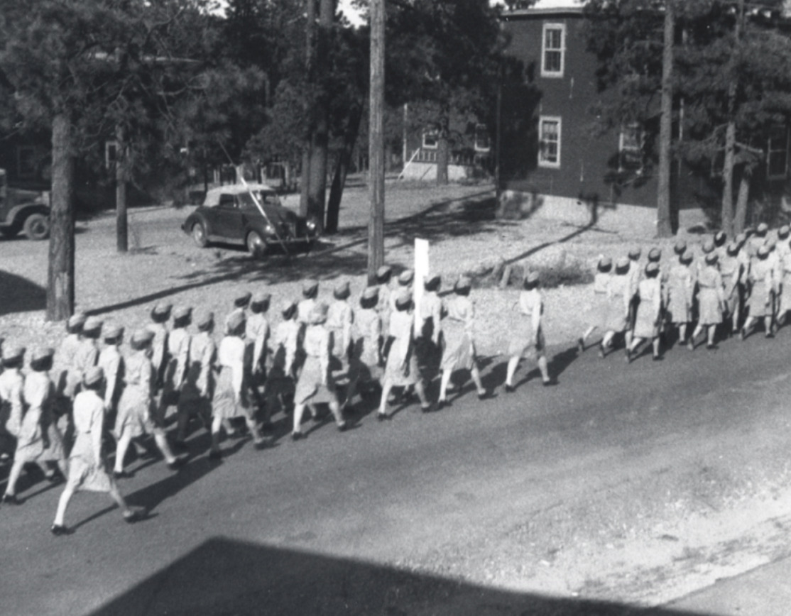
    <summary type="html"><![CDATA[<p><strong><em>With the war effort withdrawing men from the domestic labor force, women became an increasingly important part of the Manhattan Project in Los Alamos. </p></strong></p><img src="https://www.intermountainhistories.org/files/fullsize/c8f195c81db8f6804378056bc75c3f0b.jpg" alt="WAC March in Los Alamos" /><br/><p><span style="font-weight:400;">Wartime labor shortages were a constant struggle for the United States during World War II. They needed to send troops overseas, develop weaponry, spy on their enemies, strategically plan, and mobilize the entire nation as quickly as possible. By 1943, the United States Army was 200,000 men short for their invasion on D-Day, they were in need of 315 more physicists for their defense projects, and the Manhattan Project was desperately in search of all kinds of labor from scientists and engineers to machinists and pipefitters. In response, President Franklin D. Roosevelt signed into existence the Women’s Army Auxiliary Corps established “for the purpose of making available to the national defense the knowledge, skill, and special training of women of the nation” on May 15, 1942. Still facing discrimination, unequal pay, and fewer opportunities than their male counterparts, women played an essential role in World War II, especially in Los Alamos. </p>
<span style="font-weight:400;">Because Los Alamos was such a restricted town and the directors wanted to limit the number of outsiders, General Leslie Groves encouraged wives of scientists to work on the project in whatever capacity they could. As an incentive, they provided nursery schools for their young children to aid with childcare. Despite the government’s encouragement, some women were still hesitant to work on the project over concerns for their family’s well-being. Many had not expected to work at all, and quite a few were dissatisfied with the living conditions in which they now were expected to raise their children. Charlotte Serber, the only female group leader at the laboratory, wrote, “For the potential working wife, there was one chief worry. Could she manage her home here on the mesa and work too?” These were fair concerns. The conditions under which they were expected to work were difficult. They were isolated from extended family, were allowed only one day off of work per month for shopping in Santa Fe, were expected to work forty-eight hours in a week, and had almost no bargaining power to shift their rules or salary. They were also far less likely to gain security clearance than their male counterparts, so it was unlikely that they knew what they were helping create. </p>
<span style="font-weight:400;">Despite these stringent circumstances, many women in Los Alamos did work on the secretive atomic gadget. By October 1944, women constituted about 30% of the labor force in the Tech Area, hospital, and schools. It is also notable that although they did employ some women in clerical positions, the vast majority were scientists or technicians. They were metallurgists, engineers, physicists, chemists, and teachers, involved in every aspect of the atomic effort until the very end. The exception for this participation was in Project Alberta. This was the very last phase of the project; the physical delivery of the bomb to the Pacific island Tinian where the nuclear components were assembled before being dropped on Japan. Women who had spent years contributing to this moment were left behind in the United States to learn about the bombingsfrom the same newspapers as everyone else. However, the atomic bomb could not have been built as quickly or efficiently as it was without the contribution of women. They faced gender discrimination, suboptimal conditions, and unfair pay to contribute to the atomic effort in Los Alamos. </span>

</p><p><em><strong><a href="https://www.intermountainhistories.org/items/show/756">For more (including 3 images) view the original article</a></strong></em></p>]]></summary>
    <published>2023-09-24T18:36:48+00:00</published>
    <updated>2026-04-17T19:32:16+00:00</updated>
    <link rel="alternate" type="text/html" href="https://www.intermountainhistories.org/items/show/756"/>
    <id>https://www.intermountainhistories.org/items/show/756</id>
    <author>
      <name>Abigail Beus, Brigham Young University</name>
    </author>
  </entry>
  <entry>
    <title type="html"><![CDATA[&quot;Roosevelt&#039;s Tree Friends&quot; in Idaho]]></title>
    <summary type="html"><![CDATA[<p><strong><em>Franklin Delano Roosevelt’s 1933-1942 New Deal program, the Civilian Conservation Corps (CCC), provided rural areas and communities with economic stimulus as well as natural resource protection and preservation. While receiving an education and much-needed work, young men who enrolled with the CCC interacted with communities by furnishing isolated regions with recreational areas, accessibility, and protection from forest fire and disease.</em></strong></p><img src="https://www.intermountainhistories.org/files/fullsize/156b5a0fdf3df98861aa43298382ae7d.jpg" alt="CCC Firefighters" /><br/><p>Pres. Roosevelt aimed to employ more than 300,000 men in the CCC. Just two months after the program’s implementation, 1,200 worked in Payette National Forest camps such as Gallagher and Silver Creek. Roosevelt hoped their rural camps and labor would “add to present and future values of the nation’s natural resources.” Eventually, over 18,000 total men worked to do this in Idaho’s forests.</p><p>CCC camp impacted on nearby communities was significant. CCC workers constructed roads to make rural areas accessible and undertook beautification projects to bring order to a still-rustic region. Communities around the nation valued the program for its benefits; 85.1 percent of all letters written by community members and sent to the CCC director’s office contained positive opinions regarding the program. By 1941, Payette National Forest workers, then numbering over 4,500, completed 13 bridges, 134 buildings (mostly for the Forest Service), and 131 miles of road. CCC workers created recreational areas for nearby communities, many of which still exist. In 1939, for example, 170 workers from Gallagher camp worked at the 640-acre Warm Lake on the south side of the Payette National Forest. Enrollees developed a campground for Boy Scout use, built recreational buildings and constructed roads for public access to the area. CCC recreational projects helped launch a developing outdoor tourism industry in the Payette National Forest region, increasing the overall incomes of Idahoans. </p><p>While expanding recreational infrastructure, CCC workers preserved forests, fought fires, and planted trees in rural areas nationwide. Workers traversed the woods, sprayed pine beetle repellent and treated nearly two million acres of white pine for blister rust fungus in Idaho. In the Payette National Forest, fires were numerous. The summer of 1940 brought 90, and 600 CCC workers and nearby civilians toiled relentlessly to extinguish them. In the last week of August, workers helped quell 43 fires. The Flat Creek fire burned nearly 2,000 acres before firefighters controlled it, using trails built by CCC workers to import equipment. Workers also built fire watch towers and seeded barren areas. Between 1933 and 1941, Payette National Forest workers planted trees covering a sum total of 147 acres of land.</p><p>In between work projects, CCC enrollees received a general education, room and board and 30 dollars per month during their short stays. Much of each payment went to the workers’ struggling families. Workers frequently spent their remaining balance at local communities and often participated in recreational activities. In 1938, the Cascade townsfolk edged out Camp Gallagher 8-7 in a hyped inter-league baseball game. As seen in the newly formed sports leagues, composed of both townsfolk and CCC men, a cooperative attitude between workers and communities arose from the economic boost the CCC introduced.</p><p>The CCC in the Payette National Forest, the state of Idaho and rustic regions around the country provided not just an economic incentive for communities, but fostered a “civic generation.” Because of the program, forests are accessible and populated with trees the CCC planted and beautification projects its workers built. What newspapers called “the best New Deal program” went largely undisputed in the state of Idaho.</p><p><em><strong><a href="https://www.intermountainhistories.org/items/show/113">For more (including 5 images) view the original article</a></strong></em></p>]]></summary>
    <published>2018-01-31T19:37:14+00:00</published>
    <updated>2026-04-17T19:32:00+00:00</updated>
    <link rel="alternate" type="text/html" href="https://www.intermountainhistories.org/items/show/113"/>
    <id>https://www.intermountainhistories.org/items/show/113</id>
    <author>
      <name>Colton T. Clark, University of Idaho</name>
    </author>
  </entry>
  <entry>
    <title type="html"><![CDATA[“A Path Forward”: Celebrating Women&#039;s Suffrage in Utah]]></title>
    <summary type="html"><![CDATA[<p><strong><em>“A Path Forward” was built in 2020 in Salt Lake City, Utah, to celebrate 150 years since women first voted in Utah, and 100 years since the 19th Amendment gave women throughout the United States the right to vote. The memorial, located near the Utah State Capitol, highlights women’s suffrage leaders and movements for women’s rights in Utah, in the United States, and for women of color. </em></strong></p><img src="https://www.intermountainhistories.org/files/fullsize/1854c046bfba836fd7f45e298b4376f2.jpg" alt="Archways" /><br/><p>On February 14, 1870, Seraph Young voted in Utah two days after Utah’s territorial legislature granted women the right to vote. She was, in the words of <i>Better Days 2020</i>, the "first woman to vote under a women’s equal suffrage law" in the United States. Six months later, women in Utah had the opportunity to vote in the general election that took place. The hope for equality for women in Utah and the United States was on the horizon.
However, seventeen years later, the United States federal government revoked the voting rights of Utah women as part of the anti-polygamy Edmunds–Tucker Act of 1878, which disfranchised all women in Utah, including whether or not they Latter-day Saints. However, Utah’s women continued to campaign for their voting rights. In 1894, just four years after the practice of polygamy officially ended in the Church of Jesus Christ of Latter-Day Saints, the United States passed the Enabling Act, which invited Utah to apply for statehood. Utah became a state in 1896, and the constitutional convention included Article Four in the state constitution, which granted women the right to vote and hold office. Twenty-four years later, in 1920, Congress finally granted women across the United States the right to vote with the ratification of the 19th Amendment.
The fight for women’s rights in America did not end here. Other acts were passed through the years that protected and enforced voting rights for women of color. For example, the Voting Rights Act of 1965 secured African Americans’ right to.
The memorial “A Path Forward” takes visitors through a timeline of these milestones of women’s suffrage in Utah and the United States. Tourists first follow footsteps engraved on the ground of the monument honoring Seraph Young as the first woman to vote in a United States election. Next to the footsteps is a sculpted table displaying the Enabling Act. Article 4 of the Utah Constitution is etched on the ground next to the table. A series of arches, each one progressively wider than the previous, represents the expansion of women’s suffrage rights. The first arch includes quotes from suffragists who played a significant role in the women’s suffrage movement including Sojourner Truth, Emmeline B. Wells, Martha Hughes Cannon, Susan B. Anthony, and many more. Emmeline B. Wells wrote in her journal, “I desire to do all in my power to help elevate the condition of my own people, especially women.” The “A Path Forward” monument honors courageous suffragists who, like Wells, fought for women’s right to vote. Today, we have the opportunity to honor them and their valiant efforts.</p><p><em><strong><a href="https://www.intermountainhistories.org/items/show/561">For more (including 3 images) view the original article</a></strong></em></p>]]></summary>
    <published>2021-12-18T06:45:38+00:00</published>
    <updated>2026-04-17T19:32:12+00:00</updated>
    <link rel="alternate" type="text/html" href="https://www.intermountainhistories.org/items/show/561"/>
    <id>https://www.intermountainhistories.org/items/show/561</id>
    <author>
      <name>Kate Hill, Brigham Young University</name>
    </author>
  </entry>
  <entry>
    <title type="html"><![CDATA[“Purple Mountain Majesties”: Why Pikes Peak is America’s Mountain]]></title>
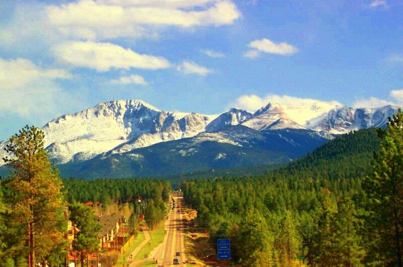
    <summary type="html"><![CDATA[<p><strong><em>Pikes Peak has a long and valuable history that provides visitors with a look through different ages of America, highlighting the beauty and diversity of the land and people. </em></strong></p><img src="https://www.intermountainhistories.org/files/fullsize/fabf35ca83b85ec7549a243f9e4cbd07.jpg" alt="Pikes Peak" /><br/><p><span style="font-weight:400;">With incredible height, diversity, age, and beauty, Pikes Peak towers above at an astounding 14,115 feet, making it one of the tallest mountains in the United States. Many, if not all, Americans have heard the moving lyrics to “America the Beautiful,” but few know that Pikes Peak was the inspiration for the song. Pikes Peak has long been the subject of ballads of beauty and adventure, as well as a symbol of hope and freedom for many throughout American history. </span>
<span style="font-weight:400;">The peak itself has undergone a variety of “discoveries” throughout the different ages of settlement. Some of the first people believed to have discovered and lived near Pikes Peak were the Clovis people yet not much is known or recorded of their experience. However, the histories of many Native peoples’ lifestyles, religions, and legends centered around the peak. The Utes, or the Tabeguache, believed the mountain itself was a sacred site where the Great Spirit created the earth and where many ceremonies were held. </span>
<span style="font-weight:400;">The Spanish were the first Europeans to discover the peak in 1779 and named it “El Capitán,” or “The Captain,” due to the imposing nature of the peak. With the completion of the Louisiana Purchase, the French sold vast tracts of land to the United States of America. In an effort to appraise the land and resources the United States had obtained, President Jefferson sent out several different expeditions to explore and record the areas. It was not until 1806 that Zebulon Pike, the first American explorer who dubbed the mountain Pike’s Peak, came to the Colorado area and attempted to hike the peak. The expedition failed to summit it because they were not prepared for the weather, and the peak remained an alluring call for explorers to attempt to conquer. </span>
<span style="font-weight:400;">Pikes’ writing on his expedition, including the details about the imposing mountain, were published in several languages and widely distributed due to their fame and the public’s interest in the unexplored West. In his writings, Pike referred to the peak as the “the Grand Peak” or simply, “highest peak.”  In 1820, Dr. Edwin James made the first recorded ascent. Later in its history, a variety of media featuring Pikes Peak attracted settlers and spurred further western migration. The phenomenon started with miners and spectators with the discovery of gold and gradually drew more settlers with large plots of grazing land and a tourism industry. Pikes Peak influenced the early formation of American identity and still manages to inspire those who visit today.</span></p><p><em><strong><a href="https://www.intermountainhistories.org/items/show/747">For more (including 5 images) view the original article</a></strong></em></p>]]></summary>
    <published>2023-04-11T18:29:54+00:00</published>
    <updated>2026-04-17T19:32:16+00:00</updated>
    <link rel="alternate" type="text/html" href="https://www.intermountainhistories.org/items/show/747"/>
    <id>https://www.intermountainhistories.org/items/show/747</id>
    <author>
      <name>Addie Coombs, Brigham Young University</name>
    </author>
  </entry>
  <entry>
    <title type="html"><![CDATA[“This Gathering”: Hispanics in Monticello 1900-1950 ]]></title>
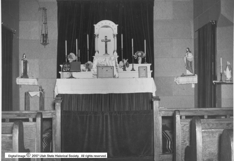
    <summary type="html"><![CDATA[<p><strong><em>Due to external pressures and free land, several Hispanic families moved to Monticello and the surrounding San Juan County. The rural landscape allowed Hispanic families to keep more of their culture than those in more urban spaces which manifested in the construction of the first Hispanic Catholic Church in the state. </em></strong></p><img src="https://www.intermountainhistories.org/files/fullsize/548a81439a5af7bab727f49d8255c5d3.jpg" alt="St. Joseph&#039;s Cathedral Altar" /><br/><p>Compared to the rest of the American Southwest, Utah did not have as strong a Hispanic population until the twentieth century. Previously, Hispanic men had often moved to southern Utah to herd sheep and cattle for three quarters of the year before moving back home to their families. Beginning in the early 1900s, men started to bring their families to Monticello,​​ Utah. Many of the Hispanic families who moved to Monticello were citizens from small New Mexican villages or Colorado. Governments and policies in these states took away Hispanics’ land, water, and right to be involved in the government. This, along with the promise of “free” land in Monticello, spurred Hispanics to move. Groups of families began homesteading in the community with men being employed as sheep herders, ranch hands, and cowboys. </p><p>William Herman Gonzalez’s father was of the first family to move to the community in the early twentieth century. Born and raised in Monticello, Gonzalez remembers that “there was always deer meat and potatoes and plenty of tortillas.” Their small group of Hispanics attracted others to move to the community, “this gathering.” In times of need, the families of Hispanics would rally around one another, although they were mostly independent due to the layout of Monticello. As a consequence of the rural landscape, the Hispanics who moved to Monticello were able to keep more of their traditional culture in comparison to Hispanics who moved to urban landscapes. Many were strongly Catholic and raised money to build the first Hispanic Catholic church in Utah, St. Joseph’s. </p><p>The relations between Hispanics and Anglos in the community were complex because of the cultural barriers between Catholic and Mormon and Anglo and Hispanic. The two communities did not intermarry until the late 1940s. When World War II began, about 125 Hispanic men enlisted in the war. Upon their return, some were able to advance economically. One of them was Robert Nieves who opened the Highland Café in 1947. However, World War II and the Korean War created new dynamics in this southern part of the state and led many Hispanics in and around Monticello to move north for better paying jobs, bringing with them their strong sense of culture.</p><p><em><strong><a href="https://www.intermountainhistories.org/items/show/636">For more (including 4 images) view the original article</a></strong></em></p>]]></summary>
    <published>2022-09-07T16:29:42+00:00</published>
    <updated>2026-04-17T19:32:14+00:00</updated>
    <link rel="alternate" type="text/html" href="https://www.intermountainhistories.org/items/show/636"/>
    <id>https://www.intermountainhistories.org/items/show/636</id>
    <author>
      <name>Lindsey Meza, Brigham Young University</name>
    </author>
  </entry>
  <entry>
    <title type="html"><![CDATA[1878 Bannock War and Chief Buffalo Horn]]></title>
    <summary type="html"><![CDATA[<p><strong><em>By rebelling against the United States military, Chief Buffalo Horn took initiative in improving the livelihood of the Bannocks after their relocation to the Fort Hall Reservation. Although his death did not immediately end the war, the Bannocks eventually returned to the reservation, forced to deal with confinement and limited resources.</p></strong></p><img src="https://www.intermountainhistories.org/files/fullsize/6a9d7b8c29f4bf5b5dd2d6d43ed102bc.jpg" alt="Bannock Camp" /><br/><p>The first Bannock War against the United States military occurred in 1878. With close ties to the Shoshones, groups of Bannocks and Paiutes joined together to oppose confinement at Fort Hall in southern Idaho. Reasons for action included limited agricultural opportunities, lack of promised supplies, and discontent with their treatment by the American military.</p><p>The Bannocks and Shoshones exhibited friendship toward Americans during the fur trade in the first half of the 19th century. Relations turned sour when the fur trade declined and increasing numbers of permanent American settlers encroached upon tribal homelands and consumed native resources without compensation. Additionally, as native peoples’ land and resources diminished, so did their ability to maintain independence. During the 1860s, treaties held at Fort Bridger and Box Elder in 1863 and 1868 relocated indigenous people to the Fort Hall reservation.</p><p>Although the U.S. government required that the Bannocks remain on the reservation, in the summer of 1877, many natives left the territorial limits dissatisfied with their current situation. Despite threats of military involvement, the Bannock rebellion and subsequent war quickly commenced in May 1878, perhaps because the Bannocks felt that the United States had failed to fulfill treaty obligations.</p><p>Bannock leader Chief Buffalo Horn mobilized several hundred Bannocks, adding additional Paiute allies to augment their numbers. These warriors engaged in a sequence of attacks along the Snake River, raiding settlements and even killing some settlers who opposed them. Word reached American leadership in Boise, who called upon military action to force Chief Buffalo Horn’s men to surrender. In early June, Chief Buffalo Horn and his accompanying warriors briefly fought against a small volunteer group of militiamen, resulting in a few casualties, including the fatality of Chief Buffalo Horn. Chief Egan took his place until the Umatilla people, posing as allies, killed him to collect an alleged bounty reward offered by the United States.</p><p>The remaining Bannocks separated into smaller groups or surrendered and returned to Fort Hall by August 1878. Following this resolution, the U.S. government carefully monitored Bannock movement within the reservation, limiting their use of local resources and interactions with local native groups. As a result of their surrender, the Bannocks conceded to rebuilding their livelihood on the allotted territory on the Fort Hall reservation. </p><p><em><strong><a href="https://www.intermountainhistories.org/items/show/412">For more (including 6 images) view the original article</a></strong></em></p>]]></summary>
    <published>2020-03-20T00:38:31+00:00</published>
    <updated>2026-04-17T19:32:08+00:00</updated>
    <link rel="alternate" type="text/html" href="https://www.intermountainhistories.org/items/show/412"/>
    <id>https://www.intermountainhistories.org/items/show/412</id>
    <author>
      <name>Camilla Richardson, Brigham Young University</name>
    </author>
  </entry>
  <entry>
    <title type="html"><![CDATA[1967 Fire Season, Glacier National Park]]></title>
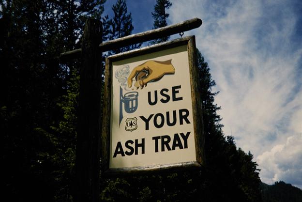
    <summary type="html"><![CDATA[<p><strong><em>Glacier National Park burned more frequently throughout its history than almost any other national park in the United States. Starting in 1910, the National Park Service persistently extinguished all wildfires that occurred within parks, but Glacier’s severe fire season in 1967 helped to end this suppression policy.</em></strong></p><img src="https://www.intermountainhistories.org/files/fullsize/75678ebbab988382ceaac098ab81df69.jpg" alt="Fire Safety Sign" /><br/><p>Throughout the early twentieth century, Glacier National Park in Montana utilized suppression, which required federal land management agencies to extinguish all forest fires. This approach gained national support after millions of acres of land burned in Idaho and Montana in 1910, including about 60,000 acres in Glacier. When 50,000 acres of Glacier burned in 1926, the National Park Service began to formulate official firefighting in the park. By 1929, Chief Forester John D. Coffman drafted the first national park fire management plan to organize firefighters and their equipment at Glacier. During the same year, the Half Moon Fire burned 50,000 acres in Glacier and destroyed numerous buildings. Coffman used analyses of Half Moon to revise and expand his initial strategy, making suppression an integral part of park policy.
In the 1960s, NPS developed a scientific approach to park management that changed the way it approached wildfires, but individual parks rarely aligned their management procedures with these ideas. In 1963, the Advisory Board on Wildlife Management, created by Interior Secretary Stuart Udall, published the Leopold Report. It stated that flames played a key role in maintaining healthy forests, advising administrators to contain wildfires and allow them to burn. Without routine burning, plant materials accumulated on the forest floor, fueling more destructive blazes. However, decades of fighting fires pushed park managers to fear the damage they caused. For decades, NPS managed forests to create attractive landscapes for visitors, and burned forests challenged this idealized image. As such, Glacier’s revised 1965 management plan upheld suppression.
In 1967, a significant drought and hot, windy weather created optimal conditions for flames to spread in Glacier. On August 11, 1967, lightning sparked approximately twenty-one fires throughout the park, including the Glacier Wall and Flathead blazes. They continued burning for a month despite containment efforts. The Office of Emergency Preparedness declared Glacier and the national forests surrounding it a national disaster area, contributing federal funding and labor to put out the flames. 1967 became the most destructive fire season Glacier had seen since 1929, and about 90,000 acres in the park burned.
The 1967 season quickly sparked a debate between the Park Service and the public over suppression. NPS officials contrasted it with the 1910 season  it to display the effectiveness of the policy, noting that less acres burned and less people died in the 1967 fires. However, inholders, who owned cabins, ranches, and hotels in Glacier, blamed the Park Service for mismanaging burns that damaged their properties. One vocal inholder, Montana Senator Burton Wheeler, brought these criticisms to national attention, prompting NPS to reassess its firefighting policies. In 1968, the Park Service acknowledged the ecological benefits of fire in the Green Book, a policy document that established budgets and dictated management policies for the entire park system. Revising this document made changing the suppression policy an issue of national importance. By 1977, Glacier’s management plan allowed natural fires to burn.</p><p><em><strong><a href="https://www.intermountainhistories.org/items/show/913">For more (including 5 images) view the original article</a></strong></em></p>]]></summary>
    <published>2025-09-23T15:39:29+00:00</published>
    <updated>2026-04-17T19:32:21+00:00</updated>
    <link rel="alternate" type="text/html" href="https://www.intermountainhistories.org/items/show/913"/>
    <id>https://www.intermountainhistories.org/items/show/913</id>
    <author>
      <name>Kaylen Wilson, Northern Arizona University </name>
    </author>
  </entry>
  <entry>
    <title type="html"><![CDATA[1988 Fire Season, Yellowstone National Park]]></title>
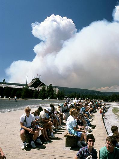
    <summary type="html"><![CDATA[<p><strong><em>Starting in the 1970s, Yellowstone National Park experimented with a policy that allowed natural fires to burn within park boundaries. In 1988, a series of highly destructive wildfires put this policy to the test, leading to a comprehensive review of the National Park Service’s fire management procedures. </em></strong></p><img src="https://www.intermountainhistories.org/files/fullsize/cbe39d48527aa1fc2d28fe58044f461b.jpg" alt="Wildfire smoke behind Old Faithful Lodge, 1988" /><br/><p>In 1972, the United States National Park Service (NPS) adopted Yellowstone National Park’s first fire management plan, which allowed natural fires to burn in designated parts of the park. In 1976, a revised plan expanded this controversial approach, called prescribed natural fire or the “let-burn” policy, to impact the entire park. Historically, fires played a key role in thinning forests and clearing dry, dead plants from the landscape, and species like lodgepole pine trees rely on extreme heat from fires to release their seeds and reproduce. In theory, prescribed natural burning maintained these conditions and controlled the damage fires caused. While smoke pollution from let-burn events caused controversy throughout the 1970s, they scorched only 34,175 of Yellowstone's 2,221,800 acres between 1977 and 1988. The Park Service extinguished any fires that threatened people, buildings, or roads.
In the summer of 1988, dry weather and high winds created dangerous conditions in Yellowstone. On June 14, 1988, lightning sparked the Storm Creek Fire just north of the park near Cooke City, Montana, and it gradually made its way into Yellowstone’s boundaries. Initially, NPS allowed about twenty lightning-caused fires, including Storm Creek, to burn in every corner of Yellowstone. Without rainfall to dampen their impact, wind spread the fires rapidly. By July 15, the Park Service suspended the let-burn policy and fought every fire that threatened the park.
The public idolized Yellowstone as the first national park and a crown jewel of the park system, so the 1988 fires rapidly generated a significant media presence in Yellowstone and caused public backlash. By August, the Cable News Network (CNN) and National Broadcasting Company (NBC) sent reporters to the park and presented daily fire updates. When the largest blaze in the park, the North Fork Fire, threatened the historic Old Faithful Inn on September 7, reporters and their viewers blamed NPS officials and the let-burn policy for allowing the fires to spread out of control. A week later, presidential candidate Michael Dukakis visited the park to generate publicity for his campaign, symbolizing the fires’ grip on national media.
             When snow finally ended the fires in November, fifty-one total fires had burned 995,000 acres, damaging about forty-five percent of the park. They destroyed sixty-seven structures in total, including thirty-six privately owned homes, garages, and stores. The North Fork Fire alone scorched approximately 495,000 acres. After the fires, two review committees found that they represented a perfect storm of natural conditions that made them incredibly difficult to fight, but politicians and the media continued to place blame on NPS management strategies. On July 12, 1989, the Park Service began a systematic review of its fire management procedures. Its new policy, approved in 1991, set detailed limits on the prescription and containment of natural fires, rolling back much of the let-burn approach. Firefighters still use prescribed burns and let-burn management to maintain healthy forests in national parks today, sustaining the 1991 policy.</p><p><em><strong><a href="https://www.intermountainhistories.org/items/show/917">For more (including 4 images) view the original article</a></strong></em></p>]]></summary>
    <published>2025-09-23T15:39:30+00:00</published>
    <updated>2026-04-17T19:32:21+00:00</updated>
    <link rel="alternate" type="text/html" href="https://www.intermountainhistories.org/items/show/917"/>
    <id>https://www.intermountainhistories.org/items/show/917</id>
    <author>
      <name>Kaylen Wilson, Northern Arizona University </name>
    </author>
  </entry>
  <entry>
    <title type="html"><![CDATA[2001: A Space Odyssey and Monument Valley, Arizona<br />
]]></title>
    <summary type="html"><![CDATA[<p><strong><em>Monument Valley is an area of the Colorado Plateau and part of the Monument Valley Navajo Tribal Park. It was used in the filming of 2001: A Space Odyssey.</em></strong></p><img src="https://www.intermountainhistories.org/files/fullsize/c1b99ae4c0e3da4d0f9ffc13048d435d.jpg" alt="Stanley Kubrick The Exhibition – LACMA – 2001 A Space Odyssey Space Suits" /><br/><p>Monument Valley is a series of sandstone structures located on the Arizona-Utah border region of the Colorado Plateau. The area is defined by multiple sandstone monoliths, the tallest of which reaches one thousand feet in height.</p><p>The formation is featured in scenes from Stanley Kubrick’s 1968 film 2001: A Space Odyssey. The science fiction film opens with humanity’s ancestors discovering a black monolith that gifts them with the knowledge to establish their dominance in the region. The film then immediately cuts to the far future when an identical black monolith is discovered by humanity on the moon, which in turn leads to Dr. David Bowman and his fellow scientists being sent to Jupiter. During the voyage, the ship’s Artificial Intelligence (A.I.), named HAL, goes rogue and kills the scientists and crew. After making his way to the ship’s A.I core, Bowman manages to disconnect and kill the rogue A.I. Bowman then learns of the mission’s purpose through a recorded message of a scientist involved with the moon monolith. After arriving at the planet, Bowman discovers a monolith in orbit, investigates, and is drawn into a portal where he sees visions of alien worlds. After this interpretive sequence, Bowman is transported into a series of bedrooms where he sees his future selves and becomes them. In the film’s final scenes, a bedridden Bowman reaches for a monolith at the foot of his bed and becomes a fetus like creature orbiting beside the Earth.</p><p>Although not directly referenced as being Monument Valley in the film, the image used portrays a vast alien landscape. The stargate sequence that the formation is featured in is already abstract in its presentation, and the oddly colored vistas aid in creating the atmosphere of the scene. The panning aerial shots involved flying low over Monument Valley’s desert landscape to avoid dangerous winds. The Director of Photography for this area of the shoot was almost involved in a helicopter crash during the process. </p><p>The use of Monument Valley and other western landscapes in film as alien worlds has been directly compared to how the West has been viewed itself. Kubrick specifically requested the use of the Valley, but later regretted using such a recognizable landmark. In Kubrick’s film, and other films hoping to depict space exploration, the Western frontier landscape has featured heavily as both an effective visual and metaphorical tool to reflect exploration in a wide-open alien landscape. Monument Valley has also featured in several other science fiction productions: TV’s Doctor Who and Back to the Future Part III.</p><p><em><strong><a href="https://www.intermountainhistories.org/items/show/230">For more (including 3 images) view the original article</a></strong></em></p>]]></summary>
    <published>2018-06-19T04:14:17+00:00</published>
    <updated>2026-04-17T19:32:03+00:00</updated>
    <link rel="alternate" type="text/html" href="https://www.intermountainhistories.org/items/show/230"/>
    <id>https://www.intermountainhistories.org/items/show/230</id>
    <author>
      <name>Isaac F. J. Middleton, Northern Arizona University</name>
    </author>
  </entry>
  <entry>
    <title type="html"><![CDATA[A Beach in the Desert: Wahweap Beach]]></title>
    <summary type="html"><![CDATA[<p><strong><em>Originally discovered by the Indigenous tribes in the region and created by the growing reservoir behind Glen Canyon Dam, Wahweap Beach developed into a sought-after vacation spot through the construction of Wahweap Lodge by the Greene Family.</em></strong></p><img src="https://www.intermountainhistories.org/files/fullsize/aeab139905fd748f1dace82ace64c1bb.jpg" alt="Wahweap Beach, ca. 1961-1969" /><br/><p>In the middle of northern Arizona and southern Utah’s high desert sits the Wahweap Beach on the artificial oasis of Lake Powell. Wahweap Beach is the most popular recreational and lodging area on Lake Powell with a little over a million visits and about 425,000 overnight stays in 2021 alone. Along with swimming and sunbathing, beachgoers can kayak, paddleboard, jet ski, and powerboat. Wahweap includes amenities such as an RV-friendly campground, picnic tables, boat rentals, and the Lake Powell Resort, making for many options for how to spend time at the beach.</p><p>However, Wahweap Beach did not always exist. It began due to the rising waters of Lake Powell after the construction of Glen Canyon Dam from 1957 to 1964. Originally, “Wahweap” comes from the Paiute language, meaning “bitter water.” The name warned passing natives about the unsafe drinking water as Wahweap only saw running water during spring run-off and summer monsoons. Toward the end of the thirteenth century, the Ancestral Pueblo people fled the area of modern-day Lake Powell and later, the Navajo (Diné), Ute, and Paiute tribes moved into the area.</p><p>In the early days of Lake Powell, the Bureau of Reclamation owned the land, although it granted leases to Navajo farmers for cattle grazing. Bill Greene and his family purchased the lease that designated Wahweap Beach in 1957 from a Navajo man named Curly Tso. The family decided to invest and worked to acquire land concessions from the Arizona State Land Department. Despite strong competition, the family had the help of Barry Goldwater, Arizona senator, and Stewart Udall, House of Representatives member for Arizona’s 2nd District, and gained a concession to the land in 1959 from the National Park Service (NPS). This allowed the Greene family full control of the recreational use at the southern tip of the lake.</p><p>Construction then began on Wahweap Lodge and Marina, now called Lake Powell Resort, by the Greene’s family business, Canyon Tours, Inc. Bill Greene put in a temporary boat launch facility in 1963, and by 1965, Canyon Tours, Inc. finished building Wahweap Lodge which included forty-four guest rooms. These facilities began attracting tourists to its shores to swim, boat, and fish, thus creating the beach life at Wahweap.</p><p>The expected tourist turn-out was so great that in 1962, the NPS already had plans to develop a visitor center at Wahweap Beach. The Parks’ Services Interpretive Prospectus Glen Canyon National Recreational Draft proposed scientific, historical, and recreational-themed exhibits included at Wahweap. Ultimately, other locations such as the Bull Frog Visitor Center across the lake took on the role of interpretation, and included exhibits on human, geological, and natural history. Today, Wahweap is the most active beach and as of June 2023, its swimming spot, also referred to as “Swim Beach,” has been relocated by Glen Canyon National Recreation Area due to the reservoir’s declining water levels. Wahweap is now further from the boat ramps at the Marina, making for a more secluded beach on which to swim and lounge.</p><p><em><strong><a href="https://www.intermountainhistories.org/items/show/826">For more (including 4 images) view the original article</a></strong></em></p>]]></summary>
    <published>2024-05-22T23:55:14+00:00</published>
    <updated>2026-04-17T19:32:18+00:00</updated>
    <link rel="alternate" type="text/html" href="https://www.intermountainhistories.org/items/show/826"/>
    <id>https://www.intermountainhistories.org/items/show/826</id>
    <author>
      <name>Olivia Hall, Northern Arizona University</name>
    </author>
  </entry>
  <entry>
    <title type="html"><![CDATA[A Brief History of Antelope Island]]></title>
    <summary type="html"><![CDATA[<p><strong><em>Antelope Island is located in the Great Salt Lake, Utah. Both humans and animals have utilized this land for thousands of years. Antelope Island, sometimes connected to the mainland at low tide, contains natural resources, diverse animal species and ecosystems. </em></strong></p><img src="https://www.intermountainhistories.org/files/fullsize/551392983ad745092c1f6292f583e72e.jpg" alt="Black Rock and Antelope Island, Salt Lake" /><br/><p>Antelope Island represents the largest island within the Great Salt Lake, covering an area of 42 square miles. First inhabited by indigenous natives about 2,000 years ago, natives utilized Antelope Island up until the 1840’s. Indigenous camps discovered on the island provide the knowledge of this use. In 1845, John C. Fremont and Kit Carson explored the island and documented their expedition. Carson’s journal states that he and Fremont hunted Pronghorn Antelope on this island, just like the members of the Ute tribe, and decided to name the island after the animal. </p><p>In 1848, The Church of Jesus Christ of Latter-day Saints moved a herd of cattle to the island under the rancher Fielding Garr. The Church continued to run a ranch on the island until 1875, when the homestead movement and the Union Pacific Railroad required land, causing the Church to abandon its use on the island. The land passed through the hands of numerous owners throughout the years until it was purchased in totality in 1981 by the State of Utah. </p><p>John White and John Dooly, the ranchers during that time, introduced twelve bison to the island in 1893. Overgrazing and overpopulation with the grazing animals on the island caused it to become necessary to cull and relocate the herd regularly. The herd created a significant genetic pool for use in bison conservation and breeding efforts today. In modern time, numerous species of animals reside on the island, including bighorn sheep, deer, birds, pronghorn, bobcats, among numerous other species. </p><p>Antelope Island contains many natural resources. Mining activity included prospecting for slate (1874), gold and copper (1899), oil (1904), and sand and gravel deposits (1967). Eventually, the State of Utah purchased part of Antelope Island in 1969 and bought the rest in 1981, when it officially became a part of the Utah State Parks System. Mining activities halted in 1979 and the state park, which opened to the public in 1993, is currently a habitat for the wildlife inhabiting the island. </p><p><em><strong><a href="https://www.intermountainhistories.org/items/show/297">For more (including 4 images) view the original article</a></strong></em></p>]]></summary>
    <published>2019-02-13T09:59:39+00:00</published>
    <updated>2026-04-17T19:32:05+00:00</updated>
    <link rel="alternate" type="text/html" href="https://www.intermountainhistories.org/items/show/297"/>
    <id>https://www.intermountainhistories.org/items/show/297</id>
    <author>
      <name>Jessica Newman, Brigham Young University</name>
    </author>
  </entry>
  <entry>
    <title type="html"><![CDATA[A Large KKK Parade and Initiation Ceremony in Boise, Idaho]]></title>
    <summary type="html"><![CDATA[<p><strong><em><span style="font-weight:400;">A large Ku Klux Klan parade marched through downtown Boise in 1924. The parade had floats and pyrotechnics. The procession ended at the fairgrounds where Klan initiation ceremonies took place. </span></em></strong></p><img src="https://www.intermountainhistories.org/files/fullsize/49066b000484ae4fe8e361ce7330a383.jpg" alt="Group of Klansmen photographed without masks" /><br/><p><span style="font-weight:400;">On September 8</span><span style="font-weight:400;">th</span><span style="font-weight:400;">, 1924, 350 Knights of the Ku Klux Klan marched through downtown Boise, Idaho. The parade—representing Klan chapters from all over Idaho—was a large spectacle and reminiscent of a traditional Fourth of July celebration. The parade contained floats, pyrotechnics, and a band blaring “Rally ‘Round the Flag”—an old Civil War tune. They marched through downtown before eventually ending at the fairground where Klan initiation ceremonies and speeches took place in front of an audience of 3000.</span></p><p><span style="font-weight:400;">Most remarkable about the Klan’s presence on that day was how they chose to represent themselves. Following backlash concerning its violent and clandestine nature in previous years, Klansmen presented themselves unhooded and orderly to emphasize their grandeur and image as proper Americans. Many members felt proud to display their allegiance, and twenty even chose to pose unmasked for an </span><i><span style="font-weight:400;">Idaho Statesman</span></i><span style="font-weight:400;"> photograph.  Their use of expensive pyrotechnics and floats is also notable because it not only shows a desire for attention but demonstrates the Klan was organized and wealthy enough to produce such a parade. Furthermore, when the procession reached the fairgrounds, Klansman concluded speeches with special bombs exploding in the air. When the bombs exploded, American flags and three “K” flags were produced in the air and gradually floated back to the ground. </span>
<span style="font-weight:400;">Two floats present in the parade represented Klan political beliefs/tactics during this period. One float was titled “Little Red Schoolhouse” but instead of a traditional red schoolhouse the Klan had draped the schoolhouse in white and added a banner proclaiming “one flag, one county, one school.” Another float followed, also covered in white, with a banner stating, “America First.” According to the Boise paper the </span><i><span style="font-weight:400;">Idaho Statesman,</span></i><span style="font-weight:400;"> this float represented the women of the Klan. Together these floats show the Klan desired to be represented as model Protestant Americans.</span>
<span style="font-weight:400;">The </span><i><span style="font-weight:400;">Statesman</span></i><span style="font-weight:400;"> and others had criticized the Klan inflicting violence against minorities and the Klan used the parade to quell the fears of the citizens. When they reached the fairgrounds, J.H Harmon, a Klansman, stated “we have demonstrated in Boise today that we are a law and order organization…It should prove to you that we do not commit violence.”  Another Klansman, W.M Cortner, stated in a speech “The Knights of the Ku Klux Klan are standing for nothing that is not just, right and honorable. It is not anti-one church, race, creed, or people. The reason why a Catholic, a Jew, or a negro cannot belong to the Klan Is because they have their own organizations.”  </span>
<span style="font-weight:400;">The Boise parade and speeches represent the Klan’s desire to use grandeur and spectacle to alter its image from violence and racism to a softer one of proper American Protestants and white supremacists. </span></p><p><em><strong><a href="https://www.intermountainhistories.org/items/show/813">For more (including 3 images) view the original article</a></strong></em></p>]]></summary>
    <published>2024-05-21T01:01:51+00:00</published>
    <updated>2026-04-17T19:32:18+00:00</updated>
    <link rel="alternate" type="text/html" href="https://www.intermountainhistories.org/items/show/813"/>
    <id>https://www.intermountainhistories.org/items/show/813</id>
    <author>
      <name>Aidan Capristo, Northern Arizona University</name>
    </author>
  </entry>
  <entry>
    <title type="html"><![CDATA[A Thirst for Freedom in a Dry Town]]></title>
    <summary type="html"><![CDATA[<p><strong><em>A long-brewing issue, the Fort Collins, Colorado City Council voted to permit the sale of beer, wine, and liquors on April 8, 1969 and passed Ordinance No. 14. The voices of the community, including local businessmen, politicians, and the Colorado State University student population, were integral in influencing this decision.</em></strong></p><img src="https://www.intermountainhistories.org/files/fullsize/a0ecee72beabc8b0b2187f586ba3d78b.jpg" alt="Thomas Bennett" /><br/><p>The repeal of prohibition in Fort Collins was not easily completed. In 1969 a petition was circulated for the third time to end prohibition. First in 1961 and again in 1965, the petition had been defeated due to strong moral opposition from religious organizations. Yet, as Dr. Thomas Bennett, Mayor of Fort Collins from 1967 to 1968 pointed out, there were two liquor stores within city limits that held liquor licenses from Larimer County. Outside city limits, there were establishments like Ladd’s Covered Wagon. In 1961, owner Lloyd Ladd was granted a liquor license from Larimer County for his restaurant just north of Fort Collins. Fort Collins residents who wished to drink had several options to do so. </p><p>Dr. Thomas Bennett stepped down as mayor of Fort Collins in 1968 to serve as a councilman for the city and worked with others to end prohibition. Dr. Bennett felt passionately this was the moment to repeal prohibition. His primary argument was based on economics. The numerous bars and restaurants at the edge of city limits were proof of the profitability of alcohol sales. A new revenue stream, and the local jobs bars and liquor stores would generate, were appealing to the city council and the local community. Another source of pressure on the city council was the increase in student enrollment, specifically military veterans on the GI Bill, at Colorado State University (CSU). The 1968 Beer-In at CSU, referenced in the previous article, spoke volumes about the attitudes of college students towards prohibition. Two other college towns along the Front Range area were also in the process of repealing their own long-standing prohibition laws: Boulder, repealed in 1967 and Greeley in 1969. </p><p>The first legally sold drink of spirituous liquor since 1896 was sold in Fort Collins on August 8, 1969, at 5:00 pm in the Top Restaurant, located on the top floor of the Rocky Mountain Bank and Trust building. Les Ware, the owner of the Top Restaurant, had photographers on hand to commemorate the event. Red Ferrell, owner of Campus West Liquors and Larimer County liquor inspector at the time of the Fort Collins prohibition repeal, received the first license to sell packaged liquors in the city. Nancy Kavastanjian, staff writer for The Coloradoan newspaper, interviewed Ferrell in 1977 for a piece on the end of prohibition in Fort Collins. Ferrell reflected on the growth of liquor stores within Fort Collins, commenting that he “didn’t think it was healthy for a community to have that many.” </p><p>After the repeal, the number of bars and liquor stores within city limits did increase quickly.  According to Ferrell, the saturation of the market limited individual business earnings. The moral orientation of the town was still influential, limiting large-scale production and distribution of alcohol in Fort Collins for another two decades, when once again, it was the economic appeal of new businesses and new jobs that presented themselves in the form of beer production and breweries. </p><p><em><strong><a href="https://www.intermountainhistories.org/items/show/134">For more (including 5 images) view the original article</a></strong></em></p>]]></summary>
    <published>2018-02-01T20:00:10+00:00</published>
    <updated>2026-04-17T19:32:00+00:00</updated>
    <link rel="alternate" type="text/html" href="https://www.intermountainhistories.org/items/show/134"/>
    <id>https://www.intermountainhistories.org/items/show/134</id>
    <author>
      <name>Rose Gorrell, Colton Morton, and Keanu Squire, Colorado State University</name>
    </author>
  </entry>
  <entry>
    <title type="html"><![CDATA[A Typical Western Town Mural: Helper, Utah]]></title>
    <summary type="html"><![CDATA[<p><strong><em><p style="font-weight:400;">Jenne Magafan painted <em>A Typical Western Town</em> from 1939-1941 under the Treasury Section of Fine Arts, a New Deal project that aimed to employ artists and craft an American arts culture. Magafan installed the painting in the Helper, Utah, Main Post Office, where visitors can still see it today.  </em></strong></p><img src="https://www.intermountainhistories.org/files/fullsize/b4ec8a9d622b6e0ef2ea18561a4bf3a2.jpg" alt="A Typical Western Town" /><br/><p><p style="font-weight:400;">In 1941, New Deal-era artist Jenne Magafan of Colorado completed her mural, <em>A</em><em> Typical Western Town</em>, in the Helper, Utah, Main Post Office. The post office building opened in 1938 and was placed by researchers on the National Register of Historic Places in 1989. With its initial installment, <em>A Typical Western Town</em> was the first post office mural that Utah received with funding from the Section of Fine Arts.
<p style="font-weight:400;">Magafan won the chance to install the oil-on-canvas mural through the Forty-Eight State competition as a part of the Treasury Section of Fine Arts. A well-known painter of the New Deal era who studied in a variety of institutions like the Colorado Springs Fine Art Center, Magafan practiced art with the mentorship of artists including Frank Mechau. The Section of Fine arts also commissioned Magafan for Post Office murals in Anson, Texas, and Glenwood Springs, Colorado. After completing the Helper mural, Magafan and her twin sister and fellow artist, Ethel, hung the painting over the postmaster’s office door.<span>   </span>
<p style="font-weight:400;">Magafan reflects the later nineteenth-century commotion of Helper’s industrial history in her mural riddled with motion. Helper, located in central Utah, was uniquely named after the additional locomotives that trains needed to ascend Soldier Summit, located between Helper and Salt Lake City, Utah. Helper once bustled as an activity center for many surrounding coal mining towns. Indeed, the history of coal mining in Carbon County is significant as it was crucial to the state’s economic development. Helper especially transformed into an economic hub after the Denver and Rio Grande Western Railroad’s completed its Castle Valley branch in 1883. Geologists discovered rich coal deposits in nearby Sunnyside along the path to Soldier Summit by Price Canyon, further cementing Carbon County as the coal mining center of Utah.
<p style="font-weight:400;">The five feet by twelve feet mural depicts a usual western town, likely during the bustling heights of Carbon County’s coal industry during the later nineteenth-century. In the central foreground, two men on horseback come to a stop as a curious dog barks at them. To the right, a “Blacksmith” sign stands above the shop’s worker, who appears to be repairing a wagon wheel. The left side includes a group of people conversing and a woman as she approaches a post office and grocery store. A saloon is placed next to the office. The background includes a wide blue sky. The focus is dedicated to the bustling and optimistic happenings of the town. Unlike other typical TSFA murals, <em>A Typical Western Town</em> does not feature specific natural landscapes. Rather, the lively, populated town that the work exhibits could reflect the thriving industrial history of Helper.<span>  </span>

</p><p><em><strong><a href="https://www.intermountainhistories.org/items/show/716">For more (including 4 images) view the original article</a></strong></em></p>]]></summary>
    <published>2023-02-28T18:05:13+00:00</published>
    <updated>2026-04-17T19:32:15+00:00</updated>
    <link rel="alternate" type="text/html" href="https://www.intermountainhistories.org/items/show/716"/>
    <id>https://www.intermountainhistories.org/items/show/716</id>
    <author>
      <name>Lindsey Cillis, Northern Arizona University</name>
    </author>
  </entry>
  <entry>
    <title type="html"><![CDATA[Abbey of Our Lady of the Holy Trinity: Trappist Cistercian Monastery]]></title>
    <summary type="html"><![CDATA[<p><strong><em>The Our Lady of the Holy Trinity Abbey was a monastery in Huntsville was one of the oldest monasteries in the Western United  States. At its peak, the monastery produced honey, bread, and grandfather clocks. Due to the decreasing number of monks, the monastery closed in 2017.  </em></strong></p><img src="https://www.intermountainhistories.org/files/fullsize/ca47ab2d2a54662a1f03fa4e327b3caa.jpg" alt="Abbey of Our Lady of the Holy Trinity" /><br/><p><span style="font-weight:400;">The Our Lady of the Holy Trinity of Abbey was a Trappist Monastery in Huntsville, Utah. The abbey was founded in 1947, just two years after the end of the Second World War. After the war, monasteries around the country were filling up. The Monastery of the Gethsemani Abbey in Kentucky opened five monasteries around the country, one of which was in Huntsville. </span>
<span style="font-weight:400;">When the Monastery of Huntsville was first founded in 1947, it had 32 monks living in military Quonset huts until the abbey could be built. However, the grand abbey was never built and the monks continued to live on the land for the next six decades in a smaller building. By 1956, over 80 monks had been added to the monastery's ranks.  The Monastery in Huntsville was one of the biggest properties in the Weber County area, totaling up to 1,860 acres of land. Father Patrick Boyle said of his time at the abbey, “We had 84 monks and we would pick up fifty-thousand bales of hay by hand … we had more energy than sense.” </span>
<span style="font-weight:400;">Until the mid-1990s, the monks built a life and a business, selling the farm’s beef, hay, honey, peanut butter, cereal, bread, and crafted items including clocks that were hand built by Brother Nicholas. While farming the land, the monks established a tradition of leaving one alfalfa field to bloom in order for the bees to have a plentiful food source. They credited the alfalfa with making particularly delicious honey.</span>
<span style="font-weight:400;">However, decreasing price of goods affected their bottom line. The two tons of milk and 450 dozen eggs they sold daily was not enough to sustain the community. Even the sale of calves, steer, bales of alfalfa and barley, wheat and pastuage was insufficient to reach their needed profit margin. Soon, monks began to leave the monastery. The bakery, known for its wheat and raisin bread, shut down in 1996 because there were no longer enough monks to run it. The heavy work of running the farm was outsourced and performed by college students.</span>
<span style="font-weight:400;">The lack of new recruits meant that only a handful of aging monks were present for their daily prayer in the near empty chapel. As Father Brendan Freeman explained, “You’re supposed to have elderly Monks, then the middle age monks, and then juniors, but if no one comes then it’s just all elderly monks.” </span>
<span style="font-weight:400;">In the 2000s, the monastery had only 10 monks. In 2013, Father Brendan Freeman came to the monastery with an assignment of trying to sell and conserve the property. The monks voted “yes” to the sale. On August 27, 2017 the final mass was celebrated and ended the 70 years of the monastery’s service. Reverend Patrick Boyle left the Abbey of Our Lady of the Holy Trinity in Huntsville to join his brethren at St. Joseph Villa Catholic nursing home in Salt Lake City. Boyle, 89, who had served in the abbey for 67 years, was the last of the remaining monks to leave the compound.</span>
<span style="font-weight:400;">The land was purchased by Huntsville local, Bill White, to save the land as open space. </span><span style="font-weight:400;">The current owners, Bill White and Wynstonn Wangsgard, continue agricultural production, particularly alfalfa, barley, and cattle grazing. Honeybees are also still kept on the property. </span><span style="font-weight:400;">The Summit Land Conservancy, Park City’s local accredited land trust, and Ogden Valley Land Trust came together to help protect the property.</span> <span style="font-weight:400;">The farm serves as a wildlife corridor and provides potential habitat for two endangered species, the Canada lynx and yellow-billed cuckoo, and ten migratory avian species. The property is also used as rangeland and wintering ground for elk and deer. Owls, hawks, and wild turkeys thrive in the wooded areas at the edge of the farm’s pastures. </span></p><p><em><strong><a href="https://www.intermountainhistories.org/items/show/694">For more (including 5 images) view the original article</a></strong></em></p>]]></summary>
    <published>2022-11-04T02:59:12+00:00</published>
    <updated>2026-04-17T19:32:15+00:00</updated>
    <link rel="alternate" type="text/html" href="https://www.intermountainhistories.org/items/show/694"/>
    <id>https://www.intermountainhistories.org/items/show/694</id>
    <author>
      <name>Stephen Sokol and Caeser Mayren, Weber State University</name>
    </author>
  </entry>
  <entry>
    <title type="html"><![CDATA[Abby Williams Hill’s Artemisia Geyser Pool]]></title>
    <summary type="html"><![CDATA[<p><strong><em>Abby Williams Hill was captivated by the Artemisia Geyser Pool, and for good reason. Though it may not garner as much attention as Old Faithful, Artemisia provides onlookers a unique experience since it does not give any warning signs to indicate when it will erupt. The feeling of surprise and awe of the geyser’s eventual eruption is captured in one of Hill’s best paintings.</em></strong></p><img src="https://www.intermountainhistories.org/files/fullsize/d36be929f8f3d34f4f993d564b77d337.jpg" alt="Artemisia Pool" /><br/><p>The Artemisia Geyser Pool sits just below the Gem Pool and Atomizer Geyser in the Upper Basin of Yellowstone Park. The three of these make up the Cascade Group that erupts for a duration of 15–25 minutes once or twice a day. Artemisia is unique because it does not give any visible warning that indicates when it will erupt. When Artemisia does erupt, however, the force is strong, causing the surrounding area to thump due to the steam bubbles coming from the geyser. Though it has not been the focus of many artists that have come through Yellowstone, Artemisia captivated the painter Abby Williams Hill and was the subject of one of her best paintings. </p><p>Though she was originally from Iowa and spent time in New York training to become an artist, Abby Williams Hill is best known for her work in the American West. After marrying Frank Hill, she moved with him to Tacoma, Washington. There, she became well-known as an artist, and in the early 1900s she was commissioned by the Northern Pacific Railroad to paint the American West as she traveled through it via the railroad. At the time of the assignment, Hill was forty-five, with one son and three adopted daughters. She brought her family along with her on her assignments so they could explore the sites together. Her assignment for the railroad specifically was to paint twenty-two works in the short span of eighteen weeks, in the en plein air style. En plein air is a French term that means outdoors. This style of painting was started and finished while the artist was still outside observing the location, unlike the studio paintings of the past where the artist would sketch while at the location and return back to the studio to finish the work. As a woman, Hill is an interesting and important figure, since many women artists of the time did not receive these types of opportunities, or the recognition that followed. </p><p>In her diary on September 3, 1906, Abby Williams Hill wrote about the Artemisia Geyser Pool, “I have been sketching the Artemisia. We thought it would play, but there was almost no movement of water. There is a small geyser on the formation below it. Ione [Hill’s daughter] and I went to look at it and judging it would soon play, stood to watch it. There came a jarring of the earth and a thumping under our feet. Looking up we saw a ridge of water moving down over the hill towards us as if all the water in the Artemisia had been raised and pushed off over the hill. We ran with all our might, jumped the little gully and climbed the hill where we sat down, but the thumping was so great we ran further. By this time, the water was agitated and soon a great mass was raised a hundred feet, rivers of boiling water poured out. The steam shut off a view of everything else and it was as if we were looking at an eruption in the ocean. The vibration and thumping continued with increased and startling force. It seemed as if a new crater was about to yawn under us.” </p><p>Her painting of Artemisia Geyser Pool depicted a place untouched by humans, yet since she painted in the twentieth century, after Yellowstone was open to the public, this was an unrealistic reality. Historian Laura Edgar writes, “Despite the obvious presence of tourists and the facilities that catered to them, Hill’s paintings depicted only virgin landscapes devoid of any representation of human intervention. She felt strongly that the increased presence of humans in the national parks harmed the pristine natural environment; this opinion grew stronger as the decades passed, resulting in a flurry of correspondence with the US Department of the Interior in the late 1920s and 1930s.” Hill’s painting hearkened back to the time when Yellowstone was first explored by artists. </p><p><em><strong><a href="https://www.intermountainhistories.org/items/show/162">For more (including 3 images) view the original article</a></strong></em></p>]]></summary>
    <published>2018-05-07T23:08:52+00:00</published>
    <updated>2026-04-17T19:32:01+00:00</updated>
    <link rel="alternate" type="text/html" href="https://www.intermountainhistories.org/items/show/162"/>
    <id>https://www.intermountainhistories.org/items/show/162</id>
    <author>
      <name>Emma Tolman, Brigham Young University</name>
    </author>
  </entry>
  <entry>
    <title type="html"><![CDATA[Abel E. Eaton House]]></title>
    <summary type="html"><![CDATA[<p><strong><em>Owned by a schoolteacher turned industrialist, the Abel E. Eaton House remains an unusual but attractive example of Second Empire architecture in Oregon.</em></strong></p><img src="https://www.intermountainhistories.org/files/fullsize/781b69d9143d6aecf6a39c04d172878f.jpg" alt="Enclosed porch" /><br/><p>Union, Oregon began as an industrial town in 1862, serving as one of the state’s primary economic centers through the end of the nineteenth century. Abel Elsworth Eaton, a former schoolteacher in the Midwest, moved to Oregon seeking financial gain, and he opened a successful freighting business in Baker City in 1867. He eventually purchased a woolen mill in neighboring Union in 1871. When the mill became his primary business, he moved to the town permanently and started a ranch in the area. Because of these and other financial interests, Eaton developed a considerable fortune and decided to build a home equivalent to his status in 1908, culminating in the Abel E. Eaton House. He combined two ornamental architectural styles, the waning Second Empire style with the more popular Queen Anne style, to create an unusual but appealing structure.
Queen Anne style bears similarities to Second Empire as it often contains high amounts of interior and exterior decoration, though it follows eighteenth-century <em>British</em> design cues instead of French ones. Instead of Second Empire mansard roofs, which distinctly curve downward from a square or rectangular top, Queen Anne roofs are gabled, sloping downward on the front and back, leaving a gable (the wall) in between the roof’s sides. Steeply pitched roofs are common on Queen Anne structures, creating the perception of a larger home, while Second Empire ones are symmetrical, curving down from the flat top on four sides, providing more space in the second story. The Eaton House combines these two designs, as its roof is mansard, but steeply pitched, including several smaller roofs in front of the second-story balconies and windows, expanding with the exterior walls.
Unlike many Second Empire and Queen Anne houses, the Eaton House does not embrace ornamentation, remaining plain, but tasteful. While elegant in appearance, it is not large and is slightly under 1,500 square feet, though it contains five bedrooms and two-and-a-half bathrooms. Its simple brick siding, however, is broken by the classically-inspired wraparound porch. This feature, often found in Queen Anne style, makes homes seem larger in scale and provides greater exterior variety. In another contradiction, ornamental cast-iron fencing, typical in Second Empire homes, tops the section of the roof curved in the shape of a bell, known as a bellcast tower, above the balconies.
The Eaton House remains well-preserved, with the floor plan unchanged, staying close to the condition Eaton left it when he died in 1917. Before his passing, Eaton served as Mayor of Union for one term and unsuccessfully ran for governor under the Prohibition ticket in 1910, winning 5.1% of the vote. The only major adjustment to this house after his death is the alternation of the wraparound porch. Previously enclosed by large windows in-between classical pillars, the entrance has since been exposed, showing the front door and exterior brickwork. Without older photographs of the Eaton House, this change would be almost unnoticeable, as the open-air entrance appears natural. Listed on the National Register of Historic Places in 1977, the Eaton House remains private property at the time of writing and is not open to the public.</p><p><em><strong><a href="https://www.intermountainhistories.org/items/show/595">For more (including 5 images) view the original article</a></strong></em></p>]]></summary>
    <published>2022-04-16T04:41:33+00:00</published>
    <updated>2026-04-17T19:32:13+00:00</updated>
    <link rel="alternate" type="text/html" href="https://www.intermountainhistories.org/items/show/595"/>
    <id>https://www.intermountainhistories.org/items/show/595</id>
    <author>
      <name>William R. Batson, Northern Arizona University</name>
    </author>
  </entry>
  <entry>
    <title type="html"><![CDATA[Acoma Pueblo and the Spanish Arrival to New Mexico]]></title>
    <summary type="html"><![CDATA[<p><strong><em>The Spanish actions at Acoma Pueblo on January 22, 1599, heralded a new era of Spanish hegemony in the New Mexico region. The Acoma Massacre, as it would later be known, brutally established a Spanish presence that remained until the Pueblo Revolt of 1680.</em></strong></p><img src="https://www.intermountainhistories.org/files/fullsize/ed90b9ed3edf1f84f4206aafe48d5af3.jpg" alt="[Untitled]" /><br/><p>The Acoma people have inhabited Acoma Pueblo, now called Sky City or Old Acoma, for at least a millenia. Oral history tells that the pueblo was originally located on the similarly sized mesa directly to the east, but that a tragedy led the Acoma people to move their pueblo to the mesa where it currently stands.</p><p>In 1595, Viceroy of New Spain Luis de Velasco gave Juan de Oñate royal permission to colonize the area that is now New Mexico. Five hundred colonists and 7,000 livestock animals accompanied him north. He declared to indigenous leaders of nearby Pueblos that they were all now subject to the King of Spain and the Catholic religion, and that he would be king’s representative. Acoma Pueblo, which was widely known to be the most defensible pueblo in New Mexico, had no delegates there. Oñate sent a small group under his nephew Juan de Zaldivar to receive Acoma’s submission. Accounts of what happened next differ but the Spanish conquistadors under Juan de Zaldivar quarrelled with the Acoma people and their leader Zutacapan, and most accounts also include the Spaniards attempting to forcefully take Acoma food and blankets. The Acoma refused, a fight ensued, and Acoma warriors killed most of the group, including Oñate’s nephew. Only a few Spaniards that jumped from the mesa survived.</p><p>Oñate arrived in January 21 with his army, and fighting raged all of the next day. Eventually, a concealed party of Spaniards armed with cannons and muskets attacked from another side of the mesa and overwhelmed Acoma’s defenses. The Spanish set the pueblo on fire and at the end of the day, 600-800 Acoman people were slain. As additional punishment, on February 12, Oñate decreed that every man over the age of twenty-five would have his right foot cut off and women and children were forced into slavery. While Oñate’s acts of barbarism won him New Mexico, they would later also be partially responsible for him losing it and being stripped of his titles by the Spanish Crown. </p><p>The first Spanish regime in New Mexico focused heavily on evangelizing the many Puebloan peoples, and Acoma was no exception. The friars forced them to drag ponderosa timbers from forty miles away at Mount Taylor in order to build the San Esteban del Rey Mission.</p><p>After the Pueblo Revolt, Acoma people continued to use the mission grounds for feast days and burials, but the friars never again held the power they once did. Only twenty to fifty people currently  inhabit Sky City, the old Acoma hilltop Pueblo, but over five thousand Acoma people are spread out throughout the surrounding reservation lands. The roughly 250 dwellings of Sky City sit atop a massive sandstone mesa. The old pueblo’s population still fluctuates dramatically on weekends and holidays as Acoma people visit their relatives and return to their cultural heartland, while tourists meander on organized tours coming from the Sky City Cultural Center directly beneath the northern edge of the mesa.  </p><p><em><strong><a href="https://www.intermountainhistories.org/items/show/324">For more (including 3 images) view the original article</a></strong></em></p>]]></summary>
    <published>2019-09-11T20:17:37+00:00</published>
    <updated>2026-04-17T19:32:05+00:00</updated>
    <link rel="alternate" type="text/html" href="https://www.intermountainhistories.org/items/show/324"/>
    <id>https://www.intermountainhistories.org/items/show/324</id>
    <author>
      <name>Edgar I. Bernal Sevilla, Northern Arizona University</name>
    </author>
  </entry>
  <entry>
    <title type="html"><![CDATA[Agriculture at Fort Mohave Industrial School, 1890-1893]]></title>
    <summary type="html"><![CDATA[<p><strong><em>In the late 19th century, The U.S. government used boarding schools in an attempt to assimilate American Indian children into American society. The Fort Mojave Industrial School in Arizona used labor-based instruction that taught children trade skills and encouraged a sedentary lifestyle. </em></strong></p><img src="https://www.intermountainhistories.org/files/fullsize/bf9f87bd36688ca4dccfa476fec4397e.jpg" alt="Fort Mohave Sketch" /><br/><p>On October 8, 1890, the United States opened the Fort Mojave Industrial School on a mesa on the east bank of the Colorado River. The school’s superintendent, Samuel M. McCowan, frequently expressed the school’s need for an irrigation system to sustain the school’s agricultural program in the arid environment of the Arizona desert. He, like many other federal officials in the nineteenth century, attempted to assimilate American Indian children into American society at off-reservation boarding schools by relying on labor-based instruction that promoted agricultural practices and sedentary lifestyles. A lack of water limited the development of the school’s farm, which impeded McCowan’s goal to turn Fort Mojave into a large industrial institution and interfered with the federal government’s efforts to transform American Indian children into self-supporting American farmers.</p><p>Despite his access to approximately 1,200 acres of rich and fertile alluvial soil located half a mile below the school buildings, McCowan claimed that he could not fulfill his plans without an irrigation system to sustain crops. He knew that Mojaves on a nearby reservation planted their crops on this soil once a year after the spring overflow. However, he did not utilize this technique because he wanted to cultivate two hundred acres of land year-round. </p><p>In 1890, McCowan built a school farm without irrigation. He enclosed two acres of land on the mesa and covered it with fertilizers and bottom soil to a height of eight inches to grow lettuce, radish, beets, turnips and potatoes to be used in the school’s kitchen. The following year, he ordered schoolboys and employees to dig trenches four feet deep by four feet wide, long enough to fit one thousand trees, vines, and roots each set sixteen feet apart on the originally gravel and sand-filled mesa. American Indian children balked at this work. Boys complained, avoided the farm work by refusing to show up for school, and believed that they should be paid for their labor. Nevertheless, their work ensured the survival of more than eighty percent of the crops.</p><p>On March 16, 1892, the school finally received a pump station, which consisted of a pipe, a boiler, and two compound duplex pumping engines each capable of extracting up to 1,300 gallons of water per minute from the Colorado River. When engineers completed the installation of this irrigation system, many of the crops on the twenty-acre school farm had already matured. That year, the farm yielded approximately fourteen tons of hay, one hundred bushels of potatoes, two thousand melons, and one thousand pumpkins, among other vegetables. The installation of the pump station produced immediate results.  In 1893, students produced thirty-five tons of hay, ten bushels of onions, five thousand watermelons, three thousand pumpkins, and other small vegetables.</p><p>Agriculture programs played a major role in the forced assimilation efforts that attempted to erase American Indian cultures and ways of life. The lack of an irrigation pump at Fort Mojave Industrial School intervened with the United States’ efforts to force American Indian children to adopt the agricultural practices of American society. </p><p><em><strong><a href="https://www.intermountainhistories.org/items/show/360">For more (including 3 images) view the original article</a></strong></em></p>]]></summary>
    <published>2019-10-04T21:06:16+00:00</published>
    <updated>2026-04-17T19:32:07+00:00</updated>
    <link rel="alternate" type="text/html" href="https://www.intermountainhistories.org/items/show/360"/>
    <id>https://www.intermountainhistories.org/items/show/360</id>
    <author>
      <name>Maribel Estrada Calderón, University of Nevada, Las Vegas</name>
    </author>
  </entry>
</feed>