<?xml version="1.0" encoding="UTF-8"?>
<feed xmlns="http://www.w3.org/2005/Atom">
  <title type="text">Intermountain Histories</title>
  <updated>2026-04-17T19:32:20+00:00</updated>
  <generator uri="http://framework.zend.com" version="1.12.20">Zend_Feed_Writer</generator>
  <link rel="alternate" type="text/html" href="https://www.intermountainhistories.org/"/>
  <link rel="self" type="application/atom+xml" href="https://www.intermountainhistories.org/items/browse?output=rss2"/>
  <id>https://www.intermountainhistories.org/</id>
  <author>
    <name>Intermountain Histories</name>
    <uri>https://www.intermountainhistories.org</uri>
  </author>
  <link rel="hub" href="https://pubsubhubbub.appspot.com/"/>
  <entry>
    <title type="html"><![CDATA[Ferron, Emery County, Utah: A History of Early Settlement]]></title>
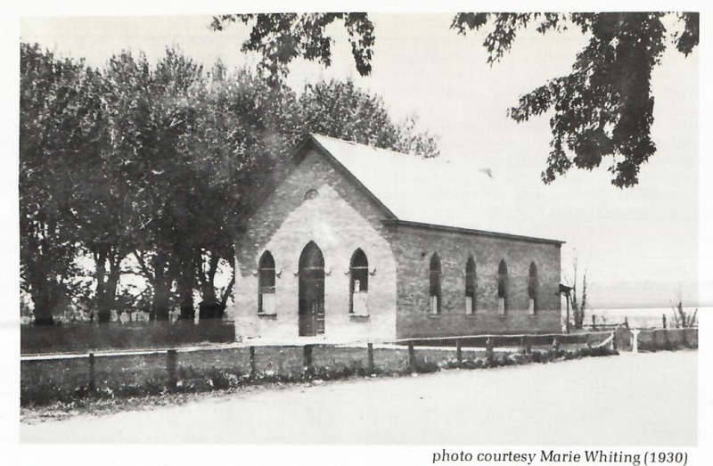
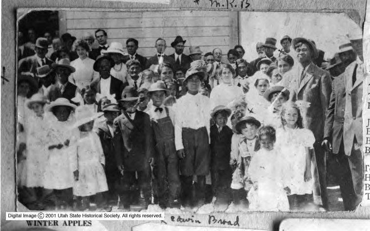
    <summary type="html"><![CDATA[<p><strong><em><span style="font-weight:400;">Ferron, Utah, fixed east of the Wasatch Plateau and west of the San Rafael Swell, in Emery County, was the last major area Brigham Young had called people to settle before he passed away in August 1877. The letter came to Saints in Sanpete County to go east over the Wasatch Mountains and settle in Castle Valley.</span></em></strong></p><img src="https://www.intermountainhistories.org/files/fullsize/aae7faea418932abc510d9073c3d522c.jpg" alt="[Untitled]" /><br/><p><span style="font-weight:400;">The need for expansion into Castle Valley came from Utah’s population rise in the late 19</span><span style="font-weight:400;">th</span><span style="font-weight:400;"> century. Every inch of habitable land needed to be used to ease the rapidly increasing population. Brigham Young called settlers in Sanpete County to move to Castle Valley.  This area was explored as early as 1776 when Domingues and Escalante traveled into Utah; they passed through modern day Castle Dale, ten miles north of Ferron on the Old Spanish Trail. Today I-70 follows parts of the Old Spanish Trail that cuts through the San Rafael Swell.</span>
<span style="font-weight:400;">As Edward Geary has written, “Few places on earth could have looked less promising for settlement than Castle Valley in 1877.” Three years after Brigham Young’s letter to the residents of Sanpete Valley, Ferron’s population had grown to 90 in 1880. On coming to the Castle Valley, Mary Ann Rowbury Brown said, “We endured willingly many hardships and cheerfully made sacrifices in order to carry on what we sincerely believed to be God’s works in subduing a desert and advancing civilization.”</span>
<span style="font-weight:400;">The state and federal governments created incentives to help cultivate land across the nation and encourage westward expansion. In 1862, the Homestead Act gave settlers 160 acres for a small registration fee if they developed the land and improved it. In 1878, the amended Timber Culture Act also gave a way to get more land if one would plant 10 acres of trees on their given acreage. The Timber Culture Act was the way one Ferron settler, John Lemon, obtained his land. Homesteading and farming was the norm in the beginnings of Ferron. Lowry Nelson, an early resident of Ferron, said, “Precipitation was so scant that plant life was limited, except along the creek bottoms.” </span>
<span style="font-weight:400;">In the late 1870’s mining began to boom in Emery County and Carbon County. This boom created jobs for people in the area, not just in the coal mines, but created a market that was not there before for farming, creating a demand for produce. Coal mining also boosted the erection of the Hunter and Huntington Power Plants in the 1970s and 1980s.</span>
<span style="font-weight:400;">Aside from farming, livestock was a fruitful business. The unique geography of Castle Valley made raising livestock a minimal expense. In the summers one could free range cattle, horses, or sheep up in the mountains and in the winter bring them down from the mountain and leave them on the desert range. Fruit farming in Ferron also began early. The growing season was tough in Emery County for fruit trees, but Ferron’s southern exposure, and deep, well-drained soil made it the best place to grow fruit in Castle Valley.” The tradition of raising livestock and planting peach orchards has continued today and is a big part of the culture in the area today. Each summer Ferron holds The Southeastern Utah Junior Livestock Show and has an annual Peach Days celebration held at the beginning of September during prime peach season. </span></p><p><em><strong><a href="https://www.intermountainhistories.org/items/show/886">For more (including 3 images) view the original article</a></strong></em></p>]]></summary>
    <published>2025-01-29T02:01:48+00:00</published>
    <updated>2026-04-17T19:32:20+00:00</updated>
    <link rel="alternate" type="text/html" href="https://www.intermountainhistories.org/items/show/886"/>
    <id>https://www.intermountainhistories.org/items/show/886</id>
    <author>
      <name>Mason Saili Faimalo, Brigham Young University</name>
    </author>
  </entry>
  <entry>
    <title type="html"><![CDATA[The Bonneville Salt Flats: A Natural Wonder and Culture Icon ]]></title>
    <summary type="html"><![CDATA[<p><strong><em><span style="font-weight:400;">The Bonneville Salt Flats are a historical wonder. Not just for the state of Utah or the United States, but for the world as well. The history of the founding, to a national speedway, and the protection of environmentalists help keep the flats to their glory and help keep people seeing the ecological wonder for generations to come. </span></em></strong></p><img src="https://www.intermountainhistories.org/files/fullsize/bf7017251a1d00dbbe0345cc056829dc.jpg" alt="Unique Hexagonal Leading Lines to the Mountains on the Horizon, Bonneville Salt Flats, Utah" /><br/><p><span style="font-weight:400;">The Bonneville Salt Flats, 12 miles long and 5 miles wide, packed in salt and located in Northwestern Utah, stands as one of the most famous natural landmarks in the United States of America. This special geological formation has attracted the attention of scientists, filmmakers, racers, and adventurers. The flats have also become a center for land speed records (racing and strip driving), ecological studies on the salt and cinematic landscapes. </span>
<span style="font-weight:400;">The salt flats are the remains of Lake Bonneville, a massive prehistoric lake that covered much of the Great Basin during the Pleistocene Epoch, which was approximately 32,000 to 14,000 years ago. Over time, climate changes caused the lake to evaporate, Which left behind a very thick layer of raw material, predominantly salt, which ultimately formed the salt flats. </span>
<span style="font-weight:400;">The Bonneville Salt Flats are named after a French-born U.S army officer who explored and mapped most of the American West in the early 19th century, Benjamin Louis Eulalie de Bonneville. During the modern era, the Bonneville Salt Flats have become identical with speed records and innovation. In the beginning of the 1910s, the flats were used for some automobile speed trials due to the endless, flat surface and the hard salt crust. This was turned into the Bonneville Speedway that was officially established in the 1930s. There are still many races that happen at the speedway today. </span>
<span style="font-weight:400;">Beyond the racetrack and the race cars, the flats have found their way into nowadays popular culture. Their appealing and otherworldly appearance have made them a big location for filmmakers and photographers. Iconic scenes from films like Independence Day and Pirates of the Caribbean: At World's End were shot in flats that set this as a cinematic symbol of the extraordinary beauty of the salt flats. </span>
<span style="font-weight:400;">Efforts to preserve and restore the Bonneville Salt Flats have gained popularity in recent years. The Save the Salt Coalition is a group of racing organizations, scientists and local stakeholders that have been advocating for increased awareness and action to help the flats. Some collaborative projects with the Bureau of Land Management (BLM) have been focused on the brine pumping programs. This aims to return salt to the flats by reintroducing the brine that was removed during mining operations. </span>
<span style="font-weight:400;">The Bonneville Salt Flats are way more than just a geological formation: they are a witness to the connection between nature and history. From their founding as a prehistoric lake to their status as a global symbol of speed and beauty, the flats embody the spirit of human </span><span style="font-weight:400;">explorations and innovations. The survival of the salt flats is not guaranteed. As the pressures from human activity and climate changes continue to go up, the responsibility to preserve the beautiful landscape lies with all who value the flats. Through future collaborative efforts and the commitment to sustaining the salt flats, we can ensure they continue to inspire and amaze generations to come. </span></p><p><em><strong><a href="https://www.intermountainhistories.org/items/show/885">For more (including 3 images) view the original article</a></strong></em></p>]]></summary>
    <published>2025-01-29T00:46:50+00:00</published>
    <updated>2026-04-17T19:32:20+00:00</updated>
    <link rel="alternate" type="text/html" href="https://www.intermountainhistories.org/items/show/885"/>
    <id>https://www.intermountainhistories.org/items/show/885</id>
    <author>
      <name>Madison A. Fountain, Brigham Young University </name>
    </author>
  </entry>
  <entry>
    <title type="html"><![CDATA[The Logan Temple]]></title>
    <summary type="html"><![CDATA[<p><strong><em><span style="font-weight:400;">Those descending out of Sardine Canyon are welcomed into Cache Valley by the Logan Temple. Perched atop the east bench of the valley, it stands 170 feet tall. For nearly a century and a half, the temple has been an icon of the valley and a testament to the diligence of the pioneers who built it.</span></em></strong></p><img src="https://www.intermountainhistories.org/files/fullsize/61cf1188f0d820b0bea3b8f3c5a1bb52.jpg" alt="Aerial view of the Logan  UtahTemple" /><br/><p><span style="font-weight:400;">The first settlement attempt of Cache Valley occurred in 1856. Having endured the brutal winter, more Latter-day Saints migrated north, and Cache Valley became an established community. But even before the area was well established, prophecies were given by church leaders on the future construction of a temple.</span>
<span style="font-weight:400;">In an 1863 meeting, Wilford Woodruff of the church’s Quorum of the Twelve Apostles said that the day would come when great cities would fall but that Logan and its temple would outlast them. Ground was finally broken on the temple in 1877, beginning a seven-year construction process. Financing the temple was a challenge for these pioneers, but they rose to the occasion. The total expenses for the temple amounted to just over $600,000, with half consisting of labor costs. Through various programs and 100% volunteer labor, the Saints were able to complete the temple and have it ready for dedication exactly seven years after breaking ground.</span>
<span style="font-weight:400;">The dedication services were held from May 17th to 19th, 1884. Church president John Taylor presided and offered the dedicatory prayer. As part of that prayer, he said, “We feel, O Lord God, our weakness and unworthiness before Thee, and our inability to do anything without Thy guidance and assistance; but as Thou hast given us a commandment…we have built this house, and present it to Thee, and pray that Thou wilt accept it in the name of Thy Son Jesus Christ.” This prayer reflects the attitudes of those that built the temple, who believed their total reliance was on God and saw the majestic building as a humble offering.</p><p>As part of the Golden Jubilee celebration of the Logan Temple in 1934, poet Harrison R. Merrill wrote of the temple:</p><p><i>“Against the turquoise Utah skies</i><i>Two solemn temple towers rise,</i><i>Twin beacons marking well the place</i><i>Where children of a mighty race</i><i>Of Pioneers assemble. They came from far</i><i>The temple gleams – A guiding star.”</i></p>
<span style="font-weight:400;">The temple has since undergone major renovations, including a complete gutting of the interior in 1976. The renovation aimed to improve efficiency in temple ordinance work but came at the expense of historic pioneer craftsmanship. Many lament the loss of pioneer heritage, but plans are in place to restore some of the original style. In 2019, church president Russell M. Nelson stated, “Ours is a sacred responsibility to care for [pioneer-era temples]. Therefore, these pioneer temples will soon undergo a period of renewal and refreshing and, for some, a major restoration. Efforts will be made to preserve the unique historicity of each temple wherever possible.” As of December 2024, no additional plans for renovations have been announced.</span></p><p><em><strong><a href="https://www.intermountainhistories.org/items/show/884">For more (including 3 images) view the original article</a></strong></em></p>]]></summary>
    <published>2025-01-29T00:24:55+00:00</published>
    <updated>2026-04-17T19:32:20+00:00</updated>
    <link rel="alternate" type="text/html" href="https://www.intermountainhistories.org/items/show/884"/>
    <id>https://www.intermountainhistories.org/items/show/884</id>
    <author>
      <name>Cameron Carlson, Brigham Young University</name>
    </author>
  </entry>
  <entry>
    <title type="html"><![CDATA[The Lone Cedar Tree]]></title>
    <summary type="html"><![CDATA[<p><strong><em>In downtown Salt Lake City sits a monument for the Lone Cedar Tree. The Lone Cedar was rumored to be the only tree in the valley at the time Mormon pioneers settled in the area. Its famous role in the story of Mormon settlement has led some to question the tale's veracity.</em></strong></p><img src="https://www.intermountainhistories.org/files/fullsize/a6aa720541f62d8183978d93e3712b78.jpg" alt="A Child with Lone Cedar" /><br/><p><span style="font-weight:400;">In 1847, Brigham Young and his party of Mormon settlers arrived in what would eventually become Utah. Mormons were escaping persecution in the East by the United States. No one had a clear idea of where their destination, and new home, would be, but many agreed that it would have to reside beyond the United States’ political border. Many initially thought that the territories of California or Oregon would be their last stop since it was as far west as one could get from the U.S. without crossing an ocean. However, John C. Fremont’s expeditions into Utah made the territory an attractive place to settle and it was eventually decided that the Utah area would be where the Mormons settled.</span>
<span style="font-weight:400;">Utah was home to the Utes, Paiutes, Dine’, Goshutes, and Shoshone. At the time, some mountain men also lived in the area. These men largely served as road guides for wagoneers heading west and their numbers were generally scarce. Utah was certainly more of a desert than the Mormons envisioned their new home to be and had what many diligent journal writers described as a “dead sea” to accompany it. However, there was one tree, the "Lone Cedar Tree," in the Salt Lake Valley which provided coveted shade. Seemingly everyone used this iconic tree to rendezvous under—children, church officials, lovers, weary travelers. The tree’s significance to these early Mormons was commemorated with a monument in 1933 by the Daughters of Utah Pioneers. The monument initially encompassed the dying tree, but in 1958, the tree was cut down and stolen. A bounty for it was placed by the Daughters of Utah Pioneers. When the missing lumber never turned up, a modified monument was erected in 1960 to preserve what remained of the leveled stump. A bronze replica soon stood in place of the section of tree that was stolen. Unfortunately, the remaining stump of the original tree was later stolen. The monument today contains no traces of the original tree.</span>
<span style="font-weight:400;">However, historians argue whether the tree ever existed in the sense that it is now remembered. Some claim that stories exaggerate the tree’s existence because journals at the time mention other trees in the valley. Some dispute whether the tree was a cedar at all. Moreover, some accounts mention a “Lone Cedar Post” in the proximity of where the tree was believed to have stood, leading a few to believe that it was the post rather than a tree which provided such needed shade. Nevetheless, the memorialization of the lone cedar tree still stands in downtown Salt Lake City to commemorate the pioneer memory that permeates much of early Utah history. </span></p><p><em><strong><a href="https://www.intermountainhistories.org/items/show/702">For more (including 3 images) view the original article</a></strong></em></p>]]></summary>
    <published>2023-02-20T21:21:14+00:00</published>
    <updated>2026-04-17T19:32:15+00:00</updated>
    <link rel="alternate" type="text/html" href="https://www.intermountainhistories.org/items/show/702"/>
    <id>https://www.intermountainhistories.org/items/show/702</id>
    <author>
      <name>Emma Dutcher, Brigham Young University</name>
    </author>
  </entry>
  <entry>
    <title type="html"><![CDATA[Tarlton Lewis, “Grand Old Man”]]></title>
    <summary type="html"><![CDATA[<p><strong><em>Tarlton Lewis, a survivor of the Hawn’s Mills Massacre in Missouri, went on to live an energetic life as he explored the West and settled new towns such as Parowan and Minersville in Iron and Beaver Counties in Utah. He lived his life helping other Latter-day Saints, farming and building on the land, and raising a family in the desert.</em></strong></p><img src="https://www.intermountainhistories.org/files/fullsize/04d4a6e7d1c614593ab9129186616d5d.jpg" alt="Tarlton Lewis" /><br/><p>Tarlton Lewis was the fourth of twelve children born to Neriah Lewis and Mary Moss on May 18, 1805 in South Carolina. Tarlton married Malinda Gimlin on March 27, 1828; over the course of their marriage, they had eight children together. While living in Illinois, Tarlton and Malinda joined The Church of Jesus Christ of Latter-day Saints (sometimes nicknamed “Mormons”) and were baptized July 25, 1836 by Tarlton’s older brother Benjamin Lewis. The brothers joined moved to Missouri to live among other Latter-day Saints, and on October 30, 1838, while living near Hawn's Mill, they were attacked by a violent mob agitating for the expulsion of all Mormons from Missouri. The mob murdered Tarlton’s older brother Benjamin, and Tarlton suffered an injury to his shoulder; their younger brother David, however, was uninjured.
After surviving this tragedy, the brothers moved with other Latter-day Saints to Nauvoo, Illinois. There, Joseph Smith, president of the Church, and his brother Hyrum set apart Tarlton as bishop of the Nauvoo Fourth Ward. Also in Tarlton and Malinda received the endowment and sealing ordinances—the Church’s highest sacraments—before joining the mass exodus of Latter-day Saints from Nauvoo, leaving behind the temple they had spent years helping build.
The Lewis family left as part of the second wave of Saints, fleeing westward across the Mississippi Rive, but Tarlton himself stayed behind to continue his service as a bishop and help the Church members under his care prepare to go West. After many weeks crossing Iowa, they settled temporarily at Council Bluffs in Pottawattamie, Iowa, 1846.
After the Latter-day Saints regrouped in Iowa, Tarlton joined the first company of pioneers departing in 1847. As part of the Vanguard Company led by Brigham Young—Smith’s successor to the Church presidency—Tarlton was captain of 50 wagons and entered the Salt Lake Valley on July 21, 1847. There, Young called Tarlton as the first bishop in Salt Lake Valley, and Tarlton remained in the valley to build cabins and plant crops for the Saints who would arrive next. After an almost two-year separation, Tarlton reunited with his family when they arrived at the Salt Lake Valley on September 21, 1848.
Two years later, in December 1850, the Church called Tarlton to travel with apostle George A. Smith and one hundred others to explore southern Utah. Tarlton again captained 50 wagons, and on January 17, 1851, the explorers officially organized Iron County. In their first election, the young county elected Tarlton Lewis as a magistrate. George Smith organized the settlement into four wards, and Tarlton became bishop of the Second Ward in Parowan. The Lewis family helped build roads, log cabins, and furniture.
After Tarlton’s brother David died in September 1855, Tarlton married two of his brother’s widows as polygamous wives. Tarlton explored the mountains of Beaver Valley for lead ore, finding a mine and becoming a director of it. They also helped found Minersville, and Tarlton was active in the community and donated a portion of his lot to finance a Relief Society building. Life in Minersville was a struggle as farming was difficult with little water from Beaver Creek.
The family managed a humble living for fourteen years until the Church assigned Tarlton to establish a United Order in Joseph, Sevier County. The most pressing issue that settlers faced was the difficulty of irrigating water for farmlands; their hard work was paid off with “diverse crops as apples, apricots, peaches, pears, grapes, and black walnuts,” but there was not enough to make Joseph prosper. The Lewises lived there a few years before moving northeast to the larger town of Richfield, and the United Order in Sevier County dissolved in November 1877. Apostle Erastus Snow then set Tarlton apart as bishop of the Richfield Second Ward on July 16, 1877. As an active citizen of Richfield, Tarlton and a hundred other citizens petitioned the Utah Territorial House to incorporate the town, and the provision passed.
Tarlton’s time as a bishop in Richfield was brief, as health complications warranted his resignation a year later, but he recovered his strength enough to serve as a stake patriarch, as listed in the Sevier Stake Conference for August 27, 1887.
Tarlton Lewis died on November 22, 1890 at Teasdale, Utah Territory, at the home of his son, Beason Lewis. He was buried in the Teasdale Cemetery. In 1987, Mount View Camp, the Daughters of Utah Pioneers, and the Lewis Family sponsored and built a marker and plaque at his burial site in 1987.</p><p><em><strong><a href="https://www.intermountainhistories.org/items/show/633">For more (including 3 images) view the original article</a></strong></em></p>]]></summary>
    <published>2022-07-01T03:06:04+00:00</published>
    <updated>2026-04-17T19:32:13+00:00</updated>
    <link rel="alternate" type="text/html" href="https://www.intermountainhistories.org/items/show/633"/>
    <id>https://www.intermountainhistories.org/items/show/633</id>
    <author>
      <name>Debra Tangren, Brigham Young University</name>
    </author>
  </entry>
  <entry>
    <title type="html"><![CDATA[Fruita Schoolhouse: Learning and Community]]></title>
    <summary type="html"><![CDATA[<p><strong><em>Capitol Reef National Park is one of the greatest hidden gems of Central Utah, home to fossils, beautiful hikes, and several historical sites. Of these historical sites, one of the most popular is the Fruita Schoolhouse, a physical memory of what life was like in humble, nineteenth-century Fruita.</em></strong></p><img src="https://www.intermountainhistories.org/files/fullsize/fdf1c72a53ae4ee8430fc91744c589cd.jpg" alt="Step into the past" /><br/><p>In 1893, historian Frederick Jackson Turner famously claimed the year 1890, three years prior, marked the closing of the American Frontier. It seemed in the 1890s that America’s expansionist spirit was shifting from the continental Wild West to locations abroad such as Cuba and the Philippines, pivoting away from consolidating a land empire and toward questing for a sea empire. Pioneers in Fruita, Utah, however, were still preoccupied in the 1890s with frontier processes. Although they had secured their isolated, red rock land, even in 1890 their community lacked important infrastructure such as education, a postal service, and a building for worship.
As they settled in and secured the land, the pioneers were able to gather sufficient time and organization to put together more of a society, beginning with an education system. Nettie Behunin, a young girl 12 years of age, became one of the first teachers.  Nettie might not have been a truly qualified teacher by twenty-first-century standards—or perhaps even by her own—but her endeavors marked the beginning of the first community project in the area: the schoolhouse.
In a collection of childhood memories of Fruita, Clay M. Robinson reflects on his experience as a young boy in the newly built Fruita schoolhouse as his mother was the teacher at the school during his childhood. He writes, “Most vivid of all in those memories, are Mama and the little one-room sawed-log Fruita school where she taught all eight grades in the years 1925–1927.” He also mentioned that the schoolhouse was used for Sunday church services and Sunday School—most of Fruita were members of The Church of Jesus Christ of Latter-day Saints, or Mormons—because there was no dedicated chapel in Fruita. Since residents could rearrange the in the schoolhouse, the small building served as a community center that could host different events like dances, box socials, knitting group meetings, and gatherings for men and young boys who enjoyed baseball. The Fruita schoolhouse evidently served as a center of the community, where the small number of settlers could gather to enjoy each other’s company.
The Fruita schoolhouse still stands today. Tourists can easily see it as they drive through the park since it is located just to the side of the highway. At times the Park Service offers tours in the old schoolhouse that allow small children to briefly roleplay pioneer school life. This schoolhouse represents the first community building of the Fruita settlement, as well as a reminder of what life was like for the small community of Latter-day Saint settlers.</p><p><em><strong><a href="https://www.intermountainhistories.org/items/show/632">For more (including 4 images) view the original article</a></strong></em></p>]]></summary>
    <published>2022-07-01T01:26:07+00:00</published>
    <updated>2026-04-17T19:32:13+00:00</updated>
    <link rel="alternate" type="text/html" href="https://www.intermountainhistories.org/items/show/632"/>
    <id>https://www.intermountainhistories.org/items/show/632</id>
    <author>
      <name>Rachelle E. Robins, Brigham Young University</name>
    </author>
  </entry>
  <entry>
    <title type="html"><![CDATA[Santo Tomas de Abiquiu: A Genízaro Settlement on the Spanish Frontier]]></title>
    <summary type="html"><![CDATA[<p><strong><em>The town of Santo Tomas de Abiquiu, a Genízaro settlement established in 1754, served as a vital defensive settlement and trading post for Colonial New Mexico. The Genízaros who lived there—formerly enslaved detribalized indigenes—experienced the brutal life of the Spanish imperial frontier.</em></strong></p><img src="https://www.intermountainhistories.org/files/fullsize/c051def285f42825c44765693e65a4be.jpg" alt="Abiquiu in the 1910s" /><br/><p>Throughout the second half of the 18th century, detribalized Native Americans known as Genízaros (pronounced heh-NEE-sah-ros) relocated to land bordering colonial New Mexico and Indigenous territory through a series of land grants from imperial Spain. These settlements played an important role in facilitating trade between New Mexico and Indigenous tribes while also providing a form of colonial defense from other indigenous raiding parties by acting as a buffer zone for the villages of the Rio Chama Valley. The Genízaro settlement of Santo Tomas de Abiquiu was formed in 1754 when Governor Tomas Cachupín issued a land grant to a group of thirty-four Genízaro families. The settlement was about 60 miles north of Santa Fe.
The Genízaros were both Indigenous former slaves and the descendents of former slaves. It was often the case that Indigenous slaves who reached an age of maturity, who married, or whose enslavers released them from their <em>rescate </em>(“ransom and redemption”) debt, received their freedom. These former slaves experienced minimal economic and social mobility. Most had to work menial tasks to survive and were often the poorest members of their communities. Some found success in working as scouts and interpreters, or in Spanish auxiliary military forces. Land grants, like the one that established Abiquiu, were one of the few ways Genízaros could obtain their own property and experience greater economic mobility.
As the Spanish imperials had hoped, Abiquiu throughout its existence served as a buffer against Ute, Navajo, and Comanche raids. And like other Genízaro settlements Abiquiu also became an important waypoint for trade with other indigenous peoples, and Abiquiu became an important frontier trading post. Thanks to a treaty of friendship negotiated between Governor Cachupín and the Ute people, Abiquiu became the site of Ute trading fairs, especially in the late autumn months. In 1786, Spain the the Comanche signed a treaty to further trade between the people of Abiquiu and other Indigenous groups.
Despite the important role Genízaro settlements played as a link between Colonial Spain and Indigenous groups, Genízaros and Spanish settlers had a fraught relationship. A series of witch trials, originating in Abiquiu and spreading throughout the region, revealed the tensions that existed both between Spaniards and Genízaros, as well as the tensions that existed between Genízaros of differing beliefs and cultural/tribal backgrounds. Genízaros made up both accused and accusers, and Spanish inquisitorial courts condemned many Genízaros’ traditional spiritual beliefs as satanic. In the end, the Inquisition never executed any accused Genízaro, but inquisitors did torture many and sentence others to perpetual servitude in Spanish Catholic homes, revealing the fragility of Genízaro freedom.
More recently, Abiquiu has been the site of important Indigenous land right battles. While the United States’ Court of Private Land Claims validated the Genízaros’ 16,000 acre land grant in 1894, some disputes over dispossessed Genízaro land remained unresolved for nearly a century. In 1969, the United States returned National Forest lands to Genízaro families, in part thanks to help from the Presbyterian Church. Later, in 2008, New Mexico expanded the land they recognized as part of the historical grant and returned another 32.5 acres to the Genízaro community.</p><p><em><strong><a href="https://www.intermountainhistories.org/items/show/631">For more (including 3 images) view the original article</a></strong></em></p>]]></summary>
    <published>2022-07-01T01:02:07+00:00</published>
    <updated>2026-04-17T19:32:13+00:00</updated>
    <link rel="alternate" type="text/html" href="https://www.intermountainhistories.org/items/show/631"/>
    <id>https://www.intermountainhistories.org/items/show/631</id>
    <author>
      <name>Jacob Morrison, Brigham Young University</name>
    </author>
  </entry>
  <entry>
    <title type="html"><![CDATA[Battle of Diamond Fork]]></title>
    <summary type="html"><![CDATA[<p><strong><em>A raid in Maple Canyon turned into a short battle. This battle, leaving eight dead, is representative of the character of the Black Hawk War in Utah County.</em></strong></p><img src="https://www.intermountainhistories.org/files/fullsize/85c8e01e353c7e050a8d9157aa8ffb59.jpg" alt="Battlefield" /><br/><p>Before daybreak on June 26, 1866, a party of Timpanogos and Utes—led by Mountain, a Colorado Ute chief—seized around fifty animals, a mix of cattle and horses, from Mapleton, Utah. It was in the middle of Black Hawk’s War, and the Native American party hoped they had achieved a meaningful victory. After driving the animals through a canyon to Little Diamond Creek and feeling they had made a clean getaway, the Native American group took a break in a clear, open field near the convergence of the Little Diamond and Diamond Fork rivers to graze their horses.
However, while the horses were grazing, militiamen roused from Springville surprised the indigenous group and cut off their escape route. Knowing they had no other way to escape, the Timpanogos retaliated, and the militiamen took cover in a grove of trees and fired on the Timpanogos. Both sides fired on each other to little avail for a few hours, and Mountain taunted the militiamen, calling out Albert Dimmick specifically as a “coward and a squaw.” Dimmick furiously stood up, out of his cover, and a Native American immediately got a hit on him. Injured, Dimmick died a few hours later.
Reinforcements from Spanish Fork came to support the Springville militiamen, further pinning the Timpanogos raiders in the brush. Both the Native Americans and the militiamen tried to spread out and surround the other, but only the settlers succeeded. Pinned between two groups of enemies, the Native Americans stopped fighting—until a leader, most likely Mountain, raised a crest above them and urged them to fight on. At his appearance, the militiamen fired until he slumped in his horse and rode away. As their leader retreated, so did the rest of the Timpanogos and Utes, heading up the steep sides of the canyon and abandoning the captured animals to save their lives.
Later, the militiamen found out from Native American contacts that they had killed five or six Utes in the battle. A second militiaman, this one from Spanish Fork, a hotheaded youth of eighteen years, Jonathan Edmiston, had also been killed when he rushed into the middle of the Timpanogos to try to reach the Springville militia’s captain. His fellow soldiers had lost track of him in the brush, and after the raiding party retreated with their wounded and dead, they searched unsuccessfully for his body. The following day, a search party returned to the battleground and found Edmiston’s scalped corpse. This exchange is demonstrative of the scattered battles of the Black Hawk War in Utah.</p><p><em><strong><a href="https://www.intermountainhistories.org/items/show/630">For more (including 3 images) view the original article</a></strong></em></p>]]></summary>
    <published>2022-06-30T23:20:52+00:00</published>
    <updated>2026-04-17T19:32:13+00:00</updated>
    <link rel="alternate" type="text/html" href="https://www.intermountainhistories.org/items/show/630"/>
    <id>https://www.intermountainhistories.org/items/show/630</id>
    <author>
      <name>Will Anderson, Brigham Young University</name>
    </author>
  </entry>
  <entry>
    <title type="html"><![CDATA[Hogup Cave]]></title>
    <summary type="html"><![CDATA[<p><strong><em>Hogup Cave provided shelter for people who hunted and gathered in the surrounding area as part of a cyclical migration. The findings at the cave provide a small glimpse of a complex and enduring culture that lasted for thousands of years.</em></strong></p><img src="https://www.intermountainhistories.org/files/fullsize/5603ff72330b9812961c5cc4c79cfedf.jpg" alt="Outside the entrance to Hogup Cave" /><br/><p>Somewhat overshadowed by the more well-known Danger Cave, Hogup Cave provides some of the same enigmas presented by Danger Cave, such as the struggle for life in the harsh environment. Excavated by Dr. C. Melvin Aikens of the University of Utah in 1967 and 1968, the archeological evidence recovered from the cave—dating back as far as 6,000 BCE—shows a desert culture in line with Native peoples of the time. Starch granules found on artifacts show the use of small scale gathering, and a prevalence of projectile points show the importance of hunting, with bighorn sheep and pronghorns acting as the prey. Both findings suggest a nomadic people who used the cave periodically while hunting on the surrounding land. The cave came to be used cross-culturally, as is seen in the evidence for the replacement (rather than assimilation) of Fremont peoples by Numic speaking groups. Fremont artifacts do not continue past Unit III (400–1350 CE), and Numic artifacts start to appear in Unit IV (1350–1850 CE).
Because the history of the cave extends back to 6000 BCE, it was an important find for understanding the ancient desert cultures put forth by Jesse Jennings in his excavation of Danger Cave, an archaeological dig site about 65 miles away from Hogup Cave. Hogup Cave provides more evidence supporting Jennings’s challenge to Ernest Antevs’ theory of widespread drought during the time of its occupation, showing how discoveries such as the one at Hogup also inspire questions relating to cultural ecology, asking to what extent environment impacts these cultures.
Not much information is available about the caves aside from the excavation done by the University of Utah and the writeups done by project supervisor C. Melvin Aikens. Such writings make up the bulk of the scholarly work, and artifacts from the excavation can be found at the university’s Museum of Natural History. But the discovery of the cave itself remains somewhat a mystery. Local folklore and oral histories point to Orval Evans discovering the cave in the 1930s, while the University of Utah eventually learned about Hogup Cave by hearing about subsequent expeditions. This story reflects the accidentalism and amateur archeological enthusiasm that sometimes surrounds archeological discovery in Utah.</p><p><em><strong><a href="https://www.intermountainhistories.org/items/show/490">For more (including 3 images) view the original article</a></strong></em></p>]]></summary>
    <published>2021-09-18T01:51:12+00:00</published>
    <updated>2026-04-17T19:32:10+00:00</updated>
    <link rel="alternate" type="text/html" href="https://www.intermountainhistories.org/items/show/490"/>
    <id>https://www.intermountainhistories.org/items/show/490</id>
    <author>
      <name>Drew Holley, Brigham Young University</name>
    </author>
  </entry>
  <entry>
    <title type="html"><![CDATA[St. George Stake Academy: The Beginnings of Dixie State University]]></title>
    <summary type="html"><![CDATA[<p><strong><em>The St. George Stake Academy was first opened in 1888, but was closed only a few years later. In 1911, it was opened again as the first high school in the St. George area. Over the course of the years, the school was expanded and grew into what is now known as Dixie State University.</em></strong></p><img src="https://www.intermountainhistories.org/files/fullsize/45c8e55b5377284aab1becd25ab1277c.jpg" alt="St. George, 1903" /><br/><p>Dixie State University’s history is intertwined with the history of the Latter-day Saints in the St. George area. In October of 1861, some 300 families were called to the cotton mission and were to join the 28 families that had already established the settlement of St. George to grow cotton. This is when St. George started its growth and the need arose  for schools in the area. One of the first orders of business at a camp meeting among the recently arrived settlers in December of 1861 was to establish a school for the children. The Saints had run into several difficulties, including a flood, but were able to maintain small schools until 1864, when the first large schoolhouse was built for the First Ward.  Even with these newly erected schools, some children were taught privately in homes and still others took classes in the basement of the Tabernacle and in the social hall for many years. </p><p>Dixie State University can trace its beginnings to the 1880s. It was first opened as St. George Stake Academy, which housed elementary and immediate grade levels. Classes were held in the basement of the St. George Tabernacle. The academy was opened along with about 20 other academies by The Church of Jesus Christ of Latter-day Saints which experienced varying rates of success. The St. George Stake Academy opened its doors in 1888 and closed its doors just a few years later as public schools grew in popularity and didn’t require tuition.</p><p>Two decades later, in 1911, the St. George Stake Academy reopened as a secondary school, the first of its kind in the St. George area. Enrollment grew steadily for the first years and the school added different classes. In 1916, the academy was approved to add a teacher preparation program and the school had its name officially changed to Dixie Normal College in 1918.  The name was changed again in 1922, this time to Dixie Junior College, when the church decided to drop the high school and keep only the college courses.  The phasing out of the high school progressed slowly, but the school donned Junior College status.</p><p>Around 10 years later, the Church decided to relinquish control of their Junior Colleges as the Great Depression took its toll. Dixie Junior College was in crisis as the legislature did not assure that it would get funds. Nevertheless, the community of St. George helped keep Dixie from going under until it was able to get funding again. Dixie has since grown and gained the title of State College in 2000, followed by that of Dixie State University in 2013. </p><p><em><strong><a href="https://www.intermountainhistories.org/items/show/392">For more (including 5 images) view the original article</a></strong></em></p>]]></summary>
    <published>2020-02-19T01:09:35+00:00</published>
    <updated>2026-04-17T19:32:07+00:00</updated>
    <link rel="alternate" type="text/html" href="https://www.intermountainhistories.org/items/show/392"/>
    <id>https://www.intermountainhistories.org/items/show/392</id>
    <author>
      <name>Christina Turner, Brigham Young University</name>
    </author>
  </entry>
  <entry>
    <title type="html"><![CDATA[Y Mountain]]></title>
    <summary type="html"><![CDATA[<p><strong><em>The construction of the Y Mountain in Provo, Utah is significant to the history and culture of Brigham Young University and Provo.</em></strong></p><img src="https://www.intermountainhistories.org/files/fullsize/a1a9daef1d4a15c98769c2216efd270b.jpg" alt="Y Mountain" /><br/><p>In the early 1900s, a common Latter-day Saint legend described how settlers in Provo were told by Native Americans that they had seen angels who declared that the people in this town would be blessed. Some of those blessings came about through Provo’s Y Mountain. In 1906, the Junior Class of BYU wanted to paint "‘07" on the mountain, upsetting members of the senior class. The President of Brigham Young University at the time, George H. Brimhall, and Brigham Young High School Principal Edwin S. Hinckley settled the argument by deciding that the letters “BYU” would be painted on the mountain. After 6 hours of painting, only the “Y” was completed, so the two other letters “B” and “U” were forgotten, the full plan discontinued. After the completion of the “Y,” students hiked up the mountain annually to re-paint the Y, creating a BYU Y Day tradition. More traditions and plans for the Y mountain would follow for the city of Provo, Utah and its residents. </p><p>The mountain plays an important role in BYU culture and the culture in Provo, Utah. It is the site of many traditions, such as lighting the Y for the holidays, BYU Homecoming, or the success of a school sports team. The tradition of lighting up the Y began in 1924. Another tradition for the incoming Freshman class at BYU involves dedicating a day for a Y mountain hike to celebrate their becoming a BYU Cougar. This tradition has carried through the years. Y mountain has been a symbol for Brigham Young University and the city of Provo, serving as one of the areas main tourist attractions. The traditions that revolve around the Y are important to BYU and Provo culture.</p><p><em><strong><a href="https://www.intermountainhistories.org/items/show/391">For more (including 3 images) view the original article</a></strong></em></p>]]></summary>
    <published>2020-02-18T02:51:08+00:00</published>
    <updated>2026-04-17T19:32:07+00:00</updated>
    <link rel="alternate" type="text/html" href="https://www.intermountainhistories.org/items/show/391"/>
    <id>https://www.intermountainhistories.org/items/show/391</id>
    <author>
      <name>Kayla M. Beck, Brigham Young University</name>
    </author>
  </entry>
  <entry>
    <title type="html"><![CDATA[Mapleton, Utah&#039;s First LDS Meetinghouse]]></title>
    <summary type="html"><![CDATA[<p><strong><em>The first dedicated LDS meetinghouse in Mapleton, Utah was built in 1893. </em></strong></p><img src="https://www.intermountainhistories.org/files/fullsize/dbc6892c395952adcb3d5ca8b045f5ff.jpg" alt="Photo of the First Chapel" /><br/><p>The community of Union Bench was an extension of Springville, but the growing community that would soon become Mapleton hit a turning point when they built their first dedicated public meetinghouse for The Church of Jesus Christ of Latter-Day-Saints. Settlement began in 1856 and the small church branch met in a public schoolhouse located near the center of town. The schoolhouse, even with an addition made to provide more space, did not last forever. The branch was officially organized into a ward in 1888. Around this time, a larger meetinghouse was needed for both the school and the church.</p><p>As a new school was finished in 1890 and the church meetings moved there the members of the Church recognized they needed a dedicated meetinghouse. A committee was formed to find a building site and local member Matilda Streeper offered to donate one acre of land if construction of the new church began immediately. Construction on the church began in 1889, the church was dedicated in 1892, and in 1893 it was completed and meetings started. The meetinghouse was a stepping-stone into Union Bench becoming a town. As the new school and church were completed, the community pulled together to petition for township. As the Mapleton ward, named after a grove of trees near the canyon, made up a majority of the community’s population, the town came to be known as Mapleton, Utah.</p><p>The meetinghouse stood and satisfied the needs of the ward for many years. The building was sturdy and any hazards to it were swiftly taken care of, but as Mapleton continued to grow after gaining town status the need for a bigger meetinghouse arose. In the 1930s, the Great Depression hit the town and the population struggled. The church and town leaders worked closely together to combat poverty and support the struggling families by finding different work projects to provide work receipts that could be exchanged for food. One of these projects was the demolition of the old meetinghouse and the construction of a new one, which is still standing. The new chapel cost $35,000, half of which was donated by the local community. The chapel was completed in 1938 and dedicated for use in 1941 and is still in use today. You can find a plaque with a brief history outside the chapel, as well as historical photos on the walls inside which convey some of the heritage of the early Mapleton residents.</p><p><em><strong><a href="https://www.intermountainhistories.org/items/show/390">For more (including 4 images) view the original article</a></strong></em></p>]]></summary>
    <published>2020-02-18T01:20:45+00:00</published>
    <updated>2026-04-17T19:32:07+00:00</updated>
    <link rel="alternate" type="text/html" href="https://www.intermountainhistories.org/items/show/390"/>
    <id>https://www.intermountainhistories.org/items/show/390</id>
    <author>
      <name>Logan Goulding, Brigham Young University</name>
    </author>
  </entry>
  <entry>
    <title type="html"><![CDATA[The Scofield Mine Disaster]]></title>
    <summary type="html"><![CDATA[<p><strong><em>On May 1, 1900, an explosion at the Winter Quarters mine killed at least 200 men. At the time, it was the worst mining accident to occur in the United States, and it devastated the families left behind in the mining town of Scofield.</em></strong></p><img src="https://www.intermountainhistories.org/files/fullsize/e97bda205bd88ea68ad598ea6aa80eb4.jpg" alt="Caskets at Wasatch Store, Winter Quarters, Utah" /><br/><p>Scofield is a small mining town located in Carbon County, located next to the Winter Quarters mine. On May 1, 1900, there was an accidental explosion in the Winter Quarters mine. While many men rushed to rescue miners caught in the blast, many were killed in the initial explosion, struck by falling debris, or killed by afterdamp, a toxic gas. Miners from other mines in the area, such as Castle Gate, Clear Creek, and Sunnyside, helped retrieve bodies the next day. A total of 200 - 246 men were killed in the accident. There were not enough coffins to bury all of the miners, so some coffins had to be ordered from Denver, Colorado and taken to Scofield on a train.</p><p>The Winter Quarters mine explosion had devastating effects on the town of Scofield. Nearly every family lost someone in the accident, with some families losing several family members. In a tragic example, the Louma family lost six sons and three grandsons, all in the same day. However, some incredible stories came from the disaster as well. One such story is that of John Wilson, who was blown 820 feet from the entrance of the mine into the surrounding canyon and miraculously survived. Another well-known story is that of Thomas Pugh, a 15-year-old boy who put his cap in his teeth, used it to plug his nose, and ran a mile and a half through toxic gas back to the mine entrance in the dark.</p><p>Although the exact cause of the explosion was never discovered, many believe that the accident could have been prevented if the Pleasant Valley Coal Company had implemented safety procedures and taken better precautions. Unsurprisingly, many families blamed the company for the accident. Labor unrest from this event no doubt contributed to later strikes in the region, such as the 1901 Pleasant Valley strike. The Winter Quarters mine puts into perspective how dangerous an occupation mining was, and how much miners were asked to sacrifice for their livelihood. Today, many remember the Scofield mining disaster as a horrible event that showcases the brutal treatment of working-class individuals in the 20th century.</p><p><em><strong><a href="https://www.intermountainhistories.org/items/show/389">For more (including 3 images) view the original article</a></strong></em></p>]]></summary>
    <published>2020-02-16T07:01:51+00:00</published>
    <updated>2026-04-17T19:32:07+00:00</updated>
    <link rel="alternate" type="text/html" href="https://www.intermountainhistories.org/items/show/389"/>
    <id>https://www.intermountainhistories.org/items/show/389</id>
    <author>
      <name>Abby Donaldson, Brigham Young University</name>
    </author>
  </entry>
  <entry>
    <title type="html"><![CDATA[Iosepa: Utah’s Little Hawai&#039;i]]></title>
    <summary type="html"><![CDATA[<p><strong><em>Far from their island home, Hawaiian converts to the Church of Jesus Christ of Latter-day Saints established a short-lived, but unique community in the Utah desert during the late-nineteenth and early-twentieth century.</em></strong></p><img src="https://www.intermountainhistories.org/files/fullsize/d8d3edd3fe52f4ac5a720da7694b3a73.jpg" alt="Iosepa Residents Celebrating Pioneer Day in 1913. " /><br/><p>“Gathering” was an important concept in early Mormon theology. Converts to the church were encouraged to make their way to Utah so they could gather with the saints and participate in ordinances that were only available in the temples in Utah. Though missionaries had first arrived in Hawai'i in 1850, Hawaiian converts were barred by strict emigration laws from emigrating to America until the 1880s. Once Hawaii relaxed their emigration laws, Hawaiian converts began to migrate to Salt Lake City. However, because of a lack of employment opportunities for the Hawaiians, cultural differences, and a growing fear in Salt Lake City of leprosy being brought over from Hawaii, it soon became apparent that the Hawaiians would need a separate settlement. In 1889 the church bought the ranch of John T. Rich in Tooele County’s Skull Valley to use as the site for the Hawaiian settlement. On August 28, fifty-two Hawaiians arrived at their new home in Skull Valley. The settlement was named Iosepa after Joseph F. Smith, a member of the church’s first presidency who had been a missionary in Hawaii.   </p><p>To get around the provision in the Edmunds-Tucker Act that prohibited the Church from owning property valued over $50,000, Iosepa operated as a joint-stock company known as the Iosepa Agricultural and Stock Company, with several white Mormon men as shareholders. Hawaiian settlers began raising livestock and planting crops such as corn and wheat in Iosepa. While living in Iosepa, the residents faced the trials that naturally accompanied settling and farming in the Great Basin such as unexpected weather, crop failure, illness, and having enough water for their crops and daily needs. Despite these difficulties, the Hawaiian settlers managed to create a little Hawai'i in the Utah desert. They raised carp and grew algae as a substitute for seaweed in a nearby reservoir. They used corn husks as a replacement for Hawaiian ti leaves to wrap pork. They spoke Hawaiian and sang Hawaiian hymns in their church meetings. Each year they celebrated their own Pioneer Day on the anniversary of the settlement’s founding with a traditional Hawaiian feast. The Hawaiian converts also helped build the Salt Lake temple and consistently made the journey to Salt Lake City to attend the temple once it was dedicated. While the Tooele desert could not be more different from the tropical island environment of Hawaii, the settlers of Iosepa found ways to adapt to their new surroundings and participate in the religion that was so important to them.</p><p>In 1915 the church announced their plans to build a temple in Hawai'i. Joseph F. Smith encouraged the Hawaiian saints in Utah to return to Hawai'i to help with the temple and promised that the church would help pay the settlers’ traveling expenses. This essentially dissolved the community at Iosepa as almost all the settlers between 1915 and 1917 sold their property and possessions back to the Iosepa Agricultural and Stock Company and returned to the island. Though Iosepa only lasted a little over twenty-five years, it stands out in Utah’s history as being the first place in the state to be settled by non-European emigrants. Iosepa continues to be an important place for Pacific Islanders today, who gather in Iosepa each Memorial Day to commemorate Utah’s first Polynesian community. </p><p><em><strong><a href="https://www.intermountainhistories.org/items/show/388">For more (including 4 images) view the original article</a></strong></em></p>]]></summary>
    <published>2020-02-15T04:34:51+00:00</published>
    <updated>2026-04-17T19:32:07+00:00</updated>
    <link rel="alternate" type="text/html" href="https://www.intermountainhistories.org/items/show/388"/>
    <id>https://www.intermountainhistories.org/items/show/388</id>
    <author>
      <name>Hannah Chapman, Brigham Young University</name>
    </author>
  </entry>
  <entry>
    <title type="html"><![CDATA[Lehi Pioneer Cemetery]]></title>
    <summary type="html"><![CDATA[<p><strong><em>The oldest cemetery in Lehi, Utah provides a rich history of the people and culture of Lehi. </em></strong></p><img src="https://www.intermountainhistories.org/files/fullsize/d5a099a9b3cc6831582125a5a9e7dc7b.jpg" alt="Eastern View of Monument and Park" /><br/><p>The Lehi Pioneer Cemetery was the first settler cemetery in the Lehi area. When the citizens first started using this land as a cemetery in 1851, it was public land. Thomas R. Jones acquired the property through the Homestead Act of 1862, but quickly deeded it to the city for its continued use as a cemetery. Although most of the records for the cemetery prior to 1895 have been lost, evidence exists proving that a pioneer who died at the age of seventy-five was the first man to be buried in this land. It is also evident that along with the many early settlers that died of natural causes there were a few murder victims buried in the Lehi Pioneer Cemetery, such as the Lehi schoolteacher, George William Thurmond, who was killed by one of his students while trying to decorate a city Christmas tree on Christmas Eve. </p><p>In 1872, Lehi's population was growing and the city decided they needed to widen the State Road that the Lehi Pioneer Cemetery was located on and build a railroad through the middle of the cemetery. Subsequently, many bodies that were buried in the cemetery were dug up and reburied in a new cemetery. Many families who had family members buried in the cemetery had moved and were indifferent to the relocation, but a few families asked for the bodies to not be moved. In the process of building, most of the bodies in the area were removed but some were not found and remain there today, including John Griggs White. </p><p>Following the removal of the bodies from the cemetery and the addition of a railroad, the land was no longer recognized as a cemetery and people could buy the land for their own property. Den Turner bought some of the land and built a tire shop called “Den’s Tire Shop” during the 1950s. Bud Nielson also bought a portion of the land to build his home around the 1970s. Den Turner eventually sold his tire shop to Don Harris during the 1970s. All three men found skeletons of the pioneers on their land while doing construction. In response to the bodies that were found, the Daughters of Utah Pioneers decided to build a monument near Den’s Tire Shop on the centennial anniversary (1951) of the cemetery’s establishment. However, in the five years that followed it became evident that the monument needed to be moved because the customers of Den’s Tire Shop were repeatedly hitting the monument while entering and exiting the shop. The Daughters of Utah Pioneers pleaded with the city for the monument to be moved and in 1958, the city gave a small piece of land to the Daughters of Utah Pioneers a block east of the actual historical cemetery for the monument and small roadside park. Currently, one can visit the monument of this historical cemetery on this roadside park located from 190-200 West State Street, Lehi Utah.</p><p><em><strong><a href="https://www.intermountainhistories.org/items/show/387">For more (including 4 images) view the original article</a></strong></em></p>]]></summary>
    <published>2020-02-15T04:05:59+00:00</published>
    <updated>2026-04-17T19:32:07+00:00</updated>
    <link rel="alternate" type="text/html" href="https://www.intermountainhistories.org/items/show/387"/>
    <id>https://www.intermountainhistories.org/items/show/387</id>
    <author>
      <name>Natalie Carroll, Brigham Young University</name>
    </author>
  </entry>
  <entry>
    <title type="html"><![CDATA[Isaac Chase Mill]]></title>
    <summary type="html"><![CDATA[<p><strong><em>The Isaac Chase Mill stands as monument to pioneer industry and innovation. It remains as a symbol of pioneer strength and their hopes for their future in the Salt Lake Valley. While not used for much more than a shed now, this monument, recognized by the state, stands as a reminder of Utah’s heritage. </em></strong></p><img src="https://www.intermountainhistories.org/files/fullsize/6e5c2212eeb6bd30cbf409242f981d56.jpg" alt="Isaac Chase Mill, 1968" /><br/><p>The Isaac Chase Mill is the oldest commercial building still standing in Utah. The mill was built beginning in 1847 when the second group of Latter-day Saints arrived in the Salt Lake Valley and was finished in 1852. The mill was made by Isaac Chase who had been a successful miller in his home state of New York as well as in Nauvoo after he had been baptized into the Church of Jesus Christ of Latter-day Saints. Isaac took the trek west in 1847 with his family, including his 13-year-old daughter who drove the wagon that had the gristmill equipment. It was with this equipment that he was able to create his mill which became one of the first in Utah. In 1854, after two years of the mill’s operation, Brigham Young joined Isaac Chase and became his partner in the mill’s production. Chase continued as a miller for the next six years before selling his share of the mill to Brigham Young in exchange for a cabin in Centerville, Utah in 1859. The mill then became known to most as Brigham Young’s lower mill as he already owned a mill further north in Salt Lake City. </p><p>The mill became well known due to the famine of 1856-1857. During the famine, Isaac Chase’s mill provided free flour to the people of the valley, helping them survive and saving numerous families. Before Brigham Young’s death, he said he wished the land on which the mill stood to be sold to the city for the lowest possible price. On April 20, 1881 Salt Lake City purchased 100 acres of land from the Brigham Young estate which included the Chase Mill. Today the mill stands as a historic monument at Liberty Park, which was once known as Mill Farm in honor of the Isaac Chase Mill.</p><p><em><strong><a href="https://www.intermountainhistories.org/items/show/386">For more (including 3 images) view the original article</a></strong></em></p>]]></summary>
    <published>2020-02-13T00:29:06+00:00</published>
    <updated>2026-04-17T19:32:07+00:00</updated>
    <link rel="alternate" type="text/html" href="https://www.intermountainhistories.org/items/show/386"/>
    <id>https://www.intermountainhistories.org/items/show/386</id>
    <author>
      <name>Chase Barfuss, Brigham Young University</name>
    </author>
  </entry>
  <entry>
    <title type="html"><![CDATA[Timpanogos Cave National Monument]]></title>
    <summary type="html"><![CDATA[<p><strong><em>High above the American Fork Canyon floor a natural wonder resides. The Timpanogos Cave system has been enjoyed by thousands of pleasure seekers over the past century. However, the Timpanogos Cave system almost became another hole in the rock. Because of early conservation efforts, the cave system being turned into a national monument, and continued efforts to preserve the cave, so many more people may continue to enjoy much of the beauty that the early discoverers found there. </p></strong></p><img src="https://www.intermountainhistories.org/files/fullsize/ff271d68c4846e9aff15e73e0ebc330f.jpg" alt="Figure 1
" /><br/><p>Timpanogos Cave represents millions of years of gentle, fragile geological formations. For these structures to be maintained in their natural state, human interaction most likely spelled doom for these natural occurring formations. The story of Timpanogos Cave is a story of unsung heroes and efforts that have fulfilled the dream of the National Park Service, to preserve unique areas of nature for enjoyment of all generations in their same state. Once the three caves (Hansen, Middle, and Timpanogos) were discovered, many people made efforts to turn the caves over to the government. The government with their funds from the Forest Service and the National Park Service would be able to continue their efforts in maintaining the natural beauty of the cave while allowing for people to enjoy the beauty of the cave. </p><p>To help maintain the beauty of these caves, President Warren Harding placed the caves and the land surrounding them under federal protection on October 13, 1922.  Almost immediately after the monument was established, trials that threatened the wonders emerged. There were private claims laid on the caves that required cooperation of those who discovered the cave to prove false. Mining claims were made on the land due to its protection under the forest service by a group of people called the Joy Riders. These claims went to court and were ultimately defeated. There was also the difficulty of protecting the cave from the hands of those who toured it. They would take little pieces of the cave like the one in Figure 1, and put them in their pocket to keep. Overtime, punishments were effective enough to discourage most from tampering with the cave ecosystem. </p><p>Once the Timpanogos Cave System was placed under jurisdiction of the National Park Service in the 1933, many problems were minimized even though periodic vandalism and theft still occurred. Under the National Park Service, the next task was to make the caves more accessible to the public due to the increasing popularity of the monument. The Caves became popular due to the spread of mouth and of media created to advertise the mountain and the cave. To make the monument more accessible, a trail was constructed to the caves in 1936 by men who received work from the CCC during the Great Depression. The three caves were also connected in 1939 and lights were installed inside of the cave to allow easier access and pleasure to the guests of the cave (Figure 2). Though difficult, the beauty and integrity of the caves were preserved despite the major projects that took place. </p><p>Despite natural disasters such as floods that destroyed the roads in American Fork Canyon in 1965 and 1983 (Figure 3) and a fire to the main building on the monument in 1991, other updates to the monument that have progressed, and Timpanogos Cave National Monument has grown in popularity.  Now, over 100,000 people visit the monument every year. Despite the continued popularity and visitation of the Caves, the conservation efforts that have been made have allowed the caves to remain relatively the same as discoveries took place in 1887 by Martin Hansen following a mountain lion.</p><p><em><strong><a href="https://www.intermountainhistories.org/items/show/312">For more (including 3 images) view the original article</a></strong></em></p>]]></summary>
    <published>2019-02-22T21:47:03+00:00</published>
    <updated>2026-04-17T19:32:05+00:00</updated>
    <link rel="alternate" type="text/html" href="https://www.intermountainhistories.org/items/show/312"/>
    <id>https://www.intermountainhistories.org/items/show/312</id>
    <author>
      <name>Robert Dayley, Brigham Young University</name>
    </author>
  </entry>
  <entry>
    <title type="html"><![CDATA[Spiral Jetty and Developments on Utah’s Land<br />
]]></title>
    <summary type="html"><![CDATA[<p><strong><em>Robert Smithson’s Spiral Jetty is a larger than life spiral that has been constructed at Rozel Point on the Great Salt Lake in 1970. Constructed from the earth on which it was made, the Spiral Jetty represents Smithson’s personal philosophies that challenged the boundaries of art and the relationship between nature and humanity. Smithson’s Spiral Jetty serves to represent a common history of the use and development of Utah’s land, specifically in regards to the early Pioneers of the Church of Jesus Christ of Latter Day Saints and Utah’s mining heritage. </p></strong></p><img src="https://www.intermountainhistories.org/files/fullsize/cd252d38c99380cc3de51de2d965df25.jpg" alt="Spiral Jetty by Robert Smithson" /><br/><p>In 1970, Robert Smithson constructed his landart piece titled, Spiral Jetty, at Rozel Point on the Great Salt Lake in Utah. Smithson is known as an artist who sought to challenge the role that art played in the world and the ways in which society defined it and being at the forefront of new developments in landart and earthworks. Fascinated by high salt content the reddish tone of the Great Salt Lake, Smithson ventured to its shores and was enthralled by the awe inspiring effect of the desolate and raw landscape surrounding Rozel Point and the ways in which the world seemed to spiral around the lake’s surface in an all encompassing manner. Smithson sought to build his jetty out of the same earth to mimic the powerful effect of the land. Smithson hired contractor Bob Phillips to use his construction equipment to move 6,650 tons of basalt and earth into a spiral that extended into the lake’s salty, pink waters. Smithson took photographs of his Spiral Jetty, created a thirty-two-minute film of its creation, and wrote an essay in 1972 about the earthwork’s conception and formation. In 1971, Smithson’s Spiral Jetty became submerged in the salty water of the Great Salt Lake and did not emerge again until 2002. Because Smithson employed the use of photography, film, and writing to capture the essence of the Spiral Jetty, the earthwork’s image and reputation did not drown with the sculpture itself. </p><p>Additionally, Smithson acknowledge the effects that time and the environment would have upon his Spiral Jetty and incorporated the transformative powers of the Great Salt Lake as a key element of his composition and entropic message. As the Spiral Jetty is continually worn away through time and the salty water, the spiral’s meaning, the world’s understanding of it, and its seemingly endless conceptual depth continues to develop and expand beyond the physical structure and embody the thought provoking intentions of Smithson’s creation. Emphasizing the earth’s connection to all life, Smithson presented his piece, in part, as an allegory for humanity’s relationship to the world, nature, and time.</p><p>Though his earthwork is unique in its composition, Smithson’s Spiral Jetty is reminiscent of previous usages and developments of the Utah’s land. Smithson’s interest in societal isolation and environmental separatism reflects the early pioneers of The Church of Jesus Christ of Latter-day Saints and their desire to leave the world they considered to be sinful. As these pioneers relied on the guiding influence of God in their journey, Smithson relied on the transformative effects of nature that enabled the jetty’s evolution through time. The Spiral Jetty is also connected to Utah’s rich history of mining. Smithson was fascinated by the earth’s geology and incorporated such interests in his Spiral Jetty. Utah’s mineral rich earth provides the perfect landscape for mining and smelting and, as a result, the state’s landscape is littered with mines that extract its resources. The Spiral Jetty resembles a similar physical connection to the earth as is seen in these mines. The Spiral Jetty, therefore, evokes a connection in its similarities and differences with previous uses and developments of the land and represents the way that Utah, and the American West, is ever changing.</p><p><em><strong><a href="https://www.intermountainhistories.org/items/show/311">For more (including 4 images) view the original article</a></strong></em></p>]]></summary>
    <published>2019-02-22T11:48:15+00:00</published>
    <updated>2026-04-17T19:32:05+00:00</updated>
    <link rel="alternate" type="text/html" href="https://www.intermountainhistories.org/items/show/311"/>
    <id>https://www.intermountainhistories.org/items/show/311</id>
    <author>
      <name>Susan Keenan Redd, Brigham Young University</name>
    </author>
  </entry>
  <entry>
    <title type="html"><![CDATA[The Polysophical Society]]></title>
    <summary type="html"><![CDATA[<p><strong><em>The Polysophical Society was an intellectual and cultural society held in the home of Lorenzo Snow from 1854-1856. </p></strong></p><img src="https://www.intermountainhistories.org/files/fullsize/83495cfadd7d9042ba0f89d135a943e8.jpg" alt=" Lorenzo Snow Brigham Street Home" /><br/><p>On December 20, 1854, siblings Lorenzo Snow and Eliza R Snow formed the Polysophical Society, where plays, poetry, music, orations, and other spectacles were performed. Eliza described that it was a “gathering for social, literary, and a general cultivation for mind and manners” and a “magnificent moral, intellectual, and spiritual picnic.” The group meet weekly in the home of Lorenzo Snow on the Southeast corner of South Temple and Third East in Salt Lake City. One of its members, Henry Naisbitt, described the society as “the first nucleus of a varied intellectual character in the Church and its speedily drew toward itself the lion’s share of that latent talent which through the gathering, gravitated to Salt Lake City.”</p><p>For a typical Polysophical Society meeting, Lorenzo’s home was “decorated in a manner to correspond to the occasion” according to Eliza. Each member was allowed no more than fifteen minutes for their performance. The acts were typically all planned and arranged beforehand. Many different types of instruments were played such as the guitar, organ, piano, violin, bagpipe, flute, and clarinet. Dramatic productions were often performed in French, Italian, or English. Many of the members also wrote poetry for the meetings. Eliza, as well as other poets such as Martha S. Heywood, penned several poems discussing a range of spiritual, social, and economic issues that they read for the society.</p><p>Eliza described, that “throughout the city quite a sensation was created...many came to my brother and with persistent earnestness begged admittance.” Soon the meetings were too large to be held in Lorenzo’s home and were often held in the Seventies Hall and the Social Hall. Prominent Church members such as Wilford Woodruff, Orson Pratt, and Brigham Young were members of the society. This original group inspired other polysophical groups to be formed within different wards in the Church.</p><p>However, in the fall of 1856, the Polysophical Society was shut down after only two years of existence. This was not the choice of its members, but the decision of Mormon Church leaders Jedediah Grant and Heber C. Kimball, who said the group had an “adulterous spirit” and was “a stink in [the] nostrils.” Despite the original society’s demise however, by the 1880s many ward and city polysophical societies spring up again and continued to inspire its members with intellectual, cultural, and spiritual refinement.</p><p><em><strong><a href="https://www.intermountainhistories.org/items/show/310">For more (including 3 images) view the original article</a></strong></em></p>]]></summary>
    <published>2019-02-22T11:19:34+00:00</published>
    <updated>2026-04-17T19:32:05+00:00</updated>
    <link rel="alternate" type="text/html" href="https://www.intermountainhistories.org/items/show/310"/>
    <id>https://www.intermountainhistories.org/items/show/310</id>
    <author>
      <name>McKenzi Christensen, Brigham Young University</name>
    </author>
  </entry>
  <entry>
    <title type="html"><![CDATA[The Old Pleasant Grove Fort<br />
]]></title>
    <summary type="html"><![CDATA[<p><strong><em>The Old Pleasant Grove Fort was built in response to the breakout of the Walker War. Brigham Young had counseled the Latter-day Saints to build forts for protection against Indian attacks. The fort was the starting point of the modern layout of Pleasant Grove. </p></strong></p><img src="https://www.intermountainhistories.org/files/fullsize/c0c61b640637527352c7773dc8bc152d.jpg" alt="Modern-day Marker of the Fort" /><br/><p>Ever since the LDS pioneers first came into Utah, Brigham Young encouraged the construction of forts for defense against the Indians. On one occasion on May 14, 1853, Brigham gave an address to the LDS people in the Tabernacle in Salt Lake City. He had been traveling around to the southern colonies and was reporting back and giving his counsel. He said: </p><p>"Every settlement that has been made in these valleys of the mountains has received strict charges from me to build in the first place a fort and live in it until they were sufficiently strong to live in a town to keep their guns and ammunition well prepared for any emergency and never cease to keep up a night watch if any apprehensions of the Indians being hostile were entertained." (Deseret News, May 14, 1853).</p><p>However, the settlers in Pleasant Grove did not build a fort as suggested by Brigham Young. When the settlers arrived at the Pleasant Grove site on September 13, 1850, they built their cabins close together to give them some protection.</p><p>When the Walker War broke out on July 17, 1853, the settlers hastily started construction of the fort in case the war made its way up to Pleasant Grove. They gathered together into a centralized area and began building the fort, covering about 4 square blocks. The fort had a public corral in the middle of it with about 120 cabins surrounding it about 10 rods out from the corral (about 55 feet). The exterior wall was constructed about another 10 rods from the houses. The walls were four feet high, giving minimal protection against an attack, but enough of a barrier to protect themselves.</p><p>When the war ended in 1854, the settlers stopped construction on the fort. Lots of American and Scandinavian immigrants came and settled in Pleasant Grove. To accommodate the growth, more houses and roads were built on the grid system based off of the layout of the fort. The fort area became the historic downtown section of the city. All that’s left of the fort are corner markers showing where the four corners of the fort would have been, located on the corners of 100 North 100 West, 100 North 300 East, 300 South 300 East, and 100 West 300 South in the historic downtown area of Pleasant Grove. </p><p>The Old Pleasant Grove Fort was an important part of Pleasant Grove’s history. It centralized the settlement to its current site. It gave a sense of security to the settlers, which led to the expansion of the city. It is a fascinating section of Pleasant Grove’s history. </p><p><em><strong><a href="https://www.intermountainhistories.org/items/show/309">For more (including 3 images) view the original article</a></strong></em></p>]]></summary>
    <published>2019-02-22T08:04:53+00:00</published>
    <updated>2026-04-17T19:32:05+00:00</updated>
    <link rel="alternate" type="text/html" href="https://www.intermountainhistories.org/items/show/309"/>
    <id>https://www.intermountainhistories.org/items/show/309</id>
    <author>
      <name>Joseph Lewis, Brigham Young University</name>
    </author>
  </entry>
  <entry>
    <title type="html"><![CDATA[Nine Mile Canyon]]></title>
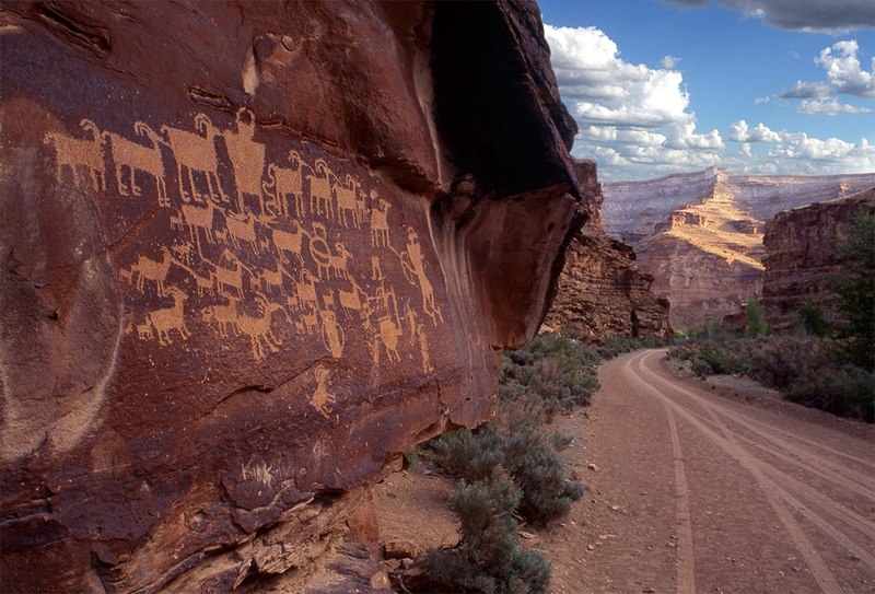
    <summary type="html"><![CDATA[<p><strong><em>With a length of more than 40 miles, the deceptively named Nine Mile Canyon is a tourist destination of eastern Utah that winds through Carbon and Duchene Counties. While the rock walls and greenery of the canyon can be breathtaking, the true pull for both archeologists and the average visitor is the clear evidence of an ancient civilization. The Fremont Indians left behind art on the rock walls of the canyon that has been remarkably well-preserved. This art provides a glimpse into an ancient culture that has left no written records.</p></strong></p><img src="https://www.intermountainhistories.org/files/fullsize/f5e88aaa9c609feed26e3dc94eb3e0d9.jpg" alt="The Great Hunt
" /><br/><p>Evidence of the Fremont culture is largely found in an area of land in eastern-central Utah about 200 miles long and 100 miles wide. The Fremont people lived in the area of Nine Mile Canyon between 900 and 1250 AD and subsisted off of a mixture of farming and a more traditional hunter-gatherer lifestyle. Because of this, the vast majority of the artifacts that have been found were located in areas with easy access to water for irrigation purposes. Nine Mile Canyon adequately served this purpose as it was formed by and still contains Nine Mile Creek, a minor water source that is nevertheless important as it is one of the only reliable, year-round sources of water in the region.</p><p>Some of the best examples of Fremont habitation sites that have been studied are located in Nine Mile Canyon. The villages were never large although they were often located close together. Many times, they were located on elevated sites close to farmable land. While the Fremont made several distinct types of buildings, the most common and representative is the pithouse. These houses which vary in size and depth were dug into the soil, walled up with adobe, and covered with a roof which also served as an entrance. Several examples of these houses are found along Minnie Maud Creek in Nine Mile Canyon.</p><p>The greatest attraction of Nine Mile Canyon, and what has caused it to be called “The World’s Largest Art Gallery”, is the abundance of petroglyphs carved and painted on the walls of the canyon. With over 1,000 rock art sites in the canyon and more than 10,000 individual images, the canyon is one of the most densely concentrated example of rock art in North America. Many of these petroglyphs are remarkably well preserved. The pictographs display a wide variety of figures and activities, including trapezoidal humanoid figures, hunting parties, snakes, and large animals. While the exact purpose of the art cannot be discerned, it is clear that there was a high degree of skill involved in creating the images. </p><p>Since the first settlement of the area by Euro Americans in the 1880s, the petroglyphs and archeological evidence of the Fremont culture have fascinated and amazed. Many of the first settlers in the region were Latter-day Saints. When seeing the petroglyphs for the first time, they were interpreted as evidence of peoples described in the Book of Mormon. In time, the analysis of the rock art has become more scientific and notable archeologists, such as John Gillin, have spent much of their life work analysing the slab and pit houses and other artifacts that the ancient culture left behind. The rock art, as well as the natural beauty of the area, has also attracted many amateur archeologists and tourists. While heavy dust from industrial traffic on unpaved roads has threatened the petroglyphs that set Nine Mile Canyon apart, a newly completed paving project has helped to ensure that the artifacts that have provided such a great opportunity to study will remain for future generations to admire and wonder at.</p><p><em><strong><a href="https://www.intermountainhistories.org/items/show/308">For more (including 3 images) view the original article</a></strong></em></p>]]></summary>
    <published>2019-02-22T07:59:49+00:00</published>
    <updated>2026-04-17T19:32:05+00:00</updated>
    <link rel="alternate" type="text/html" href="https://www.intermountainhistories.org/items/show/308"/>
    <id>https://www.intermountainhistories.org/items/show/308</id>
    <author>
      <name>Savannah Blau, Brigham Young University</name>
    </author>
  </entry>
  <entry>
    <title type="html"><![CDATA[The Black Hawk War]]></title>
    <summary type="html"><![CDATA[<p><strong><em>The Black Hawk War pitted the Mormon settlers against Native Americans in Utah Territory. Many raids took place, in which many lives were lost. As the war escalated, the relationship between the Mormon settlers and the Native Americans increased in separation. Finally, the war came to an end with a treaty that would start to mend the relationship between the Mormon settlers and the Native Americans.</p></strong></p><img src="https://www.intermountainhistories.org/files/fullsize/df1041ef2dbd946b88cdda14d537c2a6.jpg" alt="James Russell Ivie" /><br/><p>The Black Hawk War grew from severe tension between the Mormon settlers and the Native Americans in the Utah Territory. When the settlers arrived in the Utah Territory many drove the wild animals that the Natives hunted into the mountains, and allowed their cattle, horses and sheep to eat the grass, which was a major food source for the Native Americans. The Natives viewed the settlers as the cause for their lose of resources, and often took domesticated livestock in return.</p><p>These interactions resulted in violence, with both sides making declarations of war for many reasons, such as protecting their families and avenging the loss of their brethren. The Black Hawk War officially started the day the Civil War ended in 1865. During this war many raids took place, in which many lives were lost, with the majority of fatalities being Native Americans. </p><p>At the end of the war in the year 1868, Black Hawk offered a peace treaty to the Mormon settlers, which to some Native Americans was not welcomed, but in the end was accepted by both sides. However, the battles and the raids that took place during the Black Hawk War only made the relationship between the settlers and the Native Americans worse. This treaty seemed to be the first step that was accepted by both sides, which led to the start of the healing process of their relationship. Many saw this treaty as the official ending of the Black Hawk War, while others believed that the war ended when Black Hawk left to go to live in another part of the Utah Territory. </p><p><em><strong><a href="https://www.intermountainhistories.org/items/show/307">For more (including 2 images) view the original article</a></strong></em></p>]]></summary>
    <published>2019-02-22T07:03:57+00:00</published>
    <updated>2026-04-17T19:32:05+00:00</updated>
    <link rel="alternate" type="text/html" href="https://www.intermountainhistories.org/items/show/307"/>
    <id>https://www.intermountainhistories.org/items/show/307</id>
    <author>
      <name>Rachel Lee, Brigham Young University</name>
    </author>
  </entry>
  <entry>
    <title type="html"><![CDATA[Alkali Ridge<br />
]]></title>
    <summary type="html"><![CDATA[<p><strong><em>Alkali Ridge (Alkali Point) is a National Historic Landmark located in San Juan County near the city Blanding in the state of Utah. The site was found and dug by Archaeologist John O. Brew. The remains in the site show the transition of Ancestral-Pueblo culture from hunter-gatherer to a horticulture lifestyle. (c. 700 C.E – 1150 C.E.)</p></strong></p><img src="https://www.intermountainhistories.org/files/fullsize/2f709ec704253117e79d1bcda0af2973.jpg" alt="Alkali Ridge (Outer stone bricks of ruins)
" /><br/><p>Alkali Ridge (also known as Alkali Point), is one of the sites archaeologist John O. Brew excavated in Utah (1932-1934). The site is near the city Blanding, Utah in the San Juan county (consisting of the southeast corner of Utah). The Four Corners region of the southwest United States was where the ancestral Pueblo or “Anasazi” resided from c.1000 B.C. until c. 1300 A.D. when, for unknown reasons, they left Utah. The Alkali Ridge site contains the remains of a village full of ceramics and pottery pieces. The village spans an area of 240x500 feet and provides an average density of 200 remain sites (ruins, pottery) per square mile. </p><p>The site has a wide time range due to the ruins spanning from the Basketmaker III period (c.450 C.E.-750 C.E.) until the Pueblo II period (c.900 C.E.- 1150 C.E). The site shows the transition from pit dwellings, a time when the Anasazi culture were hunter and gatherers, to a change to surface homes and a horticultural lifestyle. Also found are several cliff dwellings, structures built into the sides of cliffs with walls and covers. The village consisted of about 185 units, situated in four rows. The older buildings and pit structures were built from mixtures of mud and water, formed into bricks. Newer buildings began using better stone masonry. Each group had a newer pit structure called a kiva, which served for ceremonial and communal purposes. These newer pit structures were often deeper than their predecessors and had a room that connected to the main chamber. Several rooms were used for the storage of corn. Ceramics of varying style can be found throughout the ruins. Roads (though worn terribly down by time) link the various cluster of villages in this area and are thought to have served the purpose of trade connections to the other scattered villages of the Puebloan I-II periods c.750 C.E. to c.1150 C.E. </p><p>Alkali Ridge was made a National Historic Landmark in 1964. It is under the jurisdiction of the Blanding Bureau of Land Management.</p><p><em><strong><a href="https://www.intermountainhistories.org/items/show/306">For more (including 3 images) view the original article</a></strong></em></p>]]></summary>
    <published>2019-02-15T09:54:52+00:00</published>
    <updated>2026-04-17T19:32:05+00:00</updated>
    <link rel="alternate" type="text/html" href="https://www.intermountainhistories.org/items/show/306"/>
    <id>https://www.intermountainhistories.org/items/show/306</id>
    <author>
      <name>McKay Morris, Brigham Young University</name>
    </author>
  </entry>
  <entry>
    <title type="html"><![CDATA[Japanese Youth at Topaz]]></title>
    <summary type="html"><![CDATA[<img src="https://www.intermountainhistories.org/files/fullsize/f8d2cdcd9325fab8e55f03f687e7b6ad.jpg" alt="WRA Pre-school" /><br/><p>The young, second-generation Japanese immigrants (Nisei) relocated to the Topaz Mountain Internment Camp during World War II faced a unique challenge. Born in American to the children of Japanese immigrants, they were forced to negotiate between being legal citizens and being seen as outsiders. After Pearl Harbor in 1942, President Roosevelt signed Executive Order 9066 creating the Military Exclusion Zones along the Pacific Coast. The order pushed 120,000 Japanese out of their homes and into internment camps, including Topaz. The intention was to protect America against any immigrants whose allegiance was still with Japan. The youth were directly confronted with the issue in the form of the Loyalty Exam. Two of the questions read, “Are you willing to serve in the armed forces of the United States on combat duty, wherever ordered?” and, “Will you swear unqualified allegiance to the United States of America . . . and foreswear any form of allegiance to the Japanese emperor, to any other foreign government, power, or organization?” These questions were the basis of the “Yes-Yes” and “No-No” groups that caused division among their age group and all within the camp. </p><p>The forced relocation led Japanese young people like Miné Okubo and Yoshiko Uchida to turn to art, journals, and letters to compile the effects the movement had on Japanese family structure and their own dreams of education or social advancement. These forms of communication expressed a worry for their people, confusing and hurt over being sent to internment camps, and the desire to still support the America they had been born into. This extended into subsequent post-war Sansei generations as well. <a href="https://www.rasasaki.com/about/" target="_blank" rel="noreferrer noopener">R. A. Sasaki</a>, a third-generation San Franciscan, captured this desire in her short story American Fish. The main character, Mrs. Hayashi, is asked by an old acquaintance, Mrs. Nakamoto, why Mrs. Hayashi’s parents stayed in the United States after Pearl Harbor. Mrs. Hayashi answered simply, “I guess they knew that we, I mean my brothers and sisters and I would never want to go to Japan. I mean we were born here. We belonged here. And they wanted the family to stay together.” </p><p>Despite their circumstances, Japanese-American youth held on to the hope of an America that offered opportunity. They created from scratch, along with teachers and administrators, a successful school with limited resources. In fact, many of the students complained in interviews later in life about the lack of credible teachers and resources. The draw to a world they had grown up in, like Yoshiko Uchida who continually applied to go to college while in Topaz, highlighted the difficult situation these Japanese Americans were in. They believed in a nation who could give them everything, but were left to wonder why they were building their own prison walls when they were more than willing to fight for the nation that they were both “born” to and “belonged” in.</p><p><em><strong><a href="https://www.intermountainhistories.org/items/show/167">For more (including 6 images) view the original article</a></strong></em></p>]]></summary>
    <published>2018-05-11T20:13:25+00:00</published>
    <updated>2026-04-17T19:32:02+00:00</updated>
    <link rel="alternate" type="text/html" href="https://www.intermountainhistories.org/items/show/167"/>
    <id>https://www.intermountainhistories.org/items/show/167</id>
    <author>
      <name>Chad Weight and Alex Hauber, Brigham Young University</name>
    </author>
  </entry>
</feed>