<?xml version="1.0" encoding="UTF-8"?>
<feed xmlns="http://www.w3.org/2005/Atom">
  <title type="text">Intermountain Histories</title>
  <updated>2026-04-17T19:32:18+00:00</updated>
  <generator uri="http://framework.zend.com" version="1.12.20">Zend_Feed_Writer</generator>
  <link rel="alternate" type="text/html" href="https://www.intermountainhistories.org/"/>
  <link rel="self" type="application/atom+xml" href="https://www.intermountainhistories.org/items/browse?output=rss2"/>
  <id>https://www.intermountainhistories.org/</id>
  <author>
    <name>Intermountain Histories</name>
    <uri>https://www.intermountainhistories.org</uri>
  </author>
  <link rel="hub" href="https://pubsubhubbub.appspot.com/"/>
  <entry>
    <title type="html"><![CDATA[The Heritage Streetcar of Fort Collins, Colorado ]]></title>
    <summary type="html"><![CDATA[<p><strong><em><span style="font-weight:400;">Originally operating from 1919 to 1951, the Fort Collins Municipal Railway reopened in 1984 as a seasonal “heritage” line, carrying passengers along a former service route in one of the original “Birney” cars.</span></em></strong></p><img src="https://www.intermountainhistories.org/files/fullsize/7b4c77fff926596e4029bb732cd8959a.jpg" alt="Fort Collins - aerial view. 1929." /><br/><p><span style="font-weight:400;">The Fort Collins Municipal Railway’s car depot is situated on Oak Street, near City Park in northwestern Fort Collins. Once a regularly functioning city trolley in its own right, the Municipal Railway is now a seasonal “heritage streetcar,” a living exhibition of Fort Collins’s streetcar history. Birney Safety Car No. 21, one of the original cars manufactured for the Railway by the American Car Company, features prominently.</span>
<span style="font-weight:400;">Fort Collins first acquired its own streetcar network in 1907, when the Denver & Interurban Company (D&I) built three lines of track that together carried three cars through the city’s burgeoning downtown. The D&I system did not last long, however; with the conclusion of World War I and the post-war boom in automobile sales, D&I was unable to compete. The company went bankrupt in 1918, and the Fort Collins streetcar abruptly ceased operation in July of that year.</span>
<span style="font-weight:400;">Many citizens of Fort Collins came to rely on the streetcar as a means of transportation, and so voted for the city to acquire D&I’s defunct assets in January of 1919. Because the older cars used by D&I were too expensive to upgrade, the city purchased four affordable and efficient Birney cars from the American Car Company. The city acquired five more between 1920 and 1946. The Birney cars provided service on the Municipal Railway every ten to twenty minutes, with a fare of one nickel that was kept artificially low for the Railway’s operating duration.</span>
<span style="font-weight:400;">The Municipal Railway was highly effective. Providing service from residential areas to the city center, as well as to nearby schools and amusement venues, the residents of Fort Collins loved the system. However, the rising popularity of automobiles on city streets proved inexorable, and service was discontinued in June of 1951. With the end of streetcar service, the Municipal Railway decommissioned and sold its Birney cars, all except No. 21, which the city put on display in front of Library Park.</span>
<span style="font-weight:400;">There it sat until 1976, when the Fort Collins Junior Women’s Club began its effort to refurbish the old streetcar as part of a downtown beautification project. During the years-long process, volunteers decided that they wanted to restore No. 21 to operational capacity, which entailed restoring the tracks it had once called home and building a new repository to house it. The city and the beautification volunteers organized the Fort Collins Municipal Railway Society in 1980 to spearhead the new project. In 1984, No. 21 began operating again along Mountain Avenue, and the federal government added it to the National Register of Historic Places. Since then, the Municipal Railway has run No. 21 to and from City Park on spring and summer weekends; a refurbished Birney Car No. 25 joined it in 2020.</span></p><p><em><strong><a href="https://www.intermountainhistories.org/items/show/820">For more (including 4 images) view the original article</a></strong></em></p>]]></summary>
    <published>2024-05-21T21:22:46+00:00</published>
    <updated>2026-04-17T19:32:18+00:00</updated>
    <link rel="alternate" type="text/html" href="https://www.intermountainhistories.org/items/show/820"/>
    <id>https://www.intermountainhistories.org/items/show/820</id>
    <author>
      <name>Liam Craddock, Northern Arizona University </name>
    </author>
  </entry>
  <entry>
    <title type="html"><![CDATA[Salt Lake City&#039;s Trolley Square, Utah]]></title>
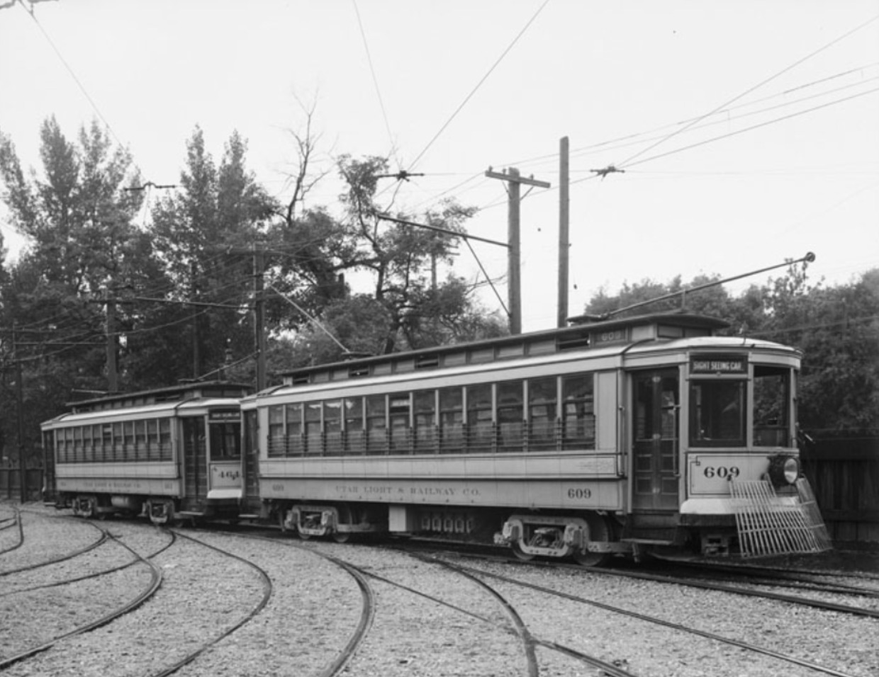
    <summary type="html"><![CDATA[<p><strong><em>Once the site of Salt Lake City’s trolley car barns, Trolley Square is now a bustling public marketplace that commemorates the city’s transit history.</em></strong></p><img src="https://www.intermountainhistories.org/files/fullsize/6449b1648fa44c9d528bf9ee7241c03c.jpg" alt="Street Cars, Utah Light and Railway Company. 1911" /><br/><p><span style="font-weight:400;">Historic Trolley Square is one of downtown Salt Lake City’s most popular tourist attractions. Though it is more renowned for its shopping center, Trolley Square also features a Trolley History Museum, dedicated to the Square’s storied lineage as the former site of the Utah Light and Rail Company’s trolley car barns.</span>
<span style="font-weight:400;">Salt Lake City’s streetcar history began in 1872. The Salt Lake Street Railway Company, formed by prominent Mormons including two sons of Brigham Young, built the first tracks, along which mules would pull the new streetcars. The mule-drawn cars were popular, and within two decades the network had expanded to include fourteen miles of track and twenty-one cars. The mules polluted the tracks with waste, however, and thus the system required constant maintenance. The advent of centralized electrification allowed for the Company to replace the mule-drawn line with Salt Lake City’s very first electric streetcar.</span>
<span style="font-weight:400;">The city’s early electric trolley system was a hit with the public, featuring over sixty cars and over forty miles of track within the first few years. However, it was also chaotic. Following the success of the Salt Lake Street Railway Company, more than a dozen companies fought bitterly and vigorously for ridership and line control. This discordant period ended in 1901, when most of the companies merged into the Consolidated Railway and Power Company, which itself became the Utah Light and Railway Company in 1904.</span>
<span style="font-weight:400;">The Salt Lake City trolley took its next major step forward in 1906, when Union Pacific Railroad executive E.H. Harriman purchased a controlling interest in the Light and Railway Company. Harriman wanted to turn the Salt Lake streetcar into a world-class model of inexpensive electrified mass transit. He added eighty miles of new track to the network, and also constructed a massive new holding facility for the network’s rapidly expanding fleet of cars on land. Due to the risk of fires at this hub of electric streetcar activity, Harriman’s architects also constructed a water tower in the vicinity.</span>
<span style="font-weight:400;">Harriman’s efforts paid off in the short term. By 1914, the Salt Lake City network operated 144 trolley cars on 146 miles of track in Salt Lake and nearby communities, and the system served as a model for others throughout the United States. However, the advent of automobiles would ultimately doom the Salt Lake streetcar. As more automobiles entered the streets, passengers complained of congestion. Even the Light and Traction Company’s new trolley buses, designed to operate without tracks on the street itself, couldn’t compete. Throughout the 1920s and 1930s, the Light and Railway Company closed lines and gradually phased out the trolley. On May 31, 1941, the last trolley car completed its run.</span>
<span style="font-weight:400;">The former car barns of Trolley Square faced the prospect of demolition in 1969, but a local family purchased them in 1972. Soon that same year, architect Wally Wright converted the car barns into a shopping center and festival marketplace. Light rail returned to Utah when the TRAX system began operation in 1999, but Trolley Square is still a powerful reminder of when electric trolleys dominated transportation in Salt Lake City.</span></p><p><em><strong><a href="https://www.intermountainhistories.org/items/show/819">For more (including 3 images) view the original article</a></strong></em></p>]]></summary>
    <published>2024-05-21T06:02:45+00:00</published>
    <updated>2026-04-17T19:32:18+00:00</updated>
    <link rel="alternate" type="text/html" href="https://www.intermountainhistories.org/items/show/819"/>
    <id>https://www.intermountainhistories.org/items/show/819</id>
    <author>
      <name>Liam Craddock, Northern Arizona University</name>
    </author>
  </entry>
  <entry>
    <title type="html"><![CDATA[The &quot;Ghost Streetcar&quot; of South Boise Station, Idaho]]></title>
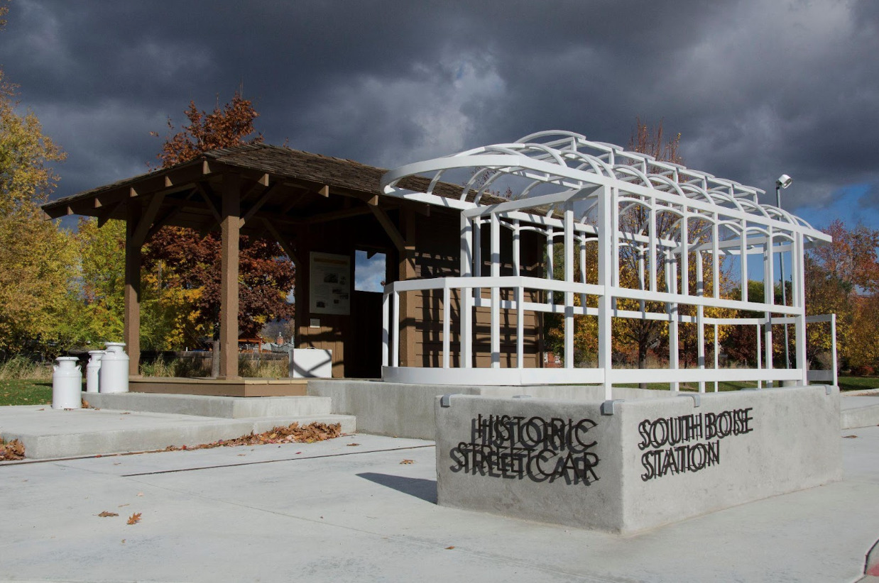
    <summary type="html"><![CDATA[<p><strong><em>Once a trolley shelter on the verge of demolition, the South Boise Streetcar Station features a “ghost streetcar,” a skeletal sculpture designed to commemorate Boise’s trolley history.</em></strong></p><img src="https://www.intermountainhistories.org/files/fullsize/0074d4188c04497c1d8f70aa728da031.jpg" alt="Historic South Boise Streetcar Station Plaza. 2013" /><br/><p><span style="font-weight:400;">Amidst the green grasses of Ivywild Park, a large recreational space in the southern end of Boise, Idaho, stands a bleached, skeletal phantom of a trolley car. This “ghost streetcar” is a to-scale installation sculpture designed by the Byron Folwell firm in 2012, and it features prominently as part of Ivywild Park’s South Boise Trolley Station Plaza, a refurbished trolley shelter that stands as one of the only remnants of the Boise Interurban.</span>
<span style="font-weight:400;">Boise’s streetcar history began in 1891, a year after Idaho achieved statehood, when the Boise City Rapid Transit Company opened an electric rail line along Main Street. From there, Boise’s streetcar network underwent enormous growth; as new communities sprang up, a slew of private companies sought to build more lines and provide service to neighborhoods across the rapidly developing city. The exponential growth of Boise’s communities was intricately intertwined with the proliferation of the streetcar, an early example of what planners now call “transit-oriented development.”</span>
<span style="font-weight:400;">Individual trolleys served communities throughout the Treasure Valley, including Boise and Caldwell, but there was a growing desire among Valley residents and investors alike to connect these disparate streetcar systems into one interurban network. The effort to create an interurban loop from these piecemeal trolleys began with Walter E. Pierce’s Boise Interurban Railway, which initiated construction of a link northward from Boise and Caldwell in 1905, with service beginning in 1907. Meanwhile, Donald Ustick and Robert Noble’s Boise Valley Railway extended southward to Nampa. The northern and southern interurban lines remained disconnected until 1912, when the Idaho Railway Light & Power Company purchased both companies and completed the Boise Valley Interurban Loop, operating streetcars along it as the Idaho Traction Company. Nearby hydroelectric dams supplied much of the power to this new interconnected trolley system.</span>
<span style="font-weight:400;">A wide variety of people relied on the Interurban’s service for their needs, from students riding to the College of Idaho campus in Caldwell to farmers taking their produce to railroad stations. At its peak in 1920, the trolley cars had carried over two and a half million passengers. The trolley had been so foundational to building community in the Valley that local community boosters nicknamed the region’s semi-professional intercity baseball club the “Trolley League.” Despite this, however, the growing popularity of automobiles heralded the end of the Boise streetcar’s profitability. Gradually, buses replaced trolley lines, and the Idaho Power Company ceased all streetcar service from Boise to nearby cities in May of 1928.</span>
<span style="font-weight:400;">The trolley shelter that had once housed streetcars in South Boise remained untouched for almost a century, the city letting it fall into disrepair and dilapidation. The shelter faced the prospect of demolition until 2012,  when three Boise city organizations - the Southeast Boise Neighborhood Association, the City of Boise Department of Arts & History, and the Boise Department of Parks and Recreation - endeavored to save the location from its grim fate. Employing the Byron Folwell design firm to create a life-size skeletal sculpture of a streetcar, the three organizations revitalized the shelter as a public historical attraction and community art piece, a monument to the streetcar history of Boise.</span></p><p><em><strong><a href="https://www.intermountainhistories.org/items/show/818">For more (including 4 images) view the original article</a></strong></em></p>]]></summary>
    <published>2024-05-21T05:33:45+00:00</published>
    <updated>2026-04-17T19:32:18+00:00</updated>
    <link rel="alternate" type="text/html" href="https://www.intermountainhistories.org/items/show/818"/>
    <id>https://www.intermountainhistories.org/items/show/818</id>
    <author>
      <name>Liam Craddock, Northern Arizona University </name>
    </author>
  </entry>
  <entry>
    <title type="html"><![CDATA[The Abandoned Car Barn of Reno&#039;s Traction Company, Nevada]]></title>
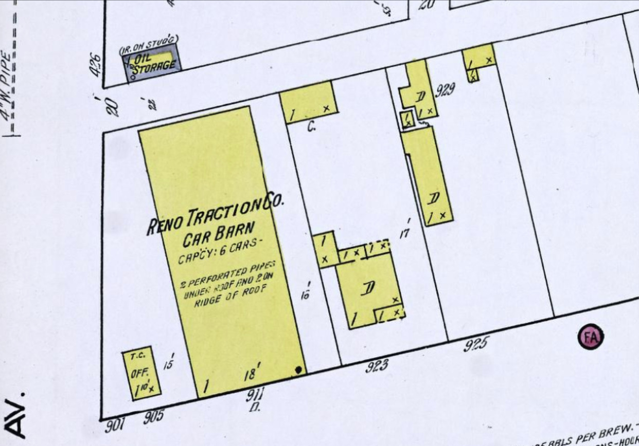
    <summary type="html"><![CDATA[<p><strong><em>Now occupied by an auto parts store and repair shop, the corner of 4th Street and Morrill Avenue was once home to the car barn of Reno’s Traction Company.</em></strong></p><img src="https://www.intermountainhistories.org/files/fullsize/cf3b7d7982b78ac18a7883d08ad9ec48.jpg" alt="Sanborn Fire Insurance Map from Reno, Washoe County, Nevada. Sanborn Map Company, 1918" /><br/><p><span style="font-weight:400;">On the I-80 Business Loop at East 4th Street, just east of downtown Reno, Nevada, there is an auto repair shop, offering transmission service and selling tires. In the early 20th century, however, this city block served as the location of a holding facility belonging to the Reno Traction Company, which operated cars on Reno’s once expansive streetcar network.</span>
<span style="font-weight:400;">Founded in 1868, the western Nevada city of Reno had undergone explosive growth in the late 19th century. By 1900, its boom in population and urban density spurred the establishment of communities on its outskirts, including Sparks to Reno’s immediate east. With the metropolitan area rapidly expanding, the necessity of a quick and easy commute within Reno and to its extremities became clear. In 1904, a group of local businessmen organized the Nevada Transit Company, which set to work on building the state’s first electric streetcar line, a three mile leg running between the Southern Pacific rail yards in Reno and Sparks respectively.</span>
<span style="font-weight:400;">The line opened on Thanksgiving Day 1904 after a construction period of four months. It was an immediate hit with Reno’s citizens, who packed the cars to make the half-hour journey for a fare of ten cents. With the trolley’s popularity, especially among working-class commuters and pleasure seekers headed to the amusement park at Asylum Crossing, the Nevada Transit Company began working on expansions, notably across the Virginia Street Bridge in 1905. The Company constructed a barn on East 4th Street to house its trolley cars, which became a focal point of the network.</span>
<span style="font-weight:400;">In 1906, the Reno Traction Company purchased the Nevada Transit Company’s assets. It continued to improve the burgeoning streetcar network and expand it across the city. New lines provided service north to the University of Nevada campus, while a separate company, the Nevada Interurban, ran cars southward to the Moana Springs resort. These expansions not only allowed for ease of transport across the Reno metropolitan area, but also facilitated the development of new communities along the trolley tracks. Of all the lines operated by both companies, the Reno-Sparks connection remained the most popular, hosting 80% of the system’s ridership.</span>
<span style="font-weight:400;">However, in the 1910s, the system found itself increasingly unable to compete with the rising popularity of automobiles. Encumbered as well by rising maintenance costs, the streetcar companies began reducing service and shutting down lines. By 1919, the Nevada Interurban had disbanded, and the Reno Traction Company closed service on all intra-city routes. The Reno-Sparks line remained open, but starting on June 15, 1927, it faced competition for passengers from the newly commissioned intercity bus line. Finally, in September of that year, the Reno Traction Company ended operations on the Reno-Sparks line, bringing Reno’s three decades with its streetcar to an end. The Company decommissioned and sold all of its trolley cars. The city tore down the car barn on 4th Street, and an auto parts and repair shop replaced it. The car barn was usurped by the very cars that had run its builders out of business.</span></p><p><em><strong><a href="https://www.intermountainhistories.org/items/show/817">For more (including 3 images) view the original article</a></strong></em></p>]]></summary>
    <published>2024-05-21T05:07:29+00:00</published>
    <updated>2026-04-17T19:32:18+00:00</updated>
    <link rel="alternate" type="text/html" href="https://www.intermountainhistories.org/items/show/817"/>
    <id>https://www.intermountainhistories.org/items/show/817</id>
    <author>
      <name>Liam Craddock, Northern Arizona University </name>
    </author>
  </entry>
  <entry>
    <title type="html"><![CDATA[The Trolley Barn at Fort Missoula, Montana]]></title>
    <summary type="html"><![CDATA[<p><strong><em><span style="font-weight:400;">The Historical Museum of Fort Missoula’s Trolley Barn hosts Streetcar #50, which once ran on Missoula’s interurban trolley line.</span></em></strong></p><img src="https://www.intermountainhistories.org/files/fullsize/41b31ef6e535bb9ab1e992eba6b7c6fd.jpg" alt="Higgins Ave. Bridge Postcard, ca. 1910-1915." /><br/><p><span style="font-weight:400;">The Fort Missoula museum sits at the outskirts of Montana’s second largest city, also named Missoula. Among this repository of historical buildings and artifacts is a reconstructed streetcar holding facility. This trolley barn houses Streetcar #50, a decommissioned trolley car that once operated on the interurban line from Missoula to the nearby sawmill company town of Bonner.</span>
<span style="font-weight:400;">Missoula’s streetcar history began in 1890 with horse-drawn carriages on steel rails. Electric streetcars came to Missoula in 1893, operating alongside the horse-drawn lines. Many people, including university students, came to rely on the streetcar, so when this early attempt ended in 1897 after the Missoula city council removed the streetcar tracks, they were left without a means of mass transit.</span>
<span style="font-weight:400;">In the 1900s, the debate over bringing a new street railway to Missoula captured public attention. Publications like the </span><i><span style="font-weight:400;">Daily Missoulian </span></i><span style="font-weight:400;">enthusiastically expressed their optimism that Missoula would see an electric trolley again soon. All the city needed to get construction underway was money, which ex-Senator William Clark, an eccentric entrepreneur making enormous profits in copper mining in Butte, was more than happy to provide. Clark’s Missoula Street Railway Company incorporated in February 1909, beginning construction shortly thereafter. The </span><i><span style="font-weight:400;">Daily Missoulian </span></i><span style="font-weight:400;">issued frequent reports on the Company’s incremental progress. Finally, on May 12, 1910, the streetcars were ready for service.</span>
<span style="font-weight:400;">Missoula’s streetcar was a technically accomplished system. In 1921, the Street Railway Company installed an automated signaling system, the first of its kind in Montana. In addition to the intra-city network, the interurban line was also novel - Streetcar #50 and its counterparts required only one operator at the helm. Within their first two years of operation, Missoula’s trolleys ferried two and a half million passengers over an accumulated distance of one million miles; at their peak, the trolley system operated ten cars over twenty-one miles of track spanning from destinations within Missoula to nearby cities like Bonner, around seven miles away. </span>
<span style="font-weight:400;">Despite its efficiency and public adoration, however, Missoula’s trolleys soon faced an insurmountable challenge. Since Montana first started licensing them in 1913, the production and purchase of automobiles had increased dramatically. As more people started driving, the streets became crowded, and passenger numbers fell to financially unsustainable levels. On January 24, 1932, the city decommissioned the last trolley car in Missoula. Bus service began the following day. They sold Streetcar #50 to various buyers, often used as temporary housing. In 1974, it was donated to the Historical Museum of Fort Missoula. A grassroots campaign saved it from being sold off in 1993, allowing it to be refurbished and exhibited. Today, Streetcar #50 and its car barn are all that remains of Missoula’s streetcar system.</span></p><p><em><strong><a href="https://www.intermountainhistories.org/items/show/816">For more (including 5 images) view the original article</a></strong></em></p>]]></summary>
    <published>2024-05-21T02:04:21+00:00</published>
    <updated>2026-04-17T19:32:18+00:00</updated>
    <link rel="alternate" type="text/html" href="https://www.intermountainhistories.org/items/show/816"/>
    <id>https://www.intermountainhistories.org/items/show/816</id>
    <author>
      <name>Liam Craddock, Northern Arizona University</name>
    </author>
  </entry>
  <entry>
    <title type="html"><![CDATA[The Salt Lake Temple]]></title>
    <summary type="html"><![CDATA[<p><strong><em>The Salt Lake Temple has become one of America’s most recognizable religious buildings. Hewn out of local granite, it prominently stands at the center of Utah’s capital city</em></strong></p><img src="https://www.intermountainhistories.org/files/fullsize/8d309b70f3e051fbd9d2babd65be04c1.jpg" alt="The Salt Lake Temple ornate granite exterior. " /><br/><p>The site of the Salt Lake Temple was identified just days after Brigham Young and the first group of Latter-day Saint pioneers entered the Salt Lake Valley on July 24th, 1847. While Young claimed to have received the basic design of the building from God, the plans for the temple evolved throughout the forty years of its construction (1853-1893). Young invited all to contribute, stating that,“[if] any good man on earth will suggest any improvements, we will receive them and adopt them.”  </p><p>Initially, the interior was planned to feature two large assembly rooms, patterned after previously built temples. However, after the construction of the Endowment House and the St. George Temple, it was clear that more space needed to be allotted for rituals. Consequently, the original plan was adapted to include several large ordinance rooms in place of a lower assembly hall. </p><p>While work on the temple began in 1853, construction was slow as the Saints tried to eke out an existence in their new territory. Resources and manpower were constantly diverted to other more urgent projects such as the Transcontinental Railroad. It took 14 years until the temple walls reached above ground level. Stones for the temple were pulled out of nearby canyons by wagon teams until the 1870’s when blocks began to be transported by rail, speeding up the building process. Finally, in 1892, a large celebration was held as the final stone of the temple was put into place. A few hours after the capstone was fastened, the golden statue of the Book of Mormon prophet Moroni was placed on top of the capstone. At this capstone ceremony, President Woodruff requested that the interior work be completed in just one year, bringing the total period of construction to forty years. </p><p>April 6, 1893 marked the first of 31 dedication sessions. The President of the Church, Wilford Woodruff, offered the dedicatory prayer. The completion of this massive granite structure captivated the nation. As dignitaries and reporters flocked to Salt Lake City to witness the celebrations, they sent back favorable reports of the “Mormons.” The Ohio Democrat touted, “The architecture of the building is without a known parallel in ancient or modern times” and credited the structure to the “courage and determination” of the “Mormons”. H. R. Harper, editor of The Chattanooga, Tennessee News, later recalled that because of his warm reception during the dedication by “honest, industrious and God-fearing people, who have done great things for the amelioration [improvement] of mankind...” he decided to stay longer than he had planned in Salt Lake City.  The positive publicity surrounding the temple dedication undoubtedly contributed to helping Utah achieve statehood in 1896. </p><p>The Salt Lake Temple features rich religious symbolism, pointing to the importance of the building to members of the faith. Some of the symbols incorporated into the building include: the all-seeing eye, angels, the big dipper constellation, beehives, and stars. These symbols are meant to enhance the religious experience of worshipers. In 1915, one Salt Lake City resident noted, “Every stone [of the temple] is a sermon to me.” </p><p>Although periodic renovations have been necessary to allow the building to accommodate the needs of worshipers, overall, the original pioneer craftsmanship has been preserved. With its iconic spires being featured in media across the globe, the Salt Lake Temple is recognized world-wide as a symbol of the Church of Jesus Christ of Latter-day Saints.</p><p><em><strong><a href="https://www.intermountainhistories.org/items/show/419">For more (including 6 images) view the original article</a></strong></em></p>]]></summary>
    <published>2020-09-24T04:45:04+00:00</published>
    <updated>2026-04-17T19:32:08+00:00</updated>
    <link rel="alternate" type="text/html" href="https://www.intermountainhistories.org/items/show/419"/>
    <id>https://www.intermountainhistories.org/items/show/419</id>
    <author>
      <name>Ryan J. Hallstrom, Brigham Young University</name>
    </author>
  </entry>
  <entry>
    <title type="html"><![CDATA[Union Pacific Depot in Salt Lake City, Utah<br />
]]></title>
    <summary type="html"><![CDATA[<p><strong><em>Proposed at the beginning of the twentieth century, and completed in 1909, the Union Depot served for years as a main railroad depot in the downtown area of Salt Lake City.   </p></strong></p><img src="https://www.intermountainhistories.org/files/fullsize/518c599c05c14103f7c42b145b29ca08.jpg" alt="Salt Lake City Union Pacific Depot" /><br/><p>Completed in July 1909, the Union Depot in downtown Salt Lake City, served as a connecting point for the San Pedro, Los Angeles, and Salt Lake Railroad to the Oregon Short Line. Previous to the construction of the depot and connecting railroads, passengers had to travel to Sacramento and then take a train to southern California. By providing a train that went straight to southern California, passenger trips became considerable shorter and more convenient. </p><p>Initially proposed around the turn of the twentieth century, the Union Deport connected and unified all the major railroads in the area. Demolition of pre-existing buildings on the site occurred in 1904 and construction of the new station begin. Architects envisioned the new station on a grander scale than the Union Station in Denver, Colorado, which had just been completed a few years prior.</p><p>Construction on the Union Depot officially began in 1908, with a proposed cost of $500,000. At this same time, the Rio Grande Railroad announced that they were building their own depot, also in downtown Salt Lake City. With this second depot being built, the idea of having one unified station in downtown Salt Lake that connected all the railways was destroyed.</p><p>The Union Depot, or Union Pacific Depot as it became known in 1921, functioned as a railroad station into the 1970s and for a short time as an Amtrak station. In 1989, however, the Union Pacific donated the building to the state of Utah. In 1999, the Boyer Company, who had already bought the land surrounding the depot, bought the Union Pacific Depot building from the state of Utah. Since that time the depot has housed various stores and been used as an event center.</p><p><em><strong><a href="https://www.intermountainhistories.org/items/show/279">For more (including 3 images) view the original article</a></strong></em></p>]]></summary>
    <published>2019-02-09T05:53:44+00:00</published>
    <updated>2026-04-17T19:32:04+00:00</updated>
    <link rel="alternate" type="text/html" href="https://www.intermountainhistories.org/items/show/279"/>
    <id>https://www.intermountainhistories.org/items/show/279</id>
    <author>
      <name>Janae Brown, Brigham Young University</name>
    </author>
  </entry>
  <entry>
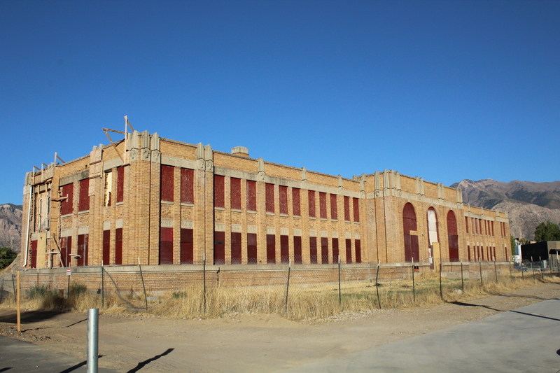
    <title type="html"><![CDATA[Ogden Union Stockyards]]></title>
    <summary type="html"><![CDATA[<p><strong><em>The Ogden Union Stockyards, now being developed by Ogden City as a new commercial, mixed-use space, was the largest stock handling facility in Utah and one of largest in the Intermountain West.</p></strong></p><img src="https://www.intermountainhistories.org/files/fullsize/25a9f160940f4cadd6565107ab7968bc.jpg" alt="Exchange Building currently being renovated" /><br/><p>The Ogden Union Stockyards were a significant part of the Ogden community during their operations.  The stockyards were the feed stops for countless train cars containing cattle, sheep, and hogs.  A good portion of these animals were sold or purchased at the stockyards.  Some animals were even slaughtered and processed in the adjoining packing plant.  The stockyards operated from 1916 to their eventual closure in 1971.</p><p>The initial construction of the stockyards in 1916-1917 was by the Ogden Packing and Provision Company which had greatly expanded since its founding in 1901. The new stockyards included a four-story building which housed offices and a pickling cellar. Plans for the building were drawn by the Packers’ Architectural & Engineering Company of Chicago. </p><p>In 1918, the stockyard managers put together a livestock show to help promote herds and to auction off livestock.  In 1919, the Ogden Livestock Show became an annual event. (In 1955, the show was renamed the Golden Spike National Livestock Show.)  By 1922, the expanded facilities included a coliseum used for the show and an exchange building to house staff for the stockyards and the livestock show.  In 1926, an all new coliseum was built.  In 1931, a new exchange building designed by Ogden architects Hodgson and McClenahan was built in the art deco style. It is currently the only building still standing at the stockyards.</p><p>The stockyards accepted every kind of livestock -- cattle, horses, hogs but more than anything else they dealt with sheep. The stockyards became the largest sheep center west of Omaha and, for a time, had the biggest lamb slaughtering industry in the country.  The year 1945 saw the peak number of animals come through the stockyards.  More than 300,000 cattle, 350,000 hogs, and 1.8 million sheep passed through the stockyards.  </p><p>Ironically, 1945 also marked a steady decline in the number of livestock handled there. The yards were modernized in 1954 to accommodate increasing use of trucks to transport livestock. The outlook for the stockyards seemed to be improving during the 1960s. It was reported in 1966 that the stockyards were still feeding, watering and resting about 350,000 head of livestock en route by rail to other destinations.” However, the Swift & Co. meat processing plant closed in 1970 and the stockyards were sold by the Denver Union Stock Yards Co. to Ogden City in 1971</p><p><em><strong><a href="https://www.intermountainhistories.org/items/show/261">For more (including 6 images) view the original article</a></strong></em></p>]]></summary>
    <published>2019-01-25T05:49:28+00:00</published>
    <updated>2026-04-17T19:32:04+00:00</updated>
    <link rel="alternate" type="text/html" href="https://www.intermountainhistories.org/items/show/261"/>
    <id>https://www.intermountainhistories.org/items/show/261</id>
    <author>
      <name>Adam Schofield, Weber State University</name>
    </author>
  </entry>
  <entry>
    <title type="html"><![CDATA[Weber River Railroad Bridge]]></title>
    <summary type="html"><![CDATA[<p><strong><em>The Weber River Railroad Bridge is a remnant of the extensive rail lines which made Ogden, Utah “Junction City.” It is the only Pegram truss bridge in Utah.</em></strong></p><img src="https://www.intermountainhistories.org/files/fullsize/33c5e9a629f54cd343def027d83beb5c.jpg" alt="The Weber River Bridge looking east" /><br/><p>The Weber River Railroad Bridge, also known  as the Ogden Pegram Truss Railroad Bridge, was built by Edge Moor Bridge Works (based out of Wilmington, Delaware) for the Oregon Short Line Railroad. It replaced an iron bridge that had been at that location for the Utah Central Railroad. The Pegram Bridge was made from timber, steel and asphalt that extended across the Weber River 157 feet in length. </p><p>The designer of the bridge, George H. Pegram (1855 - 1937) patented his truss design in 1887 -- with chords that are wider at the bottom but of the same length as each other at the top. Subsequently many Pegram truss bridges were built by various railroad companies -- 20 in 1890 for the Missouri Pacific alone. Pegram joined the Union Pacific in 1883 and spent considerable time in Utah, particularly in Ogden. He was involved in many engineering projects including a steel pipeline for the Pioneer Electric Company. </p><p>The railroad had a significant impact on Ogden. The city became known as Junction City because of the many major north-south and east-west lines which joined there. The Weber River Bridge was part of the original main line connecting Ogden with Salt Lake City in 1869. The line later became  a secondary line, the Evona Branch, providing a spur to the industrial sector west of Ogden. </p><p>Though the bridge is now currently out of use. The Weber River Railroad Bridge is an important reminder of the significance of railroads to the economic and cultural life of the area. The bridge was nominated to the National Register of Historic Places in 2015.</p><p><em><strong><a href="https://www.intermountainhistories.org/items/show/258">For more (including 4 images) view the original article</a></strong></em></p>]]></summary>
    <published>2019-01-25T03:54:23+00:00</published>
    <updated>2026-04-17T19:32:04+00:00</updated>
    <link rel="alternate" type="text/html" href="https://www.intermountainhistories.org/items/show/258"/>
    <id>https://www.intermountainhistories.org/items/show/258</id>
    <author>
      <name>Jadyn Williams, Weber State University</name>
    </author>
  </entry>
  <entry>
    <title type="html"><![CDATA[Oregon Short Line Depot]]></title>
    <summary type="html"><![CDATA[<p><strong><em>The Oregon Short Line Depot sis a reminder of the importance of the railroads in the economy of Northern Utah during the 19th and 20th centuries.</em></strong></p><img src="https://www.intermountainhistories.org/files/fullsize/5171f39269817d6a63107da110b8bf0b.jpg" alt="Oregon Short Line Depot, Brigham City, 1992. " /><br/><p>The Oregon Short Line Company was established in 1878 to provide the Union Pacific with access to the Pacific Northwest. In 1906, that company built the Brigham City Train Depot. A.C. Rainey and his staff of 22 laborers constructed a “Hudson Bay Gothic” style building. It had all of the modern amenities including plumbing, electricity, steam heat, and lavatories. The Depot was later purchased by the Union Pacific Railroad.</p><p>The Depot was important in Brigham City’s early economic success. Countless cars of locally grown fruit and produce were shipped from that location. In fact, so much fruit was shipped that the Knudson Brothers located their fruit packing and storage business close by and built a spur track. A cannery was also located on the west side of the tracks so that canned fruit could be easily loaded onto the train cars. Large quantities of fish and mail were also shipped from the Depot. Residents of Brigham City remember being able to take their mail straight to the Depot in order to get it out faster. </p><p>During WWII, the Depot had 14 employees and as many as 17 passenger trains daily. Countless soldiers passed through the Depot on their way to various assignments or the Bushnell Military Hospital located nearby.  Tons of military and medical supplies were brought in. However, by the 1950s, passenger service declined, and eventually came to a standstill. Amtrak operated daily from 1971-1977; then the Depot fell into disuse. Some in Brigham City thought the abandoned building an eyesore and urged demolition. However, on July 16, 1992, the building was listed on the National Register of Historic Buildings, and in February of 1994, it was deeded to the Golden Spike Association. </p><p>Today the Depot serves as a museum of railroad and historical artifacts and has multiple original pieces. It also serves as an education hub for nearby school children and patrons.  The Depot is the gateway to Brigham City from the West, and is popular among local photographers, history fans, and train buffs. It retains much of its original grandeur, including the large sweeping multiple hip roof, the wide overhanging eaves with wooden brackets, and even benches that passengers sat on while waiting for trains. Over 500,000 man hours have been donated by volunteers to restore this unique building to its original beauty. </p><p><em><strong><a href="https://www.intermountainhistories.org/items/show/240">For more (including 6 images) view the original article</a></strong></em></p>]]></summary>
    <published>2019-01-01T01:49:46+00:00</published>
    <updated>2026-04-17T19:32:03+00:00</updated>
    <link rel="alternate" type="text/html" href="https://www.intermountainhistories.org/items/show/240"/>
    <id>https://www.intermountainhistories.org/items/show/240</id>
    <author>
      <name>Colbie Hymas, Weber State University</name>
    </author>
  </entry>
  <entry>
    <title type="html"><![CDATA[The Ogden Union Station]]></title>
    <summary type="html"><![CDATA[<p><strong><em>The imposing Spanish Colonial Revival Ogden Union Station is the expression of Ogden as a significant railroad hub in the American West and the determination of a community to cherish that identity.</em></strong></p><img src="https://www.intermountainhistories.org/files/fullsize/58f090ae9edbfd9b32807b99f22f31bd.jpg" alt="Ogden Union Station Front Exterior" /><br/><p>In 1869, having completed its part of the transcontinental rail line, the Union Pacific Railroad constructed a line through Weber Canyon to Ogden on a grade completed by men working under a contract granted Brigham Young, president of the LDS church. It was agreed that Ogden would serve as a temporary terminal for both the Union Pacific and the Central Pacific. Both companies built and maintained facilities in Ogden, including express offices, engine, lodging, and baggage houses. By mid-January 1870, ten trains were operating daily through the Ogden terminal. </p><p>There was some controversy between Ogden and Corinne for designation as the final junction point. However, the decision of Brigham Young to designate land in Ogden for specific use as railroad yards, eventually led to Ogden becoming the “Junction City.”  The designated space included facilities serving UP and CP, the Utah Central branch line to Salt Lake City, and the Utah Northern line to Cache Valley. In 1878, the companies agreed to use a common depot – the original 1869 Union Pacific building. Therefore, the building became a “union” station.</p><p>In 1888, the Ogden Union Railway & Depot Company was organized to fill Ogden's need for a new depot. The building was designed by architect Henry Van Brunt and featured a large electric clock tower that was donated by Ogden jeweler John S. Lewis. Mayor David Eccles declared a city-wide holiday for the laying of the cornerstone. He invited businessmen to close their establishments and urged citizens to "engage in the ceremonies." Reporting on the 5,000 to 6,000 persons who attended, the Ogden Standard commented that "the old shanties called the depot will not be used much longer." </p><p>However, in 1923 the building caught fire and was all but destroyed. A new depot on the foundation of the old was completed in 1924. The father and son team of John and Donald Parkinson designed a Spanish Colonial Revival. The artist Edward Laning painted the murals that adorn the Grand Lobby, the last that the artist painted before his death in 1981. The Ogden Union Station was placed on the National Register of Historic Places in 1971.</p><p>Passenger and freight trains no longer use the Union Station. Instead, the building now hosts: the Utah State Railroad Museum, John M. Browning Firearms Museum, Browning-Kimball Classic Cars Museum, and Utah State Cowboy and the Western Heritage Museum. The building also serves as a gallery for art and as a meeting place for special events. Saved from demolition and restored by determined locals, the Station is now city-owned and city-run.</p><p><em><strong><a href="https://www.intermountainhistories.org/items/show/239">For more (including 6 images) view the original article</a></strong></em></p>]]></summary>
    <published>2019-01-01T01:35:27+00:00</published>
    <updated>2026-04-17T19:32:03+00:00</updated>
    <link rel="alternate" type="text/html" href="https://www.intermountainhistories.org/items/show/239"/>
    <id>https://www.intermountainhistories.org/items/show/239</id>
    <author>
      <name>Chris DeGroot, Weber State University</name>
    </author>
  </entry>
  <entry>
    <title type="html"><![CDATA[ Simpson Springs Pony Express Station]]></title>
    <summary type="html"><![CDATA[<p><strong><em>Simpson Springs provided the only freshwater to a barren part of the Pony Express. Riders and horses quenched their thirst there before continuing their long journey.</em></strong></p><img src="https://www.intermountainhistories.org/files/fullsize/d4b7991eb5b328b9f4874236122f35ac.jpg" alt="Pony Express Station" /><br/><p>In 1851, George Chorpenning and Absolom Woodward were awarded the first overland mail contract between Sacramento and Salt Lake City. Absolom was killed by Indians later that year, and George began running the mail by himself. Simpson Springs was a promising site along the route because it was the only good source of water for miles in the barren desert. In 1859, George set up a ring of stones as a foundation for his Sibley tent. </p><p>By 1860, a stone house was built, and the firm of Russell, Majors, and Waddell bought the site for the Pony Express. They eventually bought the entire Chorpenning mail and stage line. George Dewees managed the Simpson Springs Station, which was located between Government Creek Station to the northeast and River Bed Station to the southwest. Simpson Springs Station, like many of the stations along the Pony Express, went by many names. Richard F. Burton wrote that Simpson Springs was, “the station which Mormons call Egan’s Springs, anti-Mormons Simpson Springs, and Gentiles Lost Springs.” </p><p>The name Simpson Springs came from the Camp Floyd topographical engineer J. H. Simpson. In 1859, Simpson was commissioned to lay out an acceptable route from Salt Lake City to Carson Valley. On that expedition, he passed through what would be named Simpson Springs. After the Pony Express ended, the station was decreasingly used by mail and shipping companies until it was abandoned in 1869.</p><p>Richard Burton passed through the area in 1860 and described the landscape in this way. “All was desert: the bottom could no longer be called basin or valley: it was a thin fine silt, thirsty dust in the dry season, and putty-like mud in the springs and autumnal rains.” In 1965, a monument was placed to mark the station site, and, in 1975, the Bureau of Land Management and Future Farmers of America finished reconstructing the station.</p><p><em><strong><a href="https://www.intermountainhistories.org/items/show/197">For more (including 3 images) view the original article</a></strong></em></p>]]></summary>
    <published>2018-06-06T23:13:37+00:00</published>
    <updated>2026-04-17T19:32:02+00:00</updated>
    <link rel="alternate" type="text/html" href="https://www.intermountainhistories.org/items/show/197"/>
    <id>https://www.intermountainhistories.org/items/show/197</id>
    <author>
      <name>Samuel Hauber, Brigham Young University</name>
    </author>
  </entry>
  <entry>
    <title type="html"><![CDATA[Camp Floyd Pony Express Station<br />
]]></title>
    <summary type="html"><![CDATA[<p><strong><em>The interval of time that this Pony Express station operated coincided with an economic boom in the late 1850s. The fast-paced town was a stopover for Pony Express riders and celebrities. </em></strong></p><img src="https://www.intermountainhistories.org/files/fullsize/ff43ca28da08ed83d18a38c4a318af77.jpg" alt="John Carson House, Main Street, Fairfield, Utah County, UT" /><br/><p>Camp Floyd, also called Fairfield Station, was located between Joe’s Dugout Station and East Rush Valley Station. Since it was in the town of Fairfield, Floyd Station was one of the more comfortable and safe layovers for pony express riders. Many stations were small shacks in the middle of the desert, but the Camp Floyd station was an adobe inn that John Carson built.</p><p>John Carson, John Williams, and a few others established the Fairfield settlement in 1858 when they built homes and moved their families to the area. The settlement grew into a town when the U.S. Army arrived later that year. On July 8, 1858, the army arrived at the place where they would build Camp Floyd.   The army ordered 16 million pounds of freight to be brought to Camp Floyd by the Russell, Majors, and Waddell firm. This contract forced the firm to expand their resources and capital. Russell, Majors, and Waddell would eventually create and operate the Pony Express. The construction of the camp was completed November 9, 1858, and it was named after Secretary of War John B. Floyd.</p><p>With the construction of Camp Floyd came an influx of soldiers. This raised the population of Fairfield to a booming 7,000. In its heyday, there were seventeen saloons to keep the residents entertained, and the town became quite rowdy. John Carson applied the strict precepts of his Mormon faith to the inn that he ran. Because of these standards, his inn became the designated place for famous and important visitors to stay. Mark Twain, Horace Greeley, Porter Rockwell, and Sir Richard Burton were among the celebrities who stopped at the inn. These big names shared a roof with the rugged riders of the Pony Express.</p><p>When the Civil War broke out in 1861, things began to change. John B. Floyd joined the Confederacy and so the fort was renamed Fort Crittenden. The soldiers were called eastward and, on July 27, 1861, the last remnants of the army departed. On their way out, the army burned down their buildings and detonated their unused ammunition. By September 2, 1861, there were only eighteen families in Fairfield. One month later, the Pony Express was shut down and Fairfield’s boom period ended.</p><p><em><strong><a href="https://www.intermountainhistories.org/items/show/196">For more (including 3 images) view the original article</a></strong></em></p>]]></summary>
    <published>2018-06-06T22:39:53+00:00</published>
    <updated>2026-04-17T19:32:02+00:00</updated>
    <link rel="alternate" type="text/html" href="https://www.intermountainhistories.org/items/show/196"/>
    <id>https://www.intermountainhistories.org/items/show/196</id>
    <author>
      <name>Samuel Hauber, Brigham Young University</name>
    </author>
  </entry>
  <entry>
    <title type="html"><![CDATA[The Golden Spike: Promontory Summit and the Transcontinental Railroad]]></title>
    <summary type="html"><![CDATA[<img src="https://www.intermountainhistories.org/files/fullsize/3de2b2ada80702b84f11d853b1a6cc5f.jpg" alt="Joining of the Rails, Promontory Point; May 10, 1869" /><br/><p>Western settlers longed for a faster and easier way to travel across the West. Emigrants traveling by horseback, wagon, or foot required several months to cross the plains and the Rocky Mountains. Trains made travel faster, safer, and much less physically taxing, but there was no transcontinental railroad that connected the country from east to west in the mid-nineteenth century. Technology and political incentives made it feasible for the country to contemplate a transcontinental railroad. </p><p>By the late nineteenth century, the transcontinental railroad came to fruition.  The Union Pacific and Central Pacific Railroad companies laid hundreds of miles of tracks, but needed a place to connect. On April 8, 1869, Grenville M. Dodge, chief engineer of the Union Pacific, along with Collis Potter Huntington, president of the Central Pacific, met with Congressman Sam Hooper to settle the debate of where the two railroads would meet. Together they concluded on Promontory Summit, “at which place the rails shall meet and connect and form one continuous line.” </p><p>Located in Utah, Promontory Summit (also referred to as Promontory Point) is an area of high ground northwest of Salt Lake City. Here, at Promontory Summit, on May 10, 1869, three spikes were driven into the ground to commemorate the completion of the transcontinental railroad. The spikes symbolized different areas of the country coming together, like the different railroads that came together. The most famous spike, the golden spike, was made from California gold, the silver spike from Nevada alloy silver, and the iron spike from a combination of Arizona metals, connecting these Western states permanently in one symbolic tie of the railroad.</p><p>A crowd of up to 1,000 people gathered at Promontory Summit on May 10, 1869 to witness the historic day when the railroads joined together as one. The Deseret News reported, “A thousand throbbing hearts impulsively beat to the motion of the trains as the front locomotive of each company led on majestically up to the very verge of the narrow break between the lines, where, in a few moments, was to be consummated the nuptial rites uniting the gorgeous east and the imperial west of America, with the indissoluble seal of inter-oceanic commerce.” </p><p>Today, Promontory Summit, forever tied to the railroad, houses a Visitor Center and Engine House where people can experience the history of the transcontinental railroad.</p><p><em><strong><a href="https://www.intermountainhistories.org/items/show/189">For more (including 2 images) view the original article</a></strong></em></p>]]></summary>
    <published>2018-05-30T20:21:58+00:00</published>
    <updated>2026-04-17T19:32:02+00:00</updated>
    <link rel="alternate" type="text/html" href="https://www.intermountainhistories.org/items/show/189"/>
    <id>https://www.intermountainhistories.org/items/show/189</id>
    <author>
      <name>Emma Tolman, Brigham Young University</name>
    </author>
  </entry>
  <entry>
    <title type="html"><![CDATA[Navajo Bridge]]></title>
    <summary type="html"><![CDATA[<p><strong><em>Navajo Bridge is one of the architectural wonders of modern Arizona.  It encouraged tourism in northern Arizona and southern Utah.</em></strong></p><img src="https://www.intermountainhistories.org/files/fullsize/bb53c166ff429b49cd6b6785080d4448.jpg" alt="Construction of Navajo Bridge, 1928" /><br/><p>Navajo Bridge spans the width of Marble Canyon along the Colorado River. Constructed of concrete and steel, the bridge is tied for ninth highest in the United States. Ralf Hoffman of the Arizona Highway Department (AHD) designed it, and in June of 1927, AHD contracted Kansas City Structural Steel Company to build the structure. Funding for the bridge came from the State of Arizona and the Navajo Tribal Fund. After completing the bridge in 1929, its architects dubbed it Lee’s Ferry Bridge or Grand Canyon Bridge. Both names did not last long; Navajo leaders and others asked to change it to Navajo Bridge. The State of Arizona agreed to reflect the monetary donations made by the Navajo Nation. Navajo Bridge has been nominated as “Arizona’s most technologically significant highway bridge,” because it reflects the ingenuity of the time in building something that crossed such a deep canyon.</p><p>The bridge made a modern connection between the north and south sides of the Colorado River and made US highway 89 possible, encouraging tourism in northern Arizona and southern Utah. There were only ferry crossings hours to the north or south, and often quite limited. The bridge shortened travel time between southern Utah and northern Arizona for both tourism and commerce.  </p><p>Navajo Bridge remained the only highway crossing of the Colorado for approximately 400 miles in either direction until the 1960s. As traffic and tourism increased, Arizona and Utah constructed new bridges at Glen Canyon and Hite. As the years went by, Navajo Bridge needed repairs and was too narrow for modern vehicles. In 1995, Arizona constructed a New Navajo Bridge to replace the old one. Today, the old bridge is no longer used for vehicle traffic, but is open for tourists and pedestrians. </p><p><em><strong><a href="https://www.intermountainhistories.org/items/show/71">For more (including 3 images) view the original article</a></strong></em></p>]]></summary>
    <published>2017-06-10T19:19:18+00:00</published>
    <updated>2026-04-17T19:31:59+00:00</updated>
    <link rel="alternate" type="text/html" href="https://www.intermountainhistories.org/items/show/71"/>
    <id>https://www.intermountainhistories.org/items/show/71</id>
    <author>
      <name>Alex Anthony, Northern Arizona University</name>
    </author>
  </entry>
  <entry>
    <title type="html"><![CDATA[Hite Ferry at Dandy Crossing]]></title>
    <summary type="html"><![CDATA[<p><strong><em>For the first half of the 20th century, Hite Ferry at Dandy Crossing was the only way across the Colorado River along hundreds of miles along the northern edge of Glen Canyon.</em></strong></p><img src="https://www.intermountainhistories.org/files/fullsize/05e035156d59c2bf0307855ed580ed45.jpg" alt="Hite Bridge, 1960s" /><br/><p>Hite, Utah is located on the northern end of Lake Powell along the Colorado River. It was named after Cass Hite who came to Glen Canyon in 1883. He came after Navajo associates told him there was gold in the Colorado River. Soon, a small ‘Gold Rush’ ensued and prospectors and others settled at Hite, Utah. It served as a small trading outpost on a river bar of the Colorado. Since Hite was located in an easily navigable part of the river, it received another name - Dandy Crossing. After the gold was deemed too fine to be profitable, the outpost went quiet but by 1900, Hite evolved into an important crossing point of the Colorado River. </p><p>In the late 1890s, Arthur Chaffin came to Hite with his father and brothers looking for gold. After little luck with placer mining they gave up and went their separate ways. Chaffin traveled across the West, eventually returning to Utah in the 1920s and to Hite by the early 1930s.  At times Chaffin hay have been the only permanent resident in Hite, operating the “tent motel,” post office, and ferry. In the 1930s as the automobile came more into use, Chaffin began a life-long quest to make Hite accessible to cars. As other mineral booms occurred in the region, Chaffin took advantage of the largest  - the uranium boom. He requested that local city councils help build better roads to Hite. Then, since Hite was situated at an important Colorado River crossing, he established a ferry.  His ferry operated from the 1946 to 1964, when Lake Powell was filled.  </p><p>The ferry was small and operated using the engine of a small car.  The small-scale nature of the ferry meant that it was slow and could only support one large truck or maybe two small vehicles at a time.  Large commercial vehicles were not able to cross, forcing companies to lobby government officials into building a large bridge.  That was the least of Arthur Chaffin’s worries. Located at the northern end of Glen Canyon, the construction of Glen Canyon Dam and filling of Lake Powell left his residence underwater and the ferry unusable. He successfully sued the federal government for his impending losses, won $8,000, and left the area.</p><p>Today the site is under water, and the ferry is no longer used.  A highway and bridge cross nearby with a marker commemorating Hite ferry. The construction of a large highway and bridge made the region much more accessible, but came at the cost of Hite’s ferry.</p><p><em><strong><a href="https://www.intermountainhistories.org/items/show/68">For more (including 4 images) view the original article</a></strong></em></p>]]></summary>
    <published>2017-06-08T18:14:45+00:00</published>
    <updated>2026-04-17T19:31:59+00:00</updated>
    <link rel="alternate" type="text/html" href="https://www.intermountainhistories.org/items/show/68"/>
    <id>https://www.intermountainhistories.org/items/show/68</id>
    <author>
      <name>Alex Anthony, Northern Arizona University</name>
    </author>
  </entry>
  <entry>
    <title type="html"><![CDATA[Ephraim K. Hanks, Expert Courier]]></title>
    <summary type="html"><![CDATA[<p><strong><em>As the Latter-day Saint settlements in Utah became more established in the late 1840s, a need for a good line of communication between their territory and the rest of the country became increasingly important. The federal government established a Post Office in Salt Lake City in the winter of 1849, but it took some time to get a bi-monthly schedule to start running. In 1850, a twice a month service was established between Kanesville, Iowa, and Salt Lake City. In the years to follow, Ephraim K. Hanks would play an important role in this endeavor.</em></strong></p><img src="https://www.intermountainhistories.org/files/fullsize/9b92542e532b43d6389abe1d34909758.jpg" alt="Ephraim D. Hanks" /><br/><p>Ephraim K. Hanks'  involvement in the transportation of mail across the plains began in 1851. In August of that year, Samuel H. Woodson subcontracted the delivery of mail between Fort Laramie and Salt Lake City to Hanks and another man named Feramorz Little. Contracted for $8,000 a year, the pair arrived at Fort Laramie on the fifteenth of every month to drop off outgoing mail, pick up incoming mail, and escorted any emigrants traveling to Salt Lake City.  The trek required skill, resourcefulness, and hard work - all of which Hanks had gained through his many years of experience crossing the plains. The dangers of these trips was not lost on Hanks’ wife, Thisbee Read, who feared for her husband’s safety during his travels. Hanks, too, recognized the dangers, but also felt a sense of duty to accomplish the task that Brigham Young had entrusted to him.  </p><p>During a seven-year period, Hanks made the 2,400-mile round trip more than fifty times. He once made the journey from Salt Lake to Independence in less than 23 days--the fastest recorded time during that era.  </p><p>He frequently interacted with American Indians during his travels. Hanks’ quick thinking and friendliness enabled him to survive several potentially perilous encounters with Native Americans. The New York Herald praised Hanks for being the “most daring and intrepid of all Mormon mail carriers” for his ability to get the mail across the route safely and on time even though the “Indians on the route had refused to let others pass freely.” </p><p>His wife Thisbee spoke of his dedication and commitment to the job of getting the mail to its destination safely. His trips in the winter occasionally left him stranded in impassable snow. One on of these journeys, Hanks “lived in a cave on one of these trips with the mail, eating nothing but dried beef rolled in flour, until the winter snows melted enough for him to be on his way again.”   Hanks set up a ranch near Emigration Canyon, which served as a Pony Express station and a way station for travelers passing through the area. Although no longer there, the approximate location of the Pony Express station is remembered by a historical land marker.</p><p><em><strong><a href="https://www.intermountainhistories.org/items/show/21">For more (including 3 images) view the original article</a></strong></em></p>]]></summary>
    <published>2017-02-15T17:13:00+00:00</published>
    <updated>2026-04-17T19:31:58+00:00</updated>
    <link rel="alternate" type="text/html" href="https://www.intermountainhistories.org/items/show/21"/>
    <id>https://www.intermountainhistories.org/items/show/21</id>
    <author>
      <name>Daniel Dunford, Brigham Young University </name>
    </author>
  </entry>
</feed>