<?xml version="1.0" encoding="UTF-8"?>
<feed xmlns="http://www.w3.org/2005/Atom">
  <title type="text">Intermountain Histories</title>
  <updated>2026-04-17T19:32:17+00:00</updated>
  <generator uri="http://framework.zend.com" version="1.12.20">Zend_Feed_Writer</generator>
  <link rel="alternate" type="text/html" href="https://www.intermountainhistories.org/"/>
  <link rel="self" type="application/atom+xml" href="https://www.intermountainhistories.org/items/browse?output=rss2"/>
  <id>https://www.intermountainhistories.org/</id>
  <author>
    <name>Intermountain Histories</name>
    <uri>https://www.intermountainhistories.org</uri>
  </author>
  <link rel="hub" href="https://pubsubhubbub.appspot.com/"/>
  <entry>
    <title type="html"><![CDATA[Route 66]]></title>
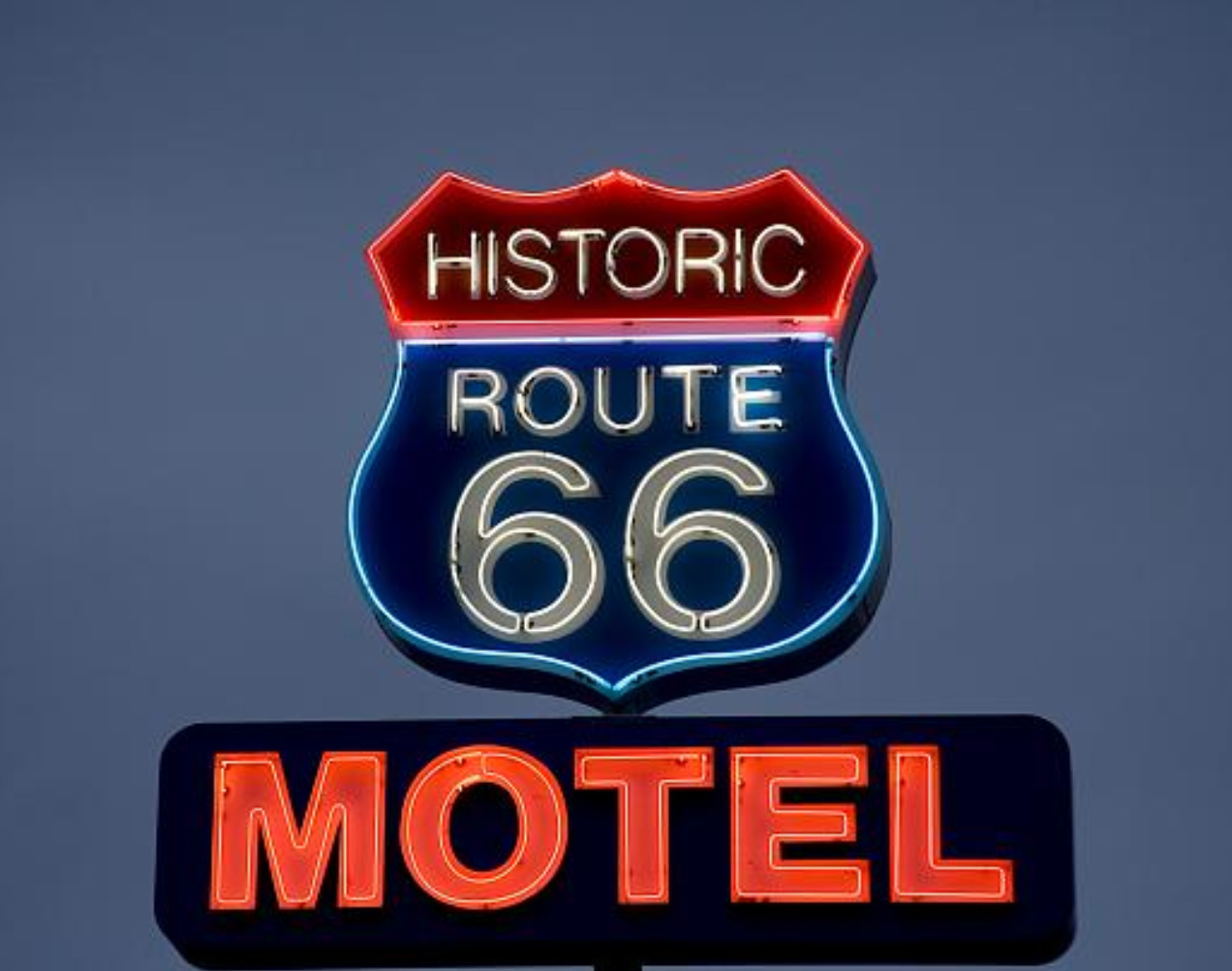
    <summary type="html"><![CDATA[<p><strong><em><span style="font-weight:400;">Route 66 is famous for its 1950s era diners and eclectic curio shops, but it was a road traveled long before it was paved and has remained iconic even after it was removed from the highway system.</span></em></strong></p><img src="https://www.intermountainhistories.org/files/fullsize/e07e210fcc5e7f610fdad382fdbd04f5.jpg" alt="Neon sign for the Historic Route 66 Motel in Seligman, Arizona." /><br/><p><span style="font-weight:400;">Route 66 revolutionized cross country travel in America. With mass auto production and transportation accessibility on the rise, the highway’s construction in 1926 was truly a product of its time. Beginning in Chicago, Illinois and ending in Santa Monica, California the new highway gave Americans a convenient way to travel west, a practice that had become increasingly popular the previous century. </span>
<span style="font-weight:400;">Route 66 was planned around several trade routes and old roads. Geographically similar paths had been used by Kiowas, Cheyennes, Comanches, and other Native peoples for centuries. In later years these paths continued to be well traversed by Euro-Americans. Many of the automobiles on the highway were occupied by migrants, but there were plenty of vacationers as well. An exciting new concept, the “road trip,” was born in the 1920s providing Americans with the opportunity to create a grand adventure of their own.</span>
<span style="font-weight:400;">As one of the original U.S. highways Route 66 was often called  “America’s Main Street” in its early days, and later, “The Mother Road,” as coined by John Steinbeck. Whole communities and businesses were established along the highway which thrived off of tourism. In the 1930s about 200,000 migrants drove cars, took trains, and even walked along Route 66, hoping for a better chance of survival and solace further west. The end goal was often California, but most of them ended up settling somewhere else along the way. America’s involvement in World War II a decade later called for the rationing of gas. This changed the demographic of highway traffic, but did not diminish it. Transportation of war supplies, military troops, and new job opportunities brought another wave of westward travelers in the mid 1940s. As the war ended, patriotism and an increased emphasis on the nuclear family led to another boom in tourism. A long drive along Route 66, a stop for dinner and photo ops, and a night or two in a roadside motel made for a relatively affordable family vacation. </span>
<span style="font-weight:400;">Beginning in 1957, Route 66 was gradually replaced by Interstate 40, whose gradual construction was mostly completed by the 1970s. Traversing similar east-west latitudes, it became the preferred route designated highway for cross country travel. Much like familiar boom-bust cycles associated with gold and other mining rushes in the West, the sudden shift of traffic away from Route 66 resulted in  an abundance of ghost towns. Now, it is the nostalgia of Route 66 and its seemingly permanent existence in the past that attracts tourists. Not everyone picked up and left town when the “rush” was over. Many of the businesses that either stayed open or have since been reopened have made a living off of nostalgia, curiosity, and the prospect of adventure. </span></p><p><em><strong><a href="https://www.intermountainhistories.org/items/show/798">For more (including 4 images) view the original article</a></strong></em></p>]]></summary>
    <published>2024-05-15T19:33:31+00:00</published>
    <updated>2026-04-17T19:32:17+00:00</updated>
    <link rel="alternate" type="text/html" href="https://www.intermountainhistories.org/items/show/798"/>
    <id>https://www.intermountainhistories.org/items/show/798</id>
    <author>
      <name>Megan Bailey, Brigham Young University</name>
    </author>
  </entry>
  <entry>
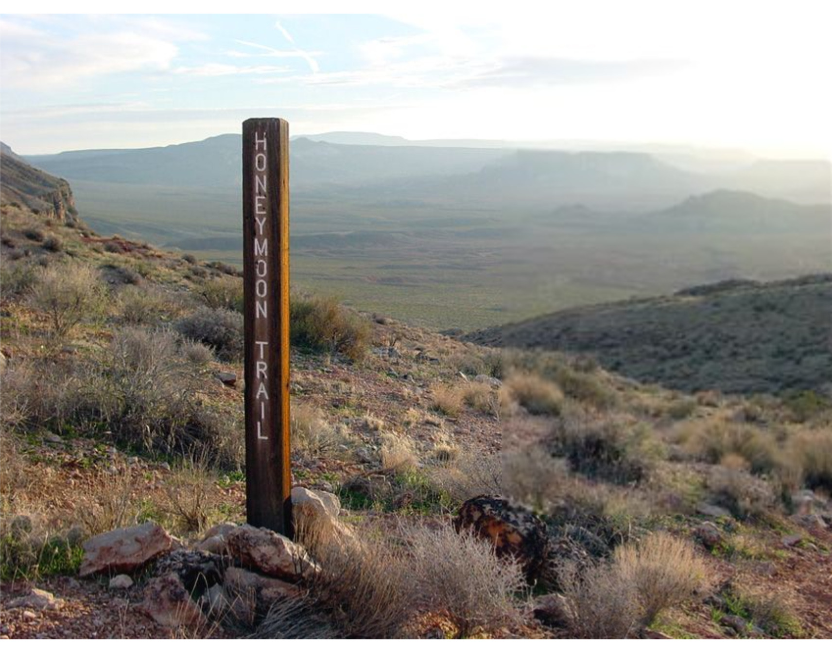
    <title type="html"><![CDATA[Honeymoon Trail]]></title>
    <summary type="html"><![CDATA[<p><strong><em>The Honeymoon Trail connected Latter-day Saint communities in Arizona to St. George and was originally known as the Mormon Wagon Road. Will C. Barnes, an American historian, coined the term Honeymoon Trail as he studied the hundreds of couples who trekked along the trail to the St. George Temple to get married. Couples continued to make the hazardous journey until 1927, when the Mesa, Arizona temple opened. </em></strong></p><img src="https://www.intermountainhistories.org/files/fullsize/b5f9fbc2448e80d9a7874c071208e8c7.jpg" alt="Honeymoon Trail" /><br/><p><span style="font-weight:400;">In 1871, leaders of the Church of Jesus Christ of Latter-Day Saints announced that a temple would be built in St. George in 1871. While this was exciting for members in southern Utah, it was also exciting to the members scattered throughout Arizona who wanted to be married for eternity in a ceremony that could only take place in a temple. After the temple in St. George was completed in 1877, couples in Arizona traveled to St. George to participate in the marriage ceremony. Depending on their starting point in northern or southern Arizona, some couples traveled over 400 miles to be married.</span>
<span style="font-weight:400;">The Honeymoon Trail was difficult to traverse under the best conditions and was sometimes made worse by the weather. Couples had no choice but to cross deep muddy washes and traverse canyons and hills. They could choose between a shorter route across mountains or avoid them by extending their journey by many miles. Although the trail did have a hazardous river crossing, most of the trail lacked adequate drinking water. It was common for oxen to die from dehydration. Some couples made the most of this loss by trading dying or dead oxen to people along the trail for other needed goods. Some couples endured snowstorms while others endured sandstorms. For instance, Joseph Fish, who undertook the trail to marry Julia Reidheid, suffered vision loss due to the sandstorms encountered on the journey. Despite their father’s challenging experience, some of Fish’s children still chose to traverse the same trail to reach the temple, fully aware of the risks they would face.</span>
<span style="font-weight:400;">The physical trail was not the only danger faced by couples. Tensions stemming from the Black Hawk War, a violent confrontation between Latter-Day Saint settlers and the Ute, Paiute, and Navajo nations from 1865 until 1872, led to ongoing confrontations. Some travelers lost horses to Indigenous raiders. However, many of the interactions between travelers and the Natives were friendly. Still, stories of past violence exaggerated the expectations of hostile interactions and caused the travelers to fear. Not only were Natives a concern, but running into strangers and outlaws also brought fear to the lawless wilderness. Danger surrounded the couples and groups who journeyed to the temple in St. George. </span>
<span style="font-weight:400;">The efforts and dedication of the Saints of Arizona were observed by Church leaders. In 1918 they announced that a temple would be built in Mesa Arizona. At the time there were only six operating temples, marking a tremendous victory for the members scattered throughout Arizona. The completion of the Mesa Temple in 1927 brought to an end the colorful history of the Honeymoon Trail.</span></p><p><em><strong><a href="https://www.intermountainhistories.org/items/show/777">For more (including 4 images) view the original article</a></strong></em></p>]]></summary>
    <published>2024-02-02T00:19:57+00:00</published>
    <updated>2026-04-17T19:32:17+00:00</updated>
    <link rel="alternate" type="text/html" href="https://www.intermountainhistories.org/items/show/777"/>
    <id>https://www.intermountainhistories.org/items/show/777</id>
    <author>
      <name>Margie Brown, Brigham Young University</name>
    </author>
  </entry>
  <entry>
    <title type="html"><![CDATA[Mount Evans Scenic Byway]]></title>
    <summary type="html"><![CDATA[<p><strong><em>Mount Evans Scenic Byway takes visitors up the highest paved road in North America while also providing an accessible method to “bag” a 14,000-foot peak.</em></strong></p><img src="https://www.intermountainhistories.org/files/fullsize/b806163671458a4258913af20f162046.jpg" alt="Evans Byway" /><br/><p><span style="font-weight:400;">On July 22, 1923, work started on the highest road in North America: the Mount Evans Scenic Byway. Today, visitors can travel its twenty-eight mile stretch one way to reach the summit of the 14,130-foot mountain. The byway begins about sixty miles west of Denver in the mining town of Idaho Springs. Along the way up, visitors pass Echo Lake, Summit Lake, and the Walter Pesman Alpine Garden, which is home to 1,700-year-old bristlecone pines. Along the road, individuals gain 7,000 feet of elevation while those starting in Denver will gain about 9,000 feet. Due to volatile winter conditions, the road is generally only open from Memorial Day to Labor Day. </span>
<span style="font-weight:400;">The first recorded summiting of Mount Evans itself was by landscape painter Albert Bierstadt in 1863. Originally, the mountain was named Mount Rosalie. After the expulsion of Governor John Evans due to the Sand Creek Massacre, the name of the mountain was changed to remember the disgraced governor. The mountain later became more accessible in 1931 when construction of the road was complete and was opened to the public. </span>
<span style="font-weight:400;">Bagging “fourteeners”—a colloquialism meaning summiting a peak 14,000 feet above sea level—is a popular sport in Colorado, and the mountains are hard to resist. Because Mount Evans Scenic Byway is so easy to access, it makes for an easy first peak. After parking at the top of the mountain, individuals only have to hike a quarter of a mile to the real summit. However, high altitude presents many dangers such as oxygen deprivation, extreme sun exposure, and sudden thunderstorms. Visitors may experience altitude sickness, which can be broken down into acute mountain sickness, high-altitude pulmonary edema, and high-altitude cerebral edema. In its less serious stage, acute mountain sickness, individuals may suffer from headaches, nausea, dizziness, and other systems. High-altitude pulmonary edema (HAPE) becomes a possible concern among 15% of healthy individuals at 14,000 feet but is still not the most dangerous form of altitude sickness. Individuals suffering from HAPE may experience confusions, serious fatigue, and coughing or chest tightness. Finally, high-altitude cerebral edema is the most dangerous form of altitude sickness and if not treated, can lead to coma and death. Its symptoms include confusion, incoordination, and even hallucinations, caused by a buildup of fluids in the brain and sometimes lungs. </span>
<span style="font-weight:400;">In order to prevent altitude sickness, individuals are advised to acclimate to altitude gradually, drink plenty of water, and travel high but sleep low. Sunscreen will also help protect individuals against the sun at 14,000 feet, where the atmosphere provides 50% less protection than visitors may be used to. Also, individuals should try to be off the mountain by the afternoon to avoid thunderstorms. All of these steps can help to prevent disaster on the mountain.</span></p><p><em><strong><a href="https://www.intermountainhistories.org/items/show/473">For more (including 4 images) view the original article</a></strong></em></p>]]></summary>
    <published>2021-09-10T09:17:57+00:00</published>
    <updated>2026-04-17T19:32:10+00:00</updated>
    <link rel="alternate" type="text/html" href="https://www.intermountainhistories.org/items/show/473"/>
    <id>https://www.intermountainhistories.org/items/show/473</id>
    <author>
      <name>Nikki Smith, Brigham Young University</name>
    </author>
  </entry>
  <entry>
    <title type="html"><![CDATA[The CCC &amp; Rim Rock Drive: Building a Road Through the Canyons]]></title>
    <summary type="html"><![CDATA[<p><strong><em>Often described as one of America’s most spectacular drives, Rim Rock Canyon takes in rugged red canyons, clear blue skies and breathtaking views. The road is a tribute to the skill, audacity and determination of the New Deal.</em></strong></p><img src="https://www.intermountainhistories.org/files/fullsize/98850de763f6e3b1582bda2985c8d85a.jpg" alt="Steep Switchbacks" /><br/><p>Rim Rock Drive is commonly regarded as one of the most beautiful roads in America. Three different New Deal agencies began construction of Rim Rock Drive: the Civilian Conservation Corps (CCC), Public Works Administration (PWA), and the Works Progress Administration (WPA). Work began on the road in 1932, but due to the extreme difficulty of the project, combined with a halt during World War Two, it took nineteen years to complete. The road stretches twenty-three miles along steep sunset-colored rocks connecting each end of Colorado National Monument. Since its completion in 1951, it has become an increasingly popular route. </p><p>Rim Rock Drive, climbing up steep canyons and tunnelling through the rock on three occasions, is the product of tireless work by the men of the CCC. The boys used dynamite to carve the tunnels, though in 1932, an avalanche caused by a dynamite explosion resulted in the death of nine construction workers. The deadly blast shows the inherent danger involved in some of the New Deal projects and the tenacity of the men who worked on them. </p><p>Today, Rim Rock Drive is regularly referred to as a must-see attraction on any American road trip. The hard work of the men involved in the project has left a legacy in the breath-taking road clinging to the twists and turns of Colorado’s scenic canyons and rugged mesas. The National Park Service describes the road as “inseparable from the monument,” demonstrating its status as an integral part of Colorado National Monument.</p><p>Many visitors today do not simply use Rim Rock Drive as a means of getting from one point to another, but choose to use the road in order to take in its spectacular views either by driving, walking, or biking along the route. Fourteen hiking trails, varying from short and flat to long and arduous, criss-cross the Colorado National Monument, making the area available to everyone. </p><p>Cycling Rim Rock drive has also become increasingly popular and there are plenty of options for cyclists of varying ability. Some choose to cycle the entirety of Rim Rock Drive and its climb of 2,300 vertical feet while others interested in off-road mountain biking take off for adjoining areas outside the park.</p><p><em><strong><a href="https://www.intermountainhistories.org/items/show/75">For more (including 3 images) view the original article</a></strong></em></p>]]></summary>
    <published>2017-06-20T04:02:31+00:00</published>
    <updated>2026-04-17T19:31:59+00:00</updated>
    <link rel="alternate" type="text/html" href="https://www.intermountainhistories.org/items/show/75"/>
    <id>https://www.intermountainhistories.org/items/show/75</id>
    <author>
      <name>Sarah Birt, Northern Arizona University and Hull University </name>
    </author>
  </entry>
</feed>