<?xml version="1.0" encoding="UTF-8"?>
<feed xmlns="http://www.w3.org/2005/Atom">
  <title type="text">Intermountain Histories</title>
  <updated>2026-04-17T19:32:17+00:00</updated>
  <generator uri="http://framework.zend.com" version="1.12.20">Zend_Feed_Writer</generator>
  <link rel="alternate" type="text/html" href="https://www.intermountainhistories.org/"/>
  <link rel="self" type="application/atom+xml" href="https://www.intermountainhistories.org/items/browse?output=rss2"/>
  <id>https://www.intermountainhistories.org/</id>
  <author>
    <name>Intermountain Histories</name>
    <uri>https://www.intermountainhistories.org</uri>
  </author>
  <link rel="hub" href="https://pubsubhubbub.appspot.com/"/>
  <entry>
    <title type="html"><![CDATA[Route 66]]></title>
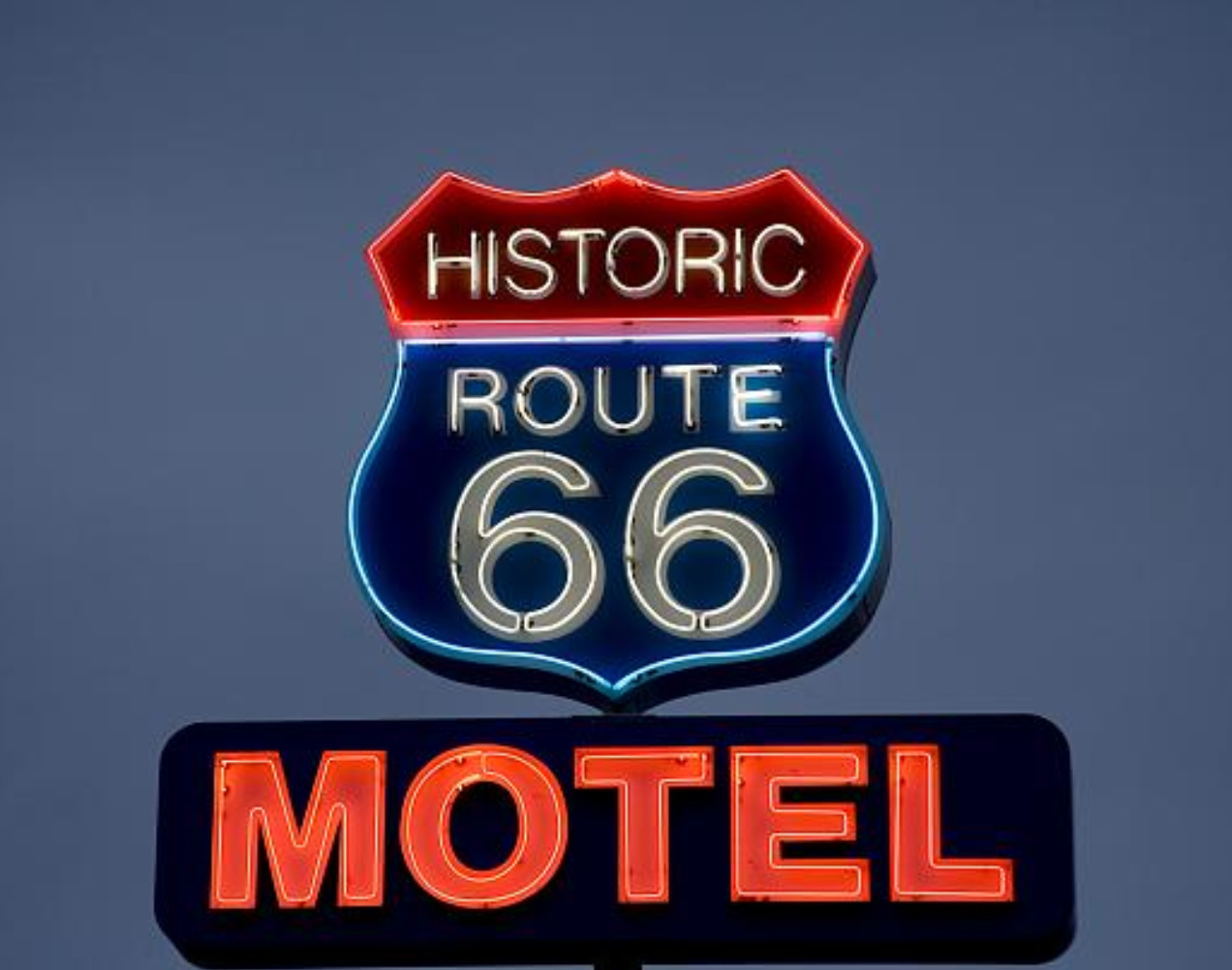
    <summary type="html"><![CDATA[<p><strong><em><span style="font-weight:400;">Route 66 is famous for its 1950s era diners and eclectic curio shops, but it was a road traveled long before it was paved and has remained iconic even after it was removed from the highway system.</span></em></strong></p><img src="https://www.intermountainhistories.org/files/fullsize/e07e210fcc5e7f610fdad382fdbd04f5.jpg" alt="Neon sign for the Historic Route 66 Motel in Seligman, Arizona." /><br/><p><span style="font-weight:400;">Route 66 revolutionized cross country travel in America. With mass auto production and transportation accessibility on the rise, the highway’s construction in 1926 was truly a product of its time. Beginning in Chicago, Illinois and ending in Santa Monica, California the new highway gave Americans a convenient way to travel west, a practice that had become increasingly popular the previous century. </span>
<span style="font-weight:400;">Route 66 was planned around several trade routes and old roads. Geographically similar paths had been used by Kiowas, Cheyennes, Comanches, and other Native peoples for centuries. In later years these paths continued to be well traversed by Euro-Americans. Many of the automobiles on the highway were occupied by migrants, but there were plenty of vacationers as well. An exciting new concept, the “road trip,” was born in the 1920s providing Americans with the opportunity to create a grand adventure of their own.</span>
<span style="font-weight:400;">As one of the original U.S. highways Route 66 was often called  “America’s Main Street” in its early days, and later, “The Mother Road,” as coined by John Steinbeck. Whole communities and businesses were established along the highway which thrived off of tourism. In the 1930s about 200,000 migrants drove cars, took trains, and even walked along Route 66, hoping for a better chance of survival and solace further west. The end goal was often California, but most of them ended up settling somewhere else along the way. America’s involvement in World War II a decade later called for the rationing of gas. This changed the demographic of highway traffic, but did not diminish it. Transportation of war supplies, military troops, and new job opportunities brought another wave of westward travelers in the mid 1940s. As the war ended, patriotism and an increased emphasis on the nuclear family led to another boom in tourism. A long drive along Route 66, a stop for dinner and photo ops, and a night or two in a roadside motel made for a relatively affordable family vacation. </span>
<span style="font-weight:400;">Beginning in 1957, Route 66 was gradually replaced by Interstate 40, whose gradual construction was mostly completed by the 1970s. Traversing similar east-west latitudes, it became the preferred route designated highway for cross country travel. Much like familiar boom-bust cycles associated with gold and other mining rushes in the West, the sudden shift of traffic away from Route 66 resulted in  an abundance of ghost towns. Now, it is the nostalgia of Route 66 and its seemingly permanent existence in the past that attracts tourists. Not everyone picked up and left town when the “rush” was over. Many of the businesses that either stayed open or have since been reopened have made a living off of nostalgia, curiosity, and the prospect of adventure. </span></p><p><em><strong><a href="https://www.intermountainhistories.org/items/show/798">For more (including 4 images) view the original article</a></strong></em></p>]]></summary>
    <published>2024-05-15T19:33:31+00:00</published>
    <updated>2026-04-17T19:32:17+00:00</updated>
    <link rel="alternate" type="text/html" href="https://www.intermountainhistories.org/items/show/798"/>
    <id>https://www.intermountainhistories.org/items/show/798</id>
    <author>
      <name>Megan Bailey, Brigham Young University</name>
    </author>
  </entry>
  <entry>
    <title type="html"><![CDATA[The CCC &amp; Capitol Reef National Monument: Creating Roads in the Wilderness]]></title>
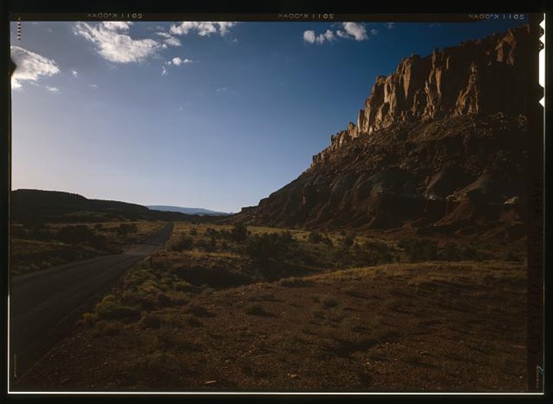
    <summary type="html"><![CDATA[<p><strong><em>At Capitol Reef National Monument, Utah, the Civilian Conservation Corps (CCC) worked tirelessly to build roads making this remote area accessible for visitors to the National Monument.</em></strong></p><img src="https://www.intermountainhistories.org/files/fullsize/8f699dd386756fc441762e509c2267b9.jpg" alt="Torrey-Boulder Road" /><br/><p>In 1937, President Franklin Roosevelt designated 37,711 acres of land in Utah as Capitol Reef National Monument. The new monument was under the jurisdiction of Zion National Park until becoming its own National Park in 1971 under President Richard Nixon. The area was also expanded to 241,000 acres, a very considerable increase in size. However, during the New Deal era of the late 1930s to early 1940s Capitol Reef was simply a small National Monument, remote, with very little infrastructure. Members of the Civilian Conservation Corps camp NM-2 (later renamed NP-6) took on the task of bringing improving infrastructure in the Monument. These men were based west of Fruita, close to Chimney Rock. </p><p>Much of what the CCC men built remains visible within Capitol Reef National Park. Two examples of this are the Fruita ranger station and a powder magazine built into the hillside. The CCC constructed the powder magazine to store the large supply of explosives they needed to quarry sandstone slabs for construction of roads, trails, and buildings within the monument. It is now listed on the National Register of Historic Places and can be seen by the many people who visit Capitol Reef. </p><p>One of the roads built by the CCC to increase access to Capitol Reef National Monument and the surrounding area was the Torrey-Boulder Road, which allowed access to the isolated town of Boulder for the first time. Except for a few scattered lodges and the small Native American population of Havasupai in the Grand Canyon, Boulder had been the last place in the United States to receive its mail by mule—as late as 1940. The road built by the CCC climbs up to 9,000 feet at points, winding its way through thick forests of Aspen and is now a part of Highway 12. The CCC built two similar roads in the area which are colloquially referred to as ‘The Million Dollar Road’ and ‘Hells Backbone Road’, names which imply their construction difficulties.</p><p><em><strong><a href="https://www.intermountainhistories.org/items/show/73">For more (including 3 images) view the original article</a></strong></em></p>]]></summary>
    <published>2017-06-12T22:55:53+00:00</published>
    <updated>2026-04-17T19:31:59+00:00</updated>
    <link rel="alternate" type="text/html" href="https://www.intermountainhistories.org/items/show/73"/>
    <id>https://www.intermountainhistories.org/items/show/73</id>
    <author>
      <name>Sarah Birt, Northern Arizona University and Hull University </name>
    </author>
  </entry>
</feed>