<?xml version="1.0" encoding="UTF-8"?>
<feed xmlns="http://www.w3.org/2005/Atom">
  <title type="text">Intermountain Histories</title>
  <updated>2026-04-17T19:32:20+00:00</updated>
  <generator uri="http://framework.zend.com" version="1.12.20">Zend_Feed_Writer</generator>
  <link rel="alternate" type="text/html" href="https://www.intermountainhistories.org/"/>
  <link rel="self" type="application/atom+xml" href="https://www.intermountainhistories.org/items/browse?output=rss2"/>
  <id>https://www.intermountainhistories.org/</id>
  <author>
    <name>Intermountain Histories</name>
    <uri>https://www.intermountainhistories.org</uri>
  </author>
  <link rel="hub" href="https://pubsubhubbub.appspot.com/"/>
  <entry>
    <title type="html"><![CDATA[Phil’s World, Cortez, CO: Follow Me, the Trails are Great]]></title>
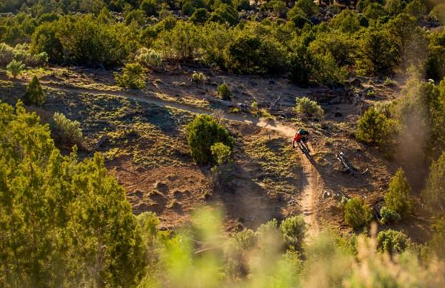
    <summary type="html"><![CDATA[<p><strong><em>Phil Vigil wanted little more than to explore. After relocating from Fairbanks, AK, to Cortez, CO, in the late 1980’s he found himself mountain biking on deer tracks and game trails across a seldom frequented patch of federal and state trust land five miles east of town. Despite his unexpected passing in 2020, his proclivity for route finding and engagement with the mountain biking community in Cortez have seen him remembered as the pioneer of one of the most renowned mountain bike trail networks on the Colorado Plateau. </em></strong></p><img src="https://www.intermountainhistories.org/files/fullsize/ef3252717c0ac23a2d1deb65ecc0bab9.jpg" alt="Mountain Biker Navigates Sweeping Right Turn, Sunset" /><br/><p>The state and federal trust land east of Cortez, CO, on which Phil’s World lies saw infrequent use into the late 1980’s with a small portion on the western half leased by a shooting range and the rest exploited or polluted through livestock grazing, firewood gathering, and illegal waste disposal. The sparse use and proximity to town did however offer enough seclusion for recent transplant Phil Vigil to trace deer tracks on his mountain bike across the undulating terrain. As the paths grew broader and more distinct, Vigil marked them with animal skulls and in-so-doing laid the groundwork for the trail system that came to bear his name.
In 1994, friends Jimbo Farley and Morgan Bell moved west from Alabama and opened Cortez’s only bike shop, Kokopelli Bike and Board. Vigil quickly became a regular. Phil’s tales of the paths near the shooting range prompted staff to nickname the area Phil’s World. Cortez local Scott Darling, then a teenager employed at the shop, was introduced to the trail system by Phil. Inspired, he and a small group of riders began to develop the network. While Phil had moved on to more remote country in the four corners region, builders like Bob Wright, Stephan Barnes, Sam Dayzie, and Shawn Gregory saw potential in the terrain and further established an engaging network unlike any other in the Southwest. Wright, Barnes, and Gregory prioritized ease, fun, and speed in their design and were advised by Dayzie, an indigenous amateur archaeologist, of conflicts in route finding with remnants of Ancestral Puebloan sites.
In the late 1990’s electricity supplier Tri-State Generation expressed interest in developing the land for coal production. While Tri-State pursued extractive access, the shooting range expanded its lease in October of 2003. Safety concerns citing repeated conflict between cyclists and target shooters and a lack of legal authority to build and maintain trail on the land placed Phil’s World in jeopardy. Advocacy groups Kokopelli Bike Club (now Southwest Colorado Cycling Association) and Greater Dolores Action filed a motion to lease 500 acres of state trust land and use adjacent Bureau of Land Management holdings to avoid conflict with gun enthusiasts with dual-members of the bike club and Four Corners Rifle and Pistol Club acting as mediating liaisons. By 2005, Tri-State Generation had shifted interest and the lease and funding for Phil’s World had been secured, mountain bikers were formally guaranteed land and resources.
To maintain the feeling of solitude for riders in the spirit of Phil’s original design, organizers established a directional loop system to minimize rider interaction and traffic. The clever layout, fast and fun trail building approach, and nearness to Cortez distinguished Phil’s as a prototype of the BLM’s Backyard to Backcountry project. The network’s revenue generating ability for Cortez and nearby Dolores, accessibility for all ability levels, and protection of sensitive resources made it a valuable asset to the BLM and encouraging example in cooperative land management for other Plateau communities.</p><p><em><strong><a href="https://www.intermountainhistories.org/items/show/907">For more (including 4 images) view the original article</a></strong></em></p>]]></summary>
    <published>2025-09-23T15:36:56+00:00</published>
    <updated>2026-04-17T19:32:20+00:00</updated>
    <link rel="alternate" type="text/html" href="https://www.intermountainhistories.org/items/show/907"/>
    <id>https://www.intermountainhistories.org/items/show/907</id>
    <author>
      <name>Nicholas Nation, Northern Arizona University </name>
    </author>
  </entry>
  <entry>
    <title type="html"><![CDATA[MEDL, Flagstaff, AZ: The People Want Trails]]></title>
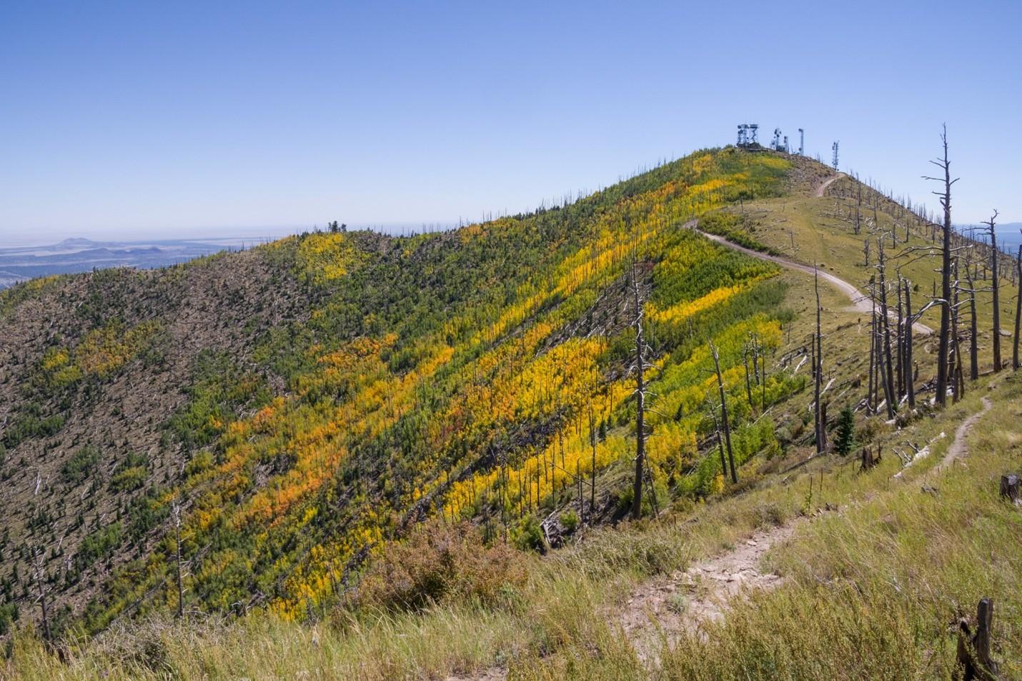
    <summary type="html"><![CDATA[<p><strong><em>The Mount Elden Dry Lake Hills trail system north of Flagstaff, AZ, traces its legacy of use closely with the history of the city. Dedicated in 1987, the network has steadily grown through community initiatives in cooperation with the Forest Service in Coconino National Forest to over 100 miles of trail. The proximity to town and rugged terrain give the illusion of a backcountry experience in an accessible frontcountry setting while the repurposing of game trails, sheepherding trails, fire breaks, and transportation lines maintains a connection to Flagstaff’s past.</em></strong></p><img src="https://www.intermountainhistories.org/files/fullsize/48b5ffa5c2b75a1821ff98ce917ee2a7.jpg" alt="Sunset Trail No. 23, Mount Elden" /><br/><p>As mountain biking developed around Marin County, CA, from the outfitting of WWII era “balloon tire” bikes with knobby tires and better brakes to more specialized equipment, two-wheeled recreation also began to take hold in the mountains and forests near Flagstaff, AZ. A local motorcycle club, the Coconino Motorcycle Trail Riders, connected remnants of the original Schultz Pass Road into a unified trail running up Schultz Creek in the 1970’s. When bicycle manufacturers began bringing bespoke mountain bikes to the market in the early 1980’s, Flagstaff’s existing cycling culture made for a quick uptake of the new machines. Mechanic Steve Garro of local shop Cosmic Cycles and the counterculture mountain bike racing team The Mutants joined other hobbyists to set about exploring the higher elevations accessible by Schultz Pass and Elden Lookout roads.
A series of disused wagon routes from the early 1900’s, old communications lines servicing the first lookout towers, fire breaks from the 1977 Radio Fire, and the plethora of livestock and game trails on the slopes were connected to unify the upper elevations of Mount Elden with the lower Dry Lake Hills to the west. As the trail network grew and diversified, so did the user base and rate of conflict. Many trails were closed to mountain bike access after unfavorable interactions with hikers and equestrians. After the forest service officially dedicated the Mount Elden Dry Lake Hills trail system in 1987, local advocacy groups successfully lobbied to restore mountain bike access and employed a code of conduct wherein cyclists were to yield to hikers or equestrians. 
As mountain bikes modernized into the 2000’s and usage expanded, MEDL supervisors recognized that mitigation of environmental damage induced by increased traffic was necessary. In 2006, the Flagstaff Bicycle Organization began advocating for directional downhill trails in the MEDL network to minimize hiker-biker interactions. Following the Schultz Fire in 2010, the forest service advanced a comprehensive trail planning scheme accounting for fire risk, endangered species protection, reduced user conflict, and local quality of life improvement. The proposed MEDL trail plan specifically focused on environmental protection and improved recreational access for residents over tourism.
Though delayed by thoughtful debate with groups like the Sierra Club, and the Museum Fire in 2019 that burned existing paths and planned expansion, the realignment of several traverses on erosive slopes in 2020 proved the venture worthwhile. The subsequent effort between the forest service and volunteer mountain bike, trail running, and motorcycle groups to professionally mark and build sustainable routes across the MEDL network garnered community support. The ongoing project has improved or created over twenty-five miles of trail since 2022 including the first sanctioned, directional mountain bike trails in Flagstaff – called Meteoride and Full Sail. The city’s assets in the sciences and passionate volunteer advocacy groups have allowed for thorough planning in current and future trail building that is as mindful of the protection of the mountain’s fragile ecology as it is of the improved quality of life that outdoor recreation can bring the community.  </p><p><em><strong><a href="https://www.intermountainhistories.org/items/show/906">For more (including 4 images) view the original article</a></strong></em></p>]]></summary>
    <published>2025-09-23T15:36:55+00:00</published>
    <updated>2026-04-17T19:32:20+00:00</updated>
    <link rel="alternate" type="text/html" href="https://www.intermountainhistories.org/items/show/906"/>
    <id>https://www.intermountainhistories.org/items/show/906</id>
    <author>
      <name>Nicholas Nation, Northern Arizona University </name>
    </author>
  </entry>
  <entry>
    <title type="html"><![CDATA[Kokopelli’s Trail, Loma, CO: In Pursuit of Solitude]]></title>
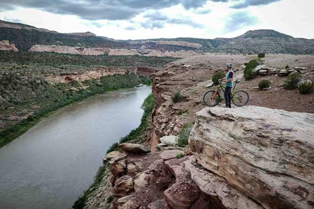
    <summary type="html"><![CDATA[<p><strong><em>Stretching 142 miles between Loma, CO, and Moab, UT, Kokopelli’s Trail is one of the earliest publicized examples of a backcountry mountain biking route. The unification of Kokopelli’s in 1989 by the Colorado Plateau Mountain Bike Trail Association helped popularize a new brand of distance cycling – bikepacking - and inadvertently made the American Southwest one of the best-known bikepacking destinations in the world. </em></strong></p><img src="https://www.intermountainhistories.org/files/fullsize/ec7c7c9ba0710082ba17aaf9f08f0443.jpg" alt="View of Kokopelli Trail Grand Junction" /><br/><p>When mountain bikes became commercially available in the early 1980’s, wealthy baby boomers from coastal California began to explore the west on their new machines enticed by the vast landscapes and inexpensive accommodation. Moabites recognized the economic opportunity afforded by mountain bike tourism and by the late 1980’s Moab, UT, had become a premier cycling destination. While the highly publicized Slickrock Trail was leveraged to draw visitors in, the vast network of 4x4 roads surrounding the town, relics of a defunct uranium industry, began to see increased use among cyclists. Nearby Grand Junction, CO, was experiencing similar backcountry traffic in the late 1980’s. Grand Junction Bureau of Land Management officials observed illegal mountain bike use in the Black Ridges Wilderness Study Area threatening to undermine ecological research. BLM area manager John Singlaub sought to protect the wilderness without alienating cyclists and proposed BLM recreation planner Carlos Sauvage build a cycling route on non-wilderness lands along the Colorado River. Lacking funding, the BLM turned to mountain biker and Grand Junction lawyer Timms Fowler to help plan and coordinate the effort. Long dreaming of a unified route across the remote region, Fowler jumped at the opportunity to aid in the construction.
Beginning in November of 1988, Sauvage and other BLM personnel began driving and mapping the dozens of dirt roads abandoned by the uranium industry between the route’s planned start point in Loma, CO, and terminus in Moab, UT. Meanwhile, Fowler set up meetings with bike shops in Grand Junction and Moab to secure volunteer support for the project. After identifying a course on 4wd tracks, BLM workers planned ten additional miles of singletrack trail to access scenic vistas and ensure an engaging riding experience. A volunteer building effort commenced in the spring of 1989 under the newly formed Colorado Plateau Mountain Bike Trail Association and after six weekends of construction, the 142 mile long Kokopelli’s Trail was completed. On May 6<sup>th</sup>, 1989, the Hopi Flute Clan for whom the trail was named held a ceremony under elder Ebin Leslie in Cisco, UT, the halfway point, to officially open Kokopelli’s to the public.  
Kokopelli’s quickly generated interest among mountain bikers. The high level of community engagement guaranteed considerable public awareness of the project and increased ridership. Proximity to major throughfares like Interstate 70 and Highway 191 made for easy access to the trail. The federal officiating in route creation and surveying resulted in an abundance of maps and backcountry planning resources for prospective users. The trail’s position on BLM land made it popular among bikepackers, backcountry cyclists who pursue multi-day, self-supported rides, because of the relaxed camping regulations imposed on remote public lands. The vastness of the landscape Kokopelli’s Trail traverses and the solitude afforded by its 142 miles in length made for an experience difficult to capture elsewhere and secured the Southwest as a stronghold for backcountry mountain biking.</p><p><em><strong><a href="https://www.intermountainhistories.org/items/show/905">For more (including 3 images) view the original article</a></strong></em></p>]]></summary>
    <published>2025-09-23T15:36:54+00:00</published>
    <updated>2026-04-17T19:32:20+00:00</updated>
    <link rel="alternate" type="text/html" href="https://www.intermountainhistories.org/items/show/905"/>
    <id>https://www.intermountainhistories.org/items/show/905</id>
    <author>
      <name>Nicholas Nation, Northern Arizona University </name>
    </author>
  </entry>
  <entry>
    <title type="html"><![CDATA[Gooseberry Mesa National Recreation Trail, Hurricane, UT: We Can Ride Too]]></title>
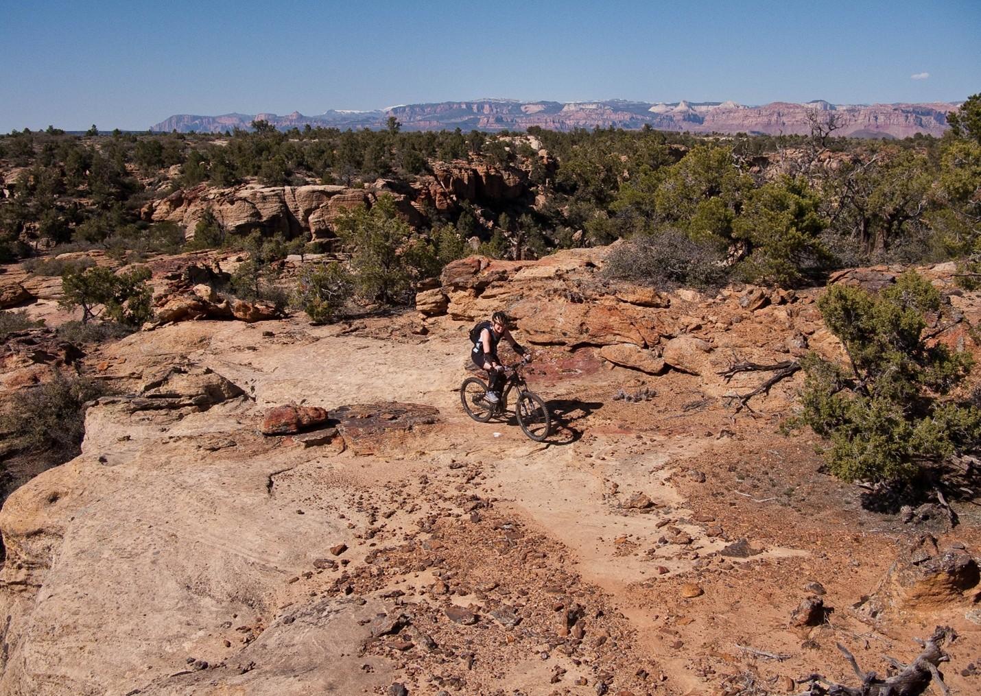
    <summary type="html"><![CDATA[<p><strong><em>After Mike and Morgan Harris started building the trail system now called Gooseberry Mesa National Recreation Trail in the early 1990’s, they had no idea it would become such a significant attraction to the mountain biking community. Situated eight and a half miles from Hurricane, Utah, and twenty miles southwest of Zion National Park, “The Goose” as it’s affectionately known is one of the most scenic riding centers on the Colorado Plateau.  </em></strong></p><img src="https://www.intermountainhistories.org/files/fullsize/7071445632eb7a04a4404768333d12d1.jpg" alt="Harris Secret Trail" /><br/><p>When Mike and Morgan Harris relocated to Hurricane, UT, in the early 1960’s, Gooseberry Mesa was a seldom frequented parcel allocated to the Bureau of Land Management that remained unused on account of the tight, maze-like topography. The water holding capacity of the rock that caps the mesa, Shinarump conglomerate, enables an ecology with pockets of lush vegetation frequented by game populations. The Harris’ early exploration of the mesa was as a hunting ground. Their use of motorcycles and frequent hikes through the formation gave them an intimate knowledge of the landscape and route-finding abilities that others lacked.
While the Harris’s were hunting the mesa, mountain biking had slowly been moving into the rural West. The fledgling sport originated in the late 1960’s in Marin County, CA, when a group of teens started riding single-speed “balloon tire” bikes up and down Mt. Tamalpais. After noticing cycling clubs optimizing old bikes for offroad races in the 1970’s, major manufacturers developed consumer market bicycles for the harsher settings mountain bikers were riding in the early 1980’s. Enticed by the new trend and cheap, rural accommodation, wealthy baby-boomers bought in and began to explore the Colorado Plateau. Moab’s Slickrock Trail came to be the pinnacle mountain biking destination in the late 1980’s and after a visit in 1993, Mike and Morgan realized their secluded hunting ground would be an ideal venue to develop deliberate mountain bike paths.
Upon returning from Moab, the Harris’ scouted and marked a primitive trail network across the twenty-four square miles of Gooseberry Mesa. Their approach attempted to fully immerse riders in the terrain by utilizing the entirety of the landscape. Though both were inexperienced riders and still honing their skills, their recognition that mountain biking equipment was consistently improving lead them to pursue increasingly challenging obstacles. They offered the spectacular scenery afforded by the mesa’s 2000 feet of prominence over the badlands below as a reward for each completed section. While their Gooseberry trails lacked the elevation gain and loss of Slickrock in Moab, they engaged mountain bikers by keeping difficult trail features like near vertical ascents and descents hidden around corners or behind foliage affording little time to prepare for each challenge. The construction style they helped popularize made riding acumen more important than quality of gear earning popularity among hobbyists and professionals alike.
After hearing that other builders were fined for similar unsanctioned work, the brothers turned themselves in to the BLM and facilitated a visit with federal officials to the mesa. To their surprise, BLM personnel were so impressed with the work that measures were taken to officially adopt the tracks resulting in their designation as the first official mountain biking trails in Washington County, Utah, on October 26<sup>th</sup>, 1999. Seven years later in 2006 the routes were upgraded to National Recreation Trail status by the BLM, an accolade that demonstrates a commitment to continued use, sustainable environmental practice, and an anticipated increase in tourism for the surrounding communities.</p><p><em><strong><a href="https://www.intermountainhistories.org/items/show/904">For more (including 3 images) view the original article</a></strong></em></p>]]></summary>
    <published>2025-09-23T15:36:54+00:00</published>
    <updated>2026-04-17T19:32:20+00:00</updated>
    <link rel="alternate" type="text/html" href="https://www.intermountainhistories.org/items/show/904"/>
    <id>https://www.intermountainhistories.org/items/show/904</id>
    <author>
      <name>Nicholas Nation, Northern Arizona University </name>
    </author>
  </entry>
</feed>