<?xml version="1.0" encoding="UTF-8"?>
<feed xmlns="http://www.w3.org/2005/Atom">
  <title type="text">Intermountain Histories</title>
  <updated>2026-04-17T19:32:19+00:00</updated>
  <generator uri="http://framework.zend.com" version="1.12.20">Zend_Feed_Writer</generator>
  <link rel="alternate" type="text/html" href="https://www.intermountainhistories.org/"/>
  <link rel="self" type="application/atom+xml" href="https://www.intermountainhistories.org/items/browse?output=rss2"/>
  <id>https://www.intermountainhistories.org/</id>
  <author>
    <name>Intermountain Histories</name>
    <uri>https://www.intermountainhistories.org</uri>
  </author>
  <link rel="hub" href="https://pubsubhubbub.appspot.com/"/>
  <entry>
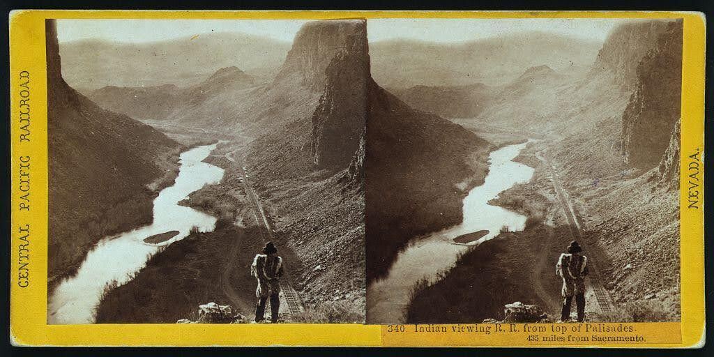
    <title type="html"><![CDATA[The Humboldt River and the Inevitable Railroad]]></title>
    <summary type="html"><![CDATA[<p><strong><em>Alfred A. Hart’s photo neatly captures the relationship that the United States had with Indigenous nations in the 19th century: persistent encroachment on and abuse of Native land. </em></strong></p><img src="https://www.intermountainhistories.org/files/fullsize/68061ca83529f9dba3c1da8a26419a79.jpg" alt="“Indian viewing railroad from top of Palisades. 435 miles from Sacramento.” " /><br/><p>Winding through the arid region of modern-day north central Nevada, the Humboldt River provided resources to support communities of a few hundred people. Punodungahnivain, or “Place where the house is” in Western Shoshone, was an area at the mouth of the South Fork River, between modern-day Carlin, Elko, and South Fork, that was home to Western Shoshone. </p><p>Water—and therefore the river—is sacred for the Western Shoshone, or “Newe” meaning “The People.” The Humboldt represents an important thoroughfare in ancient and modern trade routes, connecting goods from the Pacific with those in the Great Basin and western Rocky Mountains. The fertile river enabled Indigenous communities to thrive between modern-day Carlin and Elko. Roots and berries grew along the river, attracting birds and animals, and pine nut resources grew in the nearby Ruby mountains. The Shoshones hunted waterfowl, antelope, trout, gopher, rabbit, and beaver. </p><p>Trappers such as Peter Skene Ogden from the Hudson’s Bay Company arrived in the Humboldt region in the 1820s. They trapped as many beavers as possible in order to make it unprofitable for their competition, nearly wiping out the beaver population for a generation. After the discovery of gold at Sutter’s Mill in 1848, miners and settlers traveled along the Humboldt by the tens of thousands, negatively impacting the environment, depleting finite resources, and disrupting Indigenous lifeways. The California Trail transected Western Shoshone Territory throughout the 1840s through 1860s. Then, in the 1860s, the Central Pacific Railroad began building their Railroad from Sacramento, California, westward towards Utah Territory to join with the Union Pacific at Promontory Summit on May 10, 1869. </p><p>By the time CPRR worker Alfred A. Hart took the photo below, dated between 1865 and 1869, natural resources had already been depleted all along the Humboldt. Hart took hundreds of photographs as he traveled with the company, and many of them feature Shoshones. The completion of the railroad brought even more people west, who settled near the tracks in order to benefit from future commerce. These newcomers claimed the most fertile places for themselves and divided up ancestral Shoshone and Paiute lands. </p><p><em><strong><a href="https://www.intermountainhistories.org/items/show/851">For more (including 3 images) view the original article</a></strong></em></p>]]></summary>
    <published>2024-09-25T01:12:50+00:00</published>
    <updated>2026-04-17T19:32:19+00:00</updated>
    <link rel="alternate" type="text/html" href="https://www.intermountainhistories.org/items/show/851"/>
    <id>https://www.intermountainhistories.org/items/show/851</id>
    <author>
      <name>Ella Henricksen, Brigham Young University</name>
    </author>
  </entry>
  <entry>
    <title type="html"><![CDATA[George Edward Anderson Photographs]]></title>
    <summary type="html"><![CDATA[<p><strong><em><span style="font-weight:400;">George Edward Anderson is known for pioneering early 20</span><span style="font-weight:400;">th</span><span style="font-weight:400;"> century photography in Utah. His collection shows what was important to Utahns, particularly to members of the Church of Jesus Christ of Latter Day Saints.</span></em></strong></p><img src="https://www.intermountainhistories.org/files/fullsize/718d4ca9986add3c0b25a832b99c478b.jpg" alt="George Edward Anderson" /><br/><p><span style="font-weight:400;">George Edward Anderson was born on October 28, 1860 to parents George Anderson and </span><span style="font-weight:400;">Mary Ann Anderson in Salt Lake City. He was raised a member of the Church of Jesus Christ of Latter Day Saints. As a boy he was apprenticed to Charles R. Savage, a pioneer in photography in Utah, and set up his own studio at the age of 17. In 1886, he established the <em>Temple Bazar </em>studio in Manti, and in 1888 moved it to Springville to the southwest corner of Main and 3rd South Streets. He also operated traveling tent studios.</p><span style="font-weight:400;">Early in his career he took many studio photographs of prominent and everyday Utahns. Later he began to travel and take photographs of significant historical LDS sites. However, his travels took a toll on his relationship with his wife, Olive Lowry Anderson, so he remained home for a period. However his church commissioned him to document new temple dedications in photography. Before going to what would be his last photo shoot, his wife urged him to stay home. He ignored her warning, traveling to the Mesa Arizona Temple dedication. Shortly after the ceremony, he suffered heart failure and died on May 9, 1928 after being transported home. In his obituary the Salt Lake Telegram recounted his accomplishments in photography: “he established a studio at Springville and also had studios at Spanish Fork and Manti... He devoted considerable time to a collection of L.D.S. church historical pictures.”</span>
<span style="font-weight:400;">After Anderson’s death, his collection of photographs changed hands many times. The significance of his images were apparent to many different groups, particularly the Church of Jesus Christ of Latter-Day Saints. A group of LDS seminary teachers in Provo bought Anderson’s collection from his wife in 1928, the year he died. Later Church Historians became aware of the collection and bought it from the seminary teachers. Representatives of the Church of Jesus Christ of Latter Day Saints worked to gather all of the negatives from Anderson’s collection and brought all of his photographs into one collection. After digitizing these negatives, the Church destroyed all but 444 of the glass negatives from the collection. Finally, the collection found a home in the L. Tom Perry Special Collections at Brigham Young University.</span></p><p><em><strong><a href="https://www.intermountainhistories.org/items/show/776">For more (including 6 images) view the original article</a></strong></em></p>]]></summary>
    <published>2024-01-25T05:07:20+00:00</published>
    <updated>2026-04-17T19:32:17+00:00</updated>
    <link rel="alternate" type="text/html" href="https://www.intermountainhistories.org/items/show/776"/>
    <id>https://www.intermountainhistories.org/items/show/776</id>
    <author>
      <name>Starrla Kay Pearson, Brigham Young University</name>
    </author>
  </entry>
  <entry>
    <title type="html"><![CDATA[Dave Tatsuno: Film at Topaz Internment Camp]]></title>
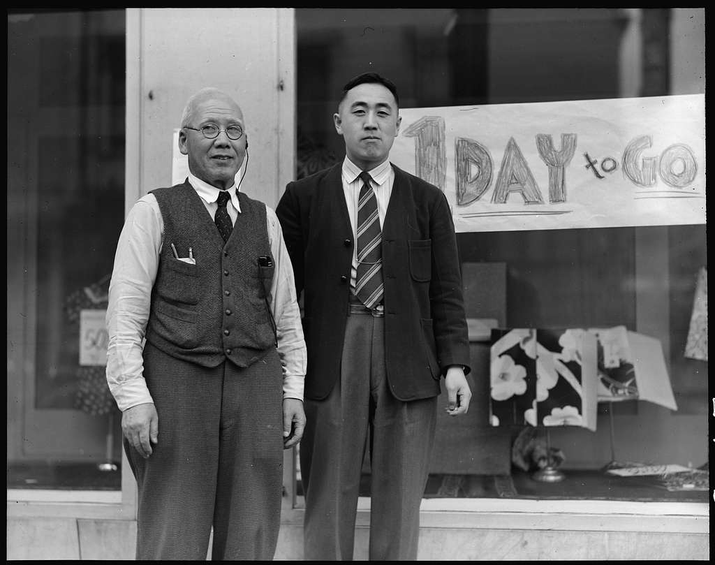
    <summary type="html"><![CDATA[<p><strong><em><span style="font-weight:400;">Dave Tatsuno was one of 11,000 Japanese and Japanese-Americans that were held in Topaz Internment Camp in Delta, Utah. His experience was unique in that he recorded some of his family’s experiences through a motion picture camera that he smuggled into camp. While never intended to be a documentary, his compiled film has since been added to the Library of Congress and further brings to light the conditions experienced by the Japanese in Topaz. </span></em></strong></p><img src="https://www.intermountainhistories.org/files/fullsize/152ee8719f930d9151064c1c1657e3d6.jpg" alt="Dave Tatsuno and his father, merchants of Japanese ancestry in San Francisco prior to evacuation " /><br/><p><span style="font-weight:400;">Born Masaharu Tatsuno in Japan in 1913, Tatsuno immigrated to the United States with his parents when he was only a few months old. Upon arrival in the Bay Area, and due to a clerical error that not even his family understands, he was given a U.S. birth certificate. At a young age, his mother abandoned his family and returned to Japan, leading him to become heavily involved in the YMCA. He decided to adopt the name “Dave” while in junior high. He married Alice Okada in 1938, and their first son, Sheldon, was born in 1940. Amateur filmmaking became a passionate hobby of his after the death of a close friend, when he realized that film had the potential to metaphorically “bring someone back to life.” </span>
<span style="font-weight:400;">Due to the Japanese attack on Pearl Harbor in 1941 (in addition to other Japanese imperialist activities) and racist attitudes towards the Japanese, President Franklin D. Roosevelt issued Executive Order 9066 in February 1942. This order divided the West Coast into military zones and gave the army authority to relocate civilians further inland. The Japanese were the main group affected by the order. Prior to evacuation and internment, Tatsuno helped his father, Shojiro, operate a dry goods store in the Bay area called “Nichi Bei Bussan.” In order to prepare to move, “Nichi Bei Bussan” had an evacuation day sale, where they were forced to sell their goods at incredibly low prices in order to get rid of inventory quickly. </span>
<span style="font-weight:400;">Tatsuno and his family were first held at Tanforan Racetrack and later relocated to Topaz in 1942. Tatsuno, who was familiar with running a business, became one of the managers of the co-op store in camp. While working, he met Walter Honderick, a War Relocation Authority official who owned a camera himself. Honderick encouraged Tatsuno to send for his camera under Honderick’s name. Tatsuno, while on a trip for supplies for the co-op, purchased film for the camera in Chicago. With camera and film, Tatsuno was able to participate in his old hobby again.</span>
<span style="font-weight:400;">In interviews, Tatsuno was adamant that his film in Topaz was never meant to be a documentary. Its focus was specifically on his family and friends. Despite that, the film does contain significant and telling scenes. One scene depicts several Japanese men digging a trench outside one of the barracks. Tatsuno’s narration (which was added to the film much later) relates that the men were repairing a broken pipe. This scene depicts the labor that the Japanese were expected to contribute in order to keep the camp running. Another scene, perhaps one of the most significant, shows Tatsuno’s brother, Masateru (or “Tut”) visiting the camp as an American soldier on his way to Germany. In later interviews, Tatsuno described that he found great irony and injustice in the fact that his brother, especially with his position as a U.S. soldier, had to visit his family behind barbed wire. </span>
<span style="font-weight:400;">Tatsuno and his family returned to the Bay Area in 1945, where they reopened “Nichi Bei Bussan” and sought to help other Japanese returning from internment camps transition back to everyday life. Tatsuno continued to serve as part of the Japanese American Citizens League (JACL) and the YMCA throughout the rest of his life. His film </span><i><span style="font-weight:400;">Topaz</span></i><span style="font-weight:400;"> was added to the Library of Congress in 1996. Tatsuno passed away in 2006, but his legacy of recording his experience at Topaz remains. </span></p><p><em><strong><a href="https://www.intermountainhistories.org/items/show/775">For more (including 3 images) view the original article</a></strong></em></p>]]></summary>
    <published>2024-01-23T05:03:04+00:00</published>
    <updated>2026-04-17T19:32:17+00:00</updated>
    <link rel="alternate" type="text/html" href="https://www.intermountainhistories.org/items/show/775"/>
    <id>https://www.intermountainhistories.org/items/show/775</id>
    <author>
      <name>Sara Davis, Brigham Young University</name>
    </author>
  </entry>
  <entry>
    <title type="html"><![CDATA[Kodachrome Basin and the Power of Photography]]></title>
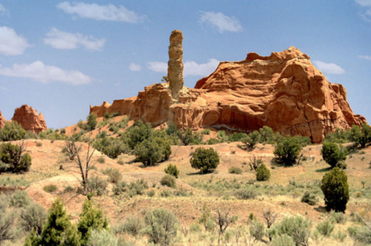
    <summary type="html"><![CDATA[<p><strong><em>Kodak released its first roll of colored film in 1936 called “Kodachrome.” This film became famous for its new method of producing color in still photography. Its use became widespread among National Geographic photographers, eventually leading to global awareness of the beauty of Southern Utah’s rust colored landscape. </p></strong></p><img src="https://www.intermountainhistories.org/files/fullsize/ef773cd98552f15f18157825eb6cc132.jpg" alt="My Beautiful Picture" /><br/><p><span style="font-weight:400;">In 1948, a group of National Geographic photographers, led by Jack Breed, set out to explore the Southern Utah terrain. Using trails only having ever been passed in modern times by a handful of cattle ranchers, Breed and his crew found a landscape that was relatively untouched. Traveling by car and hiking into more rugged regions, the National Geographic explorers found the contrasting colors of the land to be enchanting. The explorers nicknamed the area “Kodachrome Flat” after the film used to capture the rust colored canyons. Photos taken of the area were later published in a 1949 edition of National Geographic magazine, which had 60 million readers. </span>
<span style="font-weight:400;">Members of the Church of Jesus Christ of Latter-Day Saints who lived in the region were highlighted in the article as well as the landscape. Dressed in pioneer clothing, Breed photographed them recreating a traditional Latter-Day Saint dance in the Kodachrome area, perhaps using the peculiarity to catch readers’ attention. Before the photos were published in the magazine, they were shown to local members of the Lions Club at the Cameron Hotel in Panguitch. Crew member Burnett Hendryx spoke of the National Geographic team’s adventures in the desert. The invitation to view Hendryx’s photos was then extended to the general public who marveled at the color photographs.. This expedition was of great interest to the local residents of Garfield County, not only for the excitement the National Geographic visit sparked in local newspapers, but also because the highly publicized article brought tourists to the county, boosting its isolated economy. </span>
<span style="font-weight:400;">Although originally named Chimney Rock State Park due to copyright issues, the area today is officially known as Kodachrome Basin State Park. It sits in a quiet location between Bryce Canyon and Escalante National Park and is home to a plethora of campsites and hiking trails. It continues to be a tourist site, especially popular among foreigners. The park hosted a total of 179,121 visitors in 2022 and its popularity continues to grow. </span></p><p><em><strong><a href="https://www.intermountainhistories.org/items/show/772">For more (including 3 images) view the original article</a></strong></em></p>]]></summary>
    <published>2024-01-21T22:08:05+00:00</published>
    <updated>2026-04-17T19:32:17+00:00</updated>
    <link rel="alternate" type="text/html" href="https://www.intermountainhistories.org/items/show/772"/>
    <id>https://www.intermountainhistories.org/items/show/772</id>
    <author>
      <name>Jane Carlson, Brigham Young University</name>
    </author>
  </entry>
  <entry>
    <title type="html"><![CDATA[William Henry Jackson’s Hot Spring and Castle Geyser]]></title>
    <summary type="html"><![CDATA[<p><strong><em>Providing the earliest photographs of Yellowstone as he participated in the Hayden Geological Survey, William Henry Jackson was influential in creating America’s first National Park. Hayden, the leader of the survey, remarked that “collecting photographs was similar to collecting fossils and natural history specimens,” a convincing way to influence the United States government to protect these specimens found in Yellowstone. One of Jackson’s best photographs is Hot Springs and Castle Geyser. Castle Geyser is located in the Upper Basin of Yellowstone National Park, near Old Faithful Geyser. </em></strong></p><img src="https://www.intermountainhistories.org/files/fullsize/9452e04037751e30e91a3fc86069e9fb.jpg" alt="Hot Springs and Castle Geyser (color)" /><br/><p>As a member of the Hayden Geographical Survey in 1871, William Henry Jackson was the first photographer in Yellowstone. His photographs informed the government of the landscape and geological sites in Yellowstone, and provided artists on the survey like Thomas Moran with references to the sites so they could complete their works after the survey in their studios. Moran credits the accuracy of his paintings to Jackson’s photographs. Jackson’s photographs were also important to the creation of Yellowstone National Park. “As an intelligent, ambitious, and gifted individual working in a medium of great influence, Jackson became a powerful progenitor of the changes in the American conception of the West and of landscape in general,” writes the historian Peter Bacon Hales.</p><p>William Henry Jackson wrote, “Pictures were essential to the fulfillment of the doctor's plan for publicizing this Survey; but the basic purpose was always exploration. I cannot be too careful in emphasizing the fact that in this [the 1871 expedition] and all the following expeditions I was seldom more than a sideshow in a great circus.” Perhaps humble, perhaps realistic, Jackson saw himself as a small part to a greater whole, yet his photographs have been cited again and again by participants in the survey, as well as historians today, as highly influential in the creation of Yellowstone National Park.</p><p>Hot Spring and Castle Geyser provides an excellent example of his work. Since much of Europe and the eastern United States do not have geysers as a part of their geological makeup, Hot Spring and Castle Geyser documented a unique aspect of Yellowstone. In fact, Yellowstone has the largest concentrated number of geysers in the world. Castle Geyser may be the oldest geyser in Yellowstone, and although its eruption schedule may not be as predictable as Old Faithful Geyser, Castle Geyser erupts about every 10–12 hours a day. Jackson’s photograph Hot Spring and Castle Geyser was the first photograph that shared geysers with a wide audience.</p><p><em><strong><a href="https://www.intermountainhistories.org/items/show/161">For more (including 5 images) view the original article</a></strong></em></p>]]></summary>
    <published>2018-05-07T22:34:56+00:00</published>
    <updated>2026-04-17T19:32:01+00:00</updated>
    <link rel="alternate" type="text/html" href="https://www.intermountainhistories.org/items/show/161"/>
    <id>https://www.intermountainhistories.org/items/show/161</id>
    <author>
      <name>Emma Tolman, Brigham Young University</name>
    </author>
  </entry>
  <entry>
    <title type="html"><![CDATA[The 1911 Kolb Expedition through the Gates of Lodore: Part 1 of 5 of the 1911 Kolb Expedition Tour]]></title>
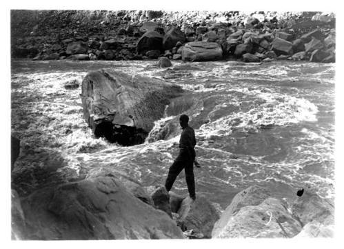
    <summary type="html"><![CDATA[<p><strong><em>A description of the Kolb Brothers’ experience river-running the Green River through Lodore Canyon in late September, 1911.</em></strong></p><img src="https://www.intermountainhistories.org/files/fullsize/98349df75c8b2578410ce6bfc853a5b0.jpg" alt="The Edith" /><br/><p>In Lodore Canyon Emery and Ellsworth Kolb quickly learned that a wild river made for a perilous journey. The Green River in this section is noted for its narrow channel, abundant boulders, and difficult rapids. Dropping 420 feet in twelve miles, the hydrologic forces funneled through this cut in the Uintah mountains are immense, measured at 9,000 cubic feet per second. At any moment, their wooden boats, laden heavy with supplies, were subjected to a force comparable to releasing five Olympic-sized swimming pools into a typical bedroom. Not only did several hundred rolls of motion picture film add weight, they were a logistical nightmare as they had to be kept secure and dry. The brothers hoped this added burden would pay out in years to come with a motion picture and photography show covering their exploits. The cold and rainy weather added to the difficulties of the trip. The arduous task of filming the journey compounded the typical trials of an already challenging whitewater expedition.</p><p>On September 22nd, 1911, Emery and Ellsworth entered Lodore Canyon, a remote and rough stretch of river. The next day Emery’s boat, The Edith, struck a boulder and began filling with water, forcing them to unload supplies and make an emergency camp. Discouraged by the blunder and damaged plates, the brothers lined their boats —pulled them by rope— down Lower Disaster Rapid. Considering the canyon is only twenty-one feet wide and the river drops fifty feet into an undercut bank, Emery was probably correct in stating later in his book about the trip, that it “would be certain death to try and run it.” Disaster struck on September 27th, when the river pinned Ellsworth’s boat against a rock and ejected him from the craft as it filled with water. Their assistant, James Fagan, retrieved the soaked gear downstream while Emery rescued his brother. As they waited for gear to dry, the brothers tried their luck fishing. Surprisingly, the cold muddy Green sustained an abundant population of fish, and the trio reeled in fourteen in under half an hour. They needed those calories shortly, as the final and largest hurdle in Lodore lay just around the bend; the notorious rapids of Triplet Falls and Hell’s Half Mile. Despite wisely choosing to line their boats and portage their gear through this stretch, it was by no means easy. In the depths of the 2,800 ft. gorge, it took them nearly three hours, nine trips, and a 100-foot climb just to move The Edith and its gear. More rain followed, leading Fagan to break down in tears.</p><p>Having successfully negotiated their first test of will power and technical skill, Ellsworth and Emery proved themselves to be competent rivermen. The fruit of their labor was the finest and earliest film ever produced of Lodore Canyon, and confidence that would be necessary for the many miles ahead. </p><p><em><strong><a href="https://www.intermountainhistories.org/items/show/67">For more (including 5 images) view the original article</a></strong></em></p>]]></summary>
    <published>2017-06-08T00:35:43+00:00</published>
    <updated>2026-04-17T19:31:59+00:00</updated>
    <link rel="alternate" type="text/html" href="https://www.intermountainhistories.org/items/show/67"/>
    <id>https://www.intermountainhistories.org/items/show/67</id>
    <author>
      <name>Jonas Dunlap, Northern Arizona University</name>
    </author>
  </entry>
  <entry>
    <title type="html"><![CDATA[The 1911 Kolb Expedition Enters the Grand Canyon: Part 5 of 5 of the 1911 Kolb Expedition Tour]]></title>
    <summary type="html"><![CDATA[<p><strong><em>A detailed account of two photographer’s river trip from Marble Canyon to Bright Angel, the last stretch of their expedition which originated in Wyoming.</em></strong></p><img src="https://www.intermountainhistories.org/files/fullsize/ff7247700c6c25328a4acd3e1e34906b.jpg" alt="Arrival at Bright Angel" /><br/><p>Leaving Lee’s Ferry, only a hundred miles separated Emery and Ellsworth Kolb from their home and studio on the Grand Canyon rim. To reach it they would have to take on the formidable rapids in the canyons of the Marble and Grand, trapped on either side by the steep walls of the inner gorge. Once across the fault line which exposed the Vermillion Cliffs, the designated end of Glen Canyon, the Colorado River drops 2,300 feet to the end of the Grand Canyon. For comparison, the entire length of their journey thus far from Wyoming had only descended 2,900 feet. Producing quality photography and motion picture film while piloting wooden boats in continuous rapids is one of the greatest feats ever attempted in the Grand Canyon. At Soap Creek Rapid, where Frank Mason Brown, a river-runner, and railroad tycoon drowned in 1889, they contended with exposed rocks and twelve-foot waves. Ellsworth attempted this first in his boat The Defiance, while Emery filmed with a hand-cranked motion picture camera from shore. Ellsworth struck a rock and was thrown out of the boat, but managed to hang on the side and quickly climb back in. On a second attempt, Ellsworth piloted Emery’s boat The Edith over the falls. Again he struck a rock, this time capsizing and being thrown into the water. While the brothers were spared injury, the soaked plates and cameras were not so lucky. As they went deeper into Marble Canyon, the gorge narrowed to just over a hundred yards with walls of smooth limestone. There they made camp in a cave carved out by the river in perfect ledges. </p><p>Now into the Grand Canyon proper, the brothers’ journals reveal familiarity with the rock units and landmarks. Although comforted by the sights of home, they could not yet relax, as the most difficult and powerful rapids lay ahead. An unnamed rapid near the Nancoweep Valley broke a rowlock, line, and flooded both boats. Reaching the Little Colorado they began to see places they had previously visited. They made their final camp under a magnificent sunset, only fourteen miles from home. The next day saw “good rapids,” large and powerful but with only a few rocks. Emery’s momentary fall into the water is the only minor accident recorded. Now in the enigmatic Vishnu Schist of the inner gorge, the brothers looked up over a billion years of geologic time, 5,000 feet to the rim. </p><p>November 16th, 1911, marked the conclusion of a two- month and eight-day journey from Green River, Wyoming, to Bright Angel, Arizona. Emery and Ellsworth photographed and filmed the last bastion of the frontier in America. The Grand Canyon section provided for their most visually striking and popular work. The brothers were wildly successful; their studio became a popular tourist destination and they traveled the country with a motion-picture show. Emery and Ellsworth survived over a thousand miles in the canyon depths of the Intermountain West and soon brought that experience to the American people. </p><p>In December, they returned to the river and followed it to Needles, California.</p><p><em><strong><a href="https://www.intermountainhistories.org/items/show/66">For more (including 6 images) view the original article</a></strong></em></p>]]></summary>
    <published>2017-06-07T23:56:01+00:00</published>
    <updated>2026-04-17T19:31:59+00:00</updated>
    <link rel="alternate" type="text/html" href="https://www.intermountainhistories.org/items/show/66"/>
    <id>https://www.intermountainhistories.org/items/show/66</id>
    <author>
      <name>Jonas Dunlap, Northern Arizona University</name>
    </author>
  </entry>
  <entry>
    <title type="html"><![CDATA[The 1911 Kolb Expedition at Green River, Utah: Part 2 of 5 of the 1911 Kolb Expedition Tour]]></title>
    <summary type="html"><![CDATA[<p><strong><em>The city of Green River, Utah, was a welcome respite along an otherwise inhospitable river for two photographers on their way from Wyoming to California.</em></strong></p><img src="https://www.intermountainhistories.org/files/fullsize/60a0f7bf9c130b9a08fb00fa95c7126e.jpg" alt="Map of Southwestern United States" /><br/><p>This tiny Utah outpost along the Green River has long served as a stopping point for travelers. Initially a ferrying point for the United States Postal Service, the Denver and Rio Grande railroad connected to the town in 1883. However, Ellsworth and Emery Kolb did not enter the community via train; arrived by boat, ragged and tired. Their previous ordeal in Lodore Canyon had been so intense that their hired assistant left the trip early. Staying only three nights, October 16th-20th, the brothers may have recovered physically, but did not have much time for a leisurely break from their expedition. Instead, these pioneering photographers had work to be done, developing plates, repairing boats, and corresponding with the outside world. They were among the first to photograph and film the rivers, which would provide material for a traveling motion-picture show. </p><p>After a tumultuous journey through Desolation Canyon some twenty miles north of the town, the brothers’ first taste of Green River hospitality came at the McPherson Ranch. Cattleman Jim McPherson had a certain understanding of the perils that both the river and an adventuresome spirit could incur; his father drowned in the Green and he had hosted the infamous Butch Cassidy. Once inside the town, Emery and Ellsworth sought proper beds and meals at the historic Metropole Hotel. </p><p>Here, in one of only a few momentary excursions into civilization, the brothers reconnected with the outside world and the families they left behind. The letters they wrote highlight some of the personality differences between the caring family man Emery, and the practical but restless Ellsworth. While Emery recounted the trip and expressed homesickness to his wife and daughter, Ellsworth wrote to comfort his sister Blanche who was worried about finances. The following year Ellsworth would go on to navigate the Colorado River to its delta in the Gulf of California, Emery accompanying him as far as Needles, California. The Flagstaff, Arizona, Coconino Sun ran an article describing their expedition thus far on October 20th, 1911. The paper likened the brothers to the great John Wesley Powell, and the article doubted their chances of survival. That same morning the brothers pushed off into the river, for the three-hundred and twenty mile paddle to the next swift water, Cataract Canyon. </p><p>The town of Green River offered Emery and Ellsworth Kolb a much appreciated break from the physical demands of river running. Their primary duties as self-sufficient photographers kept them quite busy, developing glass plates, fixing boats, and reconnecting with the outside world. As they continued to descend south into the Colorado Plateau, periods of isolation grew longer, rapids more treacherous, and film more astounding. </p><p><em><strong><a href="https://www.intermountainhistories.org/items/show/60">For more (including 3 images) view the original article</a></strong></em></p>]]></summary>
    <published>2017-06-06T19:04:07+00:00</published>
    <updated>2026-04-17T19:31:59+00:00</updated>
    <link rel="alternate" type="text/html" href="https://www.intermountainhistories.org/items/show/60"/>
    <id>https://www.intermountainhistories.org/items/show/60</id>
    <author>
      <name>Jonas Dunlap, Northern Arizona University </name>
    </author>
  </entry>
  <entry>
    <title type="html"><![CDATA[The 1911 Kolb Expedition in Cataract Canyon: Part 3 of 5 of the 1911 Kolb Expedition Tour]]></title>
    <summary type="html"><![CDATA[<p><strong><em>An account of the 1911 Kolb expedition through the Canyonlands, which was one segment on their way from Wyoming to the Grand Canyon.</em></strong></p><img src="https://www.intermountainhistories.org/files/fullsize/63f1b60851aed0c6604d6b24c4c70d45.jpg" alt="Rapid #22 Little Niagara" /><br/><p>The two intermountain rivers, the Green and the Grand, combined to form the Colorado River. The first canyon of the unified river is so incredibly wild, that when Major John Wesley Powell first descended it, he deemed that these were not ordinary rapids but cataracts or waterfalls. Emery and Ellsworth Kolb sought not only to navigate its tumultuous waters, but photograph and film their exploits as well. They hoped to provide material to show at their photography studio on the Grand Canyon rim, and in a traveling motion picture show. Prior to their 1911 expedition, there were only four known successful voyages through Cataract Canyon, and seven earlier parties that had attempted it were presumed lost. The brothers would attempt to run it in their wooden boats, The Defiance and The Edith that had been repaired many times over. From October 26th to November 2nd, 1911, the brothers negotiated some of the roughest water in the entire watershed, nearly losing their lives several times. </p><p>In a river over a hundred yards wide and with rapids a third of a mile in length, the brothers took advantage of the huge waves to obtain some excellent film in the twelve miles following the confluence. Moving into the center of Cataract Canyon, the channel narrowed and the thrills increased for the river-runners.  Nearly every rapid attempted by the brothers left them soaked and their boats swamped, but each time they passed one without major injury, the brothers’ confidence grew as well. Worsening their troubles, several rapids—21,22, and 23—brought the greatest descent on the whole river, plunging seventy-five feet in three-quarters of a mile. Rapid #22 in particular tested their resolves, when the river threw both their boats against the rocks, causing minor damage. Emery developed a minor sickness as a result of persistent rain, leaving it up to Ellsworth to run both boats through the larger rapids. The benefit to this illness was that it freed Emery to work the camera in dramatic canyons. Continuing through Big Drop Three, a notorious rapid near the end of the cataracts, the brothers came to the confluence of Dark Canyon. Here, they observed above them a cliff-dwelling, pictographs and pinecones—all signs of the heavily forested Bears Ears Mountains, rich with the treasures of native antiquity. </p><p>Despite many scares, the brothers made it out of Cataract Canyon in only four days, and filmed much of the journey. They shot the first motion picture footage of the region, along with some of the earliest photography. The experiences exposed on glass-plates and film by their cameras would strike awe into audiences for decades to come. The brothers were now more than prepared for a journey through Glen Canyon, the second to last major stretch before getting home to Bright Angel, Arizona.</p><p><em><strong><a href="https://www.intermountainhistories.org/items/show/59">For more (including 4 images) view the original article</a></strong></em></p>]]></summary>
    <published>2017-06-05T18:48:30+00:00</published>
    <updated>2026-04-17T19:31:59+00:00</updated>
    <link rel="alternate" type="text/html" href="https://www.intermountainhistories.org/items/show/59"/>
    <id>https://www.intermountainhistories.org/items/show/59</id>
    <author>
      <name>Jonas Dunlap, Northern Arizona University</name>
    </author>
  </entry>
  <entry>
    <title type="html"><![CDATA[The 1911 Kolb Expedition in Glen Canyon: Part 4 of 5 of the 1911 Kolb Expedition Tour]]></title>
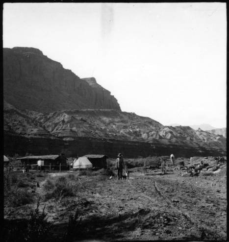
    <summary type="html"><![CDATA[<p><strong><em>A detailed account of two photographers’ river trip through Glen Canyon, a land of amphitheaters, arches, and ruins.</em></strong></p><img src="https://www.intermountainhistories.org/files/fullsize/746512ee18801850746c8da7638e720b.jpg" alt="Hite Ranch in Utah, 1911" /><br/><p>Emery and Ellsworth Kolb’s experience in Glen Canyon began at the remote settlement of Hite, Utah. There, the two brothers recovered from the previous trials of Cataract Canyon and wrote home to their families. Staying only a night, the duo waved goodbye to local legend Cass Hite and began the next leg of their trip to Bright Angel, a four- day journey to Lee’s Ferry. From November 3rd  to November 6th, 1911, the brothers became some of the only people to photograph the original landscapes in Glen Canyon, which is noted for ancestral native ruins, arches, amphitheaters, domes, and hieroglyphics. This area is now inundated by Lake Powell, and modern boat access is much easier and more comfortable than negotiating the river in an early 20th century Racine Co. wooden craft used by the brothers. Emery’s and Ellsworth’s primary motive for the expedition was to capture material for their photography business, and they took full advantage of Glen Canyon’s steady waters and picturesque views to obtain film that would captivate the public for decades to come. </p><p>The brothers enjoyed exploring the region’s cliff dwellings and natural stone bridges. Ellsworth described in his book a fascination with those near the confluence of the Escalante River, remarking, “What a story these cliffs could tell!” He then likened the tribes of the Southwest to European factions, making their last stand on the cliffs, and comparing the Colorado to the other great desert river - the Nile. At Deep Canyon, the brothers refocused on the river as it meandered through a sheer, narrow gorge. They had trouble finding a suitable campsite above the confluence with the San Juan; the few banks consisted of quicksand and mud. Under a full moon they drifted past the San Juan and into a black gorge where no moonlight entered. When they heard roaring water, the brothers scrambled out of their boats onto the bank for the night. The next morning they discovered the rapid they had heard was nothing more than swift water, and were astounded by the ominous Navajo Mountain towering above. This sighting marked a sort of premature homecoming, as they had often seen the rounded peak from their home at the Grand Canyon. After spending a day searching unsuccessfully for Rainbow Bridge, the brothers set their final camp in Glen Canyon at Ute Ford, otherwise known as the Crossing of the Fathers. Using a swift current and some hard paddling, Emery and Ellsworth floated into Lee’s Ferry the evening of November 6th. They got a hot meal and made boat repairs before taking on the last leg of their journey - into the Grand Canyon. </p><p>Without the constant demands of whitewater, Glen Canyon gave the two photographers much-welcomed free time to explore the river and its tributaries. The brothers had no way of knowing it at the time, but their careful descriptions and photography still provide a rare look into a lost canyon.</p><p><em><strong><a href="https://www.intermountainhistories.org/items/show/57">For more (including 4 images) view the original article</a></strong></em></p>]]></summary>
    <published>2017-06-05T17:07:20+00:00</published>
    <updated>2026-04-17T19:31:58+00:00</updated>
    <link rel="alternate" type="text/html" href="https://www.intermountainhistories.org/items/show/57"/>
    <id>https://www.intermountainhistories.org/items/show/57</id>
    <author>
      <name>Jonas Dunlap, Northern Arizona University</name>
    </author>
  </entry>
</feed>