<?xml version="1.0" encoding="UTF-8"?>
<feed xmlns="http://www.w3.org/2005/Atom">
  <title type="text">Intermountain Histories</title>
  <updated>2026-08-18T15:52:34+00:00</updated>
  <generator uri="http://framework.zend.com" version="1.12.20">Zend_Feed_Writer</generator>
  <link rel="alternate" type="text/html" href="https://www.intermountainhistories.org/"/>
  <link rel="self" type="application/atom+xml" href="https://www.intermountainhistories.org/items/browse?output=rss2"/>
  <id>https://www.intermountainhistories.org/</id>
  <author>
    <name>Intermountain Histories</name>
    <uri>https://www.intermountainhistories.org</uri>
  </author>
  <link rel="hub" href="https://pubsubhubbub.appspot.com/"/>
  <entry>
    <title type="html"><![CDATA[Theodore Roosevelt and the Havasupai in the Grand Canyon: Story 2 of 8 of the President Theodore Roosevelt in the West Tour]]></title>
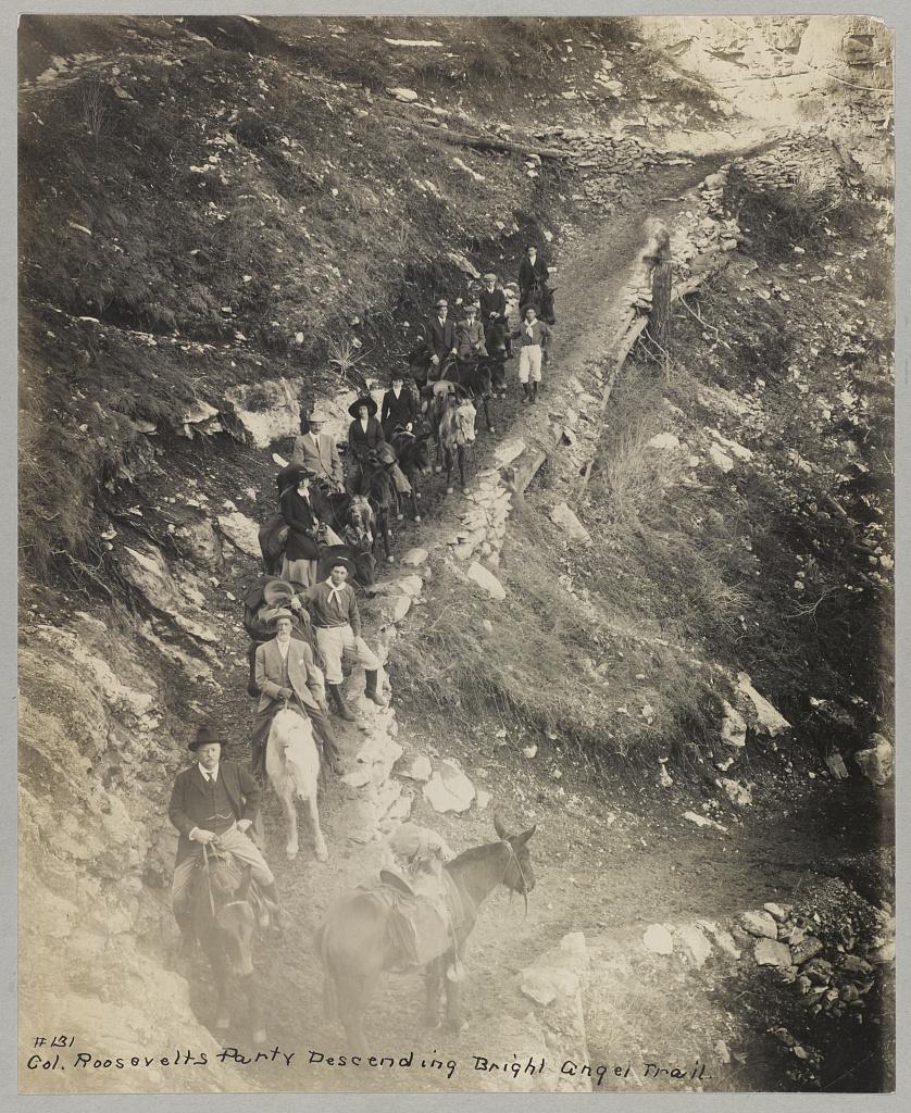
    <summary type="html"><![CDATA[<p><strong><em>President Theodore Roosevelt visits the Grand Canyon meeting the Havasupai Tribe. His efforts are making this landmark a National Park.</em></strong></p><img src="https://www.intermountainhistories.org/files/fullsize/81adde6a6a5c04daf97ec29b93d422ee.jpg" alt="Down a winding pathway, Theodore Roosevelt and others ride mules down Bright Angel Trail in the Grand Canyon" /><br/><p>Theodore Roosevelt traveled over 14,000 miles, visiting over 25 states, in the span of nine weeks in the early summer of 1903. His western tour was filled with speeches, commemorations, and his favorite thing to do: exploring the outdoors. His tours of Yosemite and Yellowstone are widely known, but in between them, he visited the Grand Canyon on May 6, 1903. He said, giving a speech, “In the Grand Canyon, Arizona has a natural wonder which, so far as I know, is absolutely unparalleled throughout the rest of the world.” Astounded, he said, “I shall not attempt to describe it, because I cannot. I could not choose words that would convey or that could convey to any outsider what that canyon is.” The majesty of Earth’s beauty there led him to explore more.
Riding a mule down Bright Angel Trail, he met two natives from the Havasupai tribe who lived in the Indian Garden with their families. For 1,000 years, the tribe lived in this region without outside contact, until Spanish priest Francisco Garces explored the area in 1776. As a result of the Santa Fe Railroad in the early 18th century, the Havasupai had increasingly more contact with other explorers and settlers. When Roosevelt and his regiment visited, he asked them to leave to make the canyon a National Park. To gain the status of a national park, all private development on the land would be illegal according to Congress. This resulted in the Havasupi’s relocation to a 518-acre reservation in Havasu Canyon instead.
Roosevelt was also concerned about the commercialization and exploitation of the land due to encroaching mining and timber interests. On June 8th, 1906, he signed the Antiquities Act, which authorized the president to “declare by public proclamation historic landmarks, historic and prehistoric structures, and other objects of historic or scientific interest that are situated upon the lands owned or controlled by the Government of the United States to be national monuments.” Subsequently, this act was used to establish the Grand Canyon National Monument on January 11th, 1908. It was made a National Park in 1919. Roosevelt Point and Trail were named in the President’s honor for the efforts he provided. A placard at Roosevelt Point reads another part from his speech advocating one request, “Leave it as it is. You can not improve on it. The ages have been at work on it, and man can only mar it. What you can do is to keep it for your children, your children's children, and for all who come after you, as one of the great sights which every American, if he can travel at all, should see.” Poetically, he wrote a letter to John Hay, former Secretary of State, summing up his experience on his Western tour and paying special attention to the Grand Canyon, “To me the most impressive piece of scenery I have ever looked at. I don’t exactly know what words to use in describing it. It is beautiful and terrible and unearthly. It made me feel as if I were gazing at a sunset of strange and awful splendor.” Today, almost 5 million tourists continue to explore this canyon that Roosevelt cared so profoundly to preserve.</p><p><em><strong><a href="https://www.intermountainhistories.org/items/show/924">For more (including 4 images) view the original article</a></strong></em></p>]]></summary>
    <published>2025-10-24T15:03:19+00:00</published>
    <updated>2026-08-18T15:52:34+00:00</updated>
    <link rel="alternate" type="text/html" href="https://www.intermountainhistories.org/items/show/924"/>
    <id>https://www.intermountainhistories.org/items/show/924</id>
    <author>
      <name>Jessika Cole, Brigham Young University</name>
    </author>
  </entry>
  <entry>
    <title type="html"><![CDATA[Cameron Trading Post — Arizona]]></title>
    <summary type="html"><![CDATA[<p><strong><em>Two businessmen founded this motel and curio shop in 1916 with tourists in mind, aiming to provide travelers with an “authentic” Southwestern experience. The trading post invited tourists to rest, indulge in a Southwestern-style cuisine, and browse a selection of authentic Navajo and Hopi arts and crafts. For these novelties, it remained a popular tourist attraction throughout the 20th century.</em></strong></p><img src="https://www.intermountainhistories.org/files/fullsize/e27f684a26c452aea3fbf91b29cbac3e.jpg" alt="Ariz. - Bridge at Cameron" /><br/><p><span>The Kansas City Midland Bridge Company constructed the steel suspension bridge over the Little Colorado River in 1911, making travel across the gorge more convenient. Brothers C.D. and Hubert Richardson saw an opportunity as they anticipated that this road would see more traffic following the bridge’s completion. In 1916, the Richardson brothers purchased 112 acres south of the bridge and built a wooden cabin as the center of their trading business. They served local Navajo and Hopi communities by trading livestock, rugs, skins, and wool in the company’s early years. As a public business in a remote area, increasing numbers of long-distance travelers visited Cameron Trading Post looking for a place to rest.</span>
<span>Cameron Trading Post became a convenient rest stop for travelers within the Four Corners region. As the site saw more patronage in the 1920s, the Richardson brothers constructed fuel pumps, a hotel, and a dining room adjacent to the trading post. Toward the mid-century, the Richardson family reported an influx of wealthy automobile tourists making stops at the Cameron Trading Post when traveling to and from the Grand Canyon. This adventurous class of automobile tourists traversing the Southwest sought the “authentic” regional experience at the trading post. Recognizing this site’s popularity, the Fred Harvey Company began including Cameron Trading Post as a stop along their Indian Detours, where guides drove tourists along rugged dirt roads to visit sights like the Painted Desert and the Grand Canyon. Cameron Trading Post was a routine stop along these tours. To cater to these travelers’ interests, the Richardson brothers filled the gift shop with cowboy hats and Native American arts and crafts. Tourists could browse from various Navajo and Hopi baskets, blankets, concho belts, pottery, and turquoise and silver jewelry.</span>
<span>Cameron Trading Post’s convenient location near the Little Colorado Bridge continued to attract droves of tourists when the federal government began regulating highways in 1925. The U.S. Bureau of Public Roads established the first stretch of Highway 89 that year, a route between Thistle, Utah, and Flagstaff, Arizona. This route provided travelers with convenient access to multiple national parks, including the Grand Canyon, Zion, and Bryce Canyon. Cameron Trading Post became a popular secondary tourist attraction along this route, offering travelers lodging, dining, and shopping with a uniquely Southwestern flair.</span>
<span>The Cameron Trading Post changed hands in 1966 when Hubert Richardson sold the business’s lease to Standard Oil and subleased the hotel, restaurant, and gift shop to the Fred Harvey Company. The trading post remained an international hub for trading Native American arts and crafts. Toward the end of the 20th century, Cameron Trading Post continued to add uniquely Southwestern elements to their business, including a fine art gallery displaying works of local artists, Navajo weavers demonstrating their craft while seated in the gift shop, and the option of ordering a Navajo taco in the dining room. Cameron Trading Post continues to offer an entertaining rest stop experience for travelers along Highway 89.</span></p><p><em><strong><a href="https://www.intermountainhistories.org/items/show/908">For more (including 4 images) view the original article</a></strong></em></p>]]></summary>
    <published>2025-09-23T15:38:23+00:00</published>
    <updated>2026-04-17T19:32:20+00:00</updated>
    <link rel="alternate" type="text/html" href="https://www.intermountainhistories.org/items/show/908"/>
    <id>https://www.intermountainhistories.org/items/show/908</id>
    <author>
      <name>Alexandra Williams, Northern Arizona University</name>
    </author>
  </entry>
  <entry>
    <title type="html"><![CDATA[Zitkala-Ša’s (Gertrude Simmons Bonnin) Sojourn in Utah<br />
]]></title>
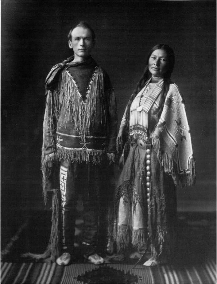
    <summary type="html"><![CDATA[<p><strong><em><span style="font-weight:400;">Zitkala-Ša, or Gertrude Simmons Bonnin, is a celebrated Yankton Dakota writer and activist. She lived in Utah from 1902-1917.</span></em></strong></p><img src="https://www.intermountainhistories.org/files/fullsize/45b71b8be1582e338eb8a6eee61bb4cc.jpg" alt="William F. Hanson and Zitkala-Ša" /><br/><p><span style="font-weight:400;">Born on the Yankton Sioux Reservation in South Dakota in 1876, Gertrude Simmons or Zitkala-Ša left the reservation at age eight to attend White’s Manual Labor Institute in Indiana. This assimilation-focused boarding school instilled Euro-American and Christian values in its students. She attended Earlham College and became an increasingly skilled writer and musician.</span> <span style="font-weight:400;">She taught at the Carlisle Indian Industrial School. After a while, she became critical of the emphasis on assimilation and acculturation and resigned. She began writing under the name Zitkala-Ša (Red Bird) around 1889, publishing essays in national magazines such as </span><i><span style="font-weight:400;">Harper’s Monthly</span></i><span style="font-weight:400;">. Her writings often criticized the practice of many reformers and stressed the importance of Native identities.</span>
<span style="font-weight:400;">Zitkala-Ša married Raymond Bonnin in 1902 and they moved to </span><span style="font-weight:400;">Whiterocks, Utah, where Raymond worked for the Indian Bureau on the Uintah and Ouray Reservation. In 1903, they had a son, Raymond “Ohiya” Bonnin. A young, orphaned Ute boy named Oran Curry and Old Sioux, a survivor of the Battle of the Little Bighorn, also lived with them. </span>
<span style="font-weight:400;">The Bonnins lived in Utah from 1902 to 1917, except for several months spent on the Standing Rock Reservation in the Dakotas. It was while away at Standing Rock that she converted to Catholicism. After returning to Utah, she kept up a correspondence with Father William Ketcham, director of the Bureau of Catholic Indian Missions, expressing her wish to introduce Catholicism to the Utes.</span>
<span style="font-weight:400;">In 1908, she met music teacher William Hanson</span><span style="font-weight:400;">. They eventually collaborated in writing and composing the </span><i><span style="font-weight:400;">Sun Dance Opera</span></i><span style="font-weight:400;">, which debuted in Vernal, Utah, in 1913. The Sun Dance is a religious ceremony practiced by some Natives, especially Plains Peoples. The opera combined Native rituals with European-styled performances. It is unclear what motivated her to collaborate on this opera, which could be viewed as a violation of religious respect. Interestingly, the Sun Dance was outlawed on the Uintah and Ouray Reservation at this time, and the opera allowed Ute performers to participate in it to some degree. At the time of its debut, a Vernal newspaper praised it as greatly pleasing the audience.</span>
<span style="font-weight:400;">During her first few years in Utah, Zitkala-Ša taught at the Whiterocks Boarding School. She also spent time working for the Indian Service. In 1913, she joined the Society of American Indians, a national organization advocating for Native rights. She was elected secretary of the SAI in 1916. After moving to Duchesne, Utah, in 1915, she created a Ute community center. While in Utah, she began an anti-peyote campaign. Zitkala-Ša and her husband Ray moved to Washington, D.C., where she continued her activism. Zitkala-Ša’s time in Utah was one of “relative obscurity." Yet, during her fourteen years there, she continued to evolve and to advance the causes she believed in.</span></p><p><em><strong><a href="https://www.intermountainhistories.org/items/show/888">For more (including 3 images) view the original article</a></strong></em></p>]]></summary>
    <published>2025-04-21T15:25:26+00:00</published>
    <updated>2026-04-17T19:32:20+00:00</updated>
    <link rel="alternate" type="text/html" href="https://www.intermountainhistories.org/items/show/888"/>
    <id>https://www.intermountainhistories.org/items/show/888</id>
    <author>
      <name>Emmaretta Barnett, Brigham Young University</name>
    </author>
  </entry>
  <entry>
    <title type="html"><![CDATA[Sheep Eaters (Mountain Shoshones) in the Greater Yellowstone Ecosystem]]></title>
    <summary type="html"><![CDATA[<p><strong><em>The Sheep Eaters (also known as Mountain Shoshones, Tukudika, or Snake Indians), resided in Yellowstone National Park, the Wind River Mountains in Wyoming, and parts of central Idaho, until the reservation era.</p></strong></p><img src="https://www.intermountainhistories.org/files/fullsize/5a9a77ddc55c952bffe2d127a3c16817.jpg" alt="Tukudika (Sheepeater) men, women, and children at Medicine Lodge Creek, Idaho, in 1871." /><br/><p><span style="font-weight:400;">Much of the history of the Sheep Eaters emanates from archeological and ethnographic research. Many scholars believe their origins are in the Great Basin, though that continues to be debated. Trappers like Osborne Russell were among the first Euro-Americans to leave written accounts about the Sheep Eaters. Russell noted that a group of about 22 Sheep Eaters he met were “neatly clothed in dressed deer and Sheep skins of the best quality and seemed to be perfectly contented and happy … [They had] about 30 dogs on which they carried their skins, clothing, provisions etc on their hunting excursions. They were well armed with bows and arrows pointed with obsidian…” Early descriptions provide useful information, but they also often encouraged stereotypes. For example, Philetus Norris, Superintendent of Yellowstone National Park in 1877, described the Sheep Eaters as “vanished” and “hermits."</span>
<span style="font-weight:400;">The Sheep Eaters domesticated dogs they used to carry packs and pull travois. Their name came from their main source of food, Rocky Mountain Bighorn Sheep, which the dogs may have assisted in hunting. Pots and pipes carved from steatite represent another distinguishing characteristic of Sheep Eater culture.</span>
<span style="font-weight:400;">The Sheep Eaters participated in the Rocky Mountain fur trade from the 1820s through the 1850s. During the 1870s, the Lemhi Valley Agency was created to oversee the removal of the Sheep Eaters, Bannocks, and Shoshones to Lemhi Valley in central Idaho. In 1880, they began to be relocated to Fort Hall, but some Sheep Eaters remained in Yellowstone, eventually joining the Eastern Shoshones on the Wind River Reservation. Idaho censuses continued to list Sheep Eaters as a distinct group through the early part of the twentieth century.</span>
<span style="font-weight:400;">It is important to note that the Sheep Eaters did not “vanish” or go extinct as Norris and others described. </span><span style="font-weight:400;">Today, some of the Sheep Eater descendants live on the Wind River Reservation in Wyoming and the Fort Hall Reservation in Idaho. </span>
<span style="font-weight:400;">In 2023, the town of Jackson, Wyoming issued a land acknowledgement concerning the Sheep Eaters:</span>
<ul>
<li><em><span style="font-weight:400;">We recognize that the land we are gathering on is the ancestral homeland of the Mountain Shoshone People who stewarded it for thousands of years and that many other tribes also lived upon and cared for this area … With gratitude, we honor Indigenous peoples, past and present. We also acknowledge the sovereignty of the Native nations closest to Jackson whose land was taken through broken treaties that resulted in the creation of the Wind River and Fort Hall Indian Reservations. We recognize this acknowledgement is simply a first step. The Town of Jackson is committed to continued and informed action to connect with Indigenous people.</span></em></li>
</ul></p><p><em><strong><a href="https://www.intermountainhistories.org/items/show/887">For more (including 3 images) view the original article</a></strong></em></p>]]></summary>
    <published>2025-04-19T02:12:32+00:00</published>
    <updated>2026-04-17T19:32:20+00:00</updated>
    <link rel="alternate" type="text/html" href="https://www.intermountainhistories.org/items/show/887"/>
    <id>https://www.intermountainhistories.org/items/show/887</id>
    <author>
      <name>Emmaretta Barnett, Brigham Young University</name>
    </author>
  </entry>
  <entry>
    <title type="html"><![CDATA[Jacob Hamblin Home]]></title>
    <summary type="html"><![CDATA[<p><strong><em><span style="font-weight:400;">The Jacob Hamblin home rests atop a small hill in the southern Utah pioneer town of Santa Clara. It stands as a monument to the man who played an important role as an Indian agent to the Paiutes and a community leader in southern Utah during the Latter-day settlement period.</span></em></strong></p><img src="https://www.intermountainhistories.org/files/fullsize/046e4adca37e858735e09524a06f24d0.jpg" alt="Jacob Hamblin Home" /><br/><p><span style="font-weight:400;">The Jacob Hamblin home has its stone foundation buried deep in the history of southern Utah. As a teenager, Jacob Hamblin had a spiritual experience wherein he felt called to work as an intermediary between the Latter-day Saints and Natives, which he felt was a lifetime calling. In 1854, Brigham Young called Hamblin and two dozen men to serve in the Southern Utah Indian Mission to work among the Paiutes. Hamblin founded the town of Santa Clara that same year, naming it after the nearby Santa Clara River. Hamblin and other Latter-day Saint newcomers recruited local Paiutes to assist them in the construction of Fort Clara. Hamblin and his family lived there until a great flood destroyed the fort and much of the settlement in 1862. </span>
<span style="font-weight:400;">With Fort Clara destroyed, leaders of The Church of Jesus Christ of Latter-day Saints sent skilled stone mason to build Hamblin a home for Hamblin and his family, consisting of wives Rachel Judd, Sara Priscilla Leavitt, and their respective children in 1863. After Rachel passed away he married Louisa Bonelli in 1865. The Hamblin home operated as the mission home, yet his important duties as president of the Southern Utah Indian Mission and as an Indian agent kept Hamblin from being home on many occasions. Yet, his endeavors in the region proved influential and significant for the Church and to Utah Territory. In 1868 the families moved to Kanab, where he continued his missionary labors among the Hopis and Navajos. Hamblin’s wife Priscilla fondly recalled, “With regrets, we left the big rock house in Santa Clara [in 1868]. This had been our first real home.”</span>
<span style="font-weight:400;">Jacob Hamblin’s work took him throughout Utah, Nevada, New Mexico, and Arizona. Between 1858 and 1863 he circumnavigated the Grand Canyon by boat. Later, in 1867, Hamblin floated down the Colorado River from the mouth of the Grand Wash to the Virgin River. In addition to his exploration ventures, Hamblin worked hard to establish peaceful relations with the neighboring tribes. In one such instance, local Paiutes worked with Latter-day Saints to build a dam to hold water for irrigating land around Santa Clara. In 1856, little rain fell and the crops wilted. Some Paiutes blamed Hamblin. </span>
<span style="font-weight:400;">The next morning Hamblin prayed, asking God for rain so that the settlers and Paiutes might maintain good relations. Having received an answer, Hamblin reported to all that they would indeed have the water they needed. The following day it began to rain, and that year the settlers and Paiutes grew record crops. From that time on, Hamblin held great standing among the Paiutes. Hamblin also brokered a peace between the Latter-day Saints and the Navajos at Fort Defiance, Arizona. Hamblin’s life is replete with moments like these—miracles, treaties, and the development of great relations with Natives. While Jacob Hamblin and his family only lived in the Jacob Hamblin home for several years, it stands as a lasting testament to the man who proved so instrumental in the development of southern Utah.</span></p><p><em><strong><a href="https://www.intermountainhistories.org/items/show/882">For more (including 5 images) view the original article</a></strong></em></p>]]></summary>
    <published>2025-01-27T05:47:00+00:00</published>
    <updated>2026-04-17T19:32:20+00:00</updated>
    <link rel="alternate" type="text/html" href="https://www.intermountainhistories.org/items/show/882"/>
    <id>https://www.intermountainhistories.org/items/show/882</id>
    <author>
      <name>Hayden Cottle, Brigham Young University</name>
    </author>
  </entry>
  <entry>
    <title type="html"><![CDATA[Ute Chief Wakara]]></title>
    <summary type="html"><![CDATA[<p><strong><em><span style="font-weight:400;">Known as “Hawk of the Mountains” and “Napoleon of the Desert,” Chief Wakara played a significant role in the early conflict between Mormon settlers and the Western Utes.</span></em></strong></p><img src="https://www.intermountainhistories.org/files/fullsize/54ecf1aa8254a5faa4fc3376ef51cbea.jpg" alt="Portrait of Wakara" /><br/><p><span style="font-weight:400;">In 1946, Charles Kelly and friend Frank Beckwith visited Chief Wakara’s burial site in Dry Canyon, near Meadow, Utah. Unfortunately, the grave had been robbed and emptied in 1909. Kelly and Beckwith confirmed this, finding the hole Wakara had once rested in and the stones and poles that once covered it. The monument built in 1973 does not mark Wakara’s exact burial place.</span>
<span style="font-weight:400;">Chief Wakara was born in the Utah Valley in the early nineteenth century. According to historian Gustive O. Larson, he was seen as “subtle, vain, and cruel.” According to others, he was “looked upon generally as unpredictable, clever, and savage.” When his father the chief died, he and his siblings entered a bloody succession struggle from which he wrested tribal leadership. Not many details exist of Wakara’s childhood, so historians looking at his life often cite the general history of the Western Utes. Very important to the Utes’ migration patterns and economic activities were horses. Horses made hunting and combat more efficient and allowed the Utes to expand the area (and people) they extracted resources from. To ensure that horses had plentiful grass, the Utes migrated back and forth between California and Utah along the Old Spanish Trail. The Utes raided more horses from California missions and also traded Paiute and Goshute enslaved persons along this trail as well. </span>
<span style="font-weight:400;">In 1847, the Mormon pioneers arrived in the Great Salt Lake valley. This was the beginning of a near-complete disruption of Wakara and the Utes’ way of life. Trade was a central tenet of Wakara and Brigham Young’s initial friendship. Brigham Young’s policy towards Indians was to establish peace through trade and gift-giving. For Wakara, he saw the arrival of the Mormons as the start of a convenient and profitable trading relationship. </span>
<span style="font-weight:400;">While peaceful at first, their relationship soured as resources that Wakara’s Utes had once relied on were exhausted and as Mormons interrupted the highly profitable Indigenous slave trade. In July 1853, the Ivie Incident served as the catalyst for the Walker War, which lasted into the spring of 1854. Interestingly, Wakara spent most of the war outside the territory on the Old Spanish Trail. In 1855, Wakara died of pneumonia, and with his death, Ute territory became gradually incorporated into Utah Territory. </span></p><p><em><strong><a href="https://www.intermountainhistories.org/items/show/881">For more (including 3 images) view the original article</a></strong></em></p>]]></summary>
    <published>2025-01-27T05:33:30+00:00</published>
    <updated>2026-04-17T19:32:20+00:00</updated>
    <link rel="alternate" type="text/html" href="https://www.intermountainhistories.org/items/show/881"/>
    <id>https://www.intermountainhistories.org/items/show/881</id>
    <author>
      <name>Sara Davis, Brigham Young University</name>
    </author>
  </entry>
  <entry>
    <title type="html"><![CDATA[Intermountain Indian School: Native Civil Rights in Boarding Schools]]></title>
    <summary type="html"><![CDATA[<p><strong><em>Intermountain Indian boarding school was a Native American off-reservation boarding school that aimed to assimilate Navajo children by giving them education in English, and job skills. It has a complicated history within the Tribes it served, with a list of controversies during and after its operation.  </em></strong></p><img src="https://www.intermountainhistories.org/files/fullsize/be30be9fe2d5d7aaf475052384f4d0a2.jpg" alt="Girl operating a &#039;Tac X&#039; word flasher" /><br/><p><span style="font-weight:400;">Intermountain Indian School hosted children from The Navajo Tribes, with 212 students in its first year before opening to host students from a variety of tribes in the 1970s. It operated until 1984, finally closing due to the high costs of operation, as well as the dwindling number of Native American boarding schools in the country. Native American off-reservation boarding schools started in the 1800s, with the main purpose of forced assimilation and removal of native culture. Children enrolled in such schools suffered much cruelty such as forbidding native language and culture, being forced to shave their heads, and experiencing abuse and mistreatment in the name of “civilizing” them. In the 1950s the government enacted its termination policy, trying to “end the native problem” by limiting funding to reservations to force natives into cities, and thus boarding schools followed the same ideals. Boarding schools began to focus on preparing Native children to participate in jobs in their new cities, without governmental support. This new policy was in effect during the creation of the Intermountain and thus existed to fit the new policy changes of the termination policy. </span>
<span style="font-weight:400;">The concept of Native American boarding schools in general is proof of the intense violations and pressure put upon the native communities by the US government to in attempts erase their culture, and history. While Intermountain did not restrict cultural expression through clothing or activities, Intermountain was not an exception to other infringements on civil rights. In 1971, a spokesperson from the  American Indian Movement (AIM) an organization created to fight for native civil rights, listed the following concerns; horrible food, unfair grading process, overcrowded and dirty living conditions, forcing students to choose a Christian religion, few native teachers, and Harsh unfair punishments. Another concern with the school was that their education set them up exclusively for jobs lacking upward mobility or chance of improvement, leaving a disparity in job opportunities for Native peoples. As the school continued to run it became increasingly aware and supportive of the needs of the native people, and took steps to rectify some of its social problems, such as making efforts to include more native teachers, and support cultural representation. </span>
<span style="font-weight:400;">The history of the Intermountain is complicated, with mixed reviews from its graduated students. Where some of its students still feeling deeply connected to the school and their time there, others remain deeply traumatized from their experience and have nothing positive to say. In its 34 years of operation, the school was rife with controversy, from both inside and outside the school, and ultimately its history is still complicated and important to the story of the previous students and native communities it interacted with. </span></p><p><em><strong><a href="https://www.intermountainhistories.org/items/show/858">For more (including 5 images) view the original article</a></strong></em></p>]]></summary>
    <published>2024-10-16T01:02:08+00:00</published>
    <updated>2026-04-17T19:32:19+00:00</updated>
    <link rel="alternate" type="text/html" href="https://www.intermountainhistories.org/items/show/858"/>
    <id>https://www.intermountainhistories.org/items/show/858</id>
    <author>
      <name>Thomas Harley, Utah State University</name>
    </author>
  </entry>
  <entry>
    <title type="html"><![CDATA[The Nephi Massacre during Wakara’s War<br />
]]></title>
    <summary type="html"><![CDATA[<p><strong><em>During Wakara’s War in 1853-54 a group of Utes killed four Mormons at Fountain Green.  The next day, Mormons killed eight Utes or Goshutes seeking peace with LDS settlers in Nephi, Utah. The discovery of their remains in Nephi’s Old Hallow in 2006 highlighted the brutality of Wakara’s War, a series of conflicts during 1853 between settlers and Indigenous residents in central Utah Territory.</em></strong></p><img src="https://www.intermountainhistories.org/files/fullsize/fafd241883d271d8b9793e3097ca8da1.jpg" alt="Nephi, Utah" /><br/><p>In 2006, an archaeological discovery in Nephi, Utah, shed light on a tragic event that occurred in 1853 during the Walker War, also known as the Wakara War. The excavation revealed a mass grave containing the remains of seven Goshutes, including a young boy. The bodies were found piled on top of each other. Forensic analysis discovered gunshot wounds, shattered bones, and evidence of blunt force trauma.</p><p>The Wakara War between settlers and Utes was infuriated by the encroachment of additional LDS settlements in Utah and Sanpete counties in Utah Territory. The incident in Nephi occurred on October 2, 1853, when a group of Utes or Goshutes came to the fort. The account reported in the Deseret News portrayed the Natives as aggressors in a tussle they initiated with the militia. Recent research, including the discovery of journals of witnesses Adelia Wilcox and Martha Spence Heywood, however, contradict this narrative.</p><p>The forensic evidence from the mass grave suggests that the Native men, ranging in ages from 16 to 25, were not killed in a skirmish but were executed. Gunshot wounds in the back of the head and traumatic injuries indicate a cold-blooded killing, challenging the original historical account. The discovery of the mass grave by construction workers laying a foundation for a home in 2006 provided an opportunity to combine scientific discovery, archaeology and forensic analysis, and historical records to correct and update the historical narrative and include the perspectives of those killed. The story of the Nephi mass grave is a significant reminder of the complexities surrounding historical narratives and how archaeological revelations can amend those stories.</p><p><em><strong><a href="https://www.intermountainhistories.org/items/show/856">For more (including 3 images) view the original article</a></strong></em></p>]]></summary>
    <published>2024-09-25T15:00:26+00:00</published>
    <updated>2026-04-17T19:32:19+00:00</updated>
    <link rel="alternate" type="text/html" href="https://www.intermountainhistories.org/items/show/856"/>
    <id>https://www.intermountainhistories.org/items/show/856</id>
    <author>
      <name>Chelsea Woodruff, Brigham Young University</name>
    </author>
  </entry>
  <entry>
    <title type="html"><![CDATA[Indigenous Inhabitants of Antelope Island ]]></title>
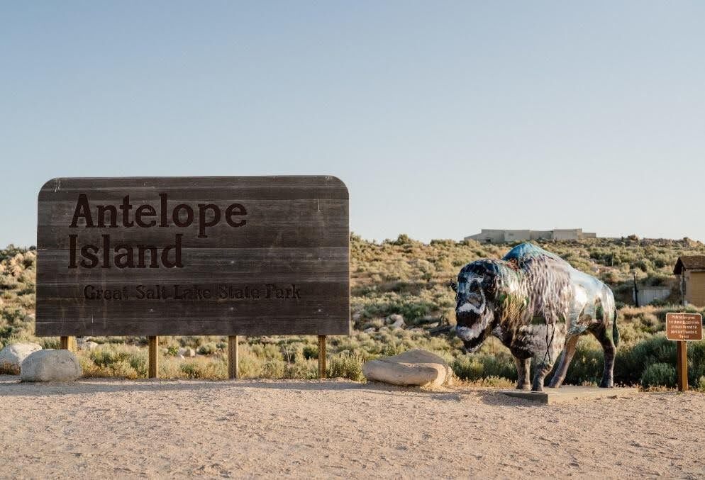
    <summary type="html"><![CDATA[<p><strong><em>The history of Indigenous interactions with Antelope Island, as documented through oral histories, artifacts, and written accounts, reveals a rich and diverse relationship over thousands of years.</em></strong></p><img src="https://www.intermountainhistories.org/files/fullsize/9ab62dc8307a1a682b90b16c59114809.jpg" alt="Antelope Island Great Salt Lake State Park " /><br/><p>Antelope Island holds great historical and geographical significance to the current and previous inhabitants of the Great Salt Lake, whose water levels rose and fell repeatedly. The interactions and ties between Natives and the Island are deeply embedded in the island’s history, encompassing exploration, resource utilization, cultural exchanges, and adaptation over millennia. </p><p><strong>Paleo, Archaic, and Fremont Peoples:</strong> </p><p>The earliest residents of Antelope Island, Paleo peoples, are estimated to have arrived in the region over 12,000 years ago. Like more recent Indigenous peoples, First peoples found the area accommodating for hunting, gathering, fishing, and insect roasting. These shoreline populations resided in caves, bush dwellings, or shelters constructed with nearby natural resources. Shoreline peoples hunted geese and rabbits and gathered berries, roots, and seeds along the Great Salt Lake’s shoreline. As climate changes occurred, island inhabitants adapted. The transition from Paleo-Indians to Archaic peoples (roughly 8000 B.C.E.) and later to the Fremont (300 B.C.E.) is evident, with each group utilizing the island’s resources differently. Archaic peoples used fine-pointed spears to hunt megafauna, big game, smaller mammals, rodents, and birds. About 2,000 years ago, the Fremont practiced many of the same food gathering techniques as their predecessors, but also farmed corn and traded with the southern Ancestral Puebloans. Around 1100 A.D., immigrants from southern California entered the scene and marked the end of the Salt Lake Fremont era, transitioning into occupation by the Numic speaking peoples including the Shoshones, Utes, and Goshutes. </p><p><strong>Nineteenth century:</p> </p><p>Explorers John C. Fremont and Kit Carson arrived at Antelope Island in 1845 and recorded some of their first impressions of the island and its wildlife. One of their most notable discoveries was Native encampments on the island. Numic-speaking peoples frequented the island. According to one account, Fremont consulted Utes residing in the area regarding the nature of the island before he and Carson explored it. The Utes said the party could easily reach the island on horseback. The explorers described their trip across the shallows to the island. The water never rose above their saddle girths. They described the lake floor as a sheet of salt resembling softening ice, into which the horses’ feet sank to their fetlocks. A variety of wildlife species lives on Antelope Island, including antelope. Fremont and his men killed an antelope for sustenance in the 18. After returning from the island, a Native man informed Fremont’s party that the antelope they had killed was one from his herd of antelope. To avoid any tension or conflict, Fremont gave the man cloth, tobacco, and a knife in exchange for their venison dinner. Ongoing Research and </p><p><strong>Conservation:</strong> </p><p>Contemporary archaeological efforts continue to survey and excavate Antelope Island, aiming to uncover prehistoric cultural sites. Discoveries, such as ancient spear points and metates, contribute to our understanding of the island’s long Indigenous occupation. Biologists monitor archaeological findings to identify native species for potential reintroduction to the island. The water level of the Great Salt Lake surrounding Antelope Island fluctuates up and down. On September 30, 2023, Native representatives from various tribes came together to offer a ceremonial blessing of healing. Former tribal chairman of the Northwest Band of Shoshones Darren Parry, Paiute Tribe of Utah Chairwoman Corrina Bow, and members of the Kanosh band participated in the event.</p><p><em><strong><a href="https://www.intermountainhistories.org/items/show/854">For more (including 4 images) view the original article</a></strong></em></p>]]></summary>
    <published>2024-09-25T03:39:42+00:00</published>
    <updated>2026-04-17T19:32:19+00:00</updated>
    <link rel="alternate" type="text/html" href="https://www.intermountainhistories.org/items/show/854"/>
    <id>https://www.intermountainhistories.org/items/show/854</id>
    <author>
      <name>Ethan Cornelius, Brigham Young University</name>
    </author>
  </entry>
  <entry>
    <title type="html"><![CDATA[St. Mary’s Mission in the Pacific Northwest]]></title>
    <summary type="html"><![CDATA[<p><strong><em>Father Pierre-Jean De Smet brought Christianity to Native peoples in Idaho and Montana through the construction of St. Mary’s Mission. With it came Catholic conversion among some Salish (Flatheads) and Nez Perce, and conflict with the Blackfeet.</em></strong></p><img src="https://www.intermountainhistories.org/files/fullsize/439956b4dff81e2ade29e5724487f46c.jpg" alt="[Untitled]" /><br/><p>A few members of Salish speaking tribes, also referred to as “Flatheads,” traveled to St. Louis in the 1830s and requested the Catholic Church send missionaries to construct a mission to teach them about Christianity and the Bible. Father Pierre-Jean De Smet, Society of Jesus, was a Flemish Jesuit priest who answered the call, traveling west with fur traders and Catholic Mohawks. He founded the Catholic mission of St. Mary’s in 1841 to provide schools, storehouses, farms, workhouses, and religious instruction. </p><p>De Smet and the St. Mary’s Mission abided by four overarching rules. First: respect the Catholic Church with submission and a desire to learn about the gospel. Second: respect your neighbors and obey those in positions of authority. Third: develop attributes such as humility, charity, and temperance for self-improvement. Fourth: limit contact between Natives and settlers who may not help cultivate Christian values.</p><p>The presence of St. Mary’s had a profound effect on many Natives. Some Salish were baptized and the mission counted converts as a sign of the mission’s success. Others, such as the Blackfeet, loathed the mission and waged war upon it, destroying the mission in 1850.</p><p>Pierre-Jean De Smet, as the mission’s supervisor, played a large role not only in spreading the gospel message, but also as a community leader. He presided over marriages, baptisms, and other ecclesiastical functions as well as social issues relating to farming, government, and interactions with outsiders. The community looked up to him as a protector and he often counseled Native leaders on matters concerning war and policy. Other Salish rejected De Smet and the Catholic intrusion in their lives and adhered to traditional teachings and practices.</p><p>Located near Stevensville, Montana, Historic St. Mary’s Mission is on the National Register of Historic Places. Buildings include the chapel, Father Ravalli’s cabin, Chief Victor’s Cabin, Ox Cart barn, Dove Cote, Smoke House, Diorama, Salish encampment, and apple orchard. A visitor center houses a museum, gift shop, office, art gallery, and research library. Volunteers serve as tour guides, grounds keepers, clerical workers, and operate a museum and gift shop.</p><p><em><strong><a href="https://www.intermountainhistories.org/items/show/853">For more (including 4 images) view the original article</a></strong></em></p>]]></summary>
    <published>2024-09-25T03:24:33+00:00</published>
    <updated>2026-04-17T19:32:19+00:00</updated>
    <link rel="alternate" type="text/html" href="https://www.intermountainhistories.org/items/show/853"/>
    <id>https://www.intermountainhistories.org/items/show/853</id>
    <author>
      <name>Samuel G. Dunn, Brigham Young University</name>
    </author>
  </entry>
  <entry>
    <title type="html"><![CDATA[Everett Ruess: Lost in the Labyrinth of Davis Gulch, Utah ]]></title>
    <summary type="html"><![CDATA[<p><strong><em>Everett Ruess left Escalante Utah on November 12th, 1934 in a light red shirt “as thin as smoking paper” and headed towards Davis Gulch with the confidence of an experienced explorer, which he very much was, but to never be seen again.</em></strong></p><img src="https://www.intermountainhistories.org/files/fullsize/a5b2261c72639e672eacb5c47cb06fbe.jpg" alt="Bement Arch in Davis Gulch" /><br/><p><span style="font-weight:400;">Davis Gulch is located about forty-five miles southeast of Escalante, Utah, down the Escalante River before it meets with the Colorado River. Before leaving Escalante, Everett was warned about the winters of southern Utah and the dangerous trek across Escalante Canyon. However, Everett planned to be home for Christmas, so these worries were behind him. He wrote and sent two letters before arriving at Davis Gulch, to his parents, Stella and Christopher, and another to his brother, Waldo. To his parents, he wrote that he would be unreachable for a couple of months, and would return before the end of the year, but to Waldo, he said that he would not revisit civilization soon, foreshadowing the uncertainty of his disappearance. When Everett did not return to Los Angeles by late December, Stella immediately sent him a Christmas card. However, one month later the card came back to Stella, and the heartfelt message now read “Unkown” and “Return to sender.” </span>
<span style="font-weight:400;">Stella and Christopher’s first objective was to call up Escalante Postmistress Mildred Allen and ask if there was any information on Everett’s whereabouts. Unfortunately, Mildred had not heard from Everett, and neither had anyone else. Next, the Ruess family contacted every Postmaster across the Southwest in search of any sign of Everett but were met with no hope. Their third step was to contact all newspapers and radio stations in the region and ask them to spread awareness of Everett’s disappearance. The first newspaper account of his disappearance was on Valentine's Day, February 14th, 1935, by the </span><i><span style="font-weight:400;">Los Angeles Evening Herald,</span></i><span style="font-weight:400;"> just over three months after he left Escalante. Everett Ruess was now officially missing. </span>
<span style="font-weight:400;">In March of 1935, a man named Gail Bailey spotted two burros deep in Escalante Canyon at Davis Gulch. The trail to Davis was hard to access, meaning that Everett must have scaled the labyrinth of the carved desert to get to the bottom of the canyon safely with two burros, which posed challenges before when he lost a burro in 1932 while climbing out of Canyon del Muerto. </span>
<span style="font-weight:400;">Searches for Everett began soon after Bailey’s report, one led by the Postmistress's husband, Jennings Allen. Found among his burros were some of his belongings, but not a diary, watercolors, or other supplies. After searches ended, the most significant marking left behind was a carving, “NEMO 1934” at the top of a Moqui trail–hand and foot holds carved into rock–next to a large pictograph deep in Davis Gulch. In 1963, The Bureau of Reclamation constructed Glen Canyon Dam, which quickly flooded the canyon, making it harder to search Davis Gulch for Everett Ruess.</span>
<span style="font-weight:400;">To this day there have been many rumors about Everett’s disappearance including a debunked case of his potential remains found in 2008. A quote from one of Everett’s letters summarized his final journey, “I’ll never stop wandering. And when the time comes to die, I’ll find the wildest, loneliest, most desolate spot there is.” Everett’s life ended in solitude, as he always wanted.</span></p><p><em><strong><a href="https://www.intermountainhistories.org/items/show/833">For more (including 4 images) view the original article</a></strong></em></p>]]></summary>
    <published>2024-05-25T04:40:54+00:00</published>
    <updated>2026-04-17T19:32:18+00:00</updated>
    <link rel="alternate" type="text/html" href="https://www.intermountainhistories.org/items/show/833"/>
    <id>https://www.intermountainhistories.org/items/show/833</id>
    <author>
      <name>Matthew T. Lankton, Northern Arizona University</name>
    </author>
  </entry>
  <entry>
    <title type="html"><![CDATA[The Last Letter of Everett Ruess: Escalante, Utah]]></title>
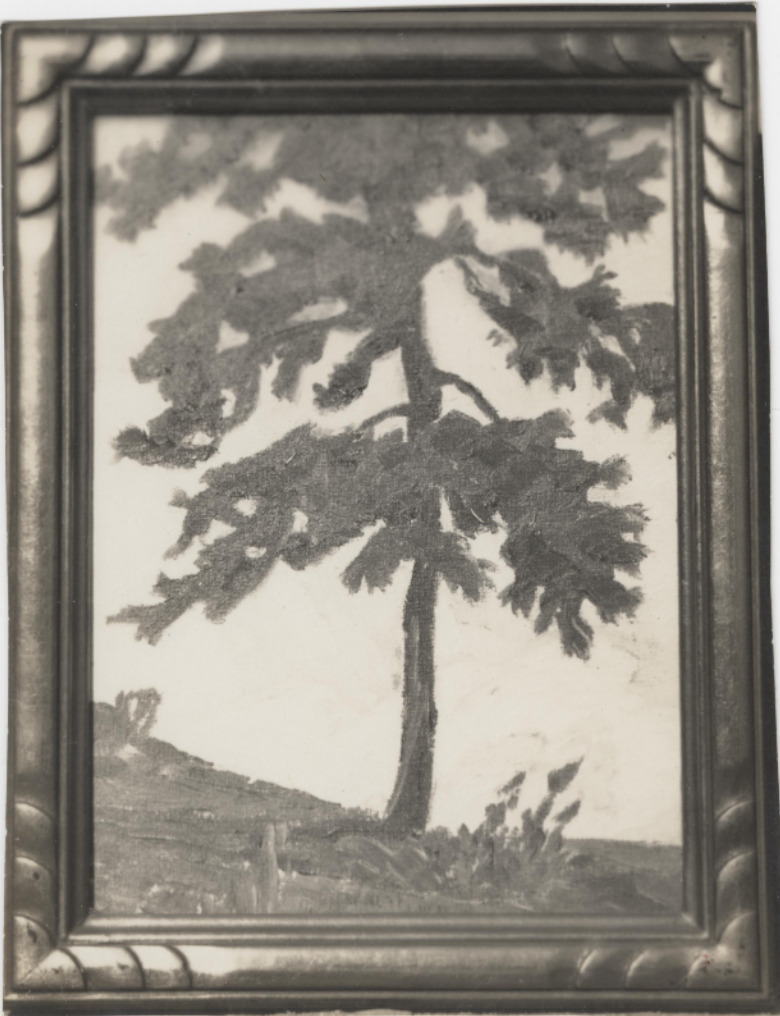
    <summary type="html"><![CDATA[<p><strong><em>Everett Ruess spent the latter half of that summer dancing with the Hopi, exploring the southern half of the Colorado Plateau, and eventually making his way from rim to rim of the Grand Canyon. He finally rested in Tropic, Utah before his final stop in civilization at Escalante, Utah.</em></strong></p><img src="https://www.intermountainhistories.org/files/fullsize/0ffdda85d33fb65d502b1812bba78b87.jpg" alt="Black and white photograph of Everett Ruess’ watercolor painting of a tree in the Colorado Plateau wilderness, ca. 1930s." /><br/><p><span style="font-weight:400;">Escalante, Utah, is a Mormon outpost founded in 1875, and named after Catholic Priest, Father Silvestre Vélez de Escalante. The town acted as a filter between the native lands to the southeast and the rest of the Mormon communities to the north. The town was all Mormon families, with most having the same last name and on average more than five children per family. Escalante’s residents followed the Mormon religion and morals since its founding sixty years prior to Everett’s arrival.</p> <span style="font-weight:400;">The vagabond who spent the last seven months living outdoors in the wilderness arrived in the Mormon town in early November 1934. Everett, a single male artist in a community of large agrarian families, immediately stood out like a sore thumb. He passed through the quaint town with his burros, Chocolatero and Cockelburro, and observed the Mormon church, its community members, and the many homes scattered throughout Escalante. Navajo traders had made their way into town occasionally to exchange with the community, but Escalante never saw a 20-year-old with two donkeys carrying watercolors, jewelry, and native rugs. Everett’s legendary status began here in 1934 due to his unique nature compared to the Mormon families, for the fact that he disappeared not far from here is the reason his myth still lives on in Utah. </span>
<span style="font-weight:400;">For the first time in five years of travel, Everett was financially stable, he had every reason to be satisfied with his life at this moment. He sent his parents ten dollars along with about twenty of his watercolor paintings. He told them to spend five dollars each on something that they “had been wishing to have,” so they proudly spent it to frame their son’s watercolors. In Escalante, Everett saw a film called </span><i><span style="font-weight:400;">Death Takes a Holiday</span></i><span style="font-weight:400;">, which is about death taking human form and asking the public why they fear death, a concept that Everett was fascinated by according to letters sent home. During these last moments in Escalante, Everett played the role of big brother to a lot of the children. According to letters sent from Escalante, he spent time “riding horses, hunting for arrowheads, and the like” with them. Everett’s role in Escalante was one of his most important ones as he served as a curiosity for not only the children but the community as a whole. Before he left, he wrote to his brother Waldo about his desire to stay out in the wilderness for an unknown period of time, for that is where he belonged.</span>
<span style="font-weight:400;">On November 12th, 1934, Everett left Escalante after chatting with the Alvey family who lived on the outskirts of town, and later recalled warning the young explorer of the conditions of the desert. His last winter excursion was in the Superstition Mountains near Phoenix, a completely different climate than southern Utah. A week later two sheepherders spotted him near Davis Gulch, Utah, and offered him mutton, but as the cool autumn air set over Escalante Canyon, Everett declined and was never seen again.</span></p><p><em><strong><a href="https://www.intermountainhistories.org/items/show/832">For more (including 5 images) view the original article</a></strong></em></p>]]></summary>
    <published>2024-05-25T04:26:23+00:00</published>
    <updated>2026-04-17T19:32:18+00:00</updated>
    <link rel="alternate" type="text/html" href="https://www.intermountainhistories.org/items/show/832"/>
    <id>https://www.intermountainhistories.org/items/show/832</id>
    <author>
      <name>Matthew T. Lankton, Northern Arizona University</name>
    </author>
  </entry>
  <entry>
    <title type="html"><![CDATA[Everett Ruess in Navajo Country and Canyon de Chelly National Monument ]]></title>
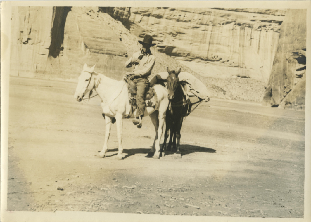
    <summary type="html"><![CDATA[<p><strong><em>In 1932 Everett Ruess set out to central Arizona where he enjoyed the mountainous desert, and later began his journey to his beloved northern Arizona wilderness.</em></strong></p><img src="https://www.intermountainhistories.org/files/fullsize/0dcf36256a9e8c5f10ae900bf7f4e951.jpg" alt="Everett and his horses, 1932" /><br/><p><span style="font-weight:400;">Canyon de Chelly (d’`SHAY) is located in the Navajo Nation and contains the architecture, artifacts, and culture of the communities that have lived there for millennia. Archeologists believe the canyon first had residents roughly 5,000 years ago with the Archaic people. The canyon contains the iconic Spider Rock, White House Ruins, and petroglyphs, and was established as a national monument in 1931 by former President Herbert Hoover. A tributary of Canyon de Chelly is Canyon del Muerto (</span><i><span style="font-weight:400;">Canyon of Death</span></i><span style="font-weight:400;">), named after prehistoric native burials found by the Smithsonian in the canyon in the late nineteenth century. The canyon serves as a monument of the native population, as well as their resilience in defending their sacred land from European settlers.</span>
<span style="font-weight:400;">Everett began his 1932 journey in central Arizona, making his way up to the Mogollon Rim, and eventually Chinle, Arizona, just west of Canyon de Chelly National Monument. Everett had been here just one year prior, before he eventually stayed in Flagstaff and the Grand Canyon, then headed back to southern California. On July 12th, the day before entering Canyon de Chelly, he wrote a lengthy letter to his brother Waldo expressing his appreciation for the outdoors and his belief that “there can be no other life for me but that of the lone wilderness wanderer.” </span>
<span style="font-weight:400;">The next morning, Everett wrote that he went “over the hill to Canyon de Chelly, their [Navajo] homeland.” The canyon welcomed Everett with powerful winds, stalling his progress. As he made his way East through Canyon del Muerto, he passed by the White House Ruin and noted the “tall monument” of Spider Rock in his journal. Everett made the journey back from the belly of de Chelly to Canyon del Muerto, where he noted the lack of water. As he had been in the canyon before in 1931, the towering walls of the canyon and the winds that del Muerto presented were very familiar. In roughly four days Everett made his way up through Canyon del Muerto with his horses Nulfo and Jonathan. The trail out of the canyon was not easy for them. He noted that Jonathan was hobbling in circles before eventually collapsing to the ground beneath him, and noting that the place really was the Canyon of Death for “gentle old Jonathan.”</span>
<span style="font-weight:400;">Everett emerged from Canyon de Chelly National Monument with Nulfo by his side, heading toward their next journey to Mesa Verde in Colorado. He remained here for about another month until hitchhiking his way back to Los Angeles where he began a semester at the University of California Los Angeles (UCLA). Despite the remarkable characteristics of his journey, he was still a human who experienced indecision like any other eighteen-year-old. While at UCLA, Everett reminisced on his time at Canyon de Chelly and the rest of the region which provoked him to write a letter explaining that he did not belong in college, but rather in the wilderness which he returned to a few months later.</span></p><p><em><strong><a href="https://www.intermountainhistories.org/items/show/830">For more (including 5 images) view the original article</a></strong></em></p>]]></summary>
    <published>2024-05-25T03:51:26+00:00</published>
    <updated>2026-04-17T19:32:18+00:00</updated>
    <link rel="alternate" type="text/html" href="https://www.intermountainhistories.org/items/show/830"/>
    <id>https://www.intermountainhistories.org/items/show/830</id>
    <author>
      <name>Matthew T. Lankton</name>
    </author>
  </entry>
  <entry>
    <title type="html"><![CDATA[North Beach at Bear Lake: The &quot;Caribbean of the Rockies&quot;]]></title>
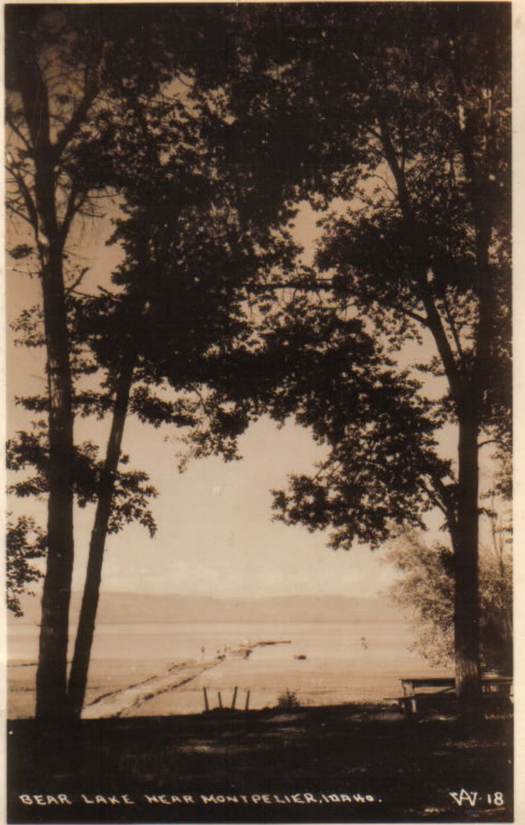
    <summary type="html"><![CDATA[<p><strong><em>Known as the "Caribbean of the Rockies," North Beach at Bear Lake is remembered for its clear, turquoise waters and the neighboring historical hot springs.</em></strong></p><img src="https://www.intermountainhistories.org/files/fullsize/10473506f86f1e2d1f5ca0c2d8a1af4f.jpg" alt="Bear Lake near Montpelier, Idaho. c. 1898" /><br/><p>The sandy shores of North Beach at Bear Lake meet the turquoise waters that inspired the nickname “Caribbean of the Rockies” and have made the beach a main tourist attraction at the Utah-Idaho border. North Beach sits on Idaho territory and provides activities such as boating, fishing, jet skiing, kayaking, picnicking, sunbathing, and swimming. Paired with these activities are the amenities, which include a boat launch ramp, grills, campgrounds, and picnic tables. In 2022 alone North Beach had over 300,000 visitors as it is a great place for families to come and wade in the shallow, warm waters.</p><p>Bear Lake has 12,000 years of Indigenous history as Native Americans would settle on the beach’s shores and use the waters for fishing and the surrounding areas for plant gathering and hunting. The native tribes that live near North Beach today are the Shoshone and Bannock tribes of southern Idaho. Following the Oregon Trail, Mormon settlers were the next prominent group to live in Bear Lake Valley. They negotiated with the Shoshone tribe for part of the land and established the community of Paris in 1863. Joseph C. Rich was an early pioneer at Bear Lake and married Ann Eliza Hunter. Together they developed the make-shift hot springs at North Beach in 1888 that used an underground pipeline to bring the hot water from the springs to the bathing pools.</p><p>Decades later in 1911, Ethel Bates became the owner of the Grand Hotel built next to the hot springs bath. The hotel became a well-known place to enjoy the scenic views of Bear Lake and allowed visitors to have multiple days at the beach. In 1939, the hotel burned down, leaving only a few pillars and stairs people can visit today. Ruth and Lorenzo Hemmert bought the property in 1950 to rebuild the lodging amenities and renovate the hot spring pools. They owned the property until 2018 when it sold to a land developer who plans to tear down the existing buildings to make room for a subdivision called Lakeview.</p><p>After years of rising popularity, in the late 1960s and early 1970s, there was much conversation about expanding the facilities because of overcrowding. In 1969 the Idaho State Journal noted that about 3,500 persons visited North Beach daily during peak summer days. Construction occurred during the early 1970s and included new campgrounds, restrooms, picnic facilities, and access to running water to mitigate overcrowding and improve sanitation.</p><p>The popularity of North Beach still reigns true and visitors must reserve a spot on the beach, up to one day in advance. Bear Lake and especially North Beach have also been the victim of drought over the past years. Bear Lake Idaho’s brochure notes the “low water levels” and how public use and the exposed lake bed have “created a concern for the lake’s environment and safe recreation use.” Respecting the beach is crucial for a future of sunbathing, swimming, and other beach activities at the “Caribbean of the Rockies.”</p><p><em><strong><a href="https://www.intermountainhistories.org/items/show/828">For more (including 5 images) view the original article</a></strong></em></p>]]></summary>
    <published>2024-05-23T01:05:00+00:00</published>
    <updated>2026-04-17T19:32:18+00:00</updated>
    <link rel="alternate" type="text/html" href="https://www.intermountainhistories.org/items/show/828"/>
    <id>https://www.intermountainhistories.org/items/show/828</id>
    <author>
      <name>Olivia Hall, Northern Arizona University</name>
    </author>
  </entry>
  <entry>
    <title type="html"><![CDATA[Saltair Beach at Great Salt Lake: The &quot;Coney Island of the West&quot; ]]></title>
    <summary type="html"><![CDATA[<p><strong><em>Attracting visitors to float in its salty waters, the southern beaches at Great Salt Lake became increasingly popular with the Saltair Resort but now face environmental threats.</em></strong></p><img src="https://www.intermountainhistories.org/files/fullsize/1dca8d46b480914c5e65caf4b1a71f24.jpg" alt="[Untitled]" /><br/><p>The Great Salt Lakes' southern beach became a well-known vacation spot because of the Saltair Resort and its motto “Try to Sink” which encouraged visitors' curiosity to swim and float in the salty waters. Today, the beach has seen a drop in visitation due to receding water levels, with about 130,000 fewer visitors from 2012 to 2022. At the beach's peak visitation during the late nineteenth century and early twentieth century, beach life consisted of swimming, picnicking, and carnival rides such as a rollercoaster, merry-go-round, and Ferris wheel.</p><p>The Goshute tribe and the Skull Valley Goshutes live near and still use the resources of the southern end of Great Salt Lake. In 1847, Mormon settlers first came to Salt Lake Valley and initiated the recreational beach life on the lake. In the 1860s, Mormon settler Heber Kimball built a ranch near Black Rock Beach. Known later as “Rock House” this spot became the first well-known swimming spot on the lake. Attraction grew with the completion of the Utah Central Railroad in 1870 and the Utah-Nevada Railway in 1875 which made Black Rock and the future Saltair Beach accessible to transcontinental visitors.</p><p>In 1893, Deseret News announced the construction of a new resort called “Saltair.” The Church of Jesus Christ of Latter-day Saints invested the most money in the Saltair Beach Company and hoped to create a wholesome recreational resort that was family-oriented. Saltair opened in 1893 and soon was nicknamed “Coney Island of the West” for its many carnival and recreational attractions. The beaches were most popular on American holidays such as the Fourth of July with thousands of people visiting to swim on weekends and special occasions. In 1919 attendance reached 450,000 people and the resort's popularity peaked during the 1920s. However, on April 22, 1925, Saltair burned down for unknown reasons, and by the 25th, its manager announced rebuilding efforts with no proposed start date. With the promise to be “larger, stronger, and more beautiful” than ever by the Salt Lake Tribune, the second Saltair opened in May of 1926. Nonetheless, the resort did not live up to its predecessor and presently the third Saltair, due to another fire, serves as a concert venue.</p><p>Saltair was the center of beach life at the southern shore of Great Salt Lake, and with the decline of the resort came the decline of beach life. The latest reviews describe the beach as having great views, but decreasing water levels means a long and smelly walk to the water. In 2023 alone the lake lost two feet of water to evaporation and while Utah policymakers and environmental programs have forged a plan to save the lake, they did not include any Native tribes in the conversation. Today, people can still swim, or rather float, in the 12% average salinity levels of the Great Salt Lake compared to the Pacific Ocean's 3.5% average salinity. As well as kayak, boat, and sunbathe on the southern beach's shores and marina.</p><p><em><strong><a href="https://www.intermountainhistories.org/items/show/827">For more (including 5 images) view the original article</a></strong></em></p>]]></summary>
    <published>2024-05-23T00:29:57+00:00</published>
    <updated>2026-04-17T19:32:18+00:00</updated>
    <link rel="alternate" type="text/html" href="https://www.intermountainhistories.org/items/show/827"/>
    <id>https://www.intermountainhistories.org/items/show/827</id>
    <author>
      <name>Olivia Hall, Northern Arizona University</name>
    </author>
  </entry>
  <entry>
    <title type="html"><![CDATA[A Beach in the Desert: Wahweap Beach]]></title>
    <summary type="html"><![CDATA[<p><strong><em>Originally discovered by the Indigenous tribes in the region and created by the growing reservoir behind Glen Canyon Dam, Wahweap Beach developed into a sought-after vacation spot through the construction of Wahweap Lodge by the Greene Family.</em></strong></p><img src="https://www.intermountainhistories.org/files/fullsize/aeab139905fd748f1dace82ace64c1bb.jpg" alt="Wahweap Beach, ca. 1961-1969" /><br/><p>In the middle of northern Arizona and southern Utah’s high desert sits the Wahweap Beach on the artificial oasis of Lake Powell. Wahweap Beach is the most popular recreational and lodging area on Lake Powell with a little over a million visits and about 425,000 overnight stays in 2021 alone. Along with swimming and sunbathing, beachgoers can kayak, paddleboard, jet ski, and powerboat. Wahweap includes amenities such as an RV-friendly campground, picnic tables, boat rentals, and the Lake Powell Resort, making for many options for how to spend time at the beach.</p><p>However, Wahweap Beach did not always exist. It began due to the rising waters of Lake Powell after the construction of Glen Canyon Dam from 1957 to 1964. Originally, “Wahweap” comes from the Paiute language, meaning “bitter water.” The name warned passing natives about the unsafe drinking water as Wahweap only saw running water during spring run-off and summer monsoons. Toward the end of the thirteenth century, the Ancestral Pueblo people fled the area of modern-day Lake Powell and later, the Navajo (Diné), Ute, and Paiute tribes moved into the area.</p><p>In the early days of Lake Powell, the Bureau of Reclamation owned the land, although it granted leases to Navajo farmers for cattle grazing. Bill Greene and his family purchased the lease that designated Wahweap Beach in 1957 from a Navajo man named Curly Tso. The family decided to invest and worked to acquire land concessions from the Arizona State Land Department. Despite strong competition, the family had the help of Barry Goldwater, Arizona senator, and Stewart Udall, House of Representatives member for Arizona’s 2nd District, and gained a concession to the land in 1959 from the National Park Service (NPS). This allowed the Greene family full control of the recreational use at the southern tip of the lake.</p><p>Construction then began on Wahweap Lodge and Marina, now called Lake Powell Resort, by the Greene’s family business, Canyon Tours, Inc. Bill Greene put in a temporary boat launch facility in 1963, and by 1965, Canyon Tours, Inc. finished building Wahweap Lodge which included forty-four guest rooms. These facilities began attracting tourists to its shores to swim, boat, and fish, thus creating the beach life at Wahweap.</p><p>The expected tourist turn-out was so great that in 1962, the NPS already had plans to develop a visitor center at Wahweap Beach. The Parks’ Services Interpretive Prospectus Glen Canyon National Recreational Draft proposed scientific, historical, and recreational-themed exhibits included at Wahweap. Ultimately, other locations such as the Bull Frog Visitor Center across the lake took on the role of interpretation, and included exhibits on human, geological, and natural history. Today, Wahweap is the most active beach and as of June 2023, its swimming spot, also referred to as “Swim Beach,” has been relocated by Glen Canyon National Recreation Area due to the reservoir’s declining water levels. Wahweap is now further from the boat ramps at the Marina, making for a more secluded beach on which to swim and lounge.</p><p><em><strong><a href="https://www.intermountainhistories.org/items/show/826">For more (including 4 images) view the original article</a></strong></em></p>]]></summary>
    <published>2024-05-22T23:55:14+00:00</published>
    <updated>2026-04-17T19:32:18+00:00</updated>
    <link rel="alternate" type="text/html" href="https://www.intermountainhistories.org/items/show/826"/>
    <id>https://www.intermountainhistories.org/items/show/826</id>
    <author>
      <name>Olivia Hall, Northern Arizona University</name>
    </author>
  </entry>
  <entry>
    <title type="html"><![CDATA[Holbrook Hauntings]]></title>
    <summary type="html"><![CDATA[<p><strong><em><span style="font-weight:400;">Once a dangerous and gritty “Wild West” town, Holbrook has survived against all odds and exists as a remnant of old roadside Americana.</span></em></strong></p><img src="https://www.intermountainhistories.org/files/fullsize/a24896a4baf9a1bbccb5cc8faa456ec3.jpg" alt="Wigwam Motel in Holbrook, Arizona" /><br/><p><span style="font-weight:400;">Located in the Painted Desert badlands of Arizona, Holbrook is one of the most famous towns along Route 66. While the town holds fast to its historic roots, it is still very much alive with a population of 4,854 in 2022. One of the biggest draws to Holbrook is its position as the gateway to the Petrified Forest National Park. Another popular attraction is the Wigwam Motel, sometimes referred to as “The Wigwam Village,” which opened in 1950. The motel consists of fifteen concrete dwellings, designed in the style of traditional Native American huts. Old diners, “Wild West” style saloons, and a historical society museum also point visitors to the storied past. The town was named after Henry Holbrook, who, as the chief engineer for the Atlantic Pacific Railroad, played a crucial role in Westward Expansion.</span>
<span style="font-weight:400;">Holbrook once described the town as, “too tough for women and churches.” In the early years, around its founding in 1888, there was little order or consequence to breaking the law. Outlaws from Texas and other surrounding territories often started new lives in Holbrook and surrounding towns, finding freedom from past charges and wreaking havoc on less developed and surveyed communities. Violent crime was common in Holbrook, especially gun-fights and theft, as people decided to take justice into their own hands. One of the most famous feuds in the region, the Pleasant Valley War, involved the Hashknife Cowboys of Holbrook–a group of men who worked for the Aztec Land and Cattle Company. In response to all of the disorder, the Navajo County Courthouse–which included a basement prison–was built in 1899. Some people claim that the old prison cells and Sheriff’s office in the basement are haunted, which is not the first claim of a supernatural element to the area. </span>
<span style="font-weight:400;">As the only national park encompassing a part of Route 66, the Petrified Forest has its fair share of lore. The land has long attracted visitors, curious about and entranced by the abundance of petrified wood. This natural phenomena occurs when minerals, like quartz,  invade the cavities in a piece of wood–the reaction giving the wood a colorful marble-like appearance. In the mid-1800s travelers would pile as many pieces of petrified wood as would fit in their wagons and automobiles. It became common practice for anyone who passed through to take home a piece of petrified wood. The Petrified Forest was declared a national monument in 1906 and then a national park in 1962, both of which made it illegal to take anything from the land. Still, many disregarded the law and continued to steal chunks of petrified wood. Several accounts of freak accidents and misfortune falling upon the thieves fueled the legend that the forest was cursed. The park began to receive packages and letters of confession, apologizing and begging park rangers to return what they had stolen in an attempt to “undo the curse.” </span>
<span style="font-weight:400;">One of the last Route 66 towns to get bypassed by Interstate 40, the community of Holbrook is nothing if not resilient. There were a decent amount of stubborn business owners and residents who stayed despite the rapid decline in population and tourism. Nothing if not resilient, Holbrook survived the gas shortage of the World War II years and rose from the ashes once again after Route 66 was stripped of its status as the great American highway. Holbrook carries on as a popular stop for its old school charm and novelty. </span></p><p><em><strong><a href="https://www.intermountainhistories.org/items/show/807">For more (including 5 images) view the original article</a></strong></em></p>]]></summary>
    <published>2024-05-16T02:20:42+00:00</published>
    <updated>2026-04-17T19:32:18+00:00</updated>
    <link rel="alternate" type="text/html" href="https://www.intermountainhistories.org/items/show/807"/>
    <id>https://www.intermountainhistories.org/items/show/807</id>
    <author>
      <name>Megan Bailey, Brigham Young University</name>
    </author>
  </entry>
  <entry>
    <title type="html"><![CDATA[The Captivity of Olive Oatman]]></title>
    <summary type="html"><![CDATA[<p><strong><em><span style="font-weight:400;">In the wake of a massacre, an orphaned girl is taken captive and raised by Native Americans on the Western Frontier. She returns to Euro-American society in adulthood, becoming a shrouded mystery through each conflicting narrative she spins.</span></em></strong></p><img src="https://www.intermountainhistories.org/files/fullsize/3ed4a32f7a4e886223523110e2babe43.jpg" alt="Portrait of Olive Oatman, 1863." /><br/><p><span style="font-weight:400;">A town in the Black Mountains of Mohave County formerly called “Vivian” after a mining company was renamed “Oatman” in 1909 to honor Olive Oatman, the victim of an infamous kidnapping. The Oatmans were Mormon pioneers who left their home in Illinois to build a new life in the Salt Lake Valley of what is now Utah. They were traveling through Arizona in February 1851 when they were ambushed by a tribe, believed to have been Western Yavapai. They killed Royce Oatman and his pregnant wife as well as four of their seven children. One son, Lorenzo, was able to escape. Sisters Olive and Mary Ann, who were about thirteen and eight-years-old, were taken captive. Neither of them had shoes and Olive was terrified that they would kill her little sister because she had a hard time keeping up with the pace of their travel. They were kept as slaves for about a year until they were sold to Mojaves for an assortment of horses, blankets, vegetables, and beads.</span>
<span style="font-weight:400;">Life with the Mojaves was more comfortable for Olive and Mary Ann as they were adopted by a tribe leader and his wife and were treated as members of the family rather than servants. In Olive’s earliest interview post-captivity she recalls that the Mojaves treated her and her sister “very well.” Members of their tribe made shoes for the girls and did their best to protect them–which included giving them tribal chin tattoos which were believed to grant access to the afterlife. Despite their best efforts, Mary Ann and several members of the tribe died of starvation during a drought in 1858. White settlers in surrounding communities began to notice Olive’s presence in the Mojave tribe, and they grew increasingly concerned. She became something of a legend before she was willfully released by the tribe to re-enter American society in 1856. </span>
<span style="font-weight:400;">Now nineteen-years-old, this transition was jarring for Olive. She had lived with the Yavapais and Mojaves for five years and was a stranger to her old way of life. She struggled to overcome culture shock and grew increasingly homesick for her Mojave family. One bright spot for Olive during these years was reuniting with her brother Lorenzo, who had been searching for her and Mary Ann for years. As she worked to readapt and relearn to dress, speak, and behave–her accounts of her time with the Western Yavapai and Mojave tribes blurred together and turned sour. A reverend, R. B. Stratton, quickly took interest in Olive’s story. He wrote a book, published a year after her return, called </span><i><span style="font-weight:400;">Captivity of the Oatman Girls</span></i><span style="font-weight:400;">. It was riddled with misinformation and prejudice, and the twisted narrative seemed to become a story Olive herself believed. Stratton arranged speaking tours for Olive all over the country, where she shocked people with this crafted version of her life. </span>
<span style="font-weight:400;">At a lecture she gave in Michigan, Olive met a man named John Fairchild, and he seemed to give her the peace she yearned for after so many years of trauma. When they married in 1865 Olive retired from touring and everything to do with Stratton, refusing to perform ever again. John never spoke publicly about her past, and they did their best to live a quiet life in Sherman, Texas. Still she was plagued by her past and mental illnesses, likely PTSD and depression, for the rest of her life. She died in 1903, at the age of 65, leaving behind John and their daughter, Mary Elizabeth. </span>
<span style="font-weight:400;">The scraps of information we have from Olive’s fateful childhood could never do her story justice. Regardless of all the hearsay and sensationalism that grew with her fame, even her earliest interviews are difficult to make sense out of. She was solemn and even glum in nearly every account we have of her, yet she laughed in that first interview while talking about her time with the Mojaves. Olive’s story is as compelling today as it was to those who once gathered in crowds around the country to hear her speak, and the true circumstances of her life remain largely as mysterious.</span></p><p><em><strong><a href="https://www.intermountainhistories.org/items/show/803">For more (including 4 images) view the original article</a></strong></em></p>]]></summary>
    <published>2024-05-16T01:11:43+00:00</published>
    <updated>2026-04-17T19:32:17+00:00</updated>
    <link rel="alternate" type="text/html" href="https://www.intermountainhistories.org/items/show/803"/>
    <id>https://www.intermountainhistories.org/items/show/803</id>
    <author>
      <name>Megan Bailey, Brigham Young University</name>
    </author>
  </entry>
  <entry>
    <title type="html"><![CDATA[Indigenous People of Bryce Canyon]]></title>
    <summary type="html"><![CDATA[<p><strong><em><span style="font-weight:400;">The place known today by millions of people as Bryce Canyon National Park has been known by different names to many other people over centuries. The history of those who have journeyed along the canyon before paths were paved there still have a deep connection to the land. And over the past century, an increasing number of people admire the beauty and appreciate such a connection.</span></em></strong></p><img src="https://www.intermountainhistories.org/files/fullsize/83f8b3ce41456cf4cf8fa80c55f1fc6d.jpg" alt="[Untitled]" /><br/><p><span style="font-weight:400;">Unka tumpee wun-nurrx tungwatsini xoopakichu ahnax, Sikyaatutukwi, Bios to chi bi kool, Angka-ku-wass-a-wits, Bryce’s Canyon. </p><p>These are the former names of the geographic marvel now known as Bryce Canyon National Park. Southern Paiutes, Hopi, Zuni, Ute, and Navajo tribes all lived in this region and enjoyed its natural beauty and wonders. Even before these nations, other ancient peoples lived here for centuries. The Indian names, meaning “place of yellow points,” “red painted faces,” and “red rock standing like a man in a hole,” come from ancient legends of the rock formations now called “hoodoos,” meaning scary or a bad omen. Some claimed that the hoodoos were once people who had been turned to stone. This incredible landscape provided a place for indigenous peoples to hunt and gather grass seeds and other foods, creating a deep connection with the land. </span>
<span style="font-weight:400;">Sadly, from 1850 to 1890, through various laws, acts, and atrocities, Native Americans were forced from Bryce Canyon, some to distant reservations. Those that were far removed from Bryce Canyon, like the Navajo, remembered its beauty through oral histories. The Paiutes were not driven out until about 1880, five years after LDS Scottish Rancher Ebenezer Bryce settled there. From the turn of the century onward, new people began coming into the area to settle or sight-see. In 1916, with help from the Union Pacific Railroad, lodges and rest stations began to be built, providing a place for visitors to stay. In 1923, Bryce Canyon became a National Monument and in 1928 it became a National Park, with the boundaries expanded in 1931 and again in 1942. In 1934 workers of the Civilian Conservation Corps created much of the infrastructure that helped make Bryce Canyon more accessible to the public. Today this beautiful National Park is visited by over 1.5 million people annually.</span>
<span style="font-weight:400;">Though this park is now accessible to many people, the indigenous nations that once lived there still have a great connection to the land through their histories and traditions. In past decades most members of those nations lack the resources needed to visit Bryce Canyon, though more indigenous people are able to visit these sacred sites today. They continue to pass on the traditions and stories to new generations. Some Paiutes have returned to the area and still live nearby. Dozens of people currently reside within Bryce Canyon's lands. Leigh Kuwanwisiwma, a member of the Hopi Tribe, teaches “This is our heaven. This is the human people’s heaven, and we need to appreciate that.” A sacred place to many tribes, and now a nationally protected park, Bryce Canyon deserves respect and reverence as visitors admire its wonders.</span></p><p><em><strong><a href="https://www.intermountainhistories.org/items/show/787">For more (including 3 images) view the original article</a></strong></em></p>]]></summary>
    <published>2024-03-01T23:35:49+00:00</published>
    <updated>2026-04-17T19:32:17+00:00</updated>
    <link rel="alternate" type="text/html" href="https://www.intermountainhistories.org/items/show/787"/>
    <id>https://www.intermountainhistories.org/items/show/787</id>
    <author>
      <name>Rachel Feilbach, Brigham Young University</name>
    </author>
  </entry>
  <entry>
    <title type="html"><![CDATA[Battle Creek Canyon Massacre]]></title>
    <summary type="html"><![CDATA[<p><strong><em>Battle Creek Canyon's name originates from Utah's first major skirmish between the Utes and the Mormon militia. </em></strong></p><img src="https://www.intermountainhistories.org/files/fullsize/54eea90162a257c6e9cd4299408aea71.jpg" alt="Kade Dallin, Purple Mountain Majesties, 2020.
" /><br/><p><span style="font-weight:400;">When the pioneers of the Church of Jesus Christ of Latter-day Saints entered the Salt Lake Valley, they generally settled in what is now Salt Lake County on the Wasatch Front. The area was largely a desert and many, including some mountain men, suggested that the people settle further south in the freshwater valley that now comprises the bulk of Utah County. Brigham Young immediately sent out people to found colonies, cities, and towns throughout modern Utah, Arizona, Nevada, California, and Mexico. Yet, the pioneers balked at the initial thought of settlement in Utah Valley because of the native tribes who already lived there. Various bands of the Ute and Timpanogos tribes lived throughout the valley and had a reputation of being warlike and aggressive as a way to defend their land and livelihood. </p>
<span style="font-weight:400;">The pioneers especially resented the Ute practice of poaching the settler’s cattle. Roman Nose, a prominent Ute, was particularly troublesome. He led a band that repeatedly raided the farms and ranches near the valley border, and was even accused of stealing several of Brigham Young’s personal horses. After Brigham Young heard of the theft, he ordered Captain John Scott to lead a posse against the Utes in hopes of apprehending Roman Nose and his band. Their orders were to find the band of thieves and to “take such measures as would put a final end to their depredations in the future.” In 1849, they began raiding the Ute bands they deemed responsible for the loss of the livestock. However, Brigham Young soon discovered that the Utes had been mistakenly blamed: his horses had simply been moved to different pastures. He ordered Scott and the posse to stand down, but they refused. </p>
<span style="font-weight:400;">On the morning of March 5, 1849, the relationship between Mormon settlers and the local band of Timpanogos Indians deteriorated into brutal hostility in what is now Pleasant Grove, Utah. Scott’s rogue posse of 44 men soon arrived where they found the Ute camp which they thought participated in the raids. The group surrounded the sleeping camp and opened fire in a reign of terror. The members of the posse then hunted down many of the Utes who managed to escape the initial shootout. In total, they killed seventeen men, women, and children, including Roman Nose. </p>
<span style="font-weight:400;">After seeing the massacre, the chief of the Native American tribe, Little-Chief was distraught. Although he reportedly agreed that the killing of the supposed thieves was justified, he understood that this would cause a rift to form between white settlers and local tribes. This event, among many other skirmishes, led to heightened tension between the two groups and permanently damaged the already delicate relationship between the Native American tribes and the Mormon settlers. After this event, the area became known as Battle Creek Canyon and is today memorialized by the Battle Creek Marker. </span>


</p><p><em><strong><a href="https://www.intermountainhistories.org/items/show/757">For more (including 2 images) view the original article</a></strong></em></p>]]></summary>
    <published>2023-10-22T05:05:29+00:00</published>
    <updated>2026-04-17T19:32:16+00:00</updated>
    <link rel="alternate" type="text/html" href="https://www.intermountainhistories.org/items/show/757"/>
    <id>https://www.intermountainhistories.org/items/show/757</id>
    <author>
      <name>Kade Dallin, Brigham Young University&amp;#32;&amp;amp;&amp;#32;Bryce Revelli, Brigham Young University</name>
    </author>
  </entry>
  <entry>
    <title type="html"><![CDATA[Strawberry Reservoir and Ute Lands]]></title>
    <summary type="html"><![CDATA[<p><strong><em>Strawberry Reservoir is known for being a popular fishing and camping spot and is an important contributor to irrigation needs along the Wasatch Front. A lesser known attribute of the reservoir is the cost in Ute Indian lands.  </em></strong></p><img src="https://www.intermountainhistories.org/files/fullsize/eccbf60b145ad9fa7819f9fe935a27c9.jpg" alt="A Map of Strawberry Valley" /><br/><p><span style="font-weight:400;">Strawberry Reservoir is located on the eastern edge of the Wasatch Mountains of Utah, nestled in Strawberry Valley east of Spanish Fork and southeast of Heber City. A tunnel four miles long runs through the Wasatch mountains and carries water from Strawberry Reservoir to the Spanish Fork River, a vital resource for agriculture in Utah Valley.</span>
<span style="font-weight:400;">The reservoir’s history for Utah settlers began at the very start of the twentieth century, when the availability of irrigation water was a major concern for farmers of Utah’s arid lands. While traveling through Strawberry Valley on a camping trip, John S. Lewis and Henry Gardner first thought of building the reservoir and a water transport system. Gardner, a Utah State Senator at the time, was aware of the dire water problem for Utah’s population centers along the Wasatch Front. The idea of the reservoir proved to be an effective solution. A few years later, in 1906, construction began on the Strawberry Valley Project. The resulting Strawberry Reservoir was completed less than a decade later.</span>
<span style="font-weight:400;">Although water diverted from the Strawberry Reservoir helped Utah Valley farmers irrigate their crops, the creation of the reservoir was devastating to the Ute Indians in the area. For years, the tribe had experienced varied encroachments of tribal land by white farmers who violated the law in doing so. Farmers grazed their cattle in Strawberry Valley and used water that belonged to reservation lands. Such actions not only posed a threat to Ute resources, but represented a disregard for Ute legitimacy. Earlier offenses were magnified by the Strawberry Reservoir project. The project neglected to consult the Ute tribe on its construction. Among the consequences of the project, the reservoir opened reservation lands to future developments like mining and white settlements, solidifying the loss for the Ute tribe. </span></p><p><em><strong><a href="https://www.intermountainhistories.org/items/show/652">For more (including 3 images) view the original article</a></strong></em></p>]]></summary>
    <published>2022-09-15T21:17:15+00:00</published>
    <updated>2026-04-17T19:32:14+00:00</updated>
    <link rel="alternate" type="text/html" href="https://www.intermountainhistories.org/items/show/652"/>
    <id>https://www.intermountainhistories.org/items/show/652</id>
    <author>
      <name>Marvin Reed Hatch III, Brigham Young University</name>
    </author>
  </entry>
  <entry>
    <title type="html"><![CDATA[The Unresolved Legacy of Intermountain Indian Boarding School]]></title>
    <summary type="html"><![CDATA[<p><strong><em><span style="font-weight:400;"> Indian boarding schools throughout the United States and Canada have reputations of  discrimination and immorality. Intermountain Indian Boarding School in Utah had a history of  scandal and struggle yet its student body largely remained positive concerning its influence, thus  separating it from traditional Indian boarding schools.  </span></em></strong></p><img src="https://www.intermountainhistories.org/files/fullsize/cb821297eb0d9723572cbb6fd67c0423.jpg" alt="Students in English Class at Intermountain" /><br/><p><span style="font-weight:400;">In January 1950, Intermountain Indian Boarding School in Brigham City, Utah was established. In its first year, the school welcomed around 500 Navajo students. Twenty-four years later, in 1974, Intermountain opened its doors to students from nations outside of the Navajo and remained inter-tribal until it closed in 1984. In comparison with other Indian boarding schools in the United States and Canada, the Intermountain Indian Boarding School has a fairly tame reputation; however, many public controversies and struggles throughout the school’s history leave its legacy complex and unresolved.  </span>
<span style="font-weight:400;">Yearbooks from Intermountain paint student experiences in a positive, culturally enriching light. Pages are rife with statements such as “at Intermountain, students retain their proud heritage and also find delight in new events - blending both elements into a rich and an unforgettable year.” Interviews with students ring with similar sentiments such as: “I really enjoyed the situation because it brought me away from a home where we had to haul water and no running water and all that stuff and everything was furnished.”  </span>
<span style="font-weight:400;">Nevertheless, even though the student body projected love for their school, some instances in the school’s history indicate an alternative view. In early 1972, a student from Intermountain committed suicide while being held in Brigham City Jail. This was the second suicide of an Intermountain student, the first of which occurred four years previous in November 1968. Regarding the second suicide, Intermountain officials released a statement stating that they had “nothing to hide.” Additionally, between these two suicides, in April 1971, a group of students filed a lawsuit against the school and its administrators on the grounds of segregation, discrimination, and the use of tranquilizers, among other things. Ultimately the court ruled in favor of the school. </span>
W<span style="font-weight:400;">hen discussions of the school's closing began, students made public demonstrations against imminent closure by running on foot for over 20 miles.</span> Without success, Intermountain Indian Boarding school closed in 1984, to the devastation of some. The legacy of the school remains complicated as its history combines tragedy and opposition in the midst of tolerance and benevolence. </p><p><em><strong><a href="https://www.intermountainhistories.org/items/show/645">For more (including 5 images) view the original article</a></strong></em></p>]]></summary>
    <published>2022-09-12T16:36:08+00:00</published>
    <updated>2026-04-17T19:32:14+00:00</updated>
    <link rel="alternate" type="text/html" href="https://www.intermountainhistories.org/items/show/645"/>
    <id>https://www.intermountainhistories.org/items/show/645</id>
    <author>
      <name>Emma Barlow, Brigham Young University</name>
    </author>
  </entry>
  <entry>
    <title type="html"><![CDATA[Santo Tomas de Abiquiu: A Genízaro Settlement on the Spanish Frontier]]></title>
    <summary type="html"><![CDATA[<p><strong><em>The town of Santo Tomas de Abiquiu, a Genízaro settlement established in 1754, served as a vital defensive settlement and trading post for Colonial New Mexico. The Genízaros who lived there—formerly enslaved detribalized indigenes—experienced the brutal life of the Spanish imperial frontier.</em></strong></p><img src="https://www.intermountainhistories.org/files/fullsize/c051def285f42825c44765693e65a4be.jpg" alt="Abiquiu in the 1910s" /><br/><p>Throughout the second half of the 18th century, detribalized Native Americans known as Genízaros (pronounced heh-NEE-sah-ros) relocated to land bordering colonial New Mexico and Indigenous territory through a series of land grants from imperial Spain. These settlements played an important role in facilitating trade between New Mexico and Indigenous tribes while also providing a form of colonial defense from other indigenous raiding parties by acting as a buffer zone for the villages of the Rio Chama Valley. The Genízaro settlement of Santo Tomas de Abiquiu was formed in 1754 when Governor Tomas Cachupín issued a land grant to a group of thirty-four Genízaro families. The settlement was about 60 miles north of Santa Fe.
The Genízaros were both Indigenous former slaves and the descendents of former slaves. It was often the case that Indigenous slaves who reached an age of maturity, who married, or whose enslavers released them from their <em>rescate </em>(“ransom and redemption”) debt, received their freedom. These former slaves experienced minimal economic and social mobility. Most had to work menial tasks to survive and were often the poorest members of their communities. Some found success in working as scouts and interpreters, or in Spanish auxiliary military forces. Land grants, like the one that established Abiquiu, were one of the few ways Genízaros could obtain their own property and experience greater economic mobility.
As the Spanish imperials had hoped, Abiquiu throughout its existence served as a buffer against Ute, Navajo, and Comanche raids. And like other Genízaro settlements Abiquiu also became an important waypoint for trade with other indigenous peoples, and Abiquiu became an important frontier trading post. Thanks to a treaty of friendship negotiated between Governor Cachupín and the Ute people, Abiquiu became the site of Ute trading fairs, especially in the late autumn months. In 1786, Spain the the Comanche signed a treaty to further trade between the people of Abiquiu and other Indigenous groups.
Despite the important role Genízaro settlements played as a link between Colonial Spain and Indigenous groups, Genízaros and Spanish settlers had a fraught relationship. A series of witch trials, originating in Abiquiu and spreading throughout the region, revealed the tensions that existed both between Spaniards and Genízaros, as well as the tensions that existed between Genízaros of differing beliefs and cultural/tribal backgrounds. Genízaros made up both accused and accusers, and Spanish inquisitorial courts condemned many Genízaros’ traditional spiritual beliefs as satanic. In the end, the Inquisition never executed any accused Genízaro, but inquisitors did torture many and sentence others to perpetual servitude in Spanish Catholic homes, revealing the fragility of Genízaro freedom.
More recently, Abiquiu has been the site of important Indigenous land right battles. While the United States’ Court of Private Land Claims validated the Genízaros’ 16,000 acre land grant in 1894, some disputes over dispossessed Genízaro land remained unresolved for nearly a century. In 1969, the United States returned National Forest lands to Genízaro families, in part thanks to help from the Presbyterian Church. Later, in 2008, New Mexico expanded the land they recognized as part of the historical grant and returned another 32.5 acres to the Genízaro community.</p><p><em><strong><a href="https://www.intermountainhistories.org/items/show/631">For more (including 3 images) view the original article</a></strong></em></p>]]></summary>
    <published>2022-07-01T01:02:07+00:00</published>
    <updated>2026-04-17T19:32:13+00:00</updated>
    <link rel="alternate" type="text/html" href="https://www.intermountainhistories.org/items/show/631"/>
    <id>https://www.intermountainhistories.org/items/show/631</id>
    <author>
      <name>Jacob Morrison, Brigham Young University</name>
    </author>
  </entry>
  <entry>
    <title type="html"><![CDATA[Battle of Diamond Fork]]></title>
    <summary type="html"><![CDATA[<p><strong><em>A raid in Maple Canyon turned into a short battle. This battle, leaving eight dead, is representative of the character of the Black Hawk War in Utah County.</em></strong></p><img src="https://www.intermountainhistories.org/files/fullsize/85c8e01e353c7e050a8d9157aa8ffb59.jpg" alt="Battlefield" /><br/><p>Before daybreak on June 26, 1866, a party of Timpanogos and Utes—led by Mountain, a Colorado Ute chief—seized around fifty animals, a mix of cattle and horses, from Mapleton, Utah. It was in the middle of Black Hawk’s War, and the Native American party hoped they had achieved a meaningful victory. After driving the animals through a canyon to Little Diamond Creek and feeling they had made a clean getaway, the Native American group took a break in a clear, open field near the convergence of the Little Diamond and Diamond Fork rivers to graze their horses.
However, while the horses were grazing, militiamen roused from Springville surprised the indigenous group and cut off their escape route. Knowing they had no other way to escape, the Timpanogos retaliated, and the militiamen took cover in a grove of trees and fired on the Timpanogos. Both sides fired on each other to little avail for a few hours, and Mountain taunted the militiamen, calling out Albert Dimmick specifically as a “coward and a squaw.” Dimmick furiously stood up, out of his cover, and a Native American immediately got a hit on him. Injured, Dimmick died a few hours later.
Reinforcements from Spanish Fork came to support the Springville militiamen, further pinning the Timpanogos raiders in the brush. Both the Native Americans and the militiamen tried to spread out and surround the other, but only the settlers succeeded. Pinned between two groups of enemies, the Native Americans stopped fighting—until a leader, most likely Mountain, raised a crest above them and urged them to fight on. At his appearance, the militiamen fired until he slumped in his horse and rode away. As their leader retreated, so did the rest of the Timpanogos and Utes, heading up the steep sides of the canyon and abandoning the captured animals to save their lives.
Later, the militiamen found out from Native American contacts that they had killed five or six Utes in the battle. A second militiaman, this one from Spanish Fork, a hotheaded youth of eighteen years, Jonathan Edmiston, had also been killed when he rushed into the middle of the Timpanogos to try to reach the Springville militia’s captain. His fellow soldiers had lost track of him in the brush, and after the raiding party retreated with their wounded and dead, they searched unsuccessfully for his body. The following day, a search party returned to the battleground and found Edmiston’s scalped corpse. This exchange is demonstrative of the scattered battles of the Black Hawk War in Utah.</p><p><em><strong><a href="https://www.intermountainhistories.org/items/show/630">For more (including 3 images) view the original article</a></strong></em></p>]]></summary>
    <published>2022-06-30T23:20:52+00:00</published>
    <updated>2026-04-17T19:32:13+00:00</updated>
    <link rel="alternate" type="text/html" href="https://www.intermountainhistories.org/items/show/630"/>
    <id>https://www.intermountainhistories.org/items/show/630</id>
    <author>
      <name>Will Anderson, Brigham Young University</name>
    </author>
  </entry>
</feed>