<?xml version="1.0" encoding="UTF-8"?>
<feed xmlns="http://www.w3.org/2005/Atom">
  <title type="text">Intermountain Histories</title>
  <updated>2026-04-17T19:32:17+00:00</updated>
  <generator uri="http://framework.zend.com" version="1.12.20">Zend_Feed_Writer</generator>
  <link rel="alternate" type="text/html" href="https://www.intermountainhistories.org/"/>
  <link rel="self" type="application/atom+xml" href="https://www.intermountainhistories.org/items/browse?output=rss2"/>
  <id>https://www.intermountainhistories.org/</id>
  <author>
    <name>Intermountain Histories</name>
    <uri>https://www.intermountainhistories.org</uri>
  </author>
  <link rel="hub" href="https://pubsubhubbub.appspot.com/"/>
  <entry>
    <title type="html"><![CDATA[The Captivity of Olive Oatman]]></title>
    <summary type="html"><![CDATA[<p><strong><em><span style="font-weight:400;">In the wake of a massacre, an orphaned girl is taken captive and raised by Native Americans on the Western Frontier. She returns to Euro-American society in adulthood, becoming a shrouded mystery through each conflicting narrative she spins.</span></em></strong></p><img src="https://www.intermountainhistories.org/files/fullsize/3ed4a32f7a4e886223523110e2babe43.jpg" alt="Portrait of Olive Oatman, 1863." /><br/><p><span style="font-weight:400;">A town in the Black Mountains of Mohave County formerly called “Vivian” after a mining company was renamed “Oatman” in 1909 to honor Olive Oatman, the victim of an infamous kidnapping. The Oatmans were Mormon pioneers who left their home in Illinois to build a new life in the Salt Lake Valley of what is now Utah. They were traveling through Arizona in February 1851 when they were ambushed by a tribe, believed to have been Western Yavapai. They killed Royce Oatman and his pregnant wife as well as four of their seven children. One son, Lorenzo, was able to escape. Sisters Olive and Mary Ann, who were about thirteen and eight-years-old, were taken captive. Neither of them had shoes and Olive was terrified that they would kill her little sister because she had a hard time keeping up with the pace of their travel. They were kept as slaves for about a year until they were sold to Mojaves for an assortment of horses, blankets, vegetables, and beads.</span>
<span style="font-weight:400;">Life with the Mojaves was more comfortable for Olive and Mary Ann as they were adopted by a tribe leader and his wife and were treated as members of the family rather than servants. In Olive’s earliest interview post-captivity she recalls that the Mojaves treated her and her sister “very well.” Members of their tribe made shoes for the girls and did their best to protect them–which included giving them tribal chin tattoos which were believed to grant access to the afterlife. Despite their best efforts, Mary Ann and several members of the tribe died of starvation during a drought in 1858. White settlers in surrounding communities began to notice Olive’s presence in the Mojave tribe, and they grew increasingly concerned. She became something of a legend before she was willfully released by the tribe to re-enter American society in 1856. </span>
<span style="font-weight:400;">Now nineteen-years-old, this transition was jarring for Olive. She had lived with the Yavapais and Mojaves for five years and was a stranger to her old way of life. She struggled to overcome culture shock and grew increasingly homesick for her Mojave family. One bright spot for Olive during these years was reuniting with her brother Lorenzo, who had been searching for her and Mary Ann for years. As she worked to readapt and relearn to dress, speak, and behave–her accounts of her time with the Western Yavapai and Mojave tribes blurred together and turned sour. A reverend, R. B. Stratton, quickly took interest in Olive’s story. He wrote a book, published a year after her return, called </span><i><span style="font-weight:400;">Captivity of the Oatman Girls</span></i><span style="font-weight:400;">. It was riddled with misinformation and prejudice, and the twisted narrative seemed to become a story Olive herself believed. Stratton arranged speaking tours for Olive all over the country, where she shocked people with this crafted version of her life. </span>
<span style="font-weight:400;">At a lecture she gave in Michigan, Olive met a man named John Fairchild, and he seemed to give her the peace she yearned for after so many years of trauma. When they married in 1865 Olive retired from touring and everything to do with Stratton, refusing to perform ever again. John never spoke publicly about her past, and they did their best to live a quiet life in Sherman, Texas. Still she was plagued by her past and mental illnesses, likely PTSD and depression, for the rest of her life. She died in 1903, at the age of 65, leaving behind John and their daughter, Mary Elizabeth. </span>
<span style="font-weight:400;">The scraps of information we have from Olive’s fateful childhood could never do her story justice. Regardless of all the hearsay and sensationalism that grew with her fame, even her earliest interviews are difficult to make sense out of. She was solemn and even glum in nearly every account we have of her, yet she laughed in that first interview while talking about her time with the Mojaves. Olive’s story is as compelling today as it was to those who once gathered in crowds around the country to hear her speak, and the true circumstances of her life remain largely as mysterious.</span></p><p><em><strong><a href="https://www.intermountainhistories.org/items/show/803">For more (including 4 images) view the original article</a></strong></em></p>]]></summary>
    <published>2024-05-16T01:11:43+00:00</published>
    <updated>2026-04-17T19:32:17+00:00</updated>
    <link rel="alternate" type="text/html" href="https://www.intermountainhistories.org/items/show/803"/>
    <id>https://www.intermountainhistories.org/items/show/803</id>
    <author>
      <name>Megan Bailey, Brigham Young University</name>
    </author>
  </entry>
  <entry>
    <title type="html"><![CDATA[Founding of the Utah People’s Party]]></title>
    <summary type="html"><![CDATA[<p><strong><em><span style="font-weight:400;">19th-century tensions between members of the Church of Jesus Christ of Latter-day Saints and opponents of the church in Utah led to the creation of two political parties in 1870, the People’s Party and the Liberal Party. The founding of these parties was controversial in that members of the Church flooded their opponents’ meeting in order to form their own party. </span></em></strong></p><img src="https://www.intermountainhistories.org/files/fullsize/59e45fffcfef628985ad3c07fba0226b.jpg" alt="William Godbe" /><br/><p><span style="font-weight:400;">In 1870, tension between the members of the Church of Jesus Christ of Latter-day Saints and non-members living in Utah was high. Church members voted as a block, which made it nearly impossible for non-members of the church to find a voice in government through traditional democratic means. </span>
<span style="font-weight:400;">The foundation of what some called the New Movement, or the Godbeites aggravated the tensions. The Godbeites were former members of the LDS Church, newfound spiritualists, and reformists. They were a unique splinter group within the Church who wanted to reform the Church rather than destroy it, as many of its enemies hoped to do. The Godbeites preached education and reform to Utah’s LDS and non-LDS residents as well as to the federal officials in the state. </span>
<span style="font-weight:400;">The Godbeites gained little traction against the the Church of Jesus Christ of Latter-day Saints, which maintained a large majority of the population in Utah, but it did capture the attention of non-members who sought to create a coalition to counter church political dominance. Godbeites joined non-member businessmen, miners, and others unaffiliated with the Church, bound by little other than their goal of disrupting the dominance of the Church of Jesus Christ in political matters. </span>
<span style="font-weight:400;">On the evening of February 10, 1870, the Godbeites and their partners gathered at the Walker Dry Goods Store on the corner of 3rd South and Main Street in Salt Lake City, Utah. The Godbeites and their new allies intended to form a new political party—one for the “People” as they advertised it. Church members caught word. Editors of the Deseret News and other church leaders organized a protest. Many members showed up at the meeting and managed to get in the doors before anyone else. They occupied all the seats, elected their own candidates, and formed a new party, calling themselves the “People’s Party” as a tongue-in-cheek reference to the Godbeites earlier advertisements. </span>
<span style="font-weight:400;">After their peaceful protest, the Saints left and the non-members organized the “Liberal Party.” One member of the new party remarked that the move by LDS leaders to flood their meeting was the “cleverest thing.” Luckily, the event did not devolve into violence, but the tension between these two parties would continue for their two decades of existence. Newspapers as far away as Sacramento, California wrote about the tension, predicting incorrectly that conflict between the competing factions spelled “impending doom.”</span></p><p><em><strong><a href="https://www.intermountainhistories.org/items/show/788">For more (including 4 images) view the original article</a></strong></em></p>]]></summary>
    <published>2024-03-02T01:46:51+00:00</published>
    <updated>2026-04-17T19:32:17+00:00</updated>
    <link rel="alternate" type="text/html" href="https://www.intermountainhistories.org/items/show/788"/>
    <id>https://www.intermountainhistories.org/items/show/788</id>
    <author>
      <name>Elle Morgan, Brigham Young University</name>
    </author>
  </entry>
  <entry>
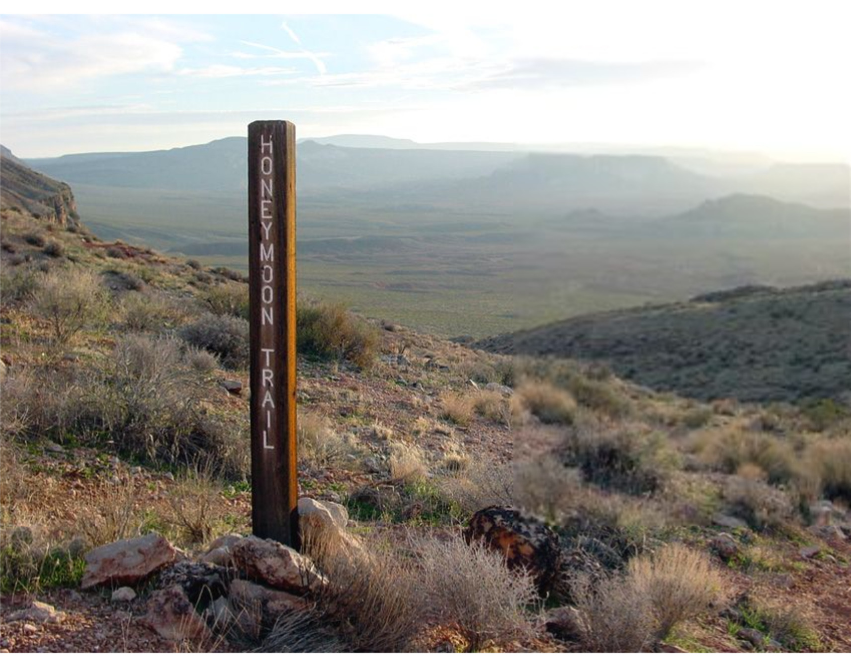
    <title type="html"><![CDATA[Honeymoon Trail]]></title>
    <summary type="html"><![CDATA[<p><strong><em>The Honeymoon Trail connected Latter-day Saint communities in Arizona to St. George and was originally known as the Mormon Wagon Road. Will C. Barnes, an American historian, coined the term Honeymoon Trail as he studied the hundreds of couples who trekked along the trail to the St. George Temple to get married. Couples continued to make the hazardous journey until 1927, when the Mesa, Arizona temple opened. </em></strong></p><img src="https://www.intermountainhistories.org/files/fullsize/b5f9fbc2448e80d9a7874c071208e8c7.jpg" alt="Honeymoon Trail" /><br/><p><span style="font-weight:400;">In 1871, leaders of the Church of Jesus Christ of Latter-Day Saints announced that a temple would be built in St. George in 1871. While this was exciting for members in southern Utah, it was also exciting to the members scattered throughout Arizona who wanted to be married for eternity in a ceremony that could only take place in a temple. After the temple in St. George was completed in 1877, couples in Arizona traveled to St. George to participate in the marriage ceremony. Depending on their starting point in northern or southern Arizona, some couples traveled over 400 miles to be married.</span>
<span style="font-weight:400;">The Honeymoon Trail was difficult to traverse under the best conditions and was sometimes made worse by the weather. Couples had no choice but to cross deep muddy washes and traverse canyons and hills. They could choose between a shorter route across mountains or avoid them by extending their journey by many miles. Although the trail did have a hazardous river crossing, most of the trail lacked adequate drinking water. It was common for oxen to die from dehydration. Some couples made the most of this loss by trading dying or dead oxen to people along the trail for other needed goods. Some couples endured snowstorms while others endured sandstorms. For instance, Joseph Fish, who undertook the trail to marry Julia Reidheid, suffered vision loss due to the sandstorms encountered on the journey. Despite their father’s challenging experience, some of Fish’s children still chose to traverse the same trail to reach the temple, fully aware of the risks they would face.</span>
<span style="font-weight:400;">The physical trail was not the only danger faced by couples. Tensions stemming from the Black Hawk War, a violent confrontation between Latter-Day Saint settlers and the Ute, Paiute, and Navajo nations from 1865 until 1872, led to ongoing confrontations. Some travelers lost horses to Indigenous raiders. However, many of the interactions between travelers and the Natives were friendly. Still, stories of past violence exaggerated the expectations of hostile interactions and caused the travelers to fear. Not only were Natives a concern, but running into strangers and outlaws also brought fear to the lawless wilderness. Danger surrounded the couples and groups who journeyed to the temple in St. George. </span>
<span style="font-weight:400;">The efforts and dedication of the Saints of Arizona were observed by Church leaders. In 1918 they announced that a temple would be built in Mesa Arizona. At the time there were only six operating temples, marking a tremendous victory for the members scattered throughout Arizona. The completion of the Mesa Temple in 1927 brought to an end the colorful history of the Honeymoon Trail.</span></p><p><em><strong><a href="https://www.intermountainhistories.org/items/show/777">For more (including 4 images) view the original article</a></strong></em></p>]]></summary>
    <published>2024-02-02T00:19:57+00:00</published>
    <updated>2026-04-17T19:32:17+00:00</updated>
    <link rel="alternate" type="text/html" href="https://www.intermountainhistories.org/items/show/777"/>
    <id>https://www.intermountainhistories.org/items/show/777</id>
    <author>
      <name>Margie Brown, Brigham Young University</name>
    </author>
  </entry>
  <entry>
    <title type="html"><![CDATA[American Fork Second Ward Meeting House]]></title>
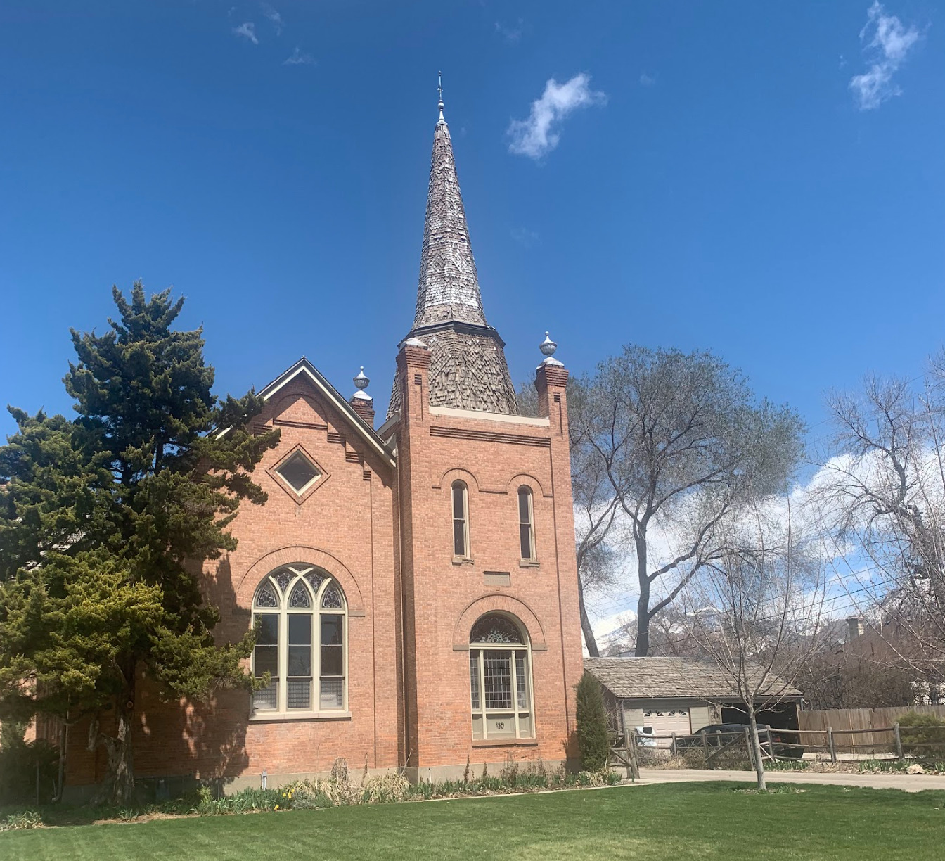
    <summary type="html"><![CDATA[<p><strong><em>The American Fork Second Ward Meeting House was built in response to the expansion of the American Fork settlement. Latter-Day Saints attended meetings there for almost eight decades. Although its use has changed, today it remains an excellent example of early 20th century gothic architecture.</em></strong></p><img src="https://www.intermountainhistories.org/files/fullsize/6368158aa6c18f215b83f77b7eb32afd.jpg" alt="East side steeple, American Fork Meeting House " /><br/><p><span style="font-weight:400;">The American Fork Second Ward Meeting House, located in American Fork Utah, was constructed in 1903 by members of The Church of Jesus Christ of Latter-day Saints. The building was originally proposed by Bishop Joseph H. Storrs on September 29, 1901. After a unanimous vote in favor of building the meeting house, plans for its construction began immediately. The ward members donated their time, talents, and money to the construction of the building. Though still under construction, they began using the meeting house in 1903. Eventually the steeple was finished, all debts were paid, and the meeting house was dedicated on February 17th, 1909. The total cost of the building was $10,000.20. In 1929 the ward members voted to expand the building to house all auxiliaries. The expansion and remodel included updating the chapel in the southeast section of the building beneath the steeple and the addition of a new recreational hall. The construction resulted in the church's current U-shape. John L. Firmage and his wife, members of the ward, donated $15,000 to the remodel. As a result, the addition was often referred to as the Firmage recreational hall. Architect Don Carlos Young, of Young and Hansen Architects, designed the renovation in the original gothic style. The total cost of the project was $48,555.54 by the end of the project. </span>
<span style="font-weight:400;">After the remodel, the updated chapel was used only for sacred purposes while the recreation hall was used for all other activities. The recreation hall was frequently the location of wedding receptions, dramas, and other community gatherings. The renovation also created enough space for classrooms to accommodate Sunday School and other auxiliary meetings. It even included offices for Bishopric members. </span>
<span style="font-weight:400;">The American Fork Second Ward utilized the building until the early 1980s when it was abandoned for a newer meeting house. In 1984 the abandoned church building was purchased by Michael Bigelow, who owned the building in 2023. An application was submitted for the meeting house to become a historical site in November 1991 and the historical status was granted in 1992. Bigelow has since made small updates to accommodate a residence for his family on the upper floor Sunday School room, and minor changes to utilize the space for their pipe organ design and construction business that is on the main and basement levels. The Bigelow family has been careful to maintain the original gothic architecture of the meeting house. </span></p><p><em><strong><a href="https://www.intermountainhistories.org/items/show/766">For more (including 4 images) view the original article</a></strong></em></p>]]></summary>
    <published>2024-01-18T03:23:29+00:00</published>
    <updated>2026-04-17T19:32:17+00:00</updated>
    <link rel="alternate" type="text/html" href="https://www.intermountainhistories.org/items/show/766"/>
    <id>https://www.intermountainhistories.org/items/show/766</id>
    <author>
      <name>Cecilie Cooper, Brigham Young University</name>
    </author>
  </entry>
  <entry>
    <title type="html"><![CDATA[Battle Creek Canyon Massacre]]></title>
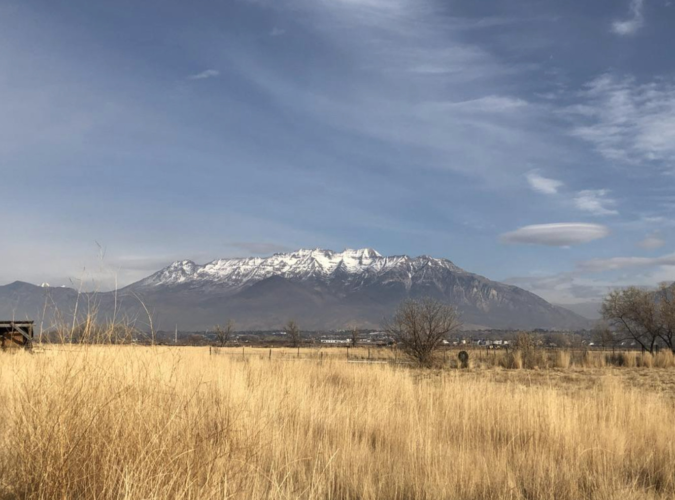
    <summary type="html"><![CDATA[<p><strong><em>Battle Creek Canyon's name originates from Utah's first major skirmish between the Utes and the Mormon militia. </em></strong></p><img src="https://www.intermountainhistories.org/files/fullsize/54eea90162a257c6e9cd4299408aea71.jpg" alt="Kade Dallin, Purple Mountain Majesties, 2020.
" /><br/><p><span style="font-weight:400;">When the pioneers of the Church of Jesus Christ of Latter-day Saints entered the Salt Lake Valley, they generally settled in what is now Salt Lake County on the Wasatch Front. The area was largely a desert and many, including some mountain men, suggested that the people settle further south in the freshwater valley that now comprises the bulk of Utah County. Brigham Young immediately sent out people to found colonies, cities, and towns throughout modern Utah, Arizona, Nevada, California, and Mexico. Yet, the pioneers balked at the initial thought of settlement in Utah Valley because of the native tribes who already lived there. Various bands of the Ute and Timpanogos tribes lived throughout the valley and had a reputation of being warlike and aggressive as a way to defend their land and livelihood. </p>
<span style="font-weight:400;">The pioneers especially resented the Ute practice of poaching the settler’s cattle. Roman Nose, a prominent Ute, was particularly troublesome. He led a band that repeatedly raided the farms and ranches near the valley border, and was even accused of stealing several of Brigham Young’s personal horses. After Brigham Young heard of the theft, he ordered Captain John Scott to lead a posse against the Utes in hopes of apprehending Roman Nose and his band. Their orders were to find the band of thieves and to “take such measures as would put a final end to their depredations in the future.” In 1849, they began raiding the Ute bands they deemed responsible for the loss of the livestock. However, Brigham Young soon discovered that the Utes had been mistakenly blamed: his horses had simply been moved to different pastures. He ordered Scott and the posse to stand down, but they refused. </p>
<span style="font-weight:400;">On the morning of March 5, 1849, the relationship between Mormon settlers and the local band of Timpanogos Indians deteriorated into brutal hostility in what is now Pleasant Grove, Utah. Scott’s rogue posse of 44 men soon arrived where they found the Ute camp which they thought participated in the raids. The group surrounded the sleeping camp and opened fire in a reign of terror. The members of the posse then hunted down many of the Utes who managed to escape the initial shootout. In total, they killed seventeen men, women, and children, including Roman Nose. </p>
<span style="font-weight:400;">After seeing the massacre, the chief of the Native American tribe, Little-Chief was distraught. Although he reportedly agreed that the killing of the supposed thieves was justified, he understood that this would cause a rift to form between white settlers and local tribes. This event, among many other skirmishes, led to heightened tension between the two groups and permanently damaged the already delicate relationship between the Native American tribes and the Mormon settlers. After this event, the area became known as Battle Creek Canyon and is today memorialized by the Battle Creek Marker. </span>


</p><p><em><strong><a href="https://www.intermountainhistories.org/items/show/757">For more (including 2 images) view the original article</a></strong></em></p>]]></summary>
    <published>2023-10-22T05:05:29+00:00</published>
    <updated>2026-04-17T19:32:16+00:00</updated>
    <link rel="alternate" type="text/html" href="https://www.intermountainhistories.org/items/show/757"/>
    <id>https://www.intermountainhistories.org/items/show/757</id>
    <author>
      <name>Kade Dallin, Brigham Young University&amp;#32;&amp;amp;&amp;#32;Bryce Revelli, Brigham Young University</name>
    </author>
  </entry>
  <entry>
    <title type="html"><![CDATA[Cove Fort<br />
: A Bulwark of Safety]]></title>
    <summary type="html"><![CDATA[<p><strong><em>Cove Fort is one of the few remaining forts built by the Latter-day Saint pioneers. Under the direction of Brigham Young, the fort was constructed in 1867 by Ira Hinckley and 40 other men near Cove Creek in today’s Millard County. Originally intended to protect travelers from attack, the fort served as a major waystation for more than a decade. After changing ownership several times, the Hinckley family purchased the fort in 1989 and later donated it to The Church of Jesus Christ of Latter-day Saints.</em></strong></p><img src="https://www.intermountainhistories.org/files/fullsize/0ef807b9607b7b3937c89b7c5f788dd3.jpg" alt="Cove Fort" /><br/><p>In the spring of 1865, Mormon settlers met with Utes of Sanpete Valley, hoping to find a resolution to years of sporadic disagreements and occasional violence between the groups. Instead of alleviating tensions, however, even greater violence erupted with the onset of the Black Hawk War. Brigham Young previously encouraged the Saints to treat Indians well, saying, “We are settled upon their lands, which materially interrupts their success in hunting, fishing, etc… For these reasons, it behooves us to exercise toward them all possible kindness, liberty, patience, and forbearance.” While his policy of kindness toward Native Nations continued, Young simultaneously recognized Mormon settlers were vulnerable to attack after dispossessing tribes of some of their settlement sites and using up the region’s finite resources.</p><p>The area around Cove Creek was a particularly dangerous resting place for travelers as 30 miles of uninhabited desert lay in both directions. On April 12, 1867, Circleville resident Ira Hinckley received a letter from Brigham Young extending a calling for him to construct a fort near Cove Creek. Its purpose was to “afford protection from the Indians to the Telegraph & Mail Stations and to travelers who are almost constantly on the road. Also to furnish feed and protection from and weather to this latter class.” Hinckley immediately told the messenger to tell Brigham Young he would accept the calling.</p><p>A few days later, Hinckley traveled to Cove Creek with his brother Arza and forty other men, and within seven months they finished building Cove Fort. While <span>most pioneer-era forts were wooden, Cove Fort was instead constructed out of volcanic rock, contributing to its structural longevity.</span></p><p></p><p>Although relatively small, measuring 100 feet by 100 feet, Hinckley and his men built an impressive fortress. The walls were 18 feet high, 4 feet thick at the base, and 2 feet at the top. Gun ports lined the walls. The fort had rooms for the Hinckley family, visitors, a kitchen and dining area, and a room for a telegraph station, which was installed in February 1867. There was also a ranch on site to provide food and a blacksmith shop to service the horses and wagons of travelers.</p><p>While the fort was initially designed for protection, it was never attacked, and the inhabitants maintained good relations with the local tribes. It did, however, serve as a refuge for all those that visited. Families, telegraph operators, mail carriers, trail workers, and even occasional Utes called upon the Fort for a place to sit or stay the night. Hinckley’s son Ira Parnell Hinckley said, “Within its then impregnable walls were safely sheltered thousands, both good and bad, the venturesome and the timid, the desperado and the saint, as they moved westward in quest of gold, or eastward in disappointment, or back and forth in their routine duty. Without it, what might have been, no one knows.”</p><p>The fort was used as a waystation from 1867 to 1882, but as the railroad became increasingly popular, fewer travelers visited the fort. The Hinckley family occupied Cove Fort until 1890, and then in 1919 the Church signed it over to William Henry Kesler. In 1989, descendants of Ira and Arza Hinckley purchased the land back from the Kesler family and subsequently donated it to The Church of Jesus Christ of Latter-day Saints. The Church restored Cove Fort to its original condition and Gordon B. Hinckley, then a member of the Church’s First Presidency and a descendant of Ira Hinckley, dedicated it as a historic monument on May 21, 1994.</p><p><em><strong><a href="https://www.intermountainhistories.org/items/show/468">For more (including 4 images) view the original article</a></strong></em></p>]]></summary>
    <published>2021-09-10T06:57:52+00:00</published>
    <updated>2026-04-17T19:32:09+00:00</updated>
    <link rel="alternate" type="text/html" href="https://www.intermountainhistories.org/items/show/468"/>
    <id>https://www.intermountainhistories.org/items/show/468</id>
    <author>
      <name>Bethany Erickson, Brigham Young University&amp;#32;&amp;amp;&amp;#32;Lindsey Conger, Brigham Young University</name>
    </author>
  </entry>
  <entry>
    <title type="html"><![CDATA[Charles Walker: St. George Poet]]></title>
    <summary type="html"><![CDATA[<p><strong><em>Charles Walker was called to the Cotton Mission in St. George and made his living there as a blacksmith and stonemason. He helped construct the St. George Temple and was renowned for his poems and songs</em></strong></p><img src="https://www.intermountainhistories.org/files/fullsize/153a43781a51f0e34aef0043afac9d06.jpg" alt="Charles L. Walker" /><br/><p>The scorching temperatures, sparse vegetation, and endless red rock of Saint George, Utah were all that greeted early settlers in the Cotton Mission. Charles Walker, born 1832 in Leek, England, was one of the individuals called by Brigham Young to settle the area and produce cotton to supplement the income for The Church of Jesus Christ of Latter-Day Saints. Upon arriving in 1862, Walker remarked, “St. George is a barren looking place. The soil is red and sandy. On the North ranges a long high red rocky bluff. On the East is a long black ridge of volcanic production. On the west the same. On the south runs the Virgin river, a shallow, rapid stream from which a great portion of the land is irrigated. To look on the country it [is a] dry, parched, barren waste with here and there a green spot on the margins of the streams.” While his observation seemed bleak, Walker exuded optimism with the work that he believed God had called him to do. He wrote in his personal journal, “Well it’s all right; we shall know how to appreciate a good country when we get to it, when the Lord has prepared the way for his people to return and build up… Zion.” Walker’s time in St. George reflected the stalwart nature of those called to settle far Western settlements, and his life in the area would have a significant impact on those around him.
The initial hope that settlers could grow cotton as a cash crop was dashed by poor soil quality. In an attempt to keep the community thriving, Brigham Young ordered the construction of a large public works project to bolster the economy: a new temple. Walker transitioned to stonemasonry and worked on the temple constantly. When the temple was completed, Walker participated in the, and a song he wrote for the occasion was sung at the event. When Walker was not busy with blacksmithing or working on the temple, he spent time with his family and saw to his various church callings. One labor that endeared him to the hearts of his neighbors was his gifted ear for writing hymns, the most famous of which is “Dearest Children, God is Near You.”
Walker later adopted polygamy as practiced by Latter-day Saints in the nineteenth century, marrying his second wife, Sarah Smith. His first wife, Abigail Middlemass, helped him select Sarah, and the trio lived together for the rest of Walker’s life. Each wife gave birth to eight children, sixteen total, with twelve of them reaching adulthood. Walker noted that his peculiar family situation allowed him to labor on the temple and work in his shop more because the burden of running the household was shared between his spouses. Walker also kept himself busy as an assistant marshal for the city and a leader in the local militia. He passed away in 1904, leaving behind a legacy of faithfulness and work ethic on the Utah Frontier.</p><p><em><strong><a href="https://www.intermountainhistories.org/items/show/464">For more (including 3 images) view the original article</a></strong></em></p>]]></summary>
    <published>2021-09-09T22:12:39+00:00</published>
    <updated>2026-04-17T19:32:09+00:00</updated>
    <link rel="alternate" type="text/html" href="https://www.intermountainhistories.org/items/show/464"/>
    <id>https://www.intermountainhistories.org/items/show/464</id>
    <author>
      <name>Dalton Bennett, Brigham Young University</name>
    </author>
  </entry>
  <entry>
    <title type="html"><![CDATA[BYU’s Underground]]></title>
    <summary type="html"><![CDATA[<p><strong><em>While BYU is known for its manicured lawns, lush landscapes, and diverse architecture, few are familiar with the complex underground network of tunnels, rooms, and passageways that lie mere feet beneath it all. </p></strong></p><img src="https://www.intermountainhistories.org/files/fullsize/b6f122116ed9acb5f5773b0098d33eac.jpg" alt="An entrance to the tunnels" /><br/><p>At BYU, rumors abound about what lies underneath campus. Whispered stories of students that have plumbed the depths of campus’ underground have intrigued the BYU community for decades. Such stories have become so enmeshed in BYU folklore that it is at times hard to separate fact from fiction. </p><p>It has been half-jokingly suggested that the tunnels extend all the way to downtown Salt Lake City, connecting with the underground passages underneath Temple Square.“ If not to Salt Lake, they surely connect to the Provo Temple,” some amateur amateur urban explorers have surmised. Since at least 2002, the popular “100 Hour Board,” “a BYU online forum run by volunteer students who answer any question,” has perpetuated the idea that there are giant blood guzzling “tunnel worms” that live under campus. </p><p>While there may not be secret passageways to temples or monsters living underneath BYU, for 25 years there was a hidden nuclear reactor nestled underneath BYU’s South Hill. The 10-watt L77 research reactor was operational from 1967 until being disassembled in 1992. The nuclear lab that had once housed the reactor was later demolished in 2009. The facility was accessible through a tunnel that began under the Maeser Building. Since 1992 that part of the tunnel system has been completely sealed off.</p><p>Students that dare to enter the tunnels without permission, do so at great risk. If a student decides to descend into the depths of the BYU tunnel network, he or she potentially faces severe repercussions. If caught, students face a mandatory $300 fine and the possibility of university and/or legal criminal sanctions. While many students who trespass do so for the thrill of discovery, some have used the tunnels for more nefarious purposes. In February 2020, one such offender, a masked nineteen-year-old student, was caught in the BYU Culinary Support Center after hours. He admitted to repeatedly using the subterranean tunnels to steal food from locked university buildings. He was arrested for burglary.</p><p>Fines, expulsion from BYU, and legal charges are not the only threats that face tunnel trespassers. The pipes that extend the length of the tunnels carry 400° steam to heat buildings all across campus. An unsuspecting person touching a pipe or encountering a steam leakage could suffer horrific burns. The motion sensors, legal threats, and other deterrents have all been put into place to protect students’ safety. Those who need to enter the tunnels for maintenance must adhere to strict procedures, including using sign-out sheets. If employees fail to return by the scheduled return time they indicated on the sign-out sheet, BYU Heating Center personnel or the police will go looking for the missing individual(s). </p><p>When the BYU Heating Plant was constructed in the 1950’s tunnels were dug to more easily and efficiently heat buildings on campus. Gradually, underground piping was replaced by pipes in the much more long-lasting and easier to maintain tunnel housing. Over time the tunnel network has grown, extending as far north as the BYU Laundry and the Missionary Training Center. Today, only an estimated 10% of underground heating pipes are not contained within the tunnel system.</p><p>Originating at the Heating Plant, pipes travel to almost every building on campus carrying 400° steam, pressurized at 300psi, to provide heating. There are around 210-220 heat exchangers on campus, allowing for the high pressured steam to be used in campus buildings. Most buildings at BYU have their own heat exchanger in an underground vault. Although less extensive than the network of pipes for heating, the tunnels also house chilled water pipes that help cool buildings during Provo’s hot months. While the primary use of the tunnels is to provide heating and cooling to BYU buildings, they also provide power and internet through fiber optic lines to some buildings. </p><p><em><strong><a href="https://www.intermountainhistories.org/items/show/462">For more (including 3 images) view the original article</a></strong></em></p>]]></summary>
    <published>2021-04-03T07:12:33+00:00</published>
    <updated>2026-04-17T19:32:09+00:00</updated>
    <link rel="alternate" type="text/html" href="https://www.intermountainhistories.org/items/show/462"/>
    <id>https://www.intermountainhistories.org/items/show/462</id>
    <author>
      <name>Ryan J. Hallstrom, Brigham Young University</name>
    </author>
  </entry>
  <entry>
    <title type="html"><![CDATA[N. Eldon Tanner Building  (TNRB)]]></title>
    <summary type="html"><![CDATA[<p><strong><em>Dedicated in 1983, the N. Eldon Tanner Building houses one of the largest colleges on campus,  the Marriott School of Business.</em></strong></p><img src="https://www.intermountainhistories.org/files/fullsize/ccce647e7feaaa4ec3bf312ca6b4c88a.jpg" alt="The Tanner Building " /><br/><p>Business courses have been offered at Brigham Young University since its infancy. BYU’s business college, called by many different names in its long history, was previously housed in Maeser Building and the Jesse Knight Building.</p><p>As the number of business students at BYU increased, in 1980, private donors funded the construction of a new, larger building that the school of management could call home-- making the structure the first on campus funded entirely by private donations. This new 144,000 square foot building was named after President N. Eldon Tanner, a prominent leader in the Church of Jesus Christ of Latter-day Saints. President Tanner, had been a teacher, politician, businessman, and apostle. “Known in and out of the Church as Mr. Integrity,” President Tanner possessed high morals and prodigious management skills. Sadly, President Tanner did not live to see his namesake building finished. He died in November 1982, just months before the April 5, 1983 dedication. </p><p>In 1988, BYU’s “School of Management” was renamed the “Marriott School of Management,” after J. Willard Marriott, the founder of the famous hospitality company “Marriott International.” J. Willard and his wife Alice S. Marriott made a large donation to the school. The name of the school was adjusted again in 2017, when the university announced that the BYU Marriott School of Management was being changed to the “BYU Marriott School of Business.”</p><p>In April 2007 work began on an addition to the Tanner Building. The large, four-story addition, dedicated by President Thomas S. Monson on October 24th, 2008, housed new classrooms, study spaces, offices, a large lecture hall, a parking garage, and a deli. Between 1983 and 2008 the Marriott School saw a 50% increase in student enrollment. This addition added 53% more space for the growing school. Since becoming accredited in the 1950’s, BYU’s business school has developed some of the top undergraduate business programs in the country. The Tanner Building, with its sleek modern lines and extensive facilities, is a fitting home for the world renowned Marriott School of Business. </p><p><em><strong><a href="https://www.intermountainhistories.org/items/show/461">For more (including 4 images) view the original article</a></strong></em></p>]]></summary>
    <published>2021-04-03T06:59:23+00:00</published>
    <updated>2026-04-17T19:32:09+00:00</updated>
    <link rel="alternate" type="text/html" href="https://www.intermountainhistories.org/items/show/461"/>
    <id>https://www.intermountainhistories.org/items/show/461</id>
    <author>
      <name>Ryan J. Hallstrom, Brigham Young University </name>
    </author>
  </entry>
  <entry>
    <title type="html"><![CDATA[BYU Creameries]]></title>
    <summary type="html"><![CDATA[<p><strong><em>While BYU is perhaps best known for its academic achievements and sports programs, since the mid 1940’s the university has owned and operated a successful dairy farm and creamery.</p></strong></p><img src="https://www.intermountainhistories.org/files/fullsize/f11b2acd3cce1c171bba4c851c42cf96.jpg" alt=" Creamery on Ninth. 
" /><br/><p>Brigham Young University has operated a dairy farm since 1946. The first farm was located on 24 acres in Northern Provo. The farm operations included a creamery, producing milk and dairy products mostly for the university community. In the 1950s, the creamery was transferred from the College of Applied Science to BYU Auxiliary Services. Then in 1957 the school purchased approximately 600 acres of farmland in Spanish Fork to increase the school’s farming operations. Agriculture professor Grant Richards helped bring BYU’s dairy herd to a prize-winning level and by 1959, BYU’s pure-bred Holsteins were known to produce over twice as much milk and butter than the average American dairy cow. </p><p>In 1949, a dairy-processing plant was built just north of the Central Heating Plant. The College of Biological and Agricultural Sciences developed a curriculum in dairy processing, though these courses were eventually replaced by food science courses. The Dairy Products Laboratory building was completed in 1964 after nine months of construction. In 2009, the facility moved locations on campus and expanded to become the BYU Culinary Support Center. This new expanded operation is responsible for all on campus food, feeding tens of thousands of people daily. </p><p>The Creamery on Ninth opened in 2000. Kent’s Market, a grocery store located in the current Creamery’s location, had closed in 1999 after serving BYU students for 59 years. Heritage Halls residents and other students complained about the closure, so the university decided to refurbish the building and open a university-run grocery store and grill. The Creamery on Ninth opened on August 23, 2000 and quickly became a popular spot for BYU students and locals alike. Besides the flagship Creamery on Ninth store, soon creamery locations were established including Helaman Creamery, Creamery Outlet, Wyview Creamery, Takeaway Creamery, and Creamery Express. </p><p>While BYU's Creamery locations sell a wide variety of goods, the main attraction has always been the ice cream. With milk supplied from BYU’s dairy farm in Elberta, Utah, BYU Creamery Operations now produce over 200,000 gallons of ice cream per year. BYU’s ice cream formulas have 2-4% higher milk fat content than most ice cream recipes, giving it an unusually rich, creamy consistency. Although LaVell’s Vanilla holds the number one spot for half-gallon sales, the Creamery reports Graham Canyon to be its most popular flavor.</p><p>BYU Creameries play an integral role in the social fabric of BYU, providing convenient locations for students and staff to buy groceries and a fun place to relax after a long day of work. </p><p><em><strong><a href="https://www.intermountainhistories.org/items/show/460">For more (including 5 images) view the original article</a></strong></em></p>]]></summary>
    <published>2021-03-30T06:24:01+00:00</published>
    <updated>2026-04-17T19:32:09+00:00</updated>
    <link rel="alternate" type="text/html" href="https://www.intermountainhistories.org/items/show/460"/>
    <id>https://www.intermountainhistories.org/items/show/460</id>
    <author>
      <name>Allie Patterson, Brigham Young University; Ryan J. Hallstrom, Brigham Young University</name>
    </author>
  </entry>
  <entry>
    <title type="html"><![CDATA[Sage Treharne Jones, Female Homesteader]]></title>
    <summary type="html"><![CDATA[<p><strong><em>Sage Treharne Jones was many things before she turned to homesteading— immigrant, teacher, wife, mother, widow, and postmistress. Efficient and industrious, Sage embodied characteristics necessary to thrive on Utah frontiers in the 19th century.</p></strong></p><img src="https://www.intermountainhistories.org/files/fullsize/8eec0e69d3629d4e63f439c06eb1a19b.jpg" alt="Image of Sage Treharne Jones
" /><br/><p>In 1849, Sage Treharne migrated from Wales to the United States after being taught by Mormon missionaries. She faced cholera and smallpox along the way and watched both her parents die. She continued west, travelling with a Greene family. On her way, Sage met Thomas Jones and, upon arriving in Utah in October 1852, the two were married. Following demand for iron workers, or possibly answering a call from church leaders, Sage and Thomas moved to Southern Utah. When the iron works were discontinued in 1858, the family turned completely to farming and livestock. In 1860, they built a small adobe house in Cedar City. Thomas developed rheumatism which grew increasingly worse, disabling him until his death in September 1862. </p><p>Sage was left a widow with six living children under the age of eight. She turned to sewing to make a livelihood and depended on her farm to raise the necessary crops and livestock. She is described as an independent woman and “determined to give her children all the advantages that could be had.” “Never ashamed of how little they had,” Sage raised her family to be hardworking and proud of their heritage. Life was difficult, but growing children stepped up, taking over the farm work, and the Jones received support from their neighbors when needed. When harvests failed, the community came together, sharing what little they had and “in their kindness to one another, they found their greatest joy.”</p><p>Her oldest sons, Lehi and Kumen, acquired a contract delivering mail and freight along Pony Express routes and Sage assumed the role of postmistress. “Without ever a word of complaint,” she was a firm supporter of the boys in their position. The mail contract continued with younger sons and nephews continuing to deliver until 1876. In 1885, Sage was appointed as the postmistress of Cedar City. In this new role and with the help of her children, Sage learned to write English. She kept the post office for thirteen years. </p><p>In 1895, at age 62, Sage filed for a homestead on two land sections in Cedar Canyon, near the intersection of Moots Hollow. With her children largely established and self-reliant, it seems she filed hoping to acquire more land for her family. Soon after, she received her US citizenship. One year after becoming a citizen and before she could legally acquire the deed to her claim, Sage died. The property defaulted to her heirs several years after her death. Sage was an active member of her community and Relief Society. A dignified woman, she “was respected and loved wherever she went.” Sage was not a homesteader, at least initially, in the traditional sense of filing on a claim, but she certainly worked hard, sought independence, and “learned to love the wild country of the West.”</p><p><em><strong><a href="https://www.intermountainhistories.org/items/show/451">For more (including 4 images) view the original article</a></strong></em></p>]]></summary>
    <published>2021-02-03T05:34:32+00:00</published>
    <updated>2026-04-17T19:32:09+00:00</updated>
    <link rel="alternate" type="text/html" href="https://www.intermountainhistories.org/items/show/451"/>
    <id>https://www.intermountainhistories.org/items/show/451</id>
    <author>
      <name>Anna Bailey, Brigham Young University</name>
    </author>
  </entry>
  <entry>
    <title type="html"><![CDATA[The Black Hawk War]]></title>
    <summary type="html"><![CDATA[<p><strong><em>The Black Hawk War pitted the Mormon settlers against Native Americans in Utah Territory. Many raids took place, in which many lives were lost. As the war escalated, the relationship between the Mormon settlers and the Native Americans increased in separation. Finally, the war came to an end with a treaty that would start to mend the relationship between the Mormon settlers and the Native Americans.</p></strong></p><img src="https://www.intermountainhistories.org/files/fullsize/df1041ef2dbd946b88cdda14d537c2a6.jpg" alt="James Russell Ivie" /><br/><p>The Black Hawk War grew from severe tension between the Mormon settlers and the Native Americans in the Utah Territory. When the settlers arrived in the Utah Territory many drove the wild animals that the Natives hunted into the mountains, and allowed their cattle, horses and sheep to eat the grass, which was a major food source for the Native Americans. The Natives viewed the settlers as the cause for their lose of resources, and often took domesticated livestock in return.</p><p>These interactions resulted in violence, with both sides making declarations of war for many reasons, such as protecting their families and avenging the loss of their brethren. The Black Hawk War officially started the day the Civil War ended in 1865. During this war many raids took place, in which many lives were lost, with the majority of fatalities being Native Americans. </p><p>At the end of the war in the year 1868, Black Hawk offered a peace treaty to the Mormon settlers, which to some Native Americans was not welcomed, but in the end was accepted by both sides. However, the battles and the raids that took place during the Black Hawk War only made the relationship between the settlers and the Native Americans worse. This treaty seemed to be the first step that was accepted by both sides, which led to the start of the healing process of their relationship. Many saw this treaty as the official ending of the Black Hawk War, while others believed that the war ended when Black Hawk left to go to live in another part of the Utah Territory. </p><p><em><strong><a href="https://www.intermountainhistories.org/items/show/307">For more (including 2 images) view the original article</a></strong></em></p>]]></summary>
    <published>2019-02-22T07:03:57+00:00</published>
    <updated>2026-04-17T19:32:05+00:00</updated>
    <link rel="alternate" type="text/html" href="https://www.intermountainhistories.org/items/show/307"/>
    <id>https://www.intermountainhistories.org/items/show/307</id>
    <author>
      <name>Rachel Lee, Brigham Young University</name>
    </author>
  </entry>
  <entry>
    <title type="html"><![CDATA[Fort Bridger the Crossroads of the West]]></title>
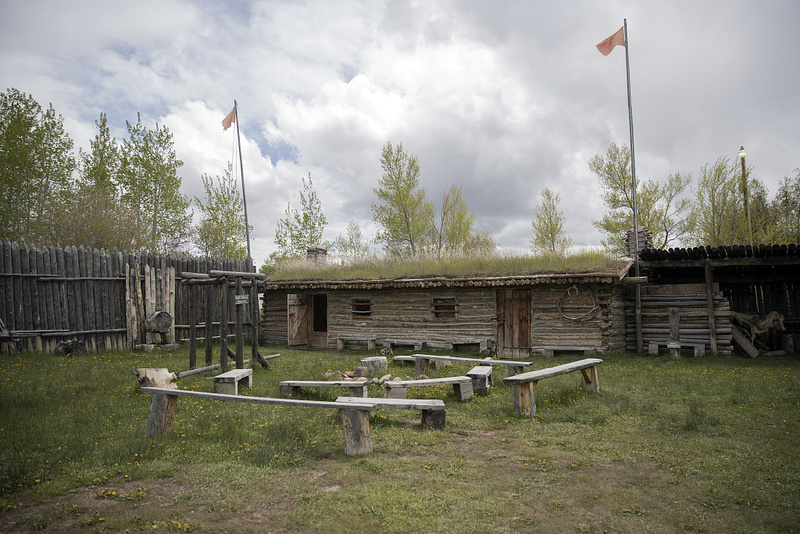
    <summary type="html"><![CDATA[<p><strong><em>“‘Fort Bridger’, as it is called, is a small trading-post, established and now occupied by Messrs. Bridger and Vasquez. The buildings are two or three miserable log-cabins, rudely constructed, and bearing but a faint resemblance to habitable houses.” – Edwin Bryant, American frontiersman and guide along the Overland trail</p></strong></p><img src="https://www.intermountainhistories.org/files/fullsize/4dbe8c195526e7485744bea72f784b0d.jpg" alt="Inside Stockade at Fort Bridger" /><br/><p>Located just off I-80, thirty miles from Evanston, Wyoming, lies the historic site of Fort Bridger. Fort Bridger has a long history of being involved with the American fur trade, western overland migration, and military involvement against the Mormons and Native Americans. It sits on the historic crossroads of the Oregon/California trail and the Mormon trail, and later the Pony Express Route, the Transcontinental Railroad, and the Lincoln Highway.</p><p>Fort Bridger was built by Jim Bridger in 1843. Bridger was a mountain man and frontiersman and heavily involved during the rendezvous fur trade period. He built his trading post close to popular rendezvous areas, as well as near the Oregon/California trail, hoping to gain business from the early emigrants heading towards Oregon and California. The original fort comprised of two log houses, about 40 feet long, with a corral for livestock. The fort also had a blacksmith shop, which was valuable for emigrants on the trail. While it was not as luxurious as Fort Laramie, Fort Bridger was still a welcome sight for travelers used to wandering in the wilderness. </p><p>In 1847, the first of the Mormon pioneers passed through the area. Jim Bridger and the Mormons initially maintained a good relationship, but quickly dissipated when the Mormons, feeling that the prices were too inflated at the fort, built their own fort nearby. After a series of raids on the fort, Bridger and his business partner, Louis Vasquez, abandoned the fort and the Mormons moved in. Eventually Bridger sold the fort to the Mormons, although he later disputes that claim. Adding additional fortifications to the fort, such as stone walls, the Mormons continued to use the fort as a supply station for emigrants heading west. However, in 1857, the Mormons abandoned and burned the fort down when rumors that federal troops were marching towards Salt Lake City with orders to bring Brigham Young in line. The US army subsequently occupied the area, deeming it a good proximity for a military presence over the Mormons. </p><p>The 1859 military reservation boundaries stretched 20 miles east to west, and 25 miles north to south, creating a buffer between the fort and the Mormon settlements. The army rebuilt the stone structures, and added a large parade ground, barracks, and supply buildings. Like most military forts in the west, Fort Bridger did not have walls that surrounded the entire fort, instead, the buildings faced inward towards each other with the open parade grounds serving as the center of the fort. The US army operated the fort from 1857 to 1890, dealing with disputes between the Mormons and the local Native American tribes. In the early 1860’s, Fort Bridger became the home to the Fort Bridger Indian Agency, which served the Eastern Shoshone, and parts of the mixed Bannock and Shoshone tribes. After the end of the Indian Wars in 1890, the military officially closed and abandoned the fort. Jim Bridger’s dream of a trading post became much more; Fort Bridger became the crossroad in the west, bridging the gap between the east and the west, political disputes, and white settlers and Native Americans. </p><p><em><strong><a href="https://www.intermountainhistories.org/items/show/243">For more (including 5 images) view the original article</a></strong></em></p>]]></summary>
    <published>2019-01-11T23:43:53+00:00</published>
    <updated>2026-04-17T19:32:03+00:00</updated>
    <link rel="alternate" type="text/html" href="https://www.intermountainhistories.org/items/show/243"/>
    <id>https://www.intermountainhistories.org/items/show/243</id>
    <author>
      <name>Rachel Hendrickson, Brigham Young University </name>
    </author>
  </entry>
  <entry>
    <title type="html"><![CDATA[Emigration Canyon: The Arrival of the Saints]]></title>
    <summary type="html"><![CDATA[<p><strong><em>In late July, 1847, the first party of Mormon pioneers entered the Salt Lake Valley, traveling through Emigration Canyon in the Wasatch Mountains. Within two days, the pioneers erected a permanent settlement at City Creek, near modern-day Temple Square in Salt Lake City. The arrival of the Mormons commenced a new era of history in Utah, attracting thousands of eager Mormon settlers to cultivate and transform the land. </em></strong></p><img src="https://www.intermountainhistories.org/files/fullsize/98f4d1a60528ad40bcbebc195b6bd91f.jpg" alt="Emigration Canyon" /><br/><p>On July 21st, 1847, after a grueling journey of 108 days, Erastus Snow and Orson Pratt had the distinction of being the first Mormon pioneers to descend from Emigration Canyon into the Salt Lake Valley, after following the remnants of a rough road through the Wasatch Mountains most recently blazed by the Donner-Reed Party. Pratt’s words capture the grandeur of that moment, “After issuing from the mountains . . . and beholding, in a moment, such an extensive scenery open before us, we could not refrain from a shout of joy . . . the grand and lovely scenery was in our view”. Although the Mormons were not the first Euro-Americans, or even emigrants, to pass through Emigration Canyon into the Salt Lake Valley, their arrival represented a dynamic transition in the history of Utah, which the Mormons would dominate from that point onward. </p><p>The day after Snow and Pratt first glimpsed and scouted the valley, the Mormon pioneers already began to reshape both the route through Emigration Canyon and the valley itself. On July 22nd, a crew from the advance wagon party lead by Stephen Markham cut a road through Donner Hill in just four hours, creating quick and suitable route around the hill that taxed the Donner-Reed Party’s animals the previous year. On the same day, led by Orson Pratt, eight members of the advance party made their way down into the Salt Lake Valley to locate a suitable location for planting. Finding the soil to be more fertile closer to the mouth of Emigration Canyon, the party discovered an area near City Creek, a “beautiful creek of pure water” according to Pratt, that would become the first settling point for the Mormon pioneers. On July 23rd, while the advance company began plowing acres of land and damming City Creek, Brigham Young, ill with “mountain fever”, made the journey over Little and Big Mountains and camped near what Orson Pratt called Last Creek, prepared to take the final 6 miles of the journey the following day.</p><p>On July 24th, now celebrated as Pioneer Day, the ailing Brigham Young descended into the Salt Lake Valley in one of Wilford Woodruff’s wagons, entering sometime after noon, and as recorded in Woodruff’s journal, “expressed his full satisfaction in the Appearance of the valley as A resting place for the Saints.” Brigham Young triumphantly entered the City Creek camp at 2 PM, finding 5 acres of potatoes planted, which the Saints irrigated at noon from the creek, thus beginning the great work of molding the Salt Lake Valley into a suitable home for the Mormons. Although the infamous words of Brigham Young, “this is the place” were not recorded until 33 years later by Wilford Woodruff in a speech commemorating the Mormon church’s 50th anniversary, “This is the Place” monument, completed in 1947 by Brigham Young’s grandson Mahonri Young, immortalized the Mormons’ arrival into the Salt Lake Valley on those July days in 1847, which would transform the land and history of Utah forever.</p><p><em><strong><a href="https://www.intermountainhistories.org/items/show/48">For more (including 3 images) view the original article</a></strong></em></p>]]></summary>
    <published>2017-05-24T01:05:38+00:00</published>
    <updated>2026-04-17T19:31:58+00:00</updated>
    <link rel="alternate" type="text/html" href="https://www.intermountainhistories.org/items/show/48"/>
    <id>https://www.intermountainhistories.org/items/show/48</id>
    <author>
      <name>Luke Eckstrom, Brigham Young University</name>
    </author>
  </entry>
</feed>