<?xml version="1.0" encoding="UTF-8"?>
<feed xmlns="http://www.w3.org/2005/Atom">
  <title type="text">Intermountain Histories</title>
  <updated>2026-04-17T19:32:18+00:00</updated>
  <generator uri="http://framework.zend.com" version="1.12.20">Zend_Feed_Writer</generator>
  <link rel="alternate" type="text/html" href="https://www.intermountainhistories.org/"/>
  <link rel="self" type="application/atom+xml" href="https://www.intermountainhistories.org/items/browse?output=rss2"/>
  <id>https://www.intermountainhistories.org/</id>
  <author>
    <name>Intermountain Histories</name>
    <uri>https://www.intermountainhistories.org</uri>
  </author>
  <link rel="hub" href="https://pubsubhubbub.appspot.com/"/>
  <entry>
    <title type="html"><![CDATA[Everett Ruess: Lost in the Labyrinth of Davis Gulch, Utah ]]></title>
    <summary type="html"><![CDATA[<p><strong><em>Everett Ruess left Escalante Utah on November 12th, 1934 in a light red shirt “as thin as smoking paper” and headed towards Davis Gulch with the confidence of an experienced explorer, which he very much was, but to never be seen again.</em></strong></p><img src="https://www.intermountainhistories.org/files/fullsize/a5b2261c72639e672eacb5c47cb06fbe.jpg" alt="Bement Arch in Davis Gulch" /><br/><p><span style="font-weight:400;">Davis Gulch is located about forty-five miles southeast of Escalante, Utah, down the Escalante River before it meets with the Colorado River. Before leaving Escalante, Everett was warned about the winters of southern Utah and the dangerous trek across Escalante Canyon. However, Everett planned to be home for Christmas, so these worries were behind him. He wrote and sent two letters before arriving at Davis Gulch, to his parents, Stella and Christopher, and another to his brother, Waldo. To his parents, he wrote that he would be unreachable for a couple of months, and would return before the end of the year, but to Waldo, he said that he would not revisit civilization soon, foreshadowing the uncertainty of his disappearance. When Everett did not return to Los Angeles by late December, Stella immediately sent him a Christmas card. However, one month later the card came back to Stella, and the heartfelt message now read “Unkown” and “Return to sender.” </span>
<span style="font-weight:400;">Stella and Christopher’s first objective was to call up Escalante Postmistress Mildred Allen and ask if there was any information on Everett’s whereabouts. Unfortunately, Mildred had not heard from Everett, and neither had anyone else. Next, the Ruess family contacted every Postmaster across the Southwest in search of any sign of Everett but were met with no hope. Their third step was to contact all newspapers and radio stations in the region and ask them to spread awareness of Everett’s disappearance. The first newspaper account of his disappearance was on Valentine's Day, February 14th, 1935, by the </span><i><span style="font-weight:400;">Los Angeles Evening Herald,</span></i><span style="font-weight:400;"> just over three months after he left Escalante. Everett Ruess was now officially missing. </span>
<span style="font-weight:400;">In March of 1935, a man named Gail Bailey spotted two burros deep in Escalante Canyon at Davis Gulch. The trail to Davis was hard to access, meaning that Everett must have scaled the labyrinth of the carved desert to get to the bottom of the canyon safely with two burros, which posed challenges before when he lost a burro in 1932 while climbing out of Canyon del Muerto. </span>
<span style="font-weight:400;">Searches for Everett began soon after Bailey’s report, one led by the Postmistress's husband, Jennings Allen. Found among his burros were some of his belongings, but not a diary, watercolors, or other supplies. After searches ended, the most significant marking left behind was a carving, “NEMO 1934” at the top of a Moqui trail–hand and foot holds carved into rock–next to a large pictograph deep in Davis Gulch. In 1963, The Bureau of Reclamation constructed Glen Canyon Dam, which quickly flooded the canyon, making it harder to search Davis Gulch for Everett Ruess.</span>
<span style="font-weight:400;">To this day there have been many rumors about Everett’s disappearance including a debunked case of his potential remains found in 2008. A quote from one of Everett’s letters summarized his final journey, “I’ll never stop wandering. And when the time comes to die, I’ll find the wildest, loneliest, most desolate spot there is.” Everett’s life ended in solitude, as he always wanted.</span></p><p><em><strong><a href="https://www.intermountainhistories.org/items/show/833">For more (including 4 images) view the original article</a></strong></em></p>]]></summary>
    <published>2024-05-25T04:40:54+00:00</published>
    <updated>2026-04-17T19:32:18+00:00</updated>
    <link rel="alternate" type="text/html" href="https://www.intermountainhistories.org/items/show/833"/>
    <id>https://www.intermountainhistories.org/items/show/833</id>
    <author>
      <name>Matthew T. Lankton, Northern Arizona University</name>
    </author>
  </entry>
  <entry>
    <title type="html"><![CDATA[The Last Letter of Everett Ruess: Escalante, Utah]]></title>
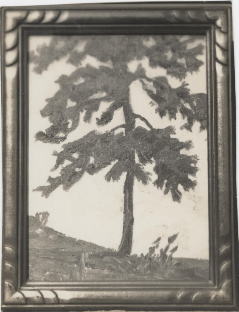
    <summary type="html"><![CDATA[<p><strong><em>Everett Ruess spent the latter half of that summer dancing with the Hopi, exploring the southern half of the Colorado Plateau, and eventually making his way from rim to rim of the Grand Canyon. He finally rested in Tropic, Utah before his final stop in civilization at Escalante, Utah.</em></strong></p><img src="https://www.intermountainhistories.org/files/fullsize/0ffdda85d33fb65d502b1812bba78b87.jpg" alt="Black and white photograph of Everett Ruess’ watercolor painting of a tree in the Colorado Plateau wilderness, ca. 1930s." /><br/><p><span style="font-weight:400;">Escalante, Utah, is a Mormon outpost founded in 1875, and named after Catholic Priest, Father Silvestre Vélez de Escalante. The town acted as a filter between the native lands to the southeast and the rest of the Mormon communities to the north. The town was all Mormon families, with most having the same last name and on average more than five children per family. Escalante’s residents followed the Mormon religion and morals since its founding sixty years prior to Everett’s arrival.</p> <span style="font-weight:400;">The vagabond who spent the last seven months living outdoors in the wilderness arrived in the Mormon town in early November 1934. Everett, a single male artist in a community of large agrarian families, immediately stood out like a sore thumb. He passed through the quaint town with his burros, Chocolatero and Cockelburro, and observed the Mormon church, its community members, and the many homes scattered throughout Escalante. Navajo traders had made their way into town occasionally to exchange with the community, but Escalante never saw a 20-year-old with two donkeys carrying watercolors, jewelry, and native rugs. Everett’s legendary status began here in 1934 due to his unique nature compared to the Mormon families, for the fact that he disappeared not far from here is the reason his myth still lives on in Utah. </span>
<span style="font-weight:400;">For the first time in five years of travel, Everett was financially stable, he had every reason to be satisfied with his life at this moment. He sent his parents ten dollars along with about twenty of his watercolor paintings. He told them to spend five dollars each on something that they “had been wishing to have,” so they proudly spent it to frame their son’s watercolors. In Escalante, Everett saw a film called </span><i><span style="font-weight:400;">Death Takes a Holiday</span></i><span style="font-weight:400;">, which is about death taking human form and asking the public why they fear death, a concept that Everett was fascinated by according to letters sent home. During these last moments in Escalante, Everett played the role of big brother to a lot of the children. According to letters sent from Escalante, he spent time “riding horses, hunting for arrowheads, and the like” with them. Everett’s role in Escalante was one of his most important ones as he served as a curiosity for not only the children but the community as a whole. Before he left, he wrote to his brother Waldo about his desire to stay out in the wilderness for an unknown period of time, for that is where he belonged.</span>
<span style="font-weight:400;">On November 12th, 1934, Everett left Escalante after chatting with the Alvey family who lived on the outskirts of town, and later recalled warning the young explorer of the conditions of the desert. His last winter excursion was in the Superstition Mountains near Phoenix, a completely different climate than southern Utah. A week later two sheepherders spotted him near Davis Gulch, Utah, and offered him mutton, but as the cool autumn air set over Escalante Canyon, Everett declined and was never seen again.</span></p><p><em><strong><a href="https://www.intermountainhistories.org/items/show/832">For more (including 5 images) view the original article</a></strong></em></p>]]></summary>
    <published>2024-05-25T04:26:23+00:00</published>
    <updated>2026-04-17T19:32:18+00:00</updated>
    <link rel="alternate" type="text/html" href="https://www.intermountainhistories.org/items/show/832"/>
    <id>https://www.intermountainhistories.org/items/show/832</id>
    <author>
      <name>Matthew T. Lankton, Northern Arizona University</name>
    </author>
  </entry>
  <entry>
    <title type="html"><![CDATA[The Beginning of the End: Kayenta, Arizona and Everett Ruess]]></title>
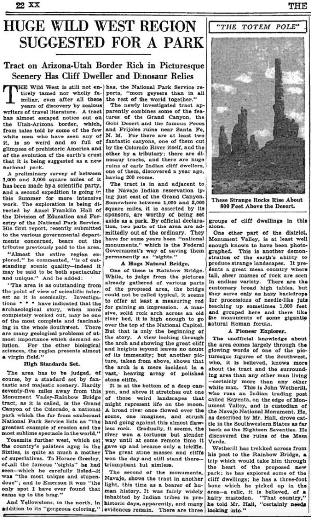
    <summary type="html"><![CDATA[<p><strong><em>On April 12th, 1934 Everett and his brother Waldo Ruess made the journey from southern California through the night. They stopped in Flagstaff for supplies, then headed north to Kayenta, Arizona, where Waldo dropped Everett off. It was the last time he was seen by anyone in his family.</em></strong></p><img src="https://www.intermountainhistories.org/files/fullsize/5132afc33e165a712d7a4a3391423c75.jpg" alt="New York Times, 1934" /><br/><p><span style="font-weight:400;">Known as the gateway to Monument Valley Navajo Tribal Park, Kayenta, Arizona lies in the Navajo Nation just south of the Arizona-Utah border. Kayenta was founded in 1909 by John Wetherill first as a trading post and eventually was established as a township by the Navajo Nation in 1962.</span>
<span style="font-weight:400;">After spending a semester at the University of California Los Angeles (UCLA) Everett traversed the Sierras in 1933. He made it clear to his brother, Waldo, that this journey in 1934 would be his last. After Waldo dropped him off, Everett spent the next two months exploring the region surrounding Kayenta. In a letter to Waldo, he wrote about his journey consisting of “Chin Lee [</span><i><span style="font-weight:400;">sic</span></i><span style="font-weight:400;">], Canyon de Chelly, the Luckachukais, and the Carrizos.” During this time Everett enjoyed the wilderness country, and experienced solitude, which he eventually achieved. During his third time in Canyon de Chelly, Everett foreshadowed his own fate when he wrote “I have been flirting pretty heavily with death” in a letter to a friend. Everett also stayed with Navajo families during this time, where he ate and hunted, making an impression that lasted generations.</span>
<span style="font-weight:400;">As the summer months approached, Everett recalled the crew of the Rainbow Bridge – Monument Valley archeological expedition near Kayenta. The expedition, funded by Ford Motor Company, aimed to provide field experience for explorers and survey the land for an attempted national park. He headed to the expedition’s camp near Skeleton Mesa, just west of Kayenta, and was hired by expedition leader Lyndon Hargrave of the Museum of Northern Arizona (MNA) in Flagstaff. He began working in exchange for meals, rather than the $3.50 a day that the other explorers received. He thoroughly enjoyed this experience because he could work alongside intelligent individuals, discuss the Navajo culture, draw and paint, climb any rock desired, and enjoy the wonders of nature with a sense of companionship for the first time.</span>
<span style="font-weight:400;">Hargrave recalled Everett’s skill from when they met briefly in 1931 at Mesa Ranch Schools’ summer camp. He assigned Everett to work under the crew of Clay Lockett, Flagstaff resident and ethnologist at MNA. The crew spent their time excavating Skeleton Mesa, specifically Woodchuck Cave, which contained archeological remains and objects from as far back as 200 C.E. During the expedition, Everett and  Lockett bonded over their love for art and nature. After his disappearance, Lockett later wrote, “I had an excellent chance to really know Everett,” demonstrating Everetts's lasting impression. It seemed that Everett made an impression on everyone he met, especially on this expedition.</span>
<span style="font-weight:400;">Everett displayed his love for adventure again when a storm approached the canyon, which encouraged him to capture the rolling clouds in watercolor as they encroached. The young vagabond displayed his risky personality while perched at the edge of the slick cliff, hunched over to protect the precious watercolor of Mother Nature in action. Everett soon finished the expedition, paused in Kayenta, and headed south to attend the Hopi snake dance one last time.</span></p><p><em><strong><a href="https://www.intermountainhistories.org/items/show/831">For more (including 4 images) view the original article</a></strong></em></p>]]></summary>
    <published>2024-05-25T04:12:43+00:00</published>
    <updated>2026-04-17T19:32:18+00:00</updated>
    <link rel="alternate" type="text/html" href="https://www.intermountainhistories.org/items/show/831"/>
    <id>https://www.intermountainhistories.org/items/show/831</id>
    <author>
      <name>Matthew T. Lankton, Northern Arizona University</name>
    </author>
  </entry>
  <entry>
    <title type="html"><![CDATA[James P. Beckwourth: Enslaved African to Crow Chief]]></title>
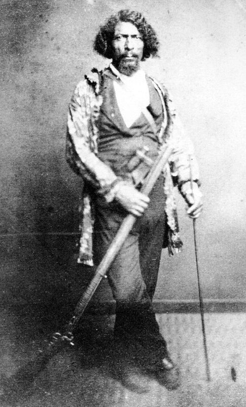
    <summary type="html"><![CDATA[<p><strong><em>James P. Beckwourth, born to a mixed-race couple in 1798, ended up becoming the Chief of the Crows. </em></strong></p><img src="https://www.intermountainhistories.org/files/fullsize/b9b6bc63d500243cc53b88766daaadf2.jpg" alt="Beckwourth in His Regalia." /><br/><p><span style="font-weight:400;">About a decade before his death, James Pierson Beckwourth recounted the events of his life to Thomas Bonner, which was published in 1856 as </span><i><span style="font-weight:400;">The Life and Adventures of James P. Beckwourth: Mountaineer, Scout, Pioneer and Chief of the Crow Nation</span></i><span style="font-weight:400;">. Although historians have criticized the account for Beckwourth’s embellishments—especially his role in certain events—the account reveals incredible details of the African American Chief. </span>
<span style="font-weight:400;">James P. Beckwourth had one of the most exciting lives among mountain men. Born on April 26, 1798, near Fredericksburg, Virginia, the son of Irish aristocrat Sir Jennings Beckwith and his mulatto servant, Miss Kill. In total, Miss Kill bore a dozen more children by Beckwith. Beckwith moved his family to St. Louis in 1809, where he could raise his mixed-race progeny as family.  </span>
<span style="font-weight:400;">When the family moved to St. Louis in 1809, Beckwith apprenticed James as a blacksmith with George Casner and John Sutton. Beckwith manumitted his son when Beckwourth turned 18. After a few years mining lead on the Galena River, James returned to St. Louis and joined the Ashley-Smith fur trapping enterprise in 1824. He attended the first Rocky Mountain Rendezvous on Henry’s Fork of the Green River on July 1, 1825. He was one of the first black men to enter and trap in the soon-to-be Utah Territory.</span>
<span style="font-weight:400;">Perhaps his most intriguing adventure was his journey to become a chief of the Crow Nation. On their way from the Rocky Mountains to the Yellowstone River, Beckwourth and his fur-trapping companion, Jim Bridger, left their trapping group to set out on their own for a few days. Beckwourth and Bridger split up at a river’s fork, planning to meet up after a few hours. Beckwourth followed the stream when suddenly he found himself surrounded by Crows. He had a long history of escaping from Indians intent to do him harm, but this time he knew he could not escape and pleaded for mercy. The Crows took Beckwourth to their chief Big Bowl, who mistook Beckwourth for his long-lost son, calling him a “great warrior.” This may have been a ritualistic adoption commonplace to replace loved ones lost in warfare. Beckwourth had taken part in many altercations with other tribes such as the Blackfeet and Cheyenne, enemies of the Crows. When Big Bowl heard about a warrior who had slain so many of his enemies, he adopted him. The people of the village celebrated and gave abundant gifts to Beckwourth, including a wife. </span>
<span style="font-weight:400;">While his mountaineer friends believed him dead, Beckwourth started a new life as a member of the Crows. He participated in many battles against enemy tribes, mostly with Blackfeet and Cheyenne warriors. Beckwourth’s strength and courage in battle continued to impress the Crows and he lived up to his reputation as a great warrior. In one battle, the Chief Arapooash died, and the tribe unanimously elected Beckwourth as one of their leaders.</span>
<span style="font-weight:400;">Beckwourth helped found a trading post in Pueblo, Colorado, supplied miners in the California gold rush, and piloted a wagon road through the Sierra-Nevadas in 1850. He supplied miners in the Colorado gold rush of 1859. He was present at the tragic massacre of Black Kettle’s peaceful Cheyenne village at Sand Creek on November 29, 1864. He worked as an army scout. Some accounts report he died on October 29, 1866, but the details are unverifiable. </span></p><p><em><strong><a href="https://www.intermountainhistories.org/items/show/748">For more (including 4 images) view the original article</a></strong></em></p>]]></summary>
    <published>2023-04-11T18:58:24+00:00</published>
    <updated>2026-04-17T19:32:16+00:00</updated>
    <link rel="alternate" type="text/html" href="https://www.intermountainhistories.org/items/show/748"/>
    <id>https://www.intermountainhistories.org/items/show/748</id>
    <author>
      <name>Marcus Anderson, Brigham Young University</name>
    </author>
  </entry>
  <entry>
    <title type="html"><![CDATA[“Purple Mountain Majesties”: Why Pikes Peak is America’s Mountain]]></title>
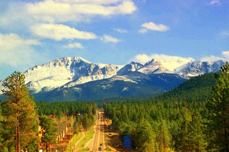
    <summary type="html"><![CDATA[<p><strong><em>Pikes Peak has a long and valuable history that provides visitors with a look through different ages of America, highlighting the beauty and diversity of the land and people. </em></strong></p><img src="https://www.intermountainhistories.org/files/fullsize/fabf35ca83b85ec7549a243f9e4cbd07.jpg" alt="Pikes Peak" /><br/><p><span style="font-weight:400;">With incredible height, diversity, age, and beauty, Pikes Peak towers above at an astounding 14,115 feet, making it one of the tallest mountains in the United States. Many, if not all, Americans have heard the moving lyrics to “America the Beautiful,” but few know that Pikes Peak was the inspiration for the song. Pikes Peak has long been the subject of ballads of beauty and adventure, as well as a symbol of hope and freedom for many throughout American history. </span>
<span style="font-weight:400;">The peak itself has undergone a variety of “discoveries” throughout the different ages of settlement. Some of the first people believed to have discovered and lived near Pikes Peak were the Clovis people yet not much is known or recorded of their experience. However, the histories of many Native peoples’ lifestyles, religions, and legends centered around the peak. The Utes, or the Tabeguache, believed the mountain itself was a sacred site where the Great Spirit created the earth and where many ceremonies were held. </span>
<span style="font-weight:400;">The Spanish were the first Europeans to discover the peak in 1779 and named it “El Capitán,” or “The Captain,” due to the imposing nature of the peak. With the completion of the Louisiana Purchase, the French sold vast tracts of land to the United States of America. In an effort to appraise the land and resources the United States had obtained, President Jefferson sent out several different expeditions to explore and record the areas. It was not until 1806 that Zebulon Pike, the first American explorer who dubbed the mountain Pike’s Peak, came to the Colorado area and attempted to hike the peak. The expedition failed to summit it because they were not prepared for the weather, and the peak remained an alluring call for explorers to attempt to conquer. </span>
<span style="font-weight:400;">Pikes’ writing on his expedition, including the details about the imposing mountain, were published in several languages and widely distributed due to their fame and the public’s interest in the unexplored West. In his writings, Pike referred to the peak as the “the Grand Peak” or simply, “highest peak.”  In 1820, Dr. Edwin James made the first recorded ascent. Later in its history, a variety of media featuring Pikes Peak attracted settlers and spurred further western migration. The phenomenon started with miners and spectators with the discovery of gold and gradually drew more settlers with large plots of grazing land and a tourism industry. Pikes Peak influenced the early formation of American identity and still manages to inspire those who visit today.</span></p><p><em><strong><a href="https://www.intermountainhistories.org/items/show/747">For more (including 5 images) view the original article</a></strong></em></p>]]></summary>
    <published>2023-04-11T18:29:54+00:00</published>
    <updated>2026-04-17T19:32:16+00:00</updated>
    <link rel="alternate" type="text/html" href="https://www.intermountainhistories.org/items/show/747"/>
    <id>https://www.intermountainhistories.org/items/show/747</id>
    <author>
      <name>Addie Coombs, Brigham Young University</name>
    </author>
  </entry>
  <entry>
    <title type="html"><![CDATA[The Debate Over Zebulon Pike&#039;s Remains<br />
]]></title>
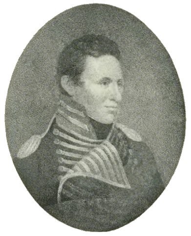
    <summary type="html"><![CDATA[<p><strong><em>Zebulon Pike, legendary American general and adventurer, was one of the predominant explorers of the American West. Although he discovered Pike’s Peak, he never reached its  summit. To help Pike finally  summit  the mountain that bears his name, the people of Colorado Springs have petitioned to have his remains moved to the top of Pikes Peak, but will the people of Sacketts Harbor, the location of his death, part with his body?</em></strong></p><img src="https://www.intermountainhistories.org/files/fullsize/e875a166dc7caa373a5ef2e6c45d5c4a.jpg" alt="Lieutenant Zebulon Pike" /><br/><p><span style="font-weight:400;">General Zebulon Montgomery Pike (1779-1813) was an American Army officer and explorer. His  expedition to the Louisiana Territory and subsequent books detailing his journey catapulted him into the national spotlight. His tragic death during the War of 1812 cemented his position in American memory.</span>
<span style="font-weight:400;">After his famous 1806 expedition, on which he attempted to climb Pikes Peak, Pike continued to rise up the ranks of the U.S. Army and, by the War of 1812, had reached the rank of Brigadier-general. As a general, Pike led the 1813 assault on York, the capital of Upper Canada on Lake Ontario. After successfully overrunning several enemy batteries, Pike and his men were awaiting the British surrender when  a huge explosion suddenly ripped through the air. The retreating force had ignited the fort’s powder magazine, which exploded and launched rocks, timber, and debris in every direction. A large piece of debris struck General Pike, ripped a hole through his back, and left him mortally wounded. After urging his soldiers forward, Pike was carried back to the </span><i><span style="font-weight:400;">Madison, </span></i><span style="font-weight:400;">an American ship, upon which he died with the captured British flag supporting his head. </span>
<span style="font-weight:400;">For many years, Pike’s remains were kept at Sacketts Harbor in Canada, the site of his death. In 1948, the mayor of Colorado Springs and the Colorado Springs Chamber of Commerce petitioned to have Pike’s remains moved to the top of Pikes Peak. While the mountain bears his name, he never reached the top due to harsh weather and a lack of supplies. The Mayor’s hope was to move his body to the top of the mountain where residents of Colorado Springs would build a monument to commemorate his achievements and discovery of the mountain, which would bring millions of dollars to the city through tourism. Despite the approval of Pike’s descendants and the excitement expressed by Colorado newspapers and the Colorado Congressional delegation,  the decision rested in the hands of the Sacketts Harbor mayor and city council.</span>
<span style="font-weight:400;">This decision has been complicated by the controversy over which remains in the Sacketts Harbor Cemetery actually belong to Pike. After his death at the Battle of York, Pike’s body was transported back to Sacketts Harbor in a barrel of whiskey to preserve it until he could be buried. In 1909, the cemetery in which he was buried changed location and experts were only able to positively identify four of the 130 bodies found; Pike’s was not one of them. They assumed Pike's body occupied a metal casket submerged in whiskey, but when they moved the lid of the casket, it cracked and exposed the remains to the open air, disintegrating them.</span>
<span style="font-weight:400;">Regardless of the debate over whether or not the remains ever belonged to Pike, the Mayor of Sacketts Harbor, Carl Jackson, vehemently refused the petitions of the Coloradans. He said, "General Pike's been buried here for more than a century, and we mean to keep him here."  It seems Pike may never reach the top of the famous American peak that bears his name.</span></p><p><em><strong><a href="https://www.intermountainhistories.org/items/show/745">For more (including 4 images) view the original article</a></strong></em></p>]]></summary>
    <published>2023-04-11T16:18:43+00:00</published>
    <updated>2026-04-17T19:32:16+00:00</updated>
    <link rel="alternate" type="text/html" href="https://www.intermountainhistories.org/items/show/745"/>
    <id>https://www.intermountainhistories.org/items/show/745</id>
    <author>
      <name>Ethan Dunham, Brigham Young University </name>
    </author>
  </entry>
  <entry>
    <title type="html"><![CDATA[Sheepherding on Fremont Island]]></title>
    <summary type="html"><![CDATA[<p><strong><em>In 1859, two pioneer brothers from Farmington, Henry William Miller and Daniel Arnold Miller, began the first ranching operation on Salt Lake’s Fremont Island.</em></strong></p><img src="https://www.intermountainhistories.org/files/fullsize/1e4eeac398afc93856bcf40417422df4.jpg" alt="Fremont Island" /><br/><p><span style="font-weight:400;">The storied explorer John C. Fremont and his traveling companions initially documented their foray onto the Great Salt Lake with incredible optimism. While paddling arduously in their small rubber craft in 1843, they observed that, “Several large islands raised their high rocky heads out of the waves; but whether or not they were timbered, was still left to our imagination…”. When they explored one of the aforementioned “high rocky heads,”  they found  an island populated with sagebrush, bunch grass, and a surprising lack of fresh water. After a day or two, Fremont dubbed his discovery “Disappointment Island.”</span>
<span style="font-weight:400;">While surveying the Great Salt Lake for The Church of Jesus Christ of Latter-day Saints in 1850, Captain Howard Stansbury, perhaps to Fremont’s chagrin, changed the name of the formerly disappointing island to Fremont Island. Stansbury noted that the plentiful bunch grass and brackish water would be perfect for livestock. In 1859, Daniel and Henry Miller demonstrated their agreement by moving flocks of sheep and some cattle to the island, which the locals then recognized as “Miller Island.”</span>
<span style="font-weight:400;">Seymour Miller, the grandson of Daniel and Henry, recorded some of his experiences as a de facto ranch hand for the family ranching business on Fremont Island. They kept 2,000 sheep on the island and ferried themselves and their stock back and forth on the </span><i><span style="font-weight:400;">Lady of the Lake</span></i><span style="font-weight:400;">, a boat designed by Jacob Miller, Seymour’s cousin. Keeping the sheep on a relatively small island (4.60 sq. mi.) led the Millers to conclude that they did not need a full-time herder on the island. Instead, they let the sheep run wild for most of the year, confident in the confines of the island.</span>
<span style="font-weight:400;">The sheep quickly went feral and became “wild as a deer.” This provided the Millers with some market advantage because “The meat of this flock tasted more like venison than mutton and would always bring a fancy price on the market when ordinary mutton could hardly be sold.” Unfortunately, during shearing and lambing seasons, these wild qualities caused numerous problems for the island herders. They would sometimes go a full day or two during round ups without successfully driving a single sheep into the shearing pens. During one especially eventful drive, Seymour and his companions cornered some sheep on a peninsular part of the island and “Rather than be caught, several of them took off into the lake. The last I saw of them they were still going.”</span>
<span style="font-weight:400;">Unfortunately for the Millers, their ranching operation did not last past 1885, when local lawyer Uriah Wenner took an interest in living on the island and began legal procedures to oust them and their flocks. The Millers were forced to move their herds to the mainland, where they continually lost woolies due to the sheep’s feral nature that befuddled conventional herders. In his memoir, Seymour concluded that “we never got a dollar out of them.”</span>
<span style="font-weight:400;">After Wenner and his wife died, possession of the island changed hands without remarkable business or improvement until 2003. For a few years, Fremont Island underwent a small stint as a hunting ground for exotic livestock and then changed ownership until it landed in the hands of the State of Utah.</span></p><p><em><strong><a href="https://www.intermountainhistories.org/items/show/735">For more (including 3 images) view the original article</a></strong></em></p>]]></summary>
    <published>2023-04-06T16:23:06+00:00</published>
    <updated>2026-04-17T19:32:16+00:00</updated>
    <link rel="alternate" type="text/html" href="https://www.intermountainhistories.org/items/show/735"/>
    <id>https://www.intermountainhistories.org/items/show/735</id>
    <author>
      <name>Joshua Rust, Brigham Young University</name>
    </author>
  </entry>
  <entry>
    <title type="html"><![CDATA[The Escalante Cross: A Reminder of Utah&#039;s Past]]></title>
    <summary type="html"><![CDATA[<p><strong><em>The Declaration of Independence was not the only progress to be made in America in the year 1776. Spanish explorers Dominguez and Escalante became known as the first Europeans to document travels in what would become Utah Territory. Their initial intention to convert Natives on their journey towards California made way for future explorers to discover the Utah Territory.</em></strong></p><img src="https://www.intermountainhistories.org/files/fullsize/b81d7023fc173daf29504bcf4bd4178b.jpg" alt="Dominguez Plaque" /><br/><p><span style="font-weight:400;">In 1776, two Spanish friars, </span><span style="font-weight:400;">Silvestre Vélez de</span><span style="font-weight:400;"> Escalante and </span><span style="font-weight:400;">Atanasio</span><span style="font-weight:400;"> Dominguez, chose to traverse the American West in search of a northern route to the missions of California. At the time, both Mexico and Spain claimed ownership of the territory. The journey became known for its historical success thanks to Escalante’s journal, which contains the first map of Utah. Beginning the exploration in Santa Fe,  Dominguez and Escalante observed and recorded landmarks that would help future explorers find their way. These recordings also helped governments know and understand the rich opportunities that lay in these lands. The journey was full of dangers for the small group, and they crossed many western states such as Utah, Colorado, and Arizona, among others. The explorers ventured through modern-day Dinosaur National Monument, down through Strawberry, Utah and eventually made their way through Spanish Fork Canyon. This path directly influenced the erection of Escalante’s Cross in Spanish Fork, Utah. </span>
<span style="font-weight:400;">These two Spanish missionaries paved the way for other explorers such as John C. Fremont to encourage The Church of Jesus Christ of Latter-Day Saints to one day settle in Utah. Escalante’s cross, located in Spanish Fork, was dedicated May 1, 1981, sponsored by The Knights of Columbus Father Escalante Council to honor Dominguez and Escalante’s expedition. It was recently restored on October 31, 2015 thanks to a member of the Woodland Hills Scout Troop’s Eagle project. The cross majestically overlooks the entrance to Spanish Fork Canyon and stands brilliantly white against the mountain range beyond. </span>
<span style="font-weight:400;">Today, the site seems like an almost forgotten piece of history. However, one sign remains in the form of a plaque at the base of the cross. It has become a beloved hike here in Utah because of the landscape’s beautiful greenery and various paths leading from the cross. Escalante Cross stands as a reminder to Utah residents of earlier explorers who literally put Utah on the map. </span></p><p><em><strong><a href="https://www.intermountainhistories.org/items/show/733">For more (including 3 images) view the original article</a></strong></em></p>]]></summary>
    <published>2023-04-05T19:50:24+00:00</published>
    <updated>2026-04-17T19:32:16+00:00</updated>
    <link rel="alternate" type="text/html" href="https://www.intermountainhistories.org/items/show/733"/>
    <id>https://www.intermountainhistories.org/items/show/733</id>
    <author>
      <name>Holly Stirling, Brigham Young University</name>
    </author>
  </entry>
  <entry>
    <title type="html"><![CDATA[Weippe Prairie Exploration ]]></title>
    <summary type="html"><![CDATA[<p><strong><em>Originally a major transportation and trade junction for the Nez Perce and their neighbors, Weippe Prairie became the location for a pivotal moment in US history in September 1805. The Nez Perce welcomed the Lewis and Clark expedition there and established a friendly relationship between the United States and the Nez Perce Nation that lasted into the 1850s. </em></strong></p><img src="https://www.intermountainhistories.org/files/fullsize/5bae0596c4e3ef4ffe9e5e6f4b994891.jpg" alt="Weippe Praire" /><br/><p>More than two hundred years ago, Weippe Prairie was a major transportation and trade junction for the Nez Perce Nation. The prairie was simply called Weippe by those living in the area (Weippe being derived from the Nez Perce term <em>Oyáyp</em>). Weippe Prairie was also one of the main root-gathering grounds, with American Indians from different bands making the journey to Weippe to harvest the root <em>qém’es, </em>later called the “camas” root by explorers.
On September 20, 1805, Lewis and Clark exited the Lolo Trail over the Bitterroot Mountains and entered Weippe Prairie. Clark took a scouting party and went ahead where they were met by Al-We-Yas, a Nez Perce village leader and the brother of Chief Twisted Hair. Al-We-Yas approached Clark’s group with caution. Unbeknownst to Clark, Chief Peo-Peo-Tah-Likt had strategically sent Nez Perce warriors to surround Clark’s group, waiting for any hostile movements. This is the first recorded historical meeting between Nez Perce leaders and US representatives. Al-We-Yas sent messengers to neighboring tribes announcing the coming of the Americans. This also represented a moment prophesied by American Indian spiritual leaders, which caused many chiefs and village leaders to make decisions concerning their relationship with the Americans. They debated whether to kill them or establish a peaceful and friendly relationship with them. Because Clark had made a favorable impression on Chief Twisted Hair and his son, the village leaders decided not to kill Lewis and Clark’s exploration group. This interaction was a pivotal moment in the life of Chief Twisted Hair’s son, Aleiya, who would later be known as Chief Lawyer. Chief Lawyer would go on to become one of the most influential advocates for an alliance between the US government and the Nez Perce Indians.
<span>Nez Perce were greatly generous toward Lewis and Clark’s exploration group. In addition to feeding the famished explorers, Nez Perce also provided geographical knowledge so they could navigate the Clearwater River. They also tended the expedition's horses throughout the winter while the group travelled to the coast and back.</span> On September 24, the Lewis and Clark exploration departed the Nez Perce village and continued via dugout canoes on to the Pacific. The following year on their return journey in 1806, Lewis and Clark reunited with the Nez Perce on their return journey and stayed with them for up to seven weeks while waiting for the snow to melt in the Bitterroot Mountains.</p><p><em><strong><a href="https://www.intermountainhistories.org/items/show/479">For more (including 3 images) view the original article</a></strong></em></p>]]></summary>
    <published>2021-09-11T08:44:58+00:00</published>
    <updated>2026-04-17T19:32:10+00:00</updated>
    <link rel="alternate" type="text/html" href="https://www.intermountainhistories.org/items/show/479"/>
    <id>https://www.intermountainhistories.org/items/show/479</id>
    <author>
      <name>Haley Hakala, Brigham Young University</name>
    </author>
  </entry>
  <entry>
    <title type="html"><![CDATA[Sulphur Springs]]></title>
    <summary type="html"><![CDATA[<p><strong><em>Sulphur Springs is located on the north bank of the Missouri River in Montana. The springs aided one of the best-known expeditions in American History. </em></strong></p><img src="https://www.intermountainhistories.org/files/fullsize/5332bd6600b597af7d7a2aaf90fc3741.jpg" alt="Labeled Map of Sulphur Spring" /><br/><p>The Sulphur Springs area of the Missouri River was used by Lewis and Clark on their expedition. Meriwether Lewis’ journal recounted that Sacagawea took ill near these banks saying “our Indian woman sick and low spirited." Her “pulse were scarcely perceptible, very quick frequently irregular and attended with strong nervous symptoms, that of the twitching of the fingers” which worried the party because of her value on the journey as well as for the health of her baby.</p><p>Lewis noticed the Sulphur Springs and wrote that “the water is a transparent as possible strongly impregnated with Sulphur…” which he deducted was similar to the sulphur spring which he had been acquainted with in Virginia, his home state. He was familiar with their medicinal qualities and used the water to help in healing Sacagawea. Lewis administered treatments of the sulphur water for her to drink with poultices of barks and laudanum. The treatments had positive effects: “now the pulse had become regular much fuller and a gentle perspiration had taken place; the nervous symptoms have also in a great measure abated, and she feels herself much freer from pain. She complains principally of the lower region of the abdomen, I therefore continued the cataplasms of barks and laudnumn.” </p><p>Recent analysis of Sulphur Spring by geologists indicates that the dissolved minerals in the water may have restored blood electrolytes and aided in the treatment of Sacagawea, which was needed because Lewis had bled her and performed sweating to rid her of her illness. Ironically, Lewis’ other treatments might have caused more harm, but the sulphur water helped her recover in two days and the expedition continued their journey.  </p><p><em><strong><a href="https://www.intermountainhistories.org/items/show/414">For more (including 3 images) view the original article</a></strong></em></p>]]></summary>
    <published>2020-03-25T02:42:59+00:00</published>
    <updated>2026-04-17T19:32:08+00:00</updated>
    <link rel="alternate" type="text/html" href="https://www.intermountainhistories.org/items/show/414"/>
    <id>https://www.intermountainhistories.org/items/show/414</id>
    <author>
      <name>Shelby Benally, Brigham Young University</name>
    </author>
  </entry>
  <entry>
    <title type="html"><![CDATA[Pompeys Pillar National Monument]]></title>
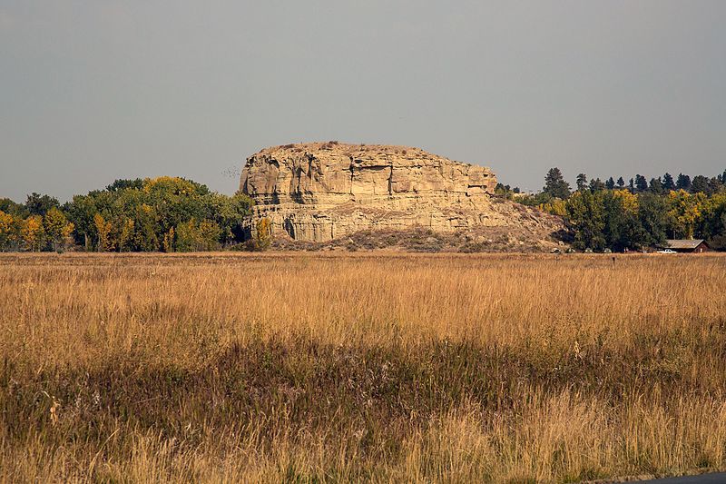
    <summary type="html"><![CDATA[<p><strong><em>Pompeys Pillar is an impressive sandstone formation standing nearly 200 feet above the Yellowstone River. Designated as a national monument in 2001, the pillar features numerous Native American petroglyphs, as well as marks and drawings made by travelers and settlers. The most notable mark on this historic rock, however, is the signature of the great explorer William Clark, who named the pillar after Sacagawea’s son.</p></strong></p><img src="https://www.intermountainhistories.org/files/fullsize/11cc09f1ff08529113f7496d29342260.jpg" alt="Pompeys Pillar" /><br/><p>The summer of 1806 found Lewis and Clark’s Corps of Discovery on their return trip from the Pacific Ocean to St. Louis. Led by Meriwether Lewis and William Clark, the band of explorers, which initially consisted of some 55 people, had traveled from St. Louis, Missouri to the Pacific Ocean. President Jefferson had tasked them to find a viable water route to the Pacific Coast. Moreover, they discovered 178 new plants species and 122 animal species. They charted and mapped the rivers and mountains of the plains and Rockies and established friendly relations with many Native American tribes.</p><p>On June 30, 1806, the Corps were returning home when they decided to make a brief stop at a meadow along the Bitterroot River known as Traveler’s Rest. During that stay, Lewis and Clark determined to divide their forces into different groups so that they could explore as much territory as possible. Clark and Sacagawea, a Shoshone woman, led their party through the Bozeman Pass. They constructed cottonwood log canoes to float down the Yellowstone River. After floating for several days, Clark spotted an enormous rock structure on July 25 and decided to stop and climb it. In his journal Clark recorded, “At 4PM [I] arrived at the remarkable rock situated in an extensive bottom. This rock I ascended and from it's top had a most extensive view in every direction. This rock which I shall call Pompy's Tower is 200 feet high and 400 paces in secumpherance and only axcessible on one side which is from the N.E. the other parts of it being a perpendicular clift of lightish coloured gritty rock.The Indians have made 2 piles of stone on the top of this tower. The nativs have ingraved on the face of this rock the figures of animals &c.” </p><p>Clark named the large sandstone rock Pompys Tower after Sacagawea’s son Jean Baptiste Charbonneau, who Clark nicknamed “Pomp” and who would eventually become Clark’s adopted son. Clark also carved his now famous inscription on the pillar, including his name and the date, July 25, 1806. This mark is one of the few visible remnants of expedition along the Lewis and Clark National Historic Trail.</p><p><em><strong><a href="https://www.intermountainhistories.org/items/show/413">For more (including 3 images) view the original article</a></strong></em></p>]]></summary>
    <published>2020-03-25T00:48:08+00:00</published>
    <updated>2026-04-17T19:32:08+00:00</updated>
    <link rel="alternate" type="text/html" href="https://www.intermountainhistories.org/items/show/413"/>
    <id>https://www.intermountainhistories.org/items/show/413</id>
    <author>
      <name>Rulon Udall, Brigham Young University</name>
    </author>
  </entry>
  <entry>
    <title type="html"><![CDATA[The Great Falls Portage]]></title>
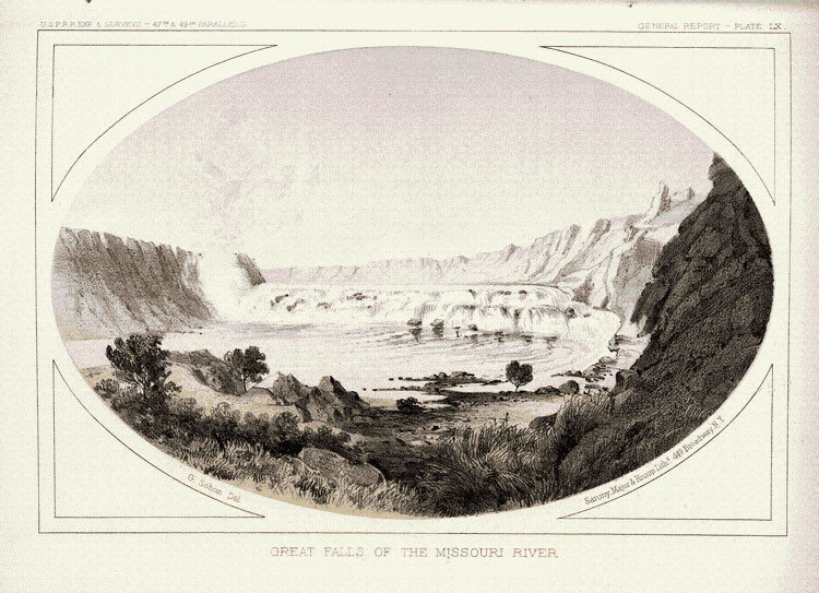
    <summary type="html"><![CDATA[<p><strong><em>In an unprecedented journey, the Lewis and Clark Expedition traveled nearly 8,000 miles across the newly-acquired Louisiana Purchase of the Northwestern half of the United States. Yet, of those 8,000 miles, the 21-mile on-foot portage around the Great Falls of the Missouri River were possibly the most gruesome and tiring of the entire voyage. </em></strong></p><img src="https://www.intermountainhistories.org/files/fullsize/649e436c528bb13cd37be0ee31b8deff.jpg" alt="&quot;Great Falls of the Missouri River&quot;" /><br/><p>The Lewis and Clark Expedition—or the Corps of Discovery, as it was officially known—reached the Great Falls of the Missouri River on June 13, 1805. The company was elated to arrive at the falls, becoming the “first white men to see the Great Falls of the Missouri River.” However, the grandeur and majesty of the falls meant that the company’s original path along the Missouri River was temporarily unsuitable for their trek. Consequently, they, along with all their cargo, would have to travel by land to circumvent the cascades. </p><p>The portage posed several challenges from unwelcome wildlife encounters to cached cargo and extreme physical exertion and injuries. When the corps realized that they would be unable to proceed by water, they spent several days creating wagons to tow their canoes, equipment and supplies. They cut small sections of tree trunks for the wheels, and used ropes, like they had on the water, to haul their canoes and cargo over steep and rough terrain. After only a few miles, the company was tormented by prickly pear cactus spines that easily poked through their moccasins into their feet, heatstroke, hail storms, and a plague of pests. On July 24, 1805, Meriwether Lewis lamented that "our trio of pests still invade and obstruct us on all occasions, these are the Musquetoes eye knats and prickley pears, equal to any three curses that ever poor Egypt laiboured under.” He continued: “at every halt these poor fellow tumble down and are so much fortiegued that many of them are asleep in an instant. In short their fatiegues are incredible; some are limping from the soreness of their feet, others faint and unable to stand for a few minutes, with heat and fatiegue, yet no one complains. All go with cheerfulness . . . “</p><p>If the 21-mile path through the Great Falls had been an ordinary stretch of the Missouri River, it would have taken only one or two days to travel; however, the portage around the Great Falls of the Missouri took the company over a month between June 13, 1805 and July 15, 1805. </p><p><em><strong><a href="https://www.intermountainhistories.org/items/show/411">For more (including 3 images) view the original article</a></strong></em></p>]]></summary>
    <published>2020-03-19T02:06:54+00:00</published>
    <updated>2026-04-17T19:32:08+00:00</updated>
    <link rel="alternate" type="text/html" href="https://www.intermountainhistories.org/items/show/411"/>
    <id>https://www.intermountainhistories.org/items/show/411</id>
    <author>
      <name>Lexi Vaughan, Brigham Young University</name>
    </author>
  </entry>
  <entry>
    <title type="html"><![CDATA[John Colter’s Run]]></title>
    <summary type="html"><![CDATA[<p><strong><em>John Colter was a celebrated mountain man and explorer who lived during the nineteenth century. He was a member of the Lewis and Clark Expedition and went on to explore many parts of the American West, including the future Yellowstone National Park in 1807-1808.</em></strong></p><img src="https://www.intermountainhistories.org/files/fullsize/202cde90c5adda9ef7220fdf6d5fddd4.jpg" alt="John Colter’s Escape" /><br/><p>While canoeing the Jefferson River near the Missouri River’s headwaters trapping beavers in 1809, John Colter and his companion, John Potts, were called ashore by a large party of Blackfoot Indians. Colter knew about the Atsinas and Blackfoot Confederacy as powerful native nations allied with the British and had fought them several times in 1807 and 1808. Colter obediently went to shore and beckoned Potts to join him. Potts, however, moved his canoe back into the water and shot and killed one of the Blackfoot. Blackfoot warriors shot Potts with numerous arrows, killing him. </p><p>Once ashore, the Blackfoot stripped Colter of his clothing. After the Blackfoot deliberated how to kill him, the chief decided to allow Colter to run for his life. The Blackfoot took Colter to a nearby plain where the race would take place. Allowing Colter a three to four hundred yard start, the chief instructed Colter to run, and then allowed five to six hundred members of the tribe to chase after Colter. Colter, who was familiar with this tradition, knew that he must outrun the Blackfoot if he had any chance of surviving. After running several miles across the plain, Colter looked over his should to find that only one of the Blackfoot was successful in catching up to him. With a newfound confidence and determination, Colter continued to run with all his might until he was in sight of the Missouri River when again, Colter turned his head to find his pursuer about twenty yards behind him. Colter stopped suddenly to confront the Indian and, using the man’s own spear, successfully killed him. Colter continued running and found refuge at a bank in the river, where Colter hid under driftwood or a beaver lodge.</p><p>Shortly after Colter found refuge, he heard the nearby shrills of the rest of the Blackfoot, who traveled up and down the river looking for him. Colter hid there until night, when he could no longer hear the Blackfoot. From his hiding spot, Colter swam down the river and traveled all night until he was a great distance from the Blackfoot. Out of the grasp of the Blackfoot, Colter still faced danger. He was exhausted from his run, frozen from the river, completely naked, and prickly pear thorns pierced his feet. Miraculously, Colter successfully traveled to Manuel Lisa’s Fort Raymond within seven days, surviving only on roots. As John Bradbury described Colter’s triumph, “These were circumstances under which almost any man but an American hunter would have despaired.”</p><p><em><strong><a href="https://www.intermountainhistories.org/items/show/401">For more (including 3 images) view the original article</a></strong></em></p>]]></summary>
    <published>2020-03-08T04:43:49+00:00</published>
    <updated>2026-04-17T19:32:08+00:00</updated>
    <link rel="alternate" type="text/html" href="https://www.intermountainhistories.org/items/show/401"/>
    <id>https://www.intermountainhistories.org/items/show/401</id>
    <author>
      <name>Meg Kelly, Brigham Young University</name>
    </author>
  </entry>
  <entry>
    <title type="html"><![CDATA[ Simpson Springs Pony Express Station]]></title>
    <summary type="html"><![CDATA[<p><strong><em>Simpson Springs provided the only freshwater to a barren part of the Pony Express. Riders and horses quenched their thirst there before continuing their long journey.</em></strong></p><img src="https://www.intermountainhistories.org/files/fullsize/d4b7991eb5b328b9f4874236122f35ac.jpg" alt="Pony Express Station" /><br/><p>In 1851, George Chorpenning and Absolom Woodward were awarded the first overland mail contract between Sacramento and Salt Lake City. Absolom was killed by Indians later that year, and George began running the mail by himself. Simpson Springs was a promising site along the route because it was the only good source of water for miles in the barren desert. In 1859, George set up a ring of stones as a foundation for his Sibley tent. </p><p>By 1860, a stone house was built, and the firm of Russell, Majors, and Waddell bought the site for the Pony Express. They eventually bought the entire Chorpenning mail and stage line. George Dewees managed the Simpson Springs Station, which was located between Government Creek Station to the northeast and River Bed Station to the southwest. Simpson Springs Station, like many of the stations along the Pony Express, went by many names. Richard F. Burton wrote that Simpson Springs was, “the station which Mormons call Egan’s Springs, anti-Mormons Simpson Springs, and Gentiles Lost Springs.” </p><p>The name Simpson Springs came from the Camp Floyd topographical engineer J. H. Simpson. In 1859, Simpson was commissioned to lay out an acceptable route from Salt Lake City to Carson Valley. On that expedition, he passed through what would be named Simpson Springs. After the Pony Express ended, the station was decreasingly used by mail and shipping companies until it was abandoned in 1869.</p><p>Richard Burton passed through the area in 1860 and described the landscape in this way. “All was desert: the bottom could no longer be called basin or valley: it was a thin fine silt, thirsty dust in the dry season, and putty-like mud in the springs and autumnal rains.” In 1965, a monument was placed to mark the station site, and, in 1975, the Bureau of Land Management and Future Farmers of America finished reconstructing the station.</p><p><em><strong><a href="https://www.intermountainhistories.org/items/show/197">For more (including 3 images) view the original article</a></strong></em></p>]]></summary>
    <published>2018-06-06T23:13:37+00:00</published>
    <updated>2026-04-17T19:32:02+00:00</updated>
    <link rel="alternate" type="text/html" href="https://www.intermountainhistories.org/items/show/197"/>
    <id>https://www.intermountainhistories.org/items/show/197</id>
    <author>
      <name>Samuel Hauber, Brigham Young University</name>
    </author>
  </entry>
  <entry>
    <title type="html"><![CDATA[Étienne Provost in Utah Valley<br />
]]></title>
    <summary type="html"><![CDATA[<p><strong><em>Étienne Provost is the namesake of the Provo river and the modern day city of Provo.</em></strong></p><img src="https://www.intermountainhistories.org/files/fullsize/2803860c347c0865516563ef6435f201.jpg" alt="Éntienne Provost" /><br/><p>Born in Canada in 1785, French-Canadian Étienne Provost moved west as a young man to pursue the life of a fur trader. Although he is recognized as one of the most influential mountain men during his time, his legacy hides in the shadows of more recognizable men, such as Jim Bridger. This portly, illiterate, self-made fur trader led expeditions and ventures through modern-day New Mexico and Utah before settling in Missouri. His influence lies within his namesake: Provo, Utah. </p><p>During his 1824 travels, Provost encountered some Shoshones between Utah Lake and the Great Salt Lake. Warren Angus Ferris, another trapper, included a version of their meeting in his writings, although he was not present at the time. He writes about an Indian “evil genius” known as “Bad Gocha” (an Anglicized version of the French nickname “mauvais gauche” or “the bad left-handed one”) who met with Provost. He asked Provost to smoke the peace pipe but requested that all metals be removed, as it would be problematic for the ritual. As the white men complied, the “Indians fell upon them and commenced their work of slaughter with their knives,” resulting in about fifteen dead. However, it should be noted that the number and story varies between accounts. The most likely estimate is that about eight died. Provost’s escape led to the renaming of the nearby Timpanoquint River to the phonetically spelled Provo. Later, when Mormon settlers moved into the area, the nearby city became Provo as well, although Provost likely never knew of either of his namesake landmarks. </p><p>While this story paints a picture of an unprovoked attack by ruthless, violent Indians, Peter Skene Ogden made a point of explanation when writing about the event. He noted that, not long before Provost’s company came, another group of white mountain men forcibly took horses and furs from the same group of Shoshone that resulted in a death of a Native American. Although there is not a record of a Shoshone perspective, this information helps to create a more relatable, human image instead of perpetuating the myth of the aggressive Indian. </p><p><em><strong><a href="https://www.intermountainhistories.org/items/show/185">For more (including 4 images) view the original article</a></strong></em></p>]]></summary>
    <published>2018-05-28T15:27:22+00:00</published>
    <updated>2026-04-17T19:32:02+00:00</updated>
    <link rel="alternate" type="text/html" href="https://www.intermountainhistories.org/items/show/185"/>
    <id>https://www.intermountainhistories.org/items/show/185</id>
    <author>
      <name>Rachel Felt, Brigham Young University</name>
    </author>
  </entry>
  <entry>
    <title type="html"><![CDATA[Great Falls of the Missouri River: When they found the Great Falls of the Missouri in June 1805, Lewis and Clark were relieved to be on the right path, but faced a difficult portage over the feature.]]></title>
    <summary type="html"><![CDATA[<img src="https://www.intermountainhistories.org/files/fullsize/3aefe050f1e709328e0fbba870599870.jpg" alt="Great Falls of the Missouri" /><br/><p>The Corps of Discovery relied heavily upon the geographic knowledge of Native peoples. They had been told of a set of impassable waterfalls high up on the Missouri River and finding them would indicate they were on the correct. However, in the late Spring of 1805, they reached a confusing confluence of two large rivers. Their Native informants had not mentioned such a large tributary - the Marias. The existence of this river puzzled the captains, who were unsure which river was the Missouri since the Marias matched it in size. Knowing the optimal months for travel were quickly passing, the captains spent a week on the decision, carefully evaluating each option knowing that a wrong choice would be costly. Eventually, Lewis and some men traveled up the Missouri where, to Lewis’ delight, they came across the Great Falls in June 1805. Lewis sent a message to Clark labeled “from the Great falls of the Missouri,” and Clark and his men rejoined the group.</p><p>Confident of their path, the captains believed the next portion of their journey to be easy, but they would find their information from Natives again incorrect. Although they had told Lewis and Clark “that the portage around the falls was not more than a half mile, the actual portage proved to be a torturous, eighteen-mile traverse that consumed more than a month of travelling season already far gone.” The water route was almost impossible to travel, forcing the group to continuously go on shore and walk, carrying their belongings. They encountered grizzly bears, rattlesnakes, and mosquitos, which created various problems and hardships for them. Eventually, they made it through the Great Falls and crossed the Missouri River, traveling onward to the west coast of the continent. </p><p>Today, Great Falls has a Lewis and Clark National Historic Trail Interpretive Center where visitors can learn more about the expedition, participate in activities that the Corps would have done, and learn about the plants and animals Lewis and Clark documented during their journey through the Falls.</p><p><em><strong><a href="https://www.intermountainhistories.org/items/show/183">For more (including 3 images) view the original article</a></strong></em></p>]]></summary>
    <published>2018-05-26T03:14:38+00:00</published>
    <updated>2026-04-17T19:32:02+00:00</updated>
    <link rel="alternate" type="text/html" href="https://www.intermountainhistories.org/items/show/183"/>
    <id>https://www.intermountainhistories.org/items/show/183</id>
    <author>
      <name>Kelsey Cogswell, Brigham Young University</name>
    </author>
  </entry>
  <entry>
    <title type="html"><![CDATA[Lake Pend Oreille: Booming Industries and Depleting Resources]]></title>
    <summary type="html"><![CDATA[<p><strong><em>The last domesticated region in Idaho, known as Lake Pend Oreille, contains a long history of human activity. Pend Oreille’s first inhabitants include indigenous peoples followed by fur traders, explorers, miners, and loggers. The lake received its name from Canadian fur trapper and mapmaker David Thompson. The words “Pend Oreille” are French for “an ear pendant” or “hangs from ears”, possibly referring to the lakes shape or the jewelry worn by the Kalispel Indians who resided there. </em></strong></p><img src="https://www.intermountainhistories.org/files/fullsize/14e0b562f8c4bad39231ac3a23bec93f.jpg" alt="Pend d&#039;Oreille Lake" /><br/><p>In the fall of 1809, a fur agent with the North-West Company named David Thompson found Lake Pend Oreille. Thompson recognized the environmental value the area held.  Years after making the discovery, he wrote in his memoir, “The impression of my mind is, from the formation of the country and its climate, its extensive Meadows and fine forests, watered by countless brooks and Rills of pure water, that it will become the abode of civilized Man, whether Natives or other people.” Soon after his arrival, Thompson established a fur-trading outpost called the Kullyspell House. It was the first permanent wooden structure in Idaho next to Lake Pend Oreille and was named after the Kalispel Indians who guided Thompson around the Columbia River Basin. Once Thompson succeeded with his trading house, he moved on to other adventures, leaving Finan McDonald in charge. The location was forgotten until 1928 when a group of Idaho historians were guided by a blind Kalispel man to the remains of the trading outpost on the lake. </p><p>Lake Pend Oreille’s history did not end with Thompson and the Kullyspell House; the area grew over the next two hundred years. With the beginning of the gold rush era in 1866, the lake served as a passage for miners traveling from the Columbia River to Helena, Montana. With the ending of one boom comes the beginning of another. The demand for timber reached North Idaho, one of the largest areas of timber in the United States. The industry began in 1880 when Robert Weeks opened a general store dealing furs in the lake’s largest community, Sandpoint, in the panhandle of Idaho. As the town expanded so did the timber industry, along with the establishment of several sawmills, including the world-class Humbird Mill. The mill sparked modernization in the little lake town. By 1920, Sandpoint became the largest shipper of cedar poles and pilings in the Northwest. </p><p>The towns’ populations grew as the industries surrounding the lake attracted people from all over the country. Today, the location is featured in the media as one of the last, best places to live, but with its discovery came the chopping of its meadows and forests. This was followed cultivation and logging, which caused pesticides and other chemicals to drain into the lake. Just as David Thompson stated in his memoir, Lake Pend Oreille did become an abode for man and suffered from the exploitation of its abundant resources along with pollution from its inhabitants.</p><p><em><strong><a href="https://www.intermountainhistories.org/items/show/171">For more (including 3 images) view the original article</a></strong></em></p>]]></summary>
    <published>2018-05-16T01:42:20+00:00</published>
    <updated>2026-04-17T19:32:02+00:00</updated>
    <link rel="alternate" type="text/html" href="https://www.intermountainhistories.org/items/show/171"/>
    <id>https://www.intermountainhistories.org/items/show/171</id>
    <author>
      <name>Madison Huck, University of Idaho</name>
    </author>
  </entry>
  <entry>
    <title type="html"><![CDATA[Utah’s First Methodist Pioneer - Jedediah Strong Smith]]></title>
    <summary type="html"><![CDATA[<p><strong><em>Said to have been the first great protestant missionary to mountain men, “Bible Totin' Jed Smith” holds a special place in the memory of the Methodist community of Utah. </em></strong></p><img src="https://www.intermountainhistories.org/files/fullsize/7b138a6554c82831c59ac1c0b4ce33a7.jpg" alt="Jedediah Smith" /><br/><p>Early American Methodism and the exploration of the American West share a common pioneering ancestor in Jedediah Smith. While many of the commonly held beliefs about Jedediah Smith’s religious background and affiliation would require the support of more historical documentation than is currently available, Jedediah Smith’s life and subsequently developed popular legend provide an influential look into how the early nineteenth century explorer helped forge a future for the development of Utah and as a result, the Methodist Community that reveres the formidable mountaineer, appropriately referred to as “Bible Totin’ Jed Smith.”</p><p>Jedediah Strong Smith, Jr. was born on January 6, 1799 in Jericho, New York (present-day Bainbridge) to Jedediah Smith, Sr. and Sally Strong. The Smith family had early Puritan roots in the Samuel Smith family, which immigrated to the Massachusetts Bay Colony from Hadleigh, England in 1634. Jedediah Smith, Sr. became associated with the Wesleyan movement in the 1790s, tying the Smith family to the Methodist Church. It was a new movement, having just been developed in the 1780s in America by John and Charles Wesley. Though tempted to consider a life in the ministry, Jedediah Smith, Jr. chose to pursue a career as a trapper, frontiersman, and explorer. However, due to the revivalist fervor of the Second Great Awakening, Jedediah undoubtedly was shaped by his upbringing in the Methodist faith, influencing his actions and worldview throughout his short life. </p><p>Jedediah Smith’s contributions to early nineteenth-century exploration of the American West are well known and many. He was the first Anglo-American to make his way to California directly overland as well as the first to make an overland journey through northwest California into Oregon, a remarkable feat considering the densely forested landscape. Further, he was the first American to traverse the length of the Pacific Coast, ranging from San Diego in the South to Vancouver in the North. Smith was among the first to pass over the Sierra Nevada Mountains, and the first Americans to journey across the length and width of Utah. In 1826, he trekked into the Salt Lake and Utah Valleys, being the first American explorer to step foot south or west of the Great Salt Lake. Smith met a young and untimely death in a conflict with Comanche Indians in Kansas on May 27, 1831. Many of Jedediah Smith’s biographers note that he was a pious, sober, and God-fearing man. While Smith’s explorations in the West kept him from any form of regular or intermittent church attendance, he is known to have regularly devoted himself to the reading of the Bible. In fact, at the time of his death, Jedediah Smith’s estate contained a modest collection of books, two of which likely traveled with him during his career: The Holy Bible and a book of Methodist hymns. Today the Utah Methodist community reveres the memory and legend of Jedediah Smith as a pioneer of both their home state and faith. First United Methodist in Salt Lake City proudly displays a portrait of Jedediah Smith as a part of the faith’s community in the Great Basin. </p><p><em><strong><a href="https://www.intermountainhistories.org/items/show/152">For more (including 3 images) view the original article</a></strong></em></p>]]></summary>
    <published>2018-05-02T22:11:31+00:00</published>
    <updated>2026-04-17T19:32:01+00:00</updated>
    <link rel="alternate" type="text/html" href="https://www.intermountainhistories.org/items/show/152"/>
    <id>https://www.intermountainhistories.org/items/show/152</id>
    <author>
      <name>Nicholas B. Shrum, Brigham Young University</name>
    </author>
  </entry>
  <entry>
    <title type="html"><![CDATA[Crossing of the Fathers]]></title>
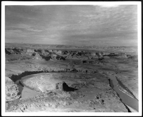
    <summary type="html"><![CDATA[<p><strong><em>With the help of their Native American guides, Spanish Franciscan priests Atanasio Domínguez and Silvestre Vélez de Escalante made a difficult crossing of the Colorado River.</em></strong></p><img src="https://www.intermountainhistories.org/files/fullsize/4f0aa82a81d59c00ca9a695cdd884141.jpg" alt="Canyon Country" /><br/><p>In 1776 an expedition left from Santa Fe, New Mexico, to find an overland route to the Catholic Mission in Monterrey, California.  Native Americans guided Franciscan priests, Fathers Escalante and Dominguez through the Colorado Plateau.  Their journey consisted of crossing through vast canyon lands and fording many rivers.  They took a large number of horses, mules, and donkeys to pack goods and to trade with Native Americans.  Their journey lasted for just over a year. </p><p>They traveled from Santa Fe north into Colorado’s Western Slope to present day Grand Junction.  Then they headed west past Green River, Utah, towards the Wasatch Front.  They ended their journey at Utah Lake near Provo.  Disappointed in their pace and failure to find an easy route to California, they began a return journey on an alternate route. They traveled south to present-day Cedar City, Utah, and then cut east along the edges of the Grand Staircase region towards Glen Canyon and the Colorado River.  </p><p>The Crossing of the Fathers is where Native guides led the expedition across the Colorado River. It was difficult to find a safe crossing of the river in the Glen Canyon region. After a thorough search, they came to a narrow spot.  In a translated journal, the Fathers described their difficult situation, “in order to have the mounts [mules, donkeys, and horses] led down to the canyon mentioned, it became necessary to cut steps with axes on a stone cliff.”  After safely taking the animals down the stairs, they next looked for a safe crossing of the river. They found a relatively easy spot to swim across that had little flow.  On November 7, 1776, they crossed the Colorado River to continue their journey back to Santa Fe.</p><p>In the ensuing 200 years few followed that specific crossing location.  Native peoples of the region knew and used many other crossings.  In fact, the Escalante and Dominguez route is one of the only mentioned crossings of this section of the Colorado.  Farther north there were easier cliffs to descend and a slower meandering river section that Native Americans used.  Today the Crossing of the Fathers lies underneath Lake Powell.  Many amateur explorers have tried to find the route the Spanish Fathers took and have searched for the original staircase that was carved into the side of the cliff. Today, the site is most likely covered by the waters of Lake Powell., though falling water levels may someday reveal its location.</p><p><em><strong><a href="https://www.intermountainhistories.org/items/show/65">For more (including 3 images) view the original article</a></strong></em></p>]]></summary>
    <published>2017-06-07T06:21:57+00:00</published>
    <updated>2026-04-17T19:31:59+00:00</updated>
    <link rel="alternate" type="text/html" href="https://www.intermountainhistories.org/items/show/65"/>
    <id>https://www.intermountainhistories.org/items/show/65</id>
    <author>
      <name>Alex Anthony, Northern Arizona University</name>
    </author>
  </entry>
  <entry>
    <title type="html"><![CDATA[The Dominguez-Escalante Expedition Reaches Utah Valley]]></title>
    <summary type="html"><![CDATA[<p><strong><em>In 1776, a pair of Spanish Franciscan friars set out to find an overland route from New Mexico to California. Their hope was to find a safe path between the difference Catholic missions in the southwestern United States. While they were never able to reach California, their expedition provided valuable map information for future travelers and part of their documented route became part of the Old Spanish Trail, a trade route that was frequently used for years afterwards. They were also the first of European ancestry to set eyes on the Utah Valley. </em></strong></p><img src="https://www.intermountainhistories.org/files/fullsize/a55569ce8c30b3a800d575dcaea85131.jpg" alt="Escalante Etching " /><br/><p>In the summer of 1776, Atanasio Domínguez and Silvestre Vélez de Escalante (along with a team of other men and Native American guides that would join them later) set out from Santa Fe, New Mexico to find an alternative route to the other Spanish missions in California along the Monterey coast. The local settlers already knew a path through modern-day Arizona, but the Grand Canyon and hostile native tribes forced the Spanish to look for an alternative route. Their trip through the southwest was carefully documented, and they often refer to the rugged landscape, local plant and animal life, and the potential for settlement by anybody who chose to follow them. </p><p>By September of 1776 the party reached Utah Valley where the mouth of Spanish Fork Canyon opens up to the wider valley. One of their native guides, Silvestre, was a member of a local tribe and this connection provided the party with safe passage and a small opportunity for trade. While this moment was important (as they were the first Europeans to see the valley), it wasn’t the end goal of their expedition. A few days later, the party continued their journey to the southwest, but not before they made the observation that, “[the area consists] of flat meadows with good land for farming; it carries more water than the foregoing two, has a larger poplar grove and meadows of good soil which can be irrigated—all good for two or even three good settlements.” Dominguez and Escalante would later encounter trouble on their journey and have to return early to New Mexico, never reaching California.  </p><p>In the 1920s, residents of Spanish Fork wanted to commemorate the arrival of the expedition to Utah Valley. A monument was erected and later dedicated in January of 1923. The Bronze tablet that accompanies it is inscribed with further information from the expedition’s visit to the valley. In 1981 a large white cross was constructed overlooking the valley, a symbolic representation of the arrival of the Spanish friars to the area. The site is accessible by hiking trail above the Spanish Fork reservoir.     </p><p><em><strong><a href="https://www.intermountainhistories.org/items/show/35">For more (including 5 images) view the original article</a></strong></em></p>]]></summary>
    <published>2017-03-20T16:43:17+00:00</published>
    <updated>2026-04-17T19:31:58+00:00</updated>
    <link rel="alternate" type="text/html" href="https://www.intermountainhistories.org/items/show/35"/>
    <id>https://www.intermountainhistories.org/items/show/35</id>
    <author>
      <name>Addison Blair, Brigham Young University </name>
    </author>
  </entry>
  <entry>
    <title type="html"><![CDATA[John Wesley Powell ]]></title>
    <summary type="html"><![CDATA[<p><strong><em>After fighting to preserve the Union in the Civil War—and losing his right arm at the Battle of Shiloh, John Wesley Powell set off to chart one of the last blank portions of the United States geographical map. His expeditions in the late 1860s and early 1870s helped to complete the geographical map and contribute to the environmental knowledge about aridity in the American West.</em></strong></p><img src="https://www.intermountainhistories.org/files/fullsize/5fb8a2748927667cabdfa9e7a2e3197b.jpg" alt="Powell Portrait " /><br/><p>In 1867, on the first of two expeditions down the Green and Colorado rivers, John Wesley Powell’s crew, consisting of ten men, embarked on the adventure of a lifetime. The trek exhausted them both physically and mentally. Sailing on in four poorly-constructed wooden boats, the crew made repairs almost every night. Powell experienced the turbulent rapids at the confluence of the Grand and Colorado rivers. After a devastating accident in ‘disaster falls,’ the men lost one of their boats and about a third of their provisions. The grueling journey continuously tested the company’s morale. Several men abandoned the expedition, planning to scale the walls of the canyon and hike to a Mormon village - they were never heard from again. After a difficult trek, the expedition arrived in Salt Lake City. Their survival solicited national attention, transforming the expedition party into American heroes. </p><p>Powell, a little bruised from his journey, remained eager to conduct a second expedition and finish the map of the Grand Canyon. The second expedition began in 1871, but this time Powell and his men came prepared. Landscape photographer E. O. Beaman accompanied them through the Grand Canyon. The photographs, depicting the men and their journey, drew public attention to the expedition. Ultimately, this second expedition contributed to Powell’s discoveries of the remaining blank space on the map. Ultimately, this second expedition, cut short because of the dangerously high and treacherous waters, still allowed Powell to gather extensive scientific information and complete his map. Powell’s sacrifice and adventures made it possible for the world to see the beauties of the American West. His explorations led to the foundation of the Grand Canyon National Monument. </p><p><em><strong><a href="https://www.intermountainhistories.org/items/show/20">For more (including 4 images) view the original article</a></strong></em></p>]]></summary>
    <published>2017-02-13T19:11:11+00:00</published>
    <updated>2026-04-17T19:31:58+00:00</updated>
    <link rel="alternate" type="text/html" href="https://www.intermountainhistories.org/items/show/20"/>
    <id>https://www.intermountainhistories.org/items/show/20</id>
    <author>
      <name>Mallory Christensen, Brigham Young University </name>
    </author>
  </entry>
</feed>