<?xml version="1.0" encoding="UTF-8"?>
<feed xmlns="http://www.w3.org/2005/Atom">
  <title type="text">Intermountain Histories</title>
  <updated>2026-08-18T16:00:24+00:00</updated>
  <generator uri="http://framework.zend.com" version="1.12.20">Zend_Feed_Writer</generator>
  <link rel="alternate" type="text/html" href="https://www.intermountainhistories.org/"/>
  <link rel="self" type="application/atom+xml" href="https://www.intermountainhistories.org/items/browse?output=rss2"/>
  <id>https://www.intermountainhistories.org/</id>
  <author>
    <name>Intermountain Histories</name>
    <uri>https://www.intermountainhistories.org</uri>
  </author>
  <link rel="hub" href="https://pubsubhubbub.appspot.com/"/>
  <entry>
    <title type="html"><![CDATA[The Boone and Crockett Club&#039;s Connection with Theodore Roosevelt: Story 8 of 8 of the President Theodore Roosevelt in the West Tour]]></title>
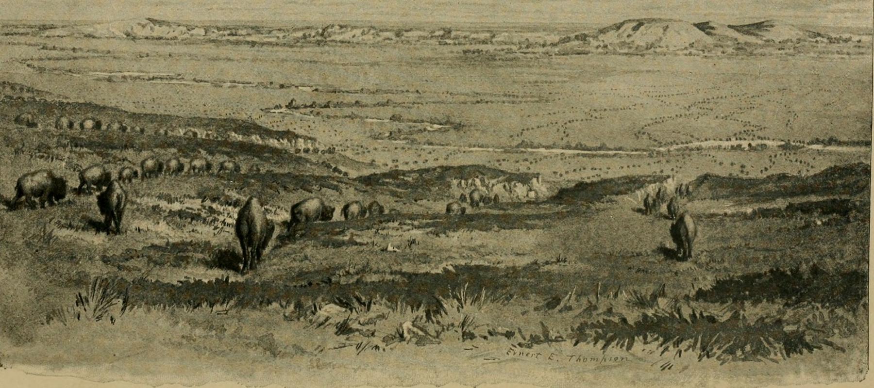
    <summary type="html"><![CDATA[<p><strong><em>By the late 1800s, Western sportsmen and settlers were hunting wildlife at such a rapid pace that many species risked extinction. Theodore Roosevelt recognized this and founded a club dedicated to conserving the land, resources, and wildlife for future generations.  </em></strong></p><img src="https://www.intermountainhistories.org/files/fullsize/31a977bb0a49566874be31d932edb7f7.jpg" alt="Artist’s depiction of big game in the American West in the late 19th century" /><br/><p>At the end of the 19th century, big game hunting became so popular that many wildlife populations faced extinction. Western railways increased access to previously remote regions, accelerating settlement. This Westward expansion also created a surge of irresponsible hunting for food, trophies, and improper land use. In 1883, on a trip to Little Cannonball Creek in Montana, Roosevelt enthusiastically hunted his first buffalo. Amid the thrill of this first-time accomplishment, he also reflected on the animal’s scarcity in his journal, “I watched the great beasts as they grazed...mixed with the eager excitement of the hunter was a certain half-melancholy feeling as I gazed on these bison, themselves part of the last remnant of a doomed and nearly vanished race.”
Like Roosevelt, many other sportsmen noticed how quickly wildlife in the West was disappearing. Determined to preserve his hobby and the land he loved, Roosevelt gathered fellow hunters to form the Boone and Crockett Club. Named after Daniel Boone and Davy Crockett, two famous frontiersmen and heroes of American expansion, the club advocated for the conservation and management of wildlife and habitat in the nation’s newest territories.
Founded on December 7, 1887, with the help of visionaries like George Bird Grinnell, Madison Grant, Gifford Pinchot, and 20 others, the club helped enact many legislative acts to protect and manage public lands. With their great influence, they initiated management regulations in the nation's first National Parks like Yellowstone, Glacier, and the Grand Canyon. They lobbied for federal laws that passed, including the 1891 General Revision Act (also known as the Forest Reserve Act), which enabled the President to withdraw forested lands from the public domain and offer them protections not guaranteed under previous legislation like the 1873 Timber Culture Act. This led to millions of acres being designated as “forest reserves” in the following two decades.
Roosevelt continued his efforts and spoke out about conservation when he was president with his annual address to Congress in 1907, saying, "Optimism is a good characteristic, but if carried to an excess, it becomes foolishness. We are prone to speak of the resources of this country as inexhaustible; this is not so." Educating the public, one of the club's biggest successes was the “Fair Chase” hunting ethic. This philosophy influenced game laws in the United States and created a system of data collection to monitor North American habitat health and big game populations today. Dedicated hunters and naturalists in the Boone and Crockett Club continually play a key role in balancing the well-being of the wild and the enjoyment of future generations. Roosevelt emphasized the importance in his book, My Life as a Naturalist, in 1918, “While my interest in natural history has added very little to my sum of achievement, it has added immeasurably to my sum of enjoyment of life.” He speaks for the wildlife as it cannot speak for itself.</p><p><em><strong><a href="https://www.intermountainhistories.org/items/show/925">For more (including 3 images) view the original article</a></strong></em></p>]]></summary>
    <published>2025-10-24T15:03:20+00:00</published>
    <updated>2026-08-18T15:52:41+00:00</updated>
    <link rel="alternate" type="text/html" href="https://www.intermountainhistories.org/items/show/925"/>
    <id>https://www.intermountainhistories.org/items/show/925</id>
    <author>
      <name>Jessika Cole, Brigham Young University</name>
    </author>
  </entry>
  <entry>
    <title type="html"><![CDATA[Teddy Roosevelt and John Muir Adventures in Yosemite: Story 3 of 8 of the President Theodore Roosevelt in the West Tour]]></title>
    <summary type="html"><![CDATA[<p><strong><em>President Theodore Roosevelt and his guide John Muir explored California’s beautiful National Park, Yellowstone, resulting in a nationwide conservation effort. </em></strong></p><img src="https://www.intermountainhistories.org/files/fullsize/091739d27efed8fc403fa07e54012ffd.jpg" alt="Theodore Roosevelt and John Muir pose in front of Glacier Point at Yosemite" /><br/><p>With a fondness for adventure, the outdoors, and the American West, President Theodore Roosevelt itched to experience the natural landscapes in California he’d heard so much about. Yosemite was one of only two national parks at the turn of the century, and he felt it fitting to include that stop in his 1903 Western tour. Roosevelt wrote a letter to John Muir, a Scottish botanist and conservationist who caught the President’s attention with his non-fiction novel “Our National Parks,” and asked him to be his guide. “I do not want anyone with me but you, and I want to drop politics absolutely for four days and just be out in the open with you.” Muir had an overseas journey planned in Europe and Asia at that time that he didn’t think he could cancel. After explaining the situation to the President of the University of California, Benjamin Ide Wheeler, he got an appeal and joined Roosevelt in the mountains, “I might be able to do some forest good in freely talking around the campfire,” Muir mused. As per Roosevelt’s request, politics were not discussed, but Muir’s agenda was nonetheless accomplished: to advocate for the land in the American West.
Roosevelt and his contingent arrived at Yosemite’s Wawona Hotel on May 15, 1903. With others remaining there, Muir, Roosevelt, a cook, two packers, and four mules left for the trees. They traveled through the giant sequoias, wandered through Mariposa Grove in the valley, and one night after camping at Glacier Point, they woke up to a blanket of snow, five inches atop them. If Roosevelt didn’t have forty wool blankets his men laid down for him and a warm fire by his side, he would have froze! Nonetheless, the men had great conversations. Charles Leidig was the cook and documented that “they talked a great deal about the conservation of forests in general and Yosemite in particular.” He also said, “he heard them discussing the setting aside of other areas in the United States for park purposes.” Muir had, indeed, done the “forest good.”
This trip jump-started Roosevelt's efforts to preserve public lands and natural resources across the nation. He was impressed to immediately go to Congress when returning to Washington and implement some of Muir’s ideas. He pushed for wildlife reserves, and on June 8, 1906, he signed the Antiquities Act which allowed the President to “declare by public proclamation historic landmarks” to be “national monuments, and may reserve as a part thereof parcels of land, the limits of which in all cases shall be confined to the smallest area compatible with proper care and management of the objects to be protected.” Roosevelt famously said in a speech in Sacramento after his experience in Yosemite, “We are not building this country for a day. It is to last through the ages.” Yosemite laid the groundwork for protecting other national forests in California and across the nation.</p><p><em><strong><a href="https://www.intermountainhistories.org/items/show/921">For more (including 3 images) view the original article</a></strong></em></p>]]></summary>
    <published>2025-10-24T15:03:18+00:00</published>
    <updated>2026-08-18T15:52:06+00:00</updated>
    <link rel="alternate" type="text/html" href="https://www.intermountainhistories.org/items/show/921"/>
    <id>https://www.intermountainhistories.org/items/show/921</id>
    <author>
      <name>Jessika Cole, Brigham Young University</name>
    </author>
  </entry>
  <entry>
    <title type="html"><![CDATA[Walker Bank Building Fire Lookout]]></title>
    <summary type="html"><![CDATA[<p><strong><em>Experience scenic vistas from an unusual site, downtown Salt Lake City.</em></strong></p><img src="https://www.intermountainhistories.org/files/fullsize/a0bda3406bdf1d5a8d85c9a99e125261.jpg" alt="The Walker Center Today" /><br/><p><p style="font-weight:400;">When describing the role of fire lookouts in the Intermountain West, one typically pictures scenic vistas atop remote woodland mountaintops. Lookouts rarely serviced urban areas, so imagine how odd it would have been to encounter a Forest Service fire lookout in the middle of a metropolitan area. As unusual as this sounds, one lookout station did operate in the center of downtown Salt Lake City, Utah, for roughly a decade.
<p style="font-weight:400;">Completed in 1912, the Walker Bank Building is a sixteen-story skyscraper in downtown Salt Lake. At the time of its construction, the building was the tallest structure in the Intermountain West. In the decades following Utah’s statehood in 1896, Utahans considered the construction of impressive infrastructure such as the Walker Bank an important step in the modernization of Salt Lake City.
<p style="font-weight:400;">During the 1930s, the city faced a water crisis. The Great Salt Lake itself is far too salty to use as drinking water, so most of the city’s water came from streams and rivers in the mountains surrounding the Salt Lake Valley. Grazing and wildfires had led to erosion that damaged the watersheds the city relied on. Determined to fix the issue, Wasatch National Forest began placing more emphasis on fire suppression. In 1939, the Forest Service and Salt Lake City Water Department banded together to establish a fire lookout to protect watersheds in the foothills around the Valley. Due to its height, the Walker Bank Building had an impeccable view of the region, so with permission from the bank, Wasatch National Forest set up a small lookout station atop the building.
<p style="font-weight:400;">The lookout itself consisted of little more than a small alidade table which was a map with a sighting device affixed to it for pinpointing spotted fires. From beneath a three-story steel tower advertising the Walker Bank and Trust, urban forest rangers surveilled the surrounding foothills for twelve hours daily. In 1941, <em>The Times</em> of San Mateo, California, reported that the Walker Bank Building had the only fire lookout in a downtown area in the entire country. In 1943, a fifteen-year-old named James Sarvis took on the lookout position. Despite his age, Wasatch National Forest at the Salt Lake Tribune credited him with the protection of the city’s valuable water resources. Sarvis returned to the post several times.
<p style="font-weight:400;">Wasatch National Forest has no records of the lookout being occupied after 1948, but the Walker Bank Building still exists. Now known as the “Walker Center,” the building is currently owned and operated by Wells Fargo.</p><p><em><strong><a href="https://www.intermountainhistories.org/items/show/712">For more (including 4 images) view the original article</a></strong></em></p>]]></summary>
    <published>2023-02-24T18:28:19+00:00</published>
    <updated>2026-04-17T19:32:15+00:00</updated>
    <link rel="alternate" type="text/html" href="https://www.intermountainhistories.org/items/show/712"/>
    <id>https://www.intermountainhistories.org/items/show/712</id>
    <author>
      <name>Tanner Hammarstrom, Northern Arizona University</name>
    </author>
  </entry>
  <entry>
    <title type="html"><![CDATA[Ute Fire Tower]]></title>
    <summary type="html"><![CDATA[<p><strong><em>Climb the stairs of the beautifully restored Ute Mountain Fire Tower and experience the last remaining lookout in the state of Utah.</em></strong></p><img src="https://www.intermountainhistories.org/files/fullsize/fe5b0baf9d6fdb8dea823b78c808f547.jpg" alt="The Ute Tower" /><br/><p><p style="font-weight:400;">During the 1930s, the Civilian Conservation Corps (CCC) was heavily involved in America’s fire policies through the construction of fire suppression infrastructure. Following the Great Fire of 1910, the federal government became increasingly concerned with the surveillance and management of wildfires. The responsibilities that arose from this concern fell at the feet of government forestry administrations, such as the Forest Service. In 1933, President Franklin Roosevelt signed the CCC into existence as part of his broader New Deal policies. The founding of the CCC both created jobs for young men struggling during the Great Depression, and provided foresters with an ample work force to help with fire suppression.
<p style="font-weight:400;">During this period, Ashley National Forest in northeastern Utah desperately needed a permanent fire tower. While mountain tops had been used as crude fire lookouts consisting of little more than campsites, no fire lookouts with living quarters had been built in the state of Utah. However, in 1937, the CCC completed the construction of the Ute Mountain Fire Tower in Ashley National Forest. It was the first and last of its kind to be built in the state.
<p style="font-weight:400;">One of the tools utilized at Ute Mountain was an Osborne Fire-Finder. This device served as an essential part of any efficient lookout facility for decades. It consisted of a circular map mounted to a table, typically at the center of a given lookout. A sighting mechanism consisting of two brass posts pivoted around the table, secured to opposite ends of one another. One post had a thin slit in it while the other stretched a single horse hair. At the direct center of the map would have been the location of the lookout. By moving the posts to line up with any smoke sighted, a lookout could record the exact location of a fresh wildfire. Ute Mountain also had a telephone and radio, and either could be used to contact Ashley National Forest’s fire command, who would subsequently rush to the site of the fire and extinguish it if <span>possible</span>.
<p style="font-weight:400;">Unfortunately, by the late 1960s, the tower was in disrepair. In 1967, a Forest Service survey of the structure proved that all four of the tower’s legs were rotting, and the structure soon closed. In an effort to preserve Utah’s only remaining fire lookout, Ashley National Forest nominated the tower for the National Register of Historic Places in 1980. The Service soon restored the tower, and the Forest held a rededication ceremony in 1987. However, in 2008 the Forest Service again discovered rot in all of the support beams. They considered demolishing the structure, but the local community believed it was too significant to the history of conservation in Utah. Ashley National Forest restored the tower most recently in 2014.
<p style="font-weight:400;">Today, the site is open to visitors as a historical interpretive site. Accessible by car, guests are encouraged to climb the steps of the tower and peer inside the large windows to experience the living quarters of a fire lookout.</p><p><em><strong><a href="https://www.intermountainhistories.org/items/show/711">For more (including 3 images) view the original article</a></strong></em></p>]]></summary>
    <published>2023-02-24T17:47:36+00:00</published>
    <updated>2026-04-17T19:32:15+00:00</updated>
    <link rel="alternate" type="text/html" href="https://www.intermountainhistories.org/items/show/711"/>
    <id>https://www.intermountainhistories.org/items/show/711</id>
    <author>
      <name>Tanner Hammarstrom, Northern Arizona University </name>
    </author>
  </entry>
  <entry>
    <title type="html"><![CDATA[Shadow Mountain Lookout]]></title>
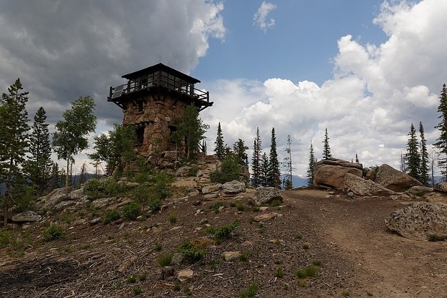
    <summary type="html"><![CDATA[<p><strong><em>This prime example of “parkitecture” offers both great views and rich architectural history.</em></strong></p><img src="https://www.intermountainhistories.org/files/fullsize/3c4e4b3b2596c254063f778413d4b7ba.jpg" alt="The Shadow Mountain Fire Lookout" /><br/><p><p style="font-weight:400;">By the beginning of the twentieth century, the environment had become an increasingly contentious topic. Led by President Theodore Roosevelt and Chief of the Forest Service, Gifford Pinchot, the conservation movement put utilitarian environmental protection at the front of the American public’s collective mind. The conservationist fervor was especially present in Colorado. This encouraged Congress to grant the Mesa Verde cliff dwellings, located in southwestern Colorado, status as a National Park in 1906. One central Colorado local and avid naturalist, Enos Mills, made it his mission to advocate for park status for a pristine set of peaks along the Rocky Mountains. After Mills campaigned for years, President Woodrow Wilson signed Rocky Mountain National Park into existence in 1915.
<p style="font-weight:400;">From the park’s beginning, wildfire suppression was a top priority. During the park’s first decade, rangers used high mountain tops to monitor the surrounding forests. In 1924, one ranger established a crude and difficult trail to the top of Shadow Mountain to be used for fire surveillance. However, the trail was far too rugged, and in 1930 the Park developed a trail from a nearby lake to the peak of the mountain. The lakes surrounding the peak were popular tourist destinations, and Park visitors soon took to scaling the trail to enjoy the views from the top. This early lookout consisted of little more than a telephone wire running down the steep mountainside and a campsite. The bare site proved successful, however, and the following year the Park Service began construction on a permanent lookout.
<p style="font-weight:400;">Rocky Mountain National Park completed the Shadow Mountain Lookout in 1933. Considering the number of visitors that would interact with the tower given the trail’s popularity, the Service constructed with aesthetics in mind, using the National Park Service rustic, or  “parkitecture”. This style utilized locally sourced materials that blended into the surrounding landscape. Parkitecture structures are meant to reflect rustic cabins more than bureaucratic facilities. With two lower stories consisting of unprocessed stone masonry and an upper story of evergreen frame, the Shadow Mountain Lookout is a prime example of parkitecture. Park supervisors expected lookouts manning the tower to participate in public relations just as much as fire suppression. In fact, the lower level of the structure acted as a museum, with exhibits concerning park wildlife and fire information.
<p style="font-weight:400;">Today, Shadow Mountain houses the only remaining lookout in Rocky Mountain National Park. Though the interior of the tower is currently closed to the public, the site is accessible by two trails on either side of the mountain. The peak of Shadow Mountain offers impressive views. The Park Service simply asks that hikers watch out for storms, as lightning can pose a danger on exposed mountaintops.</p><p><em><strong><a href="https://www.intermountainhistories.org/items/show/710">For more (including 4 images) view the original article</a></strong></em></p>]]></summary>
    <published>2023-02-23T19:13:08+00:00</published>
    <updated>2026-04-17T19:32:15+00:00</updated>
    <link rel="alternate" type="text/html" href="https://www.intermountainhistories.org/items/show/710"/>
    <id>https://www.intermountainhistories.org/items/show/710</id>
    <author>
      <name>Tanner Hammarstrom, Northern Arizona University</name>
    </author>
  </entry>
  <entry>
    <title type="html"><![CDATA[North Rim Lookout Tower]]></title>
    <summary type="html"><![CDATA[<p><strong><em>The North Rim Lookout Tower helped to protect the area of the Grand Canyon. One can still appreciate immaculate views of the Grand Canyon from high above northern Arizona’s ponderosa forests at the North Rim Lookout Tower which is available to hikers. </em></strong></p><img src="https://www.intermountainhistories.org/files/fullsize/163624658f254fa48626545cb65fa694.jpg" alt="Fire Lookout in the Grand Canyon" /><br/><p><p style="font-weight:400;">Following the Great Fire of 1910, which devastated much of the northern Rocky Mountains, the Forest Service prioritized wildfire suppression. By the mid-1910s, it constructed three small platforms along the Canyon’s edge to spot fires. The North Rim platform, constructed at Bright Angel Point, provided forest rangers and tourists with impeccable views of the forests which lined the Canyon.</p><p>As one of the natural wonders of the world, the Grand Canyon is widely considered one of America’s environmental gems. Federal attempts to preserve the Canyon date all the way back to the late nineteenth century, when the then Indiana Senator, Benjamin Harrison, proposed three bills in the 1880s to set aside the canyon as a national park.<span> </span>Though each of the bills failed, President Harrison eventually granted the Grand Canyon status as a Forest Reserve in the waning days of his presidency in 1893. After President Theodore Roosevelt visited the area in 1903, he granted the site status as a National Monument in 1908, <span>replacing Harrison’s reserve</span><span> </span>. The National Park Service wouldn’t be founded for another eight years, so the Monument fell under control of the fledgling US Forest Service.
<p style="font-weight:400;">The Grand Canyon gained status as a National Park in 1919. The Park Service continued the Forest Service’s policy of fire suppression, and in 1928, it replaced the platform with a seventy five-foot tall steel tower. Topped with a tiny observation cab, fire lookouts lived in a small cabin beneath the structure. Under contract, the Aeromotor Company constructed the Bright Angel Lookout Tower. Aerometer also designed and produced the iconic windmill water pumps which became a symbol of the American West during the late nineteenth and early twentieth centuries.
<p style="font-weight:400;">During the 1930s, the Civilian Conservation Corps (CCC) updated much of the North Rim’s infrastructure. This included moving the Bright Angel Lookout roughly fourteen miles away to the Park’s northern entrance. In 1933, the CCC renamed the structure the North Rim Lookout Tower.
<p style="font-weight:400;">From the late 1960s to the early 1970s, writer and environmentalist Edward Abbey spent four seasons working in the tower. Abbey’s time in the station inspired his book <em>Black Sun, </em>a novel which tells the story of a fire lookout in the Grand Canyon who falls in love with a tourist. When she goes missing, the lookout is blamed for her mysterious disappearance. In his book <em>Fire on the Rim</em>, Stephen Pyne references Abbey as the reason the Park ceased lookout tower operations. “Whether [Abbey] was even in the tower, no one could say. He was a writer, and the only smokes he reported were the ones in his novels… he was absent so often that he demonstrated that we did not need a lookout, because having [Abbey] in the tower was the same as having no one.” Ultimately, the Park opted for aerial fire spotting instead.
<p style="font-weight:400;">Though abandoned, North Rim Lookout Tower is still accessible. Hikers can reach the site via a short hike from the Park’s northern entrance toll booth.</p><p><em><strong><a href="https://www.intermountainhistories.org/items/show/709">For more (including 5 images) view the original article</a></strong></em></p>]]></summary>
    <published>2023-02-23T00:36:16+00:00</published>
    <updated>2026-04-17T19:32:15+00:00</updated>
    <link rel="alternate" type="text/html" href="https://www.intermountainhistories.org/items/show/709"/>
    <id>https://www.intermountainhistories.org/items/show/709</id>
    <author>
      <name>Tanner Hammarstrom, Northern Arizona University</name>
    </author>
  </entry>
  <entry>
    <title type="html"><![CDATA[Devil’s Head Lookout]]></title>
    <summary type="html"><![CDATA[<p><strong><em>Scramble up the rocky slopes of Devil’s Head, Colorado, and experience the majestic views provided by one of America’s oldest fire lookouts.</em></strong></p><img src="https://www.intermountainhistories.org/files/fullsize/93382370047342f0bfaad49a1a03397f.jpg" alt="Helen Dowe" /><br/><p><span style="font-weight:400;">As early as 1907, the two-year-old Forest Service had begun to realize the potential usefulness of high vantage points to monitor fires. William Kreutzer, the nation’s first forest ranger, recommended a series of peaks in the front range of the Rocky Mountains in Colorado for this purpose. The most prominent was Devil’s Head, a rocky granite outcropping high above Pike National Forest, near Sedalia, Colorado.</span>
<span style="font-weight:400;">In the wake of the Great Fire of 1910, the Forest Service began constructing permanent stations at these points. In 1912, Colorado foresters established a crude lookout at Devil’s Head. This primitive station consisted of a small alidade table, which is an instrument consisting of a map and sighting mechanism used to pinpoint the exact location of fires around the lookout, and a tiny log cabin on an outcropping. The Forest Service has used the site continuously since the establishment of this early station.</span>
<span style="font-weight:400;">In 1919, the Service built a more permanent structure. It consisted of a ten-foot by ten-foot wooden cabin, flanked by large windows that granted the ranger within a 360-degree view of the surrounding forests. The first lookout to occupy this new station was Helen Dowe, the second woman in United States history to staff an official forest fire lookout. In the wake of World War I, the Forest Service faced a shortage of able-bodied men to operate stations. Dowe was born in Denver in 1889, and spent much of her youth working as a horseback riding instructor in the mountains around Devil’s Head. As such, she knew the area well. Dowe spotted and reported dozens of wildfires during her tenure as a lookout from 1919 to 1921, saving thousands of acres from burning. In her time at Devil’s Head, she gained widespread publicity. As the subject of numerous magazine articles, Dowe became a prominent feminist figure at the height of the national suffrage movement. According to the </span><i><span style="font-weight:400;">Denver Post</span></i><span style="font-weight:400;">, she received thousands of letters from women around the country who envied her position. </span>
<span style="font-weight:400;">The Forest Service replaced the old observatory at Devil’s Head Lookout in 1951. The current station is the last lookout in Colorado to be staffed full-time. Pike-Isabel National Forest makes the site available to tourists and hikers, who flock to the rocky outcropping for the lookout’s history and the incredible views from the top. Visitors can access the station via a 1.5-mile hike, and parking is available at the Devil’s Head Trailhead. The last leg of the journey takes hikers up a winding wooden staircase, which works its way up massive granite outcroppings. Lucky visitors may get the chance to talk to the station’s lookout.</span></p><p><em><strong><a href="https://www.intermountainhistories.org/items/show/708">For more (including 4 images) view the original article</a></strong></em></p>]]></summary>
    <published>2023-02-22T18:41:03+00:00</published>
    <updated>2026-04-17T19:32:15+00:00</updated>
    <link rel="alternate" type="text/html" href="https://www.intermountainhistories.org/items/show/708"/>
    <id>https://www.intermountainhistories.org/items/show/708</id>
    <author>
      <name>Tanner Hammarstrom, Northern Arizona University</name>
    </author>
  </entry>
  <entry>
    <title type="html"><![CDATA[Dark Sky over Bryce Canyon National Park]]></title>
    <summary type="html"><![CDATA[<p><strong><em>A national park filled with crimson rock formations known as hoodoos, Bryce Canyon also has one of the best-sustained public astronomical programs, and it has been running for over fifty years.</em></strong></p><img src="https://www.intermountainhistories.org/files/fullsize/2988e0f433f61569bc6c5beafc753df2.jpg" alt="Milky Way over Bryce Canyon" /><br/><p>In addition to hosting the longest active program for astronomy in the National Park Service, Byce Canyon National Park also holds the honor of being a Gold Tier International Dark Sky Park, so designed by the International Dark-Sky Association in 2019. Gold Tier is a rare classification, as it denotes a place with natural nighttime conditions, little to no light pollution, and over 10,000 stars visible on a clear night.</p><p>President Warren G. Harding made Bryce Canyon a National Monument on June 8, 1923, but after a review, Congress made it a national park on February 25, 1928. Educational programs in Bryce Canyon National Park in Utah to teach visitors about astronomy began in 1969 when the Chief of Interpretation was inspired by the Abrams Planetarium to create a night sky interpretation program for Bryce Canyon. In 1972, an astronomer named Von Del Chamberlain wrote and designed a manual for sky interpretation for distribution and use at Bryce Canyon National Park. Chamberlain’s manual included cartoons about why natural skies were culturally important, a list of seven reasons for the park to include sky interpretation, and several program ideas focusing on campfires and storytelling.  Interpretative rangers and volunteers have run educational lectures, stargazing parties, and constellation tours since then, and its reputation was such that interpreters from other parks came to Bryce Canyon to train for night sky and astronomy interpretation in 2005. Patrick Wiggins, Utah’s NASA Solar System Ambassador, has been an annual speaker at Bryce Canyon National Park and involved in program creations from 1984 to 2014.</p><p>The Dark Ranger program for park rangers, sometimes referred to as the Astronomy Rangers, was also created for Bryce Canyon National Park with a mission to cultivate understanding and wonder for the vastness of the universe that has grown harder to recognize with the expansion of lights and cities. Since 2013, the Astronomy Rangers have joined with the work of volunteers and other interpretive rangers for educational programs. Astronomical festivals have also joined Bryce Canyon’s list of public programs.</p><p>For Bryce Canyon’s dedication to over fifty years of defending an intangible but culturally crucial resource, the International Astronomical Union named an asteroid after Bryce Canyon National Park.  Minor planet 49272 was discovered in 1998 by Roy Tucker, and it received the name “Bryce Canyon” in 2007 in appreciation for the park’s public astronomy programs. Orbiting the Sun between Mars and Jupiter, the asteroid has about the same length as its namesake on Earth, being three to five miles across. Bryce Canyon National Park is the second National Park to have an asteroid named after it. Though the small telescopes in Bryce Canyon National Park cannot see the dim minor planet in the sky, the park is very proud of its long record of promoting dark sky conservation. Having an asteroid named after the national park is an international honor.</p><p><em><strong><a href="https://www.intermountainhistories.org/items/show/544">For more (including 3 images) view the original article</a></strong></em></p>]]></summary>
    <published>2021-11-14T05:39:05+00:00</published>
    <updated>2026-04-17T19:32:11+00:00</updated>
    <link rel="alternate" type="text/html" href="https://www.intermountainhistories.org/items/show/544"/>
    <id>https://www.intermountainhistories.org/items/show/544</id>
    <author>
      <name>Emma Svenson, Northern Arizona University</name>
    </author>
  </entry>
  <entry>
    <title type="html"><![CDATA[Dark Sky over Hovenweep National Monument]]></title>
    <summary type="html"><![CDATA[<p><strong><em>Hovenweep National Monument has been inhabited for over ten thousand years. Its long history of celestial observation culminated in Hovenweep’s 2014 designation as an International Dark Sky Park.</em></strong></p><img src="https://www.intermountainhistories.org/files/fullsize/447ea0e1f4175ff2d0eb928d5ecc8b6e.jpg" alt="Milky Way over Hovenweep" /><br/><p>A little over half-a-century after a Latter-day Saint missionary discovered 800-year-old Ancestral Puebloan ruins on the Colorado–Utah border in 1856, Jesse Walter Fewkes of the Smithsonian Institution led a survey of the sites in 1917–1918. Fewkes concluded such a historic site needed to be preserve, and on March 2, 1923, President Warren G. Harding declared Hovenweep a National Monument in the National Park System. Its name means “deserted valley” in the Ute language.
Archaeologists have found evidence of early hunter gatherers in the area dating back to 8000 BCE, but the ruins themselves were used by the Ancestral Pueblo people, who lived in Hovenweep from 900 to 1300 CE. These Ancestral Puebloans practiced celestial observation. Hovenweep National Monument has six clusters of ancient ruins, and within the Holly ruin group there are spiral petroglyphs on a rock wall that are believed to act as markers for equinoxes and solstices.  For the Ancestral Pueblo people, spiral symbols often reresent the sun or sky. On the day of a solstice or equinox, a beam of sunlight hits the spiral and bisects the spiral petroglyph. When sunlight perfectly hit the spiral petroglyph, it would signify passage into the next season for practical purposes like expecting weather for farming but potentially also for ceremonial purposes and rituals in kivas.
Over in Hovenweep Castle of the Square Tower cluster, holes in the walls allow beams of light to enter the interior and serve as a solar calendar. Ancestral Pueblo farmers would have used the changing positions of the sunbeams to track the solar cycle and help guide planting and harvesting. Anthropologists and archaeologists continue hypothesizing potential uses for other buildings in the ruins, such as the large stone masonry towers. Further celestial observation and defensive fortification are the two likely purposes for the towers. Large structures have been used for millennia for celestial observation and ritual, such as the ziggurats of the Middle East and Latin America, and the long history of celestial observation in Hovenweep makes it a possibility.
The International Dark-Sky Association designated Hovenweep National Monument an International Dark Sky Park in July of 2014 at the Gold Tier after it accepted the National Park Service’s application for the designation.  A Gold Tier Dark Sky Park is a rare designation given to places with the highest quality dark skies, the smallest amount of light pollution, and the potential to see 15,000 stars in the sky.  For comparison, typically only 500 stars are visible from a city. An International Dark Sky Park designation is not legally binding, but rather commemorates Hovenweep’s dedication to preserving its clear night sky, an increasingly rare resource.</p><p><em><strong><a href="https://www.intermountainhistories.org/items/show/543">For more (including 3 images) view the original article</a></strong></em></p>]]></summary>
    <published>2021-11-14T05:20:32+00:00</published>
    <updated>2026-04-17T19:32:11+00:00</updated>
    <link rel="alternate" type="text/html" href="https://www.intermountainhistories.org/items/show/543"/>
    <id>https://www.intermountainhistories.org/items/show/543</id>
    <author>
      <name>Emma Svenson, Northern Arizona University</name>
    </author>
  </entry>
  <entry>
    <title type="html"><![CDATA[Dark Sky over Arches National Park]]></title>
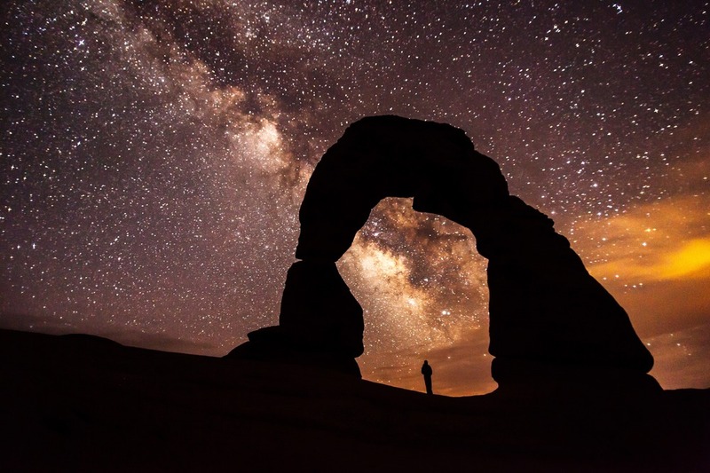
    <summary type="html"><![CDATA[<p><strong><em>Home to over 2,000 natural sandstone arches in Utah, Arches National Park applied for recognition from the International Dark-Sky Association and received the association’s “Silver Tier” designation in 2019 thanks to its commitment to preserving the natural sky and educating the public about the benefits of reducing light pollution.</em></strong></p><img src="https://www.intermountainhistories.org/files/fullsize/94128d7b834b011c0b21f969610c1bc6.jpg" alt="Milky Way over Arches" /><br/><p>First designated a national monument in 1929, Congress declared Arches a national park on November 12, 1971. Arches National Park is one of the “Mighty 5” national parks of Utah, and in 2019, the International Dark-Sky Associated recognized the park’s work toward reducing light pollution within and outside of the park with its Silver Tier designation. (The Silver Tier is given when light glow is present along the horizon to a degree that wildlife and astronomy are impacted, but the Milky Way Galaxy can still be seen in summer and winter with over six thousand stars visible to the naked eye.)
In 1999, a study of 376 parks discovered that half of all National Parks, 189 in total, were threatened by light pollution from encroaching cities. The National Park Service responded by forming the Night Sky Team to document the negative effects of light pollution with 104 photos taken in a short duration. Every photo was stitched together to form a wider picture, and then the Night Sky Team erased the light generated by stars to focus on how artificial lighting impacted the park. Arches National Park in 2003 had significant light pollution from Moab, Utah, and Grand Junction, Colorado, so the park created outdoor lighting codes with training workshops to reduce light pollution, intending to keep visitors safe while minimizing harm to wildlife.
Arches National Park’s lighting codes implement several strategies for reducing light pollution and preserving a clear night sky as a culture heritage. First, Arches’ lights use motion sensors to provide visitors with light when they need it without leaving any running constantly. Second, Arches’ outdoor light fixtures are shielded with hoods and point toward the ground. Third, Arches National Park uses warm-colored light, as blue-colored light negatively impacts insects while amber lighting minimizes sky brightness while still providing visibility to guests. Fourth, Arches encourages nearby cities and households to plan outdoor lighting efficiently and use high quality lights. This includes striving to minimize nighttime lighting and only using what is strictly necessary for public safety.  Close to 100% of all exterior lights throughout the 119-square-mile park are night-sky friendly in accordance with Arches’ principles.
The value Arches National Park places on its dark skies is not limited to lighting codes and stargazing within the park. Educational outreach programs have been created, like the Night Sky Ranger booklet that teaches children about astronomy and light pollution through stargazing and moon phase observation activities. Preservation can maintain the dark skies, but education about the value of dark skies is what will break through the night blindness created by brightly lit societies.</p><p><em><strong><a href="https://www.intermountainhistories.org/items/show/541">For more (including 5 images) view the original article</a></strong></em></p>]]></summary>
    <published>2021-11-14T03:31:12+00:00</published>
    <updated>2026-04-17T19:32:11+00:00</updated>
    <link rel="alternate" type="text/html" href="https://www.intermountainhistories.org/items/show/541"/>
    <id>https://www.intermountainhistories.org/items/show/541</id>
    <author>
      <name>Emma Svenson, Northern Arizona University</name>
    </author>
  </entry>
  <entry>
    <title type="html"><![CDATA[Dark Sky over Flagstaff]]></title>
    <summary type="html"><![CDATA[<p><strong><em>In 2001, Flagstaff, Arizona, became the first International Dark Sky City because of its long-term commitment to reducing outdoor light pollution without compromising safety.  The Colorado Plateau’s clear, dry air, cloudless nights, and distance from major cities has made Flagstaff a significant location for astronomy.</em></strong></p><img src="https://www.intermountainhistories.org/files/fullsize/ac2b6faa24e41544e57d8b18d3228661.jpg" alt="Night sky in Flagstaff" /><br/><p>Flagstaff’s history of dark sky conservation began even before the International Dark Sky City designation in 2001 when it issued the world’s first outdoor lighting ordinance in 1958. Lowell Observatory, founded in 1894 by Percival Lowell to study the surface of Mars, was concerned about how light pollution would limit the capacity of a reflecting telescope transferred from the Ohio Perkins Observatory. To protect astronomy, the Anti-Searchlight Law of 1958 passed to forbid the use of searchlights, common in advertising, within city limits.
However, light pollution levels kept rising in Flagstaff, even with the passing of a second lighting ordinance in 1972 requiring all outdoor lights be properly shielded and pointed downwards.  A shielded outdoor light has a surface or hood built in to prevent any light from escaping upwards or horizontally so the beam is directed at the ground. Fourteen years later, Tucson and Pima County updated their ordinances from 1973, and Lowell Observatory partnered with Flagstaff city planners to maintain Flagstaff’s status as an important site for astronomy.  In conjunction with the Arizona Public Service in 1987, Dr. Arthur Hoag from Lowell Observatory tested low-pressure sodium lights on Santa Fe Avenue in downtown Flagstaff as a method to reduce light pollution. With 90% approval from the public and evidence proving the new lights reduced the city’s light pollution, Flagstaff updated its lighting codes to mandate low-pressure sodium lights and ban mercury vapor light common in old streetlamps.  The amber hue of low-pressure sodium lights causes the least amount of sky glow, uses the least amount of energy to operate, and has the least impact on the natural rhythms of humans and nocturnal animals.  For astronomy, Christian Luginbuhl of the U.S. Naval Observatory documented that low-pressure sodium lights take up only two bands of the visible light spectrum, allowing astronomers to research within every other area of the light spectrum.
But in 1988, pressure from the Yellow Freight Company to allow higher levels of light pollution for a trucking yard near Lowell Observatory and the U.S. Naval Observatory Flagstaff Station split Flagstaff’s residents with arguments over economic and scientific interests.  The conflict ended in favor of continuing to reduce light pollution, and on September 26, 1989, the Flagstaff City Council enacted strict lighting codes for protecting Flagstaff’s unique natural. Yellow Freight withdrew from the city three years later.
The <em>Daily Sun</em> newspaper framed the clash over light pollution in Flagstaff as pitting money and jobs against scientific innovation and potential in the <em>Daily Sun</em> newspaper, but as time passed, the light ordinances did not harm Flagstaff’s economy.  In fact, the exceptional environmental conditions in Flagstaff grew the astronomical community with organizations such as the U.S. Naval Observatory and the U.S. Geological Survey contributing to a major tourism draw.  Residents and tourists alike interact with Flagstaff’s dark skies in different ways.  For example, the Flagstaff Star Party organizes every year with the help of astronomers Christian Luginbuhl and Jeff Hall from Lowell Observatory and helps residents and tourists learn how to observe the city’s dark skies  Another organization, the Flagstaff Dark Skies Coalition under Christian Luginbuhl, promotes music, art, and theater about Flagstaff’s skies in partnership with the Coconino Center for the Arts.
Flagstaff’s popular culture has grown to include the dark sky it is deeply proud of. In 2001, Flagstaff received an International Dark Sky City designation thanks to its conservation efforts and appreciation for a rare natural resource in the age of urban expansion.</p><p><em><strong><a href="https://www.intermountainhistories.org/items/show/540">For more (including 4 images) view the original article</a></strong></em></p>]]></summary>
    <published>2021-11-14T01:29:49+00:00</published>
    <updated>2026-04-17T19:32:11+00:00</updated>
    <link rel="alternate" type="text/html" href="https://www.intermountainhistories.org/items/show/540"/>
    <id>https://www.intermountainhistories.org/items/show/540</id>
    <author>
      <name>Emma Svenson, Northern Arizona University</name>
    </author>
  </entry>
  <entry>
    <title type="html"><![CDATA[Timpanogos Cave National Monument]]></title>
    <summary type="html"><![CDATA[<p><strong><em>High above the American Fork Canyon floor a natural wonder resides. The Timpanogos Cave system has been enjoyed by thousands of pleasure seekers over the past century. However, the Timpanogos Cave system almost became another hole in the rock. Because of early conservation efforts, the cave system being turned into a national monument, and continued efforts to preserve the cave, so many more people may continue to enjoy much of the beauty that the early discoverers found there. </p></strong></p><img src="https://www.intermountainhistories.org/files/fullsize/ff271d68c4846e9aff15e73e0ebc330f.jpg" alt="Figure 1
" /><br/><p>Timpanogos Cave represents millions of years of gentle, fragile geological formations. For these structures to be maintained in their natural state, human interaction most likely spelled doom for these natural occurring formations. The story of Timpanogos Cave is a story of unsung heroes and efforts that have fulfilled the dream of the National Park Service, to preserve unique areas of nature for enjoyment of all generations in their same state. Once the three caves (Hansen, Middle, and Timpanogos) were discovered, many people made efforts to turn the caves over to the government. The government with their funds from the Forest Service and the National Park Service would be able to continue their efforts in maintaining the natural beauty of the cave while allowing for people to enjoy the beauty of the cave. </p><p>To help maintain the beauty of these caves, President Warren Harding placed the caves and the land surrounding them under federal protection on October 13, 1922.  Almost immediately after the monument was established, trials that threatened the wonders emerged. There were private claims laid on the caves that required cooperation of those who discovered the cave to prove false. Mining claims were made on the land due to its protection under the forest service by a group of people called the Joy Riders. These claims went to court and were ultimately defeated. There was also the difficulty of protecting the cave from the hands of those who toured it. They would take little pieces of the cave like the one in Figure 1, and put them in their pocket to keep. Overtime, punishments were effective enough to discourage most from tampering with the cave ecosystem. </p><p>Once the Timpanogos Cave System was placed under jurisdiction of the National Park Service in the 1933, many problems were minimized even though periodic vandalism and theft still occurred. Under the National Park Service, the next task was to make the caves more accessible to the public due to the increasing popularity of the monument. The Caves became popular due to the spread of mouth and of media created to advertise the mountain and the cave. To make the monument more accessible, a trail was constructed to the caves in 1936 by men who received work from the CCC during the Great Depression. The three caves were also connected in 1939 and lights were installed inside of the cave to allow easier access and pleasure to the guests of the cave (Figure 2). Though difficult, the beauty and integrity of the caves were preserved despite the major projects that took place. </p><p>Despite natural disasters such as floods that destroyed the roads in American Fork Canyon in 1965 and 1983 (Figure 3) and a fire to the main building on the monument in 1991, other updates to the monument that have progressed, and Timpanogos Cave National Monument has grown in popularity.  Now, over 100,000 people visit the monument every year. Despite the continued popularity and visitation of the Caves, the conservation efforts that have been made have allowed the caves to remain relatively the same as discoveries took place in 1887 by Martin Hansen following a mountain lion.</p><p><em><strong><a href="https://www.intermountainhistories.org/items/show/312">For more (including 3 images) view the original article</a></strong></em></p>]]></summary>
    <published>2019-02-22T21:47:03+00:00</published>
    <updated>2026-04-17T19:32:05+00:00</updated>
    <link rel="alternate" type="text/html" href="https://www.intermountainhistories.org/items/show/312"/>
    <id>https://www.intermountainhistories.org/items/show/312</id>
    <author>
      <name>Robert Dayley, Brigham Young University</name>
    </author>
  </entry>
  <entry>
    <title type="html"><![CDATA[Outfitting To Research: The University of Idaho’s Taylor Wilderness Research Station<br />
]]></title>
    <summary type="html"><![CDATA[<p><strong><em>The University of Idaho has owned a research station in the Frank Church-River of No Return Wilderness Area in Idaho since 1969. The station focuses on environmental education for undergraduates and graduates from all over the country.</p></strong></p><img src="https://www.intermountainhistories.org/files/fullsize/eba0f931e10054f7c695dd20aac456f0.jpg" alt="Looking towards Taylor on the bridge" /><br/><p>The Taylor Wilderness Research Station in the Frank Church-River of No Return Wilderness Area has been owned by many people over the years. The University of Idaho (UI), who owns it now, acquired the property from Jess and Dorothy Taylor in 1969 for $100,000, who had bought the property from David “Cougar Dave” Lewis in 1935 for $1,200. The university intended to fund the research station for a couple years before research grants would fund it self-sufficiently, a hope that remains unfulfilled. The station has adapted, though, and still focuses on education and research. </p><p>One unique opportunity at the station is the University of Idaho’s Semester in the Wild Program. This program allows students to spend a semester in the wilderness taking an integrated set of classes in the sciences and humanities, while receiving field experience. </p><p>The main focus and goal for the research station has remained education, broadly defined, rather than publishable research. The research station produced even more educational research opportunities when the university bought it. For example, the caretakers Jim and Holly Akenson, who were hired by UI, managed the property from 1982 to 2003 and developed an internship program, accepting and encouraging interns and students to come do research, especially in wildlife ecology. The Akensons took the interns on backpacking and horseback riding excursions to trap wolves, cougars, bobcats, and bears to tag them and collect data. They also investigated carcasses they happened across to determine how that animal was killed. Mostly, this research focused on students’ learning opportunities and backcountry skill-building rather than academic publication. It worked, because student experiences made them more marketable for future jobs. </p><p>In recent decades, the station moved towards more long-term monitoring programs, reflecting shifts in the history of ecology, which will provide the groundwork for potential future research. Some long-term monitoring efforts have already happened. For example, bird observations are made over the seasons to determine the presence or absence of specific bird species. Another project has compared the biomass of bluebunch wheatgrass to bighorn sheep populations. This research has been active for more than 25 years. As for today, one of the caretakers is conducting a research project on the pheromones of cougars to determine if we can identify cougars based on their different smells alone. UI also collaborates; Idaho State University researchers come to the research station each year to sample multiple creeks in the Big Creek drainage, looking at the riparian area and stream productivity. This has been conducted for 31 years, which gives us data from before a major fire in 2000 that significantly affected the ecological relationships in the watershed. Research here is limited to non-invasive practices, because it is a wilderness area. Permits also limit the station’s ability to conduct research in the area. However, even with the regulations in wilderness, research continues. The size of the wilderness area makes TWRS an especially useful research site in many of the environmental sciences. </p><p>The station is invaluable for giving students hands on field experience in an unusual learning environment. It allows long-term research to be carried out in a place where getting research permits can be hard. The educational opportunities that are provided here let students from all over the country experience wilderness and education in a whole new way.  </p><p><em><strong><a href="https://www.intermountainhistories.org/items/show/303">For more (including 3 images) view the original article</a></strong></em></p>]]></summary>
    <published>2019-02-15T00:30:07+00:00</published>
    <updated>2026-04-17T19:32:05+00:00</updated>
    <link rel="alternate" type="text/html" href="https://www.intermountainhistories.org/items/show/303"/>
    <id>https://www.intermountainhistories.org/items/show/303</id>
    <author>
      <name>Hailey Shannon, University of Idaho</name>
    </author>
  </entry>
  <entry>
    <title type="html"><![CDATA[The Rush Creek Point Fire Lookout and Fire Suppression <br />
]]></title>
    <summary type="html"><![CDATA[<p><strong><em>Rush Creek Point Fire Lookout is an abandoned fire lookout overlooking the Rush, Cabin, and Big Creek drainages in central Idaho’s Payette National Forest, built by the Civilian Conservation Corps (CCC) as part of the Forest Service’s fire suppression efforts.</p></strong></p><img src="https://www.intermountainhistories.org/files/fullsize/2f634c9d453524fbbca9cd296dfe52ac.jpg" alt="Rush Creek Point Fire Lookout " /><br/><p>The Rush Creek Point Fire Lookout is a small structure built in 1937 by the Civilian Conservation Corps to monitor fires from its vantage point straddled between the Big Creek and Rush Creek drainages. Fire lookouts were necessary due to the Forest Service’s 10:00 AM policy, which announced that forest fires should be put out by 10:00 AM on the day after they occurred. To make this feasible, the CCC built fire lookouts while the Forest Service strung telephone lines throughout the national forests for communication with the outside world. The surplus of labor during the Great Depression made this development possible with the government-sponsored work-relief programs of the New Deal, such as the CCC. </p><p>The aggressive fire-fighting policy of the Forest Service often proved impracticable in Idaho. Forest Service employee Elers Koch noted in his 1935 article “The Passing of the Lolo Trail,”  the failures of the firefighters to contain the conflagrations even under ideal conditions, suggesting that perhaps some of this difficulty originated from the buildup of fuels as a result of earlier fire suppression. Despite these early concerns, the Forest Service maintained the 10:00 AM policy until 1977, after which fires were addressed with individualized plans often including alternatives to suppression.</p><p>The 1980 Central Idaho Wilderness Act further reduced the necessity of the Rush Creek Point Fire Lookout by defining this portion of the Payette National Forest as part of the Frank Church-River of No Return Wilderness Area. This limited the fire suppression activities that the Forest Service was legally allowed to conduct, since in wilderness areas the use of motorized tools is prohibited. Furthermore, suppressing fire at all in wilderness is only questionably legal, since the act calls for wilderness “untrammeled” by man. Abandoned, the Rush Creek Point Fire Lookout has been out of service for many years, a relic of the Forest Service’s aggressive fire suppression. </p><p><em><strong><a href="https://www.intermountainhistories.org/items/show/302">For more (including 2 images) view the original article</a></strong></em></p>]]></summary>
    <published>2019-02-14T00:25:36+00:00</published>
    <updated>2026-04-17T19:32:05+00:00</updated>
    <link rel="alternate" type="text/html" href="https://www.intermountainhistories.org/items/show/302"/>
    <id>https://www.intermountainhistories.org/items/show/302</id>
    <author>
      <name>Everett Masterman, University of Idaho</name>
    </author>
  </entry>
  <entry>
    <title type="html"><![CDATA[John Muir and Yosemite<br />
]]></title>
    <summary type="html"><![CDATA[<p><strong><em>John Muir is known as the Father of Conservationism.  He spent his life roaming the Sierra Nevada mountain range and writing articles that convinced the nation that the land should be protected.  His biggest success was helping Yosemite receive National Park status in 1890.</p></strong></p><img src="https://www.intermountainhistories.org/files/fullsize/e58266f0b9e2293119d38e5377ba9aa5.jpg" alt="John Muir" /><br/><p>John Muir was an American preservationist.  Born in Scotland in 1838, Muir came to love the natural world. At age eleven, Muir’s family immigrated to the United States and settled in Wisconsin working as farmers.  John loved inventing mechanical contraptions, and he took them to the Wisconsin State Fair.  Impressed with his ingenuity, faculty at the University of Wisconsin invited him to apply.  Once accepted, he studied geology and botany for four years.  Before graduating, Muir felt a drive to leave the university and explore the world.  He walked a thousand miles to Florida and then boarded a ship to California.  Upon arriving, he inquired where the wildest place in California was, and people referred him to Yosemite.</p><p>Yosemite derives its name from an indigenous tribe living in Yosemite Valley.  Known as extremely violent tribe, their neighboring tribes called the people yohhe’meti, meaning “they are killers.”  As white settlers moved in, they called the place Yosemite.  One of the first settlers in the area was James Mason Hutchings.  He built a hotel and a sawmill in the valley and advertised Yosemite as a tourist attraction.  When Congress passed the bill declaring Yosemite as protected land, Hutchings received permission to stay.  As his business grew, he hired a Scottish immigrant named John Muir to work in his sawmill.  </p><p>Upon arriving in Yosemite Valley, Muir felt “overwhelmed by the landscape, scrambling down steep cliff faces to get a closer look at the waterfalls, whooping and howling at the vistas, jumping tirelessly from flower to flower.”  He decided to stay and obtained a job working in a sawmill in the valley.  In his spare time, Muir explored the land and conducted botanical and geological studies.  Muir felt a spiritual connection to the Yosemite Valley and the Sierra Nevada mountains in general.  He called them a “temple of nature,” a place to connect to God.</p><p>John despaired that the extractive lumber and mining industry throughout the Sierra Nevada was destroying the natural beauty and would keep future generations from finding that spiritual connection.  Muir wrote articles for a number of magazines and newspapers to describe to the public the value of these beautiful lands.  He explained the horrors of the deforestation and mining that were destroying irreplaceable wonders.  The nation responded, and called upon Congress to protect these places for future generations.  </p><p>In 1864, Abraham Lincoln had signed a bill passed by Congress to set aside land in the Sierra Nevada Mountains called Yosemite.  Yosemite’s creation marked the first time in American and perhaps world history, where a government passed a law to preserve land as a park for future generations.  Yosemite became the first state park of California, and in 1890 became the nation’s second national park.</p><p>Yosemite remains one of the United States’ most popular National Parks to this day.  Each year millions of visitors enjoy its breathtaking beauty.  Among its many famous features are Half Dome, Yosemite Falls, and Mirror Lake.  The efforts to protect Yosemite from human development led the way to a string of state and national parks that we still enjoy today.   </p><p><em><strong><a href="https://www.intermountainhistories.org/items/show/290">For more (including 3 images) view the original article</a></strong></em></p>]]></summary>
    <published>2019-02-13T01:20:23+00:00</published>
    <updated>2026-04-17T19:32:05+00:00</updated>
    <link rel="alternate" type="text/html" href="https://www.intermountainhistories.org/items/show/290"/>
    <id>https://www.intermountainhistories.org/items/show/290</id>
    <author>
      <name>John Richardson, Brigham Young University</name>
    </author>
  </entry>
  <entry>
    <title type="html"><![CDATA[JFK at the Salt Lake City Municipal Airport: Story 5 of 5 of the John F. Kennedy’s Conservation Tour in September, 1963 Tour]]></title>
    <summary type="html"><![CDATA[<p><strong><em>The second public address given by President John F. Kennedy in Utah targeted the state’s development and its potential to become one of the most popular recreation areas in the U.S. At the end of his last speech during the Conservation Tour in the Intermountain West, JFK initiated the first power generator at the Flaming Gorge Powerplant along the Utah-Wyoming border.</em></strong></p><img src="https://www.intermountainhistories.org/files/fullsize/bade3215422a10e1786885a503087779.jpg" alt="President John F. Kennedy Starts the First Generator at Flaming Gorge Powerplant" /><br/><p>The last speech delivered by President Kennedy during his Conservation Tour in the Intermountain West was at Salt Lake City Municipal Airport.  In this address, which started at 9:35 a.m. on September 27, 1963, JFK explained how innovative resource conservation and development programs would benefit future generations. According to the President, wise management of resources would make a profound difference to the state of Utah, and preserving natural resources would make the state a great recreational attraction for tourists from all over the United States.</p><p>Kennedy dedicated the main part of the speech to the Flaming Gorge Dam on the Green River, one of the six dams that make up the Colorado River Storage Project. The President pointed out that the dam, with almost four million acre feet of capacity, would make Salt Lake City grow and properly organize the distribution of water along the Colorado River Basin. By pushing a buzzer, JFK started the first generator at the dam, making it run at full speed. Thus, the first unit of the Flaming Gorge Dam went into operation on September 27, 1963, at the flip of a switch by the 35th president of the United States.</p><p>Kennedy also emphasized the significance of the ceremony for the people of the state of Utah, stating that every drop of water should be organized to be of service to mankind. Using water wisely was not only crucial for the development of the state and the whole county in the 1960s, but also in the years to come. Kennedy was proud to implement the project that people had been thinking of for fifty years and highlighted the significance of the event for the state of Utah.</p><p>Before leaving, the president warmly greeted the people who had gathered to hear his speech. At 9:50 a.m. on September 27, 1963, Kennedy departed Salt Lake City Municipal Airport by jet for Seattle-Tacoma International Airport, thus ending his Conservation Tour in the Intermountain West. All of the speeches he delivered were well received, especially when he focused on foreign policy. The president’s visits made lasting impressions on everyday witnesses, thus increasing their understanding of the environment and its value.</p><p><em><strong><a href="https://www.intermountainhistories.org/items/show/225">For more (including 3 images) view the original article</a></strong></em></p>]]></summary>
    <published>2018-06-14T01:46:47+00:00</published>
    <updated>2026-08-18T15:59:49+00:00</updated>
    <link rel="alternate" type="text/html" href="https://www.intermountainhistories.org/items/show/225"/>
    <id>https://www.intermountainhistories.org/items/show/225</id>
    <author>
      <name>Anastasiia Shuvaeva, Northern Arizona University</name>
    </author>
  </entry>
  <entry>
    <title type="html"><![CDATA[JFK at Great Falls High School Memorial Stadium: Story 3 of 5 of the John F. Kennedy’s Conservation Tour in September, 1963 Tour]]></title>
    <summary type="html"><![CDATA[<p><strong><em>Although the primary purpose of President Kennedy’s Conservation Tour was environmental protection and efficient use of natural resources, a significant part of his speech in Great Falls focused on U.S. foreign policy. Maintaining mutually beneficial relations with other countries of the world and promoting U.S. national interests were on the president’s international agenda.</em></strong></p><img src="https://www.intermountainhistories.org/files/fullsize/b27f99ad4998dc498f7014d9ec7025a8.jpg" alt="Conservation Tour of Western States: Montana, Great Falls: President Kennedy Addressing and Greeting Crowd at Great Falls High School Memorial Stadium" /><br/><p>The Great Falls High School Memorial Stadium in Great Falls, Montana was President Kennedy’s next stop during his Conservation Tour. The president departed Great Falls International Airport at 11:45 a.m. on Thursday, September 26, 1963, and arrived at the stadium at 12:25 p.m. Five minutes later, he was ready to deliver his speech.</p><p>The first part of the president’s address was dedicated to the United States’ foreign policy and highlighted the importance of preventing a nuclear war between the United States and the Soviet Union. Kennedy focused on the concentration of the most powerful nuclear missile systems in the state of Montana and urged the citizens to be conscious of every possible danger. However, he shared his hopes for a peaceful conclusion to the Cold War and emphasized the United States’ commitment to help other countries like Laos, Vietnam, or the Congo in maintaining their freedom. One of the major aspects of the U.S. international agenda was, according to President Kennedy, the country’s determination to develop a world in which all countries were free. He believed this would eventually decrease the threat to the United States’ security.</p><p>President Kennedy then focused on the elimination of possible environmental threats and introduced his administration’s plans to implement natural resource conservation. Preserving the natural resources and beauty of Montana would make the Northwest United States highly attractive to people from other states and from all over the world. Kennedy also hoped that the Columbia River Treaty with Canada would be ratified and that the Libby Dam Project in Northwest Montana would soon begin. </p><p>The President emphasized the importance of making American cities better places to live; he focused on the significance of good education for children, the prosperity of the country in general, and the nation’s interest in promoting freedom around the globe. At 1:05 p.m., President Kennedy departed Great Falls High School Memorial Stadium for the airport, leaving the more than twenty thousand people who gathered to hear his speech with positive thoughts about a bright future for the United States. </p><p>The Great Falls High School Memorial Stadium is located on the campus of the Great Falls High School in Great Falls, Montana. The stadium was built in November 1930 to honor the veterans of World War I and World War II.</p><p><em><strong><a href="https://www.intermountainhistories.org/items/show/223">For more (including 3 images) view the original article</a></strong></em></p>]]></summary>
    <published>2018-06-14T00:18:04+00:00</published>
    <updated>2026-08-18T15:59:56+00:00</updated>
    <link rel="alternate" type="text/html" href="https://www.intermountainhistories.org/items/show/223"/>
    <id>https://www.intermountainhistories.org/items/show/223</id>
    <author>
      <name>Anastasiia Shuvaeva, Northern Arizona University</name>
    </author>
  </entry>
  <entry>
    <title type="html"><![CDATA[JFK at the Yellowstone County Fairgrounds: Story 2 of 5 of the John F. Kennedy’s Conservation Tour in September, 1963 Tour]]></title>
    <summary type="html"><![CDATA[<p><strong><em>At Yellowstone County Fairgrounds in Billings, Montana, President John F. Kennedy extended his message on conservation. He also focused on the prevention of a nuclear conflict and the importance of maintaining world peace. Some significant issues in the U.S. domestic policy like education, economics, and national security were also addressed. </em></strong></p><img src="https://www.intermountainhistories.org/files/fullsize/7289602c39d624563a43cf066cb2b3d8.jpg" alt="President John F. Kennedy delivers an address at Yellowstone County Fairgrounds on September 25, 1963. " /><br/><p>After giving a speech at the University of Wyoming earlier that day (September 25, 1963), President John F. Kennedy arrived at the Yellowstone Fairgrounds in Billings, Montana, at 3:55 p.m. The Secret Service estimated that more than seventeen thousand people in this Republican stronghold gathered to greet the Democratic president and listen to his speech on outdoor recreation policy. Before arriving at the Fairgrounds, Kennedy was greeted by more than one hundred thousand people waiting for his arrival both at the airport and on the streets of the city.</p><p>In his speech, the President addressed U.S. foreign policy and the complexities of the world in a time of great changes. Assisting other countries of the world served the national interest of the United States, and decreasing the chance of a military collision between the two great nuclear powers – the USA and the Soviet Union – was of key significance. Kennedy emphasized the importance of developing international relations and highlighted the support of the Nuclear Test Ban Treaty.</p><p>Kennedy also talked about significant aspects in the U.S. domestic policy, focusing on the importance of passing a new tax bill, stimulating the U.S. economy, and avoiding overwhelming economic problems. Creating new jobs, promoting the development of education, increasing youth employment and security would make the country stronger and help promote its vital interests. According to the President, it was also crucial to focus on the protection of resources like land, water, and power in order to keep the United States strong.</p><p>John F. Kennedy discussed the projects that had already been initiated in Washington, D.C. He focused on ten reclamation projects and the acquisition of wetlands, as well as the importance of saving woodlands, protecting the country’s wildlife, and supporting farmers and ranchers. Kennedy emphasized the role of the state of Montana in conservation and pointed out that creating new wilderness areas would attract even more tourists and help develop the state tourism industry. Each citizen, according to the president, should help lay the foundation for a prosperous and peaceful future for both the state and the country. Everyone should take action in order for future generations to live in greater security and prosperity.</p><p>At 4:35 p.m. on Wednesday, September 25, 1963, President John F. Kennedy departed the Yellowstone County Fairgrounds by motor for Logan Field Airport.</p><p>Yellowstone County, which is located in south-central Montana, is the state’s most populous county with an estimated population of 158,980 in 2017. Billings is the largest city in the state of Montana, and it is a major retail and wholesale trade, financial, energy, transportation and medical center.</p><p><em><strong><a href="https://www.intermountainhistories.org/items/show/222">For more (including 3 images) view the original article</a></strong></em></p>]]></summary>
    <published>2018-06-13T23:45:26+00:00</published>
    <updated>2026-08-18T16:00:24+00:00</updated>
    <link rel="alternate" type="text/html" href="https://www.intermountainhistories.org/items/show/222"/>
    <id>https://www.intermountainhistories.org/items/show/222</id>
    <author>
      <name>Anastasiia Shuvaeva, Northern Arizona University</name>
    </author>
  </entry>
  <entry>
    <title type="html"><![CDATA[St. Joe River and the Wild and Scenic Rivers Act]]></title>
    <summary type="html"><![CDATA[<p><strong><em>The Wild and Scenic Rivers Act set aside rivers for preservation and included about 891 miles of Idaho’s rivers. The St. Joe River in northern Idaho is one example.</em></strong></p><img src="https://www.intermountainhistories.org/files/fullsize/d879e12d45b986f56479f38009383cc2.jpg" alt="St. Joe River rafting, Idaho 3" /><br/><p>Idaho Senator Frank Church was a driving force behind the Wild and Scenic Rivers Act. In 1965, Senator Church introduced a new bill called the National Wild Rivers Bill. This served as a basis for what became the Wild and Scenic Rivers Act. Frank Church understood the importance of protecting America’s rivers stating, “If we fail to give these rivers . . . statutory protection now, while there is still time, we shall have only ourselves to blame later, when time has run out.” The forward thinking of Church helped push rivers into the legislative spotlight and led to the designation of numerous Idaho rivers. </p><p>On October 2, 1968, Lyndon B. Johnson signed the Wild and Scenic Rivers Act declaring, “An unspoiled river is a very rare thing in this Nation today. Their flow and vitality have been harnessed by dams and too often they have been turned into open sewers by communities and by industries.” The act signified a concerted effort to protect America’s rivers. Once the act passed, the U.S. Forest Service created teams to study many of Idaho’s rivers to see if they met the criteria of a wild and scenic river. In order to be classified, rivers needed to meet certain criteria, “Their immediate environments, possess outstandingly remarkable scenic, recreational, geological, fish and wildlife, historic, cultural, or other similar values, shall be preserved in free-flowing condition.” Those remarkable values elevated some rivers above others. After the establishment of those values, a river was put into one of three categories, wild, scenic, or recreational. To qualify as wild, a river could have neither developments nor dams and only be accessible by trail. Scenic rivers also needed to be dam-free and mostly undeveloped. Roads were allowed on scenic rivers along with trails. Lastly, recreational rivers could be accessed by both roads and trails, and there can be some development, like campgrounds, along the river. The river could still be classified as recreational even if a dam or diversion altered the course of the river in the past. Rivers could have sections that encompassed all three or just one designation. Idaho’s rivers incorporated the full range of the outstanding remarkable values and designations. </p><p>In 1969, Idaho Governor Don Samuelson requested a joint study with the Forest Service and Idaho Water Resource Board to assess the St. Joe River. In 1974, the study found the river met the criteria for inclusion into the National Wild and Scenic Rivers System and was formally designated on November 10, 1978. The scenery, recreational opportunities, and the abundance of fish and wildlife were deemed exceptional in and along the river, and 39.7 miles were designated as wild while 26.6 miles were designated as recreational. </p><p>While the mileage of rivers included in the National Wild and Scenic Rivers System is low, the passing of the act helped preserve rivers from pollution and development. In doing so, it created a system of rivers that can be enjoyed by future generations. </p><p><em><strong><a href="https://www.intermountainhistories.org/items/show/177">For more (including 3 images) view the original article</a></strong></em></p>]]></summary>
    <published>2018-05-22T00:47:52+00:00</published>
    <updated>2026-04-17T19:32:02+00:00</updated>
    <link rel="alternate" type="text/html" href="https://www.intermountainhistories.org/items/show/177"/>
    <id>https://www.intermountainhistories.org/items/show/177</id>
    <author>
      <name>Vince Wilson, University of Idaho</name>
    </author>
  </entry>
  <entry>
    <title type="html"><![CDATA[The Horse Heaven CCC Camp: Life, Work, Masculinity and Education in the Northern Idaho Forest]]></title>
    <summary type="html"><![CDATA[<p><strong><em>Horse Heaven was one of the most remote CCC camps in North Idaho. It was constructed to be a ‘forest camp’ meaning that the majority of projects conducted by the workmen were related to forestry. </em></strong></p><img src="https://www.intermountainhistories.org/files/fullsize/ddaf8ea492186afe8db42a8777a96295.jpg" alt="Hill Side View" /><br/><p>The Civilian Conservation Corps (CCC) was one of the most popular of the 1930s New Deal programs, designed to employ young me, promote economic recovery by sending funds back to their families, and completing public works projects. The Horse Heaven camp, like many of the Pacific Northwest’s CCC camps, was dedicated to forestry and conservation projects. Its location near Enaville, Idaho in the Coeur d’Alene National Forest, allowed for easy access to areas in need of forestry projects. Men at this camp had loaded into cars and driven deep into the wilderness with 40,000 pounds of supplies to build the camp from the ground up. Due to the rugged trail they had to traverse, the thirty mile trip took them six hours by car. After their trek deep into the dense woodland, the caravan camped in a clear valley meadow that had been set aside for the CCC. They had to build their camp, number F-156, from nothing but the supplies they brought with them. Once they were finished one of the camp’s leaders, Major Clarke, called it one of the most beautiful in the area. Form their central location, the men of the camp were able to work on projects like road building and limiting the spread of blister rust, a deadly fungus, in the white pine population. More than just the effect on the local forest and the education of the men at the camps, the CCC was known for improving their outlook as well. </p><p>The Great Depression challenged concepts of masculinity of the time, but through camp activities the workmen of the CCC were able to rebuild their confidence. Men who had no work could not fulfill their prescribed roles as breadwinners, and those same men with little no money for food found themselves weakening physically. The CCC worked to effectively combat these doubts. It gave young men food and a steady job that allowed them to send money home to their families. The work they did was largely outdoors and very physical. When this was coupled with a steady nutritious diet, it allowed formerly weak and sickly men to regain their strength, further improving their self-image. Along with that, the residents of the CCC camps had the opportunity to educate themselves when not at work. Each camp in the CCC had a library and offered classes in diverse topics like public speaking and radio operation. Some classes would even be taught from visiting professors from nearby colleges. This gave the workmen at Horse Heaven camp the opportunity to exercise their minds as well as their bodies.</p><p>Horse Heaven camp was one of many CCC camps in North Idaho and across the United States. These camps served as the center of conservation efforts in their time, but their impact was far larger than just environmental. These camps served to preserve the self-respect of men who had been struggling with economic circumstance.  </p><p><em><strong><a href="https://www.intermountainhistories.org/items/show/105">For more (including 3 images) view the original article</a></strong></em></p>]]></summary>
    <published>2018-01-22T20:21:54+00:00</published>
    <updated>2026-04-17T19:31:59+00:00</updated>
    <link rel="alternate" type="text/html" href="https://www.intermountainhistories.org/items/show/105"/>
    <id>https://www.intermountainhistories.org/items/show/105</id>
    <author>
      <name>Nicholas C. Cousino, University of Idaho</name>
    </author>
  </entry>
  <entry>
    <title type="html"><![CDATA[Rainbow Bridge, Native Peoples, and Tourism]]></title>
    <summary type="html"><![CDATA[<p><strong><em>Rainbow Bridge stands as one of the largest natural bridges in the world. It is sacred to six Native American tribes who successfully contested that behavior at the bridge should be respectful because of it’s great cultural importance.</em></strong></p><img src="https://www.intermountainhistories.org/files/fullsize/307a02a0fb0c0964a02078db1b9bb84b.jpg" alt="The Discoverer&#039;s View" /><br/><p>Rainbow Bridge sits at the southern edge of Lake Powell at the tip of Forbidding Canyon, which extends out from Glen Canyon. It stands at 290 feet tall and 275 wide, making it one of the largest natural bridges in the world. In 1909 Byron Cummings and W.B. Douglass publicized the bridge to the world after they saw it with the help of Paiute guides. For centuries Native Americans have known about the bridge and have incorporated it into their spiritual understanding. President William H. Taft designated the bridge a national monument in 1910, and visitors included Teddy Roosevelt who considered the bridge as one of the wonders of the world. </p><p>The waters of Lake Powell rose up to and under the bridge due to flooding from the Glen Canyon Dam, despite the fact that the Colorado River Storage Project Act of 1956 included provisions to protect the monument. Environmentalists took this to heart and there was a new zeal to stop such a thing happening again. The lake changed the accessibility of the bridge as the water allowed tourists to travel by boat to the arc, taking away from the challenging and adventurous journey experienced before.</p><p>For Native American tribes, this new accessibility presented new problems. Rainbow Bridge is an important religious site for the Navajo, Hopi, Ute Mountain Ute, San Juan Southern Paiute, Zuni, and Kaibab Paiute. These tribes felt that Lake Powell was tarnishing their sacred sites and Rainbow Bridge was their biggest concern. Lake Powell attracted tourists who considered the bridge a part of their vacation experience without respecting its religious significance. By the mid-1970s visitors to the bridge were demanding that drinking fountains be installed alongside trash cans for the waste. The bridge had become a part of the party and vacation atmosphere that surrounded Lake Powell. </p><p>In 1974 members of the Navajo tribe filed suit against the Bureau of Reclamation, as well as the Director of the National Park Service and the Secretary of the Interior, in an attempt to preserve their religious site. They lost when the district court of Utah ruled that the Navajo did not have a claim to the land the bridge was on. They also lost their 1980 appeal, as the Tenth Circuit Court of Appeals argued that in this case water storage was more important than religious rights.  </p><p>In April 2017, the National Park Service recognized Rainbow Bridge’s significance to Native Americans by designating it a Traditional Cultural Property. The national monument is the first site in Utah to receive such designation. The hope is that such designation can better preserve Rainbow Bridge for years to come; now any federal project that could impact it has to undergo a vigorous review. For example, geologists have been measuring the vibrations felt by the bridge. Certain actions such as drilling and construction cause vibrations that put strain on the bridge.  Most importantly, the designation is a vital step in recognizing the bridge’s cultural and religious significance to many Native Americans. </p><p><em><strong><a href="https://www.intermountainhistories.org/items/show/63">For more (including 5 images) view the original article</a></strong></em></p>]]></summary>
    <published>2017-06-06T20:09:49+00:00</published>
    <updated>2026-04-17T19:31:59+00:00</updated>
    <link rel="alternate" type="text/html" href="https://www.intermountainhistories.org/items/show/63"/>
    <id>https://www.intermountainhistories.org/items/show/63</id>
    <author>
      <name>George Mumford, Northern Arizona University</name>
    </author>
  </entry>
  <entry>
    <title type="html"><![CDATA[From Fossils to Conservation: Dinosaur National Monument]]></title>
    <summary type="html"><![CDATA[<p><strong><em>One of the most unique National Parks or Monuments in Utah, Dinosaur National Monument, is home to an enormous fossil quarry. It was also the center of an environmental controversy over reclamation and dam construction in the 1950s.</em></strong></p><img src="https://www.intermountainhistories.org/files/fullsize/318fadb436f495a4195e8c42e66aa223.jpg" alt="Dinosaur National Monument East Entrance" /><br/><p>Dinosaur National Monument consists of over 210 acres of mostly uninhabited land owned by the federal government, 91% of which is managed as Recommended Wilderness. Dinosaur National Monument is unlike the other National Parks Service land in Utah. It is home to almost 26 full dinosaur skeletons from over 10 different species. These fossils were discovered in 1909 by Professor Earl Douglass from Carnegie Museum, who was responsible for excavating the fossils in the quarry. Given that these fossils are 150 million years old, the area was declared a National Monument in 1915 in order to protect the fossils and keep the quarry intact. In 1938, the land of the national monument was expanded to protect the canyons of the Green and Yampa rivers. The National Monument land is not only home to these dinosaurs, but it was home to prehistoric people and archaeological sites as well.</p><p>Fremont Indians inhabited the area for hundreds of years (approximately 200-1300 AD). They have left their mark on the territory, similar to the dinosaurs. There is an abundance of petroglyphs and pictographs within the monument boundaries. Many of these ancient drawings are of animals and other things the Fremont Indians would have interacted with. It is unclear as to why exactly these people left their mark in this way, but they have stood the test of time to show us of their existence in eastern Utah. Other tribes have also inhabited the area since this time, including the Ute and Shoshone tribes. Prior to 20th excavation, the area was also traversed by the  Domínguez-Escalante Expedition in 1776. </p><p>In the early 1950s the Bureau of Reclamation proposed the building of a dam on Echo Park, which is located on the Green River in the National Monument. Many conservationists fought against this proposal because land owned by the National Park Service was not allocated for development. Fortunately for the National Monument, the Council of Conservationists were able to shut down the proposal after six years and dozens of publications. Dams were then built in Glen Canyon and Flaming Gorge to avoid being on any National Park Service land, particularly Dinosaur National Monument. Today the National Monument stands as a reminder of extinct prehistoric creatures, ancient civilizations, and environmental conservation.</p><p><em><strong><a href="https://www.intermountainhistories.org/items/show/40">For more (including 3 images) view the original article</a></strong></em></p>]]></summary>
    <published>2017-05-02T21:43:47+00:00</published>
    <updated>2026-04-17T19:31:58+00:00</updated>
    <link rel="alternate" type="text/html" href="https://www.intermountainhistories.org/items/show/40"/>
    <id>https://www.intermountainhistories.org/items/show/40</id>
    <author>
      <name>Nicole Anderson, Brigham Young University</name>
    </author>
  </entry>
</feed>