<?xml version="1.0" encoding="UTF-8"?>
<feed xmlns="http://www.w3.org/2005/Atom">
  <title type="text">Intermountain Histories</title>
  <updated>2026-04-17T19:32:20+00:00</updated>
  <generator uri="http://framework.zend.com" version="1.12.20">Zend_Feed_Writer</generator>
  <link rel="alternate" type="text/html" href="https://www.intermountainhistories.org/"/>
  <link rel="self" type="application/atom+xml" href="https://www.intermountainhistories.org/items/browse?output=rss2"/>
  <id>https://www.intermountainhistories.org/</id>
  <author>
    <name>Intermountain Histories</name>
    <uri>https://www.intermountainhistories.org</uri>
  </author>
  <link rel="hub" href="https://pubsubhubbub.appspot.com/"/>
  <entry>
    <title type="html"><![CDATA[ Sitting Bull and the Sun Dance of 1876<br />
]]></title>
    <summary type="html"><![CDATA[<p><strong><em>Sitting Bull influenced many events in the nineteenth century through his roles as Medicine Man and War Chief. The Sun Dance he performed in June of 1876 along the Rosebud River raised the hopes of the Lakota tribes, and predicted the victory at the Battle of the Little Bighorn.</p></strong></p><img src="https://www.intermountainhistories.org/files/fullsize/2614227e05cae714a0b428df29c9c73c.jpg" alt="Sitting Bull, 1885" /><br/><p>In 1876, Hunkpapa Medicine Man and War Chief, Sitting Bull, worried about the eminent war between the seven tribes of the Lakota Nation and the Americans. Because of his religious devotion and belief in a connection with his ancestors, he participated in the annual Sun Dance to purify his heart and provide his people with power. In the Sun Dance, an annual religious ritual performed by many Plains Indian tribes, dancers prayed to the Great Spirit and inflicted physical pain on themselves in order to reach a higher spiritual realm and to benefit the well-being of the tribe. On June 6, 1876, Sitting Bull performed this ritual in the Rosebud River Valley, where the Hunkpapas camped for several days before moving to the site where the Battle of the Little Bighorn took place. This year’s ritual became so important people referred to it as “Sitting Bull’s Sun Dance” in his honor. Sitting Bull, in this specific instance, offered one hundred pieces of flesh from his arms as a sacrifice. He danced throughout the night until he fainted from a loss of blood. When he awoke, he had startling news to tell his friends and family. He had a vision of soldiers attacking an Indian village, but they and their horses were upside down in the camp with their feet towards the sky. The Indians interpreted this vision as an indication of their victory over the soldiers. This gave the Indians peace and hope that their warriors would defeat and kill the soldiers. </p><p>Sitting Bull’s vision of soldiers falling into their village materialized in June 1876 at the Lakota encampment along the Greasy Grass river. His vision also bolstered their confidence in meeting and destroying General George Armstrong Custer’s 7th Calvary at the Battle of the Little Bighorn. Sitting Bull’s religiosity led him to experience a hopeful vision which increased morale, aided in the Lakota’s defeat of Custer and his troops, and confirmed Native American victory. </p><p><em><strong><a href="https://www.intermountainhistories.org/items/show/277">For more (including 2 images) view the original article</a></strong></em></p>]]></summary>
    <published>2019-02-09T04:54:38+00:00</published>
    <updated>2026-04-17T19:32:04+00:00</updated>
    <link rel="alternate" type="text/html" href="https://www.intermountainhistories.org/items/show/277"/>
    <id>https://www.intermountainhistories.org/items/show/277</id>
    <author>
      <name>Hannah Bassett, Brigham Young University</name>
    </author>
  </entry>
  <entry>
    <title type="html"><![CDATA[“Purple Mountain Majesties”: Why Pikes Peak is America’s Mountain]]></title>
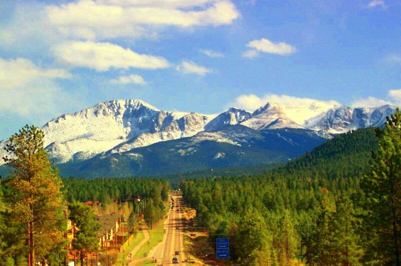
    <summary type="html"><![CDATA[<p><strong><em>Pikes Peak has a long and valuable history that provides visitors with a look through different ages of America, highlighting the beauty and diversity of the land and people. </em></strong></p><img src="https://www.intermountainhistories.org/files/fullsize/fabf35ca83b85ec7549a243f9e4cbd07.jpg" alt="Pikes Peak" /><br/><p><span style="font-weight:400;">With incredible height, diversity, age, and beauty, Pikes Peak towers above at an astounding 14,115 feet, making it one of the tallest mountains in the United States. Many, if not all, Americans have heard the moving lyrics to “America the Beautiful,” but few know that Pikes Peak was the inspiration for the song. Pikes Peak has long been the subject of ballads of beauty and adventure, as well as a symbol of hope and freedom for many throughout American history. </span>
<span style="font-weight:400;">The peak itself has undergone a variety of “discoveries” throughout the different ages of settlement. Some of the first people believed to have discovered and lived near Pikes Peak were the Clovis people yet not much is known or recorded of their experience. However, the histories of many Native peoples’ lifestyles, religions, and legends centered around the peak. The Utes, or the Tabeguache, believed the mountain itself was a sacred site where the Great Spirit created the earth and where many ceremonies were held. </span>
<span style="font-weight:400;">The Spanish were the first Europeans to discover the peak in 1779 and named it “El Capitán,” or “The Captain,” due to the imposing nature of the peak. With the completion of the Louisiana Purchase, the French sold vast tracts of land to the United States of America. In an effort to appraise the land and resources the United States had obtained, President Jefferson sent out several different expeditions to explore and record the areas. It was not until 1806 that Zebulon Pike, the first American explorer who dubbed the mountain Pike’s Peak, came to the Colorado area and attempted to hike the peak. The expedition failed to summit it because they were not prepared for the weather, and the peak remained an alluring call for explorers to attempt to conquer. </span>
<span style="font-weight:400;">Pikes’ writing on his expedition, including the details about the imposing mountain, were published in several languages and widely distributed due to their fame and the public’s interest in the unexplored West. In his writings, Pike referred to the peak as the “the Grand Peak” or simply, “highest peak.”  In 1820, Dr. Edwin James made the first recorded ascent. Later in its history, a variety of media featuring Pikes Peak attracted settlers and spurred further western migration. The phenomenon started with miners and spectators with the discovery of gold and gradually drew more settlers with large plots of grazing land and a tourism industry. Pikes Peak influenced the early formation of American identity and still manages to inspire those who visit today.</span></p><p><em><strong><a href="https://www.intermountainhistories.org/items/show/747">For more (including 5 images) view the original article</a></strong></em></p>]]></summary>
    <published>2023-04-11T18:29:54+00:00</published>
    <updated>2026-04-17T19:32:16+00:00</updated>
    <link rel="alternate" type="text/html" href="https://www.intermountainhistories.org/items/show/747"/>
    <id>https://www.intermountainhistories.org/items/show/747</id>
    <author>
      <name>Addie Coombs, Brigham Young University</name>
    </author>
  </entry>
  <entry>
    <title type="html"><![CDATA[1878 Bannock War and Chief Buffalo Horn]]></title>
    <summary type="html"><![CDATA[<p><strong><em>By rebelling against the United States military, Chief Buffalo Horn took initiative in improving the livelihood of the Bannocks after their relocation to the Fort Hall Reservation. Although his death did not immediately end the war, the Bannocks eventually returned to the reservation, forced to deal with confinement and limited resources.</p></strong></p><img src="https://www.intermountainhistories.org/files/fullsize/6a9d7b8c29f4bf5b5dd2d6d43ed102bc.jpg" alt="Bannock Camp" /><br/><p>The first Bannock War against the United States military occurred in 1878. With close ties to the Shoshones, groups of Bannocks and Paiutes joined together to oppose confinement at Fort Hall in southern Idaho. Reasons for action included limited agricultural opportunities, lack of promised supplies, and discontent with their treatment by the American military.</p><p>The Bannocks and Shoshones exhibited friendship toward Americans during the fur trade in the first half of the 19th century. Relations turned sour when the fur trade declined and increasing numbers of permanent American settlers encroached upon tribal homelands and consumed native resources without compensation. Additionally, as native peoples’ land and resources diminished, so did their ability to maintain independence. During the 1860s, treaties held at Fort Bridger and Box Elder in 1863 and 1868 relocated indigenous people to the Fort Hall reservation.</p><p>Although the U.S. government required that the Bannocks remain on the reservation, in the summer of 1877, many natives left the territorial limits dissatisfied with their current situation. Despite threats of military involvement, the Bannock rebellion and subsequent war quickly commenced in May 1878, perhaps because the Bannocks felt that the United States had failed to fulfill treaty obligations.</p><p>Bannock leader Chief Buffalo Horn mobilized several hundred Bannocks, adding additional Paiute allies to augment their numbers. These warriors engaged in a sequence of attacks along the Snake River, raiding settlements and even killing some settlers who opposed them. Word reached American leadership in Boise, who called upon military action to force Chief Buffalo Horn’s men to surrender. In early June, Chief Buffalo Horn and his accompanying warriors briefly fought against a small volunteer group of militiamen, resulting in a few casualties, including the fatality of Chief Buffalo Horn. Chief Egan took his place until the Umatilla people, posing as allies, killed him to collect an alleged bounty reward offered by the United States.</p><p>The remaining Bannocks separated into smaller groups or surrendered and returned to Fort Hall by August 1878. Following this resolution, the U.S. government carefully monitored Bannock movement within the reservation, limiting their use of local resources and interactions with local native groups. As a result of their surrender, the Bannocks conceded to rebuilding their livelihood on the allotted territory on the Fort Hall reservation. </p><p><em><strong><a href="https://www.intermountainhistories.org/items/show/412">For more (including 6 images) view the original article</a></strong></em></p>]]></summary>
    <published>2020-03-20T00:38:31+00:00</published>
    <updated>2026-04-17T19:32:08+00:00</updated>
    <link rel="alternate" type="text/html" href="https://www.intermountainhistories.org/items/show/412"/>
    <id>https://www.intermountainhistories.org/items/show/412</id>
    <author>
      <name>Camilla Richardson, Brigham Young University</name>
    </author>
  </entry>
  <entry>
    <title type="html"><![CDATA[A Brief History of Antelope Island]]></title>
    <summary type="html"><![CDATA[<p><strong><em>Antelope Island is located in the Great Salt Lake, Utah. Both humans and animals have utilized this land for thousands of years. Antelope Island, sometimes connected to the mainland at low tide, contains natural resources, diverse animal species and ecosystems. </em></strong></p><img src="https://www.intermountainhistories.org/files/fullsize/551392983ad745092c1f6292f583e72e.jpg" alt="Black Rock and Antelope Island, Salt Lake" /><br/><p>Antelope Island represents the largest island within the Great Salt Lake, covering an area of 42 square miles. First inhabited by indigenous natives about 2,000 years ago, natives utilized Antelope Island up until the 1840’s. Indigenous camps discovered on the island provide the knowledge of this use. In 1845, John C. Fremont and Kit Carson explored the island and documented their expedition. Carson’s journal states that he and Fremont hunted Pronghorn Antelope on this island, just like the members of the Ute tribe, and decided to name the island after the animal. </p><p>In 1848, The Church of Jesus Christ of Latter-day Saints moved a herd of cattle to the island under the rancher Fielding Garr. The Church continued to run a ranch on the island until 1875, when the homestead movement and the Union Pacific Railroad required land, causing the Church to abandon its use on the island. The land passed through the hands of numerous owners throughout the years until it was purchased in totality in 1981 by the State of Utah. </p><p>John White and John Dooly, the ranchers during that time, introduced twelve bison to the island in 1893. Overgrazing and overpopulation with the grazing animals on the island caused it to become necessary to cull and relocate the herd regularly. The herd created a significant genetic pool for use in bison conservation and breeding efforts today. In modern time, numerous species of animals reside on the island, including bighorn sheep, deer, birds, pronghorn, bobcats, among numerous other species. </p><p>Antelope Island contains many natural resources. Mining activity included prospecting for slate (1874), gold and copper (1899), oil (1904), and sand and gravel deposits (1967). Eventually, the State of Utah purchased part of Antelope Island in 1969 and bought the rest in 1981, when it officially became a part of the Utah State Parks System. Mining activities halted in 1979 and the state park, which opened to the public in 1993, is currently a habitat for the wildlife inhabiting the island. </p><p><em><strong><a href="https://www.intermountainhistories.org/items/show/297">For more (including 4 images) view the original article</a></strong></em></p>]]></summary>
    <published>2019-02-13T09:59:39+00:00</published>
    <updated>2026-04-17T19:32:05+00:00</updated>
    <link rel="alternate" type="text/html" href="https://www.intermountainhistories.org/items/show/297"/>
    <id>https://www.intermountainhistories.org/items/show/297</id>
    <author>
      <name>Jessica Newman, Brigham Young University</name>
    </author>
  </entry>
  <entry>
    <title type="html"><![CDATA[AIM Occupation of Fairchild Plant on Navajo Reservation]]></title>
    <summary type="html"><![CDATA[<p><strong><em>Activism plays a significant role in improving employment quality and longevity, but situations like the occupation of the Fairchild Plant on the Navajo Reservation causes people to question whether or not activism is the best method to achieve such goals.</em></strong></p><img src="https://www.intermountainhistories.org/files/fullsize/f881a04cf0a41c0bb4ee8d31723f525d.jpg" alt="Ribbon cutting at Fairchild Building Dedication, 1969" /><br/><p>In the early 1960s, unemployment on the Navajo Reservation hovered around 40% and Tribal leadership desperately tried to create jobs for Diné peoples. In 1964, Tribal chairman Raymond Nakai advocated for better economic development on the reservation and – hoping to attract outside investment – opened up the Navajo Nation to outside businesses. To further entice companies, the tribe offered $1 million toward development to any company willing to relocate. Fairchild Camera and Instrument Corporation responded to the offer and decided to build a plant in Shiprock, New Mexico and provide housing for tribal members who helped with construction. After its completion, Fairchild employed more than a thousand workers (the majority being female) and provided consistent jobs for ten years. </p><p>In the early 1970s, however, the country’s economy lagged, affecting companies like Fairchild. Many of the workers in Shiprock faced reduced paychecks or even termination. According to one Navajo account, the plant manager said, “This is a business venture, not a charitable activity.” The weakened economy combined with news of the plant’s financial solution wounded the community’s morale. The American Indian Movement (AIM) – an organization founded during the Civil Rights Era that fought for indigenous communities’ rights – heard about the situation and decided to intervene. Protestors including activist Russell Means came to Shiprock and laid siege to the plant on behalf of the underpaid and dismissed workers. The protestors demanded that Fairchild rehire the workers and restore their paychecks to pre-reduction rates. However, some local Natives considered this protest against the company dangerous and unnecessary. </p><p>Fairchild refused AIM’s conditions and let the tribal government handle the matter. However, the tribal government did not help overcome the impasse and the siege ultimately shut down the plant. Fairchild executives expressed frustration over how the tribe handled the situation and withdrew from the reservation altogether, relocating their operations to Korea. Some AIM supporters perceived this result as a victory, but locals recognized the great loss of employment opportunity alongside a damaged reputation for future incoming businesses on the Navajo Reservation. Even today, these consequential outcomes continue to have a harmful effect on Navajo employment.</p><p><em><strong><a href="https://www.intermountainhistories.org/items/show/398">For more (including 3 images) view the original article</a></strong></em></p>]]></summary>
    <published>2020-03-06T23:38:51+00:00</published>
    <updated>2026-04-17T19:32:08+00:00</updated>
    <link rel="alternate" type="text/html" href="https://www.intermountainhistories.org/items/show/398"/>
    <id>https://www.intermountainhistories.org/items/show/398</id>
    <author>
      <name>Elias Gold, Brigham Young University</name>
    </author>
  </entry>
  <entry>
    <title type="html"><![CDATA[American Settlement of Jackson Hole, Wyoming<br />
]]></title>
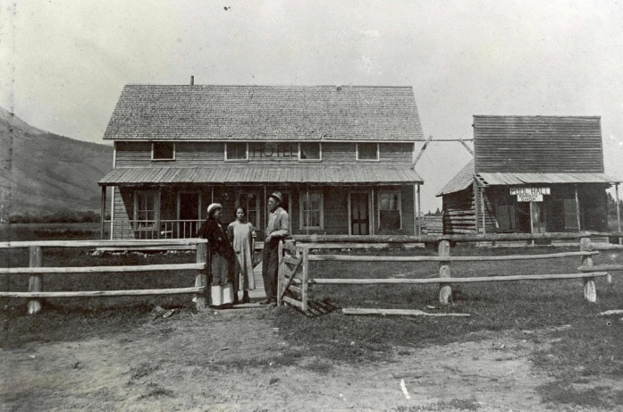
    <summary type="html"><![CDATA[<p><strong><em>In the late 19th century, Jackson Hole, Wyoming was home to seasonal hunters and fur trappers. When the Wilson-Cheney settling company crossed Teton Pass in 1889, they brought with them women, children, and the trappings of civilization to the valley.</p></strong></p><img src="https://www.intermountainhistories.org/files/fullsize/04ae0cedc5be58f1bf0b9a20cf1389af.jpg" alt="First Post Office" /><br/><p>In 1878, Sylvester Wilson and his family, members of The Church of Jesus Christ of Latter-day Saints (LDS), settled what became Wilsonville, UT. A decade later, in the face of a prolonged drought, Sylvester and his son-in-law, Selar Cheney, moved their families north seeking better conditions. Initially intending on settling in St. Anthony, ID, the group chanced upon Sylvester’s brother, Nick Wilson, who convinced them to settle instead in Jackson Hole, a fertile and relatively untouched valley in Wyoming.</p><p>Leaving most of their possessions in Idaho, the company crossed Teton Pass in 1889. As the first company to bring women, children, and wagons into the valley, the group enlarged an indigenous trail through the pass, cutting aside trees and other growth. After two weeks and 88 miles of rough terrain, the company reached Jackson Hole on November 11, 1889.</p><p>When the Wilson-Cheney company arrived, the valley was home to only 28 individuals. The large company more than doubled the valley’s population, and quickly began constructing various elements of American civilization. In 1891, following the deaths of Sarah and Joseph Wilson, they established the valley’s first cemetery. In 1892, they opened the first school in Sylvester Wilson’s home. In 1893, Nick Wilson opened a hotel and post office at the base of Teton Pass.</p><p>The company’s greatest impact on the valley, however, was the clearing of Teton Pass for wagon travel. The trail the Wilson-Cheney company expanded allowed more homesteaders and merchants to access the valley. From its initial population of roughly 28 in 1889, the valley grew to 638 men, women, and children by 1900. The short-lived town of Cheney, one of the company’s settlements, consisted itself of almost 150 people by 1910, and included a blacksmith, carpenter, postmaster, doctor, and taxidermist. Although the LDS settlers mostly left the valley during economic struggles in the 1920s and 1930s, their initial settlements in Jackson Hole brought civilization to the otherwise rugged, mountainous backcountry, and opened the door for countless more settlers.</p><p><em><strong><a href="https://www.intermountainhistories.org/items/show/283">For more (including 3 images) view the original article</a></strong></em></p>]]></summary>
    <published>2019-02-09T07:15:45+00:00</published>
    <updated>2026-04-17T19:32:04+00:00</updated>
    <link rel="alternate" type="text/html" href="https://www.intermountainhistories.org/items/show/283"/>
    <id>https://www.intermountainhistories.org/items/show/283</id>
    <author>
      <name>Matthew Cheney, Brigham Young University</name>
    </author>
  </entry>
  <entry>
    <title type="html"><![CDATA[Battle Creek Canyon Massacre]]></title>
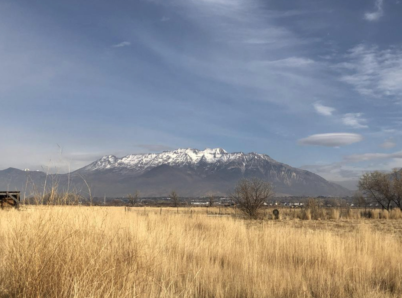
    <summary type="html"><![CDATA[<p><strong><em>Battle Creek Canyon's name originates from Utah's first major skirmish between the Utes and the Mormon militia. </em></strong></p><img src="https://www.intermountainhistories.org/files/fullsize/54eea90162a257c6e9cd4299408aea71.jpg" alt="Kade Dallin, Purple Mountain Majesties, 2020.
" /><br/><p><span style="font-weight:400;">When the pioneers of the Church of Jesus Christ of Latter-day Saints entered the Salt Lake Valley, they generally settled in what is now Salt Lake County on the Wasatch Front. The area was largely a desert and many, including some mountain men, suggested that the people settle further south in the freshwater valley that now comprises the bulk of Utah County. Brigham Young immediately sent out people to found colonies, cities, and towns throughout modern Utah, Arizona, Nevada, California, and Mexico. Yet, the pioneers balked at the initial thought of settlement in Utah Valley because of the native tribes who already lived there. Various bands of the Ute and Timpanogos tribes lived throughout the valley and had a reputation of being warlike and aggressive as a way to defend their land and livelihood. </p>
<span style="font-weight:400;">The pioneers especially resented the Ute practice of poaching the settler’s cattle. Roman Nose, a prominent Ute, was particularly troublesome. He led a band that repeatedly raided the farms and ranches near the valley border, and was even accused of stealing several of Brigham Young’s personal horses. After Brigham Young heard of the theft, he ordered Captain John Scott to lead a posse against the Utes in hopes of apprehending Roman Nose and his band. Their orders were to find the band of thieves and to “take such measures as would put a final end to their depredations in the future.” In 1849, they began raiding the Ute bands they deemed responsible for the loss of the livestock. However, Brigham Young soon discovered that the Utes had been mistakenly blamed: his horses had simply been moved to different pastures. He ordered Scott and the posse to stand down, but they refused. </p>
<span style="font-weight:400;">On the morning of March 5, 1849, the relationship between Mormon settlers and the local band of Timpanogos Indians deteriorated into brutal hostility in what is now Pleasant Grove, Utah. Scott’s rogue posse of 44 men soon arrived where they found the Ute camp which they thought participated in the raids. The group surrounded the sleeping camp and opened fire in a reign of terror. The members of the posse then hunted down many of the Utes who managed to escape the initial shootout. In total, they killed seventeen men, women, and children, including Roman Nose. </p>
<span style="font-weight:400;">After seeing the massacre, the chief of the Native American tribe, Little-Chief was distraught. Although he reportedly agreed that the killing of the supposed thieves was justified, he understood that this would cause a rift to form between white settlers and local tribes. This event, among many other skirmishes, led to heightened tension between the two groups and permanently damaged the already delicate relationship between the Native American tribes and the Mormon settlers. After this event, the area became known as Battle Creek Canyon and is today memorialized by the Battle Creek Marker. </span>


</p><p><em><strong><a href="https://www.intermountainhistories.org/items/show/757">For more (including 2 images) view the original article</a></strong></em></p>]]></summary>
    <published>2023-10-22T05:05:29+00:00</published>
    <updated>2026-04-17T19:32:16+00:00</updated>
    <link rel="alternate" type="text/html" href="https://www.intermountainhistories.org/items/show/757"/>
    <id>https://www.intermountainhistories.org/items/show/757</id>
    <author>
      <name>Kade Dallin, Brigham Young University&amp;#32;&amp;amp;&amp;#32;Bryce Revelli, Brigham Young University</name>
    </author>
  </entry>
  <entry>
    <title type="html"><![CDATA[Battle of Julesburg]]></title>
    <summary type="html"><![CDATA[<p><strong><em>After American militias massacred Cheyenne and Arapaho as part of the Civil War in the West, indigenous warriors banded together, determined to not let American colonizers’ unwarranted violence go unanswered.</em></strong></p><img src="https://www.intermountainhistories.org/files/fullsize/39ffd1ff27a2be44f963f783464803e2.jpg" alt="Battle of Julesburg" /><br/><p>In January 1865, Julesburg, Colorado was 200 miles east of Denver. Complete with an eating-house, stable, blacksmith, repair shop, granary, and corral, the town was an important waystation for immigrants and settlers traveling along the Platte River on the Oregon Trail.
However, Julesburg’s relative prominence also made it a target for Native retaliation after the Sand Creek Massacre. Six weeks earlier, on November 29, 1864, led by brevet Colonel John Chivington, the 675-men strong Third Colorado massacred several hundred Cheyenne and Arapaho men, women, and children in southeastern Colorado Territory. Dog Soldiers (a militant Cheyenne subgroup) allied with other Cheyenne, Arapaho, and Lakota warriors to avenge their relatives who died at Sand Creek. In total, they numbered some 1200 Dog Soldiers and other warriors. Sitting Bull, Spotted Tail, Pawnee Killer, and others led the attack on Julesburg. On January 7, 1865, the allied Natives found that many soldiers had left town as part of their regular patrols, leaving only 37 men to defend the fort at Julesburg.
A small group of Lakotas led the initial charge. Nicholas James O’Brien, a highly decorated Civil War soldier and commander of the troops at Julesburg, saw the oncoming attack and pursued the Lakotas, unwittingly falling into their strategic trap to encircle the soldiers once they had been separated from reinforcements. The Native alliance intended to surround the American soldiers, but some young Cheyenne left their position too early before the entrapment could be realized. Despite this minor lapse, within a few minutes of fighting, nearly half of the U.S. soldiers were killed.
O’Brien led his surviving soldiers back to the fort, and the Native alliance laid siege. The remaining tribesmen entered Julesburg and raided every building. George Bent, a Cheyenne who participated in the raid, recalled that allied Natives found all the goods they desired. Tribal women brought extra horses to carry the spoils back to their camps. The horses were so heavily loaded that it took three days to make the return trip home. The raid lasted the whole day and became the first of many Cheyenne, Arapaho, and Lakota raids conducted in the Central Plains over the coming months. The accumulation of goods brought sustenance to the tribes that winter while the United States took a staggering blow to their efforts to control American Indian affairs during the Civil War.</p><p><em><strong><a href="https://www.intermountainhistories.org/items/show/576">For more (including 4 images) view the original article</a></strong></em></p>]]></summary>
    <published>2022-03-12T07:54:28+00:00</published>
    <updated>2026-04-17T19:32:12+00:00</updated>
    <link rel="alternate" type="text/html" href="https://www.intermountainhistories.org/items/show/576"/>
    <id>https://www.intermountainhistories.org/items/show/576</id>
    <author>
      <name>Ryan Blamires, Brigham Young University</name>
    </author>
  </entry>
  <entry>
    <title type="html"><![CDATA[Bear Lake: Traders, Towns, and Tourists]]></title>
    <summary type="html"><![CDATA[<p><strong><em>For hundreds of years people have been drawn to Bear Lake along the Utah-Idaho Border. Shoshones, Fur Traders, Latter-day Saint Pioneers, and contemporary tourists have come to the lake for various purposes over the years, and it remains a vibrant and beautiful place to this day.</em></strong></p><img src="https://www.intermountainhistories.org/files/fullsize/6cec6f3c64c276dd0715a0c85fc6ac96.jpg" alt="Sweet Lake" /><br/><p>Bear Lake is a natural freshwater lake that is 18 miles long and 7 miles wide. It straddles the border between Utah and Idaho, which passes through the center of the lake. Renowned for
its bright blue waters, thanks to the limestone in the mountains surrounding it, Bear Lake has been dubbed the Caribbean of the Rockies. The lake and surrounding communities are also well known for the famous “Bear Lake raspberries” that grow in the area and the associated Raspberry Days festival held every August. In recent years the lake has become a tourism hot spot with vacation homes and resorts spreading along its shores.
The Shoshone inhabitants of the valley historically used the Bear Lake area for food; they fished the lake’s waters and hunted in the surrounding mountains. They called the lake “sweet lake” due to its exceptionally clear water, and the first European fur traders adopted the name “Sweet Lake” for the body of water. The name “Bear Lake” came about when a Scotsman named Donald McKenzie paddled up the Bear River in 1818. When he found the lake he named it “Black Bear Lake,” but later trappers soon dropped the adjective “Black” so the lake’s name matched the river. Fur trapping continued in the area but sharply increased in 1827 when mountain men held a rendezvous along the southern shore of the lake. Thousands of Natives from many tribes came to trade furs for guns, supplies, and other goods. Jim Bridger and Jedediah Smith were among the mountain men in attendance. Mountain men gathered to Bear Lake for another rendezvous in 1828, but it was the last one held in the valley.
From 1829 onward, the rendezvous moved into nearby Wyoming, and Shoshones continued to enjoy the Bear Lake Valley. The next group to arrive were laborers from the Logan, Utah area who were members of The Church of Jesus Christ of Latter-day Saints (sometimes nicknamed “Mormons”) and had come to search for pine trees tall enough to serve as support beams for the Logan Temple then under construction. When their reports of a fertile valley with a large lake reached Brigham Young in Salt Lake City, he sent Church apostle Charles C. Rich to settle the area in 1863.
The Mormons initially strove for peaceful relations with the Shoshones, and at first agreed to keep to the northern part of the valley while the Shoshone used the southern part in what is present-day Utah. These Latter-day Saint quickly established the small towns of St. Charles, Montpelier, Ovid, Bennington, and Fish Haven, all named for cities in Brigham Young’s native Vermont. For a few years the valley became known as “Mormon Valley.” As time went on, both the Mormon name and the agreement they had with the Shoshones faded from memory. The Latter-day Saint settlers expanded southward along the banks of the lake, adding the towns of Paris, Garden City, and Laketown. </p><p>Bear Lake continues to represent a place where people go to fish, boat, and recreate, just as the Shoshones and fur traders had.</p><p><em><strong><a href="https://www.intermountainhistories.org/items/show/592">For more (including 3 images) view the original article</a></strong></em></p>]]></summary>
    <published>2022-04-16T01:52:29+00:00</published>
    <updated>2026-04-17T19:32:12+00:00</updated>
    <link rel="alternate" type="text/html" href="https://www.intermountainhistories.org/items/show/592"/>
    <id>https://www.intermountainhistories.org/items/show/592</id>
    <author>
      <name>Jonathon Whitmore, Brigham Young University</name>
    </author>
  </entry>
  <entry>
    <title type="html"><![CDATA[Big Horn Medicine Wheel]]></title>
    <summary type="html"><![CDATA[<p><strong><em>In a picturesque and seemingly significant location, the Big Horn Medicine Wheel may reveal indigenous knowledge of astronomy.</em></strong></p><img src="https://www.intermountainhistories.org/files/fullsize/e3c611b4ff4e6359f87c4c7f5dede281.jpg" alt="Big Horn Medicine Wheel" /><br/><p>At the top of the Big Horn Mountains, 9,642 feet above sea level, on the west ridge of Medicine Mountain, lies the Big Horn Medicine Wheel. The wheel sits about twenty yards away from a limestone cliff face, where visitors can look down upon the Big Horn Basin, the Wind River, and the Pryor Mountains of Montana. Using a piece of wood found built into the structure, archaeologists dated the Medicine Wheel itself to around 1760 AD. Other archaeological research carbon-dated charcoal and wood fragments found near the Medicine Wheel to 4,529 BCE.
The wheel is made of hundreds of white limestone rocks arranged in roughly in the circular shape of a wheel. Spanning eighty feet in diameter, the wheel is a true marvel, as most rocks used as material for the massive wheel originate from the bottom of the mountain, meaning the builders carried them to the top. At the center of the wheel lies another smaller circle, and 28 “spokes” radiate from this smaller center circle, connecting the center to the perimeter of the wheel. Small hollow cairns surround the wheel.
Although much research has been done on the wheel, archaeologists, astronomers, and other scholars have been unable to determine its origin and function. One astronomer suggests the indigenous builders might have designed the wheel to track celestial bodies, having found the cairns are in astronomical alignment with the summer solstice sunset and sunrise as well as the rise of the stars Alderbaran, Serius, and Rigel. Another astronomer disagrees, saying that had the medicine wheel’s purpose been to track the solstice and stars, the structure’s design would have been more precise and astronomical alignments with the wheel would be more obvious and practical. An archaeologist suggests that the cairns could have been small shelters for vision quest participants while another archaeologist believes the wheel is a model of a Cheyenne medicine lodge. A Crow legend tells the story of a boy that was able to find healing and tribal acceptance through the power connected to the wheel. The Cheyenne believe that the Legend of Sweet Medicine inspired the Big Horn Medicine Wheel. Many theories have been proposed and disputed, but no theory has provided irrefutable evidence for a single explanation.
The Big Horn Medicine Wheel is a national historical landmark and is still used by tribes for religious purposes. Visitors are allowed to view the Big Horn Medicine Wheel but are asked to respect the ancient site as it holds both religious and historical significance to many Native Americans.</p><p><em><strong><a href="https://www.intermountainhistories.org/items/show/582">For more (including 5 images) view the original article</a></strong></em></p>]]></summary>
    <published>2022-03-19T10:04:39+00:00</published>
    <updated>2026-04-17T19:32:12+00:00</updated>
    <link rel="alternate" type="text/html" href="https://www.intermountainhistories.org/items/show/582"/>
    <id>https://www.intermountainhistories.org/items/show/582</id>
    <author>
      <name>Kelli Holiday, Brigham Young University</name>
    </author>
  </entry>
  <entry>
    <title type="html"><![CDATA[Black Hawk Burial Site]]></title>
    <summary type="html"><![CDATA[<p><strong><em>Brigham Young said in 1870 that Black Hawk was "the most formidable foe amongst the red men that the Saints have had to encounter.” Black Hawk experienced both support and hostility from Utah settlers, and his final resting place is marked by a thoughtful memorial that reflects his goal to care for his homeland.</em></strong></p><img src="https://www.intermountainhistories.org/files/fullsize/9057516a6f9102a0c6af54a56f807fca.jpg" alt="Blackhawk memorial" /><br/><p>Antonguer, or Black Hawk, is one of the most iconic and controversial figures in early territorial Utah history. He led the 1865-1867 Black Hawk War. </p><p>Mormon settlers who arrived in Ute lands in 1847 called Black Hawk “a friendly Indian” in his youth, however, conflict emerged between the settlers and natives. Historians theorize that Black Hawk was the only male survivor of the Creek Canyon Battle in March 1849. “The bloodiest week of Indian killing in Utah history” occurred on February 8, 1850 at the battle at Fort Utah when a group of Utes awaited refuge at the fort – Black Hawk and his family among them – but found themselves caught in the middle of violence. Black Hawk helped the Mormons during the battle. For the next fifteen years, despite continued conflicts and starvation, Black Hawk tried to maintain relatively peaceful relations with the settlers. However, some historians believe that what he witnessed during that battle lingered and motivated him to break his loyalty with the Mormon settlers and start the Black Hawk War on April 9, 1865. The majority of violence occurred 1865-1867, but intermittent conflicts continued until 1872. </p><p>Though a “dozen men in Utah claim the honor of killing Black Hawk,” he actually died of tuberculosis and an old wound. In 1869, just prior to his death, Black Hawk declared a “mission of peace” as he visited every “village from Cedar City on the South to Payson” that lost human lives or property, and asked forgiveness from the Mormon pioneers. While Black Hawk experienced both support and hostility from the settlers, his final resting place is marked by a thoughtful memorial, one that reflects his aim to care for his people and homeland.</p><p>In the decades following his 1870 death and burial near Spring Lake Villa, Utah, the controversial identity of Black Hawk resurfaced. In 1911, miners unearthed and displayed Black Hawk’s bones and personal objects, which eventually were placed in a museum in Salt Lake City. After additional relocations, Shane Armstrong and Charmaine Thompson conducted a project in 1995 to locate Black Hawk’s remains and found them at the BYU Museum of Peoples and Cultures. On May 4 the following year, Black Hawk’s family and tribe received these remains and reburied him at a memorial close to the original 1870 burial site. The Salt Lake Tribune reported that “more than 2,000 non-Utes” attended the ceremony. The official dedication for the current permanent marker took place on September 27, 1997. </p><p><em><strong><a href="https://www.intermountainhistories.org/items/show/395">For more (including 5 images) view the original article</a></strong></em></p>]]></summary>
    <published>2020-03-02T23:28:27+00:00</published>
    <updated>2026-04-17T19:32:07+00:00</updated>
    <link rel="alternate" type="text/html" href="https://www.intermountainhistories.org/items/show/395"/>
    <id>https://www.intermountainhistories.org/items/show/395</id>
    <author>
      <name>Carolina Corrales, Brigham Young University</name>
    </author>
  </entry>
  <entry>
    <title type="html"><![CDATA[Browning Firearms Museum: The Legacy of John M. Browning]]></title>
    <summary type="html"><![CDATA[<p><strong><em>The Browning Collection at The Ogden Union Station commemorates and celebrates the genius of the man who revolutionized the firearm industry.</em></strong></p><img src="https://www.intermountainhistories.org/files/fullsize/355594e8162bff8d4970bb6c897e96e9.jpg" alt="Browning shop replica" /><br/><p>On January 23, 1855 in Ogden Utah, John Moses Browning was born to Jonathan Browning and Elizabeth Clarke. From his earliest years, John spent his days in the Browning shop, experimenting with tools and firearm components while the hammer rang out at his father’s workbench. John had little formal schooling but received an education as his father’s protégé. Later accounts called the Browning shop the inventor’s school, for it was where the Browning firearms legacy emerged. Throughout his boyhood, John M. Browning committed to memory every gun part that came through the shop, gaining first-hand experience with everything related to gunsmithing. He eventually learned the fundamentals well enough to assess and tag a customer’s gun for repairs while his father was out of the shop.
Around age 10, the inventive John Moses recruited his younger brother Matt to try his hand at gunsmithing. Taking the sawn-off end of a damaged barrel they found in their father’s scrap pile, John attached the barrel to a stock he had hacked from a board of wood with his hatchet. The gun was crudely fashioned, having no hammer or trigger mechanisms, and the only way to load the gun was to insert a bullet and pour gunpowder through a small vent behind where the ammunition sat. With the newly assembled firearm and some pillaged gunpowder, John and Matt ran to the edge of the Browning property that extended beyond the Ogden City limits. Aiming at a couple of prairie hens sighted down the barrel of his gun, John told Matt to light the end of a stick with the coals in order to ignite the powder in the funnel. As John recalled, that handmade gun knocked him to the ground, but it did its job. The two boys managed to bring home three birds for supper using that single-shot makeshift weapon. When the two told their father about their success, Jonathan only remarked, “John Moses, you’re going on eleven; can’t you make a better gun than that?” Flustered at his father’s remarks, John determined to do exactly that.
It was this upbringing that laid the foundation for the firearm dynasty John Moses Browning established throughout his 71 years of life. At age 23 he designed his first gun: the John M. Browning’s Single Shot Rifle. With the help of his brothers, John manufactured this model in their own little factory in Ogden until selling the patent to Winchester in 1883. From that point on, John designed every gun that can come to mind: machine guns, shotguns, pistols, and rifles. He created designs of exceptional quality, and many of his inventions were referenced and copied throughout the world. These designs are displayed in museums worldwide, but no museum houses a more complete tribute to his legacy than the Browning Firearms Museum. The museum is an important monument to his life and represents the culmination of his life’s inventions that helped shape the United States and the world.</p><p><em><strong><a href="https://www.intermountainhistories.org/items/show/482">For more (including 4 images) view the original article</a></strong></em></p>]]></summary>
    <published>2021-09-15T06:13:52+00:00</published>
    <updated>2026-04-17T19:32:10+00:00</updated>
    <link rel="alternate" type="text/html" href="https://www.intermountainhistories.org/items/show/482"/>
    <id>https://www.intermountainhistories.org/items/show/482</id>
    <author>
      <name>Brandon E. Jeppson, Brigham Young University</name>
    </author>
  </entry>
  <entry>
    <title type="html"><![CDATA[Butch Cassidy at Montpelier ]]></title>
    <summary type="html"><![CDATA[<img src="https://www.intermountainhistories.org/files/fullsize/3137570fa383237a80e7af01cf3982ce.jpg" alt="Visitor&#039;s Bureau" /><br/><p>On August 13, 1896 Butch Cassidy robbed the Montpelier bank of gold, silver, and currency worth between $5,000-$15,000. Montpelier, Idaho, had the number one chartered bank in the state at the time. Cassidy rode into town with two accomplices, Elza Ray and Bob Meeks. His party stopped at the saloon for drinks. Afterwards, they headed over to the bank and carried out the robbery. Cassidy and Ray forced the teller, A. N. Mackintosh, to gather all the cash. They then put him up against the wall along with the other customers in the bank. While the robbers proceeded to collect anything of value. Once everything was gathered, Cassidy told his captors to wait ten minutes before they went outside. Mackintosh immediately reported the robbery to the sheriff who managed the local general store as well. The sheriff, however, did not own a horse so he attempted to give chase on a bicycle. As a result, Cassidy and his posse easily escaped on horseback. </p><p>Cassidy may have chosen to rob Montpelier bank because he needed money to pay the court and attorney fees for a former gang member Matt Warner, who was convicted of killing a couple of men in a gunfight. Cassidy also had apparently promised a judge in Wyoming that he wouldn’t commit any crimes within that state. Regardless of the true reasoning behind the robbery the Montpelier bank has been remodeled into a museum to where people can go to see where the famous robbery occurred. </p><p><em><strong><a href="https://www.intermountainhistories.org/items/show/292">For more (including 2 images) view the original article</a></strong></em></p>]]></summary>
    <published>2019-02-13T07:27:20+00:00</published>
    <updated>2026-04-17T19:32:05+00:00</updated>
    <link rel="alternate" type="text/html" href="https://www.intermountainhistories.org/items/show/292"/>
    <id>https://www.intermountainhistories.org/items/show/292</id>
    <author>
      <name> Michael Ross, Brigham Young University</name>
    </author>
  </entry>
  <entry>
    <title type="html"><![CDATA[Camp Floyd and the Mormons]]></title>
    <summary type="html"><![CDATA[<p><strong><em>Driven from state to state, early coverts of The Church of Jesus Christ of Latter day Saints faced constant persecution for their religious beliefs in antebellum America.  Eventually, they fled west to the Rocky Mountains.  Within ten years, however, the federal government sent troops after them, fearing that Brigham Young, the Mormon prophet, was becoming too autonomous and powerful in the Utah Territory.  General Albert Johnston’s presence in the Utah Territory caused a great war of ideas—and sometimes arms—between the determined Saints and unsympathetic soldiers.  The establishment of Camp Floyd increased interactions between soldiers and Mormons and church leaders cautioned against the potential negative effects to the moral, social, and economic conditions on the Mormon Zion.</em></strong></p><img src="https://www.intermountainhistories.org/files/fullsize/8b854548a43b555632b0bbf8cffae768.jpg" alt="General Albert Sidney Johnston " /><br/><p>For nearly a decade prior to the army’s arrival in 1857, the Mormons had lived relatively isolated and undisturbed by outside influences. Of early concern to church leaders, Fairfield, a satellite town of Camp Floyd, was viewed as bringing moral decay to some Mormons.  Termed “Frogtown” by the Saints and army, it became a den of gambling houses, dance halls, brothels, and saloons frequented by soldiers, teamsters, emigrants, and even some settlers. Theft, prostitution, and murder frequently filled the streets and back halls. Church leaders mourned the spread of moral and social deterioration throughout the valley.  One member said, “Camp Floyd Fairfield was full of rotteness and evil of every description and I'm sorry to say our people of both sexes mixed up with them largely and of how bad it did look to see young ladies whose parents were faithful.”  </p><p>Despite the fear of moral and social turmoil that the army brought to Mormon communities, the Saints benefited economically from the army's occupation in the territory. The soldiers began building the immense fort at Camp Floyd as soon as they arrived. The fort consisted of buildings for headquarters, infantry and artillery units, storehouses, stables, corrals, workshops, powder magazines, a theatre, aqueduct, and so on. </p><p>At its height, Camp Floyd was perhaps the largest military installation in the United States prior to the Civil War. The Saints helped build the fort, laboring as artisans, carpenters, and mechanics, which allowed them to profit from trade with the army as Camp Floyd provided business opportunities for enterprising Saints. John Carson, for example, built the Stagecoach Inn, offering a simple yet comfortable environment for higher class visitors and military personnel alike. The inn later became an Overland Stage and Pony Express stop. </p><p>The commencement of the Civil War in 1861 struck the death knell for the army's military occupation in Utah Territory, and with it went a major source of conflict for the territory’s inhabitants. Johnston's army had opened the floodgates for travelers to pour into the territory, effectively ending the Mormons' isolation. Moral decay and social tension spread at an alarming rate from the camp to the Saints. Amidst all the social discord, however, the military presence had a positive impact on the territory's economy without which the Mormons would have struggled to keep their agricultural market afloat.  Conversely, the success of the fort depended upon Mormon laborers and consumers.  In the end, the Saints and Gentiles needed each other for Utah to grow and develop into a thriving territory.</p><p><em><strong><a href="https://www.intermountainhistories.org/items/show/25">For more (including 3 images) view the original article</a></strong></em></p>]]></summary>
    <published>2017-02-15T18:01:44+00:00</published>
    <updated>2026-04-17T19:31:58+00:00</updated>
    <link rel="alternate" type="text/html" href="https://www.intermountainhistories.org/items/show/25"/>
    <id>https://www.intermountainhistories.org/items/show/25</id>
    <author>
      <name>Lorin Groesbeck, Brigham Young University </name>
    </author>
  </entry>
  <entry>
    <title type="html"><![CDATA[Castle Gate Ghost Town]]></title>
    <summary type="html"><![CDATA[<p><strong><em>Castle Gate is a ghost town located in Carbon County, Utah, situated in the eastern part of the state. Although Castle Gate was once a successful mining town, it has now been abandoned, its four mines closed, and the homes dismantled.</em></strong></p><img src="https://www.intermountainhistories.org/files/fullsize/cb6af8df8c5283c63b3b69e94a2cd6ce.jpg" alt="Castle Gate" /><br/><p>Castle Gate received its name for a large rock formation featuring two sandstone walls resembling the gate of a castle, which stands near the town at the mouth of Price Canyon. The first mine opened in 1886 following the discovery of coal, initiating the establishment of a town two years later when the Denver and the Rio Grande Western Railroad built a track over the Wasatch Plateau, traveling right through the town site.
As the town grew, more mines opened, and a diverse group of people began migrating into the area. A large group of Latter-day Saints congregated to work at the mines as well as immigrants from European countries such as Italy, Greece, and Austria. Things were going well for the Castle Gate community. The Utah Fuel Company operated the Castle Gate coal mines until Kaiser Steel bought the company 1950 and built a coal-fired electric generating plant in Castle Gate.
Although Castle Gate had times of prosperity and success, it also experienced its fair share of misfortune, including several mining disasters, a flood, and the payroll robbery of 1897 by infamous outlaws Butch Cassidy and Elza Lay. While the mining payroll was being transported from the train to the town’s bank, Butch and Elza held the transporters at gunpoint and seized about $8,800. To get away, they cut telegraph and phone lines and arranged a series of horses they could relay ride at high speed for hours, enabling them to escape the area before word of the robbery could even spread.
In 1920, a flood swept the town, incurring immense damage to local property and the railroad. Unfortunately for Castle Gate, not long after this disaster an even larger one occurred: at 8:00 AM on March 8, 1924, the first of three violent explosions from coal dust and open flames erupted, causing extensive damage and collapsing tunnels. 173 people died, and it took nine days to recover all the bodies. The website <em>Legends of America</em> calls it the tenth worst mining disaster in United States history. Fiery tragedy returned seventy-six years later, in 2000, when the last mine in operation suffered another explosion, claiming two more lives and leading to the mine closing for good.
By the time this last mine shut down, Castle Gate had already been abandoned. The Kaiser Steel company razed the townsite in 1960 to make room for their electrical plant, forcing inhabitants to relocate. In 2015, the power plant closed due to its inability to meet environmental standards, and the once-productive coal mining settlement became a desolate ghost town.</p><p><em><strong><a href="https://www.intermountainhistories.org/items/show/480">For more (including 8 images) view the original article</a></strong></em></p>]]></summary>
    <published>2021-09-12T04:56:49+00:00</published>
    <updated>2026-04-17T19:32:10+00:00</updated>
    <link rel="alternate" type="text/html" href="https://www.intermountainhistories.org/items/show/480"/>
    <id>https://www.intermountainhistories.org/items/show/480</id>
    <author>
      <name>Taylor Hayden, Brigham Young University</name>
    </author>
  </entry>
  <entry>
    <title type="html"><![CDATA[Chaco Canyon Overview]]></title>
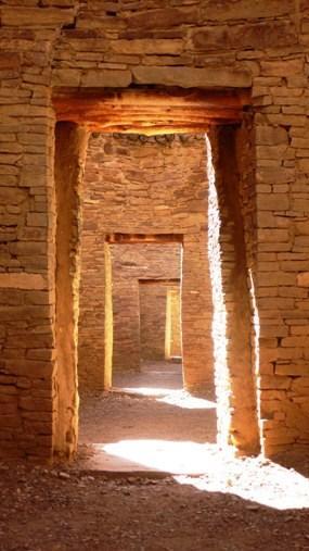
    <summary type="html"><![CDATA[<p><strong><em>Chaco Canyon bears evidence of a civilization that flourished between 9000 BC and 1300 AD.</em></strong></p><img src="https://www.intermountainhistories.org/files/fullsize/c8cb5ba557401e1c945009b3c16dbffe.jpg" alt="Doorways at Pueblo Bonito" /><br/><p>Chaco Canyon National Park is located in northwestern New Mexico. The area is open to the public to learn about the people who lived within the walls of Chaco Canyon thousands of years ago. In 9000 BC, the area was occupied by Paleo Indians and Archaic peoples. It was then occupied by Ancestral Puebloans from 1 AD to 1300 AD. Between 750 and 850 AD, much of the population of the central San Juan Basin moved to the Four Corners area, north of the San Juan River. Over 1.5 million artifacts have been documented from Chaco Canyon. In the middle of the New Mexico desert, Chaco Canyon housed hundreds of prehistoric peoples. </p><p>Early archaeologists recognized two types of structures and identified them as “great pitstructures” and “great kivas”. These structures “may represent two ways of organizing ritual, or perhaps even two ethnicities.” </p><p>Chaco Canyon was pre-planned rather than annexed; the roads were laid out in straight lines and astronomical orientation would have necessitated a certain amount of planning, skill, and leadership. People lived in the canyon in eleven “great houses”, each one of them big enough to provide homes for an entire village. Inside the great houses, there are approximately 1,133 rooms, and the average size of 1,133 rooms at Chacoan buildings is 11. 97 meters squared. </p><p>Chaco Canyon is evidence of a civilization that flourished between the ninth century BC and thirteenth century AD and attained remarkable achievements in architecture, agriculture, social complexity, engineering, astronomy, and economic organization. </p><p><em><strong><a href="https://www.intermountainhistories.org/items/show/187">For more (including 2 images) view the original article</a></strong></em></p>]]></summary>
    <published>2018-05-28T17:18:16+00:00</published>
    <updated>2026-04-17T19:32:02+00:00</updated>
    <link rel="alternate" type="text/html" href="https://www.intermountainhistories.org/items/show/187"/>
    <id>https://www.intermountainhistories.org/items/show/187</id>
    <author>
      <name>Erin Tapahe, Brigham Young University</name>
    </author>
  </entry>
  <entry>
    <title type="html"><![CDATA[Charles Walker: St. George Poet]]></title>
    <summary type="html"><![CDATA[<p><strong><em>Charles Walker was called to the Cotton Mission in St. George and made his living there as a blacksmith and stonemason. He helped construct the St. George Temple and was renowned for his poems and songs</em></strong></p><img src="https://www.intermountainhistories.org/files/fullsize/153a43781a51f0e34aef0043afac9d06.jpg" alt="Charles L. Walker" /><br/><p>The scorching temperatures, sparse vegetation, and endless red rock of Saint George, Utah were all that greeted early settlers in the Cotton Mission. Charles Walker, born 1832 in Leek, England, was one of the individuals called by Brigham Young to settle the area and produce cotton to supplement the income for The Church of Jesus Christ of Latter-Day Saints. Upon arriving in 1862, Walker remarked, “St. George is a barren looking place. The soil is red and sandy. On the North ranges a long high red rocky bluff. On the East is a long black ridge of volcanic production. On the west the same. On the south runs the Virgin river, a shallow, rapid stream from which a great portion of the land is irrigated. To look on the country it [is a] dry, parched, barren waste with here and there a green spot on the margins of the streams.” While his observation seemed bleak, Walker exuded optimism with the work that he believed God had called him to do. He wrote in his personal journal, “Well it’s all right; we shall know how to appreciate a good country when we get to it, when the Lord has prepared the way for his people to return and build up… Zion.” Walker’s time in St. George reflected the stalwart nature of those called to settle far Western settlements, and his life in the area would have a significant impact on those around him.
The initial hope that settlers could grow cotton as a cash crop was dashed by poor soil quality. In an attempt to keep the community thriving, Brigham Young ordered the construction of a large public works project to bolster the economy: a new temple. Walker transitioned to stonemasonry and worked on the temple constantly. When the temple was completed, Walker participated in the, and a song he wrote for the occasion was sung at the event. When Walker was not busy with blacksmithing or working on the temple, he spent time with his family and saw to his various church callings. One labor that endeared him to the hearts of his neighbors was his gifted ear for writing hymns, the most famous of which is “Dearest Children, God is Near You.”
Walker later adopted polygamy as practiced by Latter-day Saints in the nineteenth century, marrying his second wife, Sarah Smith. His first wife, Abigail Middlemass, helped him select Sarah, and the trio lived together for the rest of Walker’s life. Each wife gave birth to eight children, sixteen total, with twelve of them reaching adulthood. Walker noted that his peculiar family situation allowed him to labor on the temple and work in his shop more because the burden of running the household was shared between his spouses. Walker also kept himself busy as an assistant marshal for the city and a leader in the local militia. He passed away in 1904, leaving behind a legacy of faithfulness and work ethic on the Utah Frontier.</p><p><em><strong><a href="https://www.intermountainhistories.org/items/show/464">For more (including 3 images) view the original article</a></strong></em></p>]]></summary>
    <published>2021-09-09T22:12:39+00:00</published>
    <updated>2026-04-17T19:32:09+00:00</updated>
    <link rel="alternate" type="text/html" href="https://www.intermountainhistories.org/items/show/464"/>
    <id>https://www.intermountainhistories.org/items/show/464</id>
    <author>
      <name>Dalton Bennett, Brigham Young University</name>
    </author>
  </entry>
  <entry>
    <title type="html"><![CDATA[Chief Barboncito and The Treaty of 1868]]></title>
    <summary type="html"><![CDATA[<p><strong><em>After years of displacement and internment, negotiations between Chief Barboncito and the United States government resulted in a treaty that allowed the Navajo to returned to their homeland in the Four Corners region.</em></strong></p><img src="https://www.intermountainhistories.org/files/fullsize/acdbc3e43efc463260bb43435470b6cc.jpg" alt="Treaty marker" /><br/><p>Navajo Chief Barboncito (1821–1871) played an important role in the negotiations that helped the Navajo return to the Four Corners region in 1868. Fluent in Navajo and Spanish, Barboncito communicated with US negotiators, who used translators that were fluent in English and Spanish, to draft a dual language treaty that would allow the Navajo to return home, making them the first American Indian tribe able to do so.
The Navajo had lived in Bosque Redondo from 1864–1868. Arriving by forced relocation that put an end to the Navajo Wars at the command of General James Carleton and carried out by Colonel Christopher “Kit” Carson, the Navajo internment camp refinement period proved to be a failure due to the high cost required to maintain provisions to keep the Navajo alive. Due to poor soil conditions and resource constraints, the United States needed to rethink their role in confining the Navajo.
In addition to negotiating with the United States regarding Navajo internment, Barboncito was also a spiritual leader and medicine man who gained prominence alongside Chief Manulito and Ganado Mucho due to their diplomacy and oratory skills. When it came time to discuss treaty provisions, Barboncito rejected General William Sherman’s offer to relocate the Navajo to Indian Country in Oklahoma. Fearing that Oklahoma would be similar to Bosque Redondo, Barboncito advocated on behalf of himself and the 9,000 other Navajo that they would be a peaceful people upon their return home, declaring that the area between the four sacred mountains was created and given to them by their gods, First Man and First Woman, solely for them.
The treaty was signed and made official on June 1, 1868. After returning home and following the creation of the Navajo reservation system, Barboncito kept his word, and the Navajo no longer engaged in warring behavior against neighboring white settlements. Compared to the initial reservation boundary, the territory has since tripled in size, currently covering an area the size of West Virginia. The Navajo today can enjoy their ancestral land and continue to teach their traditions and cultures thanks to men like Chief Barboncito.</p><p><em><strong><a href="https://www.intermountainhistories.org/items/show/488">For more (including 3 images) view the original article</a></strong></em></p>]]></summary>
    <published>2021-09-16T22:05:02+00:00</published>
    <updated>2026-04-17T19:32:10+00:00</updated>
    <link rel="alternate" type="text/html" href="https://www.intermountainhistories.org/items/show/488"/>
    <id>https://www.intermountainhistories.org/items/show/488</id>
    <author>
      <name>Colin Tompson, Brigham Young University</name>
    </author>
  </entry>
  <entry>
    <title type="html"><![CDATA[Chief Peteetneet and Mormon Settlers]]></title>
    <summary type="html"><![CDATA[<p><strong><em>Chief Peteetneet lived in the area of modern-day Payson, Utah and experienced vacillant relations with Latter-day Saint settlers. Despite various conflicts, he finally achieved his goal of residing peacefully on Native land.</em></strong></p><img src="https://www.intermountainhistories.org/files/fullsize/b2da0e98dedcce28c239d87f8068cd60.jpg" alt="Statue of Chief Peteetneet and the Peteetneet Museum" /><br/><p>Westward expansion for The Church of Jesus Christ of Latter-day Saints largely occurred in the year 1850 under the leadership of Brigham Young, a governor of Utah Territory and prophet of the Church. He sent pioneer families to various parts of Utah Territory to settle the regions by building ditches, forts, and homes. In present-day Payson, settlers named one settlement “Peteetneet” after a local Ute chief. Relations between the settlers and Chief Peteetneet fluctuated throughout the years.</p><p>The pioneer settlers took possession of Ute land and game resources, inciting the natives to take settlers’ horses and cattle for their own use. In response to this presumably unwarranted theft, Brigham Young ordered a militia to drive out all local Utes. A violent fight ensued and after it ended, U.S. Army surgeon Dr. James Blake decapitated three Utes for scientific research. Upset by such disrespectful treatment of his people, Chief Peteetneet confronted Latter-day Saint leaders at Fort Utah. Brigham Young instructed Big Chief to write to Chief Peteetneet and several others about coexistence and cooperation. The letter states, “I know the difference between good Indians and bad Indians... we can live with good Indians, and will do them good… Indians must do as God tells them, through Mormon chief, and be good and learn to work, raise grain, and learn all Mormons know.” Over the years, Chief Peteetneet wavered between welcoming these religious settlers and wishing they would leave. In 1854, he expressed a desire to return to his lands even if that meant living near the settlers and accepting Brigham Young’s invitation to learn to build houses, raise grain, and live in peace.</p><p>When the Latter-day Saints faced war with the U.S. Army in 1857, they considered the Utes their allies. Chief Peteetneet, however, stated that if the Latter-day Saints intended to fight the United States, the Utes would not help them in order to avoid battles on Ute land. Additionally, Chief Peteetneet said he was a friend to both Americans and Latter-day Saints and was simply doing what Brigham Young told him to do by raising grain and avoiding conflict.</p><p>Another dispute between the Latter-day Saints and Chief Peteetneet arose with the arrival of Indian agent Garland Hurt. Hurt openly hated the pioneer settlers and gave Chief Peteetneet gifts that surpassed the trading relations the Utes had with the settlers. Brigham Young suspected that Hurt was exerting “an influence for evil” over Chief Peteetneet to make relations difficult for the Latter-day Saints. However, although Chief Peteetneet did not always get along with Brigham Young’s settlers, he continued to treat them with respect.</p><p>As Hurt’s relationship with the Latter-day Saints continued to deteriorate, he fled the territory alongside some Utes. Chief Peteetneet agreed to stay behind to scatter any government cattle and horses and catch up with Hurt’s group soon after. Amidst the confusion of scattering government resources, Chief Peteetneet encountered several Utes who had stolen some of the settlers’ cattle and ordered that they honorably return them. Chief Peteetneet protected and preserved Brigham Young’s settlers on several other occasions.</p><p>The settlers eventually built a house for Chief Peteetneet and his wife (fondly nicknamed Old Lady Peteetneet), which is now known as the Payson Indian Farm. Chief Peteetneet achieved his wish of peacefully living on Ute land.</p><p><em><strong><a href="https://www.intermountainhistories.org/items/show/403">For more (including 3 images) view the original article</a></strong></em></p>]]></summary>
    <published>2020-03-09T21:20:52+00:00</published>
    <updated>2026-04-17T19:32:08+00:00</updated>
    <link rel="alternate" type="text/html" href="https://www.intermountainhistories.org/items/show/403"/>
    <id>https://www.intermountainhistories.org/items/show/403</id>
    <author>
      <name>Karen Samuelson Ricks, Brigham Young University</name>
    </author>
  </entry>
  <entry>
    <title type="html"><![CDATA[Chief Sagwitch Timbimboo]]></title>
    <summary type="html"><![CDATA[<p><strong><em>In the mid- to late-1800s, when the Mormon pioneers came to the Utah territory they found the land its resources already occupied and used by various groups of Utes, Paiutes, Northwestern Shoshones, Goshutes, and Navajos. For Northwestern Shoshones, Cheif Sagwitch Timbimboo stood as a beacon for his people to follow during these early years of encounter, conflict, and negotiation.</em></strong></p><img src="https://www.intermountainhistories.org/files/fullsize/9106de5c009228b8c120e4591bf5beca.jpg" alt="Sagwitch Timbimboo" /><br/><p>Chief Sagwitch was born in 1822. As a boy, he honed his skills as a hunter and a speaker. He spent time with fur trappers and was well suited to be chief.  Sagwitch was already a chief of the Northwestern Shoshone by the age of twenty-five when Mormons settlers came to the Utah territory. Sagwitch met the new leader of the Church of Jesus Christ of Latter-day Saints, Brigham Young, and welcomed him and the rest of the Mormons into the area.</p><p>Sagwitch became friends with Brigham Young and did what he could to keep the peace between the Shoshone and the Mormons/settlers. Tensions grew and in January of 1863, Colonel Conners of the U.S. Army took his men and attacked the Shoshone who had camped at the Bear River for winter. Chief Sagwitch’s group was among them and was one of the few survivors. Sagwitch sought help for his people from Brigham Young and found aid from the Mormon Church, which Sagwitch later joined in 1875.</p><p><em><strong><a href="https://www.intermountainhistories.org/items/show/188">For more (including 2 images) view the original article</a></strong></em></p>]]></summary>
    <published>2018-05-30T19:34:26+00:00</published>
    <updated>2026-04-17T19:32:02+00:00</updated>
    <link rel="alternate" type="text/html" href="https://www.intermountainhistories.org/items/show/188"/>
    <id>https://www.intermountainhistories.org/items/show/188</id>
    <author>
      <name>Spencer Thomas, Brigham Young University</name>
    </author>
  </entry>
  <entry>
    <title type="html"><![CDATA[Chinden Boulevard: Remembering Chinese Contributions to Boise]]></title>
    <summary type="html"><![CDATA[<p><strong><em>Many residents of Idaho’s capital know the name “Boise” comes from the French word for “wooded,” but will those who call “The City of Trees” home recognize another familiar name in the valley that recalls Idaho’s storied past as a culturally diverse frontier territory?</p></strong></p><img src="https://www.intermountainhistories.org/files/fullsize/a9f4450a4cbf7c33cbfa46eac170c193.jpg" alt="A Festival on Chinden" /><br/><p><span style="font-weight:400;">“Chinden Boulevard,” or US Highway 20/26 is a vital East-West artery of the Boise metropolitan area which connects suburban homes to the workplaces, restaurants, and entertainment centers of the capital city’s quaint downtown. Many commuters on this road, or those pleasure-seekers out for a night on the town, are, perhaps, unaware that the road’s name bears the memory of the Chinese immigrants who came to the region decades before Idaho achieved statehood. Instead of the tattoo parlors and used car lots lining the road today, near the end of the 19th century, the road passed acres of beautiful vegetable gardens planted and cared for by Chinese immigrants, thus earning the name “China-garden,” or “Chinden.”</span>
<span style="font-weight:400;">The discovery of gold in Southern Idaho in 1862 marked the beginning of a mass migration into the region that extended over the course of multiple decades and paved the way to statehood. Though united in their search for fortune and opportunity, the early prospectors and adventurers who braved this new frontier came from diverse cultural and ethnic backgrounds. One early resident of Idaho expressed his first impression of Boise in these words: “In the courtyard of the Overland Hotel I saw, the morning of my arrival in Boise, an Irishman, a Spaniard, a Frenchman, two Chinamen, a Canadian, an Englishman—and not an American.”</span>
<span style="font-weight:400;">Early Idaho was diverse and one prominent group in the cultural patchwork of the region was Chinese immigrants. In fact, in a population of about 20,600 in the territory of Idaho in 1869, 4,274 were Chinese. Though many Chinese came to the region in search of gold, over time they took up other pursuits. Indeed, it could be said that in the Idaho Gold Rush the Chinese abided by the idiom, “during a gold rush, sell shovels.” Instead of mining, many began shop keeping, cleaning laundry, raising pigs, and growing and selling vegetables to mining communities. Initially, the produce from these Chinese gardens was intended for Chinese miners, but—due to the quality and availability of the vegetables—the market quickly expanded outside Chinese circles to entire communities. The produce attracted such praise that one newspaper commented that, “most of their productions surpass in size and excellence the imported articles.” With Boise as the main supply center of the region and many Chinese looking to sell their goods and services to miner customers, many Chinese gravitated to the city, becoming a crucial part of both the city and territorial economy. In 1871, a newspaper noted that “The China population are planting gardens here pretty extensively. They are so patient and puttering that they do well.” These “patient and puttering” gardeners were known to group together to lease land for their various crops. Each took part in planting, harvesting, and selling their produce.</span>
<span style="font-weight:400;">During the growing season, work in the fields would begin before dawn. By sun-up, their carts would be loaded and ready for making deliveries to homes or selling vegetables in the streets. Another newspaper report illustrates a typical interaction between a Chinese vegetable peddler and their client: “John Chinaman makes his appearance at our door bright and early every morning, with the traditional pole and baskets, the latter filled with every variety of fresh plucked and cool vegetables.” Clearly, the Chinese presence in Boise was prominent as they filled a variety of needs for a variety of customers on a regular basis.</span>
<span style="font-weight:400;">While newspapers at times praised the industry of Chinese workers, their often patronizing tone is indicative of both the underlying and overt racism and persecution the Chinese in Idaho endured. Indeed, as far removed as the territory was, it was not far enough to escape the waves of anti-Asian legislation that spread in the wake of the Chinese Exclusion Act of 1882. After only a few decades, many Chinese left Idaho, and the once vibrant Chinese community became a shadow of what it once was. Today, Chinden Boulevard still passes through Garden City, the lowlands west of Boise’s downtown where scores of Chinese immigrants cultivated gardens to build themselves better lives. Though their exodus out of Idaho left a vacancy in Boise’s Chinese population that has not been filled since, the memory of their resolve in the face of adversity can continue to inspire generations of Idahoans as they travel along the old China-gardens road.</span></p><p><em><strong><a href="https://www.intermountainhistories.org/items/show/739">For more (including 3 images) view the original article</a></strong></em></p>]]></summary>
    <published>2023-04-07T18:08:21+00:00</published>
    <updated>2026-04-17T19:32:16+00:00</updated>
    <link rel="alternate" type="text/html" href="https://www.intermountainhistories.org/items/show/739"/>
    <id>https://www.intermountainhistories.org/items/show/739</id>
    <author>
      <name>Jacob Johnson, Brigham Young University</name>
    </author>
  </entry>
  <entry>
    <title type="html"><![CDATA[Colonel Patrick Edward Connor and the Bear River Massacre]]></title>
    <summary type="html"><![CDATA[<p><strong><em>On 29 January 1863 Colonel Patrick Edward Connor led a contingent of California militiamen against a Northwestern Shoshone village in present day Cache Valley, Idaho.  Connor and his men destroyed and burned the village, killing roughly 250 Indian men, women, and children over the space of four hours. The militiamen hopelessly outmatched the Northwestern Shoshone warriors who had only “bows and arrows, tomahawks, and a few rifles.”  Connor’s men, on the other hand, possessed 16,000 rounds of ammunition for their rifles and handguns, and additional ammunition for their mountain howitzers.  Historians refer to the events of this fateful day as the Bear River Massacre.</em></strong></p><img src="https://www.intermountainhistories.org/files/fullsize/b898db3530c02cc31fcbf5599aab4c2a.jpg" alt="Chief Sagwitch " /><br/><p> President Abraham Lincoln placed Connor in charge of the 3rd California Volunteer Infantry at the outbreak of the American Civil War in 1861. Fearing that the Confederates would try to isolate the newly formed state of California from the rest of the Union, Lincoln ordered Connor and his men to Salt Lake City to protect the overland mail routes from Indian attack. Incensed by this assignment, Connor pleaded with his superior officers to allow him to take his men east to fight in the main theater of the Civil War. He argued that the men under his command wanted to "serve their country in shooting traitors instead of eating rations and freezing to death around sage brush fires..." They longed for “the privilege of going to the Potomac and getting shot."  His request denied, he stayed in Utah Territory to protect the mail routes.  He ordered his men to construct Fort Douglas in Salt Lake City.</p><p>After two years without any military action, Connor instigated an opportunity to fight. The Northwestern Shoshone periodically traded with emigrant parties on the Oregon Trail, one of the primary routes under Connor’s protection, or defended themselves against unscrupulous miners traveling between Utah Territory and the future states of Idaho and Montana. Mormon settlement in Utah Territory and increased traffic along the Oregon Trail limited the resources available to the Northwestern Shoshone.  By the 1860s, the Shoshones had few choices but to exact a toll from emigrants and settlers utilizing Indian resources without compensating the tribe. Northwestern Shoshone warriors attacked a group of eight miners early in January 1863, killing two of them. The survivors made their way to Salt Lake City where they testified to Chief Justice John F. Kinney that Shoshones had attacked them. Kinney issued a warrant for the arrest of several Indian chiefs from the Northwestern Shoshone tribe including chiefs Bear Hunter, Sagwitch, and Sanpitch. The territorial marshal, Isaac L. Gibbs, recognizing that he would not be able to pursue and arrest the Shoshone chiefs by himself, requested the aid of Connor and his men.  Connor accepted enthusiastically. </p><p>Connor made it abundantly clear that because his superiors denied him the chance to fight Confederates in the South, he intended to fight Indian warriors instead. “Connor anticipated that a major fight with the Indians would give his bored troops an opportunity to exhibit their fighting prowess and might gain him new and more exciting appointments.”  He later admitted, “it was not my intention to take any prisoners.”  His expedition had nothing to do with protecting the overland mail routes, or arresting the Shoshone chiefs--he simply wanted a chance to fight but instead orchestrated a massacre.</p><p><em><strong><a href="https://www.intermountainhistories.org/items/show/24">For more (including 2 images) view the original article</a></strong></em></p>]]></summary>
    <published>2017-02-15T17:49:51+00:00</published>
    <updated>2026-04-17T19:31:58+00:00</updated>
    <link rel="alternate" type="text/html" href="https://www.intermountainhistories.org/items/show/24"/>
    <id>https://www.intermountainhistories.org/items/show/24</id>
    <author>
      <name>Erik Peterson, Brigham Young University </name>
    </author>
  </entry>
  <entry>
    <title type="html"><![CDATA[Cove Fort<br />
: A Bulwark of Safety]]></title>
    <summary type="html"><![CDATA[<p><strong><em>Cove Fort is one of the few remaining forts built by the Latter-day Saint pioneers. Under the direction of Brigham Young, the fort was constructed in 1867 by Ira Hinckley and 40 other men near Cove Creek in today’s Millard County. Originally intended to protect travelers from attack, the fort served as a major waystation for more than a decade. After changing ownership several times, the Hinckley family purchased the fort in 1989 and later donated it to The Church of Jesus Christ of Latter-day Saints.</em></strong></p><img src="https://www.intermountainhistories.org/files/fullsize/0ef807b9607b7b3937c89b7c5f788dd3.jpg" alt="Cove Fort" /><br/><p>In the spring of 1865, Mormon settlers met with Utes of Sanpete Valley, hoping to find a resolution to years of sporadic disagreements and occasional violence between the groups. Instead of alleviating tensions, however, even greater violence erupted with the onset of the Black Hawk War. Brigham Young previously encouraged the Saints to treat Indians well, saying, “We are settled upon their lands, which materially interrupts their success in hunting, fishing, etc… For these reasons, it behooves us to exercise toward them all possible kindness, liberty, patience, and forbearance.” While his policy of kindness toward Native Nations continued, Young simultaneously recognized Mormon settlers were vulnerable to attack after dispossessing tribes of some of their settlement sites and using up the region’s finite resources.</p><p>The area around Cove Creek was a particularly dangerous resting place for travelers as 30 miles of uninhabited desert lay in both directions. On April 12, 1867, Circleville resident Ira Hinckley received a letter from Brigham Young extending a calling for him to construct a fort near Cove Creek. Its purpose was to “afford protection from the Indians to the Telegraph & Mail Stations and to travelers who are almost constantly on the road. Also to furnish feed and protection from and weather to this latter class.” Hinckley immediately told the messenger to tell Brigham Young he would accept the calling.</p><p>A few days later, Hinckley traveled to Cove Creek with his brother Arza and forty other men, and within seven months they finished building Cove Fort. While <span>most pioneer-era forts were wooden, Cove Fort was instead constructed out of volcanic rock, contributing to its structural longevity.</span></p><p></p><p>Although relatively small, measuring 100 feet by 100 feet, Hinckley and his men built an impressive fortress. The walls were 18 feet high, 4 feet thick at the base, and 2 feet at the top. Gun ports lined the walls. The fort had rooms for the Hinckley family, visitors, a kitchen and dining area, and a room for a telegraph station, which was installed in February 1867. There was also a ranch on site to provide food and a blacksmith shop to service the horses and wagons of travelers.</p><p>While the fort was initially designed for protection, it was never attacked, and the inhabitants maintained good relations with the local tribes. It did, however, serve as a refuge for all those that visited. Families, telegraph operators, mail carriers, trail workers, and even occasional Utes called upon the Fort for a place to sit or stay the night. Hinckley’s son Ira Parnell Hinckley said, “Within its then impregnable walls were safely sheltered thousands, both good and bad, the venturesome and the timid, the desperado and the saint, as they moved westward in quest of gold, or eastward in disappointment, or back and forth in their routine duty. Without it, what might have been, no one knows.”</p><p>The fort was used as a waystation from 1867 to 1882, but as the railroad became increasingly popular, fewer travelers visited the fort. The Hinckley family occupied Cove Fort until 1890, and then in 1919 the Church signed it over to William Henry Kesler. In 1989, descendants of Ira and Arza Hinckley purchased the land back from the Kesler family and subsequently donated it to The Church of Jesus Christ of Latter-day Saints. The Church restored Cove Fort to its original condition and Gordon B. Hinckley, then a member of the Church’s First Presidency and a descendant of Ira Hinckley, dedicated it as a historic monument on May 21, 1994.</p><p><em><strong><a href="https://www.intermountainhistories.org/items/show/468">For more (including 4 images) view the original article</a></strong></em></p>]]></summary>
    <published>2021-09-10T06:57:52+00:00</published>
    <updated>2026-04-17T19:32:09+00:00</updated>
    <link rel="alternate" type="text/html" href="https://www.intermountainhistories.org/items/show/468"/>
    <id>https://www.intermountainhistories.org/items/show/468</id>
    <author>
      <name>Bethany Erickson, Brigham Young University&amp;#32;&amp;amp;&amp;#32;Lindsey Conger, Brigham Young University</name>
    </author>
  </entry>
  <entry>
    <title type="html"><![CDATA[Curtis Edwin Bolton, Founder of Boltonheim, Utah]]></title>
    <summary type="html"><![CDATA[<p><strong><em><span style="font-weight:400;">The winds of time swept the frontier town of Boltonheim, Utah Territory, into historical obscurity. Its founder, Curtis Edwin Bolton, served as postmaster from 1878-1880. </span></em></strong></p><img src="https://www.intermountainhistories.org/files/fullsize/3e28561583744c431a467eba45d02141.jpg" alt="Bureau of Land Management, “Survey Search” from General Land Office Records" /><br/><p><span style="font-weight:400;">Sent by his wealthy merchant father, Curtis Edwin Bolton sailed to Europe in 1832 to study French and German, leaving his fiancée </span><span style="font-weight:400;">behind in New York. At twenty-years-old Curtis Edwin Bolton was 5’9” with blue eyes and black hair. He returned stateside in the fall of 1834. As a new convert, he pilgrimaged with the diaspora of The Church of Jesus Christ of Latter-day Saints to the Great Salt Lake Valley in 1848. His first winter, he taught French in the evenings in their bedbug-infested fort. In 1849, Curtis accepted a mission call to serve in France, embarking with a small group of missionaries.</span>
<span style="font-weight:400;">While Curtis labored to translate the Book of Mormon into French in his Paris apartment in 1851, a tangible stillness fell upon the noisy bustling city as Louis-Napoléon Bonaparte’s troops flooded through the streets nearby. On signal, the soldiers leveled their weapons at the innocent bystanders watching out their windows. With an infernal roar of artillery, they bombarded thousands of men, women, and children. After hiding in his apartment for two days, Curtis stepped out, stunned by the destruction of the coup d’état. He resided in France until 1853. </span>
<span style="font-weight:400;">Life pulled him to the frontier desert areas of southern Utah Territory. He led a Fourth of July celebration in Santaquin, rode the rapids in the Muddy Mission, and taught school in Long Valley and Monroe. Popular in local elections, he served as Piute County Clerk and Justice of the Peace, in addition to merchant, miner, and sawmill owner. </span>
<span style="font-weight:400;">Proud of his robust nature, he boasted he could walk fifty miles in one day. His strength and endurance fueled many of his accomplishments. In his sixties, he homesteaded in Piute County near the Sevier River, where he built his final home, a two-room log house with a shingle roof and board floor. He also dug miles of irrigation ditches and cultivated twenty acres (SLC Land Office, Curtis Bolton homestead file). He founded a town called Boltonheim, meaning “Bolton home” in German, located five miles south of Marysvale, where he served as the postmaster from 1878 until 1880. In those days, a letter only cost three cents for postage.</span>
<span style="font-weight:400;">A stroke in 1883 prompted Curtis to transfer ownership of his homestead to Sarah Howes, in exchange for her pledge of lifelong care. After battling stiffness in his right hand for two years, he stepped down from his role as county clerk at the age of seventy-three. Curtis’s life reflects the adventurous drive that brought many pioneering individuals westward.</span></p><p><em><strong><a href="https://www.intermountainhistories.org/items/show/876">For more (including 6 images) view the original article</a></strong></em></p>]]></summary>
    <published>2025-01-25T02:32:23+00:00</published>
    <updated>2026-04-17T19:32:20+00:00</updated>
    <link rel="alternate" type="text/html" href="https://www.intermountainhistories.org/items/show/876"/>
    <id>https://www.intermountainhistories.org/items/show/876</id>
    <author>
      <name>Connie L. Vance, Brigham Young University</name>
    </author>
  </entry>
</feed>