Map of Yellowstone Lake area, National Park Service (modified)
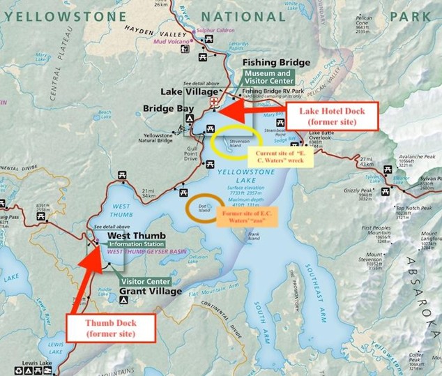
The Thumb Dock (located at West Thumb Geyser Basin) is on the left, with the Lake Hotel Dock on the right. Both have since been removed. Dot Island, where the “zoo” was located, is circled in orange. Stevenson Island, still home to the E.C. Waters wreck, is circled in yellow. The Zillah’s route, which sometimes included a stop at Dot Island, kept to the east shore to avoid the lake’s frequent bad weather, as well as for general efficiency. | Source:

Park Map – Yellowstone National Park. Map. Originally created February 1, 2023. Modified by Anaëlle DePoint. National Park Service. Accessed April 28, 2025. https://www.nps.gov/media/photo/collection-item.htm?pg=7323739&cid=305fb7af-a71b-469b-941e-a98b439c882f&id=dc30085e-3713-4a8f-856b-19ac1c566066&sid=a4e6a581-87cd-48b5-bb71-597876409532&p=1&sort=relevance.

Download Original File