<?xml version="1.0" encoding="UTF-8"?>
<feed xmlns="http://www.w3.org/2005/Atom">
  <title type="text">Intermountain Histories</title>
  <updated>2026-04-17T19:32:17+00:00</updated>
  <generator uri="http://framework.zend.com" version="1.12.20">Zend_Feed_Writer</generator>
  <link rel="alternate" type="text/html" href="https://www.intermountainhistories.org/"/>
  <link rel="self" type="application/atom+xml" href="https://www.intermountainhistories.org/items/browse?output=rss2"/>
  <id>https://www.intermountainhistories.org/</id>
  <author>
    <name>Intermountain Histories</name>
    <uri>https://www.intermountainhistories.org</uri>
  </author>
  <link rel="hub" href="https://pubsubhubbub.appspot.com/"/>
  <entry>
    <title type="html"><![CDATA[The Great Salt Lake Shorelands Preserve]]></title>
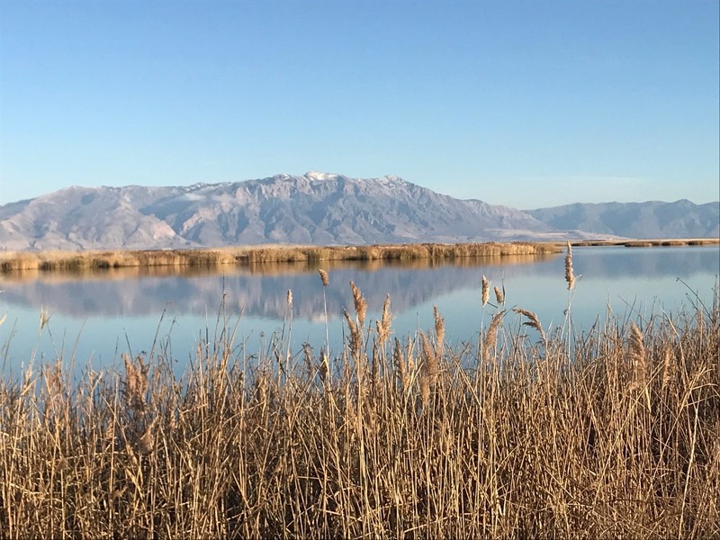
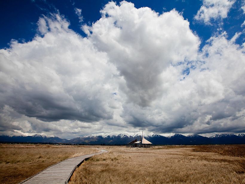
    <summary type="html"><![CDATA[<p><strong><em>Nicknamed “the Bird Refuge,” The Great Salt Lake Shorelands Preserve in Layton, Utah is a rest stop for 4-6 million birds migrating annually. The protected land has also become a recreational spot for tourists and locals to bird watch and enjoy the wetlands of the Great Salt Lake.</em></strong></p><img src="https://www.intermountainhistories.org/files/fullsize/3ea1ff3a8d741ab1d715b39c0db58c87.jpg" alt="Great Salt Lake Pavilion " /><br/><p><span style="font-weight:400;">In 2003, a group called “The Nature Conservancy” gained custody of 4,400 acres of wetlands fed by the waters of the Great Salt Lake. The wetlands lie on the eastern shore of the lake near Farmington Bay and Antelope Island State Park. Nicknamed “the Bird Refuge,” this preserve’s mission is to provide refuge to 4-6 million birds as they make their annual migrations on routes that span from the Arctic to Central and South America. Bird watchers have documented 250 species visiting the Shorelands preserve to feed or rest and 93 species that nest there. The number of birds passing through the area has increased by 25% since 2020, showing the importance of the preserve. </span>
<span style="font-weight:400;">The Shorelands Preserve includes a circular boardwalk spanning about 1 mile. Two wooden structures serve as stops along the boardwalk, one hosting a 30-foot viewing tower for visitors to better observe the surrounding area and to increase their chances of spotting birds. The other is a large wooden pavilion. Informative signs dot the boardwalk, helping visitors identify the birds that frequent the Preserve. They also provide information about the ecosystem of the area. </span>
<span style="font-weight:400;">In May 2020, the Mitigation Commission released a statement turning over ownership of The Nature Conservancy to the federal government. Giving the federal government stewardship over The Nature Conservancy was viewed as a better way to protect the lands from future development. This was crucial at a time when Utah’s Department of Transportation was considering expanding the West Davis Corridor, a road system. The drought-driven shrinking of the Great Salt Lake poses an additional risk to the region. The Nature Conservancy is in the process of developing strategies to divert water to the preserve to help the wetlands and aid the bird species that rely on it.</span></p><p><em><strong><a href="https://www.intermountainhistories.org/items/show/790">For more (including 4 images) view the original article</a></strong></em></p>]]></summary>
    <published>2024-03-03T03:57:53+00:00</published>
    <updated>2026-04-17T19:32:17+00:00</updated>
    <link rel="alternate" type="text/html" href="https://www.intermountainhistories.org/items/show/790"/>
    <id>https://www.intermountainhistories.org/items/show/790</id>
    <author>
      <name>Gabby Segura, Brigham Young University</name>
    </author>
  </entry>
  <entry>
    <title type="html"><![CDATA[Hardware Ranch ]]></title>
    <summary type="html"><![CDATA[<p><strong><em>Hardware Ranch in Hyrum, Utah was created to keep elk away from the lower valley and its inhabitants. Today, the ranch is a popular spot for visitors to get a closer look at elk and other wildlife. </p></strong></p><img src="https://www.intermountainhistories.org/files/fullsize/f81afce9790f5a0a5591caf762da95b5.jpg" alt="An Elk in Hardware Ranch" /><br/><p><span style="font-weight:400;">In the 1940s, complaints from people in the valley of the Blacksmith Fork Canyon about elk eating their stores of hay began to be more frequent. This prompted the state of Utah to purchase the Hardware Ranch to prevent elk from entering the lower parts of the Blacksmith Fork Canyon and interfering with the settlers in the valley of inner Hyrum. The state then created the winter feeding program to keep elk out of the valley. </span>
<span style="font-weight:400;">Before the ranch was a place for Elk to receive food and refuge during the winter, it was a sawmill during the 1870s, then later home to Utah’s largest Cheese company during the 1890s. Lehi Curtis, who homesteaded the ranch during the late 1860s, was part of the 16th Company of pioneers who emigrated to Utah. The company was led by Lehi’s father Uriah Curtis and had a total of 266 members; it traveled from Kanesville, Iowa in 1852 to Cache County, Utah. Upon arriving at Cache Valley, Lehi helped plan out a road that lead to Blacksmith Canyon. Soon, farmers began to further settle the area. </span>
<span style="font-weight:400;">Hardware Ranch was purchased 8 years after the Pittman-Robertson Act was passed. The act, also known as the Wildlife Restoration Act, allowed for revenue from the sporting arms tax to be used as for restoring and managing wildlife. In 1945, the revenue was used to purchase the Ranch from the family estate of Ernst Lorentz Petersen. The original size of the ranch was 7,560 acres but acquisitions by the state enlarged it to about 19,000 acres.During the first year, 120 Rocky Mountain Elk were fed through the winter. Within a few years the number of elk rose to above 500. </span>
<span style="font-weight:400;">In 1971, The state built an education center with two outside viewing areas to observe the elk. Sleigh rides were also provided to further enjoy the ranch and the local elk. In 1988, the Utah Legislature cut funding support for the sleigh rides. Outrage led the state to approve a fee structure and the sleigh rides resumed.</span>
<span style="font-weight:400;">Although the purpose of the ranch was initially to prevent the Elk from eating the hay from the settlers and to keep the elk out of the lower valley, the ranch has become a popular site in Utah and has had thousands of visitors since its opening. People can bring their children to have very close interactions with the Elk and learn about the history of the Ranch. The ranch also provides researchers with vital information in the preservation of wildlife. </span>
<span style="font-weight:400;">The elk is the state animal of Utah. Once winter forage grasses are covered in snow, Division of Wildlife Resources stadd begin feeding the elk. The feed is grown by the ranch. Soon, between 400 and 700 animals migrate to the ranch for the winter. </span></p><p><em><strong><a href="https://www.intermountainhistories.org/items/show/691">For more (including 5 images) view the original article</a></strong></em></p>]]></summary>
    <published>2022-11-03T15:08:01+00:00</published>
    <updated>2026-04-17T19:32:15+00:00</updated>
    <link rel="alternate" type="text/html" href="https://www.intermountainhistories.org/items/show/691"/>
    <id>https://www.intermountainhistories.org/items/show/691</id>
    <author>
      <name>Rosa Rodriguez, Weber State University</name>
    </author>
  </entry>
  <entry>
    <title type="html"><![CDATA[Lake Lowell: Transforming Treasure Valley]]></title>
    <summary type="html"><![CDATA[<p><strong><em>The Reclamation Act of June 17, 1902, aimed to create proper irrigation systems that could provide water access for residents of western states. Lake Lowell was one of those projects.</em></strong></p><img src="https://www.intermountainhistories.org/files/fullsize/8dafc9cce562e3302960bcf13f35ebe2.jpg" alt="Building up" /><br/><p>Under the direction of the 1902 Reclamation Act—congressional legislation intended to irrigate western states and provide greater access to water—the Bureau of Reclamation approved and developed Lake Lowell, starting in 1902 and finishing in 1909. Three dams—the Upper, Middle, and Lower Embankments (embankments are walls of earth or stone built to prevent a river from flooding an area)—surround a natural depression southwest of Nampa, Idaho to form the lake. A fourth wall, called the East Embankment, was added later to protect farmsteads on the eastern end of the reservoir.
In the irrigation off-season, the Boise River Diversion Dam and New York Canal provide most of Lake Lowell’s volume, discharging water intp the upper end of the lake, where there is a capacity ranging from 12.7 feet on the Middle Embankment to 65 feet on the Upper. During the irrigation season, Lake Lowell becomes one of the major irrigation providers for Canyon County agriculture. With the capacity to irrigate over 200,000 acres of land, it is one of the American West’s largest off-stream reservoirs.
As with many other western irrigation projects, Lake Lowell presented a significant opportunity for economic growth and restructured the relationship between people and their environment. Along with other government investment projects that opened the area to construction and farming, irrigation attracted migrants from the Midwest who worked as laborers to develop the dam and as farmers to till the land. In 1900, the census counted 161,772 people living in Idaho; by the 1920 census, the population had more than doubled to 431,866 people. This growth was sharpest in southwestern Idaho, which grew by 130% during this twenty-year period as agricultural and ex-urban communities transformed Treasure Valley into fertile land. Lake Lowell made that change possible.
In addition to serving local farms, towns, and cities, Lake Lowell also plays a role in how people and other living things interact with the region’s nature. The lake hosts the Deer Flat Reservoir, one of the oldest refuges in the National Wildlife Refuge System. As for humans in nature, Lake Lowell is a popular destination for numerous outdoor activities, including boating, swimming, fishing, birdwatching, hiking, and hunting.</p><p><em><strong><a href="https://www.intermountainhistories.org/items/show/629">For more (including 5 images) view the original article</a></strong></em></p>]]></summary>
    <published>2022-06-30T21:27:42+00:00</published>
    <updated>2026-04-17T19:32:13+00:00</updated>
    <link rel="alternate" type="text/html" href="https://www.intermountainhistories.org/items/show/629"/>
    <id>https://www.intermountainhistories.org/items/show/629</id>
    <author>
      <name>Legna Roximar Morales, College of Idaho</name>
    </author>
  </entry>
  <entry>
    <title type="html"><![CDATA[Petrified Forest National Park]]></title>
    <summary type="html"><![CDATA[<p><strong><em>Petrified Forest National Park is rich in fossilized wood from the Triassic Period, which took place 200 to 250 million years ago. Although the park is mainly known for the petrified wood, it presently hosts a diverse ecosystem and also has archeological significance to human history.</em></strong></p><img src="https://www.intermountainhistories.org/files/fullsize/289440d180cb0f3ca961f4a85f464d4c.jpg" alt="Petrified wood" /><br/><p>During the Triassic Period, northeastern Arizona’s Colorado Plateau was near the equator on part of the prehistoric supercontinent Pangea. Due to the different climate, there existed massive trees and rivers all over the area. Some trees fell into the surrounding floodplains, or rivers, and were buried in mud, becoming petrified over time. The process of petrification is where the cellular structure of organic materials is replaced by minerals. The most common of these minerals are quartz, manganese oxide, and iron oxide, and each give petrified wood different colors. There are fossils of three different extinct tree species in the park: Woodworthia, Schilderia, and Araucarioxylon.
Millions of years later, in 1906, President Theodore Roosevelt declared the region a national monument. Congress passed legislation in 1962 to make it a national park, calling it Petrified Forest National Park, and in 2004 to expand the park’s boundaries further in order to protect more of the area from fossil thieves and better preserve the environment. Today, the park spans 221,390 acres, with over 50,000 acres of designated wilderness where the National Park Service allows recreational activities like camping and backpacking.
Visitors can get information and backcountry permits at the Painted Desert Visitor Center, which also hosts an orientation film, bookstore, restaurant, walking trail, and some hands-on exhibits. The Painted Desert Inn National Historic Landmark is two miles from the north entrance of the park and hosts museum galleries, visitor information, sweeping desert vistas, and access to the Wilderness Area and other trails. Rainbow Forest Museum is another park attraction similar to the visitor center, but it is more focused on museum exhibition. It doesn’t have a restaurant but does host complete paleontological exhibits with prehistoric animal skeletons.
Although Petrified Forest National Park is most immediately known for fossil remains, the region continues to be home for a wide variety of native wildlife. There are hundreds of animal species in its ecosystem, including tiger salamander, toad, porcupine, coyote, bat, Kit Fox, pronghorn, snake, woodrat, box turtle, and golden eagle. Many unusual migratory species like pelican and other shore birds occasionally can be seen in the park. The majority of the wildlife is crepuscular, meaning that they are most active at dawn and dusk. The park recommends visiting in the early morning or evening hours for a much better chance of observing wildlife.
The park also has over 800 archeological and historic sites exhibiting at least 12,000 years of human presence. There are petroglyph sites ranging in age from 600 to 2000 years ago. The earliest types of artifacts found at the park are stone spear points and arrowheads crafted by Paleoindians, the first people to have traveled to the region who arrived during the Pleistocene period at least 11,500 years ago. These earliest people were nomadic hunter-gatherers. Eventually, people began permanently inhabiting the area to farm corn. They constructed pit structures and pueblos, and made pottery. Ruins of these later structures and ceramic artifacts can still be seen by visitors at sites throughout the park.</p><p><em><strong><a href="https://www.intermountainhistories.org/items/show/511">For more (including 5 images) view the original article</a></strong></em></p>]]></summary>
    <published>2021-10-15T05:38:32+00:00</published>
    <updated>2026-04-17T19:32:10+00:00</updated>
    <link rel="alternate" type="text/html" href="https://www.intermountainhistories.org/items/show/511"/>
    <id>https://www.intermountainhistories.org/items/show/511</id>
    <author>
      <name>Jacob French, Northern Arizona University</name>
    </author>
  </entry>
  <entry>
    <title type="html"><![CDATA[Outfitting To Research: The University of Idaho’s Taylor Wilderness Research Station<br />
]]></title>
    <summary type="html"><![CDATA[<p><strong><em>The University of Idaho has owned a research station in the Frank Church-River of No Return Wilderness Area in Idaho since 1969. The station focuses on environmental education for undergraduates and graduates from all over the country.</p></strong></p><img src="https://www.intermountainhistories.org/files/fullsize/eba0f931e10054f7c695dd20aac456f0.jpg" alt="Looking towards Taylor on the bridge" /><br/><p>The Taylor Wilderness Research Station in the Frank Church-River of No Return Wilderness Area has been owned by many people over the years. The University of Idaho (UI), who owns it now, acquired the property from Jess and Dorothy Taylor in 1969 for $100,000, who had bought the property from David “Cougar Dave” Lewis in 1935 for $1,200. The university intended to fund the research station for a couple years before research grants would fund it self-sufficiently, a hope that remains unfulfilled. The station has adapted, though, and still focuses on education and research. </p><p>One unique opportunity at the station is the University of Idaho’s Semester in the Wild Program. This program allows students to spend a semester in the wilderness taking an integrated set of classes in the sciences and humanities, while receiving field experience. </p><p>The main focus and goal for the research station has remained education, broadly defined, rather than publishable research. The research station produced even more educational research opportunities when the university bought it. For example, the caretakers Jim and Holly Akenson, who were hired by UI, managed the property from 1982 to 2003 and developed an internship program, accepting and encouraging interns and students to come do research, especially in wildlife ecology. The Akensons took the interns on backpacking and horseback riding excursions to trap wolves, cougars, bobcats, and bears to tag them and collect data. They also investigated carcasses they happened across to determine how that animal was killed. Mostly, this research focused on students’ learning opportunities and backcountry skill-building rather than academic publication. It worked, because student experiences made them more marketable for future jobs. </p><p>In recent decades, the station moved towards more long-term monitoring programs, reflecting shifts in the history of ecology, which will provide the groundwork for potential future research. Some long-term monitoring efforts have already happened. For example, bird observations are made over the seasons to determine the presence or absence of specific bird species. Another project has compared the biomass of bluebunch wheatgrass to bighorn sheep populations. This research has been active for more than 25 years. As for today, one of the caretakers is conducting a research project on the pheromones of cougars to determine if we can identify cougars based on their different smells alone. UI also collaborates; Idaho State University researchers come to the research station each year to sample multiple creeks in the Big Creek drainage, looking at the riparian area and stream productivity. This has been conducted for 31 years, which gives us data from before a major fire in 2000 that significantly affected the ecological relationships in the watershed. Research here is limited to non-invasive practices, because it is a wilderness area. Permits also limit the station’s ability to conduct research in the area. However, even with the regulations in wilderness, research continues. The size of the wilderness area makes TWRS an especially useful research site in many of the environmental sciences. </p><p>The station is invaluable for giving students hands on field experience in an unusual learning environment. It allows long-term research to be carried out in a place where getting research permits can be hard. The educational opportunities that are provided here let students from all over the country experience wilderness and education in a whole new way.  </p><p><em><strong><a href="https://www.intermountainhistories.org/items/show/303">For more (including 3 images) view the original article</a></strong></em></p>]]></summary>
    <published>2019-02-15T00:30:07+00:00</published>
    <updated>2026-04-17T19:32:05+00:00</updated>
    <link rel="alternate" type="text/html" href="https://www.intermountainhistories.org/items/show/303"/>
    <id>https://www.intermountainhistories.org/items/show/303</id>
    <author>
      <name>Hailey Shannon, University of Idaho</name>
    </author>
  </entry>
  <entry>
    <title type="html"><![CDATA[Bear River Migratory Bird Refuge<br />
]]></title>
    <summary type="html"><![CDATA[<p><strong><em>The 79,000 acres of the Bear River Migratory Bird Refuge are federal and state lands managed by the U.S. Fish and Wildlife Service to protect the area for the millions of birds along their migration routes.</p></strong></p><img src="https://www.intermountainhistories.org/files/fullsize/95d229f169fa71229a3c44c9886cd822.jpg" alt="Bear River Bird Refuge" /><br/><p>The Bear River courses 600 miles from the Uinta Mountains through parts of Wyoming, Idaho, and Utah to the Great Salt Lake creating an extensive marsh area. The waterfowl which inhabit the marshes have been hunted for food for hundreds of years. However, after non-Natives settled in the area, water was diverted for irrigation and hunting became commercialized. From 1877 to 1900, more than 200,000 ducks were killed annually for transport to both California and eastern markets.</p><p>By 1900, the watershed was overgrazed by cattle and sheep; diversions had greatly reduced the summer water flow; hunters had decimated the waterfowl populations. Disease took further toll on the waterfowl. In 1910, a half million ducks died around the mouth of the Bear River during the late summer.</p><p>Alexander Wetmore began researching and believed that the sickness was caused by the alkaline water that had formed in pools throughout the marshlands. E. R. Kalmbach did further research and found that the sickness was not actually caused by the water, but by a form of botulism which lives in alkaline conditions. </p><p>The first efforts to save the waterfowl were made by sportsmen. The several duck hunting clubs which operated in the area acted to purchase or lease the remaining marshes and control the hunting. The Bear River Club organized in 1901, for example, owned 8,000 acres in North Bay and acted to preserve nesting and feeding areas.</p><p>These sports clubs, federal researchers, and the Utah Fish and Game Commission worked together to establish the establishment of the Bear River Migratory Bird Refuge by a special act of Congress on April 23, 1928. The nearly 65,000 acres acquired under this act were to be "maintained as a refuge and breeding place for migratory birds included in the terms of the convention between the United States and Great Britain for the protection of migratory birds, concluded August 16, 1916." The act provided that "at no time shall less than 60 per centum of the total acreage of the said refuge be maintained as an inviolate sanctuary for such migratory birds.'' The Bear River Migratory Bird Refuge was the first waterfowl refuge to be created by law.</p><p>A dam was built across the river canals led off across the marshes. Nearly 40 miles of earthen dikes were built to keep the marshland water levels consistent. The Refuge was a Civilian Conservation Corps project during the Great Depression. However, in 1983 the dikes broke due to high water levels in the Great Salt Lake and the refuge was deemed inoperable because of flooding. However, by 1990 the waters had receded and work began to restore the refuge. </p><p>In 2006, the James V. Hansen Wildlife Education Center was built. The Center features exhibits and hosts a variety of special events throughout the year to promote learning and participation in wildlife preservation. In addition to the visitor center, the refuge offers various locations for hunting, fishing, bird-watching, and photography.</p><p><em><strong><a href="https://www.intermountainhistories.org/items/show/260">For more (including 6 images) view the original article</a></strong></em></p>]]></summary>
    <published>2019-01-25T05:17:36+00:00</published>
    <updated>2026-04-17T19:32:04+00:00</updated>
    <link rel="alternate" type="text/html" href="https://www.intermountainhistories.org/items/show/260"/>
    <id>https://www.intermountainhistories.org/items/show/260</id>
    <author>
      <name>Dawn Smith, Weber State University</name>
    </author>
  </entry>
</feed>