<?xml version="1.0" encoding="UTF-8"?>
<feed xmlns="http://www.w3.org/2005/Atom">
  <title type="text">Intermountain Histories</title>
  <updated>2026-04-17T19:32:17+00:00</updated>
  <generator uri="http://framework.zend.com" version="1.12.20">Zend_Feed_Writer</generator>
  <link rel="alternate" type="text/html" href="https://www.intermountainhistories.org/"/>
  <link rel="self" type="application/atom+xml" href="https://www.intermountainhistories.org/items/browse?output=rss2"/>
  <id>https://www.intermountainhistories.org/</id>
  <author>
    <name>Intermountain Histories</name>
    <uri>https://www.intermountainhistories.org</uri>
  </author>
  <link rel="hub" href="https://pubsubhubbub.appspot.com/"/>
  <entry>
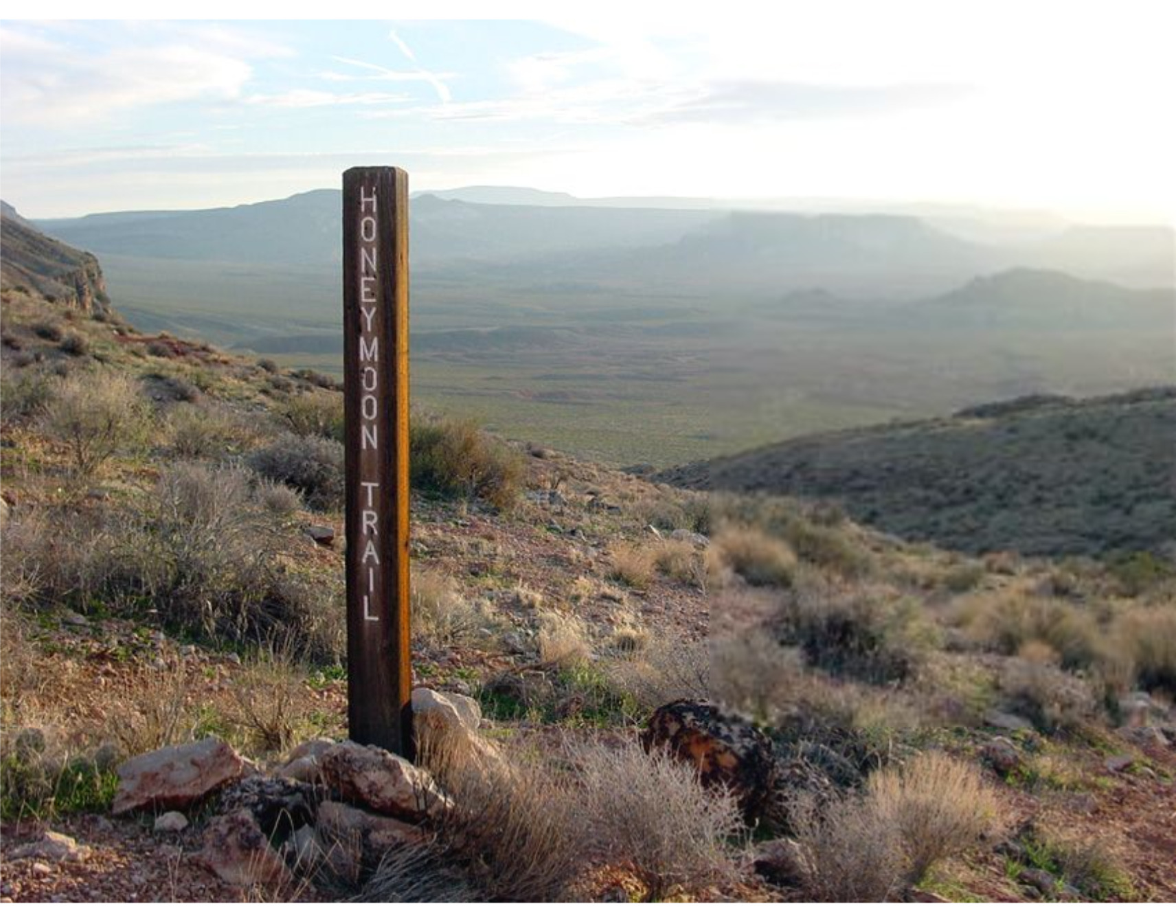
    <title type="html"><![CDATA[Honeymoon Trail]]></title>
    <summary type="html"><![CDATA[<p><strong><em>The Honeymoon Trail connected Latter-day Saint communities in Arizona to St. George and was originally known as the Mormon Wagon Road. Will C. Barnes, an American historian, coined the term Honeymoon Trail as he studied the hundreds of couples who trekked along the trail to the St. George Temple to get married. Couples continued to make the hazardous journey until 1927, when the Mesa, Arizona temple opened. </em></strong></p><img src="https://www.intermountainhistories.org/files/fullsize/b5f9fbc2448e80d9a7874c071208e8c7.jpg" alt="Honeymoon Trail" /><br/><p><span style="font-weight:400;">In 1871, leaders of the Church of Jesus Christ of Latter-Day Saints announced that a temple would be built in St. George in 1871. While this was exciting for members in southern Utah, it was also exciting to the members scattered throughout Arizona who wanted to be married for eternity in a ceremony that could only take place in a temple. After the temple in St. George was completed in 1877, couples in Arizona traveled to St. George to participate in the marriage ceremony. Depending on their starting point in northern or southern Arizona, some couples traveled over 400 miles to be married.</span>
<span style="font-weight:400;">The Honeymoon Trail was difficult to traverse under the best conditions and was sometimes made worse by the weather. Couples had no choice but to cross deep muddy washes and traverse canyons and hills. They could choose between a shorter route across mountains or avoid them by extending their journey by many miles. Although the trail did have a hazardous river crossing, most of the trail lacked adequate drinking water. It was common for oxen to die from dehydration. Some couples made the most of this loss by trading dying or dead oxen to people along the trail for other needed goods. Some couples endured snowstorms while others endured sandstorms. For instance, Joseph Fish, who undertook the trail to marry Julia Reidheid, suffered vision loss due to the sandstorms encountered on the journey. Despite their father’s challenging experience, some of Fish’s children still chose to traverse the same trail to reach the temple, fully aware of the risks they would face.</span>
<span style="font-weight:400;">The physical trail was not the only danger faced by couples. Tensions stemming from the Black Hawk War, a violent confrontation between Latter-Day Saint settlers and the Ute, Paiute, and Navajo nations from 1865 until 1872, led to ongoing confrontations. Some travelers lost horses to Indigenous raiders. However, many of the interactions between travelers and the Natives were friendly. Still, stories of past violence exaggerated the expectations of hostile interactions and caused the travelers to fear. Not only were Natives a concern, but running into strangers and outlaws also brought fear to the lawless wilderness. Danger surrounded the couples and groups who journeyed to the temple in St. George. </span>
<span style="font-weight:400;">The efforts and dedication of the Saints of Arizona were observed by Church leaders. In 1918 they announced that a temple would be built in Mesa Arizona. At the time there were only six operating temples, marking a tremendous victory for the members scattered throughout Arizona. The completion of the Mesa Temple in 1927 brought to an end the colorful history of the Honeymoon Trail.</span></p><p><em><strong><a href="https://www.intermountainhistories.org/items/show/777">For more (including 4 images) view the original article</a></strong></em></p>]]></summary>
    <published>2024-02-02T00:19:57+00:00</published>
    <updated>2026-04-17T19:32:17+00:00</updated>
    <link rel="alternate" type="text/html" href="https://www.intermountainhistories.org/items/show/777"/>
    <id>https://www.intermountainhistories.org/items/show/777</id>
    <author>
      <name>Margie Brown, Brigham Young University</name>
    </author>
  </entry>
  <entry>
    <title type="html"><![CDATA[The Escalante Cross: A Reminder of Utah&#039;s Past]]></title>
    <summary type="html"><![CDATA[<p><strong><em>The Declaration of Independence was not the only progress to be made in America in the year 1776. Spanish explorers Dominguez and Escalante became known as the first Europeans to document travels in what would become Utah Territory. Their initial intention to convert Natives on their journey towards California made way for future explorers to discover the Utah Territory.</em></strong></p><img src="https://www.intermountainhistories.org/files/fullsize/b81d7023fc173daf29504bcf4bd4178b.jpg" alt="Dominguez Plaque" /><br/><p><span style="font-weight:400;">In 1776, two Spanish friars, </span><span style="font-weight:400;">Silvestre Vélez de</span><span style="font-weight:400;"> Escalante and </span><span style="font-weight:400;">Atanasio</span><span style="font-weight:400;"> Dominguez, chose to traverse the American West in search of a northern route to the missions of California. At the time, both Mexico and Spain claimed ownership of the territory. The journey became known for its historical success thanks to Escalante’s journal, which contains the first map of Utah. Beginning the exploration in Santa Fe,  Dominguez and Escalante observed and recorded landmarks that would help future explorers find their way. These recordings also helped governments know and understand the rich opportunities that lay in these lands. The journey was full of dangers for the small group, and they crossed many western states such as Utah, Colorado, and Arizona, among others. The explorers ventured through modern-day Dinosaur National Monument, down through Strawberry, Utah and eventually made their way through Spanish Fork Canyon. This path directly influenced the erection of Escalante’s Cross in Spanish Fork, Utah. </span>
<span style="font-weight:400;">These two Spanish missionaries paved the way for other explorers such as John C. Fremont to encourage The Church of Jesus Christ of Latter-Day Saints to one day settle in Utah. Escalante’s cross, located in Spanish Fork, was dedicated May 1, 1981, sponsored by The Knights of Columbus Father Escalante Council to honor Dominguez and Escalante’s expedition. It was recently restored on October 31, 2015 thanks to a member of the Woodland Hills Scout Troop’s Eagle project. The cross majestically overlooks the entrance to Spanish Fork Canyon and stands brilliantly white against the mountain range beyond. </span>
<span style="font-weight:400;">Today, the site seems like an almost forgotten piece of history. However, one sign remains in the form of a plaque at the base of the cross. It has become a beloved hike here in Utah because of the landscape’s beautiful greenery and various paths leading from the cross. Escalante Cross stands as a reminder to Utah residents of earlier explorers who literally put Utah on the map. </span></p><p><em><strong><a href="https://www.intermountainhistories.org/items/show/733">For more (including 3 images) view the original article</a></strong></em></p>]]></summary>
    <published>2023-04-05T19:50:24+00:00</published>
    <updated>2026-04-17T19:32:16+00:00</updated>
    <link rel="alternate" type="text/html" href="https://www.intermountainhistories.org/items/show/733"/>
    <id>https://www.intermountainhistories.org/items/show/733</id>
    <author>
      <name>Holly Stirling, Brigham Young University</name>
    </author>
  </entry>
  <entry>
    <title type="html"><![CDATA[Mount Evans Scenic Byway]]></title>
    <summary type="html"><![CDATA[<p><strong><em>Mount Evans Scenic Byway takes visitors up the highest paved road in North America while also providing an accessible method to “bag” a 14,000-foot peak.</em></strong></p><img src="https://www.intermountainhistories.org/files/fullsize/b806163671458a4258913af20f162046.jpg" alt="Evans Byway" /><br/><p><span style="font-weight:400;">On July 22, 1923, work started on the highest road in North America: the Mount Evans Scenic Byway. Today, visitors can travel its twenty-eight mile stretch one way to reach the summit of the 14,130-foot mountain. The byway begins about sixty miles west of Denver in the mining town of Idaho Springs. Along the way up, visitors pass Echo Lake, Summit Lake, and the Walter Pesman Alpine Garden, which is home to 1,700-year-old bristlecone pines. Along the road, individuals gain 7,000 feet of elevation while those starting in Denver will gain about 9,000 feet. Due to volatile winter conditions, the road is generally only open from Memorial Day to Labor Day. </span>
<span style="font-weight:400;">The first recorded summiting of Mount Evans itself was by landscape painter Albert Bierstadt in 1863. Originally, the mountain was named Mount Rosalie. After the expulsion of Governor John Evans due to the Sand Creek Massacre, the name of the mountain was changed to remember the disgraced governor. The mountain later became more accessible in 1931 when construction of the road was complete and was opened to the public. </span>
<span style="font-weight:400;">Bagging “fourteeners”—a colloquialism meaning summiting a peak 14,000 feet above sea level—is a popular sport in Colorado, and the mountains are hard to resist. Because Mount Evans Scenic Byway is so easy to access, it makes for an easy first peak. After parking at the top of the mountain, individuals only have to hike a quarter of a mile to the real summit. However, high altitude presents many dangers such as oxygen deprivation, extreme sun exposure, and sudden thunderstorms. Visitors may experience altitude sickness, which can be broken down into acute mountain sickness, high-altitude pulmonary edema, and high-altitude cerebral edema. In its less serious stage, acute mountain sickness, individuals may suffer from headaches, nausea, dizziness, and other systems. High-altitude pulmonary edema (HAPE) becomes a possible concern among 15% of healthy individuals at 14,000 feet but is still not the most dangerous form of altitude sickness. Individuals suffering from HAPE may experience confusions, serious fatigue, and coughing or chest tightness. Finally, high-altitude cerebral edema is the most dangerous form of altitude sickness and if not treated, can lead to coma and death. Its symptoms include confusion, incoordination, and even hallucinations, caused by a buildup of fluids in the brain and sometimes lungs. </span>
<span style="font-weight:400;">In order to prevent altitude sickness, individuals are advised to acclimate to altitude gradually, drink plenty of water, and travel high but sleep low. Sunscreen will also help protect individuals against the sun at 14,000 feet, where the atmosphere provides 50% less protection than visitors may be used to. Also, individuals should try to be off the mountain by the afternoon to avoid thunderstorms. All of these steps can help to prevent disaster on the mountain.</span></p><p><em><strong><a href="https://www.intermountainhistories.org/items/show/473">For more (including 4 images) view the original article</a></strong></em></p>]]></summary>
    <published>2021-09-10T09:17:57+00:00</published>
    <updated>2026-04-17T19:32:10+00:00</updated>
    <link rel="alternate" type="text/html" href="https://www.intermountainhistories.org/items/show/473"/>
    <id>https://www.intermountainhistories.org/items/show/473</id>
    <author>
      <name>Nikki Smith, Brigham Young University</name>
    </author>
  </entry>
  <entry>
    <title type="html"><![CDATA[Goat Haunt Ranger Station: Waterton–Glacier International Peace Park]]></title>
    <summary type="html"><![CDATA[<p><strong><em>The Goat Haunt Ranger Station is both a bridge between the Glacier and Waterton National Parks and the northern terminus of the 3,000-mile-long Continental Divide Trail.</em></strong></p><img src="https://www.intermountainhistories.org/files/fullsize/ab2c1a108b32fdcc805dbd19ddbad615.jpg" alt="Goat Haunt Ranger Station" /><br/><p><span style="font-weight:400;">In 1978, the Continental Divide Trail (CDT) was added as one of America’s scenic long-distance trails. It, the Pacific Crest Trail, and the Appalachian Trail are the three most prominent national scenic trails. The CDT’s roughly 3,000 miles of trail are open to day hikers, backpackers, and thru-hikers, with unique sections also open to equestrian use. Anywhere from 150 to 200 hikers attempt the full distance each year but only a third will complete the full distance. To officially count as a thru-hike of the CDT, the hiker must stay within 100 miles of the Continental Divide itself. This is complicated by the fact that only 85% of the trail is officially completed and marked. In order to finish their hike within the five to six months of good weather, hikers need to average about 22 to 25 miles a day. This aggressive pace requires consistently consuming about 6,000 calories each day. </span>
<span style="font-weight:400;">The CDT started as the Blue Can Trail, named for the painted tuna cans used by the Colorado Mountain Club to mark the trail in 1964. The first individual to hike the Continental Divide is disputed, although there is documented evidence through journals and photographs that it may have been by Peter Parsons in 1924. The trail was first proposed to the National Park Service in the 1960s, but it did not become official until 1978. Still, individuals explored the Continental Divide in the years in between. In 1972, Erik Ryback became the first individual to complete the “Triple Crown” of the Appalachian Trail, the Pacific Crest Trail, and the Continental Divide Trail. </span>
<span style="font-weight:400;">Waterton Lake serves as the Northern Terminus for the CDT and marks either the end or the beginning of a thru-hike between the U.S.–Mexico and U.S.–Canada borders. Approximately 20% of CDT thru-hikers begin there as “South Bounders,” and 80% end there as “North Bounders,” all passing through the Goat Haunt Ranger Station located just above Waterton Lake and the international border. The Ranger Station works as a customs station to allow hikers to pass between the two countries and also showcases the international agreement that combined Glacier National Park in the United States with Waterton National Park in Canada to become the first International Peace Park. Ultimately, the Goat Haunt Ranger Station represents both international peace and the start or end of an incredible adventure along the Continental Divide. Those finishing their thru-hikes there will have crossed five states, three national parks, seven different ecoregions, and fourteen native tribal land regions.</span></p><p><em><strong><a href="https://www.intermountainhistories.org/items/show/471">For more (including 3 images) view the original article</a></strong></em></p>]]></summary>
    <published>2021-09-10T08:25:03+00:00</published>
    <updated>2026-04-17T19:32:09+00:00</updated>
    <link rel="alternate" type="text/html" href="https://www.intermountainhistories.org/items/show/471"/>
    <id>https://www.intermountainhistories.org/items/show/471</id>
    <author>
      <name>Nikki Smith, Brigham Young University</name>
    </author>
  </entry>
  <entry>
    <title type="html"><![CDATA[The CCC &amp; Arches National Monument and Park]]></title>
    <summary type="html"><![CDATA[<p><strong><em>Between the years 1938-1942 the Civilian Conservation Corps (CCC) completed an impressive amount of work building bridges, trails, and roads in Arches National Monument.</em></strong></p><img src="https://www.intermountainhistories.org/files/fullsize/4d4bd60d7e1db17da38aa27f1a6dbf34.jpg" alt="Moab Canyon Wash Culvert" /><br/><p>The area which is now Arches National Park first came to the attention of the government in the early part of the 20th century. In 1929, President Herbert Hoover designated 4,500 acres of the region a National Monument and in 1938 President Franklin Roosevelt enlarged it substantially to 33,000 acres. This was the size of the area when the CCC worked there, making it a challenge to create roads, trails, bridges, and other infrastructure projects over such a vast area. In 1969, President Richard Nixon granted the area National Park status.</p><p>In nearby Moab, Utah, the government created CCC camp NP-7 in 1940 with the aim of improving the infrastructure of Arches National Monument. The men of the CCC were the first people to attempt projects such as trail building in this remote area. Their efforts in the 1940’s helped the area to become more accessible when tourism boomed during the post-World War II period. This growth, caused predominantly by increased leisure time and money along with access to automobiles, has continued to this day with Arches National Park becoming an increasingly popular choice for tourists of all types visiting the Southwest. </p><p>Those in the NP-7 camp, one of the last CCC camps in America to close down, had completed an impressive amount of work when it closed in 1942. One of the most distinctive CCC projects to look for in the park is an impressive red sandstone building near the visitor center. Other remnants include many of the trails leading to key attractions in the park, including the ones leading to Delicate Arch and Landscape Arch. In addition to this the CCC completed work on the headquarters buildings, drainage culverts and a scenic park road. </p><p>Today Arches National Park is popular with all types of tourists, from avid mountain bike enthusiasts attracted by the surrounding region's trails to curious sightseers simply wishing to take in the stunning natural beauty of the park. </p><p><em><strong><a href="https://www.intermountainhistories.org/items/show/72">For more (including 3 images) view the original article</a></strong></em></p>]]></summary>
    <published>2017-06-12T22:22:32+00:00</published>
    <updated>2026-04-17T19:31:59+00:00</updated>
    <link rel="alternate" type="text/html" href="https://www.intermountainhistories.org/items/show/72"/>
    <id>https://www.intermountainhistories.org/items/show/72</id>
    <author>
      <name>Sarah Birt, Northern Arizona University and Hull University </name>
    </author>
  </entry>
</feed>
