<?xml version="1.0" encoding="UTF-8"?>
<feed xmlns="http://www.w3.org/2005/Atom">
  <title type="text">Intermountain Histories</title>
  <updated>2026-04-17T19:32:13+00:00</updated>
  <generator uri="http://framework.zend.com" version="1.12.20">Zend_Feed_Writer</generator>
  <link rel="alternate" type="text/html" href="https://www.intermountainhistories.org/"/>
  <link rel="self" type="application/atom+xml" href="https://www.intermountainhistories.org/items/browse?output=rss2"/>
  <id>https://www.intermountainhistories.org/</id>
  <author>
    <name>Intermountain Histories</name>
    <uri>https://www.intermountainhistories.org</uri>
  </author>
  <link rel="hub" href="https://pubsubhubbub.appspot.com/"/>
  <entry>
    <title type="html"><![CDATA[Santo Tomas de Abiquiu: A Genízaro Settlement on the Spanish Frontier]]></title>
    <summary type="html"><![CDATA[<p><strong><em>The town of Santo Tomas de Abiquiu, a Genízaro settlement established in 1754, served as a vital defensive settlement and trading post for Colonial New Mexico. The Genízaros who lived there—formerly enslaved detribalized indigenes—experienced the brutal life of the Spanish imperial frontier.</em></strong></p><img src="https://www.intermountainhistories.org/files/fullsize/c051def285f42825c44765693e65a4be.jpg" alt="Abiquiu in the 1910s" /><br/><p>Throughout the second half of the 18th century, detribalized Native Americans known as Genízaros (pronounced heh-NEE-sah-ros) relocated to land bordering colonial New Mexico and Indigenous territory through a series of land grants from imperial Spain. These settlements played an important role in facilitating trade between New Mexico and Indigenous tribes while also providing a form of colonial defense from other indigenous raiding parties by acting as a buffer zone for the villages of the Rio Chama Valley. The Genízaro settlement of Santo Tomas de Abiquiu was formed in 1754 when Governor Tomas Cachupín issued a land grant to a group of thirty-four Genízaro families. The settlement was about 60 miles north of Santa Fe.
The Genízaros were both Indigenous former slaves and the descendents of former slaves. It was often the case that Indigenous slaves who reached an age of maturity, who married, or whose enslavers released them from their <em>rescate </em>(“ransom and redemption”) debt, received their freedom. These former slaves experienced minimal economic and social mobility. Most had to work menial tasks to survive and were often the poorest members of their communities. Some found success in working as scouts and interpreters, or in Spanish auxiliary military forces. Land grants, like the one that established Abiquiu, were one of the few ways Genízaros could obtain their own property and experience greater economic mobility.
As the Spanish imperials had hoped, Abiquiu throughout its existence served as a buffer against Ute, Navajo, and Comanche raids. And like other Genízaro settlements Abiquiu also became an important waypoint for trade with other indigenous peoples, and Abiquiu became an important frontier trading post. Thanks to a treaty of friendship negotiated between Governor Cachupín and the Ute people, Abiquiu became the site of Ute trading fairs, especially in the late autumn months. In 1786, Spain the the Comanche signed a treaty to further trade between the people of Abiquiu and other Indigenous groups.
Despite the important role Genízaro settlements played as a link between Colonial Spain and Indigenous groups, Genízaros and Spanish settlers had a fraught relationship. A series of witch trials, originating in Abiquiu and spreading throughout the region, revealed the tensions that existed both between Spaniards and Genízaros, as well as the tensions that existed between Genízaros of differing beliefs and cultural/tribal backgrounds. Genízaros made up both accused and accusers, and Spanish inquisitorial courts condemned many Genízaros’ traditional spiritual beliefs as satanic. In the end, the Inquisition never executed any accused Genízaro, but inquisitors did torture many and sentence others to perpetual servitude in Spanish Catholic homes, revealing the fragility of Genízaro freedom.
More recently, Abiquiu has been the site of important Indigenous land right battles. While the United States’ Court of Private Land Claims validated the Genízaros’ 16,000 acre land grant in 1894, some disputes over dispossessed Genízaro land remained unresolved for nearly a century. In 1969, the United States returned National Forest lands to Genízaro families, in part thanks to help from the Presbyterian Church. Later, in 2008, New Mexico expanded the land they recognized as part of the historical grant and returned another 32.5 acres to the Genízaro community.</p><p><em><strong><a href="https://www.intermountainhistories.org/items/show/631">For more (including 3 images) view the original article</a></strong></em></p>]]></summary>
    <published>2022-07-01T01:02:07+00:00</published>
    <updated>2026-04-17T19:32:13+00:00</updated>
    <link rel="alternate" type="text/html" href="https://www.intermountainhistories.org/items/show/631"/>
    <id>https://www.intermountainhistories.org/items/show/631</id>
    <author>
      <name>Jacob Morrison, Brigham Young University</name>
    </author>
  </entry>
  <entry>
    <title type="html"><![CDATA[Utah Lake]]></title>
    <summary type="html"><![CDATA[<p><strong><em>Utah Lake sustained indigenous populations with fresh water and fishing for centuries. Beginning in the 1800s, Mormon pioneers settled the area; nowadays, heavy industry has polluted the once welcoming water source.</em></strong></p><img src="https://www.intermountainhistories.org/files/fullsize/6c9471ba4cb86b91b4ca1e37337e562e.jpg" alt="Utah Lake" /><br/><p>Utah Lake is a freshwater body situated in the Provo–Orem area of Utah County. The Lake has been utilized for hundreds of years by a variety of Native tribes, including but not limited to the Utes, Paiutes, and Shoshones. A variety of American Indian groups such as the Fremont people lived along the lake’s shores prior to these contemporary tribes, and they all had settlements and benefitted from the lake’s resources and fresh drinking water.
Excavation sites organized by archeologist Joel Janetski have yielded a variety of culture-rich native artifacts including arrowheads, beads, shells, cooking utensils, and ceramics like clay pots. The Dominguez and Escalante Expedition of 1776 visited Utah Valley from New Mexico and described the lake and valley in glowing terms. Fur traders also frequented the area in the 1820s and 1830s. In 1847, Euro-American members of The Church of Jesus Christ of Latter-day Saints entered Utah Valley, and they eventually utilized Utah Lake as a source of food and water for agriculture. This marked the beginning of settler colonialism and Western encroachment into the region which ultimately led to numerous settler–native conflicts over the land around Utah Lake.
As one of the largest freshwater lakes west of the Mississippi River, Utah Lake historically was home to a wide variety of fish, bird, and plant species. The water now has high levels of phosphorus and calcium carbonate sediments, a result of pollution. Utah Lake remains an expansive sight for those living in the Provo–Orem area, and residents and visitors sometimes use the lake for watersports in the summer and ice fishing & skating in the winter.</p><p><em><strong><a href="https://www.intermountainhistories.org/items/show/591">For more (including 3 images) view the original article</a></strong></em></p>]]></summary>
    <published>2022-04-16T00:51:10+00:00</published>
    <updated>2026-04-17T19:32:12+00:00</updated>
    <link rel="alternate" type="text/html" href="https://www.intermountainhistories.org/items/show/591"/>
    <id>https://www.intermountainhistories.org/items/show/591</id>
    <author>
      <name>Devin Blake Sanders, Brigham Young University</name>
    </author>
  </entry>
  <entry>
    <title type="html"><![CDATA[Santa Fe Trail’s Indigenous Origins]]></title>
    <summary type="html"><![CDATA[<p><strong><em>The Santa Fe Trail was a conduit of trade in the Americas controlled by the Comanches and Utes.</em></strong></p><img src="https://www.intermountainhistories.org/files/fullsize/904510e761af8d3ad907e44dde960226.jpg" alt="Braves and their steeds" /><br/><p>The Santa Fe Trail is one of the symbols of American westward expansion and Manifest Destiny. The trail runs from Independence, Missouri to Santa Fe, New Mexico and was a major artery of trade between American pioneers, Mexican settlers, and most significantly, indigenous peoples. For decades before and throughout its history, the trade along the Trail was controlled by its main beneficiary: the Comanche nation.
The first man to make the journey from Santa Fe to Independence in the late 1700s was Pedro Vial, a Frenchman who had lived among the Comanche and was on peaceful terms with the powerful nation. Most Comanche–American relations around the advent of the 19<sup>th</sup> century were friendly and trade-based because of the Comanche’s ambitions for economic expansion. To the delight of the Comanche, declining Spanish colonial power in the American Southwest culminated in Mexican independence in 1821, sweeping away barriers to trade/
Through utilizing Spanish horses and raiding tactics, the Comanche had already established themselves as the dominant force in the Southwest. This was evident through the significant contractions of the neighboring tribes and the Spanish colonists themselves. An American officer, General Stephen Long, was the subject of a second-hand account of Comanche-Spanish conflict in the nineteenth century: “It was stated last fall by the Spanish officers at the Sabine, who were attached to the Spanish expedition against Gen. Long and his followers, that those Indians had, within the last season, destroyed upwards of 1000 families on the Rio del Norte, and in parts of the Spanish provinces.” The Americans recognized that the Comanche were a force to be respected.
While the Comanche could be brutal to those who didn’t cooperate with their terms, the Santa Fe trade flourished under their control. Tens of thousands of dollars of goods moved along the trail between 1820 and 1840. American traders like Josiah Greggs and Thomas James learned to pay for their passage and abide by Comanche rules and traditions, and they profited for years off of their economically beneficial friendship. James himself was even adopted into a Comanche tribe as a result.
Unfortunately for many American and Mexican settlers along the trail—therefore in Comanche territory—this meant Comanche tributary demands. When these demands for tribute or trade were not met, settlers suffered the consequences. Entire settlements in present-day Texas and New Mexico were destroyed because of their lack of cooperation with Comanche trade policy.</p><p><em><strong><a href="https://www.intermountainhistories.org/items/show/590">For more (including 3 images) view the original article</a></strong></em></p>]]></summary>
    <published>2022-04-16T00:16:42+00:00</published>
    <updated>2026-04-17T19:32:12+00:00</updated>
    <link rel="alternate" type="text/html" href="https://www.intermountainhistories.org/items/show/590"/>
    <id>https://www.intermountainhistories.org/items/show/590</id>
    <author>
      <name>Joshua Rust, Brigham Young University</name>
    </author>
  </entry>
  <entry>
    <title type="html"><![CDATA[Crossing of the Fathers]]></title>
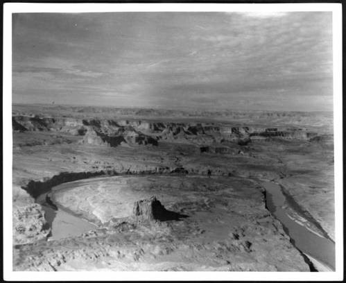
    <summary type="html"><![CDATA[<p><strong><em>With the help of their Native American guides, Spanish Franciscan priests Atanasio Domínguez and Silvestre Vélez de Escalante made a difficult crossing of the Colorado River.</em></strong></p><img src="https://www.intermountainhistories.org/files/fullsize/4f0aa82a81d59c00ca9a695cdd884141.jpg" alt="Canyon Country" /><br/><p>In 1776 an expedition left from Santa Fe, New Mexico, to find an overland route to the Catholic Mission in Monterrey, California.  Native Americans guided Franciscan priests, Fathers Escalante and Dominguez through the Colorado Plateau.  Their journey consisted of crossing through vast canyon lands and fording many rivers.  They took a large number of horses, mules, and donkeys to pack goods and to trade with Native Americans.  Their journey lasted for just over a year. </p><p>They traveled from Santa Fe north into Colorado’s Western Slope to present day Grand Junction.  Then they headed west past Green River, Utah, towards the Wasatch Front.  They ended their journey at Utah Lake near Provo.  Disappointed in their pace and failure to find an easy route to California, they began a return journey on an alternate route. They traveled south to present-day Cedar City, Utah, and then cut east along the edges of the Grand Staircase region towards Glen Canyon and the Colorado River.  </p><p>The Crossing of the Fathers is where Native guides led the expedition across the Colorado River. It was difficult to find a safe crossing of the river in the Glen Canyon region. After a thorough search, they came to a narrow spot.  In a translated journal, the Fathers described their difficult situation, “in order to have the mounts [mules, donkeys, and horses] led down to the canyon mentioned, it became necessary to cut steps with axes on a stone cliff.”  After safely taking the animals down the stairs, they next looked for a safe crossing of the river. They found a relatively easy spot to swim across that had little flow.  On November 7, 1776, they crossed the Colorado River to continue their journey back to Santa Fe.</p><p>In the ensuing 200 years few followed that specific crossing location.  Native peoples of the region knew and used many other crossings.  In fact, the Escalante and Dominguez route is one of the only mentioned crossings of this section of the Colorado.  Farther north there were easier cliffs to descend and a slower meandering river section that Native Americans used.  Today the Crossing of the Fathers lies underneath Lake Powell.  Many amateur explorers have tried to find the route the Spanish Fathers took and have searched for the original staircase that was carved into the side of the cliff. Today, the site is most likely covered by the waters of Lake Powell., though falling water levels may someday reveal its location.</p><p><em><strong><a href="https://www.intermountainhistories.org/items/show/65">For more (including 3 images) view the original article</a></strong></em></p>]]></summary>
    <published>2017-06-07T06:21:57+00:00</published>
    <updated>2026-04-17T19:31:59+00:00</updated>
    <link rel="alternate" type="text/html" href="https://www.intermountainhistories.org/items/show/65"/>
    <id>https://www.intermountainhistories.org/items/show/65</id>
    <author>
      <name>Alex Anthony, Northern Arizona University</name>
    </author>
  </entry>
  <entry>
    <title type="html"><![CDATA[The Dominguez-Escalante Expedition Reaches Utah Valley]]></title>
    <summary type="html"><![CDATA[<p><strong><em>In 1776, a pair of Spanish Franciscan friars set out to find an overland route from New Mexico to California. Their hope was to find a safe path between the difference Catholic missions in the southwestern United States. While they were never able to reach California, their expedition provided valuable map information for future travelers and part of their documented route became part of the Old Spanish Trail, a trade route that was frequently used for years afterwards. They were also the first of European ancestry to set eyes on the Utah Valley. </em></strong></p><img src="https://www.intermountainhistories.org/files/fullsize/a55569ce8c30b3a800d575dcaea85131.jpg" alt="Escalante Etching " /><br/><p>In the summer of 1776, Atanasio Domínguez and Silvestre Vélez de Escalante (along with a team of other men and Native American guides that would join them later) set out from Santa Fe, New Mexico to find an alternative route to the other Spanish missions in California along the Monterey coast. The local settlers already knew a path through modern-day Arizona, but the Grand Canyon and hostile native tribes forced the Spanish to look for an alternative route. Their trip through the southwest was carefully documented, and they often refer to the rugged landscape, local plant and animal life, and the potential for settlement by anybody who chose to follow them. </p><p>By September of 1776 the party reached Utah Valley where the mouth of Spanish Fork Canyon opens up to the wider valley. One of their native guides, Silvestre, was a member of a local tribe and this connection provided the party with safe passage and a small opportunity for trade. While this moment was important (as they were the first Europeans to see the valley), it wasn’t the end goal of their expedition. A few days later, the party continued their journey to the southwest, but not before they made the observation that, “[the area consists] of flat meadows with good land for farming; it carries more water than the foregoing two, has a larger poplar grove and meadows of good soil which can be irrigated—all good for two or even three good settlements.” Dominguez and Escalante would later encounter trouble on their journey and have to return early to New Mexico, never reaching California.  </p><p>In the 1920s, residents of Spanish Fork wanted to commemorate the arrival of the expedition to Utah Valley. A monument was erected and later dedicated in January of 1923. The Bronze tablet that accompanies it is inscribed with further information from the expedition’s visit to the valley. In 1981 a large white cross was constructed overlooking the valley, a symbolic representation of the arrival of the Spanish friars to the area. The site is accessible by hiking trail above the Spanish Fork reservoir.     </p><p><em><strong><a href="https://www.intermountainhistories.org/items/show/35">For more (including 5 images) view the original article</a></strong></em></p>]]></summary>
    <published>2017-03-20T16:43:17+00:00</published>
    <updated>2026-04-17T19:31:58+00:00</updated>
    <link rel="alternate" type="text/html" href="https://www.intermountainhistories.org/items/show/35"/>
    <id>https://www.intermountainhistories.org/items/show/35</id>
    <author>
      <name>Addison Blair, Brigham Young University </name>
    </author>
  </entry>
</feed>