<?xml version="1.0" encoding="UTF-8"?>
<feed xmlns="http://www.w3.org/2005/Atom">
  <title type="text">Intermountain Histories</title>
  <updated>2026-04-17T19:32:11+00:00</updated>
  <generator uri="http://framework.zend.com" version="1.12.20">Zend_Feed_Writer</generator>
  <link rel="alternate" type="text/html" href="https://www.intermountainhistories.org/"/>
  <link rel="self" type="application/atom+xml" href="https://www.intermountainhistories.org/items/browse?output=rss2"/>
  <id>https://www.intermountainhistories.org/</id>
  <author>
    <name>Intermountain Histories</name>
    <uri>https://www.intermountainhistories.org</uri>
  </author>
  <link rel="hub" href="https://pubsubhubbub.appspot.com/"/>
  <entry>
    <title type="html"><![CDATA[Culture, Coulee, and the Columbia National Wildlife Refuge]]></title>
    <summary type="html"><![CDATA[<p><strong><em>For thousands of years, the Columbia River has been a home to unique ecosystems and indigenous tribes from all across the region. The Grand Coulee Dam became another way for the river to support human life, though its legacy has been complicated.</em></strong></p><img src="https://www.intermountainhistories.org/files/fullsize/0e3a173212c0e651de5a1cbf4b33e802.jpg" alt="Fish River Road" /><br/><p>The Columbia River has a unique and essential history involving indigenous people from across the Columbia Plateau, spanning thousands of years and dozens of tribes. A gathering place and trade site for many, the Columbia River has long provided its inhabitants with food, shelter, and other natural resources. Chief among these is the wild salmon population that runs through the river’s reaches, which confederated Columbia tribes such as the Yakama, Warm Springs, Chinook, and Wasco among others have fished for as long as living memory. Even more important, however, is the abundant fresh water—a source that homesteaders and developers in the area have repeatedly been eager to utilize.</p><p>In the early twentieth century, farmers attempting to settle the Columbia Plateau faced roadblocks due to the region’s low rainfall. When other attempts to irrigate the landscape failed, interested parties began to formulate proposals for a dam on the Grand Coulee riverbed. However, as the idea gained popularity, its proponents coalesced around two different preferences for the dam’s primary design and purpose: irrigation and electricity generation. Changes to the dam’s design continued even after initial construction began in 1933. None of these contests, however, considered the needs of the Columbia’s other inhabitants. Though the dam would severely alter salmon migration patterns, designers gave no consideration to how this would impact the tribes of the Columbia River.</p><p>Grand Coulee Dam’s changes to the Columbia Plateau water levels had unforeseen ecological impacts. Though surrounded by desert scrub and sagebrush plains, water from the newly formed Roosevelt Lake flooded parts of the landscape carved out during the last Ice Age. The resulting wetlands attracted species that could now live comfortably in the area, mainly waterfowl, and pushed naturally occurring desert species to higher elevations. Ironically, these waterfowl inspired the United States to create Columbia National Wildlife Refuge.</p><p>Not even damming the river could stop Columbia tribes from fishing in the waters they had used for so long. However, some of the Grand Coulee Dam’s effects were irreversible. Areas south of the dam, including parts of Columbia Refuge, still run with salmon, but tribes living north of the dam have lost the fish’s spawn sites, preventing them from performing certain rituals. Multiple dams along the river have also flooded traditional fishing sites, such as Kettle Falls near Grand Coulee and the now-submerged Celilo Village near Dalles Dam. Regardless of the rights that Columbia tribes have retained, their losses are significant.</p><p>The Grand Coulee Dam has drawn an abundance of life to the Columbia River and its basins, providing environments and opportunities that were once unimaginable. Yet the various ancestral homelands—of Yakama, Colville, Spokane, and more—surrounding the Columbia Refuge on all sides provide a constant reminder of what used to be.</p><p><em><strong><a href="https://www.intermountainhistories.org/items/show/549">For more (including 3 images) view the original article</a></strong></em></p>]]></summary>
    <published>2021-12-17T03:45:17+00:00</published>
    <updated>2026-04-17T19:32:11+00:00</updated>
    <link rel="alternate" type="text/html" href="https://www.intermountainhistories.org/items/show/549"/>
    <id>https://www.intermountainhistories.org/items/show/549</id>
    <author>
      <name>Len Truelsen, Northern Arizona University</name>
    </author>
  </entry>
  <entry>
    <title type="html"><![CDATA[Glen and Bessie’s Colorado River Trip, Part 2: Kolb Studio]]></title>
    <summary type="html"><![CDATA[<p><strong><em>After leaving Lee’s Ferry, the Hydes headed for Grand Canyon Village. There sought out Emery Kolb at his photographic studio, a veteran of the river who represented all Glen and Bessie wanted to achieve.</em></strong></p><img src="https://www.intermountainhistories.org/files/fullsize/6a772c22dedef13b31efd9658d09e823.jpg" alt="Kolb Studio" /><br/><p><p style="margin:0in;"><span style="color:#0e101a;">Founded in 1901, Grand Canyon Village is a historic, national park community located on the South Rim of the Grand Canyon, 5,000 feet above the Colorado River. Originally composed of several privately-owned businesses catering to tourists, the community eventually came under the control of the National Park Service beginning with the founding of Grand Canyon National Park in 1919. Two of this small hamlet’s early notable inhabitants were Emery and Ellsworth Kolb. The brothers moved to the area at the turn of the century, opening a photography studio in 1906, naming it “Kolb Studio.” Early on, the Kolbs found themselves in competition with the Fred Harvey Company, which possessed a monopoly over much of the Grand Canyon’s tourist industry.</span>

<p style="margin:0in;">
<p style="margin:0in;"><span style="color:#0e101a;">To stay competitive, the Kolbs ran the Colorado River, with mixed results, to capture new photographs and films of the sites along the route. They toured the East Coast to show the film they captured and regularly displayed it back at their Studio in Grand Canyon Village. Ellsworth also wrote a book about their experiences, titled <em>Through the Grand Canyon From Wyoming to Mexico</em>. Further journeys into the Grand Canyon in 1921 and 1923 as part of a Government survey team gave the brothers additional renown. Though Ellsworth had departed by the time the Hydes came to the area, the business the brothers built was thriving. </span>

<p style="margin:0in;">
<p style="margin:0in;"><span style="color:#0e101a;">Glen and Bessie arrived in Grand Canyon Village on November 15 after a week of hard travel. They had gotten stuck several times while negotiating rapids in Marble Canyon. The force of the rapids even caused Glen to fall overboard at one point. Still, the Hydes were confident in their success, if a little tired.</span>

<p style="margin:0in;">
<p style="margin:0in;"><span style="color:#0e101a;">Given their ultimate quest to attain fame, it was no surprise the couple sought out Emery Kolb. His experiences on the river reflected what the Hydes wanted to achieve. Kolb was happy to meet travelers and extended a warm welcome to the them. On October 16, he and his wife Blanche gave Glen and Bessie tours of the studio and the village. He also gave them a signed copy of his brother’s book, sold them a few photos to send home, and invited them to attend one of his regular lectures about his experiences in the Grand Canyon. Emery also took a few pictures of the couple outside his studio. The Hydes left Grand Canyon Village the next day.</span>

<p style="margin:0in;">
<p style="margin:0in;"><span style="color:#0e101a;">In the years following Glen and Bessie’s disappearance, the Great Depression hit Kolb Studio hard. The studio also entered a decades-long feud with the Fred Harvey Company and with the National Park Service, which wanted to demolish the Kolb Studio. In 1962, Emery finally reached an agreement with the NPS, with the agency agreeing to maintain the property upon his death. Emery Kolb passed away in 1976 at the age of 96. True to its word, the National Park Service continues to maintain Kolb Studio in Grand Canyon Village.</span>
</p><p><em><strong><a href="https://www.intermountainhistories.org/items/show/523">For more (including 6 images) view the original article</a></strong></em></p>]]></summary>
    <published>2021-10-20T07:07:42+00:00</published>
    <updated>2026-04-17T19:32:11+00:00</updated>
    <link rel="alternate" type="text/html" href="https://www.intermountainhistories.org/items/show/523"/>
    <id>https://www.intermountainhistories.org/items/show/523</id>
    <author>
      <name>William Knapp, Northern Arizona University</name>
    </author>
  </entry>
  <entry>
    <title type="html"><![CDATA[Glen and Bessie’s Colorado River Trip, Part 1: Lee’s Ferry]]></title>
    <summary type="html"><![CDATA[<p><strong><em>Hoping for fame and wealth, Glen and Bessie Hyde began the adventure that has since then lived in infamy in Grand Canyon Lore. One of their last stops before entering the Grand Canyon was Lee’s Ferry. </em></strong></p><img src="https://www.intermountainhistories.org/files/fullsize/5ca492318f46bcb92d010b211cc24f53.jpg" alt="Ferry and ranch" /><br/><p>John D. Lee, a member of The Church of Jesus Christ of Latter-day Saints, founded Lee’s Ferry in the early 1870s to function as a link between the Latter-day Saint heartland in Utah and new settlements in Arizona. A committed polygamist, Lee built several houses for his multiple families in the following years, naming this group of buildings Lonely Dell Ranch. After the authorities arrested Lee for his role in the Mountain Meadows Massacre of 1857, Church leaders gave the title for the Ferry and Ranch to Warren Johnson and his family in 1879. The Johnson family was still living on the post when Glen and Bessie Hyde arrived on November 5, 1928, though the Ferry had permanently closed that summer.
The Hydes had started their journey from Greenriver, Utah, on October 20, well provisioned with food and other supplies. They came equipped with all the necessary tools to document their trek, including a small Kodak camera and a notebook which Bessie used to record daily events. Yet curiously they did not take any life preservers or personal floatation devices with them.
The Hydes’ trip to Lee’s Ferry was relatively uneventful, aside from Bessie falling out of the scow on October 27 in Cataract Canyon. Overall, both were in good spirits.
The inhabitants of Lee’s Ferry were aware of the hazards of the Colorado River. Glen and Bessie were just one in a series of river expeditions that came through Lee’s Ferry. Other private excursions, Latter-day Saint expeditions, and US Government Survey teams had all passed by the post through the years. Most of these groups had foundered in the rough waters south of the station, just before the entrance to the Grand Canyon. Also, three of the inhabitants had drowned when they tried to recover the outpost’s ferryboat after a summer flood washed it away in June. 
With these past events in mind, the Johnson family and the outpost’s government agent, Owen Clark, attempted to convince Glen and Bessie to abandon their trek. They warned them their scow wasn’t suited to the rapids downriver. If they continued, the size of their boat and their lack of life preservers could result in disaster. However, the Hydes did not take the resident's concerns seriously, convinced they were already through the worst the Colorado River had to offer.
After exploring the surrounding area for a few days, the Hydes left the station on November 8. They were bound for Grand Canyon Village. In an ironic twist, the last glimpse of the couple caught the station’s residents caught was of Glen nearly falling off the scow.
In the years following the Hydes’ disappearance, Lee’s Ferry became a backwater. The completion of the Navajo Bridge several miles downstream in 1929 rendered the ferry obsolete. The post became a ghost town by the early 1940s. Today, it’s a historic site maintained by the National Park Service.</p><p><em><strong><a href="https://www.intermountainhistories.org/items/show/522">For more (including 5 images) view the original article</a></strong></em></p>]]></summary>
    <published>2021-10-20T06:55:57+00:00</published>
    <updated>2026-04-17T19:32:11+00:00</updated>
    <link rel="alternate" type="text/html" href="https://www.intermountainhistories.org/items/show/522"/>
    <id>https://www.intermountainhistories.org/items/show/522</id>
    <author>
      <name>William Knapp, Northern Arizona University</name>
    </author>
  </entry>
  <entry>
    <title type="html"><![CDATA[Glen Hyde’s Prior River Experience: Salmon and Snake Rivers]]></title>
    <summary type="html"><![CDATA[<p><strong><em>Glen Hyde had previous boating experience, which he thought would be enough to get them through the Colorado. </em></strong></p><img src="https://www.intermountainhistories.org/files/fullsize/828dfad11ea5fd88c3790a10db2e5ab3.jpg" alt="Scow" /><br/><p>River travel was one of Glen Hyde's passions, born out of a childhood spent outdoors. In his first significant river excursion in 1919, Glen and his friend Jess Nebeker made a six-month canoe trip through the rivers of British Columbia and the Pacific Northwest. This journey's success encouraged the Hyde to continue pursuing his favorite hobby, which eventually led to his decision to sail down the Salmon and Snake Rivers with his sister Jeanne in 1926.
Known as the “River of No Return,” the Salmon River consists of a series of rapids along its length, meaning that most of the traffic on it is limited to relatively small crafts. Boatmen on the Salmon River in the 1920s generally preferred to use boats called scows. These small wooden crafts measured no more than thirty-five feet long and ten feet wide and usually carried two people. The crew of a scow typically numbered just two people, one to steer the boat in the front, while the other steered from the back. The crew steered using oars called sweeps. Since the 1870s, these boats had transported goods and supplies down the Salmon and Snake Rivers, with rivermen like Harry Guleke becoming a fixture of the river economy.
However, Glen and Jeanne's trek down the rivers was different. Rather than travel for business, the Hydes made the journey purely for their enjoyment. They sought out Guleke, who Glen already knew, to help them construct a scow and teach them how to navigate the river. Naming their new craft <em>Balaam’s Ass</em>, the Hydes left Salmon, Idaho, on August 26, 1926. 
The siblings, especially Glen, learned the basics of river boating relatively quickly. However, they did have several setbacks. At the Pine Creek rapids, they lost both their sweeps and had to replace them with logs. The scow upturned at Salmon Falls and nearly flooded, losing most of their supplies in the process. All the while, the weather was inclement, soaking what supplies they saved with rainwater. Despite these troubles, Jeanne noted that Glen seemed to be in his element, enjoying the sites they passed as they traveled down the Salmon and into the Snake River. Their journey came to an end after seventeen days when the siblings reached Lewiston, Idaho, 300-miles from their starting point. 
While Glen and Jeanne received little acclaim for their accomplishment, as boating on the Salmon and Snake Rivers was common, they, especially Glen, did display dogged determination to succeed in their intended goal. The trip also further reinforced Glen’s passion for river boating, a hobby which, in late 1928, he would use to seek fame for himself and his new wife on their honeymoon. Glen Hyde believed he was ready for the Colorado River.</p><p><em><strong><a href="https://www.intermountainhistories.org/items/show/521">For more (including 4 images) view the original article</a></strong></em></p>]]></summary>
    <published>2021-10-16T09:10:04+00:00</published>
    <updated>2026-04-17T19:32:11+00:00</updated>
    <link rel="alternate" type="text/html" href="https://www.intermountainhistories.org/items/show/521"/>
    <id>https://www.intermountainhistories.org/items/show/521</id>
    <author>
      <name>William Knapp, Northern Arizona University</name>
    </author>
  </entry>
  <entry>
    <title type="html"><![CDATA[Nellie Burgess, Female Homesteader<br />
]]></title>
    <summary type="html"><![CDATA[<p><strong><em>Eager to “help tame that Wild West,” Nellie Burgess Sudduth left a job at the Chicago Daily News with plans to establish a homestead. Nellie followed in the footsteps of her father, who had gone to California during the Gold Rush, and headed west seeking independence and adventure.</p></strong></p><img src="https://www.intermountainhistories.org/files/fullsize/b5fe1ab92bde2b87268d4550dbc33a1d.jpg" alt="Nellie as a young woman" /><br/><p>In 1908, Nellie Burgess was spurred west by the suggestion of a doctor to treat a nagging cough. An ad for a land raffle in Idaho was the only additional inducement she needed. When she arrived in King Hill, it was little more than a shed and city of tents on the banks of the Snake River. Many would-be settlers left empty handed, but Nellie persisted. Her number was the fortieth drawn from the old wooden butter churn used as the raffle pot. By that time, her first preference was already spoken for, so she selected her second—forty acres neighboring a bend in the Snake River. </p><p>Having secured her property claim, Nellie set to work improving it, both for her own quality of life and to fulfill the requirements of the Carey Act of 1894, under which she had filed her claim. Later, this would require irrigating her property, but she first set about constructing a prove-up cabin. Nellie’s was 14x16 with a small attic used as her bedroom. She rigged the trapdoor that served as its entrance to deliver a barrage of pungent pepper to the face of anyone who opened it while she slept. The resulting sound would alert Nellie and allow time to ready the gun that she slept with.</p><p>Still concerned about her safety, her family sent her sixteen year old nephew Glenn Mills to join her in 1912. By that time, her “Rainbow Ranch'' homestead was well established and she was enjoying many successes. After an initial crop of alfalfa, she added wheat, corn, melons, assorted fruits, sunflowers, and lilacs. In the first season, Nellie even grew a forty pound watermelon. Irrigation brought new weeds, but ensured that the garden grew fast. Wildlife occasionally threatened her crops, but she learned to fend them off. To supplement crops, she bought livestock, a horse, cow, pig, and chickens. Demonstrating remarkable independence and ability, she learned to hunt to supply meat. Nellie and Glenn took trips out to the mountains where they gathered berries and hunted large game.  Once, fishing along the banks of the Snake River, Glenn caught a 10 foot sturgeon that weighed over 400 pounds. They used the ferry to cross the river for other needed supplies.</p><p>In 1914, Nellie married Dave Sudduth, a neighboring rancher from Montana. She lived to see the 50th anniversary of the King Hill land drawings. By the 60th anniversary in 1968, she was the only original settler left. She died later that year. Esteemed for her courageous and adventurous spirit, friends and community members raised funds to establish a bronze plaque honoring her memory. It was cemented to a stone wall at Rainbow Ranch in 1969. The property has since been sold, but the plaque remains there in tribute to her legacy.</p><p><em><strong><a href="https://www.intermountainhistories.org/items/show/452">For more (including 11 images) view the original article</a></strong></em></p>]]></summary>
    <published>2021-02-05T03:09:47+00:00</published>
    <updated>2026-04-17T19:32:09+00:00</updated>
    <link rel="alternate" type="text/html" href="https://www.intermountainhistories.org/items/show/452"/>
    <id>https://www.intermountainhistories.org/items/show/452</id>
    <author>
      <name>Anna Bailey, Brigham Young University</name>
    </author>
  </entry>
  <entry>
    <title type="html"><![CDATA[Great Falls of the Missouri River: When they found the Great Falls of the Missouri in June 1805, Lewis and Clark were relieved to be on the right path, but faced a difficult portage over the feature.]]></title>
    <summary type="html"><![CDATA[<img src="https://www.intermountainhistories.org/files/fullsize/3aefe050f1e709328e0fbba870599870.jpg" alt="Great Falls of the Missouri" /><br/><p>The Corps of Discovery relied heavily upon the geographic knowledge of Native peoples. They had been told of a set of impassable waterfalls high up on the Missouri River and finding them would indicate they were on the correct. However, in the late Spring of 1805, they reached a confusing confluence of two large rivers. Their Native informants had not mentioned such a large tributary - the Marias. The existence of this river puzzled the captains, who were unsure which river was the Missouri since the Marias matched it in size. Knowing the optimal months for travel were quickly passing, the captains spent a week on the decision, carefully evaluating each option knowing that a wrong choice would be costly. Eventually, Lewis and some men traveled up the Missouri where, to Lewis’ delight, they came across the Great Falls in June 1805. Lewis sent a message to Clark labeled “from the Great falls of the Missouri,” and Clark and his men rejoined the group.</p><p>Confident of their path, the captains believed the next portion of their journey to be easy, but they would find their information from Natives again incorrect. Although they had told Lewis and Clark “that the portage around the falls was not more than a half mile, the actual portage proved to be a torturous, eighteen-mile traverse that consumed more than a month of travelling season already far gone.” The water route was almost impossible to travel, forcing the group to continuously go on shore and walk, carrying their belongings. They encountered grizzly bears, rattlesnakes, and mosquitos, which created various problems and hardships for them. Eventually, they made it through the Great Falls and crossed the Missouri River, traveling onward to the west coast of the continent. </p><p>Today, Great Falls has a Lewis and Clark National Historic Trail Interpretive Center where visitors can learn more about the expedition, participate in activities that the Corps would have done, and learn about the plants and animals Lewis and Clark documented during their journey through the Falls.</p><p><em><strong><a href="https://www.intermountainhistories.org/items/show/183">For more (including 3 images) view the original article</a></strong></em></p>]]></summary>
    <published>2018-05-26T03:14:38+00:00</published>
    <updated>2026-04-17T19:32:02+00:00</updated>
    <link rel="alternate" type="text/html" href="https://www.intermountainhistories.org/items/show/183"/>
    <id>https://www.intermountainhistories.org/items/show/183</id>
    <author>
      <name>Kelsey Cogswell, Brigham Young University</name>
    </author>
  </entry>
  <entry>
    <title type="html"><![CDATA[St. Joe River and the Wild and Scenic Rivers Act]]></title>
    <summary type="html"><![CDATA[<p><strong><em>The Wild and Scenic Rivers Act set aside rivers for preservation and included about 891 miles of Idaho’s rivers. The St. Joe River in northern Idaho is one example.</em></strong></p><img src="https://www.intermountainhistories.org/files/fullsize/d879e12d45b986f56479f38009383cc2.jpg" alt="St. Joe River rafting, Idaho 3" /><br/><p>Idaho Senator Frank Church was a driving force behind the Wild and Scenic Rivers Act. In 1965, Senator Church introduced a new bill called the National Wild Rivers Bill. This served as a basis for what became the Wild and Scenic Rivers Act. Frank Church understood the importance of protecting America’s rivers stating, “If we fail to give these rivers . . . statutory protection now, while there is still time, we shall have only ourselves to blame later, when time has run out.” The forward thinking of Church helped push rivers into the legislative spotlight and led to the designation of numerous Idaho rivers. </p><p>On October 2, 1968, Lyndon B. Johnson signed the Wild and Scenic Rivers Act declaring, “An unspoiled river is a very rare thing in this Nation today. Their flow and vitality have been harnessed by dams and too often they have been turned into open sewers by communities and by industries.” The act signified a concerted effort to protect America’s rivers. Once the act passed, the U.S. Forest Service created teams to study many of Idaho’s rivers to see if they met the criteria of a wild and scenic river. In order to be classified, rivers needed to meet certain criteria, “Their immediate environments, possess outstandingly remarkable scenic, recreational, geological, fish and wildlife, historic, cultural, or other similar values, shall be preserved in free-flowing condition.” Those remarkable values elevated some rivers above others. After the establishment of those values, a river was put into one of three categories, wild, scenic, or recreational. To qualify as wild, a river could have neither developments nor dams and only be accessible by trail. Scenic rivers also needed to be dam-free and mostly undeveloped. Roads were allowed on scenic rivers along with trails. Lastly, recreational rivers could be accessed by both roads and trails, and there can be some development, like campgrounds, along the river. The river could still be classified as recreational even if a dam or diversion altered the course of the river in the past. Rivers could have sections that encompassed all three or just one designation. Idaho’s rivers incorporated the full range of the outstanding remarkable values and designations. </p><p>In 1969, Idaho Governor Don Samuelson requested a joint study with the Forest Service and Idaho Water Resource Board to assess the St. Joe River. In 1974, the study found the river met the criteria for inclusion into the National Wild and Scenic Rivers System and was formally designated on November 10, 1978. The scenery, recreational opportunities, and the abundance of fish and wildlife were deemed exceptional in and along the river, and 39.7 miles were designated as wild while 26.6 miles were designated as recreational. </p><p>While the mileage of rivers included in the National Wild and Scenic Rivers System is low, the passing of the act helped preserve rivers from pollution and development. In doing so, it created a system of rivers that can be enjoyed by future generations. </p><p><em><strong><a href="https://www.intermountainhistories.org/items/show/177">For more (including 3 images) view the original article</a></strong></em></p>]]></summary>
    <published>2018-05-22T00:47:52+00:00</published>
    <updated>2026-04-17T19:32:02+00:00</updated>
    <link rel="alternate" type="text/html" href="https://www.intermountainhistories.org/items/show/177"/>
    <id>https://www.intermountainhistories.org/items/show/177</id>
    <author>
      <name>Vince Wilson, University of Idaho</name>
    </author>
  </entry>
  <entry>
    <title type="html"><![CDATA[The 1911 Kolb Expedition through the Gates of Lodore: Part 1 of 5 of the 1911 Kolb Expedition Tour]]></title>
    <summary type="html"><![CDATA[<p><strong><em>A description of the Kolb Brothers’ experience river-running the Green River through Lodore Canyon in late September, 1911.</em></strong></p><img src="https://www.intermountainhistories.org/files/fullsize/98349df75c8b2578410ce6bfc853a5b0.jpg" alt="The Edith" /><br/><p>In Lodore Canyon Emery and Ellsworth Kolb quickly learned that a wild river made for a perilous journey. The Green River in this section is noted for its narrow channel, abundant boulders, and difficult rapids. Dropping 420 feet in twelve miles, the hydrologic forces funneled through this cut in the Uintah mountains are immense, measured at 9,000 cubic feet per second. At any moment, their wooden boats, laden heavy with supplies, were subjected to a force comparable to releasing five Olympic-sized swimming pools into a typical bedroom. Not only did several hundred rolls of motion picture film add weight, they were a logistical nightmare as they had to be kept secure and dry. The brothers hoped this added burden would pay out in years to come with a motion picture and photography show covering their exploits. The cold and rainy weather added to the difficulties of the trip. The arduous task of filming the journey compounded the typical trials of an already challenging whitewater expedition.</p><p>On September 22nd, 1911, Emery and Ellsworth entered Lodore Canyon, a remote and rough stretch of river. The next day Emery’s boat, The Edith, struck a boulder and began filling with water, forcing them to unload supplies and make an emergency camp. Discouraged by the blunder and damaged plates, the brothers lined their boats —pulled them by rope— down Lower Disaster Rapid. Considering the canyon is only twenty-one feet wide and the river drops fifty feet into an undercut bank, Emery was probably correct in stating later in his book about the trip, that it “would be certain death to try and run it.” Disaster struck on September 27th, when the river pinned Ellsworth’s boat against a rock and ejected him from the craft as it filled with water. Their assistant, James Fagan, retrieved the soaked gear downstream while Emery rescued his brother. As they waited for gear to dry, the brothers tried their luck fishing. Surprisingly, the cold muddy Green sustained an abundant population of fish, and the trio reeled in fourteen in under half an hour. They needed those calories shortly, as the final and largest hurdle in Lodore lay just around the bend; the notorious rapids of Triplet Falls and Hell’s Half Mile. Despite wisely choosing to line their boats and portage their gear through this stretch, it was by no means easy. In the depths of the 2,800 ft. gorge, it took them nearly three hours, nine trips, and a 100-foot climb just to move The Edith and its gear. More rain followed, leading Fagan to break down in tears.</p><p>Having successfully negotiated their first test of will power and technical skill, Ellsworth and Emery proved themselves to be competent rivermen. The fruit of their labor was the finest and earliest film ever produced of Lodore Canyon, and confidence that would be necessary for the many miles ahead. </p><p><em><strong><a href="https://www.intermountainhistories.org/items/show/67">For more (including 5 images) view the original article</a></strong></em></p>]]></summary>
    <published>2017-06-08T00:35:43+00:00</published>
    <updated>2026-04-17T19:31:59+00:00</updated>
    <link rel="alternate" type="text/html" href="https://www.intermountainhistories.org/items/show/67"/>
    <id>https://www.intermountainhistories.org/items/show/67</id>
    <author>
      <name>Jonas Dunlap, Northern Arizona University</name>
    </author>
  </entry>
  <entry>
    <title type="html"><![CDATA[The 1911 Kolb Expedition Enters the Grand Canyon: Part 5 of 5 of the 1911 Kolb Expedition Tour]]></title>
    <summary type="html"><![CDATA[<p><strong><em>A detailed account of two photographer’s river trip from Marble Canyon to Bright Angel, the last stretch of their expedition which originated in Wyoming.</em></strong></p><img src="https://www.intermountainhistories.org/files/fullsize/ff7247700c6c25328a4acd3e1e34906b.jpg" alt="Arrival at Bright Angel" /><br/><p>Leaving Lee’s Ferry, only a hundred miles separated Emery and Ellsworth Kolb from their home and studio on the Grand Canyon rim. To reach it they would have to take on the formidable rapids in the canyons of the Marble and Grand, trapped on either side by the steep walls of the inner gorge. Once across the fault line which exposed the Vermillion Cliffs, the designated end of Glen Canyon, the Colorado River drops 2,300 feet to the end of the Grand Canyon. For comparison, the entire length of their journey thus far from Wyoming had only descended 2,900 feet. Producing quality photography and motion picture film while piloting wooden boats in continuous rapids is one of the greatest feats ever attempted in the Grand Canyon. At Soap Creek Rapid, where Frank Mason Brown, a river-runner, and railroad tycoon drowned in 1889, they contended with exposed rocks and twelve-foot waves. Ellsworth attempted this first in his boat The Defiance, while Emery filmed with a hand-cranked motion picture camera from shore. Ellsworth struck a rock and was thrown out of the boat, but managed to hang on the side and quickly climb back in. On a second attempt, Ellsworth piloted Emery’s boat The Edith over the falls. Again he struck a rock, this time capsizing and being thrown into the water. While the brothers were spared injury, the soaked plates and cameras were not so lucky. As they went deeper into Marble Canyon, the gorge narrowed to just over a hundred yards with walls of smooth limestone. There they made camp in a cave carved out by the river in perfect ledges. </p><p>Now into the Grand Canyon proper, the brothers’ journals reveal familiarity with the rock units and landmarks. Although comforted by the sights of home, they could not yet relax, as the most difficult and powerful rapids lay ahead. An unnamed rapid near the Nancoweep Valley broke a rowlock, line, and flooded both boats. Reaching the Little Colorado they began to see places they had previously visited. They made their final camp under a magnificent sunset, only fourteen miles from home. The next day saw “good rapids,” large and powerful but with only a few rocks. Emery’s momentary fall into the water is the only minor accident recorded. Now in the enigmatic Vishnu Schist of the inner gorge, the brothers looked up over a billion years of geologic time, 5,000 feet to the rim. </p><p>November 16th, 1911, marked the conclusion of a two- month and eight-day journey from Green River, Wyoming, to Bright Angel, Arizona. Emery and Ellsworth photographed and filmed the last bastion of the frontier in America. The Grand Canyon section provided for their most visually striking and popular work. The brothers were wildly successful; their studio became a popular tourist destination and they traveled the country with a motion-picture show. Emery and Ellsworth survived over a thousand miles in the canyon depths of the Intermountain West and soon brought that experience to the American people. </p><p>In December, they returned to the river and followed it to Needles, California.</p><p><em><strong><a href="https://www.intermountainhistories.org/items/show/66">For more (including 6 images) view the original article</a></strong></em></p>]]></summary>
    <published>2017-06-07T23:56:01+00:00</published>
    <updated>2026-04-17T19:31:59+00:00</updated>
    <link rel="alternate" type="text/html" href="https://www.intermountainhistories.org/items/show/66"/>
    <id>https://www.intermountainhistories.org/items/show/66</id>
    <author>
      <name>Jonas Dunlap, Northern Arizona University</name>
    </author>
  </entry>
  <entry>
    <title type="html"><![CDATA[The 1911 Kolb Expedition at Green River, Utah: Part 2 of 5 of the 1911 Kolb Expedition Tour]]></title>
    <summary type="html"><![CDATA[<p><strong><em>The city of Green River, Utah, was a welcome respite along an otherwise inhospitable river for two photographers on their way from Wyoming to California.</em></strong></p><img src="https://www.intermountainhistories.org/files/fullsize/60a0f7bf9c130b9a08fb00fa95c7126e.jpg" alt="Map of Southwestern United States" /><br/><p>This tiny Utah outpost along the Green River has long served as a stopping point for travelers. Initially a ferrying point for the United States Postal Service, the Denver and Rio Grande railroad connected to the town in 1883. However, Ellsworth and Emery Kolb did not enter the community via train; arrived by boat, ragged and tired. Their previous ordeal in Lodore Canyon had been so intense that their hired assistant left the trip early. Staying only three nights, October 16th-20th, the brothers may have recovered physically, but did not have much time for a leisurely break from their expedition. Instead, these pioneering photographers had work to be done, developing plates, repairing boats, and corresponding with the outside world. They were among the first to photograph and film the rivers, which would provide material for a traveling motion-picture show. </p><p>After a tumultuous journey through Desolation Canyon some twenty miles north of the town, the brothers’ first taste of Green River hospitality came at the McPherson Ranch. Cattleman Jim McPherson had a certain understanding of the perils that both the river and an adventuresome spirit could incur; his father drowned in the Green and he had hosted the infamous Butch Cassidy. Once inside the town, Emery and Ellsworth sought proper beds and meals at the historic Metropole Hotel. </p><p>Here, in one of only a few momentary excursions into civilization, the brothers reconnected with the outside world and the families they left behind. The letters they wrote highlight some of the personality differences between the caring family man Emery, and the practical but restless Ellsworth. While Emery recounted the trip and expressed homesickness to his wife and daughter, Ellsworth wrote to comfort his sister Blanche who was worried about finances. The following year Ellsworth would go on to navigate the Colorado River to its delta in the Gulf of California, Emery accompanying him as far as Needles, California. The Flagstaff, Arizona, Coconino Sun ran an article describing their expedition thus far on October 20th, 1911. The paper likened the brothers to the great John Wesley Powell, and the article doubted their chances of survival. That same morning the brothers pushed off into the river, for the three-hundred and twenty mile paddle to the next swift water, Cataract Canyon. </p><p>The town of Green River offered Emery and Ellsworth Kolb a much appreciated break from the physical demands of river running. Their primary duties as self-sufficient photographers kept them quite busy, developing glass plates, fixing boats, and reconnecting with the outside world. As they continued to descend south into the Colorado Plateau, periods of isolation grew longer, rapids more treacherous, and film more astounding. </p><p><em><strong><a href="https://www.intermountainhistories.org/items/show/60">For more (including 3 images) view the original article</a></strong></em></p>]]></summary>
    <published>2017-06-06T19:04:07+00:00</published>
    <updated>2026-04-17T19:31:59+00:00</updated>
    <link rel="alternate" type="text/html" href="https://www.intermountainhistories.org/items/show/60"/>
    <id>https://www.intermountainhistories.org/items/show/60</id>
    <author>
      <name>Jonas Dunlap, Northern Arizona University </name>
    </author>
  </entry>
  <entry>
    <title type="html"><![CDATA[The 1911 Kolb Expedition in Cataract Canyon: Part 3 of 5 of the 1911 Kolb Expedition Tour]]></title>
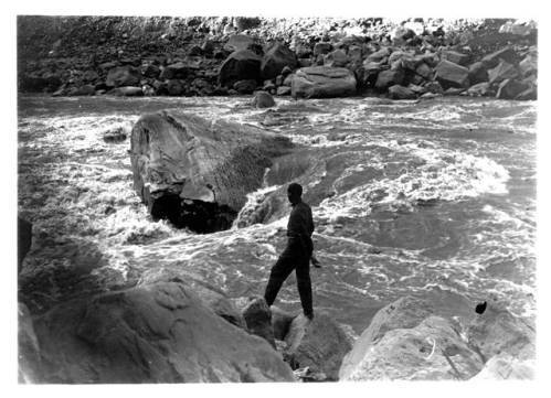
    <summary type="html"><![CDATA[<p><strong><em>An account of the 1911 Kolb expedition through the Canyonlands, which was one segment on their way from Wyoming to the Grand Canyon.</em></strong></p><img src="https://www.intermountainhistories.org/files/fullsize/63f1b60851aed0c6604d6b24c4c70d45.jpg" alt="Rapid #22 Little Niagara" /><br/><p>The two intermountain rivers, the Green and the Grand, combined to form the Colorado River. The first canyon of the unified river is so incredibly wild, that when Major John Wesley Powell first descended it, he deemed that these were not ordinary rapids but cataracts or waterfalls. Emery and Ellsworth Kolb sought not only to navigate its tumultuous waters, but photograph and film their exploits as well. They hoped to provide material to show at their photography studio on the Grand Canyon rim, and in a traveling motion picture show. Prior to their 1911 expedition, there were only four known successful voyages through Cataract Canyon, and seven earlier parties that had attempted it were presumed lost. The brothers would attempt to run it in their wooden boats, The Defiance and The Edith that had been repaired many times over. From October 26th to November 2nd, 1911, the brothers negotiated some of the roughest water in the entire watershed, nearly losing their lives several times. </p><p>In a river over a hundred yards wide and with rapids a third of a mile in length, the brothers took advantage of the huge waves to obtain some excellent film in the twelve miles following the confluence. Moving into the center of Cataract Canyon, the channel narrowed and the thrills increased for the river-runners.  Nearly every rapid attempted by the brothers left them soaked and their boats swamped, but each time they passed one without major injury, the brothers’ confidence grew as well. Worsening their troubles, several rapids—21,22, and 23—brought the greatest descent on the whole river, plunging seventy-five feet in three-quarters of a mile. Rapid #22 in particular tested their resolves, when the river threw both their boats against the rocks, causing minor damage. Emery developed a minor sickness as a result of persistent rain, leaving it up to Ellsworth to run both boats through the larger rapids. The benefit to this illness was that it freed Emery to work the camera in dramatic canyons. Continuing through Big Drop Three, a notorious rapid near the end of the cataracts, the brothers came to the confluence of Dark Canyon. Here, they observed above them a cliff-dwelling, pictographs and pinecones—all signs of the heavily forested Bears Ears Mountains, rich with the treasures of native antiquity. </p><p>Despite many scares, the brothers made it out of Cataract Canyon in only four days, and filmed much of the journey. They shot the first motion picture footage of the region, along with some of the earliest photography. The experiences exposed on glass-plates and film by their cameras would strike awe into audiences for decades to come. The brothers were now more than prepared for a journey through Glen Canyon, the second to last major stretch before getting home to Bright Angel, Arizona.</p><p><em><strong><a href="https://www.intermountainhistories.org/items/show/59">For more (including 4 images) view the original article</a></strong></em></p>]]></summary>
    <published>2017-06-05T18:48:30+00:00</published>
    <updated>2026-04-17T19:31:59+00:00</updated>
    <link rel="alternate" type="text/html" href="https://www.intermountainhistories.org/items/show/59"/>
    <id>https://www.intermountainhistories.org/items/show/59</id>
    <author>
      <name>Jonas Dunlap, Northern Arizona University</name>
    </author>
  </entry>
  <entry>
    <title type="html"><![CDATA[The 1911 Kolb Expedition in Glen Canyon: Part 4 of 5 of the 1911 Kolb Expedition Tour]]></title>
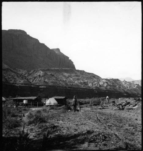
    <summary type="html"><![CDATA[<p><strong><em>A detailed account of two photographers’ river trip through Glen Canyon, a land of amphitheaters, arches, and ruins.</em></strong></p><img src="https://www.intermountainhistories.org/files/fullsize/746512ee18801850746c8da7638e720b.jpg" alt="Hite Ranch in Utah, 1911" /><br/><p>Emery and Ellsworth Kolb’s experience in Glen Canyon began at the remote settlement of Hite, Utah. There, the two brothers recovered from the previous trials of Cataract Canyon and wrote home to their families. Staying only a night, the duo waved goodbye to local legend Cass Hite and began the next leg of their trip to Bright Angel, a four- day journey to Lee’s Ferry. From November 3rd  to November 6th, 1911, the brothers became some of the only people to photograph the original landscapes in Glen Canyon, which is noted for ancestral native ruins, arches, amphitheaters, domes, and hieroglyphics. This area is now inundated by Lake Powell, and modern boat access is much easier and more comfortable than negotiating the river in an early 20th century Racine Co. wooden craft used by the brothers. Emery’s and Ellsworth’s primary motive for the expedition was to capture material for their photography business, and they took full advantage of Glen Canyon’s steady waters and picturesque views to obtain film that would captivate the public for decades to come. </p><p>The brothers enjoyed exploring the region’s cliff dwellings and natural stone bridges. Ellsworth described in his book a fascination with those near the confluence of the Escalante River, remarking, “What a story these cliffs could tell!” He then likened the tribes of the Southwest to European factions, making their last stand on the cliffs, and comparing the Colorado to the other great desert river - the Nile. At Deep Canyon, the brothers refocused on the river as it meandered through a sheer, narrow gorge. They had trouble finding a suitable campsite above the confluence with the San Juan; the few banks consisted of quicksand and mud. Under a full moon they drifted past the San Juan and into a black gorge where no moonlight entered. When they heard roaring water, the brothers scrambled out of their boats onto the bank for the night. The next morning they discovered the rapid they had heard was nothing more than swift water, and were astounded by the ominous Navajo Mountain towering above. This sighting marked a sort of premature homecoming, as they had often seen the rounded peak from their home at the Grand Canyon. After spending a day searching unsuccessfully for Rainbow Bridge, the brothers set their final camp in Glen Canyon at Ute Ford, otherwise known as the Crossing of the Fathers. Using a swift current and some hard paddling, Emery and Ellsworth floated into Lee’s Ferry the evening of November 6th. They got a hot meal and made boat repairs before taking on the last leg of their journey - into the Grand Canyon. </p><p>Without the constant demands of whitewater, Glen Canyon gave the two photographers much-welcomed free time to explore the river and its tributaries. The brothers had no way of knowing it at the time, but their careful descriptions and photography still provide a rare look into a lost canyon.</p><p><em><strong><a href="https://www.intermountainhistories.org/items/show/57">For more (including 4 images) view the original article</a></strong></em></p>]]></summary>
    <published>2017-06-05T17:07:20+00:00</published>
    <updated>2026-04-17T19:31:58+00:00</updated>
    <link rel="alternate" type="text/html" href="https://www.intermountainhistories.org/items/show/57"/>
    <id>https://www.intermountainhistories.org/items/show/57</id>
    <author>
      <name>Jonas Dunlap, Northern Arizona University</name>
    </author>
  </entry>
</feed>