<?xml version="1.0" encoding="UTF-8"?>
<feed xmlns="http://www.w3.org/2005/Atom">
  <title type="text">Intermountain Histories</title>
  <updated>2026-04-17T19:32:20+00:00</updated>
  <generator uri="http://framework.zend.com" version="1.12.20">Zend_Feed_Writer</generator>
  <link rel="alternate" type="text/html" href="https://www.intermountainhistories.org/"/>
  <link rel="self" type="application/atom+xml" href="https://www.intermountainhistories.org/items/browse?output=rss2"/>
  <id>https://www.intermountainhistories.org/</id>
  <author>
    <name>Intermountain Histories</name>
    <uri>https://www.intermountainhistories.org</uri>
  </author>
  <link rel="hub" href="https://pubsubhubbub.appspot.com/"/>
  <entry>
    <title type="html"><![CDATA[The Logan Temple]]></title>
    <summary type="html"><![CDATA[<p><strong><em><span style="font-weight:400;">Those descending out of Sardine Canyon are welcomed into Cache Valley by the Logan Temple. Perched atop the east bench of the valley, it stands 170 feet tall. For nearly a century and a half, the temple has been an icon of the valley and a testament to the diligence of the pioneers who built it.</span></em></strong></p><img src="https://www.intermountainhistories.org/files/fullsize/61cf1188f0d820b0bea3b8f3c5a1bb52.jpg" alt="Aerial view of the Logan  UtahTemple" /><br/><p><span style="font-weight:400;">The first settlement attempt of Cache Valley occurred in 1856. Having endured the brutal winter, more Latter-day Saints migrated north, and Cache Valley became an established community. But even before the area was well established, prophecies were given by church leaders on the future construction of a temple.</span>
<span style="font-weight:400;">In an 1863 meeting, Wilford Woodruff of the church’s Quorum of the Twelve Apostles said that the day would come when great cities would fall but that Logan and its temple would outlast them. Ground was finally broken on the temple in 1877, beginning a seven-year construction process. Financing the temple was a challenge for these pioneers, but they rose to the occasion. The total expenses for the temple amounted to just over $600,000, with half consisting of labor costs. Through various programs and 100% volunteer labor, the Saints were able to complete the temple and have it ready for dedication exactly seven years after breaking ground.</span>
<span style="font-weight:400;">The dedication services were held from May 17th to 19th, 1884. Church president John Taylor presided and offered the dedicatory prayer. As part of that prayer, he said, “We feel, O Lord God, our weakness and unworthiness before Thee, and our inability to do anything without Thy guidance and assistance; but as Thou hast given us a commandment…we have built this house, and present it to Thee, and pray that Thou wilt accept it in the name of Thy Son Jesus Christ.” This prayer reflects the attitudes of those that built the temple, who believed their total reliance was on God and saw the majestic building as a humble offering.</p><p>As part of the Golden Jubilee celebration of the Logan Temple in 1934, poet Harrison R. Merrill wrote of the temple:</p><p><i>“Against the turquoise Utah skies</i><i>Two solemn temple towers rise,</i><i>Twin beacons marking well the place</i><i>Where children of a mighty race</i><i>Of Pioneers assemble. They came from far</i><i>The temple gleams – A guiding star.”</i></p>
<span style="font-weight:400;">The temple has since undergone major renovations, including a complete gutting of the interior in 1976. The renovation aimed to improve efficiency in temple ordinance work but came at the expense of historic pioneer craftsmanship. Many lament the loss of pioneer heritage, but plans are in place to restore some of the original style. In 2019, church president Russell M. Nelson stated, “Ours is a sacred responsibility to care for [pioneer-era temples]. Therefore, these pioneer temples will soon undergo a period of renewal and refreshing and, for some, a major restoration. Efforts will be made to preserve the unique historicity of each temple wherever possible.” As of December 2024, no additional plans for renovations have been announced.</span></p><p><em><strong><a href="https://www.intermountainhistories.org/items/show/884">For more (including 3 images) view the original article</a></strong></em></p>]]></summary>
    <published>2025-01-29T00:24:55+00:00</published>
    <updated>2026-04-17T19:32:20+00:00</updated>
    <link rel="alternate" type="text/html" href="https://www.intermountainhistories.org/items/show/884"/>
    <id>https://www.intermountainhistories.org/items/show/884</id>
    <author>
      <name>Cameron Carlson, Brigham Young University</name>
    </author>
  </entry>
  <entry>
    <title type="html"><![CDATA[Jacob Hamblin Home]]></title>
    <summary type="html"><![CDATA[<p><strong><em><span style="font-weight:400;">The Jacob Hamblin home rests atop a small hill in the southern Utah pioneer town of Santa Clara. It stands as a monument to the man who played an important role as an Indian agent to the Paiutes and a community leader in southern Utah during the Latter-day settlement period.</span></em></strong></p><img src="https://www.intermountainhistories.org/files/fullsize/046e4adca37e858735e09524a06f24d0.jpg" alt="Jacob Hamblin Home" /><br/><p><span style="font-weight:400;">The Jacob Hamblin home has its stone foundation buried deep in the history of southern Utah. As a teenager, Jacob Hamblin had a spiritual experience wherein he felt called to work as an intermediary between the Latter-day Saints and Natives, which he felt was a lifetime calling. In 1854, Brigham Young called Hamblin and two dozen men to serve in the Southern Utah Indian Mission to work among the Paiutes. Hamblin founded the town of Santa Clara that same year, naming it after the nearby Santa Clara River. Hamblin and other Latter-day Saint newcomers recruited local Paiutes to assist them in the construction of Fort Clara. Hamblin and his family lived there until a great flood destroyed the fort and much of the settlement in 1862. </span>
<span style="font-weight:400;">With Fort Clara destroyed, leaders of The Church of Jesus Christ of Latter-day Saints sent skilled stone mason to build Hamblin a home for Hamblin and his family, consisting of wives Rachel Judd, Sara Priscilla Leavitt, and their respective children in 1863. After Rachel passed away he married Louisa Bonelli in 1865. The Hamblin home operated as the mission home, yet his important duties as president of the Southern Utah Indian Mission and as an Indian agent kept Hamblin from being home on many occasions. Yet, his endeavors in the region proved influential and significant for the Church and to Utah Territory. In 1868 the families moved to Kanab, where he continued his missionary labors among the Hopis and Navajos. Hamblin’s wife Priscilla fondly recalled, “With regrets, we left the big rock house in Santa Clara [in 1868]. This had been our first real home.”</span>
<span style="font-weight:400;">Jacob Hamblin’s work took him throughout Utah, Nevada, New Mexico, and Arizona. Between 1858 and 1863 he circumnavigated the Grand Canyon by boat. Later, in 1867, Hamblin floated down the Colorado River from the mouth of the Grand Wash to the Virgin River. In addition to his exploration ventures, Hamblin worked hard to establish peaceful relations with the neighboring tribes. In one such instance, local Paiutes worked with Latter-day Saints to build a dam to hold water for irrigating land around Santa Clara. In 1856, little rain fell and the crops wilted. Some Paiutes blamed Hamblin. </span>
<span style="font-weight:400;">The next morning Hamblin prayed, asking God for rain so that the settlers and Paiutes might maintain good relations. Having received an answer, Hamblin reported to all that they would indeed have the water they needed. The following day it began to rain, and that year the settlers and Paiutes grew record crops. From that time on, Hamblin held great standing among the Paiutes. Hamblin also brokered a peace between the Latter-day Saints and the Navajos at Fort Defiance, Arizona. Hamblin’s life is replete with moments like these—miracles, treaties, and the development of great relations with Natives. While Jacob Hamblin and his family only lived in the Jacob Hamblin home for several years, it stands as a lasting testament to the man who proved so instrumental in the development of southern Utah.</span></p><p><em><strong><a href="https://www.intermountainhistories.org/items/show/882">For more (including 5 images) view the original article</a></strong></em></p>]]></summary>
    <published>2025-01-27T05:47:00+00:00</published>
    <updated>2026-04-17T19:32:20+00:00</updated>
    <link rel="alternate" type="text/html" href="https://www.intermountainhistories.org/items/show/882"/>
    <id>https://www.intermountainhistories.org/items/show/882</id>
    <author>
      <name>Hayden Cottle, Brigham Young University</name>
    </author>
  </entry>
  <entry>
    <title type="html"><![CDATA[Thomas Rhoads, The Forgotten Mormon<br />
]]></title>
    <summary type="html"><![CDATA[<img src="https://www.intermountainhistories.org/files/fullsize/8270cbc2aff28b5cd485285278466bee.jpg" alt="Map demonstrating the “Old Spanish Trail” initially used by Colonial Spanish in the late sixteenth century." /><br/><p><span style="font-weight:400;">Born in 1796 in Kentucky, Thomas Rhoads fought for the U.S. Army in the War of 1812. Marrying his first wife Elizabeth Forter in 1817, having sixteen children together, he then converted to The Church of Jesus Christ of Latter-day Saints in Nauvoo, Illinois, in 1835. Rhoads belonged to the Danites and to the Nauvoo Legion as Lieutenant. He moved his family from Illinois to Missouri and finally to California. Rhoads led the first LDS pioneers into future Utah Territory in 1846, before continuing west into California, where he struck gold. After Samuel Brannon refused church leaders’ call to return to Great Salt Lake City, Brigham Young wrote to Rhoads asking him to lead members and tithes back to Salt Lake.</p> <span style="font-weight:400;">Arriving in 1849 at the head of a wagon train, the Saints hailed Rhoads as a hero in a parade wherein Young spoke of Rhoads’ vital contributions of gold to the territory. Submitting four thousand dollars’ worth of gold members had sent as tithing, Rhoads then gave his own seventeen thousand dollars of gold. In exchange Rhoads was given an exceptional plot of land near the temple in Salt Lake and credited with over ten thousand dollars in the church bank ledger, the only man to receive his own dedicated page in the ledger aside from Brigham Young himself.</p> <span style="font-weight:400;">Rhoads served Brigham Young in many ways to help establish Utah Territory’s economic footing over the coming years. Young handpicked Rhoads multiple times to accompany him on scouting parties around the state to determine future settlements. Furthermore, Rhoads continued to provide a steady supply of gold each year to the Mormon mint. Multiple primary sources describe his deliveries in person; however, the church ledgers do not record the deposits, and scholars debate the amounts. Ultimately, the income was crucial to the young community facing extreme opposition as minted gold coins contributed to the perpetual immigration fund as well as construction of the temple.</p> <span style="font-weight:400;">Just as the amount is contested, so are the various sources. Accounts detail how Rhoads knew about a multitude of old mines in the mountains, abandoned by the Spanish. Several of these mines have been located and confirmed, others were claimed to have been found but were not accessible, while others still are lost. Most controversial amongst these is “Carre Shin Ob” located near White Rocks Canyon in the Wasatch Forests of Eastern Utah. As the story goes, in 1852 Brigham Young and Utes Chief Walker entered an arrangement thanks to Isaac Morely, wherein Rhoads would be permitted to travel alone deep into Indian territory to retrieve gold for the Mormon church. Walker was a convert and believed in the church, giving three simple rules: only Rhoads may know the location, he only takes the specified amount, and no Ute Indians would transport gold.</p> <span style="font-weight:400;">Dozens of accounts detail Rhoads’ travels; and the days absent compared to confirmed distance traveled proves wherever Rhoads retrieved gold from, he did not have to mine it himself. Scientific analysis of remaining Mormon mint coins matches the chemical makeup of old Spanish gold mined in the era. There are critiques that doubt the stories of Rhoads’ lost mine; regardless, Rhoads gathered gold from somewhere and this gold was immensely important to the foundation of Salt Lake City and eventually Utah.</span></p><p><em><strong><a href="https://www.intermountainhistories.org/items/show/877">For more (including 4 images) view the original article</a></strong></em></p>]]></summary>
    <published>2025-01-25T03:15:14+00:00</published>
    <updated>2026-04-17T19:32:20+00:00</updated>
    <link rel="alternate" type="text/html" href="https://www.intermountainhistories.org/items/show/877"/>
    <id>https://www.intermountainhistories.org/items/show/877</id>
    <author>
      <name>Travis Sorensen, Brigham Young University</name>
    </author>
  </entry>
  <entry>
    <title type="html"><![CDATA[The Captivity of Olive Oatman]]></title>
    <summary type="html"><![CDATA[<p><strong><em><span style="font-weight:400;">In the wake of a massacre, an orphaned girl is taken captive and raised by Native Americans on the Western Frontier. She returns to Euro-American society in adulthood, becoming a shrouded mystery through each conflicting narrative she spins.</span></em></strong></p><img src="https://www.intermountainhistories.org/files/fullsize/3ed4a32f7a4e886223523110e2babe43.jpg" alt="Portrait of Olive Oatman, 1863." /><br/><p><span style="font-weight:400;">A town in the Black Mountains of Mohave County formerly called “Vivian” after a mining company was renamed “Oatman” in 1909 to honor Olive Oatman, the victim of an infamous kidnapping. The Oatmans were Mormon pioneers who left their home in Illinois to build a new life in the Salt Lake Valley of what is now Utah. They were traveling through Arizona in February 1851 when they were ambushed by a tribe, believed to have been Western Yavapai. They killed Royce Oatman and his pregnant wife as well as four of their seven children. One son, Lorenzo, was able to escape. Sisters Olive and Mary Ann, who were about thirteen and eight-years-old, were taken captive. Neither of them had shoes and Olive was terrified that they would kill her little sister because she had a hard time keeping up with the pace of their travel. They were kept as slaves for about a year until they were sold to Mojaves for an assortment of horses, blankets, vegetables, and beads.</span>
<span style="font-weight:400;">Life with the Mojaves was more comfortable for Olive and Mary Ann as they were adopted by a tribe leader and his wife and were treated as members of the family rather than servants. In Olive’s earliest interview post-captivity she recalls that the Mojaves treated her and her sister “very well.” Members of their tribe made shoes for the girls and did their best to protect them–which included giving them tribal chin tattoos which were believed to grant access to the afterlife. Despite their best efforts, Mary Ann and several members of the tribe died of starvation during a drought in 1858. White settlers in surrounding communities began to notice Olive’s presence in the Mojave tribe, and they grew increasingly concerned. She became something of a legend before she was willfully released by the tribe to re-enter American society in 1856. </span>
<span style="font-weight:400;">Now nineteen-years-old, this transition was jarring for Olive. She had lived with the Yavapais and Mojaves for five years and was a stranger to her old way of life. She struggled to overcome culture shock and grew increasingly homesick for her Mojave family. One bright spot for Olive during these years was reuniting with her brother Lorenzo, who had been searching for her and Mary Ann for years. As she worked to readapt and relearn to dress, speak, and behave–her accounts of her time with the Western Yavapai and Mojave tribes blurred together and turned sour. A reverend, R. B. Stratton, quickly took interest in Olive’s story. He wrote a book, published a year after her return, called </span><i><span style="font-weight:400;">Captivity of the Oatman Girls</span></i><span style="font-weight:400;">. It was riddled with misinformation and prejudice, and the twisted narrative seemed to become a story Olive herself believed. Stratton arranged speaking tours for Olive all over the country, where she shocked people with this crafted version of her life. </span>
<span style="font-weight:400;">At a lecture she gave in Michigan, Olive met a man named John Fairchild, and he seemed to give her the peace she yearned for after so many years of trauma. When they married in 1865 Olive retired from touring and everything to do with Stratton, refusing to perform ever again. John never spoke publicly about her past, and they did their best to live a quiet life in Sherman, Texas. Still she was plagued by her past and mental illnesses, likely PTSD and depression, for the rest of her life. She died in 1903, at the age of 65, leaving behind John and their daughter, Mary Elizabeth. </span>
<span style="font-weight:400;">The scraps of information we have from Olive’s fateful childhood could never do her story justice. Regardless of all the hearsay and sensationalism that grew with her fame, even her earliest interviews are difficult to make sense out of. She was solemn and even glum in nearly every account we have of her, yet she laughed in that first interview while talking about her time with the Mojaves. Olive’s story is as compelling today as it was to those who once gathered in crowds around the country to hear her speak, and the true circumstances of her life remain largely as mysterious.</span></p><p><em><strong><a href="https://www.intermountainhistories.org/items/show/803">For more (including 4 images) view the original article</a></strong></em></p>]]></summary>
    <published>2024-05-16T01:11:43+00:00</published>
    <updated>2026-04-17T19:32:17+00:00</updated>
    <link rel="alternate" type="text/html" href="https://www.intermountainhistories.org/items/show/803"/>
    <id>https://www.intermountainhistories.org/items/show/803</id>
    <author>
      <name>Megan Bailey, Brigham Young University</name>
    </author>
  </entry>
  <entry>
    <title type="html"><![CDATA[George Edward Anderson Photographs]]></title>
    <summary type="html"><![CDATA[<p><strong><em><span style="font-weight:400;">George Edward Anderson is known for pioneering early 20</span><span style="font-weight:400;">th</span><span style="font-weight:400;"> century photography in Utah. His collection shows what was important to Utahns, particularly to members of the Church of Jesus Christ of Latter Day Saints.</span></em></strong></p><img src="https://www.intermountainhistories.org/files/fullsize/718d4ca9986add3c0b25a832b99c478b.jpg" alt="George Edward Anderson" /><br/><p><span style="font-weight:400;">George Edward Anderson was born on October 28, 1860 to parents George Anderson and </span><span style="font-weight:400;">Mary Ann Anderson in Salt Lake City. He was raised a member of the Church of Jesus Christ of Latter Day Saints. As a boy he was apprenticed to Charles R. Savage, a pioneer in photography in Utah, and set up his own studio at the age of 17. In 1886, he established the <em>Temple Bazar </em>studio in Manti, and in 1888 moved it to Springville to the southwest corner of Main and 3rd South Streets. He also operated traveling tent studios.</p><span style="font-weight:400;">Early in his career he took many studio photographs of prominent and everyday Utahns. Later he began to travel and take photographs of significant historical LDS sites. However, his travels took a toll on his relationship with his wife, Olive Lowry Anderson, so he remained home for a period. However his church commissioned him to document new temple dedications in photography. Before going to what would be his last photo shoot, his wife urged him to stay home. He ignored her warning, traveling to the Mesa Arizona Temple dedication. Shortly after the ceremony, he suffered heart failure and died on May 9, 1928 after being transported home. In his obituary the Salt Lake Telegram recounted his accomplishments in photography: “he established a studio at Springville and also had studios at Spanish Fork and Manti... He devoted considerable time to a collection of L.D.S. church historical pictures.”</span>
<span style="font-weight:400;">After Anderson’s death, his collection of photographs changed hands many times. The significance of his images were apparent to many different groups, particularly the Church of Jesus Christ of Latter-Day Saints. A group of LDS seminary teachers in Provo bought Anderson’s collection from his wife in 1928, the year he died. Later Church Historians became aware of the collection and bought it from the seminary teachers. Representatives of the Church of Jesus Christ of Latter Day Saints worked to gather all of the negatives from Anderson’s collection and brought all of his photographs into one collection. After digitizing these negatives, the Church destroyed all but 444 of the glass negatives from the collection. Finally, the collection found a home in the L. Tom Perry Special Collections at Brigham Young University.</span></p><p><em><strong><a href="https://www.intermountainhistories.org/items/show/776">For more (including 6 images) view the original article</a></strong></em></p>]]></summary>
    <published>2024-01-25T05:07:20+00:00</published>
    <updated>2026-04-17T19:32:17+00:00</updated>
    <link rel="alternate" type="text/html" href="https://www.intermountainhistories.org/items/show/776"/>
    <id>https://www.intermountainhistories.org/items/show/776</id>
    <author>
      <name>Starrla Kay Pearson, Brigham Young University</name>
    </author>
  </entry>
  <entry>
    <title type="html"><![CDATA[Battle Creek Canyon Massacre]]></title>
    <summary type="html"><![CDATA[<p><strong><em>Battle Creek Canyon's name originates from Utah's first major skirmish between the Utes and the Mormon militia. </em></strong></p><img src="https://www.intermountainhistories.org/files/fullsize/54eea90162a257c6e9cd4299408aea71.jpg" alt="Kade Dallin, Purple Mountain Majesties, 2020.
" /><br/><p><span style="font-weight:400;">When the pioneers of the Church of Jesus Christ of Latter-day Saints entered the Salt Lake Valley, they generally settled in what is now Salt Lake County on the Wasatch Front. The area was largely a desert and many, including some mountain men, suggested that the people settle further south in the freshwater valley that now comprises the bulk of Utah County. Brigham Young immediately sent out people to found colonies, cities, and towns throughout modern Utah, Arizona, Nevada, California, and Mexico. Yet, the pioneers balked at the initial thought of settlement in Utah Valley because of the native tribes who already lived there. Various bands of the Ute and Timpanogos tribes lived throughout the valley and had a reputation of being warlike and aggressive as a way to defend their land and livelihood. </p>
<span style="font-weight:400;">The pioneers especially resented the Ute practice of poaching the settler’s cattle. Roman Nose, a prominent Ute, was particularly troublesome. He led a band that repeatedly raided the farms and ranches near the valley border, and was even accused of stealing several of Brigham Young’s personal horses. After Brigham Young heard of the theft, he ordered Captain John Scott to lead a posse against the Utes in hopes of apprehending Roman Nose and his band. Their orders were to find the band of thieves and to “take such measures as would put a final end to their depredations in the future.” In 1849, they began raiding the Ute bands they deemed responsible for the loss of the livestock. However, Brigham Young soon discovered that the Utes had been mistakenly blamed: his horses had simply been moved to different pastures. He ordered Scott and the posse to stand down, but they refused. </p>
<span style="font-weight:400;">On the morning of March 5, 1849, the relationship between Mormon settlers and the local band of Timpanogos Indians deteriorated into brutal hostility in what is now Pleasant Grove, Utah. Scott’s rogue posse of 44 men soon arrived where they found the Ute camp which they thought participated in the raids. The group surrounded the sleeping camp and opened fire in a reign of terror. The members of the posse then hunted down many of the Utes who managed to escape the initial shootout. In total, they killed seventeen men, women, and children, including Roman Nose. </p>
<span style="font-weight:400;">After seeing the massacre, the chief of the Native American tribe, Little-Chief was distraught. Although he reportedly agreed that the killing of the supposed thieves was justified, he understood that this would cause a rift to form between white settlers and local tribes. This event, among many other skirmishes, led to heightened tension between the two groups and permanently damaged the already delicate relationship between the Native American tribes and the Mormon settlers. After this event, the area became known as Battle Creek Canyon and is today memorialized by the Battle Creek Marker. </span>


</p><p><em><strong><a href="https://www.intermountainhistories.org/items/show/757">For more (including 2 images) view the original article</a></strong></em></p>]]></summary>
    <published>2023-10-22T05:05:29+00:00</published>
    <updated>2026-04-17T19:32:16+00:00</updated>
    <link rel="alternate" type="text/html" href="https://www.intermountainhistories.org/items/show/757"/>
    <id>https://www.intermountainhistories.org/items/show/757</id>
    <author>
      <name>Kade Dallin, Brigham Young University&amp;#32;&amp;amp;&amp;#32;Bryce Revelli, Brigham Young University</name>
    </author>
  </entry>
  <entry>
    <title type="html"><![CDATA[The Lone Cedar Tree]]></title>
    <summary type="html"><![CDATA[<p><strong><em>In downtown Salt Lake City sits a monument for the Lone Cedar Tree. The Lone Cedar was rumored to be the only tree in the valley at the time Mormon pioneers settled in the area. Its famous role in the story of Mormon settlement has led some to question the tale's veracity.</em></strong></p><img src="https://www.intermountainhistories.org/files/fullsize/a6aa720541f62d8183978d93e3712b78.jpg" alt="A Child with Lone Cedar" /><br/><p><span style="font-weight:400;">In 1847, Brigham Young and his party of Mormon settlers arrived in what would eventually become Utah. Mormons were escaping persecution in the East by the United States. No one had a clear idea of where their destination, and new home, would be, but many agreed that it would have to reside beyond the United States’ political border. Many initially thought that the territories of California or Oregon would be their last stop since it was as far west as one could get from the U.S. without crossing an ocean. However, John C. Fremont’s expeditions into Utah made the territory an attractive place to settle and it was eventually decided that the Utah area would be where the Mormons settled.</span>
<span style="font-weight:400;">Utah was home to the Utes, Paiutes, Dine’, Goshutes, and Shoshone. At the time, some mountain men also lived in the area. These men largely served as road guides for wagoneers heading west and their numbers were generally scarce. Utah was certainly more of a desert than the Mormons envisioned their new home to be and had what many diligent journal writers described as a “dead sea” to accompany it. However, there was one tree, the "Lone Cedar Tree," in the Salt Lake Valley which provided coveted shade. Seemingly everyone used this iconic tree to rendezvous under—children, church officials, lovers, weary travelers. The tree’s significance to these early Mormons was commemorated with a monument in 1933 by the Daughters of Utah Pioneers. The monument initially encompassed the dying tree, but in 1958, the tree was cut down and stolen. A bounty for it was placed by the Daughters of Utah Pioneers. When the missing lumber never turned up, a modified monument was erected in 1960 to preserve what remained of the leveled stump. A bronze replica soon stood in place of the section of tree that was stolen. Unfortunately, the remaining stump of the original tree was later stolen. The monument today contains no traces of the original tree.</span>
<span style="font-weight:400;">However, historians argue whether the tree ever existed in the sense that it is now remembered. Some claim that stories exaggerate the tree’s existence because journals at the time mention other trees in the valley. Some dispute whether the tree was a cedar at all. Moreover, some accounts mention a “Lone Cedar Post” in the proximity of where the tree was believed to have stood, leading a few to believe that it was the post rather than a tree which provided such needed shade. Nevetheless, the memorialization of the lone cedar tree still stands in downtown Salt Lake City to commemorate the pioneer memory that permeates much of early Utah history. </span></p><p><em><strong><a href="https://www.intermountainhistories.org/items/show/702">For more (including 3 images) view the original article</a></strong></em></p>]]></summary>
    <published>2023-02-20T21:21:14+00:00</published>
    <updated>2026-04-17T19:32:15+00:00</updated>
    <link rel="alternate" type="text/html" href="https://www.intermountainhistories.org/items/show/702"/>
    <id>https://www.intermountainhistories.org/items/show/702</id>
    <author>
      <name>Emma Dutcher, Brigham Young University</name>
    </author>
  </entry>
  <entry>
    <title type="html"><![CDATA[Stalwart as Stone: Legacy of the Mason John Rowe Moyle]]></title>
    <summary type="html"><![CDATA[<p><strong><em>Having carved his legacy into the Salt Lake Temple, John Rowe Moyle carved too a living in what could sometimes be an unforgiving land. He proved himself constantly as unmoving as the stones he carved in his determination to better those around him despite any obstacle.</em></strong></p><img src="https://www.intermountainhistories.org/files/fullsize/7034311df1a23fd605d31f02397f502f.jpg" alt="A Picture of John Rowe Moyle" /><br/><p><span style="font-weight:400;">On April 6, 1893, thousands gathered in awe outside the newly dedicated Salt Lake Temple. Embossed upon the eastern edifice of the temple gleamed the golden words, “Holiness to the Lord, the House of the Lord.” Yet the stonecutter who’d carved those words was not among the assembled that day. John Rowe Moyle had died four years prior on February 15, 1889. </span>
<span style="font-weight:400;">Moyle had immigrated to Utah Territory in the 1850’s from England with the Ellsworth Handcart Company. He settled in Alpine with his wife and children. Miner and mason alike, he seemed a natural choice to help carve one of the temple’s most prominent features. Moyle had stalwartly taken up the task. Despite old age, he made the 22 mile hike over the mountains to Salt Lake City every week and then back to spend the weekend with his family. This trek was made all the more difficult when Moyle lost his leg during an accident milking his cow. But Moyle never shirked his duty. Crafting a leg, he re-learned to walk and once more set about carving the words which are now immortalized in one of Utah’s most iconic landmarks. </span>
<span style="font-weight:400;">Moyle left his mark on more than just the temple, though, and he overcame more hardships than the arduous journey to Salt Lake City. Now renamed Moyle Park, his homestead still stands in Alpine. Around the farm are a stone tower and walls which serve to protect it. Moyle’s farm is the only one in the state of Utah to have received such fortifications. Other forts were reserved for the defense of entire towns. Moyle had worked on his family’s home with the same fervor he had worked on the temple. Moyle Park stands as a memorial to John Rowe Moyle’s unwavering determination and selfless duty to church and family.</span></p><p><em><strong><a href="https://www.intermountainhistories.org/items/show/655">For more (including 3 images) view the original article</a></strong></em></p>]]></summary>
    <published>2022-09-16T18:32:18+00:00</published>
    <updated>2026-04-17T19:32:14+00:00</updated>
    <link rel="alternate" type="text/html" href="https://www.intermountainhistories.org/items/show/655"/>
    <id>https://www.intermountainhistories.org/items/show/655</id>
    <author>
      <name>Avery Morgan, Brigham Young University</name>
    </author>
  </entry>
  <entry>
    <title type="html"><![CDATA[Tarlton Lewis, “Grand Old Man”]]></title>
    <summary type="html"><![CDATA[<p><strong><em>Tarlton Lewis, a survivor of the Hawn’s Mills Massacre in Missouri, went on to live an energetic life as he explored the West and settled new towns such as Parowan and Minersville in Iron and Beaver Counties in Utah. He lived his life helping other Latter-day Saints, farming and building on the land, and raising a family in the desert.</em></strong></p><img src="https://www.intermountainhistories.org/files/fullsize/04d4a6e7d1c614593ab9129186616d5d.jpg" alt="Tarlton Lewis" /><br/><p>Tarlton Lewis was the fourth of twelve children born to Neriah Lewis and Mary Moss on May 18, 1805 in South Carolina. Tarlton married Malinda Gimlin on March 27, 1828; over the course of their marriage, they had eight children together. While living in Illinois, Tarlton and Malinda joined The Church of Jesus Christ of Latter-day Saints (sometimes nicknamed “Mormons”) and were baptized July 25, 1836 by Tarlton’s older brother Benjamin Lewis. The brothers joined moved to Missouri to live among other Latter-day Saints, and on October 30, 1838, while living near Hawn's Mill, they were attacked by a violent mob agitating for the expulsion of all Mormons from Missouri. The mob murdered Tarlton’s older brother Benjamin, and Tarlton suffered an injury to his shoulder; their younger brother David, however, was uninjured.
After surviving this tragedy, the brothers moved with other Latter-day Saints to Nauvoo, Illinois. There, Joseph Smith, president of the Church, and his brother Hyrum set apart Tarlton as bishop of the Nauvoo Fourth Ward. Also in Tarlton and Malinda received the endowment and sealing ordinances—the Church’s highest sacraments—before joining the mass exodus of Latter-day Saints from Nauvoo, leaving behind the temple they had spent years helping build.
The Lewis family left as part of the second wave of Saints, fleeing westward across the Mississippi Rive, but Tarlton himself stayed behind to continue his service as a bishop and help the Church members under his care prepare to go West. After many weeks crossing Iowa, they settled temporarily at Council Bluffs in Pottawattamie, Iowa, 1846.
After the Latter-day Saints regrouped in Iowa, Tarlton joined the first company of pioneers departing in 1847. As part of the Vanguard Company led by Brigham Young—Smith’s successor to the Church presidency—Tarlton was captain of 50 wagons and entered the Salt Lake Valley on July 21, 1847. There, Young called Tarlton as the first bishop in Salt Lake Valley, and Tarlton remained in the valley to build cabins and plant crops for the Saints who would arrive next. After an almost two-year separation, Tarlton reunited with his family when they arrived at the Salt Lake Valley on September 21, 1848.
Two years later, in December 1850, the Church called Tarlton to travel with apostle George A. Smith and one hundred others to explore southern Utah. Tarlton again captained 50 wagons, and on January 17, 1851, the explorers officially organized Iron County. In their first election, the young county elected Tarlton Lewis as a magistrate. George Smith organized the settlement into four wards, and Tarlton became bishop of the Second Ward in Parowan. The Lewis family helped build roads, log cabins, and furniture.
After Tarlton’s brother David died in September 1855, Tarlton married two of his brother’s widows as polygamous wives. Tarlton explored the mountains of Beaver Valley for lead ore, finding a mine and becoming a director of it. They also helped found Minersville, and Tarlton was active in the community and donated a portion of his lot to finance a Relief Society building. Life in Minersville was a struggle as farming was difficult with little water from Beaver Creek.
The family managed a humble living for fourteen years until the Church assigned Tarlton to establish a United Order in Joseph, Sevier County. The most pressing issue that settlers faced was the difficulty of irrigating water for farmlands; their hard work was paid off with “diverse crops as apples, apricots, peaches, pears, grapes, and black walnuts,” but there was not enough to make Joseph prosper. The Lewises lived there a few years before moving northeast to the larger town of Richfield, and the United Order in Sevier County dissolved in November 1877. Apostle Erastus Snow then set Tarlton apart as bishop of the Richfield Second Ward on July 16, 1877. As an active citizen of Richfield, Tarlton and a hundred other citizens petitioned the Utah Territorial House to incorporate the town, and the provision passed.
Tarlton’s time as a bishop in Richfield was brief, as health complications warranted his resignation a year later, but he recovered his strength enough to serve as a stake patriarch, as listed in the Sevier Stake Conference for August 27, 1887.
Tarlton Lewis died on November 22, 1890 at Teasdale, Utah Territory, at the home of his son, Beason Lewis. He was buried in the Teasdale Cemetery. In 1987, Mount View Camp, the Daughters of Utah Pioneers, and the Lewis Family sponsored and built a marker and plaque at his burial site in 1987.</p><p><em><strong><a href="https://www.intermountainhistories.org/items/show/633">For more (including 3 images) view the original article</a></strong></em></p>]]></summary>
    <published>2022-07-01T03:06:04+00:00</published>
    <updated>2026-04-17T19:32:13+00:00</updated>
    <link rel="alternate" type="text/html" href="https://www.intermountainhistories.org/items/show/633"/>
    <id>https://www.intermountainhistories.org/items/show/633</id>
    <author>
      <name>Debra Tangren, Brigham Young University</name>
    </author>
  </entry>
  <entry>
    <title type="html"><![CDATA[Fruita Schoolhouse: Learning and Community]]></title>
    <summary type="html"><![CDATA[<p><strong><em>Capitol Reef National Park is one of the greatest hidden gems of Central Utah, home to fossils, beautiful hikes, and several historical sites. Of these historical sites, one of the most popular is the Fruita Schoolhouse, a physical memory of what life was like in humble, nineteenth-century Fruita.</em></strong></p><img src="https://www.intermountainhistories.org/files/fullsize/fdf1c72a53ae4ee8430fc91744c589cd.jpg" alt="Step into the past" /><br/><p>In 1893, historian Frederick Jackson Turner famously claimed the year 1890, three years prior, marked the closing of the American Frontier. It seemed in the 1890s that America’s expansionist spirit was shifting from the continental Wild West to locations abroad such as Cuba and the Philippines, pivoting away from consolidating a land empire and toward questing for a sea empire. Pioneers in Fruita, Utah, however, were still preoccupied in the 1890s with frontier processes. Although they had secured their isolated, red rock land, even in 1890 their community lacked important infrastructure such as education, a postal service, and a building for worship.
As they settled in and secured the land, the pioneers were able to gather sufficient time and organization to put together more of a society, beginning with an education system. Nettie Behunin, a young girl 12 years of age, became one of the first teachers.  Nettie might not have been a truly qualified teacher by twenty-first-century standards—or perhaps even by her own—but her endeavors marked the beginning of the first community project in the area: the schoolhouse.
In a collection of childhood memories of Fruita, Clay M. Robinson reflects on his experience as a young boy in the newly built Fruita schoolhouse as his mother was the teacher at the school during his childhood. He writes, “Most vivid of all in those memories, are Mama and the little one-room sawed-log Fruita school where she taught all eight grades in the years 1925–1927.” He also mentioned that the schoolhouse was used for Sunday church services and Sunday School—most of Fruita were members of The Church of Jesus Christ of Latter-day Saints, or Mormons—because there was no dedicated chapel in Fruita. Since residents could rearrange the in the schoolhouse, the small building served as a community center that could host different events like dances, box socials, knitting group meetings, and gatherings for men and young boys who enjoyed baseball. The Fruita schoolhouse evidently served as a center of the community, where the small number of settlers could gather to enjoy each other’s company.
The Fruita schoolhouse still stands today. Tourists can easily see it as they drive through the park since it is located just to the side of the highway. At times the Park Service offers tours in the old schoolhouse that allow small children to briefly roleplay pioneer school life. This schoolhouse represents the first community building of the Fruita settlement, as well as a reminder of what life was like for the small community of Latter-day Saint settlers.</p><p><em><strong><a href="https://www.intermountainhistories.org/items/show/632">For more (including 4 images) view the original article</a></strong></em></p>]]></summary>
    <published>2022-07-01T01:26:07+00:00</published>
    <updated>2026-04-17T19:32:13+00:00</updated>
    <link rel="alternate" type="text/html" href="https://www.intermountainhistories.org/items/show/632"/>
    <id>https://www.intermountainhistories.org/items/show/632</id>
    <author>
      <name>Rachelle E. Robins, Brigham Young University</name>
    </author>
  </entry>
  <entry>
    <title type="html"><![CDATA[Ephraim Pioneer Cemetery]]></title>
    <summary type="html"><![CDATA[<p><strong><em>Ephraim’s forgotten cemetery stands as a memorial to early Scandinavian settlers and a reminder of violence in pioneer-era Utah.  </em></strong></p><img src="https://www.intermountainhistories.org/files/fullsize/0a0ea5bdb78a58b830875ad874dbde59.jpg" alt="View of Ephraim Pioneer Cemetery Facing East" /><br/><p>The events that led to the creation of Ephraim Pioneer Cemetery reflect the tumult of early Euro-American settlement in Utah. Members of The Church of Jesus Christ of Latter-day Saints established Fort Ephraim in 1854 near, the geographic center of Utah. These first settlers in Ephraim were far from their homelands; most were converts to the Church who had immigrated from Denmark. Consequently, the settlement became known as “Little Denmark.” When Chief Wakara met Brigham Young in 1849 he invited Latter-day Saints to settle in Central Utah, but amicable relations between Euro-American settlers and the indigenous peoples of the region did not last for long. The Walker War fought between Euro-American Latter-day Saints and Utes brought violence to the Ephraim region from 1853 to 1854, just as Fort Ephraim was being built. The first person from Fort Ephraim to die was a Mr. Manwaring, though the details surrounding his death are unknown. The fort was small and did not have a cemetery in the plans, so the settlers received permission to bury Manwaring in Spring City, ten miles to the north. When the funeral party was just two miles out of Ephraim there came word of an imminent attack. Stuck vulnerably between the two settlements, the settlers went no farther but quickly buried Mr. Manwaring’s body and returned to the safety of the fort. These unexpected circumstances determined where Ephraim residents would be buried until 1905, when residents began using the Park Cemetery in town.
Ephraim Pioneer Cemetery hosts the graves of various inhabitants whose diverse occupations were useful to Fort Ephraim’s functions. They were masons, blacksmiths, stonecutters, millers, harness makers, shingle makers and more. Nearly all the names on the cemetery’s headstones end in the Scandinavian “son” or “sen.” Where a place of birth was added, it nearly always indicates Denmark and occasionally Sweden. The history of violence in the area is also etched on the cemetery’s headstones. For example, the marker for Christian Thorpe indicates he was a second lieutenant in the Blackhawk War, fought between the United States and Sauk leader Black Hawk. Additionally, a granite stone marks the burial site of seven individuals who were killed in 1865. Other cemetery residents were victims of drowning, and disease was also a prevalent threat, as evidenced by the many children’s graves. The cemetery acts as a reminder of the many risks early pioneers faced in Utah.
Approaching Ephraim from the north, it is easy to miss the small clump of trees marking the cemetery off in the distance west of the highway. The cemetery is more than a mile out of town and is accessible only by a dirt road.  The cemetery has gone through periods of neglect and renewal through the decades. In 1990, a committee organized to transform the derelict cemetery to a more respectful resting place. In 1995, the Daughters of Utah Pioneers added plaques to inform visitors about the history of the site. In 2017, a local Boy Scout collected old farm equipment from the mid to late-1800s and placed them in the cemetery as part of an Eagle Scout project. Visitors today will see new, shiny replacement headstones for some alongside broken pieces marking the burial of others.</p><p><em><strong><a href="https://www.intermountainhistories.org/items/show/560">For more (including 6 images) view the original article</a></strong></em></p>]]></summary>
    <published>2021-12-18T04:48:49+00:00</published>
    <updated>2026-04-17T19:32:12+00:00</updated>
    <link rel="alternate" type="text/html" href="https://www.intermountainhistories.org/items/show/560"/>
    <id>https://www.intermountainhistories.org/items/show/560</id>
    <author>
      <name>Tessa Smith, Brigham Young University</name>
    </author>
  </entry>
  <entry>
    <title type="html"><![CDATA[The Hotel Metlen]]></title>
    <summary type="html"><![CDATA[<p><strong><em>Joseph Metlen, was a local businessman and politician who wanted to promote city growth in Dillon, Montana, by building a hotel in 1897. The Union Pacific Railroad brought travelers to the hotel.</em></strong></p><img src="https://www.intermountainhistories.org/files/fullsize/18eed40e8c1ccabadaace3e9bdede462.jpg" alt="Hotel Metlen" /><br/><p>Joseph C. Metlen was born in Pennsylvania in 1834. He arrived in Montana, in 1867, thirty years before he constructed Hotel Metlen. He and his brother worked as freighters from Corrine, Utah. Metlen valued his civic duty and represented Beaverhead County in the territorial legislature in 1871 and was elected as county treasurer in Dillion in 1883. As ambitious as he was, Metlen ran for sheriff in 1884 without success. The Hotel Metlen opened to the public on February 11, 1898.
The Metlen’s design modeled the Second Empire Style popular in the nineteenth century. Its most distinguishable feature is the Mansard roof typical of many other hotels built around the same period and most popular between the 1860s and 1880s. The roof’s style is recognizable by the slopes on each side. Another major characteristic of Second Empire architecture is the hotel’s two stories and brick walls. Inside of the building is a lobby, a bar, sample rooms, a kitchen, twenty-seven guest rooms, and the proprietor’s room. 
The hotel did not start successfully, as there were a few issues with its first structure. Originally, when the hotel was still named the Corrine in 1897, the structure was made of cloth-lined partitions that lacked the stability and permanence necessary for it to thrive. In 1892, a fire destroyed the Corrine, leading Metlen to build a new and improved hotel. With a clean slate, Metlen altered the structure’s overall appearance. These changes included painting the exterior white and building a penthouse on the roof. Metlen set up the hotel to potentially have multiple functions. (For example, during WWII, the penthouse served as an aircraft control center for report aircraft movements.) A local newspaper called the Hotel Metlen “the dawn of an era of better things for the city,” as it would attract tourists and provide commerce.
The hotel closed in 2008, but two bars inside the building, owned by Phylly Sax, remain open. Current staff have said that keys go missing and furniture moves, contributing to rumors of hauntings and strange activity. Most of the old furnishings and original woodwork remain intact. The appearance of the inside of the hotel caters to fans of the Old West aesthetic with a hodgepodge of items like pistols and animal skulls.</p><p><em><strong><a href="https://www.intermountainhistories.org/items/show/534">For more (including 5 images) view the original article</a></strong></em></p>]]></summary>
    <published>2021-11-13T08:44:10+00:00</published>
    <updated>2026-04-17T19:32:11+00:00</updated>
    <link rel="alternate" type="text/html" href="https://www.intermountainhistories.org/items/show/534"/>
    <id>https://www.intermountainhistories.org/items/show/534</id>
    <author>
      <name>Nova Jesswein, Northern Arizona University</name>
    </author>
  </entry>
  <entry>
    <title type="html"><![CDATA[The St. Charles Muller’s]]></title>
    <summary type="html"><![CDATA[<p><strong><em>In 1862 when George Remington and Albert Muller were in their twenties, they decided to build a brick hotel to help Carson City in Nevada Territory grow. Remington and Muller named the hotel after Saint Charles, modeling some finer hotels on the East coast with that name.</em></strong></p><img src="https://www.intermountainhistories.org/files/fullsize/2ab1c76dd24f8faad38a2f4360e93c1d.jpg" alt="The hotel restored" /><br/><p>The original owner of the St. Charles was French-born Albert J. Muller. Muller started his career in Carson City as a professional baker until he realized that a hotel business was more promising. Although most of his patrons were French-Canadian wood choppers, the hotel became a frequent host to social gatherings in town.
The hotel is the second oldest in Nevada, and it is one of the oldest extant commercial buildings in Carson City. It was typical for commercial buildings in the late-nineteenth century to have a low-pitched roof, decorative brackets under a cornice, and tall narrow windows. Initially, the hotel existed as two separate buildings. Construction on the northern section, the St. Charles, started April 1, 1862, and the southern section, the Muller Hotel, began the following month. Numerous alterations to the hotel over the years result in its unique look, not belonging to any particular architectural period. The architectural style is closest to Italianate, a style that was most common for many American main-street commercial buildings. 
The hotel remained a successful business as it went through several name and ownership changes until the 1980s. Before its period of decline, the hotel went through many transformations. In 1895, Gilbert and Dorcas Briggs changed its name to the Briggs’ House. In 1910, it became the Golden West Hotel. Over the years, the hotel changed again and was known as the Travelers Hotel, Hotel Page, the Pony Express Hotel when it was at its largest room count, and finally back to St. Charles Muller’s Hotel. Overall, the hotel’s ownership changed sixteen times over a 142-year period. On top of its many name changes, the hotel building has also several different businesses occupy its grounds. Some of these were a stagecoach office, a saloon, a restaurant, retail shops, and a grammar school classroom.
Not much of the building remains in its original form, yet it shows signs of the changes it has gone through in its purposes, names, and owners. Today, the hotel is beautifully painted red and gold. Rooms with modern décor and comforts are available through Airbnb, making it easy to book online. In the hotel’s history, there were periods of time where the hotel was inaccessible, but today it is open and catering to current methods of booking a place to stay.</p><p><em><strong><a href="https://www.intermountainhistories.org/items/show/533">For more (including 4 images) view the original article</a></strong></em></p>]]></summary>
    <published>2021-10-27T02:55:06+00:00</published>
    <updated>2026-04-17T19:32:11+00:00</updated>
    <link rel="alternate" type="text/html" href="https://www.intermountainhistories.org/items/show/533"/>
    <id>https://www.intermountainhistories.org/items/show/533</id>
    <author>
      <name>Nova Jesswein, Northern Arizona University</name>
    </author>
  </entry>
  <entry>
    <title type="html"><![CDATA[The Grand Imperial Hotel]]></title>
    <summary type="html"><![CDATA[<p><strong><em>The Thompson brothers constructed the Grand Imperial Hotel in 1882. The first train from Durango to Silverton, Colorado, arrived on July 4, 1882, the same year that construction of the hotel started.</em></strong></p><img src="https://www.intermountainhistories.org/files/fullsize/4e0e539a981e9dcd42a2fbe332095b39.jpg" alt="Grand Imperial" /><br/><p>The founder of The Grand Imperial, C.S. Thompson, represented the Crown Perfumery in London, England. He moved to Silverton, Colorado in 1882 to inspect mining prospects, and he purchased four lots of the twenty-first block to make Silverton “the best town in the Southern part of Colorado.” Thompson knew that a hostelry was necessary for housing visitors such as wealthy mine owners, black powder explosives salesmen and other speculators. Many of the early guests were, like Thompson, silver barons checking on their holdings.
The structure of the building includes French Second Empire features such as dormer windows that extend from the Mansard roof. The columns on the exterior of the first floor are examples of Italianate architecture. The centerpiece in the tavern was made of mahogany and cherry wood backed by three one-inch-thick plate glass mirrors that were imported from France. Much of the western influence in the hotel’s design is due to later owner Winfield Morton wanting to incorporate his Texas background into the heavily Victorian appearance. The result was the addition of western furnishings and interior decorating. Yet, the most recent owners stated that “there was never a more classic example of Victorian architecture.” Although the decorations and general appearance are eclectic, the owners chose to maintain a uniform appearance to match what the building looked like in its most successful period during the silver rush. 
The hotel was originally known as the Grand Hotel and has gone through many phases since, not all of which were successful. The construction plans for the hotel included three stories, arch windows, a saloon, a dining hall, stores, offices, guest rooms, sample rooms, and suites. The first floor housed the local post office, the town bank, the Bureau of Mines, a general store, a doctor’s office, and the <em>Silverton Standard Newspaper</em>. The second-floor housed courtrooms for the town government. The Sample Room allowed for salesmen to use the hotel for their commercial ventures. Instead of lugging sample cases, businessmen could leave their belongings to sell in a room near to where they were staying. In 1950 Winfiled Morton of Texas bought the hotel but after refurbishing it he went into foreclosure. In 1958 management passed to a longtime resident of Silverton, Lou Parcell, until he passed it along to the Broadmoor Hotel’s ownership group in 1963. 
The Harper family—who also owned the Durango and Silverton Narrow Gauge Railroad—bought the hotel in 2015 to begin restoration. The family restored windows, carpet, and bathrooms. The Harpers added authentic furniture from the late nineteenth to guestrooms to restore the hotel as closely as possible to the state of its original appearance. </p><p><em><strong><a href="https://www.intermountainhistories.org/items/show/532">For more (including 3 images) view the original article</a></strong></em></p>]]></summary>
    <published>2021-10-23T12:28:36+00:00</published>
    <updated>2026-04-17T19:32:11+00:00</updated>
    <link rel="alternate" type="text/html" href="https://www.intermountainhistories.org/items/show/532"/>
    <id>https://www.intermountainhistories.org/items/show/532</id>
    <author>
      <name>Nova Jesswein, Northern Arizona University</name>
    </author>
  </entry>
  <entry>
    <title type="html"><![CDATA[The Strater Hotel]]></title>
    <summary type="html"><![CDATA[<p><strong><em>The Strater Hotel opened on August 31, 1888, during the silver rush. It was a block and a half away from the narrow-gauge railroad depot and directly in front of the track.</em></strong></p><img src="https://www.intermountainhistories.org/files/fullsize/5f506f27fbda007b66082962ac8c9838.jpg" alt="Reception desk" /><br/><p>Henry Strater, a pharmacist from Cleveland, developed an interest in seeing the town of Durango, Colorado prosper. Believing the town needed place for railroad travelers to stay, Stater built the hotel with his brothers, Fred and Frank, and his father Antone, who backed the costs of building. The three brothers traveled to Durango by train in 1880 to bid on a plumbing contract in the town’s early days. Within the first few months of their arrival, the brothers established the Strater Brothers Paints and Oils Store. Henry was less interested in selling goods and more intrigued by the prospects of the hotel business. However, Henry had no desire to run the hotel and he leased the building to a proprietor named H.L. Rice. 
At the height of the Gilded Age, architects combined historical styles. The Strater is an excellent example, as the structure of the hotel is an eclectic Victorian design with a boxy Italianate Romanesque structure and Renaissance details. The original building included a corner tower that combined Palladian and Gothic architecture. The original four-story brick building sits on the southwest corner of Main Street and 7th Street. Henry Strater constructed a three-story annex in 1892. The owners restored or refurbished the lobby and guest rooms to maintain its original condition as needed. The extravagant appearance cost $70,000, and the building’s height fit the narrative of Durango’s boom-town atmosphere. Desires to expand the city resulted in the improvements to the hotel. 
The hotel declined in the Silver Panic of 1895, when the market price of silver plummeted. Mining was no longer profitable as it once wa,s and both Durango and the Strater Hotel lost income. Henry Strater and H.L. Rice went out of business due to the panic’s financial devastation, as many of their visitors were miners checking on their holdings. After losing the hotel, Henry Strater and his wife Carrie moved to Philadelphia, leaving behind the once successful hotel. Hattie Mashburn and Charles E. Stilwell bought the hotel in 1893. At the turn of the century, Mashburn and Stilwell offered opera and fine dinners at the hotel. It was the start of a new era for the Strater. 
Jentra and Earl Barker Jr., whose family bought the hotel from Stillwell and Mashburn in 1926, are credited for renovating the Strater. Their goal was to restore the interior to resemble how it may have looked in the Victorian Era. The couple found authentic Victorian furniture at antique stores. Their son continued the restoration by adding woodwork and hand-printed wallpaper by Bradbury and Bradbury, a company that specializes in recreating historical patterns. 
The legacy of the Strater is in the hands of the current owner, Rod Barker, who continues to hold up the standard of the hotel. The Office Spiritorium, award-winning Mahogany Grill, and The Diamond Belle Saloon with Ragtime Pianists, are all parts of the hotel that make it inviting to guests. Barker has incorporated the collective vision of each of the hotel’s previous owners to create an exciting place for visitors to stay, while still heavily embracing historical background. </p><p><em><strong><a href="https://www.intermountainhistories.org/items/show/531">For more (including 3 images) view the original article</a></strong></em></p>]]></summary>
    <published>2021-10-23T00:50:39+00:00</published>
    <updated>2026-04-17T19:32:11+00:00</updated>
    <link rel="alternate" type="text/html" href="https://www.intermountainhistories.org/items/show/531"/>
    <id>https://www.intermountainhistories.org/items/show/531</id>
    <author>
      <name>Nova Jesswein, Northern Arizona University</name>
    </author>
  </entry>
  <entry>
    <title type="html"><![CDATA[Glen and Bessie’s Colorado River Trip, Part 1: Lee’s Ferry]]></title>
    <summary type="html"><![CDATA[<p><strong><em>Hoping for fame and wealth, Glen and Bessie Hyde began the adventure that has since then lived in infamy in Grand Canyon Lore. One of their last stops before entering the Grand Canyon was Lee’s Ferry. </em></strong></p><img src="https://www.intermountainhistories.org/files/fullsize/5ca492318f46bcb92d010b211cc24f53.jpg" alt="Ferry and ranch" /><br/><p>John D. Lee, a member of The Church of Jesus Christ of Latter-day Saints, founded Lee’s Ferry in the early 1870s to function as a link between the Latter-day Saint heartland in Utah and new settlements in Arizona. A committed polygamist, Lee built several houses for his multiple families in the following years, naming this group of buildings Lonely Dell Ranch. After the authorities arrested Lee for his role in the Mountain Meadows Massacre of 1857, Church leaders gave the title for the Ferry and Ranch to Warren Johnson and his family in 1879. The Johnson family was still living on the post when Glen and Bessie Hyde arrived on November 5, 1928, though the Ferry had permanently closed that summer.
The Hydes had started their journey from Greenriver, Utah, on October 20, well provisioned with food and other supplies. They came equipped with all the necessary tools to document their trek, including a small Kodak camera and a notebook which Bessie used to record daily events. Yet curiously they did not take any life preservers or personal floatation devices with them.
The Hydes’ trip to Lee’s Ferry was relatively uneventful, aside from Bessie falling out of the scow on October 27 in Cataract Canyon. Overall, both were in good spirits.
The inhabitants of Lee’s Ferry were aware of the hazards of the Colorado River. Glen and Bessie were just one in a series of river expeditions that came through Lee’s Ferry. Other private excursions, Latter-day Saint expeditions, and US Government Survey teams had all passed by the post through the years. Most of these groups had foundered in the rough waters south of the station, just before the entrance to the Grand Canyon. Also, three of the inhabitants had drowned when they tried to recover the outpost’s ferryboat after a summer flood washed it away in June. 
With these past events in mind, the Johnson family and the outpost’s government agent, Owen Clark, attempted to convince Glen and Bessie to abandon their trek. They warned them their scow wasn’t suited to the rapids downriver. If they continued, the size of their boat and their lack of life preservers could result in disaster. However, the Hydes did not take the resident's concerns seriously, convinced they were already through the worst the Colorado River had to offer.
After exploring the surrounding area for a few days, the Hydes left the station on November 8. They were bound for Grand Canyon Village. In an ironic twist, the last glimpse of the couple caught the station’s residents caught was of Glen nearly falling off the scow.
In the years following the Hydes’ disappearance, Lee’s Ferry became a backwater. The completion of the Navajo Bridge several miles downstream in 1929 rendered the ferry obsolete. The post became a ghost town by the early 1940s. Today, it’s a historic site maintained by the National Park Service.</p><p><em><strong><a href="https://www.intermountainhistories.org/items/show/522">For more (including 5 images) view the original article</a></strong></em></p>]]></summary>
    <published>2021-10-20T06:55:57+00:00</published>
    <updated>2026-04-17T19:32:11+00:00</updated>
    <link rel="alternate" type="text/html" href="https://www.intermountainhistories.org/items/show/522"/>
    <id>https://www.intermountainhistories.org/items/show/522</id>
    <author>
      <name>William Knapp, Northern Arizona University</name>
    </author>
  </entry>
  <entry>
    <title type="html"><![CDATA[Historic Pine Valley&#039;s Latter-day Saint Chapel]]></title>
    <summary type="html"><![CDATA[<p><strong><em>In 1856, early settlers of Southern Utah built a chapel in Pine Valley. It is the longest-operating chapel in The Church of Jesus Christ of Latter-day Saints.</em></strong></p><img src="https://www.intermountainhistories.org/files/fullsize/b7335f22f5911fdde2b2529a24866156.jpg" alt="Pine Valley Chapel today" /><br/><p>While herding cattle during the summer of 1855, members of The Church of Jesus Christ of Latter-day Saints who had been called to settle southern Utah discovered the location of beautiful Pine Valley in southwestern Utah. The following year, St. George residents went to Pine Valley to harvest timber and establish several sawmills.
As more people settled in Pine Valley, they constructed a chapel. They called upon Ebenezer Bryce, a shipbuilder from Scotland and the namesake for Bryce Canyon National Park in Utah, to design and build the structure. There is some discrepancy regarding the methods used to design the chapel. Some sources claim that because he was a shipbuilder, the roof of the building is constructed to model an upside-down ship, while other sources state that Bryce used materials appropriately common for buildings, not ships.
While the roof may look similar to a ship, the description provided by The Church of Jesus Christ of Latter-day Saints gives doubt to that claim: the building is made of pine wood, from “the finest trees in the valley, the same stand as those from which the pipe organ in the Salt Lake Tabernacle was constructed.” The foundation is made of local stone, mainly granite and red limestone. The building has three floors: a basement in which auxiliary meetings were held, a ground floor used for community purposes and as a schoolhouse, and an upper floor which contains the building’s chapel, used as the main space of worship.
Following the chapel’s original completion, Latter-day Saints in Pine Valley have since added an attic containing pictures of the original settlers and other historical artifacts. Another small building, the Tithing Office, was constructed in the corner of the lot. In 1971, the two buildings, the chapel and Tithing Office, were added to the National Register of Historic Places. Both are still in use today by Pine Valley locals as a church building and community gathering place, making it the longest-operating chapel in The Church of Jesus Christ of Latter-day Saints.</p><p><em><strong><a href="https://www.intermountainhistories.org/items/show/485">For more (including 3 images) view the original article</a></strong></em></p>]]></summary>
    <published>2021-09-15T07:33:02+00:00</published>
    <updated>2026-04-17T19:32:10+00:00</updated>
    <link rel="alternate" type="text/html" href="https://www.intermountainhistories.org/items/show/485"/>
    <id>https://www.intermountainhistories.org/items/show/485</id>
    <author>
      <name>Emily Little, Brigham Young University</name>
    </author>
  </entry>
  <entry>
    <title type="html"><![CDATA[Cove Fort<br />
: A Bulwark of Safety]]></title>
    <summary type="html"><![CDATA[<p><strong><em>Cove Fort is one of the few remaining forts built by the Latter-day Saint pioneers. Under the direction of Brigham Young, the fort was constructed in 1867 by Ira Hinckley and 40 other men near Cove Creek in today’s Millard County. Originally intended to protect travelers from attack, the fort served as a major waystation for more than a decade. After changing ownership several times, the Hinckley family purchased the fort in 1989 and later donated it to The Church of Jesus Christ of Latter-day Saints.</em></strong></p><img src="https://www.intermountainhistories.org/files/fullsize/0ef807b9607b7b3937c89b7c5f788dd3.jpg" alt="Cove Fort" /><br/><p>In the spring of 1865, Mormon settlers met with Utes of Sanpete Valley, hoping to find a resolution to years of sporadic disagreements and occasional violence between the groups. Instead of alleviating tensions, however, even greater violence erupted with the onset of the Black Hawk War. Brigham Young previously encouraged the Saints to treat Indians well, saying, “We are settled upon their lands, which materially interrupts their success in hunting, fishing, etc… For these reasons, it behooves us to exercise toward them all possible kindness, liberty, patience, and forbearance.” While his policy of kindness toward Native Nations continued, Young simultaneously recognized Mormon settlers were vulnerable to attack after dispossessing tribes of some of their settlement sites and using up the region’s finite resources.</p><p>The area around Cove Creek was a particularly dangerous resting place for travelers as 30 miles of uninhabited desert lay in both directions. On April 12, 1867, Circleville resident Ira Hinckley received a letter from Brigham Young extending a calling for him to construct a fort near Cove Creek. Its purpose was to “afford protection from the Indians to the Telegraph & Mail Stations and to travelers who are almost constantly on the road. Also to furnish feed and protection from and weather to this latter class.” Hinckley immediately told the messenger to tell Brigham Young he would accept the calling.</p><p>A few days later, Hinckley traveled to Cove Creek with his brother Arza and forty other men, and within seven months they finished building Cove Fort. While <span>most pioneer-era forts were wooden, Cove Fort was instead constructed out of volcanic rock, contributing to its structural longevity.</span></p><p></p><p>Although relatively small, measuring 100 feet by 100 feet, Hinckley and his men built an impressive fortress. The walls were 18 feet high, 4 feet thick at the base, and 2 feet at the top. Gun ports lined the walls. The fort had rooms for the Hinckley family, visitors, a kitchen and dining area, and a room for a telegraph station, which was installed in February 1867. There was also a ranch on site to provide food and a blacksmith shop to service the horses and wagons of travelers.</p><p>While the fort was initially designed for protection, it was never attacked, and the inhabitants maintained good relations with the local tribes. It did, however, serve as a refuge for all those that visited. Families, telegraph operators, mail carriers, trail workers, and even occasional Utes called upon the Fort for a place to sit or stay the night. Hinckley’s son Ira Parnell Hinckley said, “Within its then impregnable walls were safely sheltered thousands, both good and bad, the venturesome and the timid, the desperado and the saint, as they moved westward in quest of gold, or eastward in disappointment, or back and forth in their routine duty. Without it, what might have been, no one knows.”</p><p>The fort was used as a waystation from 1867 to 1882, but as the railroad became increasingly popular, fewer travelers visited the fort. The Hinckley family occupied Cove Fort until 1890, and then in 1919 the Church signed it over to William Henry Kesler. In 1989, descendants of Ira and Arza Hinckley purchased the land back from the Kesler family and subsequently donated it to The Church of Jesus Christ of Latter-day Saints. The Church restored Cove Fort to its original condition and Gordon B. Hinckley, then a member of the Church’s First Presidency and a descendant of Ira Hinckley, dedicated it as a historic monument on May 21, 1994.</p><p><em><strong><a href="https://www.intermountainhistories.org/items/show/468">For more (including 4 images) view the original article</a></strong></em></p>]]></summary>
    <published>2021-09-10T06:57:52+00:00</published>
    <updated>2026-04-17T19:32:09+00:00</updated>
    <link rel="alternate" type="text/html" href="https://www.intermountainhistories.org/items/show/468"/>
    <id>https://www.intermountainhistories.org/items/show/468</id>
    <author>
      <name>Bethany Erickson, Brigham Young University&amp;#32;&amp;amp;&amp;#32;Lindsey Conger, Brigham Young University</name>
    </author>
  </entry>
  <entry>
    <title type="html"><![CDATA[The American Fork Wall]]></title>
    <summary type="html"><![CDATA[<p><strong><em>The American Fork Wall was a wood and earthen structure meant to encompass the entirety of the American Fork settlement (then known as Lake City) for protection.</em></strong></p><img src="https://www.intermountainhistories.org/files/fullsize/b424cbe5ceb277a4cb095b6b519886f9.jpg" alt="Plaque indicating the Fort Wall" /><br/><p>When the Mormon pioneers migrated to the Great Basin to construct new settlements in July 1847, they initially settled in the Salt Lake Valley. As the population grew, the need for new settlements beyond the valley arose. This led to the establishment of Lake City, now known as American Fork. Settlers faced a reality of few supplies, harsh weather, and uncertainty amid an exposed position in Ute territory. 
General Daniel H. Wells and the Deseret Militia took the offensive about the Timpanogos Utes on March 5, 1849, killing several dozen Utes in the Battle Creek Massacre near present-day Pleasant Grove. Afterward, Wells ordered the American Fork villagers to construct a twelve-foot-tall wall surrounding the town for protection. He and other leaders feared reprisal for their hasty and violent actions against their native neighbors. Leaders like Wells were far more concerned with the need for a wall than were American Fork settlers, evidenced by the reality that they never truly finished building the wall according to its planned specifications.
To divide the labor, each family was required to build the portion of the wall connected to their plot of land. This resulted in the construction taking a longer than planned, and each section differed in dimension and construction. The city code references a tax levied on any citizen that did not nor could not complete their portion of the wall, but no record has been found documenting this bylaw’s implementation.
Eventually, in 1855, a significant enough portion of the wall was completed that it could be described as encompassing the town; however, it never reached the height of twelve feet as originally ordered. At that time 85 Latter-day Saint families lived within the fort walls. The Utes exercised tremendous restraint towards their new neighbors and never attacked the settlement before, during, nor after the wall’s construction. Whether the wall served as a reasonable deterrent to such threats or was an unnecessary product of exaggerated concerns cannot be confirmed. Today all physical remnants of the wall have been lost to time with the exception of a number of stones found in William S. Robinson park in downtown American Fork. A small plaque affixed to the base of a statue in the same park offers information about the wall.</p><p><em><strong><a href="https://www.intermountainhistories.org/items/show/467">For more (including 4 images) view the original article</a></strong></em></p>]]></summary>
    <published>2021-09-10T06:37:18+00:00</published>
    <updated>2026-04-17T19:32:09+00:00</updated>
    <link rel="alternate" type="text/html" href="https://www.intermountainhistories.org/items/show/467"/>
    <id>https://www.intermountainhistories.org/items/show/467</id>
    <author>
      <name>Collin Carroll, Brigham Young University</name>
    </author>
  </entry>
  <entry>
    <title type="html"><![CDATA[Fort Utah (Provo)]]></title>
    <summary type="html"><![CDATA[<p><strong><em>Within a year of the establishment of Fort Utah, relations between Latter-day Saint settlers and the Timpanogos Utes dissolved into violence, culminating in a two-day conflict. The original Fort Utah has since been demolished, but a replica stands in its place in Provo, Utah.</em></strong></p><img src="https://www.intermountainhistories.org/files/fullsize/0d695e51f1f5d39ac9125b391c285fc3.jpg" alt="Drawing of Fort Utah in the winter" /><br/><p>Fort Utah was first established a mile and a half east of Utah Lake by a company of one hundred and fifty Latter-day Saints. Led by John Higbee, the Saints arrived on April 1, 1849. They chose the location with the intention to farm on the fertile river soil, but when President Brigham Young visited the fort, he suggested they move to higher ground. The secondary location became the nucleus for the city of Provo. The Saints settled next to the indigenous village of the Timpanogos Utes. Initially, the Utes treated their new neighbors with kindness and generosity, and they fished and gambled together.
That winter, however, misunderstandings broke out between the Utes and Saints. It began in August with a dispute between Richard Ivie and a native known to the Latter-day Saints as Old Bishop, whom Ivie accused of stealing his shirt. When Bishop refused to give the shirt up, Ivie and his friends killed him and threw his body into the Provo River. Furious, the Timpanogos demanded the settlers hand over the murderers. When their requests were denied, they insisted the Saints provide compensation for Bishop’s death, which the Saints also refused. Considering how generous the tribe had been in sharing their prized fishing and hunting resources during the summer, the Utes felt justified in collecting rent through involuntary cattle and corn payments from their neighbors during the fall and winter. As the amicable relations began to sour, Higbee asked Brigham Young permission to declare war against the Timpanogos, whom he misrepresented to Young as hostile.
Young granted the request. Parley P. Pratt and Willard Richards agreed with him, not wanting to find themselves cut off from their southern colonies. They sent the Nauvoo Legion to assist the local Latter-day Saints in attacking the Timpanogos. After just one day, the soldiers cornered their enemies into an abandoned cabin. The next day they placed shields on sledges and attacked. Desperate, the natives fled during the second night only to be hunted down. When the fighting ended, there were more than one hundred Timpanogos casualties and one dead Latter-day Saint. This dark episode serves as a reminder that while Latter-day Saints generally had positive interactions with the Native Americans, there were certainly episodes of unwarranted and reprehensible violence.</p><p><em><strong><a href="https://www.intermountainhistories.org/items/show/465">For more (including 3 images) view the original article</a></strong></em></p>]]></summary>
    <published>2021-09-09T22:51:24+00:00</published>
    <updated>2026-04-17T19:32:09+00:00</updated>
    <link rel="alternate" type="text/html" href="https://www.intermountainhistories.org/items/show/465"/>
    <id>https://www.intermountainhistories.org/items/show/465</id>
    <author>
      <name>Andrew Burt, Brigham Young University</name>
    </author>
  </entry>
  <entry>
    <title type="html"><![CDATA[Charles Walker: St. George Poet]]></title>
    <summary type="html"><![CDATA[<p><strong><em>Charles Walker was called to the Cotton Mission in St. George and made his living there as a blacksmith and stonemason. He helped construct the St. George Temple and was renowned for his poems and songs</em></strong></p><img src="https://www.intermountainhistories.org/files/fullsize/153a43781a51f0e34aef0043afac9d06.jpg" alt="Charles L. Walker" /><br/><p>The scorching temperatures, sparse vegetation, and endless red rock of Saint George, Utah were all that greeted early settlers in the Cotton Mission. Charles Walker, born 1832 in Leek, England, was one of the individuals called by Brigham Young to settle the area and produce cotton to supplement the income for The Church of Jesus Christ of Latter-Day Saints. Upon arriving in 1862, Walker remarked, “St. George is a barren looking place. The soil is red and sandy. On the North ranges a long high red rocky bluff. On the East is a long black ridge of volcanic production. On the west the same. On the south runs the Virgin river, a shallow, rapid stream from which a great portion of the land is irrigated. To look on the country it [is a] dry, parched, barren waste with here and there a green spot on the margins of the streams.” While his observation seemed bleak, Walker exuded optimism with the work that he believed God had called him to do. He wrote in his personal journal, “Well it’s all right; we shall know how to appreciate a good country when we get to it, when the Lord has prepared the way for his people to return and build up… Zion.” Walker’s time in St. George reflected the stalwart nature of those called to settle far Western settlements, and his life in the area would have a significant impact on those around him.
The initial hope that settlers could grow cotton as a cash crop was dashed by poor soil quality. In an attempt to keep the community thriving, Brigham Young ordered the construction of a large public works project to bolster the economy: a new temple. Walker transitioned to stonemasonry and worked on the temple constantly. When the temple was completed, Walker participated in the, and a song he wrote for the occasion was sung at the event. When Walker was not busy with blacksmithing or working on the temple, he spent time with his family and saw to his various church callings. One labor that endeared him to the hearts of his neighbors was his gifted ear for writing hymns, the most famous of which is “Dearest Children, God is Near You.”
Walker later adopted polygamy as practiced by Latter-day Saints in the nineteenth century, marrying his second wife, Sarah Smith. His first wife, Abigail Middlemass, helped him select Sarah, and the trio lived together for the rest of Walker’s life. Each wife gave birth to eight children, sixteen total, with twelve of them reaching adulthood. Walker noted that his peculiar family situation allowed him to labor on the temple and work in his shop more because the burden of running the household was shared between his spouses. Walker also kept himself busy as an assistant marshal for the city and a leader in the local militia. He passed away in 1904, leaving behind a legacy of faithfulness and work ethic on the Utah Frontier.</p><p><em><strong><a href="https://www.intermountainhistories.org/items/show/464">For more (including 3 images) view the original article</a></strong></em></p>]]></summary>
    <published>2021-09-09T22:12:39+00:00</published>
    <updated>2026-04-17T19:32:09+00:00</updated>
    <link rel="alternate" type="text/html" href="https://www.intermountainhistories.org/items/show/464"/>
    <id>https://www.intermountainhistories.org/items/show/464</id>
    <author>
      <name>Dalton Bennett, Brigham Young University</name>
    </author>
  </entry>
  <entry>
    <title type="html"><![CDATA[Cecelia Weiss, Female Homesteader<br />
]]></title>
    <summary type="html"><![CDATA[<p><strong><em>“Disregarding whatever pecuniary gain there may be, it is a real inspiration to be part of a modern pioneer colony conquering the wilderness. At least it is an inspiration in the retrospect.” Cecelia Weiss recognized and exhibited the determination and grit required of a homesteader in the desert mountains of southern Utah.</p></strong></p><img src="https://www.intermountainhistories.org/files/fullsize/ae6547733ba3c480b60048add163e233.jpg" alt="Cecelia and the Piano Box
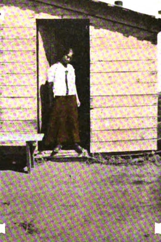
" /><br/><p>With the introduction and improvement of dry farming in the late nineteenth century, land previously considered worthless could suddenly be used. Land fever took hold of many prospective homesteaders, including Cecelia Weiss. Following the lead of her sister, in 1912 Cecelia filed for 320 acres of sagebrush in Iron County of southwestern Utah. With neighboring claims and most others in the region filed by men (only two of whom had wives), they quickly became known as “The Girls.” The two depended on one another and Cecelia recalled, “Without my sister’s companionship I think I would have deserted before the first season was half over.”</p><p>Upon acquiring her land, Cecelia hired out the building of a simple home. It was “not entirely weather-proof, but as it rarely rained in summer it afforded sufficient protection.” Cecelia was spared the “privilege of naming [her] residence.” It had scarcely been completed when a homesteader passed by, remarking that the “piano box” was finished and the “nickname clung to it ever since.”</p><p>In her accounts, Cecelia wrote, “my 320 acres do not support me — yet. I support them.” Establishing a home and a farm was no simple, or cheap, task. Cecelia returned to the city every winter, during the five month furlough allowed under homestead law, to earn the necessary funds to continue work in the summer. A Russian immigrant, she quipped that, unlike in her home country, “there are no relief commissions for girl homesteaders, and the Red Cross pays no attention to them.”</p><p>Together, the sisters worked on improvements for their land. There was no running water for miles, so they were dependent on a neighbor who could afford the expense of digging and establishing a well. Cecelia wrote, “Until I had to walk a mile and a half and carry every drop I had no conception of the value of water.” Out of necessity, “water conservation became a religion.” Putting up fences was “always one of the worst jobs of a homesteader.” When Cecelia and her sister first began digging post holes and setting the posts, they could only manage one in the morning and one in the evening, with their best effort and leaving them exhausted. Before long though, they increased to ten in the morning and ten more at night. Together, they set 600 posts and saved $75 that it would have cost to hire the work out. </p><p>To meet ownership requirements for the land, Cecelia needed to cultivate 40 acres. She paid cash for the heavy labor of clearing, plowing, seeding, and hauling. It was a helpful arrangement, but, worse than increasing her costs, it added to her “hours of leisure.” She despised the abundant spare time, writing, “I never knew how much time there is in the world, how it refuses to be prodded and hurried in its snaily crawl, until I contracted with Uncle Sam to spend seven consecutive months in the sagebrush, with the nearest neighbor almost out of sight and not sufficient work to make me forget the heat.”</p><p>Her garden became a “source of great delight.” The arid soil was not in great condition for growing, and she had to compete with rabbits and gophers, but what she was able to raise was a help. Food became less of an issue when a store was established in the nearby town, Beryl.</p><p>Even with her sister nearby, homesteading could be lonely. “In the sagebrush,” Cecelia commented, “It is not sufficient that [a young woman] should avoid evil itself; she must avoid the appearance of evil.” She records having to be careful that if a young man came to call, they would sit outside on “a hard wooden bench in the broiling sun” because it was not proper to invite him inside her one bedroom home alone. Cecelia felt “handicapped by the fear of gossip and scandal” that would “spring up overnight without provocation” in a place “where folks have nothing to do for recreation but scan the empty miles and sit and think about their neighbor.” A young girl like Cecelia, without the protection of a chaperon, made “the best material for such stories.” </p><p>Life was “not all thirst, desolation and dreariness” and, “in spite of everybody,” they made time to enjoy themselves. Cecelia found “many congenial friends” among the other settlers. Trips to call on neighbors, when managed, were all day affairs because “distances between homes [were] too great to be taken lightly” and to be travelled during midday heat. Parties “in the land of hope and thirst” were just as exciting and enjoyable as those in the city. They also often served additional practical purposes. When a big job or task was at hand, one might send for friends and neighbors to make light work of it. Food and festivities would take place after its completion. </p><p>In 1916, Cecelia received the title to her land. If she chose to sell, she could have made a neat profit of $2,200, but that was not what Cecelia wished for. She “would rather make a real farm out of the sagebrush tract.” While others saw the patent as an end goal, to her it only marked the beginning, a continuation of a dream. She wrote, “It has taken pluck to stick to the venture and see it through. There have been times when it has been very hard to stay, but I have never thought of quitting.” To develop a farm from raw land took “money, grit, perseverance, and self-denial,” but “in spite of drouth and loneliness, this plucky girl ‘won through.’”</p><p><em><strong><a href="https://www.intermountainhistories.org/items/show/458">For more (including 3 images) view the original article</a></strong></em></p>]]></summary>
    <published>2021-02-07T06:05:00+00:00</published>
    <updated>2026-04-17T19:32:09+00:00</updated>
    <link rel="alternate" type="text/html" href="https://www.intermountainhistories.org/items/show/458"/>
    <id>https://www.intermountainhistories.org/items/show/458</id>
    <author>
      <name>Anna Bailey, Brigham Young University </name>
    </author>
  </entry>
  <entry>
    <title type="html"><![CDATA[Kate Heizer, Female Homesteader<br />
]]></title>
    <summary type="html"><![CDATA[<p><strong><em>Of homesteading, Kate Heizer wrote, “One inquirer has an exaggerated idea of the difficulties and hardships. Another has a mistaken notion of taking a pleasant vacation while waiting till he receives title to a piece of property that will place him above financial anxiety for the rest of his life.” As for herself, Kate recognized the truth lay somewhere in the middle. </p></strong></p><img src="https://www.intermountainhistories.org/files/fullsize/5dff0bee6f413282d2b91a59c25175a3.jpg" alt="First Cabin on Heizer Claim" /><br/><p>The Dawes Severalty Act of 1887 authorized and began a process of subdividing reservation lands among Native families, breaking up and diminishing Native landholdings, including the Uintah Indian Reservation. In August 1905, “surplus” land was opened to homesteading and mineral claims. Kate Heizer was only one of thousands who applied for property in these areas. Preference for pieces of property was decided by drawing lots and Kate picked #247, low when compared to other higher possible picks. Time for potential homesteaders to look over the available land was short. Wasatch Land Company and other professional “locators” promised to identify prime lots for a price, but, with high stakes, there was a general mistrust of anyone claiming to know anything. </p><p>Potential for success rested all on the decision of what piece of land was selected. Prospective owners frantically learned all they could of sagebrush and other indicators of soil quality. Kate was skeptical of her ability to choose, writing, “I was as little capable of judging [the land] as I am of discussing the canals on Mars.” She questioned and listened to everyone who could give her any information, carefully judging “which men really understood conditions and were giving honest advice, and which either mistakenly thought they knew or had interested motives.” Her biggest concern was how the property would be irrigated, so she decided largely based on where others gathered, hoping that community would increase value and ensure a greater effort and feasibility for irrigation schemes. Kate’s study and planning paid off and she “secured a better claim than many a one who had had an earlier choice.”</p><p>The filing took place in early fall and, once settled, Kate returned to her teaching job to finish out the school year. To fulfill settlement requirements, she “resided” on her homestead for several days during the Christmas break. It was common for individuals to leave for periods to save money to fund work done in the spring. There were lonely spells as people moved in and out. Contests were raised, occasionally, against abandoned claims and Kate had one filed against herself in her absence. Fortunately, empathetic neighbors “with unmistakable western emphasis” advised the man to drop it—and he did. The incident spurred Kate to move out permanently and begin her required 14 months of continuous residence. The first summer was a difficult season. Many homesteaders needed ditches that didn’t yet exist to access water. Kate was fortunate in that her property was within a gully that retained water into midsummer and provided shade that grew trees for lumber. Once it was completed, she paid $1.25 per acre to the Indian Fund and, in exchange, received her patent. </p><p>Supplies had to be freighted in and were expensive to acquire. When funds ran dry, Kate had to sell 50 acres to continue improvements to the rest of her land. She was tormented by rabbits and prairie dogs that ate her crops and gardens, making “scarecrows, guns, and poison... futile.” Despite its difficulties, she persevered, seeing homesteading as an opportunity to learn and a cause for hope. Kate planted 90 acres of alfalfa and studied agriculture so she could take over management of her ranch entirely. </p><p>Regarding success, Kate explained that “the man who is alert and ready to seize opportunities, who holds to a purpose until it is accomplished, is the man most likely to succeed in any undertaking, and homesteading is no exception.” She certainly followed her own advice. While Kate took pride in becoming successful and competent, she found something even more gratifying—“the realization of being an important factor in the community, one whose voice has weight, a person to be consulted about matters of public interest.” Through her hard work and determination, Kate found success, independence, and political influence as a single woman in the American West.</p><p><em><strong><a href="https://www.intermountainhistories.org/items/show/455">For more (including 4 images) view the original article</a></strong></em></p>]]></summary>
    <published>2021-02-06T08:54:57+00:00</published>
    <updated>2026-04-17T19:32:09+00:00</updated>
    <link rel="alternate" type="text/html" href="https://www.intermountainhistories.org/items/show/455"/>
    <id>https://www.intermountainhistories.org/items/show/455</id>
    <author>
      <name>Anna Bailey, Brigham Young University</name>
    </author>
  </entry>
  <entry>
    <title type="html"><![CDATA[Marie Jordan Bell, Female Homesteader<br />
]]></title>
    <summary type="html"><![CDATA[<p><strong><em> Ranching was the preferred way of life for Marie Jordan Belle. Homesteading, for her, was an outlet for independence and an economic investment for her future.</p></strong></p><img src="https://www.intermountainhistories.org/files/fullsize/0abbd421f7d0b37611bce6ff3f925943.jpg" alt="Marie Jordan Bell in her ranch house
" /><br/><p>Born on a family ranch in Iron Mountain, Wyoming in 1898, Ella Marie Jordan grew up riding and working horses with her father and brothers. From her toddler years, she sustained a love for horses and her wild home. A lack of modern conveniences like electricity, running water, or a telephone characterized her early years. It was “just a way of life” and never impeded her love for ranching. She found passion in her work, opting to continue it even into her eighties.</p><p>When she turned 16, Marie took out a homestead section “up in the meadow by a tiny stream” near her family’s home. Her father built a small house for her that she lived in for three years, except when she was at school. It was small and simple, with only a bed, stove, mirror, window, and garden, but Marie “was sort of proud of it.” At the end of those three years, she was able to prove her claim (colloquial phrase for the legal process of securing a title to homestead lands after meeting certain government requirements). Marie’s father leased the land from her for several years, but ultimately purchased it from her for $1,000 after she tried to simply give it to him. In that way, the homestead served as an investment property for Marie rather than a permanent home. </p><p>After going to Baltimore, and later Kansas, to attend college, Marie met and married John Bell, “a gregarious, fun-loving cowboy with an acute business sense.” Together they built a large and successful ranch from the ground up in southern Wyoming. The money she had earned from her homestead was used to fix up their home, something they would have been unable to afford otherwise. John died of cancer in 1972, but Marie never considered moving away from their ranch. “What would I do in town?” she asked—a cowgirl through and through.</p><p><em><strong><a href="https://www.intermountainhistories.org/items/show/453">For more (including 4 images) view the original article</a></strong></em></p>]]></summary>
    <published>2021-02-05T03:39:06+00:00</published>
    <updated>2026-04-17T19:32:09+00:00</updated>
    <link rel="alternate" type="text/html" href="https://www.intermountainhistories.org/items/show/453"/>
    <id>https://www.intermountainhistories.org/items/show/453</id>
    <author>
      <name>Anna Bailey, Brigham Young University</name>
    </author>
  </entry>
</feed>