<?xml version="1.0" encoding="UTF-8"?>
<feed xmlns="http://www.w3.org/2005/Atom">
  <title type="text">Intermountain Histories</title>
  <updated>2026-04-17T19:32:19+00:00</updated>
  <generator uri="http://framework.zend.com" version="1.12.20">Zend_Feed_Writer</generator>
  <link rel="alternate" type="text/html" href="https://www.intermountainhistories.org/"/>
  <link rel="self" type="application/atom+xml" href="https://www.intermountainhistories.org/items/browse?output=rss2"/>
  <id>https://www.intermountainhistories.org/</id>
  <author>
    <name>Intermountain Histories</name>
    <uri>https://www.intermountainhistories.org</uri>
  </author>
  <link rel="hub" href="https://pubsubhubbub.appspot.com/"/>
  <entry>
    <title type="html"><![CDATA[Dowa Yalanne Mountain]]></title>
    <summary type="html"><![CDATA[<p><strong><em>Many notable events for the Zuni people transpired on Dowa Yalanne, including traditional legends and ceremonies. It provided the Zunis protection against the invading Spanish and other raiding groups and continues to inspire and remind the Zuni people of their culture and history.</em></strong></p><img src="https://www.intermountainhistories.org/files/fullsize/ae143c3a012b84adff08586fd045f838.jpg" alt="“Dowa Yalanne Mountain.”" /><br/><p>Located in New Mexico on the Zuni reservation, Dowa Yalanne, or Corn Mountain, overlooks Zuni Pueblo at an elevation ranging in the 7000s. A Zuni legend explains that during an intense flood, the people fled to the top of the Dowa Yalanne, bringing their corn. To cause the water to recede, they sent a son and daughter of a Zuni priest into the water as an offering. Eventually the waters receded, revealing that the son and daughter turned to stone. Corn Mountain’s mesa features approximately 320 acres of Zuni sandstone, mudstone, and Dakota sandstone. Based on these sedimentary rocks, Dowa Yalanne appears to have formed during the Triassic and Jurassic periods and is recognizable by its red and white coloring. Piñon-juniper trees populate the mountain, along with smaller brush and foliage. </p><p>During the early days of European contact, Dowa Yalanne offered the Zuni people refuge from the Spanish conquistadors. In 1540, after Francisco Vasquez Coronado and his men battled at the Zuni village of Hawikuh, the remaining Zunis fled to Corn Mountain to escape Spanish occupation. Familiar with the mountain trails, they remained secluded until the Spanish left. The Zuni then returned to their villages once it appeared safe. </p><p>Zunis utilized Dowa Yalanne as a place of retreat before contact with the Spanish when conflict arose with other tribes. Zunis returned to Dowa Yalanne in 1632 after they conspired and killed two Franciscan Friars and Spanish soldiers stationed at Hawikuh. It was not until 1635 that the people of the six Zuni villages entirely left the mountain’s protection. This particular cycle continued in 1680, after the immediate events of the Pueblo Revolt, and again in 1703 when the Zunis repulsed Spanish interlopers.  From that point on, the use of Dowa Yalanne as a place of protection significantly diminished due to fewer conflicts.</p><p>Zuni rock art decorates Dowa Yalanne in locations where they took refuge. The historic engraved shields and mountain lion iconography served a magical protective function for them. Zunis still maintain sacred shrines on the top of Dowa Yalanne mesa, cementing its spiritual reminder of Zuni culture and resilience during difficult circumstances.</p><p><em><strong><a href="https://www.intermountainhistories.org/items/show/849">For more (including 4 images) view the original article</a></strong></em></p>]]></summary>
    <published>2024-09-24T18:01:38+00:00</published>
    <updated>2026-04-17T19:32:19+00:00</updated>
    <link rel="alternate" type="text/html" href="https://www.intermountainhistories.org/items/show/849"/>
    <id>https://www.intermountainhistories.org/items/show/849</id>
    <author>
      <name>Joseph Namingha, Brigham Young University</name>
    </author>
  </entry>
  <entry>
    <title type="html"><![CDATA[The Great Salt Lake Shorelands Preserve]]></title>
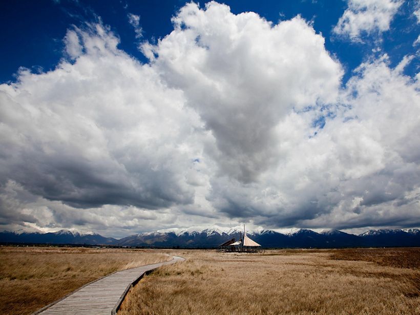
    <summary type="html"><![CDATA[<p><strong><em>Nicknamed “the Bird Refuge,” The Great Salt Lake Shorelands Preserve in Layton, Utah is a rest stop for 4-6 million birds migrating annually. The protected land has also become a recreational spot for tourists and locals to bird watch and enjoy the wetlands of the Great Salt Lake.</em></strong></p><img src="https://www.intermountainhistories.org/files/fullsize/3ea1ff3a8d741ab1d715b39c0db58c87.jpg" alt="Great Salt Lake Pavilion " /><br/><p><span style="font-weight:400;">In 2003, a group called “The Nature Conservancy” gained custody of 4,400 acres of wetlands fed by the waters of the Great Salt Lake. The wetlands lie on the eastern shore of the lake near Farmington Bay and Antelope Island State Park. Nicknamed “the Bird Refuge,” this preserve’s mission is to provide refuge to 4-6 million birds as they make their annual migrations on routes that span from the Arctic to Central and South America. Bird watchers have documented 250 species visiting the Shorelands preserve to feed or rest and 93 species that nest there. The number of birds passing through the area has increased by 25% since 2020, showing the importance of the preserve. </span>
<span style="font-weight:400;">The Shorelands Preserve includes a circular boardwalk spanning about 1 mile. Two wooden structures serve as stops along the boardwalk, one hosting a 30-foot viewing tower for visitors to better observe the surrounding area and to increase their chances of spotting birds. The other is a large wooden pavilion. Informative signs dot the boardwalk, helping visitors identify the birds that frequent the Preserve. They also provide information about the ecosystem of the area. </span>
<span style="font-weight:400;">In May 2020, the Mitigation Commission released a statement turning over ownership of The Nature Conservancy to the federal government. Giving the federal government stewardship over The Nature Conservancy was viewed as a better way to protect the lands from future development. This was crucial at a time when Utah’s Department of Transportation was considering expanding the West Davis Corridor, a road system. The drought-driven shrinking of the Great Salt Lake poses an additional risk to the region. The Nature Conservancy is in the process of developing strategies to divert water to the preserve to help the wetlands and aid the bird species that rely on it.</span></p><p><em><strong><a href="https://www.intermountainhistories.org/items/show/790">For more (including 4 images) view the original article</a></strong></em></p>]]></summary>
    <published>2024-03-03T03:57:53+00:00</published>
    <updated>2026-04-17T19:32:17+00:00</updated>
    <link rel="alternate" type="text/html" href="https://www.intermountainhistories.org/items/show/790"/>
    <id>https://www.intermountainhistories.org/items/show/790</id>
    <author>
      <name>Gabby Segura, Brigham Young University</name>
    </author>
  </entry>
  <entry>
    <title type="html"><![CDATA[“Purple Mountain Majesties”: Why Pikes Peak is America’s Mountain]]></title>
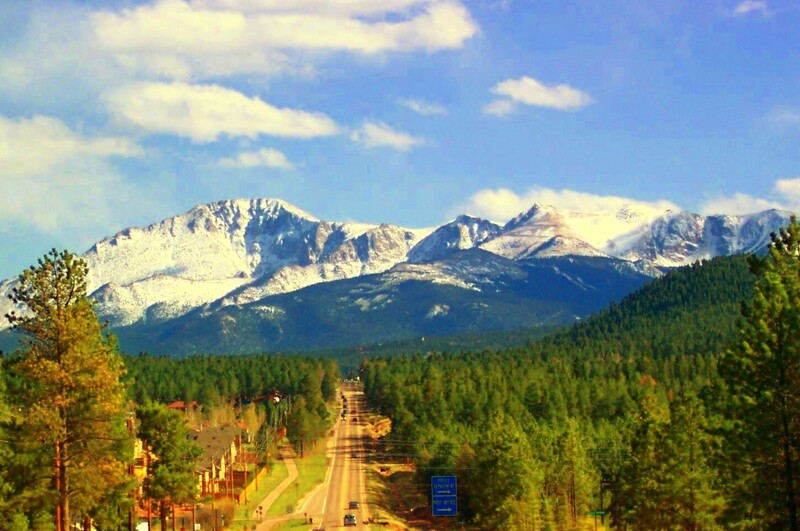
    <summary type="html"><![CDATA[<p><strong><em>Pikes Peak has a long and valuable history that provides visitors with a look through different ages of America, highlighting the beauty and diversity of the land and people. </em></strong></p><img src="https://www.intermountainhistories.org/files/fullsize/fabf35ca83b85ec7549a243f9e4cbd07.jpg" alt="Pikes Peak" /><br/><p><span style="font-weight:400;">With incredible height, diversity, age, and beauty, Pikes Peak towers above at an astounding 14,115 feet, making it one of the tallest mountains in the United States. Many, if not all, Americans have heard the moving lyrics to “America the Beautiful,” but few know that Pikes Peak was the inspiration for the song. Pikes Peak has long been the subject of ballads of beauty and adventure, as well as a symbol of hope and freedom for many throughout American history. </span>
<span style="font-weight:400;">The peak itself has undergone a variety of “discoveries” throughout the different ages of settlement. Some of the first people believed to have discovered and lived near Pikes Peak were the Clovis people yet not much is known or recorded of their experience. However, the histories of many Native peoples’ lifestyles, religions, and legends centered around the peak. The Utes, or the Tabeguache, believed the mountain itself was a sacred site where the Great Spirit created the earth and where many ceremonies were held. </span>
<span style="font-weight:400;">The Spanish were the first Europeans to discover the peak in 1779 and named it “El Capitán,” or “The Captain,” due to the imposing nature of the peak. With the completion of the Louisiana Purchase, the French sold vast tracts of land to the United States of America. In an effort to appraise the land and resources the United States had obtained, President Jefferson sent out several different expeditions to explore and record the areas. It was not until 1806 that Zebulon Pike, the first American explorer who dubbed the mountain Pike’s Peak, came to the Colorado area and attempted to hike the peak. The expedition failed to summit it because they were not prepared for the weather, and the peak remained an alluring call for explorers to attempt to conquer. </span>
<span style="font-weight:400;">Pikes’ writing on his expedition, including the details about the imposing mountain, were published in several languages and widely distributed due to their fame and the public’s interest in the unexplored West. In his writings, Pike referred to the peak as the “the Grand Peak” or simply, “highest peak.”  In 1820, Dr. Edwin James made the first recorded ascent. Later in its history, a variety of media featuring Pikes Peak attracted settlers and spurred further western migration. The phenomenon started with miners and spectators with the discovery of gold and gradually drew more settlers with large plots of grazing land and a tourism industry. Pikes Peak influenced the early formation of American identity and still manages to inspire those who visit today.</span></p><p><em><strong><a href="https://www.intermountainhistories.org/items/show/747">For more (including 5 images) view the original article</a></strong></em></p>]]></summary>
    <published>2023-04-11T18:29:54+00:00</published>
    <updated>2026-04-17T19:32:16+00:00</updated>
    <link rel="alternate" type="text/html" href="https://www.intermountainhistories.org/items/show/747"/>
    <id>https://www.intermountainhistories.org/items/show/747</id>
    <author>
      <name>Addie Coombs, Brigham Young University</name>
    </author>
  </entry>
</feed>