<?xml version="1.0" encoding="UTF-8"?>
<feed xmlns="http://www.w3.org/2005/Atom">
  <title type="text">Intermountain Histories</title>
  <updated>2026-04-17T19:32:19+00:00</updated>
  <generator uri="http://framework.zend.com" version="1.12.20">Zend_Feed_Writer</generator>
  <link rel="alternate" type="text/html" href="https://www.intermountainhistories.org/"/>
  <link rel="self" type="application/atom+xml" href="https://www.intermountainhistories.org/items/browse?output=rss2"/>
  <id>https://www.intermountainhistories.org/</id>
  <author>
    <name>Intermountain Histories</name>
    <uri>https://www.intermountainhistories.org</uri>
  </author>
  <link rel="hub" href="https://pubsubhubbub.appspot.com/"/>
  <entry>
    <title type="html"><![CDATA[Parowan Gap Petroglyphs]]></title>
    <summary type="html"><![CDATA[<img src="https://www.intermountainhistories.org/files/fullsize/ae788130d6314850832eb9fc11464fb9.jpg" alt="Ancient carvings were made by Natives passing through Parowan Gap" /><br/><p>Over a thousand years ago, Fremont Indians inhabited southern Utah in an area known as the Parowan Gap. Once a flowing river, the Parowan Gap dried out over time. Erosion by wind and rain have further shaped this 600 foot deep notch or pass used by Natives and newcomers to traverse the Red Hills, a low range of mountains that forms the western border of the Parowan Valley. Hopis, Utes, and Paiutes used this area to travel back and forth to obtain resources and mingle with one another. </p><p>About 13 miles west of Parowan are the famous petroglyphs, carved or pecked into the sedimentary rock walls of this historic landmark. Petroglyphs depict images of people, animals and different lines and shapes, although the meaning of some of the depictions remains a mystery. Images of humans, snakes, mountain sheep, and lizards fill the wall panels. Archaeologists believe the gallery represents rock art extending over a thousand years. Some researchers postulate the wall was used for religious purposes and others contend the engravings represent a hunting ritual. One petroglyph depicts a calendrical system indicating when to plant and harvest crops. Zipper Glyph, the most famous petroglyph, depicts the route Paiutes traveled and indicates how long their journey through the gap might take. </p><p>The petroglyphs at Parowan Gap are fragile and can be ruined by human touch or by trying to chalk over them. Enjoy them at a distance by taking a photo or sketching them yourself. Everyone shares a responsibility to help preserve archaeological and historically significant sites.</p><p><em><strong><a href="https://www.intermountainhistories.org/items/show/857">For more (including 3 images) view the original article</a></strong></em></p>]]></summary>
    <published>2024-09-25T20:44:31+00:00</published>
    <updated>2026-04-17T19:32:19+00:00</updated>
    <link rel="alternate" type="text/html" href="https://www.intermountainhistories.org/items/show/857"/>
    <id>https://www.intermountainhistories.org/items/show/857</id>
    <author>
      <name>Samantha Worthington, Brigham Young University</name>
    </author>
  </entry>
  <entry>
    <title type="html"><![CDATA[Oraibi, Arizona: A Resilient Hopi Community ]]></title>
    <summary type="html"><![CDATA[<p><strong><em>Discovered in 1540 by the Spanish explorer Pedro de Tovar, Oraibi, a Hopi residence, is regarded as one of the longest continuously inhabited settlements in the United States. Its people have endured centuries of drought, colonial pressures, and internal and external conflict. Oraibi remains a visible reminder of the resilient spirit of the Hopis.</em></strong></p><img src="https://www.intermountainhistories.org/files/fullsize/fb072444d0994c36619ad1169908c110.jpg" alt="Low oblique view from above the Hopi village of Oraibi, showing terraced houses, Arizona, 1898" /><br/><p>Oraibi has existed since at least 1100 AD, but due to the paucity of archaeological research, it may have been occupied much earlier. Located in Northern Arizona and situated atop the 3rd Mesa of the Hopi Nation. Spanish explorer Francisco Vázquez de Coronado sent Pedro de Tovar and 20 men to make contact in 1540. The Spanish built the San Francisco mission in 1629, but the Hopis destroyed the mission in 1680 during the Pueblo revolt. Oraibi represented one of the central Hopi village sites until the turn of the twentieth century, when some of its population relocated in 1906.</p><p>Throughout Oraibi’s history, the city has not only undergone population fluctuations but also architectural reformation. An examination of thousands of photographs, prints, and detailed maps dating back to the 1800s reveal the first houses in Oraibi were one room wide and often four stories tall. The town was structured so houses were built in long, linear room blocks, with adjacent houses sharing walls. There were 25 room blocks that most faced southeast. Toward the end of the 19th century, when Navajo raids became less common, many upper stories of the shelters were dismantled, as living on lower stories became preferred. European materials such as glass windows, milled lumber, and woodburning stoves were added within Oraibi architecture. The introduction of stoves led to an increase in room size, allowing for the heating of larger spaces. After 1906 many room blocks were abandoned as people consolidated into the west part of the village near the main plaza.</p><p>Oraibi remains a vibrant testament to the Hopi spirit of resilience. The peaceful people of Oraibi have endured centuries of drought, colonial pressures, and conflicts with other Indigenous peoples. The current residents of Oraibi are private, and while they are welcoming to visitors, they ask them to refrain from taking pictures or videos. The remarkable settlement of Oraibi offers unique insight into Indigenous America and contributes profoundly to Hopi history.</p><p><em><strong><a href="https://www.intermountainhistories.org/items/show/852">For more (including 4 images) view the original article</a></strong></em></p>]]></summary>
    <published>2024-09-25T02:44:44+00:00</published>
    <updated>2026-04-17T19:32:19+00:00</updated>
    <link rel="alternate" type="text/html" href="https://www.intermountainhistories.org/items/show/852"/>
    <id>https://www.intermountainhistories.org/items/show/852</id>
    <author>
      <name>Samuel Fuller, Brigham Young University</name>
    </author>
  </entry>
  <entry>
    <title type="html"><![CDATA[Dowa Yalanne Mountain]]></title>
    <summary type="html"><![CDATA[<p><strong><em>Many notable events for the Zuni people transpired on Dowa Yalanne, including traditional legends and ceremonies. It provided the Zunis protection against the invading Spanish and other raiding groups and continues to inspire and remind the Zuni people of their culture and history.</em></strong></p><img src="https://www.intermountainhistories.org/files/fullsize/ae143c3a012b84adff08586fd045f838.jpg" alt="“Dowa Yalanne Mountain.”" /><br/><p>Located in New Mexico on the Zuni reservation, Dowa Yalanne, or Corn Mountain, overlooks Zuni Pueblo at an elevation ranging in the 7000s. A Zuni legend explains that during an intense flood, the people fled to the top of the Dowa Yalanne, bringing their corn. To cause the water to recede, they sent a son and daughter of a Zuni priest into the water as an offering. Eventually the waters receded, revealing that the son and daughter turned to stone. Corn Mountain’s mesa features approximately 320 acres of Zuni sandstone, mudstone, and Dakota sandstone. Based on these sedimentary rocks, Dowa Yalanne appears to have formed during the Triassic and Jurassic periods and is recognizable by its red and white coloring. Piñon-juniper trees populate the mountain, along with smaller brush and foliage. </p><p>During the early days of European contact, Dowa Yalanne offered the Zuni people refuge from the Spanish conquistadors. In 1540, after Francisco Vasquez Coronado and his men battled at the Zuni village of Hawikuh, the remaining Zunis fled to Corn Mountain to escape Spanish occupation. Familiar with the mountain trails, they remained secluded until the Spanish left. The Zuni then returned to their villages once it appeared safe. </p><p>Zunis utilized Dowa Yalanne as a place of retreat before contact with the Spanish when conflict arose with other tribes. Zunis returned to Dowa Yalanne in 1632 after they conspired and killed two Franciscan Friars and Spanish soldiers stationed at Hawikuh. It was not until 1635 that the people of the six Zuni villages entirely left the mountain’s protection. This particular cycle continued in 1680, after the immediate events of the Pueblo Revolt, and again in 1703 when the Zunis repulsed Spanish interlopers.  From that point on, the use of Dowa Yalanne as a place of protection significantly diminished due to fewer conflicts.</p><p>Zuni rock art decorates Dowa Yalanne in locations where they took refuge. The historic engraved shields and mountain lion iconography served a magical protective function for them. Zunis still maintain sacred shrines on the top of Dowa Yalanne mesa, cementing its spiritual reminder of Zuni culture and resilience during difficult circumstances.</p><p><em><strong><a href="https://www.intermountainhistories.org/items/show/849">For more (including 4 images) view the original article</a></strong></em></p>]]></summary>
    <published>2024-09-24T18:01:38+00:00</published>
    <updated>2026-04-17T19:32:19+00:00</updated>
    <link rel="alternate" type="text/html" href="https://www.intermountainhistories.org/items/show/849"/>
    <id>https://www.intermountainhistories.org/items/show/849</id>
    <author>
      <name>Joseph Namingha, Brigham Young University</name>
    </author>
  </entry>
  <entry>
    <title type="html"><![CDATA[Geronimo Surrender Monument]]></title>
    <summary type="html"><![CDATA[<p><strong><em>For many years, the ferocity and war tactics of the Chiricahua Apaches deterred the American military from taking their land in Arizona. General William T. Sherman became so frustrated by the Apache that he suggested Arizona should be abandoned to the American Indians. Despite these resilient efforts in maintaining their land, the Chiricahua surrendered to preserve their people from a “bitter end.” The Geronimo Surrender Monument stands as a stark reminder in Skeleton Canyon of southern Arizona. </em></strong></p><img src="https://www.intermountainhistories.org/files/fullsize/ab99b990d9a8de68c67dae2ffd6fa20b.jpg" alt="Apache Gaan dancers " /><br/><p>The Chiricahua Apaches settled in southeastern Arizona, southwestern New Mexico, and northern Mexico in the Sonoran and Chihuahuan Deserts. They fielded fierce warriors with agile, athletic builds that proved a formidable fighting force in the desert Southwest. Apaches constructed easily built dome-shaped wickiup dwellings made of thatch and poles and covered with animal skins.</p><p>Few Americans entered Chiricahua territory before the gold rush. The 1851 discovery of gold in the Pinos Altos region of New Mexico, which lay at the Southern end of the Black Mountains, homeland of the Warm Springs Band of Chiricahua, was an early source of conflict. Apaches did not understand the allure of this metal to Americans. The endeavor to mine for gold was purposeless and sacrilegious to their nation. Nonetheless, miners were determined to invade their territory and take its resources and the Chiricahua successfully resisted those efforts for several decades. The federal government attempted to create peace through several treaties, but both sides had difficulty adhering to the terms.</p><p>Many battles ensued between the Chiricahua, settlers, and American troops. While the Americans had better developed equipment and weapons, the Apache knew the land better and had more experience fighting to defend their homeland. They evaded and defeated military forces hundreds of times their size. Despite their best efforts to protect their sovereignty, the Chiricahuas knew they could not continue to thwart the efforts of the American militia indefinitely. The Apache wars brought great hardships to their people, so Apache leaders Geronimo and Nachiz, met with Lieutenant Gatewood to discuss the future of their people. The Lieutenant explained that if they surrendered, their families would be sent to Florida to await the final decision of the President. If they did not surrender, they would have to fight to the bitter end. After some discussion, Nachiz and Geronimo decided to surrender in order to preserve their people. Despite many years of successfully resisting American encroachment, the Chiricahua Apaches capitulated to the government’s demands in Skeleton Canyon on September 4, 1886, a location now known as the Last Stand of the Chiricahua Apaches. The Chiricahua Apaches were evicted from their ancestral homeland, temporarily assigned to Florida and Alabama, before being the last Indigenous nation the U.S. Congress relocated into present-day Oklahoma in 1894.</p><p><em><strong><a href="https://www.intermountainhistories.org/items/show/848">For more (including 4 images) view the original article</a></strong></em></p>]]></summary>
    <published>2024-09-24T04:49:59+00:00</published>
    <updated>2026-04-17T19:32:19+00:00</updated>
    <link rel="alternate" type="text/html" href="https://www.intermountainhistories.org/items/show/848"/>
    <id>https://www.intermountainhistories.org/items/show/848</id>
    <author>
      <name>Leah T. Smith, Brigham Young University</name>
    </author>
  </entry>
  <entry>
    <title type="html"><![CDATA[Everett Ruess: Lost in the Labyrinth of Davis Gulch, Utah ]]></title>
    <summary type="html"><![CDATA[<p><strong><em>Everett Ruess left Escalante Utah on November 12th, 1934 in a light red shirt “as thin as smoking paper” and headed towards Davis Gulch with the confidence of an experienced explorer, which he very much was, but to never be seen again.</em></strong></p><img src="https://www.intermountainhistories.org/files/fullsize/a5b2261c72639e672eacb5c47cb06fbe.jpg" alt="Bement Arch in Davis Gulch" /><br/><p><span style="font-weight:400;">Davis Gulch is located about forty-five miles southeast of Escalante, Utah, down the Escalante River before it meets with the Colorado River. Before leaving Escalante, Everett was warned about the winters of southern Utah and the dangerous trek across Escalante Canyon. However, Everett planned to be home for Christmas, so these worries were behind him. He wrote and sent two letters before arriving at Davis Gulch, to his parents, Stella and Christopher, and another to his brother, Waldo. To his parents, he wrote that he would be unreachable for a couple of months, and would return before the end of the year, but to Waldo, he said that he would not revisit civilization soon, foreshadowing the uncertainty of his disappearance. When Everett did not return to Los Angeles by late December, Stella immediately sent him a Christmas card. However, one month later the card came back to Stella, and the heartfelt message now read “Unkown” and “Return to sender.” </span>
<span style="font-weight:400;">Stella and Christopher’s first objective was to call up Escalante Postmistress Mildred Allen and ask if there was any information on Everett’s whereabouts. Unfortunately, Mildred had not heard from Everett, and neither had anyone else. Next, the Ruess family contacted every Postmaster across the Southwest in search of any sign of Everett but were met with no hope. Their third step was to contact all newspapers and radio stations in the region and ask them to spread awareness of Everett’s disappearance. The first newspaper account of his disappearance was on Valentine's Day, February 14th, 1935, by the </span><i><span style="font-weight:400;">Los Angeles Evening Herald,</span></i><span style="font-weight:400;"> just over three months after he left Escalante. Everett Ruess was now officially missing. </span>
<span style="font-weight:400;">In March of 1935, a man named Gail Bailey spotted two burros deep in Escalante Canyon at Davis Gulch. The trail to Davis was hard to access, meaning that Everett must have scaled the labyrinth of the carved desert to get to the bottom of the canyon safely with two burros, which posed challenges before when he lost a burro in 1932 while climbing out of Canyon del Muerto. </span>
<span style="font-weight:400;">Searches for Everett began soon after Bailey’s report, one led by the Postmistress's husband, Jennings Allen. Found among his burros were some of his belongings, but not a diary, watercolors, or other supplies. After searches ended, the most significant marking left behind was a carving, “NEMO 1934” at the top of a Moqui trail–hand and foot holds carved into rock–next to a large pictograph deep in Davis Gulch. In 1963, The Bureau of Reclamation constructed Glen Canyon Dam, which quickly flooded the canyon, making it harder to search Davis Gulch for Everett Ruess.</span>
<span style="font-weight:400;">To this day there have been many rumors about Everett’s disappearance including a debunked case of his potential remains found in 2008. A quote from one of Everett’s letters summarized his final journey, “I’ll never stop wandering. And when the time comes to die, I’ll find the wildest, loneliest, most desolate spot there is.” Everett’s life ended in solitude, as he always wanted.</span></p><p><em><strong><a href="https://www.intermountainhistories.org/items/show/833">For more (including 4 images) view the original article</a></strong></em></p>]]></summary>
    <published>2024-05-25T04:40:54+00:00</published>
    <updated>2026-04-17T19:32:18+00:00</updated>
    <link rel="alternate" type="text/html" href="https://www.intermountainhistories.org/items/show/833"/>
    <id>https://www.intermountainhistories.org/items/show/833</id>
    <author>
      <name>Matthew T. Lankton, Northern Arizona University</name>
    </author>
  </entry>
  <entry>
    <title type="html"><![CDATA[The Last Letter of Everett Ruess: Escalante, Utah]]></title>
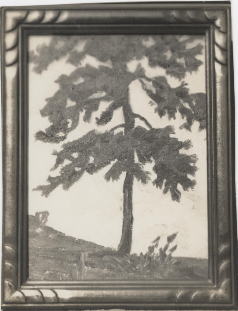
    <summary type="html"><![CDATA[<p><strong><em>Everett Ruess spent the latter half of that summer dancing with the Hopi, exploring the southern half of the Colorado Plateau, and eventually making his way from rim to rim of the Grand Canyon. He finally rested in Tropic, Utah before his final stop in civilization at Escalante, Utah.</em></strong></p><img src="https://www.intermountainhistories.org/files/fullsize/0ffdda85d33fb65d502b1812bba78b87.jpg" alt="Black and white photograph of Everett Ruess’ watercolor painting of a tree in the Colorado Plateau wilderness, ca. 1930s." /><br/><p><span style="font-weight:400;">Escalante, Utah, is a Mormon outpost founded in 1875, and named after Catholic Priest, Father Silvestre Vélez de Escalante. The town acted as a filter between the native lands to the southeast and the rest of the Mormon communities to the north. The town was all Mormon families, with most having the same last name and on average more than five children per family. Escalante’s residents followed the Mormon religion and morals since its founding sixty years prior to Everett’s arrival.</p> <span style="font-weight:400;">The vagabond who spent the last seven months living outdoors in the wilderness arrived in the Mormon town in early November 1934. Everett, a single male artist in a community of large agrarian families, immediately stood out like a sore thumb. He passed through the quaint town with his burros, Chocolatero and Cockelburro, and observed the Mormon church, its community members, and the many homes scattered throughout Escalante. Navajo traders had made their way into town occasionally to exchange with the community, but Escalante never saw a 20-year-old with two donkeys carrying watercolors, jewelry, and native rugs. Everett’s legendary status began here in 1934 due to his unique nature compared to the Mormon families, for the fact that he disappeared not far from here is the reason his myth still lives on in Utah. </span>
<span style="font-weight:400;">For the first time in five years of travel, Everett was financially stable, he had every reason to be satisfied with his life at this moment. He sent his parents ten dollars along with about twenty of his watercolor paintings. He told them to spend five dollars each on something that they “had been wishing to have,” so they proudly spent it to frame their son’s watercolors. In Escalante, Everett saw a film called </span><i><span style="font-weight:400;">Death Takes a Holiday</span></i><span style="font-weight:400;">, which is about death taking human form and asking the public why they fear death, a concept that Everett was fascinated by according to letters sent home. During these last moments in Escalante, Everett played the role of big brother to a lot of the children. According to letters sent from Escalante, he spent time “riding horses, hunting for arrowheads, and the like” with them. Everett’s role in Escalante was one of his most important ones as he served as a curiosity for not only the children but the community as a whole. Before he left, he wrote to his brother Waldo about his desire to stay out in the wilderness for an unknown period of time, for that is where he belonged.</span>
<span style="font-weight:400;">On November 12th, 1934, Everett left Escalante after chatting with the Alvey family who lived on the outskirts of town, and later recalled warning the young explorer of the conditions of the desert. His last winter excursion was in the Superstition Mountains near Phoenix, a completely different climate than southern Utah. A week later two sheepherders spotted him near Davis Gulch, Utah, and offered him mutton, but as the cool autumn air set over Escalante Canyon, Everett declined and was never seen again.</span></p><p><em><strong><a href="https://www.intermountainhistories.org/items/show/832">For more (including 5 images) view the original article</a></strong></em></p>]]></summary>
    <published>2024-05-25T04:26:23+00:00</published>
    <updated>2026-04-17T19:32:18+00:00</updated>
    <link rel="alternate" type="text/html" href="https://www.intermountainhistories.org/items/show/832"/>
    <id>https://www.intermountainhistories.org/items/show/832</id>
    <author>
      <name>Matthew T. Lankton, Northern Arizona University</name>
    </author>
  </entry>
  <entry>
    <title type="html"><![CDATA[Everett Ruess in Navajo Country and Canyon de Chelly National Monument ]]></title>
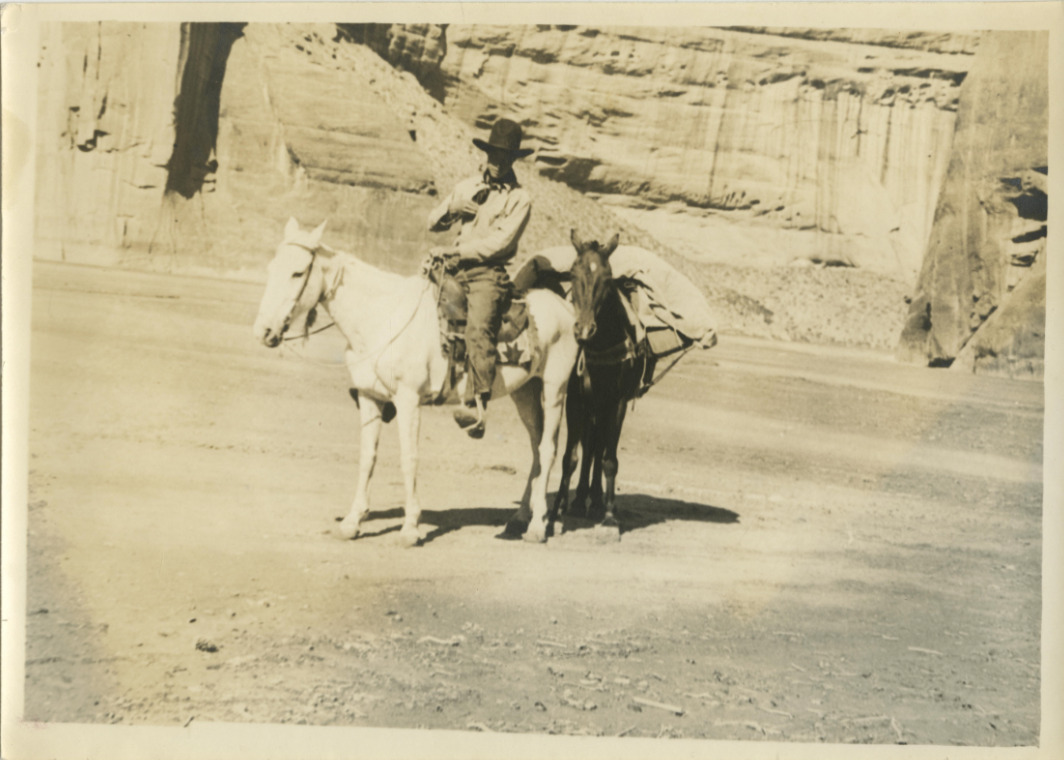
    <summary type="html"><![CDATA[<p><strong><em>In 1932 Everett Ruess set out to central Arizona where he enjoyed the mountainous desert, and later began his journey to his beloved northern Arizona wilderness.</em></strong></p><img src="https://www.intermountainhistories.org/files/fullsize/0dcf36256a9e8c5f10ae900bf7f4e951.jpg" alt="Everett and his horses, 1932" /><br/><p><span style="font-weight:400;">Canyon de Chelly (d’`SHAY) is located in the Navajo Nation and contains the architecture, artifacts, and culture of the communities that have lived there for millennia. Archeologists believe the canyon first had residents roughly 5,000 years ago with the Archaic people. The canyon contains the iconic Spider Rock, White House Ruins, and petroglyphs, and was established as a national monument in 1931 by former President Herbert Hoover. A tributary of Canyon de Chelly is Canyon del Muerto (</span><i><span style="font-weight:400;">Canyon of Death</span></i><span style="font-weight:400;">), named after prehistoric native burials found by the Smithsonian in the canyon in the late nineteenth century. The canyon serves as a monument of the native population, as well as their resilience in defending their sacred land from European settlers.</span>
<span style="font-weight:400;">Everett began his 1932 journey in central Arizona, making his way up to the Mogollon Rim, and eventually Chinle, Arizona, just west of Canyon de Chelly National Monument. Everett had been here just one year prior, before he eventually stayed in Flagstaff and the Grand Canyon, then headed back to southern California. On July 12th, the day before entering Canyon de Chelly, he wrote a lengthy letter to his brother Waldo expressing his appreciation for the outdoors and his belief that “there can be no other life for me but that of the lone wilderness wanderer.” </span>
<span style="font-weight:400;">The next morning, Everett wrote that he went “over the hill to Canyon de Chelly, their [Navajo] homeland.” The canyon welcomed Everett with powerful winds, stalling his progress. As he made his way East through Canyon del Muerto, he passed by the White House Ruin and noted the “tall monument” of Spider Rock in his journal. Everett made the journey back from the belly of de Chelly to Canyon del Muerto, where he noted the lack of water. As he had been in the canyon before in 1931, the towering walls of the canyon and the winds that del Muerto presented were very familiar. In roughly four days Everett made his way up through Canyon del Muerto with his horses Nulfo and Jonathan. The trail out of the canyon was not easy for them. He noted that Jonathan was hobbling in circles before eventually collapsing to the ground beneath him, and noting that the place really was the Canyon of Death for “gentle old Jonathan.”</span>
<span style="font-weight:400;">Everett emerged from Canyon de Chelly National Monument with Nulfo by his side, heading toward their next journey to Mesa Verde in Colorado. He remained here for about another month until hitchhiking his way back to Los Angeles where he began a semester at the University of California Los Angeles (UCLA). Despite the remarkable characteristics of his journey, he was still a human who experienced indecision like any other eighteen-year-old. While at UCLA, Everett reminisced on his time at Canyon de Chelly and the rest of the region which provoked him to write a letter explaining that he did not belong in college, but rather in the wilderness which he returned to a few months later.</span></p><p><em><strong><a href="https://www.intermountainhistories.org/items/show/830">For more (including 5 images) view the original article</a></strong></em></p>]]></summary>
    <published>2024-05-25T03:51:26+00:00</published>
    <updated>2026-04-17T19:32:18+00:00</updated>
    <link rel="alternate" type="text/html" href="https://www.intermountainhistories.org/items/show/830"/>
    <id>https://www.intermountainhistories.org/items/show/830</id>
    <author>
      <name>Matthew T. Lankton</name>
    </author>
  </entry>
  <entry>
    <title type="html"><![CDATA[North Beach at Bear Lake: The &quot;Caribbean of the Rockies&quot;]]></title>
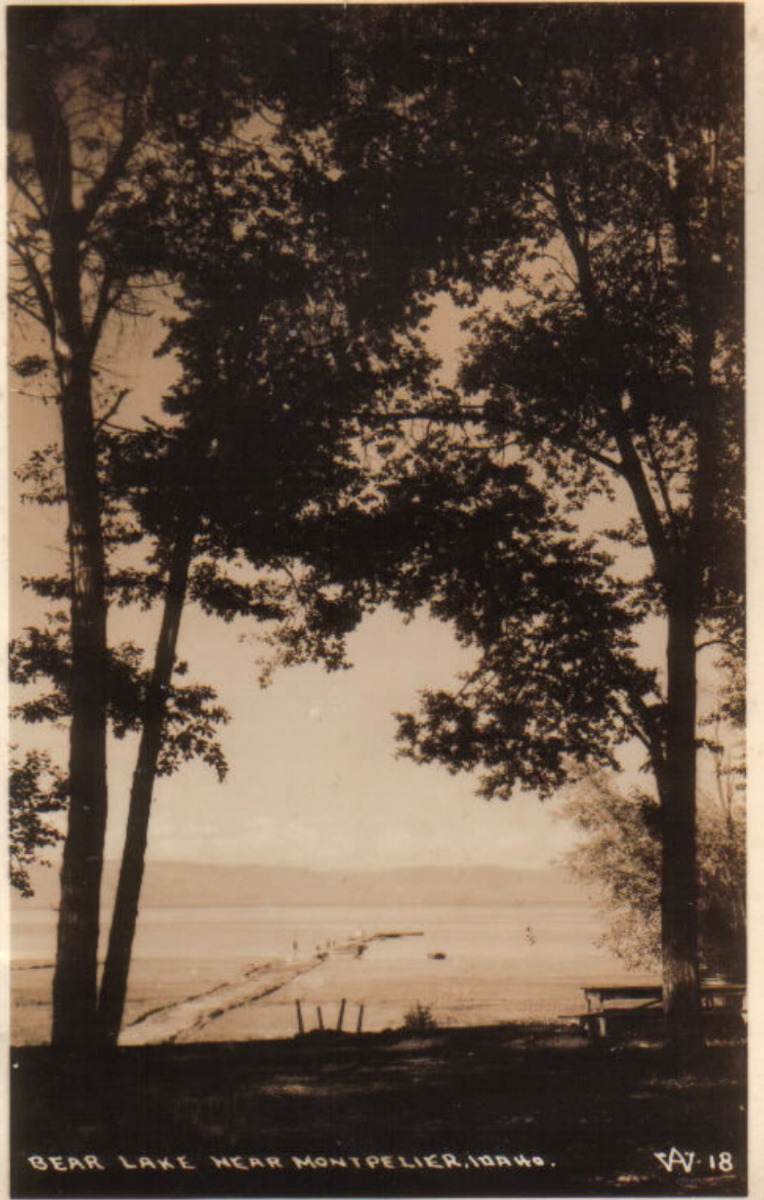
    <summary type="html"><![CDATA[<p><strong><em>Known as the "Caribbean of the Rockies," North Beach at Bear Lake is remembered for its clear, turquoise waters and the neighboring historical hot springs.</em></strong></p><img src="https://www.intermountainhistories.org/files/fullsize/10473506f86f1e2d1f5ca0c2d8a1af4f.jpg" alt="Bear Lake near Montpelier, Idaho. c. 1898" /><br/><p>The sandy shores of North Beach at Bear Lake meet the turquoise waters that inspired the nickname “Caribbean of the Rockies” and have made the beach a main tourist attraction at the Utah-Idaho border. North Beach sits on Idaho territory and provides activities such as boating, fishing, jet skiing, kayaking, picnicking, sunbathing, and swimming. Paired with these activities are the amenities, which include a boat launch ramp, grills, campgrounds, and picnic tables. In 2022 alone North Beach had over 300,000 visitors as it is a great place for families to come and wade in the shallow, warm waters.</p><p>Bear Lake has 12,000 years of Indigenous history as Native Americans would settle on the beach’s shores and use the waters for fishing and the surrounding areas for plant gathering and hunting. The native tribes that live near North Beach today are the Shoshone and Bannock tribes of southern Idaho. Following the Oregon Trail, Mormon settlers were the next prominent group to live in Bear Lake Valley. They negotiated with the Shoshone tribe for part of the land and established the community of Paris in 1863. Joseph C. Rich was an early pioneer at Bear Lake and married Ann Eliza Hunter. Together they developed the make-shift hot springs at North Beach in 1888 that used an underground pipeline to bring the hot water from the springs to the bathing pools.</p><p>Decades later in 1911, Ethel Bates became the owner of the Grand Hotel built next to the hot springs bath. The hotel became a well-known place to enjoy the scenic views of Bear Lake and allowed visitors to have multiple days at the beach. In 1939, the hotel burned down, leaving only a few pillars and stairs people can visit today. Ruth and Lorenzo Hemmert bought the property in 1950 to rebuild the lodging amenities and renovate the hot spring pools. They owned the property until 2018 when it sold to a land developer who plans to tear down the existing buildings to make room for a subdivision called Lakeview.</p><p>After years of rising popularity, in the late 1960s and early 1970s, there was much conversation about expanding the facilities because of overcrowding. In 1969 the Idaho State Journal noted that about 3,500 persons visited North Beach daily during peak summer days. Construction occurred during the early 1970s and included new campgrounds, restrooms, picnic facilities, and access to running water to mitigate overcrowding and improve sanitation.</p><p>The popularity of North Beach still reigns true and visitors must reserve a spot on the beach, up to one day in advance. Bear Lake and especially North Beach have also been the victim of drought over the past years. Bear Lake Idaho’s brochure notes the “low water levels” and how public use and the exposed lake bed have “created a concern for the lake’s environment and safe recreation use.” Respecting the beach is crucial for a future of sunbathing, swimming, and other beach activities at the “Caribbean of the Rockies.”</p><p><em><strong><a href="https://www.intermountainhistories.org/items/show/828">For more (including 5 images) view the original article</a></strong></em></p>]]></summary>
    <published>2024-05-23T01:05:00+00:00</published>
    <updated>2026-04-17T19:32:18+00:00</updated>
    <link rel="alternate" type="text/html" href="https://www.intermountainhistories.org/items/show/828"/>
    <id>https://www.intermountainhistories.org/items/show/828</id>
    <author>
      <name>Olivia Hall, Northern Arizona University</name>
    </author>
  </entry>
  <entry>
    <title type="html"><![CDATA[Saltair Beach at Great Salt Lake: The &quot;Coney Island of the West&quot; ]]></title>
    <summary type="html"><![CDATA[<p><strong><em>Attracting visitors to float in its salty waters, the southern beaches at Great Salt Lake became increasingly popular with the Saltair Resort but now face environmental threats.</em></strong></p><img src="https://www.intermountainhistories.org/files/fullsize/1dca8d46b480914c5e65caf4b1a71f24.jpg" alt="[Untitled]" /><br/><p>The Great Salt Lakes' southern beach became a well-known vacation spot because of the Saltair Resort and its motto “Try to Sink” which encouraged visitors' curiosity to swim and float in the salty waters. Today, the beach has seen a drop in visitation due to receding water levels, with about 130,000 fewer visitors from 2012 to 2022. At the beach's peak visitation during the late nineteenth century and early twentieth century, beach life consisted of swimming, picnicking, and carnival rides such as a rollercoaster, merry-go-round, and Ferris wheel.</p><p>The Goshute tribe and the Skull Valley Goshutes live near and still use the resources of the southern end of Great Salt Lake. In 1847, Mormon settlers first came to Salt Lake Valley and initiated the recreational beach life on the lake. In the 1860s, Mormon settler Heber Kimball built a ranch near Black Rock Beach. Known later as “Rock House” this spot became the first well-known swimming spot on the lake. Attraction grew with the completion of the Utah Central Railroad in 1870 and the Utah-Nevada Railway in 1875 which made Black Rock and the future Saltair Beach accessible to transcontinental visitors.</p><p>In 1893, Deseret News announced the construction of a new resort called “Saltair.” The Church of Jesus Christ of Latter-day Saints invested the most money in the Saltair Beach Company and hoped to create a wholesome recreational resort that was family-oriented. Saltair opened in 1893 and soon was nicknamed “Coney Island of the West” for its many carnival and recreational attractions. The beaches were most popular on American holidays such as the Fourth of July with thousands of people visiting to swim on weekends and special occasions. In 1919 attendance reached 450,000 people and the resort's popularity peaked during the 1920s. However, on April 22, 1925, Saltair burned down for unknown reasons, and by the 25th, its manager announced rebuilding efforts with no proposed start date. With the promise to be “larger, stronger, and more beautiful” than ever by the Salt Lake Tribune, the second Saltair opened in May of 1926. Nonetheless, the resort did not live up to its predecessor and presently the third Saltair, due to another fire, serves as a concert venue.</p><p>Saltair was the center of beach life at the southern shore of Great Salt Lake, and with the decline of the resort came the decline of beach life. The latest reviews describe the beach as having great views, but decreasing water levels means a long and smelly walk to the water. In 2023 alone the lake lost two feet of water to evaporation and while Utah policymakers and environmental programs have forged a plan to save the lake, they did not include any Native tribes in the conversation. Today, people can still swim, or rather float, in the 12% average salinity levels of the Great Salt Lake compared to the Pacific Ocean's 3.5% average salinity. As well as kayak, boat, and sunbathe on the southern beach's shores and marina.</p><p><em><strong><a href="https://www.intermountainhistories.org/items/show/827">For more (including 5 images) view the original article</a></strong></em></p>]]></summary>
    <published>2024-05-23T00:29:57+00:00</published>
    <updated>2026-04-17T19:32:18+00:00</updated>
    <link rel="alternate" type="text/html" href="https://www.intermountainhistories.org/items/show/827"/>
    <id>https://www.intermountainhistories.org/items/show/827</id>
    <author>
      <name>Olivia Hall, Northern Arizona University</name>
    </author>
  </entry>
  <entry>
    <title type="html"><![CDATA[A Beach in the Desert: Wahweap Beach]]></title>
    <summary type="html"><![CDATA[<p><strong><em>Originally discovered by the Indigenous tribes in the region and created by the growing reservoir behind Glen Canyon Dam, Wahweap Beach developed into a sought-after vacation spot through the construction of Wahweap Lodge by the Greene Family.</em></strong></p><img src="https://www.intermountainhistories.org/files/fullsize/aeab139905fd748f1dace82ace64c1bb.jpg" alt="Wahweap Beach, ca. 1961-1969" /><br/><p>In the middle of northern Arizona and southern Utah’s high desert sits the Wahweap Beach on the artificial oasis of Lake Powell. Wahweap Beach is the most popular recreational and lodging area on Lake Powell with a little over a million visits and about 425,000 overnight stays in 2021 alone. Along with swimming and sunbathing, beachgoers can kayak, paddleboard, jet ski, and powerboat. Wahweap includes amenities such as an RV-friendly campground, picnic tables, boat rentals, and the Lake Powell Resort, making for many options for how to spend time at the beach.</p><p>However, Wahweap Beach did not always exist. It began due to the rising waters of Lake Powell after the construction of Glen Canyon Dam from 1957 to 1964. Originally, “Wahweap” comes from the Paiute language, meaning “bitter water.” The name warned passing natives about the unsafe drinking water as Wahweap only saw running water during spring run-off and summer monsoons. Toward the end of the thirteenth century, the Ancestral Pueblo people fled the area of modern-day Lake Powell and later, the Navajo (Diné), Ute, and Paiute tribes moved into the area.</p><p>In the early days of Lake Powell, the Bureau of Reclamation owned the land, although it granted leases to Navajo farmers for cattle grazing. Bill Greene and his family purchased the lease that designated Wahweap Beach in 1957 from a Navajo man named Curly Tso. The family decided to invest and worked to acquire land concessions from the Arizona State Land Department. Despite strong competition, the family had the help of Barry Goldwater, Arizona senator, and Stewart Udall, House of Representatives member for Arizona’s 2nd District, and gained a concession to the land in 1959 from the National Park Service (NPS). This allowed the Greene family full control of the recreational use at the southern tip of the lake.</p><p>Construction then began on Wahweap Lodge and Marina, now called Lake Powell Resort, by the Greene’s family business, Canyon Tours, Inc. Bill Greene put in a temporary boat launch facility in 1963, and by 1965, Canyon Tours, Inc. finished building Wahweap Lodge which included forty-four guest rooms. These facilities began attracting tourists to its shores to swim, boat, and fish, thus creating the beach life at Wahweap.</p><p>The expected tourist turn-out was so great that in 1962, the NPS already had plans to develop a visitor center at Wahweap Beach. The Parks’ Services Interpretive Prospectus Glen Canyon National Recreational Draft proposed scientific, historical, and recreational-themed exhibits included at Wahweap. Ultimately, other locations such as the Bull Frog Visitor Center across the lake took on the role of interpretation, and included exhibits on human, geological, and natural history. Today, Wahweap is the most active beach and as of June 2023, its swimming spot, also referred to as “Swim Beach,” has been relocated by Glen Canyon National Recreation Area due to the reservoir’s declining water levels. Wahweap is now further from the boat ramps at the Marina, making for a more secluded beach on which to swim and lounge.</p><p><em><strong><a href="https://www.intermountainhistories.org/items/show/826">For more (including 4 images) view the original article</a></strong></em></p>]]></summary>
    <published>2024-05-22T23:55:14+00:00</published>
    <updated>2026-04-17T19:32:18+00:00</updated>
    <link rel="alternate" type="text/html" href="https://www.intermountainhistories.org/items/show/826"/>
    <id>https://www.intermountainhistories.org/items/show/826</id>
    <author>
      <name>Olivia Hall, Northern Arizona University</name>
    </author>
  </entry>
  <entry>
    <title type="html"><![CDATA[Battle Creek Canyon Massacre]]></title>
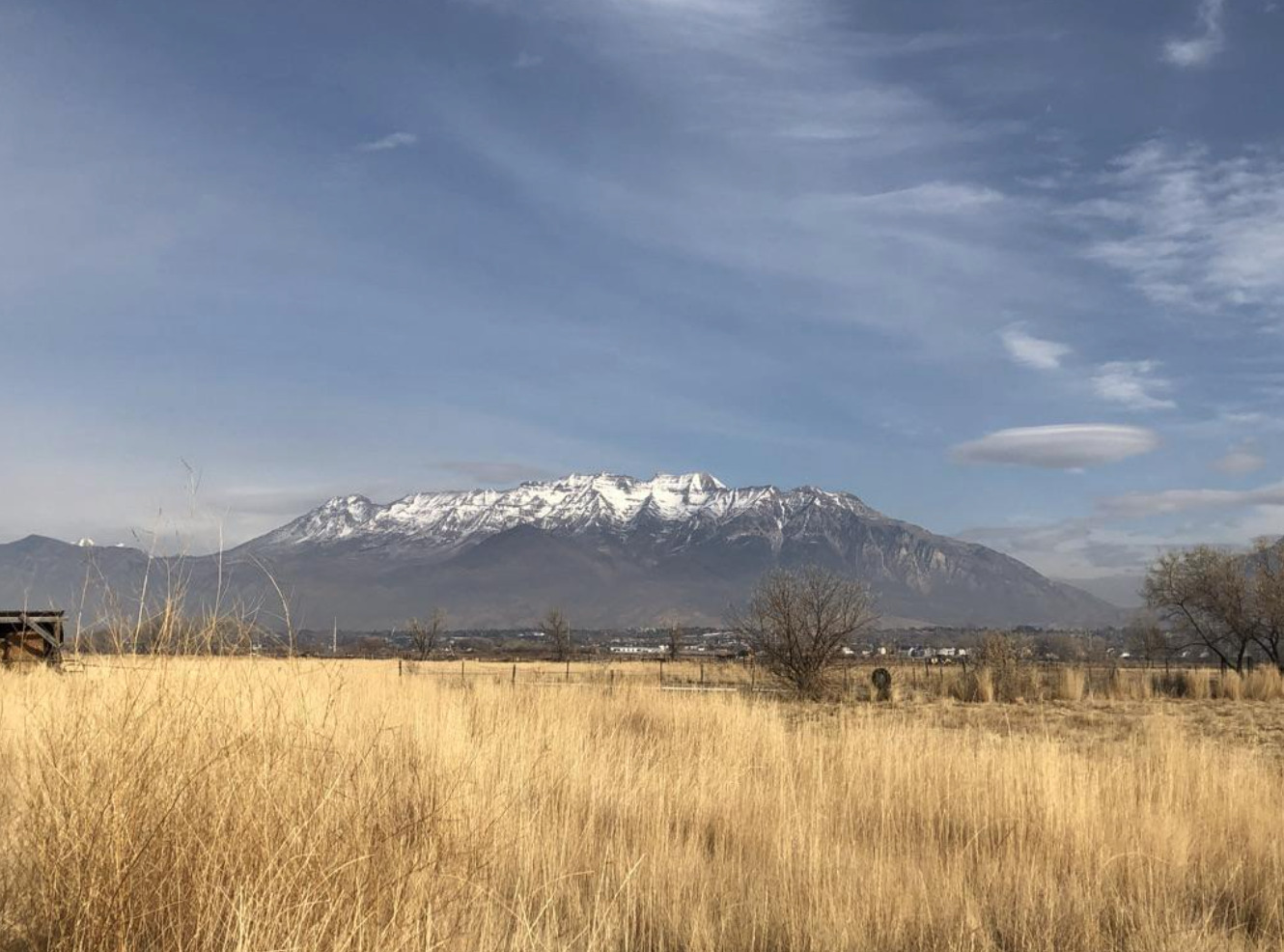
    <summary type="html"><![CDATA[<p><strong><em>Battle Creek Canyon's name originates from Utah's first major skirmish between the Utes and the Mormon militia. </em></strong></p><img src="https://www.intermountainhistories.org/files/fullsize/54eea90162a257c6e9cd4299408aea71.jpg" alt="Kade Dallin, Purple Mountain Majesties, 2020.
" /><br/><p><span style="font-weight:400;">When the pioneers of the Church of Jesus Christ of Latter-day Saints entered the Salt Lake Valley, they generally settled in what is now Salt Lake County on the Wasatch Front. The area was largely a desert and many, including some mountain men, suggested that the people settle further south in the freshwater valley that now comprises the bulk of Utah County. Brigham Young immediately sent out people to found colonies, cities, and towns throughout modern Utah, Arizona, Nevada, California, and Mexico. Yet, the pioneers balked at the initial thought of settlement in Utah Valley because of the native tribes who already lived there. Various bands of the Ute and Timpanogos tribes lived throughout the valley and had a reputation of being warlike and aggressive as a way to defend their land and livelihood. </p>
<span style="font-weight:400;">The pioneers especially resented the Ute practice of poaching the settler’s cattle. Roman Nose, a prominent Ute, was particularly troublesome. He led a band that repeatedly raided the farms and ranches near the valley border, and was even accused of stealing several of Brigham Young’s personal horses. After Brigham Young heard of the theft, he ordered Captain John Scott to lead a posse against the Utes in hopes of apprehending Roman Nose and his band. Their orders were to find the band of thieves and to “take such measures as would put a final end to their depredations in the future.” In 1849, they began raiding the Ute bands they deemed responsible for the loss of the livestock. However, Brigham Young soon discovered that the Utes had been mistakenly blamed: his horses had simply been moved to different pastures. He ordered Scott and the posse to stand down, but they refused. </p>
<span style="font-weight:400;">On the morning of March 5, 1849, the relationship between Mormon settlers and the local band of Timpanogos Indians deteriorated into brutal hostility in what is now Pleasant Grove, Utah. Scott’s rogue posse of 44 men soon arrived where they found the Ute camp which they thought participated in the raids. The group surrounded the sleeping camp and opened fire in a reign of terror. The members of the posse then hunted down many of the Utes who managed to escape the initial shootout. In total, they killed seventeen men, women, and children, including Roman Nose. </p>
<span style="font-weight:400;">After seeing the massacre, the chief of the Native American tribe, Little-Chief was distraught. Although he reportedly agreed that the killing of the supposed thieves was justified, he understood that this would cause a rift to form between white settlers and local tribes. This event, among many other skirmishes, led to heightened tension between the two groups and permanently damaged the already delicate relationship between the Native American tribes and the Mormon settlers. After this event, the area became known as Battle Creek Canyon and is today memorialized by the Battle Creek Marker. </span>


</p><p><em><strong><a href="https://www.intermountainhistories.org/items/show/757">For more (including 2 images) view the original article</a></strong></em></p>]]></summary>
    <published>2023-10-22T05:05:29+00:00</published>
    <updated>2026-04-17T19:32:16+00:00</updated>
    <link rel="alternate" type="text/html" href="https://www.intermountainhistories.org/items/show/757"/>
    <id>https://www.intermountainhistories.org/items/show/757</id>
    <author>
      <name>Kade Dallin, Brigham Young University&amp;#32;&amp;amp;&amp;#32;Bryce Revelli, Brigham Young University</name>
    </author>
  </entry>
  <entry>
    <title type="html"><![CDATA[Serving My People and the Earth Mother: Bear Tribe Medicine Society]]></title>
    <summary type="html"><![CDATA[<p><strong><em>Bear Tribe Medicine Society was an interracial center founded in 1971 by Sun Bear, an Ojibwe man who had a vision of people of all ethnicities coming together to learn to live in harmony with the Earth. It was controversial among some Native American groups who felt that he was commercializing Native spirituality.</em></strong></p><img src="https://www.intermountainhistories.org/files/fullsize/8e7de5dc5d0dc54c37cd2525860f464c.jpg" alt="Sun Bear" /><br/><p><p style="font-weight:400;">Bear Tribe Medicine Society was founded by Sun Bear (1929-1992), a half-Ojibwe man born as Vincent LaDuke on the White Earth Reservation in Minnesota. After travelling the country, he landed in California, where he worked as a Hollywood actor. He also was involved with various self-help and fundraising activities for Native communities.
<p style="font-weight:400;">Sun Bear related that he learned the ways of medicine men from his uncles and older brothers on the reservation, and then studied with other tribes around the country. He worked as a medicine man exclusively for Native people until 1971, when he had visions of catastrophic changes to the Earth due to the imbalances created by modern secular society, and a revelation that he should start working with non-Native people. He later stated that his purpose was to look for ways to serve his people and the Earth Mother and clarified that “his people” referred to not only Native people but others seeking a more harmonious way of living. He went on to establish the Bear Tribe Medicine Society, described as an “ecologically oriented cooperative community striving to relearn a harmonious relationship to the Earth Mother, the Great Spirit, and the mineral, plant, animal, and human kingdoms of the earth.”
<p style="font-weight:400;">As of 1988, the Society had a full-time community of fifteen to twenty<span> </span>members who lived on a forty-acre farm on Vision Mountain in Tumtum, near Spokane, Washington, as well as 320 apprentices who lived across the country. The society offered a ten-day screening program in order to select new apprentices. The community valued self-sufficiency. Aside from organizing seminars and workshops, members engaged in various economic activities including publishing a magazine and books and organizing events where Native craftspeople from reservations could earn income. They raised 80-90% of their own food and collected timber left by local loggers for fuel.
<p style="font-weight:400;">Upon Sun Bear’s death in 1992, leadership of the Bear Tribe Medicine Society passed to his assistant Wabun Wind, who led the group for four years until passing the role on to Wind Daughter, a long-time student. She continues to lead the community under the name of Panther Lodge Bear Tribe Medicine Society in Mobile, AL.
<p style="font-weight:400;">Sun Bear encountered criticism from some Native American groups who labelled him as a “plastic medicine man” and claimed that he was commercializing Native American spiritual practices. They felt that he was not a recognized leader in any tribe and that one cannot simply start one’s own tribe. Sun Bear contended that he was not teaching truly Indian spirituality but rather something else, as he took inspiration from the practices of various tribes and added to them with his own ideas. In response to the claim that Sun Bear was profiting from traditional cultural practices, one author commented that Sun Bear drove a beat-up car and lived on a small stipend.
<p style="font-weight:400;">Winona LaDuke, the daughter of Sun Bear and a Jewish-American woman, is an activist who became the first Green Party candidate and the first Native-American woman to receive an electoral college vote for vice president of the United States.</p><p><em><strong><a href="https://www.intermountainhistories.org/items/show/707">For more (including 4 images) view the original article</a></strong></em></p>]]></summary>
    <published>2023-02-22T16:19:26+00:00</published>
    <updated>2026-04-17T19:32:15+00:00</updated>
    <link rel="alternate" type="text/html" href="https://www.intermountainhistories.org/items/show/707"/>
    <id>https://www.intermountainhistories.org/items/show/707</id>
    <author>
      <name>Evan Železny-Green, Northern Arizona University</name>
    </author>
  </entry>
</feed>