<?xml version="1.0" encoding="UTF-8"?>
<feed xmlns="http://www.w3.org/2005/Atom">
  <title type="text">Intermountain Histories</title>
  <updated>2026-04-17T19:32:12+00:00</updated>
  <generator uri="http://framework.zend.com" version="1.12.20">Zend_Feed_Writer</generator>
  <link rel="alternate" type="text/html" href="https://www.intermountainhistories.org/"/>
  <link rel="self" type="application/atom+xml" href="https://www.intermountainhistories.org/items/browse?output=rss2"/>
  <id>https://www.intermountainhistories.org/</id>
  <author>
    <name>Intermountain Histories</name>
    <uri>https://www.intermountainhistories.org</uri>
  </author>
  <link rel="hub" href="https://pubsubhubbub.appspot.com/"/>
  <entry>
    <title type="html"><![CDATA[Fort Hall: Nathaniel J. Wyeth’s Snake River Outpost]]></title>
    <summary type="html"><![CDATA[<p><strong><em>Nathaniel J. Wyeth established a fort along the Snake River that acted as a significant military and economic waypoint to the American West. Even after passing from his hands, the fort maintained its strategic and even religious significance.</em></strong></p><img src="https://www.intermountainhistories.org/files/fullsize/2b5558685da96adff0223558e857869c.jpg" alt="Fort Hall replica" /><br/><p>Boston inventor and businessman Nathaniel J. Wyeth conducted two separate expeditions to the Pacific Northwest in 1832 and 1834 with his Columbia River Fishing and Trading Company. On his latter expedition, Wyeth established a fort in what is now Idaho and named it after his traveling partner, Hall J. Kelly. While the longevity of Wyeth’s company was limited, Fort Hall stood as an essential location for the military, Oregon Trail, and California Tsrail for decades. Its replica now stands as a long-lasting monument to the Rocky Mountain fur trade and mountain man era of the 1830s.
Located at the future junction of the California and Oregon overland trails, Fort Hall transitioned from a fur trade post to a vital resupply destination for American overlanders, Indigenous peoples, and fur traders alike. In a letter to his uncle Jarvis on October 6, 1834, Wyeth described the fort: “Its Bastions stand a terror to the sculking Indian and a beacon of saf[e]ty to the fugitive hunter.”
Even after the fort was sold to the Hudson Bay Company in 1836, and later purchased by the U.S. military, it remained an important landmark for the next 80 years. Its significance came as no surprise to Wyeth. Its strategic location on the Snake River made it an ideal spot for transferring supplies and for troop garrisons on the frontier. In his statement of facts concerning the sale of the fort he wrote: “disposing of the property to the best advantage. All the property in the interior including Fort Hall was sold, it being necessary to retain that post, to keep up a garrison for its defense against the Indians, and to forward annual supplies to it, an operation at that time beyond our means.”
What made Fort Hall especially unique to the history of American expansionism was the presence of Protestant American missionaries. While many European powers had colonized through religion, this was one of the first official ecumenical efforts to spread religious beliefs in this American region. This exemplified how Manifest Destiny envisioned expansion not only economically, but also religiously, as America established its presence as a power on the frontier.
There are only seven American-built forts along the Oregon Trail. Each stand as a legacy to American expansion. While Nathaniel Wyeth only maintained the fort for two years, the fort was built on principles which came to define America as a nation.</p><p><em><strong><a href="https://www.intermountainhistories.org/items/show/580">For more (including 3 images) view the original article</a></strong></em></p>]]></summary>
    <published>2022-03-12T10:30:23+00:00</published>
    <updated>2026-04-17T19:32:12+00:00</updated>
    <link rel="alternate" type="text/html" href="https://www.intermountainhistories.org/items/show/580"/>
    <id>https://www.intermountainhistories.org/items/show/580</id>
    <author>
      <name>Ruth Hardy, Brigham Young University</name>
    </author>
  </entry>
  <entry>
    <title type="html"><![CDATA[Battle of Julesburg]]></title>
    <summary type="html"><![CDATA[<p><strong><em>After American militias massacred Cheyenne and Arapaho as part of the Civil War in the West, indigenous warriors banded together, determined to not let American colonizers’ unwarranted violence go unanswered.</em></strong></p><img src="https://www.intermountainhistories.org/files/fullsize/39ffd1ff27a2be44f963f783464803e2.jpg" alt="Battle of Julesburg" /><br/><p>In January 1865, Julesburg, Colorado was 200 miles east of Denver. Complete with an eating-house, stable, blacksmith, repair shop, granary, and corral, the town was an important waystation for immigrants and settlers traveling along the Platte River on the Oregon Trail.
However, Julesburg’s relative prominence also made it a target for Native retaliation after the Sand Creek Massacre. Six weeks earlier, on November 29, 1864, led by brevet Colonel John Chivington, the 675-men strong Third Colorado massacred several hundred Cheyenne and Arapaho men, women, and children in southeastern Colorado Territory. Dog Soldiers (a militant Cheyenne subgroup) allied with other Cheyenne, Arapaho, and Lakota warriors to avenge their relatives who died at Sand Creek. In total, they numbered some 1200 Dog Soldiers and other warriors. Sitting Bull, Spotted Tail, Pawnee Killer, and others led the attack on Julesburg. On January 7, 1865, the allied Natives found that many soldiers had left town as part of their regular patrols, leaving only 37 men to defend the fort at Julesburg.
A small group of Lakotas led the initial charge. Nicholas James O’Brien, a highly decorated Civil War soldier and commander of the troops at Julesburg, saw the oncoming attack and pursued the Lakotas, unwittingly falling into their strategic trap to encircle the soldiers once they had been separated from reinforcements. The Native alliance intended to surround the American soldiers, but some young Cheyenne left their position too early before the entrapment could be realized. Despite this minor lapse, within a few minutes of fighting, nearly half of the U.S. soldiers were killed.
O’Brien led his surviving soldiers back to the fort, and the Native alliance laid siege. The remaining tribesmen entered Julesburg and raided every building. George Bent, a Cheyenne who participated in the raid, recalled that allied Natives found all the goods they desired. Tribal women brought extra horses to carry the spoils back to their camps. The horses were so heavily loaded that it took three days to make the return trip home. The raid lasted the whole day and became the first of many Cheyenne, Arapaho, and Lakota raids conducted in the Central Plains over the coming months. The accumulation of goods brought sustenance to the tribes that winter while the United States took a staggering blow to their efforts to control American Indian affairs during the Civil War.</p><p><em><strong><a href="https://www.intermountainhistories.org/items/show/576">For more (including 4 images) view the original article</a></strong></em></p>]]></summary>
    <published>2022-03-12T07:54:28+00:00</published>
    <updated>2026-04-17T19:32:12+00:00</updated>
    <link rel="alternate" type="text/html" href="https://www.intermountainhistories.org/items/show/576"/>
    <id>https://www.intermountainhistories.org/items/show/576</id>
    <author>
      <name>Ryan Blamires, Brigham Young University</name>
    </author>
  </entry>
  <entry>
    <title type="html"><![CDATA[Camels at Missoula]]></title>
    <summary type="html"><![CDATA[<p><strong><em>Though camels were well adapted to the harsh conditions of little water and extreme temperatures that prevail in the American West, they never became common beasts of burden because they frightened the ubiquitous horses and mules. The advent of railroads also made them obsolete for improving supply lines.</em></strong></p><img src="https://www.intermountainhistories.org/files/fullsize/06e68eff813ad5be0b7024fb0a1f829b.jpg" alt="Mullan Road" /><br/><p>As an instrumental wagon route across the Rocky Mountains, the Mullan Road carried much of the traffic between Fort Benton in what is now Montana to Fort Walla Walla in present-day Washington. With the discovery of placer and quartz mines in places such as Gold Creek, Virginia City, Bear Gulch, and Deer Lodge in Montana from 1862 to 1864, population and the demand for supplies boomed. Along this route plodded horses, mules, and also camels.
The first arrived in Montana in 1865. Some had been bought from Nevada salt delivery trains; others had been acquired from the scattered stock of the US government’s short-lived Camel Corps. Still others may have come from the efforts of businessman Frank Laumeister to employ them in the British Columbia Cariboo Mining Company. These camels carried everything from mail to flour to nail kegs to gold dust, and they worked the routes between mining camps in the west and south of Montana territory before they began plying the Mullan Road across the Rockies. These exotic creatures made for memorable stories, including one in which a hunter shot one down thinking it was a moose, and had to surrender to the camel’s owner his cash, gun, ammunition, watch, and his deed to a claim in Ophir. Though both the camel’s owner and the <em>Montana Post</em> article printing the story ridiculed this hunter for being ignorant of camels, quotidian camel sightings did not remain a feature of western Montana life for long. A settler who moved to the Helena area at the age of nine in 1867 reported that by then camel trains were already the subject of stories only and not firsthand experience.
A major obstacle against widespread adoption of camels, despite their load carrying capacity and remarkable endurance, was that mules and horses could not stand them. The smell and sight of camels instigated many commotions, including one that deprived Missoulans of their Fourth of July shipment of liquor. One Montana settler even claimed he won a bet based on horses’ fear of camels.
Furthermore, camels had to compete not only with other, more common beasts of burden, but also with the railroads advancing across the continent. The establishment of transcontinental rail systems shaped the development of transport, trade, and settlement away from the highway of the Mullan Road that camels traveled and, eventually, away from the need for camels at all. While the 1869 track connection did not pass directly through Montana, merchants and settlers and territorial governments pioneered new southerly transportation routes to link up with the transcontinental railway. Given the opposition of many muleteers and horse handlers, it is not surprising camels were not transplanted to these new trails. Then, 1883 saw the completion of Montana’s own Northern Pacific Railroad, reducing the necessity of the Mullan Road and the camels that plied it. These Montanan camels soon faded into the stuff of legend and colorful history.</p><p><em><strong><a href="https://www.intermountainhistories.org/items/show/528">For more (including 5 images) view the original article</a></strong></em></p>]]></summary>
    <published>2021-10-22T21:54:24+00:00</published>
    <updated>2026-04-17T19:32:11+00:00</updated>
    <link rel="alternate" type="text/html" href="https://www.intermountainhistories.org/items/show/528"/>
    <id>https://www.intermountainhistories.org/items/show/528</id>
    <author>
      <name>Emily Moore, Northern Arizona University</name>
    </author>
  </entry>
  <entry>
    <title type="html"><![CDATA[Camels at Fort Defiance]]></title>
    <summary type="html"><![CDATA[<p><strong><em>The US government brought camels to the Southwest to use them in the short-lived US Camel Corps, formed in 1857 and lasting until 1863, which experimented with the pack animals for military use. Lieutenant Edward Fitzgerald Beale used them to survey a wagon route from Fort Defiance to the Colorado River, charting the “dim, uncertain, and unknown.”</em></strong></p><img src="https://www.intermountainhistories.org/files/fullsize/746aac8579a2592361a2a2a65a514dba.jpg" alt="Camel camp" /><br/><p>Fort Defiance marks the starting point of Lieutenant Edward Fitzgerald Beale’s 1857–1858 wagon road survey across the 35th parallel to the Colorado River, the very first deployment of the US Camel Corps. The government was eager to boost the efficiency of transport and trade between the East and California and furthermore wanted to survey the land acquired from the Mexican government after the Mexican–American War. Recommendations by military officials such as Major Henry C. Wayne eventually resulted in two shipments of camels, as well as camel handlers such as the Arizona-famous Hi Jolly, docking at Indianola, Texas, on May 14, 1856. From there they were moved to a fort near San Antonio. Lieutenant Beale, appointed by Major Wayne to use this Camel Corps for the wagon road survey, set out from San Antonio with twenty-eight camels on June 25, 1857.
Along the way to Fort Defiance, Lieutenant Beale was to meet up with a Colonel Loring, a general who had lost one arm in the Mexican War and would later go on to help train troops in Egypt. At this early date, however, he was unacquainted with camels, and Beale rather literally left him in the dust, as the camel Beale was riding easily outpaced Loring’s horse. They met back together some two days later and reached Fort Defiance together on August 25, 1857.
Colonel Edwin Vose Sumner established Fort Defiance to assert dominance over the Navajo population with a military presence. Lacking defensive fortifications, however, it took the form of a “military village,” with barracks, stables, storehouses, a civilian trading store, a hospital, and a structure for Navajos staying overnight, all arrayed around a parade ground. At this time, the fort held a tentative peace with the Native Americans of the region. They traded with the Zuni and the Navajo for food, but the fort occupied what had been grazing land, and occasional raids continued. While 1856–1857 was relatively quiet around the vicinity of the fort, Beale’s careful notes of any Native American sightings or interactions on his journey demonstrate the government’s uneasy relationship with the native inhabitants of the territory.
When he reached Fort Defiance, Beale wrote in his journal that “No one who has not commanded an expedition of this kind, where everything ahead is dim, uncertain, and unknown, except the dangers, can imagine the anxiety with which I start upon this journey.” Beale himself had already led an expedition such as this, charting a “Central Route” to California in 1853 from Missouri. Seeing the camels’ performance on this expedition from Fort Defiance left Beale with great admiration for their ability to carry enormous loads, travel great distances, and go long periods of time without water. He even developed a particular affinity for one camel named Seid.  Even after the Camel Corps was officially disbanded, Beale kept a collection of camels at his ranch near Fort Tejon, California.</p><p><em><strong><a href="https://www.intermountainhistories.org/items/show/525">For more (including 5 images) view the original article</a></strong></em></p>]]></summary>
    <published>2021-10-20T09:06:17+00:00</published>
    <updated>2026-04-17T19:32:11+00:00</updated>
    <link rel="alternate" type="text/html" href="https://www.intermountainhistories.org/items/show/525"/>
    <id>https://www.intermountainhistories.org/items/show/525</id>
    <author>
      <name>Emily Moore, Northern Arizona University</name>
    </author>
  </entry>
  <entry>
    <title type="html"><![CDATA[Cove Fort<br />
: A Bulwark of Safety]]></title>
    <summary type="html"><![CDATA[<p><strong><em>Cove Fort is one of the few remaining forts built by the Latter-day Saint pioneers. Under the direction of Brigham Young, the fort was constructed in 1867 by Ira Hinckley and 40 other men near Cove Creek in today’s Millard County. Originally intended to protect travelers from attack, the fort served as a major waystation for more than a decade. After changing ownership several times, the Hinckley family purchased the fort in 1989 and later donated it to The Church of Jesus Christ of Latter-day Saints.</em></strong></p><img src="https://www.intermountainhistories.org/files/fullsize/0ef807b9607b7b3937c89b7c5f788dd3.jpg" alt="Cove Fort" /><br/><p>In the spring of 1865, Mormon settlers met with Utes of Sanpete Valley, hoping to find a resolution to years of sporadic disagreements and occasional violence between the groups. Instead of alleviating tensions, however, even greater violence erupted with the onset of the Black Hawk War. Brigham Young previously encouraged the Saints to treat Indians well, saying, “We are settled upon their lands, which materially interrupts their success in hunting, fishing, etc… For these reasons, it behooves us to exercise toward them all possible kindness, liberty, patience, and forbearance.” While his policy of kindness toward Native Nations continued, Young simultaneously recognized Mormon settlers were vulnerable to attack after dispossessing tribes of some of their settlement sites and using up the region’s finite resources.</p><p>The area around Cove Creek was a particularly dangerous resting place for travelers as 30 miles of uninhabited desert lay in both directions. On April 12, 1867, Circleville resident Ira Hinckley received a letter from Brigham Young extending a calling for him to construct a fort near Cove Creek. Its purpose was to “afford protection from the Indians to the Telegraph & Mail Stations and to travelers who are almost constantly on the road. Also to furnish feed and protection from and weather to this latter class.” Hinckley immediately told the messenger to tell Brigham Young he would accept the calling.</p><p>A few days later, Hinckley traveled to Cove Creek with his brother Arza and forty other men, and within seven months they finished building Cove Fort. While <span>most pioneer-era forts were wooden, Cove Fort was instead constructed out of volcanic rock, contributing to its structural longevity.</span></p><p></p><p>Although relatively small, measuring 100 feet by 100 feet, Hinckley and his men built an impressive fortress. The walls were 18 feet high, 4 feet thick at the base, and 2 feet at the top. Gun ports lined the walls. The fort had rooms for the Hinckley family, visitors, a kitchen and dining area, and a room for a telegraph station, which was installed in February 1867. There was also a ranch on site to provide food and a blacksmith shop to service the horses and wagons of travelers.</p><p>While the fort was initially designed for protection, it was never attacked, and the inhabitants maintained good relations with the local tribes. It did, however, serve as a refuge for all those that visited. Families, telegraph operators, mail carriers, trail workers, and even occasional Utes called upon the Fort for a place to sit or stay the night. Hinckley’s son Ira Parnell Hinckley said, “Within its then impregnable walls were safely sheltered thousands, both good and bad, the venturesome and the timid, the desperado and the saint, as they moved westward in quest of gold, or eastward in disappointment, or back and forth in their routine duty. Without it, what might have been, no one knows.”</p><p>The fort was used as a waystation from 1867 to 1882, but as the railroad became increasingly popular, fewer travelers visited the fort. The Hinckley family occupied Cove Fort until 1890, and then in 1919 the Church signed it over to William Henry Kesler. In 1989, descendants of Ira and Arza Hinckley purchased the land back from the Kesler family and subsequently donated it to The Church of Jesus Christ of Latter-day Saints. The Church restored Cove Fort to its original condition and Gordon B. Hinckley, then a member of the Church’s First Presidency and a descendant of Ira Hinckley, dedicated it as a historic monument on May 21, 1994.</p><p><em><strong><a href="https://www.intermountainhistories.org/items/show/468">For more (including 4 images) view the original article</a></strong></em></p>]]></summary>
    <published>2021-09-10T06:57:52+00:00</published>
    <updated>2026-04-17T19:32:09+00:00</updated>
    <link rel="alternate" type="text/html" href="https://www.intermountainhistories.org/items/show/468"/>
    <id>https://www.intermountainhistories.org/items/show/468</id>
    <author>
      <name>Bethany Erickson, Brigham Young University&amp;#32;&amp;amp;&amp;#32;Lindsey Conger, Brigham Young University</name>
    </author>
  </entry>
  <entry>
    <title type="html"><![CDATA[Fort Utah (Provo)]]></title>
    <summary type="html"><![CDATA[<p><strong><em>Within a year of the establishment of Fort Utah, relations between Latter-day Saint settlers and the Timpanogos Utes dissolved into violence, culminating in a two-day conflict. The original Fort Utah has since been demolished, but a replica stands in its place in Provo, Utah.</em></strong></p><img src="https://www.intermountainhistories.org/files/fullsize/0d695e51f1f5d39ac9125b391c285fc3.jpg" alt="Drawing of Fort Utah in the winter" /><br/><p>Fort Utah was first established a mile and a half east of Utah Lake by a company of one hundred and fifty Latter-day Saints. Led by John Higbee, the Saints arrived on April 1, 1849. They chose the location with the intention to farm on the fertile river soil, but when President Brigham Young visited the fort, he suggested they move to higher ground. The secondary location became the nucleus for the city of Provo. The Saints settled next to the indigenous village of the Timpanogos Utes. Initially, the Utes treated their new neighbors with kindness and generosity, and they fished and gambled together.
That winter, however, misunderstandings broke out between the Utes and Saints. It began in August with a dispute between Richard Ivie and a native known to the Latter-day Saints as Old Bishop, whom Ivie accused of stealing his shirt. When Bishop refused to give the shirt up, Ivie and his friends killed him and threw his body into the Provo River. Furious, the Timpanogos demanded the settlers hand over the murderers. When their requests were denied, they insisted the Saints provide compensation for Bishop’s death, which the Saints also refused. Considering how generous the tribe had been in sharing their prized fishing and hunting resources during the summer, the Utes felt justified in collecting rent through involuntary cattle and corn payments from their neighbors during the fall and winter. As the amicable relations began to sour, Higbee asked Brigham Young permission to declare war against the Timpanogos, whom he misrepresented to Young as hostile.
Young granted the request. Parley P. Pratt and Willard Richards agreed with him, not wanting to find themselves cut off from their southern colonies. They sent the Nauvoo Legion to assist the local Latter-day Saints in attacking the Timpanogos. After just one day, the soldiers cornered their enemies into an abandoned cabin. The next day they placed shields on sledges and attacked. Desperate, the natives fled during the second night only to be hunted down. When the fighting ended, there were more than one hundred Timpanogos casualties and one dead Latter-day Saint. This dark episode serves as a reminder that while Latter-day Saints generally had positive interactions with the Native Americans, there were certainly episodes of unwarranted and reprehensible violence.</p><p><em><strong><a href="https://www.intermountainhistories.org/items/show/465">For more (including 3 images) view the original article</a></strong></em></p>]]></summary>
    <published>2021-09-09T22:51:24+00:00</published>
    <updated>2026-04-17T19:32:09+00:00</updated>
    <link rel="alternate" type="text/html" href="https://www.intermountainhistories.org/items/show/465"/>
    <id>https://www.intermountainhistories.org/items/show/465</id>
    <author>
      <name>Andrew Burt, Brigham Young University</name>
    </author>
  </entry>
  <entry>
    <title type="html"><![CDATA[Fort Verde State Park and General Crook]]></title>
    <summary type="html"><![CDATA[<p><strong><em>Brigadier General George R. Crook (September 8, 1828 -March 21, 1890) is popularly recognized as the quintessential 'Indian Fighter' of the late nineteenth century, despite the fact that he sometimes expressed anger not at the native peoples but toward the interfering white settlers. In 1871 Crook's forces deployed from Fort Verde in the northern Arizona Territory in pursuit of the Tonto Apache.</em></strong></p><img src="https://www.intermountainhistories.org/files/fullsize/6c733c5983f11c9a8df63d66a11a7fcc.jpg" alt="Married Officers&#039; Quarters" /><br/><p>General George R. Crook used Fort Verde in northern Arizona Territory as his primary base of operations for the unenviable task of relocating Apache tribes in the Arizona territory onto reservations. Located at the confluence of the East Fork of Beaver Creek and the 'Rio' Verde River, at the base of the Colorado Plateau, Fort Verde housed officers, doctors, enlisted men, families, and scouts. Many of the officers' wives enjoyed their time at the fort because of its many modern amenities including, bath tubs, silver ware, and draperies. Martha Summerhayes (wife of Lt. John Summehayes) recounted that she felt as though they had finally reached “civilization” when arriving at Fort Verde. </p><p>Crook's objective at Ft. Verde was to provide protection to the early settlers, the Butterfield Stage, and to facilitate the removal of all Indians from both Verde Valley and the Tonto Basin to the east. Crook appreciated the necessity of recruiting scouts. Captain John G. Bourke remembered, “There were Navajoes(sic), Apaches, Yaquis, Mexicans, and half-breeds of any tribe one could name.” Among the most celebrated scouts were Alchesay, and Chiquito, both of whom received the Medal of Honor for their actions against the Tonto Apache. Crook also admired how   “Our Indian allies would crawl upon their hands and knees for long distances.” in pursuit of renegades.  Crook especially appreciated this dedication given the challenge of the rugged Tonto terrain north of the fort, “There is hardly a space of ten miles square, that has not some lava bed, precipitous canyons, or caves with which the Indians can hold out.” After three years of driving the Tonto Apache from their rugged homeland, the Army force marched the survivors 180 miles to the reservation at San Carlos. The War Department  also required the peaceful Yavapai people to join their Apache neighbors on the journey referred to as the 'Exodus'.    </p><p>Ironically, one of the greatest challenges for the Army was protecting the Indians from the homesteaders. In a letter to General Philip H. Sheridan, Crook described, “There are large flocks of human vultures wrangling over the patronage to be bestowed, and who in greed do not hesitate at any deed; the complications arising can be imagined.” The most egregious incident resulted in the death of a young cavalry officer in a conflict with local settlers.  Lieutenant Jacob Arny lost his life, defending the Indians from the settlers.  Despite Crook's request for punishment, the courts never prosecuted the locals responsible for the deed.  </p><p>The State of Arizona established Fort Verde State Park in 1972, in recognition of it being the finest, preserved military facility of the Indian Wars in the state. The Park features the former administrative building, the doctor's quarters, the officer's quarters, the married officer's quarters, and a significant collection of military artifacts.</p><p><em><strong><a href="https://www.intermountainhistories.org/items/show/337">For more (including 4 images) view the original article</a></strong></em></p>]]></summary>
    <published>2019-09-18T03:58:22+00:00</published>
    <updated>2026-04-17T19:32:06+00:00</updated>
    <link rel="alternate" type="text/html" href="https://www.intermountainhistories.org/items/show/337"/>
    <id>https://www.intermountainhistories.org/items/show/337</id>
    <author>
      <name>Robert M. Estrada, Northern Arizona University</name>
    </author>
  </entry>
  <entry>
    <title type="html"><![CDATA[Fort Fetterman State Historic Site and General Crook]]></title>
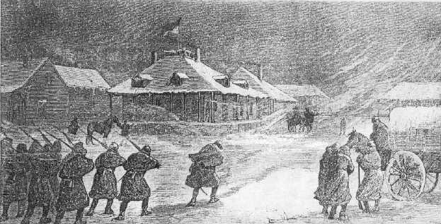
    <summary type="html"><![CDATA[<p><strong><em>Brigadier General George R. Crook (September 8, 1828 -March 21, 1890) is popularly recognized as the quintessential 'Indian Fighter' of the late nineteenth century, despite expressing sympathy for his native adversaries. In the summer of 1876, Crook's forces deployed from Fort Fetterman in central Wyoming on three Yellowstone Expeditions to force the Plains Indians onto reservations.</em></strong></p><img src="https://www.intermountainhistories.org/files/fullsize/ab8b9b567b5421ec48af7c746016a2a0.jpg" alt="Fort Fetterman, 1876" /><br/><p>In 1876, Fort Fetterman, near present-day Douglas, Wyoming, served as the embarkation site for General George Crook's three Yellowstone Expeditions into the Powder River region. General Philip H. Sheridan ordered Crook to facilitate the relocation of the Sioux and Northern Cheyenne onto the reservations at Standing Rock and Pine Ridge, Dakota Territory, after they had been driven from the Black Hills.  Crook had the support from the 7th Cavalry of Lieutenant Colonel George A. Custer to the North and General J.J. Reynold's 2nd Cavalry to the East. </p><p>The Fort had been named for Captain William J. Fetterman, who was killed on December 21, 1866 near Fort Kearney, Wyoming. A year later, the army constructed Fort Fetterman to provide protection for European Americans traveling west on the Bozeman trail. After the Fort Laramie Treaty of 1868, Ft. Fetterman became the most remote outpost on the Northern Plains.               </p><p>The journey to Fort Fetterman possessed its own share of hardship. To reach the fort, it was necessary for troopers and teamsters to cross the high spring waters of the North Platte.  The fast current made it necessary to ferry the mules across the river, “because the animals would not approach the swollen Platte; here they showed more sense than the men in charge” recounted Captain John G. Bourke. Despite their cautions, a teamster fell into the river and drowned in late July 1876.                                                              </p><p>Once at the fort, Crook and his men learned Fort Fetterman was one of the worst outposts to be assigned to during the 1870's. Troopers wrote home about the “lack of female society” and the harsh winter conditions. The soil did not support a garden, which normally would provide vegetables for the soldiers. To be stationed at Fort Fetterman was considered a punishment in the cavalry.          </p><p>To prepare for the Yellowstone Expedition, soldiers at the fort organized and packed the 103 wagons and hundreds of pack mules.  Crook's 1,000 man force then departed Fort Fetterman on May 23, 1876. Crook hoped that this imposing force of strength would encourage the Sioux and Northern Cheyenne to report to their reservations. Crook felt optimistic about his mission to relocate the Plains Indians, recanting, “He is more ready to abandon his old habits and accept civilization, than civilization is to accept him.” Two weeks later, warriors surprised Crook with a frontal assault at Rosebud Creek, forcing his troops to retreat to Camp Cloud Peak and Ft. Fetterman.                                                 </p><p>Today, Fort Fetterman State Historic Site is administered by the State of Wyoming.  Only the officer's quarters and the ordnance building remain. These are decorated in period furnishings and feature multiple military artifacts, including maps and drawings of the 1870's. The State of Wyoming also has developed an interpretive trail, camping, and RV facilities for visitors.</p><p><em><strong><a href="https://www.intermountainhistories.org/items/show/336">For more (including 3 images) view the original article</a></strong></em></p>]]></summary>
    <published>2019-09-18T03:49:02+00:00</published>
    <updated>2026-04-17T19:32:06+00:00</updated>
    <link rel="alternate" type="text/html" href="https://www.intermountainhistories.org/items/show/336"/>
    <id>https://www.intermountainhistories.org/items/show/336</id>
    <author>
      <name>Robert M. Estrada, Northern Arizona University</name>
    </author>
  </entry>
  <entry>
    <title type="html"><![CDATA[Fort Apache Historic District and General Crook]]></title>
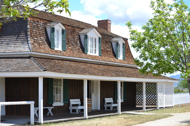
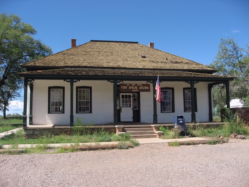
    <summary type="html"><![CDATA[<p><strong><em>Brigadier General George R. Crook (September 8, 1828 -March 21, 1890) is popularly recognized as the quintessential 'Indian Fighter' of the late nineteenth century, despite expressing admiration for his adversaries. In December 1870, Crook's forces established a camp known as Fort Apache in the territory of the White Mountain Apache.</em></strong></p><img src="https://www.intermountainhistories.org/files/fullsize/728298278231858bb3a3ca390e8c9870.jpg" alt="Former 1876 Adjutant&#039;s Office" /><br/><p>Fort Apache was the main terminus for General George Crook's recruiting efforts with the White Mountain Apache and in the forced relocation of most indigenous people in the area in 1874. In 1871, Camp Apache was a semi permanent bivouac with only a single log cabin for General Crook.  The majority of the permanent construction began in 1874 during the Apache and Yavapai 'Exodus' from the Verde Valley to the San Carlos Reservation. Captain John Bourke of the Third Cavalry recorded, “The post, still in the rawest state, is situated on a gently sloping mesa, surrounded by higher hills.”  Ten months later, the United States negotiated a treaty establishing the White Mountain Agency in November, 1871. In exchange, the White Mountain people supported the Army against the other tribes and were promised to retain their ancestral land and receive farming equipment.      </p><p>The tactical support of the White Mountain Apache was indispensable for the success of the Army's mission, and Crook responded with friendship. According to Captain James Shannon, “The Indian cannot be beaten at his own game. He is like a wild animal stalking his prey.” General Crook befriended Alchesay, a local chief and scout. During the campaign against the Tonto Apache, Alchesay was virtually inseparable from 'Gray Wolf', or General Crook. Many enlisted men were perplexed by the apparent friendship between the two men. Captain John G. Bourke remembered about Crook, “He wanted to treat the Apache just the same as he would treat any other man--as a man. He did not believe in one kind of treatment for the white and another for the Indian.”                                </p><p>Prior to the 'Exodus' relocation of the Tonto and Yavapai, Crook complained to General Philip H. Sheridan about the corruption with Indian agents in delivering promised material to the White Mountain Allies, “It was a grievance among the Indians at Fort Apache that they could get nothing from the Government, not even farming implements.” Crook was desirous to enforce the U.S. obligations in the treaty with the White Mountain Apache in order to maintain peace in  northern Arizona. In 1875, with much unfinished business, the army ordered General Crook to leave Arizona and report to the Department of the Platte. </p><p>The Fort Apache Historic District is the original site of the Fort Apache military post. Fort Apache was a major outpost during the Apache wars (1871-1886) and remained a military post until 1922. In 1923 the fort became the site of the Theodore Roosevelt Indian Boarding School. The district contains over thirty structures, ranging from a reconstruction of an early log building to original two-story dormitories.  Included in the Historic Site are the headquarters building, barracks, corrals, warehouses, a guardhouse, an armory, stables, and an old cemetery. The museum and surrounding property is operated by the White Mountain Apache Reservation.</p><p><em><strong><a href="https://www.intermountainhistories.org/items/show/335">For more (including 3 images) view the original article</a></strong></em></p>]]></summary>
    <published>2019-09-18T03:32:07+00:00</published>
    <updated>2026-04-17T19:32:06+00:00</updated>
    <link rel="alternate" type="text/html" href="https://www.intermountainhistories.org/items/show/335"/>
    <id>https://www.intermountainhistories.org/items/show/335</id>
    <author>
      <name>Robert M. Estrada, Northern Arizona University</name>
    </author>
  </entry>
  <entry>
    <title type="html"><![CDATA[The Old Pleasant Grove Fort<br />
]]></title>
    <summary type="html"><![CDATA[<p><strong><em>The Old Pleasant Grove Fort was built in response to the breakout of the Walker War. Brigham Young had counseled the Latter-day Saints to build forts for protection against Indian attacks. The fort was the starting point of the modern layout of Pleasant Grove. </p></strong></p><img src="https://www.intermountainhistories.org/files/fullsize/c0c61b640637527352c7773dc8bc152d.jpg" alt="Modern-day Marker of the Fort" /><br/><p>Ever since the LDS pioneers first came into Utah, Brigham Young encouraged the construction of forts for defense against the Indians. On one occasion on May 14, 1853, Brigham gave an address to the LDS people in the Tabernacle in Salt Lake City. He had been traveling around to the southern colonies and was reporting back and giving his counsel. He said: </p><p>"Every settlement that has been made in these valleys of the mountains has received strict charges from me to build in the first place a fort and live in it until they were sufficiently strong to live in a town to keep their guns and ammunition well prepared for any emergency and never cease to keep up a night watch if any apprehensions of the Indians being hostile were entertained." (Deseret News, May 14, 1853).</p><p>However, the settlers in Pleasant Grove did not build a fort as suggested by Brigham Young. When the settlers arrived at the Pleasant Grove site on September 13, 1850, they built their cabins close together to give them some protection.</p><p>When the Walker War broke out on July 17, 1853, the settlers hastily started construction of the fort in case the war made its way up to Pleasant Grove. They gathered together into a centralized area and began building the fort, covering about 4 square blocks. The fort had a public corral in the middle of it with about 120 cabins surrounding it about 10 rods out from the corral (about 55 feet). The exterior wall was constructed about another 10 rods from the houses. The walls were four feet high, giving minimal protection against an attack, but enough of a barrier to protect themselves.</p><p>When the war ended in 1854, the settlers stopped construction on the fort. Lots of American and Scandinavian immigrants came and settled in Pleasant Grove. To accommodate the growth, more houses and roads were built on the grid system based off of the layout of the fort. The fort area became the historic downtown section of the city. All that’s left of the fort are corner markers showing where the four corners of the fort would have been, located on the corners of 100 North 100 West, 100 North 300 East, 300 South 300 East, and 100 West 300 South in the historic downtown area of Pleasant Grove. </p><p>The Old Pleasant Grove Fort was an important part of Pleasant Grove’s history. It centralized the settlement to its current site. It gave a sense of security to the settlers, which led to the expansion of the city. It is a fascinating section of Pleasant Grove’s history. </p><p><em><strong><a href="https://www.intermountainhistories.org/items/show/309">For more (including 3 images) view the original article</a></strong></em></p>]]></summary>
    <published>2019-02-22T08:04:53+00:00</published>
    <updated>2026-04-17T19:32:05+00:00</updated>
    <link rel="alternate" type="text/html" href="https://www.intermountainhistories.org/items/show/309"/>
    <id>https://www.intermountainhistories.org/items/show/309</id>
    <author>
      <name>Joseph Lewis, Brigham Young University</name>
    </author>
  </entry>
  <entry>
    <title type="html"><![CDATA[Camp Floyd Pony Express Station<br />
]]></title>
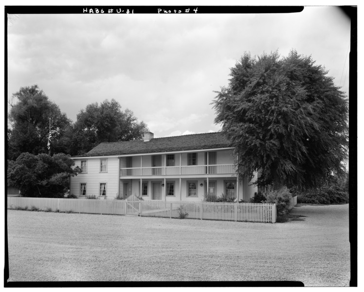
    <summary type="html"><![CDATA[<p><strong><em>The interval of time that this Pony Express station operated coincided with an economic boom in the late 1850s. The fast-paced town was a stopover for Pony Express riders and celebrities. </em></strong></p><img src="https://www.intermountainhistories.org/files/fullsize/ff43ca28da08ed83d18a38c4a318af77.jpg" alt="John Carson House, Main Street, Fairfield, Utah County, UT" /><br/><p>Camp Floyd, also called Fairfield Station, was located between Joe’s Dugout Station and East Rush Valley Station. Since it was in the town of Fairfield, Floyd Station was one of the more comfortable and safe layovers for pony express riders. Many stations were small shacks in the middle of the desert, but the Camp Floyd station was an adobe inn that John Carson built.</p><p>John Carson, John Williams, and a few others established the Fairfield settlement in 1858 when they built homes and moved their families to the area. The settlement grew into a town when the U.S. Army arrived later that year. On July 8, 1858, the army arrived at the place where they would build Camp Floyd.   The army ordered 16 million pounds of freight to be brought to Camp Floyd by the Russell, Majors, and Waddell firm. This contract forced the firm to expand their resources and capital. Russell, Majors, and Waddell would eventually create and operate the Pony Express. The construction of the camp was completed November 9, 1858, and it was named after Secretary of War John B. Floyd.</p><p>With the construction of Camp Floyd came an influx of soldiers. This raised the population of Fairfield to a booming 7,000. In its heyday, there were seventeen saloons to keep the residents entertained, and the town became quite rowdy. John Carson applied the strict precepts of his Mormon faith to the inn that he ran. Because of these standards, his inn became the designated place for famous and important visitors to stay. Mark Twain, Horace Greeley, Porter Rockwell, and Sir Richard Burton were among the celebrities who stopped at the inn. These big names shared a roof with the rugged riders of the Pony Express.</p><p>When the Civil War broke out in 1861, things began to change. John B. Floyd joined the Confederacy and so the fort was renamed Fort Crittenden. The soldiers were called eastward and, on July 27, 1861, the last remnants of the army departed. On their way out, the army burned down their buildings and detonated their unused ammunition. By September 2, 1861, there were only eighteen families in Fairfield. One month later, the Pony Express was shut down and Fairfield’s boom period ended.</p><p><em><strong><a href="https://www.intermountainhistories.org/items/show/196">For more (including 3 images) view the original article</a></strong></em></p>]]></summary>
    <published>2018-06-06T22:39:53+00:00</published>
    <updated>2026-04-17T19:32:02+00:00</updated>
    <link rel="alternate" type="text/html" href="https://www.intermountainhistories.org/items/show/196"/>
    <id>https://www.intermountainhistories.org/items/show/196</id>
    <author>
      <name>Samuel Hauber, Brigham Young University</name>
    </author>
  </entry>
  <entry>
    <title type="html"><![CDATA[Fort Boise&#039;s Historic Transitions]]></title>
    <summary type="html"><![CDATA[<p><strong><em>During the nineteenth century, the Boise Basin hosted an abundance of natural resources. These resources, specifically furs and gold, attracted settlers from the East, triggering a massive migration out West. Settlers, miners, and fur traders traveled the nearby Oregon Trail. A series of fort locations were employed starting in 1834 near the confluence of the Boise and Snake Rivers to provide support and stimulate economic growth by enabling settlers to trade goods with each other and nearby Native tribes. </em></strong></p><img src="https://www.intermountainhistories.org/files/fullsize/62d23d4b423fe9a0d3055e24e29e6bdf.jpg" alt="Fort Boise 2" /><br/><p>Snake Fort, founded in 1834 by Thomas McKay of the Hudson Bay Fur Trading Company, was originally located at the confluence of the Snake and Boise River near present-day Parma, Idaho, at the Oregon border. Later renamed Fort Boise, the fur trading post directly competed with Fort Hall, established by Nathaniel Wyeth, upriver in what is now present-day Pocatello, Idaho. The adobe style structure was highly susceptible to flooding, and Fort Boise was relocated several times within the general vicinity to reduce flooding risk. Within a few years, regional fur trading sharply declined, and the economy of Fort Boise transitioned to salmon fisheries. The great flood of 1853, along with escalating conflicts among settlers and Native Americans in 1854, contributed to its demise. The old fort was abandoned in 1855. </p><p>The new Fort Boise, situated in the heart of downtown Boise, Idaho, was established as a military post by the U.S. government in 1863 under the guidance of Major Pinkney Lugenbeel. Gold mining prevailed in the Boise Basin, and the military post provided a protective buffer to settlers and miners, reducing conflicts between them and surrounding tribes. Inspiration for the design came from brick buildings in Walla Walla, Washington, where Major Lugenbeel stopped on his way to the Boise Basin. Charles May, the builder responsible for the construction of the brick buildings, was hired to assist in the construction of Fort Boise. He used strong materials that consisted of brick and sandstone quarried from the nearby foothills and Table Rock.</p><p>In 1879, Fort Boise was renamed the Boise Barracks and served as a military base and a community center by hosting numerous social events such as theatrical performances, religious services, concerts, balls, tea and dinner parties, dancing, and tennis matches. The fort played a vital role in establishing the city and providing a center for diverse activities, meeting the needs of military and civilian. In the early twentieth century, the decision by the U.S. War Department to reduce small military bases and forts resulted in the fort’s second abandonment. Following several years of vacancy, Governor D.W. Davis loaned the property to the U.S. Public Health Service, enabling World War I veterans to receive treatments from postwar injuries. Passed in 1922, the Hospital Bill qualified veterans to receive medical treatments regardless of active status. The Public Health Service later turned the hospital over to the Veterans Bureau and in 1930 to the Veterans Administration. </p><p>Despite its many shortcomings, Fort Boise became a fundamental component to the development of the current city. Initially facilitating economic growth and prosperity in the region through the trade of natural capital, the fort later transitioned to a protective force, a location for social interaction among settlers and finally a place of healing for the wounded.</p><p><em><strong><a href="https://www.intermountainhistories.org/items/show/174">For more (including 8 images) view the original article</a></strong></em></p>]]></summary>
    <published>2018-05-17T00:07:10+00:00</published>
    <updated>2026-04-17T19:32:02+00:00</updated>
    <link rel="alternate" type="text/html" href="https://www.intermountainhistories.org/items/show/174"/>
    <id>https://www.intermountainhistories.org/items/show/174</id>
    <author>
      <name>Zachary A. Sanchez, University of Idaho</name>
    </author>
  </entry>
  <entry>
    <title type="html"><![CDATA[Fort Sherman on Lake Coeur d&#039;Alene]]></title>
    <summary type="html"><![CDATA[<p><strong><em>Thought of as a resort destination today, the town of Coeur d’Alene got its start with the building of Fort Sherman. While often told as a peaceful story, the building of the fort illustrated the military presence that helped ensure the forced removal of Native people and the control of labor unions. </em></strong></p><img src="https://www.intermountainhistories.org/files/fullsize/60f935d4e12337cb546ae353a2704d60.jpg" alt="The Fort Sherman Chapel" /><br/><p>In 1877, United States General William Tecumseh Sherman went on an inspection tour throughout the west. One of his stops brought him to the banks of Lake Coeur d’Alene in northern Idaho. General Sherman fell in love with the scenery in the area and was impressed enough to suggest building a military fort there. Within a year, a military post was established following Sherman’s advice, originally taking the name of Camp Coeur d’Alene. The name was changed to Fort Coeur d’Alene in 1879, and eventually to Fort Sherman in 1887 to honor General Sherman as he retired from military duty.</p><p>While stationed at Fort Sherman, US soldiers had three major duties. They were asked to help keep the peace in northern Idaho between those settling in the area and the Native people who were attempting to retain their lands and resources. Other duties included protecting the railroad and telegraph lines, as well as protecting the Canadian border from any conflict with the province of British Columbia. Overall, the troops stationed here generally didn’t encounter much need for military interference. They were only sent out from the fort twice keep peace within northern Idaho. First, they dispatched in 1878 to fight against Bannocks in the Bannock Indian War, taking place in southern Idaho. Second, they were called to the Coeur d’Alene miner strike of 1892. The miners were fighting against the reduction of wages and increase of hours, and spurred on by the discovery union information was being passed to mine owners. The military from Fort Sherman came to aid civil authorities against the miners and prevent insurrection and violence. Both times, the troops were gone for around a month, returning back after very little conflict.</p><p>As Fort Sherman grew, the community surrounding it did as well. A hospital, school, chapel, and library were built on the fort, making it more comfortable for the soldiers and their families. Yet this expansion of the settler community threatened the land of  Coeur d’Alene Indians. The tribe started to be forcibly removed prior to the building of the fort in 1873, but were officially moved in 1885 to a reservation forty miles away, on the southern tip of the lake. </p><p>Fort Sherman was officially declared abandoned in March, 1900, and the buildings and property were sold at a public auction in 1905. Today, only two of the original buildings remain, the chapel and the one of the officer’s quarters. The Fort Sherman Chapel now stands as Coeur d’Alene’s oldest church and school and is also listed on the National Register of Historical Places in order to ensure its preservation. The rest of the land bought from Fort Sherman was used to build the North Idaho College campus, instead of returning it back to the Coeur d’Alene tribe. Today, the campus is full of memorials, commemorating the settlers that removed Native people from their homes.</p><p><em><strong><a href="https://www.intermountainhistories.org/items/show/106">For more (including 3 images) view the original article</a></strong></em></p>]]></summary>
    <published>2018-01-23T20:56:05+00:00</published>
    <updated>2026-04-17T19:31:59+00:00</updated>
    <link rel="alternate" type="text/html" href="https://www.intermountainhistories.org/items/show/106"/>
    <id>https://www.intermountainhistories.org/items/show/106</id>
    <author>
      <name>Christopher Gibbons, University of Idaho</name>
    </author>
  </entry>
  <entry>
    <title type="html"><![CDATA[Camp Floyd and the Mormons]]></title>
    <summary type="html"><![CDATA[<p><strong><em>Driven from state to state, early coverts of The Church of Jesus Christ of Latter day Saints faced constant persecution for their religious beliefs in antebellum America.  Eventually, they fled west to the Rocky Mountains.  Within ten years, however, the federal government sent troops after them, fearing that Brigham Young, the Mormon prophet, was becoming too autonomous and powerful in the Utah Territory.  General Albert Johnston’s presence in the Utah Territory caused a great war of ideas—and sometimes arms—between the determined Saints and unsympathetic soldiers.  The establishment of Camp Floyd increased interactions between soldiers and Mormons and church leaders cautioned against the potential negative effects to the moral, social, and economic conditions on the Mormon Zion.</em></strong></p><img src="https://www.intermountainhistories.org/files/fullsize/8b854548a43b555632b0bbf8cffae768.jpg" alt="General Albert Sidney Johnston " /><br/><p>For nearly a decade prior to the army’s arrival in 1857, the Mormons had lived relatively isolated and undisturbed by outside influences. Of early concern to church leaders, Fairfield, a satellite town of Camp Floyd, was viewed as bringing moral decay to some Mormons.  Termed “Frogtown” by the Saints and army, it became a den of gambling houses, dance halls, brothels, and saloons frequented by soldiers, teamsters, emigrants, and even some settlers. Theft, prostitution, and murder frequently filled the streets and back halls. Church leaders mourned the spread of moral and social deterioration throughout the valley.  One member said, “Camp Floyd Fairfield was full of rotteness and evil of every description and I'm sorry to say our people of both sexes mixed up with them largely and of how bad it did look to see young ladies whose parents were faithful.”  </p><p>Despite the fear of moral and social turmoil that the army brought to Mormon communities, the Saints benefited economically from the army's occupation in the territory. The soldiers began building the immense fort at Camp Floyd as soon as they arrived. The fort consisted of buildings for headquarters, infantry and artillery units, storehouses, stables, corrals, workshops, powder magazines, a theatre, aqueduct, and so on. </p><p>At its height, Camp Floyd was perhaps the largest military installation in the United States prior to the Civil War. The Saints helped build the fort, laboring as artisans, carpenters, and mechanics, which allowed them to profit from trade with the army as Camp Floyd provided business opportunities for enterprising Saints. John Carson, for example, built the Stagecoach Inn, offering a simple yet comfortable environment for higher class visitors and military personnel alike. The inn later became an Overland Stage and Pony Express stop. </p><p>The commencement of the Civil War in 1861 struck the death knell for the army's military occupation in Utah Territory, and with it went a major source of conflict for the territory’s inhabitants. Johnston's army had opened the floodgates for travelers to pour into the territory, effectively ending the Mormons' isolation. Moral decay and social tension spread at an alarming rate from the camp to the Saints. Amidst all the social discord, however, the military presence had a positive impact on the territory's economy without which the Mormons would have struggled to keep their agricultural market afloat.  Conversely, the success of the fort depended upon Mormon laborers and consumers.  In the end, the Saints and Gentiles needed each other for Utah to grow and develop into a thriving territory.</p><p><em><strong><a href="https://www.intermountainhistories.org/items/show/25">For more (including 3 images) view the original article</a></strong></em></p>]]></summary>
    <published>2017-02-15T18:01:44+00:00</published>
    <updated>2026-04-17T19:31:58+00:00</updated>
    <link rel="alternate" type="text/html" href="https://www.intermountainhistories.org/items/show/25"/>
    <id>https://www.intermountainhistories.org/items/show/25</id>
    <author>
      <name>Lorin Groesbeck, Brigham Young University </name>
    </author>
  </entry>
  <entry>
    <title type="html"><![CDATA[The Diverse Roles of Fort Douglas]]></title>
    <summary type="html"><![CDATA[<img src="https://www.intermountainhistories.org/files/fullsize/94d54e2a1b5155f87bcd5cd902618adb.jpg" alt="Camp Douglas, 1866" /><br/><p>Fort Douglas, originally named Camp Douglas after the recently deceased Illinois senator Stephen A. Douglas, was established in 1862 at the onset of the Civil War. Its primary concern was the protection of the Overland Mail Route, which was left unattended as most of Abraham Lincoln’s frontier troops went to fight against the South. Led by Colonel Patrick E. Connor, volunteers from California and Nevada guarded the Overland Mail Route from Indian attacks and also kept a wary eye on the Mormons, a wild card in the fight between the North and the secessionist South, and a potentially dangerous group with radical ideas.</p><p>After the war, the volunteers were replaced by army regulars as Camp Douglas turned into Fort Douglas, a supply center for Western military cavalries and Regimental Headquarters that trained soldiers for service elsewhere. One of the most prominent units to go through Fort Douglas was the 24th Infantry, a unit of black soldiers and white officers, that fought in Cuba during the Spanish-American War. </p><p>During the First World War, Fort Douglas was used as a German internment camp, holding an estimated 900 prisoners. During the Second World War,  after the bombing of Pearl Harbor, it  became the headquarters of the Ninth Service Command, because it was more landlocked than the previous location (San Francisco) which would provide more protection against foreign attacks. It once again served as an internment camp, and also as a finance center for the military. After World War II, Fort Douglas gave parcels of its land away to the nearby University of Utah. In 1974 it became an official US Army Museum and in 1988 it was turned over entirely to the University of Utah, which continues to run it under the sponsorship of the Utah National Guard</p><p><em><strong><a href="https://www.intermountainhistories.org/items/show/7">For more view the original article</a></strong></em></p>]]></summary>
    <published>2017-01-10T23:45:39+00:00</published>
    <updated>2026-04-17T19:31:57+00:00</updated>
    <link rel="alternate" type="text/html" href="https://www.intermountainhistories.org/items/show/7"/>
    <id>https://www.intermountainhistories.org/items/show/7</id>
    <author>
      <name>Ina Haskell, Brigham Young University</name>
    </author>
  </entry>
</feed>