<?xml version="1.0" encoding="UTF-8"?>
<feed xmlns="http://www.w3.org/2005/Atom">
  <title type="text">Intermountain Histories</title>
  <updated>2026-04-17T19:32:17+00:00</updated>
  <generator uri="http://framework.zend.com" version="1.12.20">Zend_Feed_Writer</generator>
  <link rel="alternate" type="text/html" href="https://www.intermountainhistories.org/"/>
  <link rel="self" type="application/atom+xml" href="https://www.intermountainhistories.org/items/browse?output=rss2"/>
  <id>https://www.intermountainhistories.org/</id>
  <author>
    <name>Intermountain Histories</name>
    <uri>https://www.intermountainhistories.org</uri>
  </author>
  <link rel="hub" href="https://pubsubhubbub.appspot.com/"/>
  <entry>
    <title type="html"><![CDATA[Origins of Bryce Canyon National Park]]></title>
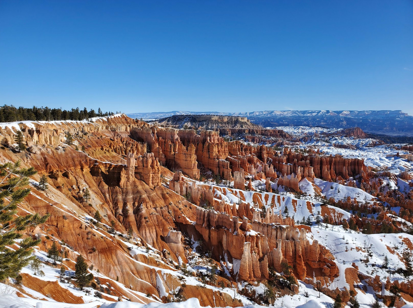
    <summary type="html"><![CDATA[<p><strong><em><span style="font-weight:400;">The land around Bryce Canyon was owned by Paiutes, Mormon settlers, the Union Pacific Railroad, and the federal government before it became a national park in 1924. This gorgeous geological wonder is now enjoyed by millions of visitors each year.</span></em></strong></p><img src="https://www.intermountainhistories.org/files/fullsize/4583d33941339bd9472eeb68144da8cd.jpg" alt="Snow on the Rim of Bryce Canyon" /><br/><p><span style="font-weight:400;">According to archaeological surveys, Bryce Canyon has been inhabited for at least 10,000 years. Paiutes hunted small game and gathered pine nuts in the area. After the Black Hawk War in the 1860s, Mormon settlers moved into areas previously occupied by the Paiutes. One such settler was Ebenezer Bryce, who built a road through the canyon that adopted his name. Mormons in the small settlement of Tropic built the Tropic Irrigation Ditch through Bryce Canyon in 1892. For decades, the beautiful scenery of Bryce Canyon was largely kept private due to the difficulty of travel and the harsh conditions of the area.</span>
<span style="font-weight:400;"> S. Forest Service Supervisor J.W. Humphrey pushed for Bryce Canyon to become a National Park after he first visited the land in 1915. He said, “You can perhaps imagine my surprise at the indescribable beauty that greeted us, and it was sundown before I could be dragged from the canyon view. You may be sure that I went back the next morning to see the canyon once more, and to plan in my mind how this attraction could be made accessible to the public.” After sending photographs and film to the federal Forest Service and the Union Pacific Railroad, the canyon began to attract national attention. Ruby and Minnie Syrett bought land along the rim of Bryce Canyon and built a lodge and an inn for tourists in the 1920s. The Union Pacific Railroad bought much of the land from the Syretts, but Ruby’s Inn still stands today.</span></p><p><span style="font-weight:400;">Bryce Canyon was declared a national monument in 1923 by President Warren G. Harding. On February 25, 1928, Bryce Canyon officially became a national park by an act of  Congress. The size of the park was increased in 1931 by President Hoover, to the current 35,835 acres. Today, over 2 million people visit the park each year to enjoy southern Utah’s stunning scenery and recreational opportunities.</span></p><p><em><strong><a href="https://www.intermountainhistories.org/items/show/784">For more (including 4 images) view the original article</a></strong></em></p>]]></summary>
    <published>2024-02-26T20:05:24+00:00</published>
    <updated>2026-04-17T19:32:17+00:00</updated>
    <link rel="alternate" type="text/html" href="https://www.intermountainhistories.org/items/show/784"/>
    <id>https://www.intermountainhistories.org/items/show/784</id>
    <author>
      <name>Renae Cameron, Brigham Young University</name>
    </author>
  </entry>
  <entry>
    <title type="html"><![CDATA[Devil&#039;s Slide]]></title>
    <summary type="html"><![CDATA[<p><strong><em>Not far from the border between Utah and Wyoming is a compelling natural landmark: Devil's Slide. This landmark was so famous, a company used Devil's Slide as its logo.</em></strong></p><img src="https://www.intermountainhistories.org/files/fullsize/db1dccb467cf45e10122cdb981c728f3.jpg" alt="The Devil&#039;s Slide, Utah 1873" /><br/><p><span style="font-weight:400;">Devil’s Slide rock formation is nestled on the side of the steep Wasatch mountain range, hovering over Interstate 84. It has a height of 40 feet, and the length of the formation runs vertically hundreds of feet down a mountain. There is also an in-between space, the slide, which is about 25 feet in open space between the two vertical limestone rock slides.</span>
<span style="font-weight:400;">It is presumed that the name of the formation was given by a railroad worker named James John Walker, whose family was  one of the first to live in Croydon. According to the family history of Walker, James John was working on railway tracks in the region, likely in 1868, when some of his colleagues asked him to give a name to the strange rocky chute–his answer was Devil’s Slide.</span>
<span style="font-weight:400;">This region is rich in limestone resources, and, in 1904, </span><span style="font-weight:400;">the Union Portland Cement Company was founded by several prominent Utah citizens: Reed Smoot, M.S. Browning, Joseph Scowcroft, and James Pingree.  A company town soon sprang-up a couple hundred yards downstream from the plant site. The town was named Devil’s Slide after the nearby rock formation. </span><span style="font-weight:400;">The original plant supplied materials to most of Utah’s construction industry. After World War II, a second plant on the site replaced the original facility. </span>
<span style="font-weight:400;">At its height, the population of Devil’s Slide exceeded 250 people. As was typical with mining towns at the time, many of the workers were foreign born. Most of them cam from Italy, Austria, Greece, and Japan. Many of the these migrant workers lived in the local hotel, the largest structure in the town. This two-story building contained twenty bedrooms on the second level with each room accommodating two men to each room. Other notable buildings located in the town were the combination drug store/post office, railroad depot, mercantile, two schoolhouses, and a company clubhouse. The company laid cement sidewalks, built a baseball diamond, and planted one hundred trees throughout the village.</span>
<span style="font-weight:400;">By the mid-1980s, only a handful of families remained. By the end of the decade, the company decided to close the village altogether. All the families had moved on with the exception of the railroad section foreman who lived in a house owned by the railroad. The railroad demolished this house not long after the town was emptied.</span></p><p><em><strong><a href="https://www.intermountainhistories.org/items/show/365">For more (including 3 images) view the original article</a></strong></em></p>]]></summary>
    <published>2019-10-10T22:48:52+00:00</published>
    <updated>2026-04-17T19:32:07+00:00</updated>
    <link rel="alternate" type="text/html" href="https://www.intermountainhistories.org/items/show/365"/>
    <id>https://www.intermountainhistories.org/items/show/365</id>
    <author>
      <name>Jesse Wayment, Weber State University</name>
    </author>
  </entry>
</feed>
