<?xml version="1.0" encoding="UTF-8"?>
<feed xmlns="http://www.w3.org/2005/Atom">
  <title type="text">Intermountain Histories</title>
  <updated>2026-04-17T19:32:18+00:00</updated>
  <generator uri="http://framework.zend.com" version="1.12.20">Zend_Feed_Writer</generator>
  <link rel="alternate" type="text/html" href="https://www.intermountainhistories.org/"/>
  <link rel="self" type="application/atom+xml" href="https://www.intermountainhistories.org/items/browse?output=rss2"/>
  <id>https://www.intermountainhistories.org/</id>
  <author>
    <name>Intermountain Histories</name>
    <uri>https://www.intermountainhistories.org</uri>
  </author>
  <link rel="hub" href="https://pubsubhubbub.appspot.com/"/>
  <entry>
    <title type="html"><![CDATA[Tree Spiking in Idaho&#039;s Clearwater National Forest, 1989 ]]></title>
    <summary type="html"><![CDATA[<p><strong><em><span style="font-weight:400;">In 1989, a group sought to sabotage a lumber sale by spiking trees in Idaho’s Clearwater National Forest. The incident led to decades of controversy for the environmentalist movement.</span></em></strong></p><img src="https://www.intermountainhistories.org/files/fullsize/04567ad38d5a1641ca7d1bf82bced03b.jpg" alt="Nail in a Tree" /><br/><p><span style="font-weight:400;">In March 1989, the U.S. Forest Service received a letter warning that trees in the Clearwater National Forest in Idaho had been spiked, claiming that nine people spent 11 days spiking trees with 500 pounds of nails. It mentioned that the land was important to the earth, and home to wildlife and the trees. The group signed the letter under the pseudonym “George Hayduke” in reference to a protagonist in Edward Abbey’s </span><i><span style="font-weight:400;">The Monkey Wrench Gang</span></i><span style="font-weight:400;">, followed by a threat that disregarding the message could result in a lot of people getting hurt. Investigations by the Forest Service revealed that 284 trees had been spiked with 384 nails. As a result, the Plum Creek Sawmill in Montana suffered damages when a saw exploded after hitting a spike.</span>
<span style="font-weight:400;">The perpetrators were a group associated with Earth First! who had first met in Missoula, Montana in 1988. They were protesting the Post Office Creek Timber sale, which opened a northeast parcel of Clearwater National Forest to logging operations. By spiking trees in the area, they hoped to preserve old growth in the forest. Earth First! founder Dave Foreman’s environmentalist guidebook </span><i><span style="font-weight:400;">Ecodefense</span></i><span style="font-weight:400;">, published in 1985, cites tree spiking as a viable tactic to disrupt logging and deforestation. The book includes a how-to section for tree spikers, as well as instructional diagrams. Spiking trees in a visible way was seen as an immediate deterrent for loggers, while concealing spikes could be effective in destroying equipment. By the 1990s, Earth First! literature no longer supported spiking due to both danger for humans and legal repercussions. </span>
<span style="font-weight:400;">The mailing of the letter led to FBI and Forest Service investigations into the Environmental Studies Department at the University of Montana. Agents raided student housing, collecting notebooks and calendars for evidence. The FBI subpoenaed seven Missoula residents to provide handwriting and hair samples for physical evidence before an Idaho grand jury. Investigators discovered that Tracy Stone-Manning, a University of Montana graduate student associated with the group, had rented a typewriter from the library to retype the letter then mailed the letter to the Forest Service. Stone-Manning, facing charges of conspiracy, received immunity in exchange for her testimony against other members of the group. In February 1993, a grand jury indicted Jeffrey Fairchild and John Blount in connection to the tree-spiking. A federal jury in Spokane, Washington convicted the men of conspiracy and depredation against property of the United States following a June 1993 trial. Blount was sentenced to 17 months in prison and ordered to pay restitution, while Fairchild received probation. </span>
<span style="font-weight:400;">The incident at Clearwater National Forest returned to the national spotlight in 2021 when President Joe Biden nominated Tracy Stone-Manning as director of the Bureau of Land Management. Her confirmation by the Senate Committee on Energy and Natural Resources was marked by discussions on ecoterrorism and participation in radical environmentalist groups. Despite the controversy around her involvement in the 1989 tree-spiking, the Senate Committee confirmed Stone-Manning as director of the BLM.</span></p><p><em><strong><a href="https://www.intermountainhistories.org/items/show/837">For more (including 4 images) view the original article</a></strong></em></p>]]></summary>
    <published>2024-05-29T18:55:12+00:00</published>
    <updated>2026-04-17T19:32:18+00:00</updated>
    <link rel="alternate" type="text/html" href="https://www.intermountainhistories.org/items/show/837"/>
    <id>https://www.intermountainhistories.org/items/show/837</id>
    <author>
      <name>Emily Roth, Northern Arizona University</name>
    </author>
  </entry>
  <entry>
    <title type="html"><![CDATA[Walker Bank Building Fire Lookout]]></title>
    <summary type="html"><![CDATA[<p><strong><em>Experience scenic vistas from an unusual site, downtown Salt Lake City.</em></strong></p><img src="https://www.intermountainhistories.org/files/fullsize/a0bda3406bdf1d5a8d85c9a99e125261.jpg" alt="The Walker Center Today" /><br/><p><p style="font-weight:400;">When describing the role of fire lookouts in the Intermountain West, one typically pictures scenic vistas atop remote woodland mountaintops. Lookouts rarely serviced urban areas, so imagine how odd it would have been to encounter a Forest Service fire lookout in the middle of a metropolitan area. As unusual as this sounds, one lookout station did operate in the center of downtown Salt Lake City, Utah, for roughly a decade.
<p style="font-weight:400;">Completed in 1912, the Walker Bank Building is a sixteen-story skyscraper in downtown Salt Lake. At the time of its construction, the building was the tallest structure in the Intermountain West. In the decades following Utah’s statehood in 1896, Utahans considered the construction of impressive infrastructure such as the Walker Bank an important step in the modernization of Salt Lake City.
<p style="font-weight:400;">During the 1930s, the city faced a water crisis. The Great Salt Lake itself is far too salty to use as drinking water, so most of the city’s water came from streams and rivers in the mountains surrounding the Salt Lake Valley. Grazing and wildfires had led to erosion that damaged the watersheds the city relied on. Determined to fix the issue, Wasatch National Forest began placing more emphasis on fire suppression. In 1939, the Forest Service and Salt Lake City Water Department banded together to establish a fire lookout to protect watersheds in the foothills around the Valley. Due to its height, the Walker Bank Building had an impeccable view of the region, so with permission from the bank, Wasatch National Forest set up a small lookout station atop the building.
<p style="font-weight:400;">The lookout itself consisted of little more than a small alidade table which was a map with a sighting device affixed to it for pinpointing spotted fires. From beneath a three-story steel tower advertising the Walker Bank and Trust, urban forest rangers surveilled the surrounding foothills for twelve hours daily. In 1941, <em>The Times</em> of San Mateo, California, reported that the Walker Bank Building had the only fire lookout in a downtown area in the entire country. In 1943, a fifteen-year-old named James Sarvis took on the lookout position. Despite his age, Wasatch National Forest at the Salt Lake Tribune credited him with the protection of the city’s valuable water resources. Sarvis returned to the post several times.
<p style="font-weight:400;">Wasatch National Forest has no records of the lookout being occupied after 1948, but the Walker Bank Building still exists. Now known as the “Walker Center,” the building is currently owned and operated by Wells Fargo.</p><p><em><strong><a href="https://www.intermountainhistories.org/items/show/712">For more (including 4 images) view the original article</a></strong></em></p>]]></summary>
    <published>2023-02-24T18:28:19+00:00</published>
    <updated>2026-04-17T19:32:15+00:00</updated>
    <link rel="alternate" type="text/html" href="https://www.intermountainhistories.org/items/show/712"/>
    <id>https://www.intermountainhistories.org/items/show/712</id>
    <author>
      <name>Tanner Hammarstrom, Northern Arizona University</name>
    </author>
  </entry>
  <entry>
    <title type="html"><![CDATA[Ute Fire Tower]]></title>
    <summary type="html"><![CDATA[<p><strong><em>Climb the stairs of the beautifully restored Ute Mountain Fire Tower and experience the last remaining lookout in the state of Utah.</em></strong></p><img src="https://www.intermountainhistories.org/files/fullsize/fe5b0baf9d6fdb8dea823b78c808f547.jpg" alt="The Ute Tower" /><br/><p><p style="font-weight:400;">During the 1930s, the Civilian Conservation Corps (CCC) was heavily involved in America’s fire policies through the construction of fire suppression infrastructure. Following the Great Fire of 1910, the federal government became increasingly concerned with the surveillance and management of wildfires. The responsibilities that arose from this concern fell at the feet of government forestry administrations, such as the Forest Service. In 1933, President Franklin Roosevelt signed the CCC into existence as part of his broader New Deal policies. The founding of the CCC both created jobs for young men struggling during the Great Depression, and provided foresters with an ample work force to help with fire suppression.
<p style="font-weight:400;">During this period, Ashley National Forest in northeastern Utah desperately needed a permanent fire tower. While mountain tops had been used as crude fire lookouts consisting of little more than campsites, no fire lookouts with living quarters had been built in the state of Utah. However, in 1937, the CCC completed the construction of the Ute Mountain Fire Tower in Ashley National Forest. It was the first and last of its kind to be built in the state.
<p style="font-weight:400;">One of the tools utilized at Ute Mountain was an Osborne Fire-Finder. This device served as an essential part of any efficient lookout facility for decades. It consisted of a circular map mounted to a table, typically at the center of a given lookout. A sighting mechanism consisting of two brass posts pivoted around the table, secured to opposite ends of one another. One post had a thin slit in it while the other stretched a single horse hair. At the direct center of the map would have been the location of the lookout. By moving the posts to line up with any smoke sighted, a lookout could record the exact location of a fresh wildfire. Ute Mountain also had a telephone and radio, and either could be used to contact Ashley National Forest’s fire command, who would subsequently rush to the site of the fire and extinguish it if <span>possible</span>.
<p style="font-weight:400;">Unfortunately, by the late 1960s, the tower was in disrepair. In 1967, a Forest Service survey of the structure proved that all four of the tower’s legs were rotting, and the structure soon closed. In an effort to preserve Utah’s only remaining fire lookout, Ashley National Forest nominated the tower for the National Register of Historic Places in 1980. The Service soon restored the tower, and the Forest held a rededication ceremony in 1987. However, in 2008 the Forest Service again discovered rot in all of the support beams. They considered demolishing the structure, but the local community believed it was too significant to the history of conservation in Utah. Ashley National Forest restored the tower most recently in 2014.
<p style="font-weight:400;">Today, the site is open to visitors as a historical interpretive site. Accessible by car, guests are encouraged to climb the steps of the tower and peer inside the large windows to experience the living quarters of a fire lookout.</p><p><em><strong><a href="https://www.intermountainhistories.org/items/show/711">For more (including 3 images) view the original article</a></strong></em></p>]]></summary>
    <published>2023-02-24T17:47:36+00:00</published>
    <updated>2026-04-17T19:32:15+00:00</updated>
    <link rel="alternate" type="text/html" href="https://www.intermountainhistories.org/items/show/711"/>
    <id>https://www.intermountainhistories.org/items/show/711</id>
    <author>
      <name>Tanner Hammarstrom, Northern Arizona University </name>
    </author>
  </entry>
  <entry>
    <title type="html"><![CDATA[Shadow Mountain Lookout]]></title>
    <summary type="html"><![CDATA[<p><strong><em>This prime example of “parkitecture” offers both great views and rich architectural history.</em></strong></p><img src="https://www.intermountainhistories.org/files/fullsize/3c4e4b3b2596c254063f778413d4b7ba.jpg" alt="The Shadow Mountain Fire Lookout" /><br/><p><p style="font-weight:400;">By the beginning of the twentieth century, the environment had become an increasingly contentious topic. Led by President Theodore Roosevelt and Chief of the Forest Service, Gifford Pinchot, the conservation movement put utilitarian environmental protection at the front of the American public’s collective mind. The conservationist fervor was especially present in Colorado. This encouraged Congress to grant the Mesa Verde cliff dwellings, located in southwestern Colorado, status as a National Park in 1906. One central Colorado local and avid naturalist, Enos Mills, made it his mission to advocate for park status for a pristine set of peaks along the Rocky Mountains. After Mills campaigned for years, President Woodrow Wilson signed Rocky Mountain National Park into existence in 1915.
<p style="font-weight:400;">From the park’s beginning, wildfire suppression was a top priority. During the park’s first decade, rangers used high mountain tops to monitor the surrounding forests. In 1924, one ranger established a crude and difficult trail to the top of Shadow Mountain to be used for fire surveillance. However, the trail was far too rugged, and in 1930 the Park developed a trail from a nearby lake to the peak of the mountain. The lakes surrounding the peak were popular tourist destinations, and Park visitors soon took to scaling the trail to enjoy the views from the top. This early lookout consisted of little more than a telephone wire running down the steep mountainside and a campsite. The bare site proved successful, however, and the following year the Park Service began construction on a permanent lookout.
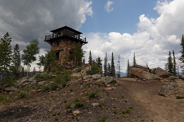
<p style="font-weight:400;">Rocky Mountain National Park completed the Shadow Mountain Lookout in 1933. Considering the number of visitors that would interact with the tower given the trail’s popularity, the Service constructed with aesthetics in mind, using the National Park Service rustic, or  “parkitecture”. This style utilized locally sourced materials that blended into the surrounding landscape. Parkitecture structures are meant to reflect rustic cabins more than bureaucratic facilities. With two lower stories consisting of unprocessed stone masonry and an upper story of evergreen frame, the Shadow Mountain Lookout is a prime example of parkitecture. Park supervisors expected lookouts manning the tower to participate in public relations just as much as fire suppression. In fact, the lower level of the structure acted as a museum, with exhibits concerning park wildlife and fire information.
<p style="font-weight:400;">Today, Shadow Mountain houses the only remaining lookout in Rocky Mountain National Park. Though the interior of the tower is currently closed to the public, the site is accessible by two trails on either side of the mountain. The peak of Shadow Mountain offers impressive views. The Park Service simply asks that hikers watch out for storms, as lightning can pose a danger on exposed mountaintops.</p><p><em><strong><a href="https://www.intermountainhistories.org/items/show/710">For more (including 4 images) view the original article</a></strong></em></p>]]></summary>
    <published>2023-02-23T19:13:08+00:00</published>
    <updated>2026-04-17T19:32:15+00:00</updated>
    <link rel="alternate" type="text/html" href="https://www.intermountainhistories.org/items/show/710"/>
    <id>https://www.intermountainhistories.org/items/show/710</id>
    <author>
      <name>Tanner Hammarstrom, Northern Arizona University</name>
    </author>
  </entry>
  <entry>
    <title type="html"><![CDATA[North Rim Lookout Tower]]></title>
    <summary type="html"><![CDATA[<p><strong><em>The North Rim Lookout Tower helped to protect the area of the Grand Canyon. One can still appreciate immaculate views of the Grand Canyon from high above northern Arizona’s ponderosa forests at the North Rim Lookout Tower which is available to hikers. </em></strong></p><img src="https://www.intermountainhistories.org/files/fullsize/163624658f254fa48626545cb65fa694.jpg" alt="Fire Lookout in the Grand Canyon" /><br/><p><p style="font-weight:400;">Following the Great Fire of 1910, which devastated much of the northern Rocky Mountains, the Forest Service prioritized wildfire suppression. By the mid-1910s, it constructed three small platforms along the Canyon’s edge to spot fires. The North Rim platform, constructed at Bright Angel Point, provided forest rangers and tourists with impeccable views of the forests which lined the Canyon.</p><p>As one of the natural wonders of the world, the Grand Canyon is widely considered one of America’s environmental gems. Federal attempts to preserve the Canyon date all the way back to the late nineteenth century, when the then Indiana Senator, Benjamin Harrison, proposed three bills in the 1880s to set aside the canyon as a national park.<span> </span>Though each of the bills failed, President Harrison eventually granted the Grand Canyon status as a Forest Reserve in the waning days of his presidency in 1893. After President Theodore Roosevelt visited the area in 1903, he granted the site status as a National Monument in 1908, <span>replacing Harrison’s reserve</span><span> </span>. The National Park Service wouldn’t be founded for another eight years, so the Monument fell under control of the fledgling US Forest Service.
<p style="font-weight:400;">The Grand Canyon gained status as a National Park in 1919. The Park Service continued the Forest Service’s policy of fire suppression, and in 1928, it replaced the platform with a seventy five-foot tall steel tower. Topped with a tiny observation cab, fire lookouts lived in a small cabin beneath the structure. Under contract, the Aeromotor Company constructed the Bright Angel Lookout Tower. Aerometer also designed and produced the iconic windmill water pumps which became a symbol of the American West during the late nineteenth and early twentieth centuries.
<p style="font-weight:400;">During the 1930s, the Civilian Conservation Corps (CCC) updated much of the North Rim’s infrastructure. This included moving the Bright Angel Lookout roughly fourteen miles away to the Park’s northern entrance. In 1933, the CCC renamed the structure the North Rim Lookout Tower.
<p style="font-weight:400;">From the late 1960s to the early 1970s, writer and environmentalist Edward Abbey spent four seasons working in the tower. Abbey’s time in the station inspired his book <em>Black Sun, </em>a novel which tells the story of a fire lookout in the Grand Canyon who falls in love with a tourist. When she goes missing, the lookout is blamed for her mysterious disappearance. In his book <em>Fire on the Rim</em>, Stephen Pyne references Abbey as the reason the Park ceased lookout tower operations. “Whether [Abbey] was even in the tower, no one could say. He was a writer, and the only smokes he reported were the ones in his novels… he was absent so often that he demonstrated that we did not need a lookout, because having [Abbey] in the tower was the same as having no one.” Ultimately, the Park opted for aerial fire spotting instead.
<p style="font-weight:400;">Though abandoned, North Rim Lookout Tower is still accessible. Hikers can reach the site via a short hike from the Park’s northern entrance toll booth.</p><p><em><strong><a href="https://www.intermountainhistories.org/items/show/709">For more (including 5 images) view the original article</a></strong></em></p>]]></summary>
    <published>2023-02-23T00:36:16+00:00</published>
    <updated>2026-04-17T19:32:15+00:00</updated>
    <link rel="alternate" type="text/html" href="https://www.intermountainhistories.org/items/show/709"/>
    <id>https://www.intermountainhistories.org/items/show/709</id>
    <author>
      <name>Tanner Hammarstrom, Northern Arizona University</name>
    </author>
  </entry>
  <entry>
    <title type="html"><![CDATA[Devil’s Head Lookout]]></title>
    <summary type="html"><![CDATA[<p><strong><em>Scramble up the rocky slopes of Devil’s Head, Colorado, and experience the majestic views provided by one of America’s oldest fire lookouts.</em></strong></p><img src="https://www.intermountainhistories.org/files/fullsize/93382370047342f0bfaad49a1a03397f.jpg" alt="Helen Dowe" /><br/><p><span style="font-weight:400;">As early as 1907, the two-year-old Forest Service had begun to realize the potential usefulness of high vantage points to monitor fires. William Kreutzer, the nation’s first forest ranger, recommended a series of peaks in the front range of the Rocky Mountains in Colorado for this purpose. The most prominent was Devil’s Head, a rocky granite outcropping high above Pike National Forest, near Sedalia, Colorado.</span>
<span style="font-weight:400;">In the wake of the Great Fire of 1910, the Forest Service began constructing permanent stations at these points. In 1912, Colorado foresters established a crude lookout at Devil’s Head. This primitive station consisted of a small alidade table, which is an instrument consisting of a map and sighting mechanism used to pinpoint the exact location of fires around the lookout, and a tiny log cabin on an outcropping. The Forest Service has used the site continuously since the establishment of this early station.</span>
<span style="font-weight:400;">In 1919, the Service built a more permanent structure. It consisted of a ten-foot by ten-foot wooden cabin, flanked by large windows that granted the ranger within a 360-degree view of the surrounding forests. The first lookout to occupy this new station was Helen Dowe, the second woman in United States history to staff an official forest fire lookout. In the wake of World War I, the Forest Service faced a shortage of able-bodied men to operate stations. Dowe was born in Denver in 1889, and spent much of her youth working as a horseback riding instructor in the mountains around Devil’s Head. As such, she knew the area well. Dowe spotted and reported dozens of wildfires during her tenure as a lookout from 1919 to 1921, saving thousands of acres from burning. In her time at Devil’s Head, she gained widespread publicity. As the subject of numerous magazine articles, Dowe became a prominent feminist figure at the height of the national suffrage movement. According to the </span><i><span style="font-weight:400;">Denver Post</span></i><span style="font-weight:400;">, she received thousands of letters from women around the country who envied her position. </span>
<span style="font-weight:400;">The Forest Service replaced the old observatory at Devil’s Head Lookout in 1951. The current station is the last lookout in Colorado to be staffed full-time. Pike-Isabel National Forest makes the site available to tourists and hikers, who flock to the rocky outcropping for the lookout’s history and the incredible views from the top. Visitors can access the station via a 1.5-mile hike, and parking is available at the Devil’s Head Trailhead. The last leg of the journey takes hikers up a winding wooden staircase, which works its way up massive granite outcroppings. Lucky visitors may get the chance to talk to the station’s lookout.</span></p><p><em><strong><a href="https://www.intermountainhistories.org/items/show/708">For more (including 4 images) view the original article</a></strong></em></p>]]></summary>
    <published>2023-02-22T18:41:03+00:00</published>
    <updated>2026-04-17T19:32:15+00:00</updated>
    <link rel="alternate" type="text/html" href="https://www.intermountainhistories.org/items/show/708"/>
    <id>https://www.intermountainhistories.org/items/show/708</id>
    <author>
      <name>Tanner Hammarstrom, Northern Arizona University</name>
    </author>
  </entry>
  <entry>
    <title type="html"><![CDATA[Manitou Experimental Forest]]></title>
    <summary type="html"><![CDATA[<p><strong><em>Expanding from forest, range, and watershed studies, the Manitou Experimental Forest in Colorado continues its research in meteorology, ecology, and biology, spreading the importance of renewable resources and forest lands to the public.</em></strong></p><img src="https://www.intermountainhistories.org/files/fullsize/48f7d53902ba825a3208861c124bbe73.jpg" alt="[Untitled]" /><br/><p>Located northwest of Colorado Springs in Manitou, Colorado, the Forest Service established the Manitou Experimental Forest (MEF) in 1936 to study land use and forest management of the ponderosa pines in the Colorado Front Range. Spanning from northern New Mexico to southern Wyoming, the Front Range includes a unique diversity of vegetation including not just ponderosa pines but also Douglas firs, aspens, willows, shrubs, brushes, and native grasses. The Forest’s research station, the Rocky Mountain Research Station, is one of five of the Forest Service’s regional stations in the Rocky Mountains, which help monitor the health and sustainable use of our country’s valuable forests. </p><p>Fur traders originally used much of the land in the area in the early 1800s, but as the availability of furs declined in the later part of the century, mining and logging became prevalent along with farming and raising of livestock. Consequentially, the culmination of grazing and logging resulted in the near devastation of the forest by 1900, and erosion caused by poor farming techniques left the soil nearly depleted by the mid-1930s. Thus, MEF began forest, range, and watershed research to find ways to restore the land’s natural resources, while also allowing for long-term productivity. In the early years, it focused on how to use the region’s watershed to revegetate the area and to minimize flooding and sedimentation deterioration caused by storms, which included studying the area’s precipitation, pollution, streamflow, and runoff. From the late 1940s to the late 1950s, the MEF  invested in pasture studies that addressed the quality of cattle diets to allow maximum livestock production, without causing erosion or depleting the watershed and native grasses. </p><p>The natural and artificial regeneration of ponderosa pine became one of  its long-term studies in 1980. Throughout the 1980s, foresters worked in cooperation with Colorado State University to evaluate performance and patterns of growth and survival of ponderosa pines with seeds collected from seventy-five different zones in Colorado. They recorded measurements of height, diameter, and when growth would stop or resume with the seasons. This research also included monitoring the progress of natural seedlings, methods of cutting seed-trees, how seeds germinate and spread, how far to space trees when planting, and the prevalence of the invasive plant species to discover the most effective forest management practices for ponderosa pines, while also improving water yields. Other projects during this period included evaluating habitat requirements for the region’s Flammulated Owl population, and monitoring the health of Manitou’s lakes, streams, and domestic water supply by studying its fish diversity and levels of pollution, bacteria, and algae.</p><p>In 1998, the National Park Service added the MEF's experimental station and six of its buildings to the National Register of Historic Places. Currently, its research focuses on studies in meteorology, ecology, and biology. It also often partners with various universities and museums in Colorado in order to continue research and expand public awareness on the importance of renewable resources and forest lands.</p><p><em><strong><a href="https://www.intermountainhistories.org/items/show/322">For more (including 5 images) view the original article</a></strong></em></p>]]></summary>
    <published>2019-09-11T18:46:33+00:00</published>
    <updated>2026-04-17T19:32:05+00:00</updated>
    <link rel="alternate" type="text/html" href="https://www.intermountainhistories.org/items/show/322"/>
    <id>https://www.intermountainhistories.org/items/show/322</id>
    <author>
      <name>Abbey Buckham, Northern Arizona University</name>
    </author>
  </entry>
  <entry>
    <title type="html"><![CDATA[Fort Valley Experimental Forest Station]]></title>
    <summary type="html"><![CDATA[<p><strong><em>The study of ponderosa pine regeneration in northern Arizona’s Fort Valley Experimental Forest Station helps us preserve the nation’s unique forests after damage and depletion caused by excessive logging and livestock grazing.</em></strong></p><img src="https://www.intermountainhistories.org/files/fullsize/52e2e5d5f1bdf9332fe80b674b26b53b.jpg" alt="[Untitled]" /><br/><p>Fort Valley, in northern Arizona near Flagstaff, is unique in its abundance of native grasses, water from the Leroux Springs, and plethora of ponderosa pines. The demand for timber from logging and railroad companies as well as livestock grazing began to threaten the region's isolated vegetation during the late 1880s, as loggers noticed that the ponderosa pines were not regenerating after cutting. To address this issue, Arizona Lumber and Timber Company owners Timothy and Michael Riordan invited the Chief of the Forest Service, Gifford Pinchot, to visit the area in 1891. The Riordans also hosted biologist C. Hart Merriam and the chief of the Division of Forestry, Bernhard E. Fernow in 1896. Fernow and Pinchot worked with foresters Raphael Zon and Gustaf Pearson to urge the federal government to set aside the area as part of the Forest Reserves, now known as National Forests. The Forest Service granted their request, and established the Fort Valley Experimental Forest Station in 1908 to study high-altitude ponderosa pine regeneration, with Pearson serving as the station’s first director until his retirement in 1944. </p><p>The station started a summer training school for rangers in 1909, and through the 1910s and 1920s, its workers focused on researching the effects of cattle grazing and ways to improve range production through water development, fence building, removal of poisonous plants, and growth of supplemental pasture grass to aid the regeneration of natural vegetation. During this time, it also began keeping weather records and constructed six meteorological observation locations to detect how elevation changes affected seed regeneration of ponderosa pines. Foresters also developed long-term studies to explore natural and artificial regeneration, how disease and pests distressed growth, and began attaching identification tags to help scientists monitor the lives of individual trees.</p><p>The Civilian Conservation Corps assisted by providing water access to Leroux Springs, a greenhouse, and electricity during the 1930s, and a 1931 Forester’s Order from the federal government established the station as part of Coconino National Forest lands, which protected it from logging, hunting, and cutting. Throughout the 1940s, the Forest Service expanded the land holdings of the Fort Valley Experimental Forest, and began working with the Arizona State College’s (now Northern Arizona University) new School of Forestry by using the station as a field site for its research facilities in 1958. In 1960, the U.S. Geological Survey used some of its   structures to record and measure the earth’s magnetic forces and underground movements, research which later helped establish plate tectonics theory. </p><p>Through the 1950s to the 2000s, research shifted to include long-term studies on watershed management, wildlife habitats, and how wildfires and prescribed burning affect the regeneration and diversity of native and invasive plants. Fort Valley still collaborates with NAU’s School of Forestry and the U.S. Forest Service. In 2001, it was added to the National Register of Historic Places and continues to research best forest management techniques in order to preserve the region’s unique ponderosa pines. </p><p><em><strong><a href="https://www.intermountainhistories.org/items/show/321">For more (including 4 images) view the original article</a></strong></em></p>]]></summary>
    <published>2019-09-11T07:23:41+00:00</published>
    <updated>2026-04-17T19:32:05+00:00</updated>
    <link rel="alternate" type="text/html" href="https://www.intermountainhistories.org/items/show/321"/>
    <id>https://www.intermountainhistories.org/items/show/321</id>
    <author>
      <name>Abbey Buckham, Northern Arizona University</name>
    </author>
  </entry>
  <entry>
    <title type="html"><![CDATA[The Rush Creek Point Fire Lookout and Fire Suppression <br />
]]></title>
    <summary type="html"><![CDATA[<p><strong><em>Rush Creek Point Fire Lookout is an abandoned fire lookout overlooking the Rush, Cabin, and Big Creek drainages in central Idaho’s Payette National Forest, built by the Civilian Conservation Corps (CCC) as part of the Forest Service’s fire suppression efforts.</p></strong></p><img src="https://www.intermountainhistories.org/files/fullsize/2f634c9d453524fbbca9cd296dfe52ac.jpg" alt="Rush Creek Point Fire Lookout " /><br/><p>The Rush Creek Point Fire Lookout is a small structure built in 1937 by the Civilian Conservation Corps to monitor fires from its vantage point straddled between the Big Creek and Rush Creek drainages. Fire lookouts were necessary due to the Forest Service’s 10:00 AM policy, which announced that forest fires should be put out by 10:00 AM on the day after they occurred. To make this feasible, the CCC built fire lookouts while the Forest Service strung telephone lines throughout the national forests for communication with the outside world. The surplus of labor during the Great Depression made this development possible with the government-sponsored work-relief programs of the New Deal, such as the CCC. </p><p>The aggressive fire-fighting policy of the Forest Service often proved impracticable in Idaho. Forest Service employee Elers Koch noted in his 1935 article “The Passing of the Lolo Trail,”  the failures of the firefighters to contain the conflagrations even under ideal conditions, suggesting that perhaps some of this difficulty originated from the buildup of fuels as a result of earlier fire suppression. Despite these early concerns, the Forest Service maintained the 10:00 AM policy until 1977, after which fires were addressed with individualized plans often including alternatives to suppression.</p><p>The 1980 Central Idaho Wilderness Act further reduced the necessity of the Rush Creek Point Fire Lookout by defining this portion of the Payette National Forest as part of the Frank Church-River of No Return Wilderness Area. This limited the fire suppression activities that the Forest Service was legally allowed to conduct, since in wilderness areas the use of motorized tools is prohibited. Furthermore, suppressing fire at all in wilderness is only questionably legal, since the act calls for wilderness “untrammeled” by man. Abandoned, the Rush Creek Point Fire Lookout has been out of service for many years, a relic of the Forest Service’s aggressive fire suppression. </p><p><em><strong><a href="https://www.intermountainhistories.org/items/show/302">For more (including 2 images) view the original article</a></strong></em></p>]]></summary>
    <published>2019-02-14T00:25:36+00:00</published>
    <updated>2026-04-17T19:32:05+00:00</updated>
    <link rel="alternate" type="text/html" href="https://www.intermountainhistories.org/items/show/302"/>
    <id>https://www.intermountainhistories.org/items/show/302</id>
    <author>
      <name>Everett Masterman, University of Idaho</name>
    </author>
  </entry>
  <entry>
    <title type="html"><![CDATA[The Horse Heaven CCC Camp: Life, Work, Masculinity and Education in the Northern Idaho Forest]]></title>
    <summary type="html"><![CDATA[<p><strong><em>Horse Heaven was one of the most remote CCC camps in North Idaho. It was constructed to be a ‘forest camp’ meaning that the majority of projects conducted by the workmen were related to forestry. </em></strong></p><img src="https://www.intermountainhistories.org/files/fullsize/ddaf8ea492186afe8db42a8777a96295.jpg" alt="Hill Side View" /><br/><p>The Civilian Conservation Corps (CCC) was one of the most popular of the 1930s New Deal programs, designed to employ young me, promote economic recovery by sending funds back to their families, and completing public works projects. The Horse Heaven camp, like many of the Pacific Northwest’s CCC camps, was dedicated to forestry and conservation projects. Its location near Enaville, Idaho in the Coeur d’Alene National Forest, allowed for easy access to areas in need of forestry projects. Men at this camp had loaded into cars and driven deep into the wilderness with 40,000 pounds of supplies to build the camp from the ground up. Due to the rugged trail they had to traverse, the thirty mile trip took them six hours by car. After their trek deep into the dense woodland, the caravan camped in a clear valley meadow that had been set aside for the CCC. They had to build their camp, number F-156, from nothing but the supplies they brought with them. Once they were finished one of the camp’s leaders, Major Clarke, called it one of the most beautiful in the area. Form their central location, the men of the camp were able to work on projects like road building and limiting the spread of blister rust, a deadly fungus, in the white pine population. More than just the effect on the local forest and the education of the men at the camps, the CCC was known for improving their outlook as well. </p><p>The Great Depression challenged concepts of masculinity of the time, but through camp activities the workmen of the CCC were able to rebuild their confidence. Men who had no work could not fulfill their prescribed roles as breadwinners, and those same men with little no money for food found themselves weakening physically. The CCC worked to effectively combat these doubts. It gave young men food and a steady job that allowed them to send money home to their families. The work they did was largely outdoors and very physical. When this was coupled with a steady nutritious diet, it allowed formerly weak and sickly men to regain their strength, further improving their self-image. Along with that, the residents of the CCC camps had the opportunity to educate themselves when not at work. Each camp in the CCC had a library and offered classes in diverse topics like public speaking and radio operation. Some classes would even be taught from visiting professors from nearby colleges. This gave the workmen at Horse Heaven camp the opportunity to exercise their minds as well as their bodies.</p><p>Horse Heaven camp was one of many CCC camps in North Idaho and across the United States. These camps served as the center of conservation efforts in their time, but their impact was far larger than just environmental. These camps served to preserve the self-respect of men who had been struggling with economic circumstance.  </p><p><em><strong><a href="https://www.intermountainhistories.org/items/show/105">For more (including 3 images) view the original article</a></strong></em></p>]]></summary>
    <published>2018-01-22T20:21:54+00:00</published>
    <updated>2026-04-17T19:31:59+00:00</updated>
    <link rel="alternate" type="text/html" href="https://www.intermountainhistories.org/items/show/105"/>
    <id>https://www.intermountainhistories.org/items/show/105</id>
    <author>
      <name>Nicholas C. Cousino, University of Idaho</name>
    </author>
  </entry>
</feed>