<?xml version="1.0" encoding="UTF-8"?>
<feed xmlns="http://www.w3.org/2005/Atom">
  <title type="text">Intermountain Histories</title>
  <updated>2026-06-16T14:34:55+00:00</updated>
  <generator uri="http://framework.zend.com" version="1.12.20">Zend_Feed_Writer</generator>
  <link rel="alternate" type="text/html" href="https://www.intermountainhistories.org/"/>
  <link rel="self" type="application/atom+xml" href="https://www.intermountainhistories.org/items/browse?output=rss2"/>
  <id>https://www.intermountainhistories.org/</id>
  <author>
    <name>Intermountain Histories</name>
    <uri>https://www.intermountainhistories.org</uri>
  </author>
  <link rel="hub" href="https://pubsubhubbub.appspot.com/"/>
  <entry>
    <title type="html"><![CDATA[The Atomic Legacy of Hanford]]></title>
    <summary type="html"><![CDATA[<p><strong><em>Rural farming towns in Eastern Washington were transformed into the backbone of the Manhattan Project. Hanford and Richland were bought by the government to aid in the project. The Hanford site, while being talked about the least, was crucial for the successes of the Manhattan Project, and changed the trajectory of the area.</em></strong></p><img src="https://www.intermountainhistories.org/files/fullsize/d3448cee385cf3b26312497fc10886dc.jpg" alt="The Hanford Construction Camp in Richland" /><br/><p>Hanford, a rural area in the Columbia Basin and Benton County in Washington, was once a farming town before the involvement of the United States Government and the Manhattan Project during World War II. Hanford and the neighboring towns were chosen by Brigadier General Leslie R. Groves to be the area that would produce plutonium for the Manhattan Project to build an atomic bomb. Hanford Engineer Works (later known as the Hanford site) was born in March 1943 with the government contracting the DuPont Corporation along with the U.S. Army Corps of Engineers. Before construction could begin the government had to relocate the local residents, evicting 1,500 people from their homes, taking sacred fishing grounds of the local Native tribe Wanapum, disinterring 177 bodies from the White Bluffs cemetery, and relocating the bodies to Prosser. The displaced residents either moved away or stayed to work on the project. The residents, mostly farmers, were given 30 days to evacuate and were compensated for their homes and businesses. The government also bought the neighboring towns of Richland to house the white workers and the town of Pasco to house the black and ethnic workers.</p><p>The Hanford Construction Camp provided temporary housing to house the builders and their families while building the facility and new Richland that would house the site’s employees. The government contracted Gustav Albin Pehrson, a Swedish-born architect from Spokane to see that Richland was made into a town for the arriving 16,000 employees and their families. Construction took 18 months, assisted by Pehrson’s assembly line style of prefabrication techniques. The cookie cutter houses he had created were called “letter houses,” “ABC houses,” or “alphabet houses” due to Pehrson assigning each style of house a letter of the alphabet. Many of these houses are still standing to this day.</p><p>Once construction was completed in 1944, Hanford began creating the plutonium. Due to the secrecy of the project the workers had no idea what they were making until they learned of the nuclear bombs that were dropped on Japan. They soon realized what they had helped create at Hanford and embraced their contribution, with their new city slogan, "Richland: The Atom-Bustin' Village of the West." After the war, the military turned over control of the site to General Electric and the nuclear program to the Atomic Energy Commission (AEC). The town of Richland was bought back by the residents from the government on July 15, 1958, becoming the eleventh largest town in the state. During the Cold War, Hanford was again producing weapons-grade plutonium, and the AEC was commissioned to research, develop, produce, and regulate nuclear power, which has led to a multitude of health and environmental consequences that are still being dealt with today.</p><p><em><strong><a href="https://www.intermountainhistories.org/items/show/869">For more (including 5 images) view the original article</a></strong></em></p>]]></summary>
    <published>2024-10-22T03:35:21+00:00</published>
    <updated>2026-04-17T19:32:19+00:00</updated>
    <link rel="alternate" type="text/html" href="https://www.intermountainhistories.org/items/show/869"/>
    <id>https://www.intermountainhistories.org/items/show/869</id>
    <author>
      <name>Mason Williamson, Rocky Mountain College</name>
    </author>
  </entry>
  <entry>
    <title type="html"><![CDATA[Arson at the Vail Ski Resort, 1998]]></title>
    <summary type="html"><![CDATA[<p><strong><em><span style="font-weight:400;">In 1998, radical environmentalists targeted a ski resort in Colorado, leading to the most infamous eco-terrorist attack of all time.</span></em></strong></p><img src="https://www.intermountainhistories.org/files/fullsize/5633ebcaa19a669c5b376d439eda1ea1.jpg" alt="Vail Ski Resort in 1983" /><br/><p><span style="font-weight:400;">In the early hours of the morning on October 19, 1998, agents of the notorious eco-terrorist cell known as “the Family” ignited seven separate fires across the Vail Ski Resort in Colorado. They had traveled to Colorado from their homes in Oregon to orchestrate an attack that would send a message. By the time the fires were extinguished, eight structures had been either damaged or completely destroyed. Four ski lift towers, the ski patrol headquarters, radio towers, and the Two Elk Lodge restaurant had all been affected by the attack. No people or animals had been injured, but damages were extensive at an estimated $24 million.</span>
<span style="font-weight:400;">Later that same day, individuals from the Earth Liberation Front (ELF) and the Animal Liberation Front (ALF) called into radio stations and sent a communique to several newspapers to claim responsibility for the fires in Vail. Their motives were clear: to protect lynx habitats by preventing expansion. A coalition of environmental groups had recently lost a legal battle to halt Vail’s plans to develop 885 acres of virgin national forest, an area the environmentalists claimed to be a prime habitat for the Canadian lynx. In retaliation, radical members turned to arson, stating in their communique that “Putting profit ahead of Colorado’s wildlife will not be tolerated.” They warned skiers to find somewhere else to go.</span>
<span style="font-weight:400;">In the days following the attack, local and national newspapers began to categorize the fires as the worst eco-terrorist attack in history. News stories connected the events to Edward Abbey’s fictional work </span><i><span style="font-weight:400;">The Monkey Wrench Gang</span></i><span style="font-weight:400;">, indicating the level of influence literature had on the public imagination, even being referenced in testimonies in following years by the Federal Bureau of Investigation to the Senate Judiciary Committee. The FBI and other federal agencies categorized the Vail arson as particularly destructive compared to other eco terrorist attacks. The FBI soon identified eco-terrorist and special interest extremist groups as the number one domestic terrorist threat, and highlighted the perpetrators of the Vail attack as one of the most prolific domestic terrorism cells of all time.</span>
<span style="font-weight:400;">The federal government launched an inter-agency investigation, known as Operation Backfire, to take down the group responsible for the Vail arson and other eco-terrorist attacks. Their investigation targeted the group known as “the Family” which was a particularly radical faction branching off of the Earth Liberation Front. Between 1995 and 2001, the FBI credits the group with over forty criminal acts, with the Vail arson seen as their most notorious attack. Damages related to these crimes are estimated at $40 million. The investigation gave insight to the highly secretive inner workings of eco-terrorist groups. Operation Backfire led to the capture, indictments, and convictions of six out of the seven individuals involved in the attack on the Vail Ski Resort. Josephine Sunshine Overaker, the only uncaptured perpetrator, remains on the FBI’s Most Wanted list for crimes of domestic terrorism. Twenty-five years later, the federal government continues to seek justice.</span></p><p><em><strong><a href="https://www.intermountainhistories.org/items/show/838">For more (including 2 images) view the original article</a></strong></em></p>]]></summary>
    <published>2024-05-29T19:22:31+00:00</published>
    <updated>2026-04-17T19:32:18+00:00</updated>
    <link rel="alternate" type="text/html" href="https://www.intermountainhistories.org/items/show/838"/>
    <id>https://www.intermountainhistories.org/items/show/838</id>
    <author>
      <name>Emily Roth, Northern Arizona University</name>
    </author>
  </entry>
  <entry>
    <title type="html"><![CDATA[Ashley Pond]]></title>
    <summary type="html"><![CDATA[<p><strong><em>From a soggy bog to a beloved community gathering place, the change and continuity of Ashley Pond illustrates the many eras of Los Alamos from homestead to Ranch School to government laboratory to the vibrant community of today.</em></strong></p><img src="https://www.intermountainhistories.org/files/fullsize/474ae326a19e2d428271b8e7a2ab5485.jpg" alt="1946 Aerial View of Los Alamos" /><br/><p><span style="font-weight:400;">Although Ashley Pond is now a prominent green space in the center of Los Alamos, it had a less majestic beginning. In 1908, it was a soggy depression used by homesteader H. H. Brook for watering his stock. Later, the Los Alamos Ranch School used it for the same purpose. Its applicable, albeit unimaginative, first name was the Stock Watering Tank. This was later switched to the Duck Pond in honor of its most popular visitors. The waterhole continued to remain a relatively unimpressive morass until the Ranch School built a dam in Los Alamos Canyon in 1923. This created a small reservoir which fed a pipeline to provide the school with water. The overflow from the pipeline was then dispersed into a puddle which progressively grew into a pond and then a small lake. </p>
<span style="font-weight:400;">The all-boys Los Alamos Ranch School was founded in 1917 by Detroit native, Ashley Pond Jr., who created it to generate tough, intelligent, well-rounded, and experienced outdoorsmen. As such, the students were encouraged to utilize the beautiful landscape for recreation and exercise. The pond provided an ideal place to put their learning into practice. Although never deep enough for true diving, the pond was perfect for canoeing and an excellent place to practice swimming. In the winter, the boys skated across its frozen surface playing hockey and harvesting the ice for the coming year. Ice blocks were stored in a nearby stone ice house and they were known to have collected enough ice to sustain them for up to two years. Once sufficiently filled, school faculty member—and notorious lover of puns—William Mills, provided the name of Ashley Pond in honor of the founder. The official title for the pond is Ashley Pond, not Ashley Pond Pond, but today Los Alamos natives enjoy the humorous anecdote. </p>
<span style="font-weight:400;">When the United States government acquired the land for the Manhattan Project, they allowed the school two months to make other arrangements. The boys went through a hurried graduation and left their beloved mountains, mesas, and pond in the hands of scientists. Manhattan Project staff built the Technical Area, also called TA 1, around the south side of Ashley Pond as a safeguard against fire. They repurposed the ice house as well, using it in 1945 to assemble nuclear components of the “gadget” which would be tested at Trinity. As such, Ashley Pond became restricted under laboratory security and very few outsiders were able to enjoy it. </p>
<span style="font-weight:400;">Today, Ashley Pond is a pleasant downtown landmark of Los Alamos. Situated near the center of town, it is used for picnics, walks, and outdoor concerts in the summer. Los Alamos natives attentively watch the ducks and geese who live at the pond, especially during chick season. During the winter, surrounding trees are decorated with colorful Christmas lights. The local winter parade currently ends at the pond, the same place where the Ranch School boys canoed and harvested ice nearly a century ago. </span>


</p><p><em><strong><a href="https://www.intermountainhistories.org/items/show/750">For more (including 6 images) view the original article</a></strong></em></p>]]></summary>
    <published>2023-09-07T23:39:58+00:00</published>
    <updated>2026-04-17T19:32:16+00:00</updated>
    <link rel="alternate" type="text/html" href="https://www.intermountainhistories.org/items/show/750"/>
    <id>https://www.intermountainhistories.org/items/show/750</id>
    <author>
      <name>Abigail Beus, Brigham Young University</name>
    </author>
  </entry>
  <entry>
    <title type="html"><![CDATA[The Creation of Canyonlands National Park<br />
]]></title>
    <summary type="html"><![CDATA[<p><strong><em>Although the area of Canyonlands National Park enthralled many visitors for years before the creation of a national park there, the road to becoming federally protected land took many years, controversies, and compromises. </em></strong></p><img src="https://www.intermountainhistories.org/files/fullsize/8560da34733564e52bd87816ca22e0b7.jpg" alt="View of Shafer Trail " /><br/><p>Situated about 40 minutes from Moab, Utah, Canyonlands National Park is the largest and most remote of all the National Parks in the state. Covering 337,589 acres, the park is split into three major districts by the Colorado and Green rivers known as the Islands in the Sky, The Needles, and The Maze. The Park is also famous for being the location where the two rivers meet, and home to many ruins and artifacts from ancient peoples who lived there thousands of years ago. Despite the area of the park being famous for its natural wonders, the creation of the park was a long and arduous process that included many controversies and compromises. </p><p>Serious consideration for creating the area into a National Park grew in the early 1960s after the election of President John F. Kennedy and his appointment of Stewart Udall as Secretary of the Interior. Udall believed heavily in conservation and was enthralled by the beauty of the area when he visited in 1961. Recruiting Utah Senator Frank Moss as an ally for the project, the two set out to preserve the Canyonlands area as a National Park. Immediately, Udall and Moss ran into opposition from other local legislators including Utah Senator Wallace Bennett. While Bennett was not completely opposed to the idea of a National Park in the Canyonlands region, he wanted a much smaller protected area in order to keep most of the region open for commercial use. Bennett thought that much of the area was better suited for mining, drilling, and grazing. </p><p>Senators Moss and Bennett fought for a few years before a final proposal was sent to the United States Congress in 1964. This proposal included most of the area that Moss and Udall wanted to have protected, but removed a portion from the north side of the park for commercial developments at the wish of Bennett and other local people. Moss continued to fight to protect more of the land around Canyonlands for the rest of his tenure as senator in Utah and is a large reason that the park is enjoyed by thousands today.</p><p><em><strong><a href="https://www.intermountainhistories.org/items/show/647">For more (including 4 images) view the original article</a></strong></em></p>]]></summary>
    <published>2022-09-12T21:18:55+00:00</published>
    <updated>2026-04-17T19:32:14+00:00</updated>
    <link rel="alternate" type="text/html" href="https://www.intermountainhistories.org/items/show/647"/>
    <id>https://www.intermountainhistories.org/items/show/647</id>
    <author>
      <name>Allie Castañeda and Forrest Filetti, Brigham Young University </name>
    </author>
  </entry>
  <entry>
    <title type="html"><![CDATA[Lake Lowell: Transforming Treasure Valley]]></title>
    <summary type="html"><![CDATA[<p><strong><em>The Reclamation Act of June 17, 1902, aimed to create proper irrigation systems that could provide water access for residents of western states. Lake Lowell was one of those projects.</em></strong></p><img src="https://www.intermountainhistories.org/files/fullsize/8dafc9cce562e3302960bcf13f35ebe2.jpg" alt="Building up" /><br/><p>Under the direction of the 1902 Reclamation Act—congressional legislation intended to irrigate western states and provide greater access to water—the Bureau of Reclamation approved and developed Lake Lowell, starting in 1902 and finishing in 1909. Three dams—the Upper, Middle, and Lower Embankments (embankments are walls of earth or stone built to prevent a river from flooding an area)—surround a natural depression southwest of Nampa, Idaho to form the lake. A fourth wall, called the East Embankment, was added later to protect farmsteads on the eastern end of the reservoir.
In the irrigation off-season, the Boise River Diversion Dam and New York Canal provide most of Lake Lowell’s volume, discharging water intp the upper end of the lake, where there is a capacity ranging from 12.7 feet on the Middle Embankment to 65 feet on the Upper. During the irrigation season, Lake Lowell becomes one of the major irrigation providers for Canyon County agriculture. With the capacity to irrigate over 200,000 acres of land, it is one of the American West’s largest off-stream reservoirs.
As with many other western irrigation projects, Lake Lowell presented a significant opportunity for economic growth and restructured the relationship between people and their environment. Along with other government investment projects that opened the area to construction and farming, irrigation attracted migrants from the Midwest who worked as laborers to develop the dam and as farmers to till the land. In 1900, the census counted 161,772 people living in Idaho; by the 1920 census, the population had more than doubled to 431,866 people. This growth was sharpest in southwestern Idaho, which grew by 130% during this twenty-year period as agricultural and ex-urban communities transformed Treasure Valley into fertile land. Lake Lowell made that change possible.
In addition to serving local farms, towns, and cities, Lake Lowell also plays a role in how people and other living things interact with the region’s nature. The lake hosts the Deer Flat Reservoir, one of the oldest refuges in the National Wildlife Refuge System. As for humans in nature, Lake Lowell is a popular destination for numerous outdoor activities, including boating, swimming, fishing, birdwatching, hiking, and hunting.</p><p><em><strong><a href="https://www.intermountainhistories.org/items/show/629">For more (including 5 images) view the original article</a></strong></em></p>]]></summary>
    <published>2022-06-30T21:27:42+00:00</published>
    <updated>2026-04-17T19:32:13+00:00</updated>
    <link rel="alternate" type="text/html" href="https://www.intermountainhistories.org/items/show/629"/>
    <id>https://www.intermountainhistories.org/items/show/629</id>
    <author>
      <name>Legna Roximar Morales, College of Idaho</name>
    </author>
  </entry>
  <entry>
    <title type="html"><![CDATA[Hells Canyon Dam]]></title>
    <summary type="html"><![CDATA[<p><strong><em>Straddling the Idaho–Oregon border and holding firm to the walls of Hells Canyon, the Hells Canyon Dam provides hydroelectric power and irrigation channels to surrounding localities. A creation of the Idaho Power Company, the concrete dam is one of three in the Hells Canyon Complex, the largest privately-owned hydroelectric power complex in the nation, whose motivations and consequences can be felt politically and ecologically.</em></strong></p><img src="https://www.intermountainhistories.org/files/fullsize/010642938f4450485d7ddd6aff0409f0.jpg" alt="Damming Hells Canyon" /><br/><p>The Hells Canyon Complex was controversial before even being built, ever since the Idaho public scrutinized the Idaho Power Company’s request to license three dams on the Snake River in 1947. During the New Deal era, public power—a method of energy administration defined in which communities owned infrastructure under local government—was the norm for hydroelectricity; while Idaho Power wanted to privately run three dams, advocates for public power in the region instead contended against Idaho Power in favor of establishing a single, high dam. After a long battle, private power won when the Federal Power Commission issued Idaho Power a license in 1955, allowing them to build a private hydroelectric complex, in turn signaling a decline of public power’s favor nationwide. Due to the Hells Canyon dam construction in the deepest gorge on the North American continent, the construction process proved difficult, and builders had to dig a twenty-three-mile access road into the Idaho side of the canyon. Along with the road, contractors set up offices, facilities, housing, and a mess hall for construction workers. In a matter of six months, the Hells Canyon Dam’s construction was complete in 1967, and it began generating electricity shortly after.
The political controversy in the postwar years about whether hydropower was something to be publicly or privately owned has roots deep in the ecological. The Hells Canyon Complex sits on the Snake River Basin, a desert ecosystem, while many of the models that public ownership advocates used were based on dams built on the Columbia River Basin, which was forested and mountainous. Because of the ecological differences inherent to these basins, people interacted differently with these water systems, and as a result, their priorities varied in what services a dam should provide. In the Columbia Basin, priority was given to energy production, while in the Snake Basin, priority was given to irrigation. This is largely due to the relationship people had with the land. In the Snake Basin, people cultivated the land for crop harvest, so they wanted the Hells Canyon Complex to have irrigation as its chief operating principle. This gave wind to Idaho Power’s licensing for the three Snake River dams; a single high dam would better serve power generation, but Idaho Power contended that the three-dam complex better served irrigation.
While ecology shaped Hells Canyon Dam, the dam also reshaped the environment. By its very design, the Hells Canyon Complex has no passage for andronomous fish species, a type of fish that migrates from freshwater to the ocean in the Snake and Columbia Rivers. Limiting certain fish species’ ability to access any of the upper Snake River Basin between the complex to Shoshone Falls has dramatically reduced the species’ population and disturbed several ecosystems. This can be traced back to the general neglect of biological research before the construction of dams along the Columbia and Snake Rivers.</p><p><em><strong><a href="https://www.intermountainhistories.org/items/show/627">For more (including 3 images) view the original article</a></strong></em></p>]]></summary>
    <published>2022-06-30T19:53:46+00:00</published>
    <updated>2026-04-17T19:32:13+00:00</updated>
    <link rel="alternate" type="text/html" href="https://www.intermountainhistories.org/items/show/627"/>
    <id>https://www.intermountainhistories.org/items/show/627</id>
    <author>
      <name>Hunter Marang, College of Idaho</name>
    </author>
  </entry>
  <entry>
    <title type="html"><![CDATA[Stibnite Mine: Dormant but Not Dead]]></title>
    <summary type="html"><![CDATA[<p><strong><em>Nestled up in the mountains above Valley County, Idaho, in the Payette National Forest, beyond even the most remote town in the region, and in the middle of an otherwise densely green forest, sits Stibnite the currently dormant Stibnite Mine: a landscape of stripped earth, dead grass, rock, and the infamous “Glory Hole,” an open pit with a sluggish pond of waste. </em></strong></p><img src="https://www.intermountainhistories.org/files/fullsize/20dc0bda7b67c07ecd976075edfdf300.jpg" alt="Glory ole" /><br/><p>The Stibnite Mine, located in what is now the Payette National Forest, started during the 1899 Thunder Mountain gold rush. The first known claims were staked by Albert Hennesy in 1914. Those were later purchased by the United Mercury Mining Company of Boise and optioned by the San Francisco-based Bradley Mining Company in 1927 for mining and milling gold. Stibnite’s most active period of operation came during World War II. A core sample taken from the site revealed an abundance of tungsten and high-grade antimony, materials crucial to the war effort for supplying reinforced armor, ammunition shells, fire resistant clothing, and electrical chips. Between 1941 and 1945, Stibnite miners provided 90% and 40$ of the nation's domestic supply of antimony and tungsten, respectively. 
To extract so much material, Bradley Mining expanded Stibnite into a much larger beast. Instead of digging mine shafts, Bradley initiated open pit mining. To process the raw material, the company installed heavier equipment, such as a smelter and mill. When WWII ended, the demand for antimony and tungsten dwindled, and Stibnite’s profits with it. From this point forward, Stibnite operated off and on throughout the years, passing through different companies several times until it completely shut down in 1997.
The end of active mining didn’t end Stibnite’s story, though; instead, environmental issues took front and center stage. After years of mining, Stibnite had accumulated a massive amount of waste, raising the problem of what to do with it. One major point of contamination came from the Bradley Tailing Pile Dump in the Meadow Creek Floodplain. Preventing massive amounts of mine waste from washing downriver into the valley required diverting Meadow Creek twice. Even after this intervention, an environment and water quality survey conducted periodically from 2011 to 2017 around the Stibnite–Yellow Pine area, which included Meadow Creek, revealed elevated levels of mercury, antimony, and arsenic contamination.
In addition to efforts to minimize the effect of tailings leeching contaminants into the waterways below the site, there have also been efforts to clean up and restore the environmental quality of Stibnite itself. For example, high school students conducted a multi-year tree planting project. Alongside these restoration and monitoring efforts have also been proposals to reevaluate the area’s continued resource potential by Perpetua Resources, the company now in charge of the Stibnite site. As of now, there has been an ongoing bid to reopen the Stibnite area mining once again—gold this time—bringing Stibnite’s mining story up to the present but not necessarily to its end.</p><p><em><strong><a href="https://www.intermountainhistories.org/items/show/625">For more (including 3 images) view the original article</a></strong></em></p>]]></summary>
    <published>2022-06-26T01:59:56+00:00</published>
    <updated>2026-06-16T14:34:55+00:00</updated>
    <link rel="alternate" type="text/html" href="https://www.intermountainhistories.org/items/show/625"/>
    <id>https://www.intermountainhistories.org/items/show/625</id>
    <author>
      <name>Meghan Laughlin, College of Idaho</name>
    </author>
  </entry>
  <entry>
    <title type="html"><![CDATA[The Big Burn of 1910]]></title>
    <summary type="html"><![CDATA[<p><strong><em>The summer of 1910 was very dry in the northwest United States, with absolutely no precipitation May through July. The resulting fire was so destructive that Americans named it “the Big Burn.”</em></strong></p><img src="https://www.intermountainhistories.org/files/fullsize/1aac363c55b106acdcbdfdad043cc9a0.jpg" alt="Scars of Wallace, ID" /><br/><p>In the summer of 1910, every step through the forests in the Bitterroot Mountains between Idaho and Montana could meet with a resounding <em>crunch</em> from the arid twigs and leaves. The season had been extremely dry, with no rain at all from May through July.
On the night of July 26, a lightning storm swept across the Bitterroots. Thunder roared through the valleys, but there was no rainfall. By the following morning, nearly a thousand fires had sprung up around the region, sparked by the lightning. In the following weeks, even more blazes emerged. Sparks, thrown by trains rumbling through the dense forest had no trouble lighting the desiccant woodland, adding to the crisis. By the middle of August, there were 2,500 separate fires burning in Idaho and Montana.
On the morning of August 20, a breeze picked up through the Coeur d’Alene National Forest and the St. Joe Mountains. The wind gradually intensified throughout the day. Before the firefighters knew it, they were dealing with gusts of up to 70 mph. Hurricane-like winds pushed together hundreds of fires. By this point, there was virtually no hope of containing the fire. The Big Burn had started.
The dry wilderness was like an endless source of fuel, and he giant blaze devoured everything in its path. Flaming trees were pulled from the ground and tossed like mere sticks while dry timber caught fire and instantly exploded into a ball of sparks. Firefighters that survived reported that it was near impossible to outrun the heat because the inferno moved at the speed of a charging horse. Those with a head start had a chance of survival; most others did not. Over the course of two days, the Big Burn torched three million acres of land. A third of Wallace, Idaho—a town of three thousand people—burned to the ground. The fire almost completely leveled the mining towns of Grand Forks, Idaho and Taft, Montana. Eighty-six people died, seventy-eight of whom were firefighters.
It was soon clear that the Big Burn was the most destructive fire the United States Forest Service had ever seen. The fire would also be recognized as the most significant wildfire emergency because of its deep impact on future forest policies. The disaster inspired a wave of priority and policy concerning national land. The incredible loss of life and forest showed the Forest Service needed serious recognition from the people. Donations poured in, and Congress doubled the organization’s budget. Parks and forest stations hired more staff and established resources in preparation of another wildfire catastrophe. The disaster of 1910 imprinted on the nation how dangerous fire could be; it was a lesson learned at incredible human cost.</p><p><em><strong><a href="https://www.intermountainhistories.org/items/show/623">For more (including 5 images) view the original article</a></strong></em></p>]]></summary>
    <published>2022-06-25T06:54:15+00:00</published>
    <updated>2026-04-17T19:32:13+00:00</updated>
    <link rel="alternate" type="text/html" href="https://www.intermountainhistories.org/items/show/623"/>
    <id>https://www.intermountainhistories.org/items/show/623</id>
    <author>
      <name>Brennen Donahue, College of Idaho</name>
    </author>
  </entry>
  <entry>
    <title type="html"><![CDATA[Cache Valley Rendezvous of 1826]]></title>
    <summary type="html"><![CDATA[<p><strong><em>Cache Valley was the site of the second rendezvous organized in the Rocky Mountains by white fur traders. This year marked a shift in ownership of fur industry interests, as well as a shift in the atmosphere of the event.</em></strong></p><img src="https://www.intermountainhistories.org/files/fullsize/cba1adc9c85fc22f600d3fcd3d99d81f.jpg" alt="Cache Valley Mountains" /><br/><p>Cache Valley is a high mountain valley in northern Utah, near the border with Idaho. Although there has been historical debate as to whether the 1826 rendezvous was held specifically in Cove or Hyrum, the contemporary consensus is that Hyrum is the accurate location. Cache Valley is named after the caches fur trappers used to store their pelts and supplies. Fur trappers referred to the valley as Willow, for the many willows which grew in the area. William Henry Ashley, founder of the Rocky Mountain Rendezvous, chose the location in part for the abundance of beavers around the banks of the Bear River. The Rocky Mountain Fur company had also held the spring hunt of 1826 in northern Utah, making Cache Valley a convenient place for the summer rendezvous.
Ashley arrived with the supply train at Cache Valley on July 25 along with Jedediah Smith. In contrast to the business-focused atmosphere of the first rendezvous, the 1826 meeting was more a social gathering and celebration. It lasted for at least a month, possibly up to eight weeks. This was the first year that alcohol was present, and later rendezvous also featured spirits. In keeping with the Trade and Intercourse Act of 1790—which required a trading post for legal fur trading—fur traders built Fort Defiance, a settlement of log cabins and brush shelters to use in winter months.
Traders packed the furs and shipped them to St. Louis once trading at the rendezvous concluded. Ashley had decided to leave the fur industry after a profitable winter season, and he sold his interests to Jedediah Smith, David E. Jackson, and William Sublette as they headed to St. Louis along the Bear River. The men purchased surplus supplies at 150%, to be paid over the next five years in either currency or beaver. The new firm also contracted Ashley to purchase and transport supplies for new rendezvous locations in the future. He had managed to make over $80,000 from the last two meetings, clearing his debts and giving him a small fortune. In a speech, he declared “I now wash my hands of the toils of the Rocky Mountains.” At the 1826 rendezvous, the pelts amounted to a worth of $60,000. Jackson and Sublette then took groups of trappers north to Idaho and Wyoming to begin the fall hunt.</p><p><em><strong><a href="https://www.intermountainhistories.org/items/show/610">For more (including 4 images) view the original article</a></strong></em></p>]]></summary>
    <published>2022-06-10T23:25:23+00:00</published>
    <updated>2026-04-17T19:32:13+00:00</updated>
    <link rel="alternate" type="text/html" href="https://www.intermountainhistories.org/items/show/610"/>
    <id>https://www.intermountainhistories.org/items/show/610</id>
    <author>
      <name>Emily Roth, Northern Arizona University</name>
    </author>
  </entry>
  <entry>
    <title type="html"><![CDATA[Grand Canyon Depot]]></title>
    <summary type="html"><![CDATA[<p><strong><em>Take the Grand Canyon Railway to the historic train depot in Grand Canyon National Park and experience the unique architectural design of the only operating log depot in the United States.</em></strong></p><img src="https://www.intermountainhistories.org/files/fullsize/f9bfc58de0278251fc6045574c950f38.jpg" alt="The depot in 1975" /><br/><p>Designed by architect and Santa Barbara, California native Francis W. Wilson, the Grand Canyon Train Depot is one of fourteen log depots ever constructed in the United States and is now one of only three remaining. Out of these, the Grand Canyon Depot is the only one built mainly from logs and the only one still operating today. The building features a central two-story section and a wing on each side one-story in height. The unique design of the wood—three flat sides and one rounded—allowed the building to give off a frontier appearance while keeping out moisture and maintaining structural integrity. The original copper lettering on the front spelled out “Grand Canon,” but workers replaced it in 1911 to spell “Grand Canyon.” Between the late-1920s and mid-1950s the depot underwent structural and functional renovations which added office space and upgraded lighting.
Before 1901, a trip to the Grand Canyon required a bumpy, sixty-five-mile stagecoach ride on dirt roads to reach the South Rim. To rectify this—and simultaneously capitalize on interest to the park—in 1901, the Santa Fe Railway built a line of tracks connecting their depot in Williams, Arizona to what would become Grand Canyon Village. Instead of going by stagecoach, visitors to the Grand Canyon could ride the train and relax while enjoying the view on the way to one of the greatest natural wonders in the world.
The arrival of the railroad in 1901 shifted the tourist experience to what became the Grand Canyon Village. In 1905, the Santa Fe Railroad completed the El Tovar Hotel between the track and the canyon. Santa Fe then partnered with the Fred Harvey Company and the National Park Service to add more buildings to accommodate the growing number of tourists, including Hopi House, Bright Angel Lodge, and the Red Horse Cabin. Architect Mary Jane Colter designed many of these structures.
Popularity for the railroad dwindled as the automobile industry grew, however; in 1968, the Grand Canyon Railway made its final passenger run, and the Santa Fe Railway left the buildings it owned to the National Park Service. Freight transportation continued on the line, but soon after, in 1972, the railway discontinued passenger services to the Grand Canyon. In 1989 the formation of the Grand Canyon Railway revived the route when entrepreneurs Max and Thelma Biegert funded the restoration of the Grand Canyon Line: tourists once again could travel to the park by train. For visitors today, the station represents the idea of western national parks as rustic and scenic. Often the first experience guests have when they step off the train, the depot remains one of the best structures from the National Park’s rustic period.</p><p><em><strong><a href="https://www.intermountainhistories.org/items/show/603">For more (including 4 images) view the original article</a></strong></em></p>]]></summary>
    <published>2022-06-09T22:59:59+00:00</published>
    <updated>2026-04-17T19:32:13+00:00</updated>
    <link rel="alternate" type="text/html" href="https://www.intermountainhistories.org/items/show/603"/>
    <id>https://www.intermountainhistories.org/items/show/603</id>
    <author>
      <name>Jennifer John, Northern Arizona University</name>
    </author>
  </entry>
  <entry>
    <title type="html"><![CDATA[Zion Lodge]]></title>
    <summary type="html"><![CDATA[<p><strong><em>There are sixty-one registered historic structures in Zion National Park, the buildings of the Zion Lodge complex being among them.</em></strong></p><img src="https://www.intermountainhistories.org/files/fullsize/b99f86cd2dbd3a60e1905a3de5eb0e89.jpg" alt="Probable dedication of Zion Lodge" /><br/><p>The Union Pacific Railroad and its subsidiary, the Utah Parks Company, completed a railway line near Cedar City in 1923, granting visitors of Zion National Park an easy and convenient method of travel from the railway station to the park by motorbus. The Union Pacific also collaborated with the Park Service to build hotels along its routes to attract customers for each company, resulting in the construction of Zion Lodge, an in-park hotel where guests could stay during their travels. Stephen Mather, director of the National Park Service, initially balked at Union Pacific’s desired size for the lodge and requested something smaller. In the end, each side compromised to build a medium-sized lodge that blended into its natural surroundings inside the heart of the canyon. 
Gilbert Stanley Underwood, an American architect who studied at Yale and Harvard, worked with the Utah Parks Company to design the structure, and construction began in 1923. Underwood envisioned the lodge as a warm and inviting atmosphere for guests. The building incorporated 265,000 board feet of lumber from the Colorado Plateau brought down by the Cable Mountain Draw Works, a mechanism of wires and pulleys extending from the top of the canyon to an area 2,000 feet below. Construction teams finished the lodge in May 1925, and the park held a small dedication ceremony on the front lawn. The later addition of individual cabins to the lodging accommodations in Zion signaled a milestone in park success and development.
The original lodge featured natural wood design, locally sourced stone for the entrance columns, and a green roof that harmonized the building with its surrounding canyon and forest environment. The original structure served visitors and staff for over forty years until it was lost to a fire on January 26, 1966. But in only 108 days, crews constructed a new building to replace the original lodge. The new lodge continues to offer a variety of accommodations.
In addition to being the only place inside Zion that serves food, at the lodge visitors can also attend or embark on ranger-led activities such as patio talks, guided hikes, shuttle bus tours, and outdoor evening programs. To access the lodge, visitors who are staying overnight must present a permit that allows car access up the Zion Canyon Scenic Drive. Otherwise, catching a ride on the shuttle takes visitors to the lodge and nearby trailheads. The park’s swift move to replace Zion Lodge after the fire and maintain accommodations shows the Service’s commitment to visitors and the importance of the lodge to Zion National Park.</p><p><em><strong><a href="https://www.intermountainhistories.org/items/show/602">For more (including 4 images) view the original article</a></strong></em></p>]]></summary>
    <published>2022-06-09T22:21:29+00:00</published>
    <updated>2026-04-17T19:32:13+00:00</updated>
    <link rel="alternate" type="text/html" href="https://www.intermountainhistories.org/items/show/602"/>
    <id>https://www.intermountainhistories.org/items/show/602</id>
    <author>
      <name>Jennifer John, Northern Arizona University</name>
    </author>
  </entry>
  <entry>
    <title type="html"><![CDATA[Moraine Park Museum and Amphitheater]]></title>
    <summary type="html"><![CDATA[<p><strong><em>Catch the morning sun at the Moraine Park Amphitheater and enjoy a view of Longs Peak in the distance.</em></strong></p><img src="https://www.intermountainhistories.org/files/fullsize/4a03e1b6c12de566555b8cbb98c72010.jpg" alt="Moraine Amphitheater" /><br/><p>In the 1930s, the Civilian Conservation Corps removed Moraine Lodge from Rocky Mountain National Park in an initiative to restore the land to its original state. They converted the lodge’s remaining assembly hall into a museum in 1936 and the following year added the Moraine Park Museum Amphitheater. Like other outdoor venues in the national parks, the amphitheater follows Greek design with a rustic naturalism that blends in with the setting. The architecture plays a subordinate role to nature, responding to the terrain rather than controlling it, by following basic principles such as refraining from removing large numbers of trees to create seating, incorporating a distant natural view as the stage background, and placing a campfire near the stage. The amphitheater also reflects the ‘Parkitecture’ era of Park Service design that naturalized visitor centers, creating an organic aesthetic for guests that blended manmade structures with nature.
Overlooking a view of Longs Peak, the amphitheater features rustic design elements like the plank and stone seating built around the topographic shape of the bowl, ponderosa pines creating a wall around the stage, and stone steps and trails for pedestrian traffic. The new museum and theater were important additions to the Park Service’s education and interpretation programs at Rocky Mountain and served as a venue for delivering slideshow presentations. The first lecture took place in the summer of 1937 and hosted 97 guests. The <em>Estes Park Trail</em>—a local newspaper—published a list of weekly programs held at the amphitheater which included motion pictures like <em>Glimpses of the National Parks</em> and campfire lectures such as “Oddities in Nature’s Gardens” and “Winter Life in the Rockies,” both given in the week of July 25, 1938.
The Moraine Park Museum Amphitheater site is one of the best representations of National Park rustic design and remains unchanged to this day. Using the natural landscape, retaining native plants, and including views of the park were key elements of the Park Service’s conservation movement in the 1930s. Citizens nominated the site to the National Register of Historic Places in 1976, and promoted understanding landscapes as places of historical information.
Since its original construction, the National Park Service replaced the amphitheater’s stone seating with wood planks in the 1950s. The amphitheater has hosted many events over the years, ranging from lectures and religious gatherings to stargazing and campfires. It remains in use today largely for weddings and school education programs.</p><p><em><strong><a href="https://www.intermountainhistories.org/items/show/601">For more (including 3 images) view the original article</a></strong></em></p>]]></summary>
    <published>2022-06-09T22:08:39+00:00</published>
    <updated>2026-04-17T19:32:13+00:00</updated>
    <link rel="alternate" type="text/html" href="https://www.intermountainhistories.org/items/show/601"/>
    <id>https://www.intermountainhistories.org/items/show/601</id>
    <author>
      <name>Jennifer John, Northern Arizona University</name>
    </author>
  </entry>
  <entry>
    <title type="html"><![CDATA[Beaver Creek Administrative Area Historic District Cultural Landscape]]></title>
    <summary type="html"><![CDATA[<p><strong><em>Explore the beautiful mountain range of Grand Teton National Park and sneak a peek at exemplary rustic architecture while there. </em></strong></p><img src="https://www.intermountainhistories.org/files/fullsize/50f5f2bba465e7d5d66e479abeb52569.jpg" alt="Superintendent’s residence" /><br/><p>The first development at the Beaver Creek Administrative Area in what became Wyoming’s Grand Teton National Park was in 1908, when Forest Service ranger Al Austin built the Stewart Ranger Station in what was then known as Teton National Forest. Between 1908 and 1929, there were a few small additions to the landscape, including three buildings, a road, fencing, and a flagpole. When Grand Teton became a National Park in 1929, the National Park Service took over the land and used it as a utility and administrative site. The 1930s brought new infrastructure to the park which conformed to the Park Service’s rustic building style. With funds from the New Deal program, the Park Service had a superintendent residence built, and they designed this first construction in the area to look rustic. The Civilian Conservation Corps added log cabins, garages, and buildings to the landscape. In addition, replanting natural vegetation was key to blending human development with the region’s natural aesthetic. 
The Beaver Creek Administrative Area continued to serve as the park’s headquarters from 1929 until 1958, when a new site near Moose, Wyoming replaced it. The original administrative area remains one of the easiest-to-identify National Park Service rustic sites in the United States. The use of unprocessed building materials like the lodgepole pine trees and river stones create a sense that the building grew directly out of the landscape, and the dark brown paint and green-rolled asphalt roofing meld the buildings with the natural color palette of the Teton forest. The absence of decorative design helps these man-made structures further blend into their environment. The Forest Service buildings that remain in Beaver Creek have undergone renovations since their construction in 1908 which combined the two log buildings into one under a new roof and added porches to the east and west sides of the structure.
The historic administrative area has been a topic of debate for Grand Teton National Park in years past. The buildings are still in use as housing, offices, and storage, but the NPS believes the area is an opportunity to showcase National Park designed rustic architecture. Accommodating both tourism and administrative operation requires conscience respect for the the size and design of the historic district. These buildings stand the test of time and exemplify the conservation movement and rustic architecture that the National Parks strove for in the 1930s.</p><p><em><strong><a href="https://www.intermountainhistories.org/items/show/600">For more (including 3 images) view the original article</a></strong></em></p>]]></summary>
    <published>2022-06-09T20:57:46+00:00</published>
    <updated>2026-04-17T19:32:13+00:00</updated>
    <link rel="alternate" type="text/html" href="https://www.intermountainhistories.org/items/show/600"/>
    <id>https://www.intermountainhistories.org/items/show/600</id>
    <author>
      <name>Jennifer John, Northern Arizona University</name>
    </author>
  </entry>
  <entry>
    <title type="html"><![CDATA[Grand Canyon Lodge]]></title>
    <summary type="html"><![CDATA[<p><strong><em>Take a trip down US Highway 64 to the Grand Canyon’s North Rim and find yourself greeted by the marvelous front entrance of the Grand Canyon Lodge.</em></strong></p><img src="https://www.intermountainhistories.org/files/fullsize/d31bf7b7b8601221ce5830499cba07b3.jpg" alt="Welcome to the Grand Canyon" /><br/><p>In the 1920s, the National Park Service gave the first permanent concession on the North Rim of the Grand Canyon to the Union Pacific Railroad and its subsidiary Utah Parks Company. From 1901, the railroad provided transportation for tourists to the South Rim of the canyon but did not reach the North Rim directly. To help tourists reach the North Rim, Union Pacific eventually established a railway station one-hundred miles away at Cedar City, Utah, and they provided motor coaches that could then take tourists to one of three parks: Bryce Canyon, the Grand Canyon, and Zion National Park. In the 1920s, new modes of transportation sparked the need for accommodations on the North Rim, and late in the decade the National Park Service contracted private architect Gilbert Stanley Underwood to design and construct the Grand Canyon Lodge to the rustic requirements of park architecture, or <em>parkitecture</em>. Instead of making a single, simple lodge, Underwood envisioned a community of cabins with the lodge as its centerpiece. A crew of just over a hundred men worked through the winter of 1927–1928 to complete the site; each laborer earned anywhere from fifty to eighty-five cents per hour. 
The original lodge featured Kaibab limestone on the exterior designed to resemble natural rock formations, making the lodge appear to rise directly out of the canyon. The glass-enclosed interior faced south, giving visitors inside a direct view of the chasm and of the exterior terrace with its observation tower.
On September 1, 1932, tragedy struck in the late hours of the night; a fire took down the lodge in minutes. Luckily, the lodge had not been used as a hotel, and the only employees inside made it out in time. All but four of the surrounding cabins survived the blaze, and the Park Service still actively uses these cabins today, though the Great Depression slowed progress on repairs. Four years passed before the Park began building a new lodge in 1936, and workers finished it in July 1937. Laborers made use of the surviving materials from the lodge and reconstructed the exterior with Kaibab limestone to maintain the original flow of the lodge with the canyon below. The architects also took advantage of the remodel to add steeper roof lines to better withstand the winter snow and to rebuild with materials that could tolerate fire.
The National Park Service’s Mission 66 program in the 1950s and 1960s raised questions about repurposing the lodge into a visitor center and building motels on the North Rim, but this plan proved too expensive and was never brought to fruition. The lodge has undergone changes in ownership through the years but remains physically unchanged since 1937. Despite being a replacement, architects consider it to be one of the most intact rustic lodge complexes to survive in the National Parks, and in 1987 the Secretary of the Interior designated it a National Historic Landmark.</p><p><em><strong><a href="https://www.intermountainhistories.org/items/show/599">For more (including 3 images) view the original article</a></strong></em></p>]]></summary>
    <published>2022-04-28T02:58:40+00:00</published>
    <updated>2026-04-17T19:32:13+00:00</updated>
    <link rel="alternate" type="text/html" href="https://www.intermountainhistories.org/items/show/599"/>
    <id>https://www.intermountainhistories.org/items/show/599</id>
    <author>
      <name>Jennifer John, Northern Arizona University</name>
    </author>
  </entry>
  <entry>
    <title type="html"><![CDATA[Bear Lake: Traders, Towns, and Tourists]]></title>
    <summary type="html"><![CDATA[<p><strong><em>For hundreds of years people have been drawn to Bear Lake along the Utah-Idaho Border. Shoshones, Fur Traders, Latter-day Saint Pioneers, and contemporary tourists have come to the lake for various purposes over the years, and it remains a vibrant and beautiful place to this day.</em></strong></p><img src="https://www.intermountainhistories.org/files/fullsize/6cec6f3c64c276dd0715a0c85fc6ac96.jpg" alt="Sweet Lake" /><br/><p>Bear Lake is a natural freshwater lake that is 18 miles long and 7 miles wide. It straddles the border between Utah and Idaho, which passes through the center of the lake. Renowned for
its bright blue waters, thanks to the limestone in the mountains surrounding it, Bear Lake has been dubbed the Caribbean of the Rockies. The lake and surrounding communities are also well known for the famous “Bear Lake raspberries” that grow in the area and the associated Raspberry Days festival held every August. In recent years the lake has become a tourism hot spot with vacation homes and resorts spreading along its shores.
The Shoshone inhabitants of the valley historically used the Bear Lake area for food; they fished the lake’s waters and hunted in the surrounding mountains. They called the lake “sweet lake” due to its exceptionally clear water, and the first European fur traders adopted the name “Sweet Lake” for the body of water. The name “Bear Lake” came about when a Scotsman named Donald McKenzie paddled up the Bear River in 1818. When he found the lake he named it “Black Bear Lake,” but later trappers soon dropped the adjective “Black” so the lake’s name matched the river. Fur trapping continued in the area but sharply increased in 1827 when mountain men held a rendezvous along the southern shore of the lake. Thousands of Natives from many tribes came to trade furs for guns, supplies, and other goods. Jim Bridger and Jedediah Smith were among the mountain men in attendance. Mountain men gathered to Bear Lake for another rendezvous in 1828, but it was the last one held in the valley.
From 1829 onward, the rendezvous moved into nearby Wyoming, and Shoshones continued to enjoy the Bear Lake Valley. The next group to arrive were laborers from the Logan, Utah area who were members of The Church of Jesus Christ of Latter-day Saints (sometimes nicknamed “Mormons”) and had come to search for pine trees tall enough to serve as support beams for the Logan Temple then under construction. When their reports of a fertile valley with a large lake reached Brigham Young in Salt Lake City, he sent Church apostle Charles C. Rich to settle the area in 1863.
The Mormons initially strove for peaceful relations with the Shoshones, and at first agreed to keep to the northern part of the valley while the Shoshone used the southern part in what is present-day Utah. These Latter-day Saint quickly established the small towns of St. Charles, Montpelier, Ovid, Bennington, and Fish Haven, all named for cities in Brigham Young’s native Vermont. For a few years the valley became known as “Mormon Valley.” As time went on, both the Mormon name and the agreement they had with the Shoshones faded from memory. The Latter-day Saint settlers expanded southward along the banks of the lake, adding the towns of Paris, Garden City, and Laketown. </p><p>Bear Lake continues to represent a place where people go to fish, boat, and recreate, just as the Shoshones and fur traders had.</p><p><em><strong><a href="https://www.intermountainhistories.org/items/show/592">For more (including 3 images) view the original article</a></strong></em></p>]]></summary>
    <published>2022-04-16T01:52:29+00:00</published>
    <updated>2026-04-17T19:32:12+00:00</updated>
    <link rel="alternate" type="text/html" href="https://www.intermountainhistories.org/items/show/592"/>
    <id>https://www.intermountainhistories.org/items/show/592</id>
    <author>
      <name>Jonathon Whitmore, Brigham Young University</name>
    </author>
  </entry>
  <entry>
    <title type="html"><![CDATA[Utah Lake]]></title>
    <summary type="html"><![CDATA[<p><strong><em>Utah Lake sustained indigenous populations with fresh water and fishing for centuries. Beginning in the 1800s, Mormon pioneers settled the area; nowadays, heavy industry has polluted the once welcoming water source.</em></strong></p><img src="https://www.intermountainhistories.org/files/fullsize/6c9471ba4cb86b91b4ca1e37337e562e.jpg" alt="Utah Lake" /><br/><p>Utah Lake is a freshwater body situated in the Provo–Orem area of Utah County. The Lake has been utilized for hundreds of years by a variety of Native tribes, including but not limited to the Utes, Paiutes, and Shoshones. A variety of American Indian groups such as the Fremont people lived along the lake’s shores prior to these contemporary tribes, and they all had settlements and benefitted from the lake’s resources and fresh drinking water.
Excavation sites organized by archeologist Joel Janetski have yielded a variety of culture-rich native artifacts including arrowheads, beads, shells, cooking utensils, and ceramics like clay pots. The Dominguez and Escalante Expedition of 1776 visited Utah Valley from New Mexico and described the lake and valley in glowing terms. Fur traders also frequented the area in the 1820s and 1830s. In 1847, Euro-American members of The Church of Jesus Christ of Latter-day Saints entered Utah Valley, and they eventually utilized Utah Lake as a source of food and water for agriculture. This marked the beginning of settler colonialism and Western encroachment into the region which ultimately led to numerous settler–native conflicts over the land around Utah Lake.
As one of the largest freshwater lakes west of the Mississippi River, Utah Lake historically was home to a wide variety of fish, bird, and plant species. The water now has high levels of phosphorus and calcium carbonate sediments, a result of pollution. Utah Lake remains an expansive sight for those living in the Provo–Orem area, and residents and visitors sometimes use the lake for watersports in the summer and ice fishing & skating in the winter.</p><p><em><strong><a href="https://www.intermountainhistories.org/items/show/591">For more (including 3 images) view the original article</a></strong></em></p>]]></summary>
    <published>2022-04-16T00:51:10+00:00</published>
    <updated>2026-04-17T19:32:12+00:00</updated>
    <link rel="alternate" type="text/html" href="https://www.intermountainhistories.org/items/show/591"/>
    <id>https://www.intermountainhistories.org/items/show/591</id>
    <author>
      <name>Devin Blake Sanders, Brigham Young University</name>
    </author>
  </entry>
  <entry>
    <title type="html"><![CDATA[Culture, Coulee, and the Columbia National Wildlife Refuge]]></title>
    <summary type="html"><![CDATA[<p><strong><em>For thousands of years, the Columbia River has been a home to unique ecosystems and indigenous tribes from all across the region. The Grand Coulee Dam became another way for the river to support human life, though its legacy has been complicated.</em></strong></p><img src="https://www.intermountainhistories.org/files/fullsize/0e3a173212c0e651de5a1cbf4b33e802.jpg" alt="Fish River Road" /><br/><p>The Columbia River has a unique and essential history involving indigenous people from across the Columbia Plateau, spanning thousands of years and dozens of tribes. A gathering place and trade site for many, the Columbia River has long provided its inhabitants with food, shelter, and other natural resources. Chief among these is the wild salmon population that runs through the river’s reaches, which confederated Columbia tribes such as the Yakama, Warm Springs, Chinook, and Wasco among others have fished for as long as living memory. Even more important, however, is the abundant fresh water—a source that homesteaders and developers in the area have repeatedly been eager to utilize.</p><p>In the early twentieth century, farmers attempting to settle the Columbia Plateau faced roadblocks due to the region’s low rainfall. When other attempts to irrigate the landscape failed, interested parties began to formulate proposals for a dam on the Grand Coulee riverbed. However, as the idea gained popularity, its proponents coalesced around two different preferences for the dam’s primary design and purpose: irrigation and electricity generation. Changes to the dam’s design continued even after initial construction began in 1933. None of these contests, however, considered the needs of the Columbia’s other inhabitants. Though the dam would severely alter salmon migration patterns, designers gave no consideration to how this would impact the tribes of the Columbia River.</p><p>Grand Coulee Dam’s changes to the Columbia Plateau water levels had unforeseen ecological impacts. Though surrounded by desert scrub and sagebrush plains, water from the newly formed Roosevelt Lake flooded parts of the landscape carved out during the last Ice Age. The resulting wetlands attracted species that could now live comfortably in the area, mainly waterfowl, and pushed naturally occurring desert species to higher elevations. Ironically, these waterfowl inspired the United States to create Columbia National Wildlife Refuge.</p><p>Not even damming the river could stop Columbia tribes from fishing in the waters they had used for so long. However, some of the Grand Coulee Dam’s effects were irreversible. Areas south of the dam, including parts of Columbia Refuge, still run with salmon, but tribes living north of the dam have lost the fish’s spawn sites, preventing them from performing certain rituals. Multiple dams along the river have also flooded traditional fishing sites, such as Kettle Falls near Grand Coulee and the now-submerged Celilo Village near Dalles Dam. Regardless of the rights that Columbia tribes have retained, their losses are significant.</p><p>The Grand Coulee Dam has drawn an abundance of life to the Columbia River and its basins, providing environments and opportunities that were once unimaginable. Yet the various ancestral homelands—of Yakama, Colville, Spokane, and more—surrounding the Columbia Refuge on all sides provide a constant reminder of what used to be.</p><p><em><strong><a href="https://www.intermountainhistories.org/items/show/549">For more (including 3 images) view the original article</a></strong></em></p>]]></summary>
    <published>2021-12-17T03:45:17+00:00</published>
    <updated>2026-04-17T19:32:11+00:00</updated>
    <link rel="alternate" type="text/html" href="https://www.intermountainhistories.org/items/show/549"/>
    <id>https://www.intermountainhistories.org/items/show/549</id>
    <author>
      <name>Len Truelsen, Northern Arizona University</name>
    </author>
  </entry>
  <entry>
    <title type="html"><![CDATA[Prairies, Pollution, &amp; Coeur d’Alene River Wildlife Management Area]]></title>
    <summary type="html"><![CDATA[<p><strong><em>The Coeur d’Alene River is historically the meeting site of multiple tribes, including the Nez Perce, and its surrounding camas prairielands were a major source of food pre-contact. The arrival of Euro-American settlers saw increasing pollution in the river’s waters, a problem that continues today.</em></strong></p><img src="https://www.intermountainhistories.org/files/fullsize/9aec81bc49a356f757d3701f2832dada.jpg" alt="Nez Perce on the prairie" /><br/><p>Though it covers a small portion of northern Idaho’s land, the Coeur d’Alene River Wildlife Management Area has its roots in a cultural history that once spread across the Columbia Plateau. Situated just north of Idaho’s camas prairielands, the Coeur d’Alene River is part of a complex that ranges from lake to canyon to prairie. The river and its basin lake were named for the Coeur d’Alene people, originally known as the Schitsu’umsh, who made their homes in the area. They were not alone, however: the Nez Perce, among other tribes, would collect the bulbs of the local camas flower for their own food and later brought horse herds to the prairie to graze.
When French, British, and Dutch traders came to the Americas, the Coeur d’Alene made various treaties with them to preserve access to their native lands. However, once the United States became a full-fledged entity, they continually encroached on Coeur d’Alene and Nez Perce territory. During the 1855 treaty negotiations in Walla Walla, Washington, newly appointed Washington governor Isaac Stevens pressed the Nez Perce into moving to a miniscule reservation in exchange for access to their ancient hunting and fishing lands. In subsequent decades, homesteaders discovered the large quantities of gold, silver, and lead on the already diminished reservations, and instead of enforcing tribal sovereignty, the federal government turned a blind eye. Despite resistance from bands of Nez Perce, the government seized both Coeur d’Alene and Nez Perce reservation lands and opened them up for non-native colonization.
This decision had long-lasting impacts on the landscape, especially the Coeur d’Alene River. Runoff from nearby mines polluted the surrounding waters, and within a few decades, the river became toxic. In the 1920s and 1930s, environmental surveys found that most aquatic life could no longer survive in the Coeur d’Alene’s waters, and migrating waterfowl frequently died as well. To address this crisis, in conjunction with other widespread environmental efforts in the 1960s, the American Game Association donated a large parcel of land in the Coeur d’Alene River’s vicinity to Idaho Fish and Game, creating what eventually became Coeur d’Alene River Wildlife Management Area. More aggressive cleanup began in the 1980s when the EPA designated Bunker Hill Mine, located along the river, a national cleanup priority.
In recent years, the Coeur d’Alene’s waters have become significantly clearer, owing to the vigilance of state and federal organizations and proactive restoration projects in the area. Though the river basin is full of wildlife once again, mining pollutants still rest on Lake Coeur d’Alene’s bottom, overlooked by river cleanup efforts. Pollution in Coeur d’Alene River WMA remains a present threat and is just one example of how historical mistreatment of the land has lasting consequences.</p><p><em><strong><a href="https://www.intermountainhistories.org/items/show/546">For more (including 3 images) view the original article</a></strong></em></p>]]></summary>
    <published>2021-12-17T01:38:09+00:00</published>
    <updated>2026-04-17T19:32:11+00:00</updated>
    <link rel="alternate" type="text/html" href="https://www.intermountainhistories.org/items/show/546"/>
    <id>https://www.intermountainhistories.org/items/show/546</id>
    <author>
      <name>Len Truelsen, Northern Arizona University</name>
    </author>
  </entry>
  <entry>
    <title type="html"><![CDATA[Desert National Wildlife Refuge and Competing Agendas in Nevada]]></title>
    <summary type="html"><![CDATA[<p><strong><em>Desert National Wildlife Refuge encompasses a large portion of southern Nevada, spanning from Area 51 to the northern tip of the greater Las Vegas area, and is part of a wildlife refuge complex protecting Nevada’s unique and rare species. However, the Nevada desert offers promising opportunities for many, and the contest for its usage is seemingly never-ending.</em></strong></p><img src="https://www.intermountainhistories.org/files/fullsize/74cfd8c703bc5ebd8b073c9827586909.jpg" alt="Petrogylphs at Desert NWR" /><br/><p>Desert National Wildlife Refuge (Desert NWR), the largest national wildlife refuge in the contiguous United States, spans vast tracts of land in Nevada. Adjacent to the Nevada Nuclear Test Site and overlapping the Nellis Air Force Range, the refuge and surrounding preserves form the Desert National Wildlife Refuge Complex, home to several rare and endangered species such as the Devils Hole pupfish. Though established to preserve Nevada’s natural landscape, various interest groups in the region are in continual conflict over how to use Desert NWR, some sharing its preservationist goals and some not.
The US Fish and Wildlife Service created Desert NWR in 1936 primarily to protect desert bighorn sheep. In doing so, the government also recognized southern Nevada’s high biodiversity and varied desert environments, from the oasis of Ash Meadows to the landscape of the Great Basin. However, not all shared this appreciation. When military officials searched for a place to test nuclear weapons in the wake of World War II, they chose Nevada’s “wasteland” as the site that would generate the least collateral damage. The Nuclear Test Site settled in Nye County, Nevada in 1951, coming to rest on land that the Shoshone people had called home for millennia.
The Western Shoshone Nation quickly challenged the military’s appropriation, pointing to the terms set in the 1863 Treaty of Ruby Valley. Though the US government had acknowledged Shoshone sovereignty in the region, they still asserted that their nuclear agendas took precedent. In addition to the Western Shoshone’s rights to the land, the environmental impact of nuclear testing quickly became a pressing issue due to how far wind carried radioactive remnants of bomb tests. The Test Site terminated above-ground testing in the 1990s and fully closed in 2010. In the late 2010s and early 2020s, however, the federal government continued to encroach on the refuge’s land. Conflicts about the nearby Air Force range have proposed both expanding and withdrawing its reaches, with the debate still ongoing. The presidency of Donald Trump even reopened discussions on the proposed nuclear waste site at nearby Yucca Mountain.
The prevalent and continued debate over Nevada desert land shares fundamental elements with many land rights conversations in the West. Paiute and Shoshone presence within the Refuge confines is impossible to ignore, especially with petroglyphs and sacred sites scattered across the landscape. Military presence also touches upon another sensitive topic in Western states—the overwhelming amount of federally-owned land. Much of the strong Nevadan opposition to test site expansion stems from resentment towards the government, as many feel that the state government should maintain more dominion over local land. Yet the state itself continues to violate the dominion of those who have used the land far longer than any Nevada citizen. For a so-called wasteland, the deserts of southern Nevada draw much attention.</p><p><em><strong><a href="https://www.intermountainhistories.org/items/show/545">For more (including 4 images) view the original article</a></strong></em></p>]]></summary>
    <published>2021-12-17T01:03:55+00:00</published>
    <updated>2026-04-17T19:32:11+00:00</updated>
    <link rel="alternate" type="text/html" href="https://www.intermountainhistories.org/items/show/545"/>
    <id>https://www.intermountainhistories.org/items/show/545</id>
    <author>
      <name>Len Truelsen, Northern Arizona University</name>
    </author>
  </entry>
  <entry>
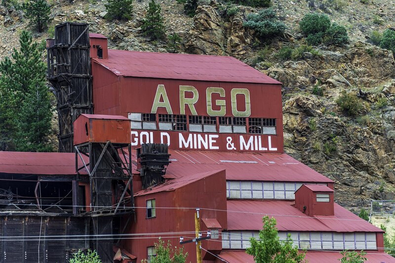
    <title type="html"><![CDATA[Idaho Springs’ Argo Mill &amp; Tunnel]]></title>
    <summary type="html"><![CDATA[<p><strong><em>The Argo Tunnel and Mill serves as a reminder of Central City and Idaho Springs’ importance in the Colorado Gold Rush, and it is part of the historic preservation efforts of the Idaho Springs, Black Hawk, and Central City areas. </em></strong></p><img src="https://www.intermountainhistories.org/files/fullsize/eaa667bf498f4f3a7ddeb6f5cb1c2c44.jpg" alt="Argo Mill" /><br/><p>In January of 1859, George Andrew Jackson discovered gold in Clear Creek, and John Gregory found gold in the North Fork of the same river on May 6. Jackson’s discovery led to the creation of modern-day Idaho Springs, and out of Gregory’s discovery emerged Central City, Black Hawk, and Nevadaville. Nevadaville has since become a ghost town, but Idaho Springs remains home to approximately 2,000 people. Central City and Black Hawk, although less populated, now primarily serve as gambling towns. The Argo Tunnel, whose construction began in 1891 and finished in 1910, served to connect the two mining areas and provide drainage for the water used in mining operations. At about $5 million dollars to build and just under 22,000 feet long, the Argo Tunnel was the longest tunnel in the world in 1910. The effects of the Argo tunnel are still noticeable in both tourism and the efforts to clean up the Clear Creek area.
Mining took place in Idaho Springs from 1859 to the early-1940s, when gold mining halted due to World War II. Meanwhile, the Central City–Black Hawk area quickly lost mining importance in the 1880s, and in 1918 the area stopped producing gold, pivoting to emphasize tourism through the Central City Opera House. However, by the 1980s, Central City and Black Hawk faced significant structural and health issues. The water had been condemned, and the city could not financially provide upkeep for historic buildings. In response, Colorado voters brought gambling back to the area. Once known as “the richest square mile on earth,” Central City has since taken a backseat to Black Hawk, although both still retain own casino districts. Due to the reintroduction of gambling, Black Hawk and Central City became concerned with cleaning up the pollution from and remnants of mines.
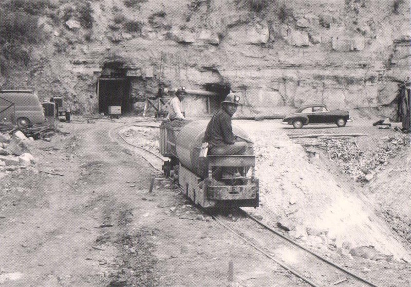
Meanwhile, because of Idaho Springs’ proximity to Interstate 70—convenient for commuting to Denver—the old Argo Mill and Argo Tunnel are visible from the freeway. The tunnel was sealed on January 19, 1943 when an accident flooded the chamber and killed four individuals. In addition to draining water from mines by using a low-grade decline from its origin in Central City to the end point in Idaho Springs, the Argo Tunnel also served to ventilate the mines and provide ore transportation.
In total, the Argo Tunnel processed around three trillion dollars’ worth of gold by today’s standard. Today, visitors can view original mining equipment, the Argo mill itself, and part of the Argo Tunnel. The tunnel is not safe due to the buildup of mining pollution, but removing the pollution is currently part of the EPA superfund site’s goals. Individuals can even experience a glimpse of the lives of Jackson and Gregory as they pan for gold. Overall, the Argo Tunnel serves as a reminder of the environmental damage caused by decades of mining as well as the town histories of Central City, Black Hawk, and Idaho Springs.</p><p><em><strong><a href="https://www.intermountainhistories.org/items/show/487">For more (including 4 images) view the original article</a></strong></em></p>]]></summary>
    <published>2021-09-16T21:20:26+00:00</published>
    <updated>2026-04-17T19:32:10+00:00</updated>
    <link rel="alternate" type="text/html" href="https://www.intermountainhistories.org/items/show/487"/>
    <id>https://www.intermountainhistories.org/items/show/487</id>
    <author>
      <name>Nikki Smith, Brigham Young University</name>
    </author>
  </entry>
  <entry>
    <title type="html"><![CDATA[Oro City: The Beginnings of Leadville]]></title>
    <summary type="html"><![CDATA[<p><strong><em>A once prosperous mining town, Oro City is not just a ghost town left behind by the Colorado gold rush. It is also an environmental hazard.</em></strong></p><img src="https://www.intermountainhistories.org/files/fullsize/128ef543b5fc00e04b72795a7bffb3a1.jpg" alt="Hydraulic mining in California Gulch" /><br/><p><span style="font-weight:400;">In early 1860, prospectors were exploring gulches and panning for gold deep in the Rocky Mountains of Colorado. One prospector, Abe Lee, produced the lucky pan with gold in late April. They named the area California Gulch, supposedly because Abe Lee exclaimed, “I’ve just got California in this here pan!” By summer of the same year, California Gulch’s population had risen from the original party of miners to five thousand individuals, including women. California Gulch was seven miles long and a city grew around it, eventually concentrated toward the northern end of the Gulch. This town came to be known as Oro City and served as the precursor to the modern-day city of Leadville.</span>
<span style="font-weight:400;">Oro City experienced waves of growth and decline as the seasons changed and as gold waned and silver and ore increased. In the beginning, the city had no official government and instead operated using the miners’ code and group meetings.  When Colorado became a territory the next year, Oro City became the county seat of Lake County and elections were held. The city’s population fluctuated seasonally, as winter conditions made mining difficult or impossible. Annual spring thaws repeatedly brought miners back until around 1865. By that point around five million dollars of gold had been extracted from three miles of the gulch, but gold-producing ore was exhausted. The population began to decline thereafter. A stamp mill named “The Printer Boy” was constructed in 1868 and helped partially sustain the local economy, but diminishing ore and continued technological troubles with requisite water pumping hindered business. The Printer Boy soon closed, along with other mills and smelters, and Oro City’s population moved elsewhere.</span>
<span style="font-weight:400;">In 1873 or 1874, a new settlement emerged near Oro City named Slabtown. Slabtown </span><span style="font-weight:400;">later became Leadville when William H. Stevens and Albinus B. Wood began the “Oro Mining Ditch and Fluming Company.” Stevens and Wood bought up large areas in the California Gulch and began producing silver and lead. Mining became concentrated in the Gulch, and the population moved down the mountain.</span>
<span style="font-weight:400;">Today, California Gulch is one of over 200 superfund sites in the state of Colorado, sites the EPA has specifically set aside for environmental recovery. For the most part, the 18 square miles of the superfund site is under control, although young children and expecting mothers should monitor their blood for heavy metals. Although the exposure is under control, the EPA will need to finish construction to seal up mines to create an area that is safe for the public to enter.</span></p><p><em><strong><a href="https://www.intermountainhistories.org/items/show/475">For more (including 3 images) view the original article</a></strong></em></p>]]></summary>
    <published>2021-09-10T23:09:03+00:00</published>
    <updated>2026-04-17T19:32:10+00:00</updated>
    <link rel="alternate" type="text/html" href="https://www.intermountainhistories.org/items/show/475"/>
    <id>https://www.intermountainhistories.org/items/show/475</id>
    <author>
      <name>Nikki Smith, Brigham Young University</name>
    </author>
  </entry>
  <entry>
    <title type="html"><![CDATA[Uranium Mining on the Navajo Reservation]]></title>
    <summary type="html"><![CDATA[<p><strong><em>The mining of uranium on the Navajo Reservation at the numerous Kerr-McGee mines aided weapon development during the Cold War. For many Navajo miners, this mining also exposed them to harmful radiation.</em></strong></p><img src="https://www.intermountainhistories.org/files/fullsize/1b04369a7d813bd703c61eb424a5f89d.jpg" alt="Navajo miners near Cove, Arizona in 1952" /><br/><p>After the conclusion of World War II, uranium ore was discovered in Northeast Arizona in the Lukachukai Mountains near the towns of Cove and Red Valley , Arizona. The Kerr-McGee Corporation started mining operations in 1952 in the Red Valley area by opening the Cove and Mesa mines on the Navajo Reservation. These uranium digs helped fuel the nuclear Arms Race between the United States and the Soviet Union during the 1950s and 1960s. Unlike other mines in Arizona, however, mining here proved more difficult since this uranium ore had formed in irregular and thin layers. The corporation used manual labor, employing mostly Navajo people, instead of machines to crush the stone. This crushed ore resembled a yellow chalk that could then undergo a refining process to extract the uranium. </p><p>This type of mining produced critically contaminated air, filling the mine shafts with radioactive uranium dust, radon gas, and superfine silica. Smaller mines in particular lacked proper ventilation systems to remove or filter air, and as a result, workers inhaled these chemicals constantly. Many miners developed health complications ranging from damaged lungs to cancer due to lack of knowledge about the long-term effects of radiation as well as inadequate protective equipment. </p><p>Mining operations peaked in 1955 and 1956 with the fervor of the Cold War, but two decades later in 1967, all uranium mining ceased. The fatalities that occurred from mining efforts, in addition to lingering health problems, left their mark on the history of uranium mining; its legacy of damaged lives and environmental landscapes eventually resulted in government action. Congress passed the Radiation Exposure Compensation Act (RECA) in 1990 to compensate those affected by nuclear or radioactive exposure. Uranium miners and ore transporters, among them many Navajos, received the largest compensation of $100,000. While monetary compensation cannot reverse the consequences of uranium mining, RECA demonstrates the cooperation between the U.S. government and the Navajo Reservation.</p><p><em><strong><a href="https://www.intermountainhistories.org/items/show/402">For more (including 3 images) view the original article</a></strong></em></p>]]></summary>
    <published>2020-03-08T05:33:53+00:00</published>
    <updated>2026-04-17T19:32:08+00:00</updated>
    <link rel="alternate" type="text/html" href="https://www.intermountainhistories.org/items/show/402"/>
    <id>https://www.intermountainhistories.org/items/show/402</id>
    <author>
      <name>Kee Ranger, Brigham Young University</name>
    </author>
  </entry>
  <entry>
    <title type="html"><![CDATA[Murray Smelter: The Purpose of the Superfund Program]]></title>
    <summary type="html"><![CDATA[<p><strong><em>State, local, and EPA officials worked together in Murray, Utah - a suburb of Salt Lake City - to clean up a lead smelter that had received the highest ever hazard rating from the EPA. </em></strong></p><img src="https://www.intermountainhistories.org/files/fullsize/f5dd95bbbf8d8a7695a767a59e41168b.jpg" alt="Murray Smelter" /><br/><p>The Murray Smelter Superfund demonstrates the potential of the ambitious Superfund program and stands as a testament to its limitations. Modern industry has had staggering destructive impacts across the West. Clean-up processes have been complicated and often delayed. There are flaws in the Superfund program, but ultimately it was created for a good purpose. It marked an era when Americans started to be conscious of the impacts that they were having on the environment and strove to remediate the damage they had done. </p><p>Opened in 1902 and operated by the American Smelting and Refining Company (ASARCO), the Murray Smelter grew to become the nation’s largest supplier of lead. As early as 1907, nearby farmers began to complain of the effect that lead and arsenic released into the air were having on livestock and crops. A national court case forced ASARCO to invest in new towering smokestacks that would reduce the effects of the pollution. The smelter operated 24 hours a day, seven days a week, superheating lead ore and separating it from other material while also releasing copious amounts of toxic material into the air and water. Following the end of WWII, the demand for lead declined and the Murray Smelter closed in 1949, leaving behind the iconic smokestacks and 142 deserted acres of polluted property. In 1994 when the EPA evaluated the site for consideration on the Superfund list, it received the highest ever hazard rating ever given in agency’s history, at 86.6. By comparison, the average hazard rating for the other Superfund sites in this tour is only 45.3. The hazard rating is used “to assess the relative potential of sites to pose a threat to human health or the environment.” The rating that the Murray Smelter received was alarming, especially when considering the town’s high school was just across the street.</p><p>And yet, the city of Murray refused to be defined by its environmental problem. City, state, and EPA officials immediately began work together on cleanup operations. The smokestacks that were caked in toxic lead and asbestos were demolished in 2000, and thousands of tons of contaminated soil have since been removed. ASARCO has contributed to the cleanup as well, providing funding and installing groundwater monitoring stations. By 2002, the site was deemed clean enough for commercial development, and now is home to a massive Intermountain Healthcare Medical Center, Costco, and the local public transportation Frontrunner station. The EPA’s site manager commented, “The ability to work and problem solve with so many different groups made the cleanup process exciting.” The successful collaboration turned one of the most potentially dangerous toxic sites in America into a thriving commercial area. </p><p>The Murray Smelter site shows the potential that the Superfund program has; however, it also shows that the clean-up process can be highly selective. In the other locations featured in Superfund Me: Stories of Environmental Tragedies in the West, as well as many others across the nation, groups of people are neglected because of the lack of economic opportunities in their cities. The Navajo and the Coeur d’Alene tribes are ignored as the land and water they have relied on for generations is poisoned. The cries for help from the people of Monticello, Silverton, and Libby are discarded because their communities are so small. The immigrant miners of Butte were forced to move as their homes were consumed by a giant pit, and just as the people of Hayden today face economic and environmental pressures that threaten to create a new ghost town. The attention and effort that we give to clean the massive messes we have made should not be based on the economic potential of that area. We should learn from those past mistakes to ensure a healthy relationship between man and the environment in the future. We owe it to everyone and everything that considers the West its home.  </p><p><em><strong><a href="https://www.intermountainhistories.org/items/show/383">For more (including 4 images) view the original article</a></strong></em></p>]]></summary>
    <published>2020-01-08T23:38:49+00:00</published>
    <updated>2026-04-17T19:32:07+00:00</updated>
    <link rel="alternate" type="text/html" href="https://www.intermountainhistories.org/items/show/383"/>
    <id>https://www.intermountainhistories.org/items/show/383</id>
    <author>
      <name>Sam Heywood, Brigham Young University</name>
    </author>
  </entry>
  <entry>
    <title type="html"><![CDATA[Run Like Hell: The Libby Asbestos Story	]]></title>
    <summary type="html"><![CDATA[<p><strong><em>In 2009, the EPA declared the situation in Libby, Montana a public health emergency due to residents' levels of exposure to asbestos from nearby mines.  </em></strong></p><img src="https://www.intermountainhistories.org/files/fullsize/bb2ee5fd316ff1cffbb7fa0dbb243e89.jpg" alt="Zonolite Insulation Advertisement" /><br/><p>In 1999 the EPA began to investigate claims that an alarming number of residents of Libby, Montana were experiencing health problems from exposure to asbestos. This was linked to nearby mines and Libby was placed on the superfund list in 2002. In 2009 the EPA declared the situation in Libby a “Public Health Emergency” - a first in the agency’s history - citing the immediate need for additional funding from the national government. Over 400 people have died in this small mountain town due to an asbestos contamination, and an estimated 3,000 additional people have been diagnosed with diseases such as mesothelioma. </p><p>The Zonolite company first started mining operations in Libby in the 1920s, extracting the mineral vermiculite from the surrounding mountains. Vermiculite is a unique mineral that expands when exposed to heat and is used for a variety of purposes. Zonolite marketed vermiculite as the cheapest, most efficient way to insulate homes and experienced great success initially. During its operation, the mine in Libby was responsible for providing 80% of the country’s vermiculite supply and was successfully marketed to homeowners across America.  Pure vermiculite is not dangerous, but unfortunately for the townspeople of Libby, the nearby deposit was contaminated by a naturally occurring form of asbestos called tremolite-actinolite.</p><p>By 1956 it was clear that Zonolite knew about the asbestos risk, but they did not disclose it to their employees. In 1963 when W. R. Grace and Company bought the mine in Libby, the effects of the asbestos were readily apparent in miners. A company report from 1965 contained a long list of employees that are listed as having “abnormal chests,” many of whom had already died from lung disease. People in the town were certainly aware that the large quantity of dust was linked to rising number of health problems, but when they asked about the mysterious “dust disease,” company officials always responded that the mine only contained tremolite. One miner remembered confronting a mining operator upon learning that tremolite is one of the most dangerous forms of asbestos. “That really upset me because we’re not geologists. There’s not a person up on that hill that new the definition for tremolite.”</p><p>The dust affected the entire community, not just the employees. When miners returned home from work, they were covered in toxic dust. Embraces with loved ones were unknowingly dangerous for their families. Waste and dust from the mines contaminated over one million cubic yards of soil, land on which schools and playgrounds were built. Surrounding groundwater was contaminated as well, carrying deadly fibers of asbestos into the intestines of the people of Libby. By the time the mine closed in 1990, it was too little too late for many of the town’s residents. Asbestos from the mine devastated Libby, killing up to 10% of the population, and afflicting many more. </p><p>W. R. Grace executives were acquitted in a trail brought against them by the federal government for knowingly causing harm to the people of Libby, in which the CEO stated "the company worked hard to keep the operations in compliance with the laws and standards of the day." The judge who presided in the case took issue with the prosecution’s “inexcusable dereliction of duty” in the handling of some evidence, and ultimately could not convict a company responsible for violating a law (the Clean Air Act) that was not in effect during the mine’s operation. Locals of Libby were disappointed in the verdict, but many admit that the company was not entirely to blame for the mine staying open for so long. Zonolite and Grace provided jobs for these people and are responsible in large part for the existence and identity of the town. One miner summed up the precarious situation like this, “I loved my job at Zonolite. I loved it so much that even if they had told me that I was endangering my life, I would probably have stayed. But if they’d told me it was killing my wife and my family too, I would have run like hell.” </p><p>The EPA initially divided Libby into zones for the cleanup operation. Today, certain zones have been deemed “clean,” while other, more isolated areas still report contamination. People in Libby still gather every year to remember the loved ones they have lost to disease. Some still demand compensation from the government, but the Superfund program is unable to offer any financial assistance to affected residents. By law, the EPA can only divert funds to cleanup operations. Others want to move on from the disaster, and look forward to a future where their small town is not defined by the asbestos tragedy.  </p><p><em><strong><a href="https://www.intermountainhistories.org/items/show/382">For more (including 7 images) view the original article</a></strong></em></p>]]></summary>
    <published>2020-01-08T23:23:55+00:00</published>
    <updated>2026-04-17T19:32:07+00:00</updated>
    <link rel="alternate" type="text/html" href="https://www.intermountainhistories.org/items/show/382"/>
    <id>https://www.intermountainhistories.org/items/show/382</id>
    <author>
      <name>Sam Heywood, Brigham Young University</name>
    </author>
  </entry>
</feed>