<?xml version="1.0" encoding="UTF-8"?>
<feed xmlns="http://www.w3.org/2005/Atom">
  <title type="text">Intermountain Histories</title>
  <updated>2026-04-17T19:32:19+00:00</updated>
  <generator uri="http://framework.zend.com" version="1.12.20">Zend_Feed_Writer</generator>
  <link rel="alternate" type="text/html" href="https://www.intermountainhistories.org/"/>
  <link rel="self" type="application/atom+xml" href="https://www.intermountainhistories.org/items/browse?output=rss2"/>
  <id>https://www.intermountainhistories.org/</id>
  <author>
    <name>Intermountain Histories</name>
    <uri>https://www.intermountainhistories.org</uri>
  </author>
  <link rel="hub" href="https://pubsubhubbub.appspot.com/"/>
  <entry>
    <title type="html"><![CDATA[Parowan Gap Petroglyphs]]></title>
    <summary type="html"><![CDATA[<img src="https://www.intermountainhistories.org/files/fullsize/ae788130d6314850832eb9fc11464fb9.jpg" alt="Ancient carvings were made by Natives passing through Parowan Gap" /><br/><p>Over a thousand years ago, Fremont Indians inhabited southern Utah in an area known as the Parowan Gap. Once a flowing river, the Parowan Gap dried out over time. Erosion by wind and rain have further shaped this 600 foot deep notch or pass used by Natives and newcomers to traverse the Red Hills, a low range of mountains that forms the western border of the Parowan Valley. Hopis, Utes, and Paiutes used this area to travel back and forth to obtain resources and mingle with one another. </p><p>About 13 miles west of Parowan are the famous petroglyphs, carved or pecked into the sedimentary rock walls of this historic landmark. Petroglyphs depict images of people, animals and different lines and shapes, although the meaning of some of the depictions remains a mystery. Images of humans, snakes, mountain sheep, and lizards fill the wall panels. Archaeologists believe the gallery represents rock art extending over a thousand years. Some researchers postulate the wall was used for religious purposes and others contend the engravings represent a hunting ritual. One petroglyph depicts a calendrical system indicating when to plant and harvest crops. Zipper Glyph, the most famous petroglyph, depicts the route Paiutes traveled and indicates how long their journey through the gap might take. </p><p>The petroglyphs at Parowan Gap are fragile and can be ruined by human touch or by trying to chalk over them. Enjoy them at a distance by taking a photo or sketching them yourself. Everyone shares a responsibility to help preserve archaeological and historically significant sites.</p><p><em><strong><a href="https://www.intermountainhistories.org/items/show/857">For more (including 3 images) view the original article</a></strong></em></p>]]></summary>
    <published>2024-09-25T20:44:31+00:00</published>
    <updated>2026-04-17T19:32:19+00:00</updated>
    <link rel="alternate" type="text/html" href="https://www.intermountainhistories.org/items/show/857"/>
    <id>https://www.intermountainhistories.org/items/show/857</id>
    <author>
      <name>Samantha Worthington, Brigham Young University</name>
    </author>
  </entry>
  <entry>
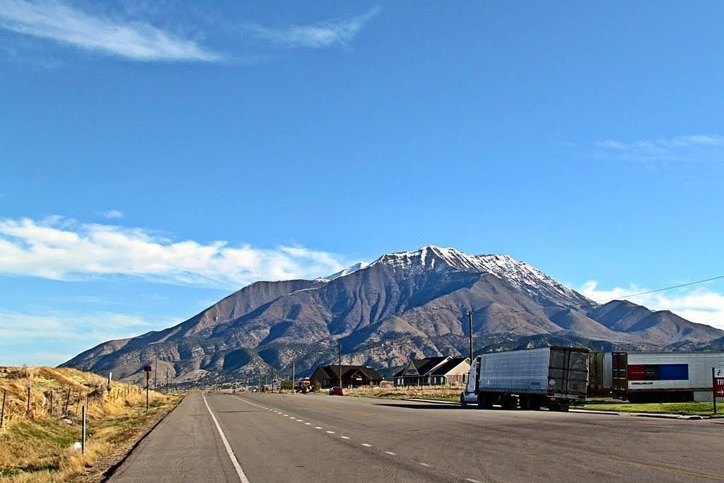
    <title type="html"><![CDATA[The Nephi Massacre during Wakara’s War<br />
]]></title>
    <summary type="html"><![CDATA[<p><strong><em>During Wakara’s War in 1853-54 a group of Utes killed four Mormons at Fountain Green.  The next day, Mormons killed eight Utes or Goshutes seeking peace with LDS settlers in Nephi, Utah. The discovery of their remains in Nephi’s Old Hallow in 2006 highlighted the brutality of Wakara’s War, a series of conflicts during 1853 between settlers and Indigenous residents in central Utah Territory.</em></strong></p><img src="https://www.intermountainhistories.org/files/fullsize/fafd241883d271d8b9793e3097ca8da1.jpg" alt="Nephi, Utah" /><br/><p>In 2006, an archaeological discovery in Nephi, Utah, shed light on a tragic event that occurred in 1853 during the Walker War, also known as the Wakara War. The excavation revealed a mass grave containing the remains of seven Goshutes, including a young boy. The bodies were found piled on top of each other. Forensic analysis discovered gunshot wounds, shattered bones, and evidence of blunt force trauma.</p><p>The Wakara War between settlers and Utes was infuriated by the encroachment of additional LDS settlements in Utah and Sanpete counties in Utah Territory. The incident in Nephi occurred on October 2, 1853, when a group of Utes or Goshutes came to the fort. The account reported in the Deseret News portrayed the Natives as aggressors in a tussle they initiated with the militia. Recent research, including the discovery of journals of witnesses Adelia Wilcox and Martha Spence Heywood, however, contradict this narrative.</p><p>The forensic evidence from the mass grave suggests that the Native men, ranging in ages from 16 to 25, were not killed in a skirmish but were executed. Gunshot wounds in the back of the head and traumatic injuries indicate a cold-blooded killing, challenging the original historical account. The discovery of the mass grave by construction workers laying a foundation for a home in 2006 provided an opportunity to combine scientific discovery, archaeology and forensic analysis, and historical records to correct and update the historical narrative and include the perspectives of those killed. The story of the Nephi mass grave is a significant reminder of the complexities surrounding historical narratives and how archaeological revelations can amend those stories.</p><p><em><strong><a href="https://www.intermountainhistories.org/items/show/856">For more (including 3 images) view the original article</a></strong></em></p>]]></summary>
    <published>2024-09-25T15:00:26+00:00</published>
    <updated>2026-04-17T19:32:19+00:00</updated>
    <link rel="alternate" type="text/html" href="https://www.intermountainhistories.org/items/show/856"/>
    <id>https://www.intermountainhistories.org/items/show/856</id>
    <author>
      <name>Chelsea Woodruff, Brigham Young University</name>
    </author>
  </entry>
  <entry>
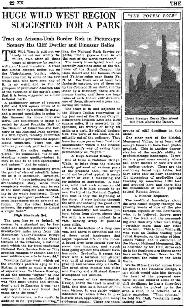
    <title type="html"><![CDATA[The Beginning of the End: Kayenta, Arizona and Everett Ruess]]></title>
    <summary type="html"><![CDATA[<p><strong><em>On April 12th, 1934 Everett and his brother Waldo Ruess made the journey from southern California through the night. They stopped in Flagstaff for supplies, then headed north to Kayenta, Arizona, where Waldo dropped Everett off. It was the last time he was seen by anyone in his family.</em></strong></p><img src="https://www.intermountainhistories.org/files/fullsize/5132afc33e165a712d7a4a3391423c75.jpg" alt="New York Times, 1934" /><br/><p><span style="font-weight:400;">Known as the gateway to Monument Valley Navajo Tribal Park, Kayenta, Arizona lies in the Navajo Nation just south of the Arizona-Utah border. Kayenta was founded in 1909 by John Wetherill first as a trading post and eventually was established as a township by the Navajo Nation in 1962.</span>
<span style="font-weight:400;">After spending a semester at the University of California Los Angeles (UCLA) Everett traversed the Sierras in 1933. He made it clear to his brother, Waldo, that this journey in 1934 would be his last. After Waldo dropped him off, Everett spent the next two months exploring the region surrounding Kayenta. In a letter to Waldo, he wrote about his journey consisting of “Chin Lee [</span><i><span style="font-weight:400;">sic</span></i><span style="font-weight:400;">], Canyon de Chelly, the Luckachukais, and the Carrizos.” During this time Everett enjoyed the wilderness country, and experienced solitude, which he eventually achieved. During his third time in Canyon de Chelly, Everett foreshadowed his own fate when he wrote “I have been flirting pretty heavily with death” in a letter to a friend. Everett also stayed with Navajo families during this time, where he ate and hunted, making an impression that lasted generations.</span>
<span style="font-weight:400;">As the summer months approached, Everett recalled the crew of the Rainbow Bridge – Monument Valley archeological expedition near Kayenta. The expedition, funded by Ford Motor Company, aimed to provide field experience for explorers and survey the land for an attempted national park. He headed to the expedition’s camp near Skeleton Mesa, just west of Kayenta, and was hired by expedition leader Lyndon Hargrave of the Museum of Northern Arizona (MNA) in Flagstaff. He began working in exchange for meals, rather than the $3.50 a day that the other explorers received. He thoroughly enjoyed this experience because he could work alongside intelligent individuals, discuss the Navajo culture, draw and paint, climb any rock desired, and enjoy the wonders of nature with a sense of companionship for the first time.</span>
<span style="font-weight:400;">Hargrave recalled Everett’s skill from when they met briefly in 1931 at Mesa Ranch Schools’ summer camp. He assigned Everett to work under the crew of Clay Lockett, Flagstaff resident and ethnologist at MNA. The crew spent their time excavating Skeleton Mesa, specifically Woodchuck Cave, which contained archeological remains and objects from as far back as 200 C.E. During the expedition, Everett and  Lockett bonded over their love for art and nature. After his disappearance, Lockett later wrote, “I had an excellent chance to really know Everett,” demonstrating Everetts's lasting impression. It seemed that Everett made an impression on everyone he met, especially on this expedition.</span>
<span style="font-weight:400;">Everett displayed his love for adventure again when a storm approached the canyon, which encouraged him to capture the rolling clouds in watercolor as they encroached. The young vagabond displayed his risky personality while perched at the edge of the slick cliff, hunched over to protect the precious watercolor of Mother Nature in action. Everett soon finished the expedition, paused in Kayenta, and headed south to attend the Hopi snake dance one last time.</span></p><p><em><strong><a href="https://www.intermountainhistories.org/items/show/831">For more (including 4 images) view the original article</a></strong></em></p>]]></summary>
    <published>2024-05-25T04:12:43+00:00</published>
    <updated>2026-04-17T19:32:18+00:00</updated>
    <link rel="alternate" type="text/html" href="https://www.intermountainhistories.org/items/show/831"/>
    <id>https://www.intermountainhistories.org/items/show/831</id>
    <author>
      <name>Matthew T. Lankton, Northern Arizona University</name>
    </author>
  </entry>
  <entry>
    <title type="html"><![CDATA[Big Horn Medicine Wheel]]></title>
    <summary type="html"><![CDATA[<p><strong><em>In a picturesque and seemingly significant location, the Big Horn Medicine Wheel may reveal indigenous knowledge of astronomy.</em></strong></p><img src="https://www.intermountainhistories.org/files/fullsize/e3c611b4ff4e6359f87c4c7f5dede281.jpg" alt="Big Horn Medicine Wheel" /><br/><p>At the top of the Big Horn Mountains, 9,642 feet above sea level, on the west ridge of Medicine Mountain, lies the Big Horn Medicine Wheel. The wheel sits about twenty yards away from a limestone cliff face, where visitors can look down upon the Big Horn Basin, the Wind River, and the Pryor Mountains of Montana. Using a piece of wood found built into the structure, archaeologists dated the Medicine Wheel itself to around 1760 AD. Other archaeological research carbon-dated charcoal and wood fragments found near the Medicine Wheel to 4,529 BCE.
The wheel is made of hundreds of white limestone rocks arranged in roughly in the circular shape of a wheel. Spanning eighty feet in diameter, the wheel is a true marvel, as most rocks used as material for the massive wheel originate from the bottom of the mountain, meaning the builders carried them to the top. At the center of the wheel lies another smaller circle, and 28 “spokes” radiate from this smaller center circle, connecting the center to the perimeter of the wheel. Small hollow cairns surround the wheel.
Although much research has been done on the wheel, archaeologists, astronomers, and other scholars have been unable to determine its origin and function. One astronomer suggests the indigenous builders might have designed the wheel to track celestial bodies, having found the cairns are in astronomical alignment with the summer solstice sunset and sunrise as well as the rise of the stars Alderbaran, Serius, and Rigel. Another astronomer disagrees, saying that had the medicine wheel’s purpose been to track the solstice and stars, the structure’s design would have been more precise and astronomical alignments with the wheel would be more obvious and practical. An archaeologist suggests that the cairns could have been small shelters for vision quest participants while another archaeologist believes the wheel is a model of a Cheyenne medicine lodge. A Crow legend tells the story of a boy that was able to find healing and tribal acceptance through the power connected to the wheel. The Cheyenne believe that the Legend of Sweet Medicine inspired the Big Horn Medicine Wheel. Many theories have been proposed and disputed, but no theory has provided irrefutable evidence for a single explanation.
The Big Horn Medicine Wheel is a national historical landmark and is still used by tribes for religious purposes. Visitors are allowed to view the Big Horn Medicine Wheel but are asked to respect the ancient site as it holds both religious and historical significance to many Native Americans.</p><p><em><strong><a href="https://www.intermountainhistories.org/items/show/582">For more (including 5 images) view the original article</a></strong></em></p>]]></summary>
    <published>2022-03-19T10:04:39+00:00</published>
    <updated>2026-04-17T19:32:12+00:00</updated>
    <link rel="alternate" type="text/html" href="https://www.intermountainhistories.org/items/show/582"/>
    <id>https://www.intermountainhistories.org/items/show/582</id>
    <author>
      <name>Kelli Holiday, Brigham Young University</name>
    </author>
  </entry>
  <entry>
    <title type="html"><![CDATA[Hogup Cave]]></title>
    <summary type="html"><![CDATA[<p><strong><em>Hogup Cave provided shelter for people who hunted and gathered in the surrounding area as part of a cyclical migration. The findings at the cave provide a small glimpse of a complex and enduring culture that lasted for thousands of years.</em></strong></p><img src="https://www.intermountainhistories.org/files/fullsize/5603ff72330b9812961c5cc4c79cfedf.jpg" alt="Outside the entrance to Hogup Cave" /><br/><p>Somewhat overshadowed by the more well-known Danger Cave, Hogup Cave provides some of the same enigmas presented by Danger Cave, such as the struggle for life in the harsh environment. Excavated by Dr. C. Melvin Aikens of the University of Utah in 1967 and 1968, the archeological evidence recovered from the cave—dating back as far as 6,000 BCE—shows a desert culture in line with Native peoples of the time. Starch granules found on artifacts show the use of small scale gathering, and a prevalence of projectile points show the importance of hunting, with bighorn sheep and pronghorns acting as the prey. Both findings suggest a nomadic people who used the cave periodically while hunting on the surrounding land. The cave came to be used cross-culturally, as is seen in the evidence for the replacement (rather than assimilation) of Fremont peoples by Numic speaking groups. Fremont artifacts do not continue past Unit III (400–1350 CE), and Numic artifacts start to appear in Unit IV (1350–1850 CE).
Because the history of the cave extends back to 6000 BCE, it was an important find for understanding the ancient desert cultures put forth by Jesse Jennings in his excavation of Danger Cave, an archaeological dig site about 65 miles away from Hogup Cave. Hogup Cave provides more evidence supporting Jennings’s challenge to Ernest Antevs’ theory of widespread drought during the time of its occupation, showing how discoveries such as the one at Hogup also inspire questions relating to cultural ecology, asking to what extent environment impacts these cultures.
Not much information is available about the caves aside from the excavation done by the University of Utah and the writeups done by project supervisor C. Melvin Aikens. Such writings make up the bulk of the scholarly work, and artifacts from the excavation can be found at the university’s Museum of Natural History. But the discovery of the cave itself remains somewhat a mystery. Local folklore and oral histories point to Orval Evans discovering the cave in the 1930s, while the University of Utah eventually learned about Hogup Cave by hearing about subsequent expeditions. This story reflects the accidentalism and amateur archeological enthusiasm that sometimes surrounds archeological discovery in Utah.</p><p><em><strong><a href="https://www.intermountainhistories.org/items/show/490">For more (including 3 images) view the original article</a></strong></em></p>]]></summary>
    <published>2021-09-18T01:51:12+00:00</published>
    <updated>2026-04-17T19:32:10+00:00</updated>
    <link rel="alternate" type="text/html" href="https://www.intermountainhistories.org/items/show/490"/>
    <id>https://www.intermountainhistories.org/items/show/490</id>
    <author>
      <name>Drew Holley, Brigham Young University</name>
    </author>
  </entry>
  <entry>
    <title type="html"><![CDATA[Tuzigoot National Monument and the Sinagua People]]></title>
    <summary type="html"><![CDATA[<p><strong><em>The Tuzigoot National Monument, located in the Verde Valley of central Arizona, is a Pueblo ruin abandoned by the Sinagua people. The archeological discoveries made at this ruin reveal many characteristics about the inhabitants’ culture and lifestyle, as well as hints to what became of the Sinagua people after leaving this structure around 600 years ago.</em></strong></p><img src="https://www.intermountainhistories.org/files/fullsize/b0612f8997e858bc8511c6e1e9677038.jpg" alt="Tuzigoot in 1989" /><br/><p>Between 1933 and 1935, the Federal Emergency Relief Agency’s Civil Works Administration excavated the ruins of the Tuzigoot Pueblo. Archeologists Louis R. Caywood and Edward H. Spicer led the project under the direction of the U.S. Department of the Interior National Park Service. They discovered remains of an agricultural community that inhabited the valley for centuries.
The Sinagua people who built Tuzigoot inhabited the Verde Valley from approximately 1000 CE to 1450 CE. Archeologist Harold S. Colton named the people after the San Francisco peaks located north of the valley, which early Spanish explorers called “Sierra Sin Agua,” meaning “mountain range without water.” The explorers chose this title due to the lack of perennial rivers that were so common to the mountains of Spain. While the name given to the inhabitants derives from the Spanish language, Tuzigoot received its name from the Apache name for Peck’s Lake near the site, meaning “crooked water.”
Various valley communities contributed to the Sinagua culture. Archaeological remnants of these communities were discovered from Montezuma’s Castle all the way to the Platki and Honanki sites. The Sinagua included diverse lifestyles: an agricultural society, likely attracted to the favorable growing conditions of the Verde Valley; hunters, concluded from the bones of deer, beaver, and other animals discovered in middens near the site; and skilled artists, derived from clay animal and human effigies, ceremonial and cooking pottery, spindle whorls, painted coil baskets, and turquoise and shell jewelry. Furthermore, the presence of macaw bones—not a local item—demonstrates the Sinagua people had trade connections.
The ruins of Tuzigoot span just over one square mile, but were home to an estimated 250 people. It was first described as a “rambling pueblo” because rooms fell into disuse and other rooms were built on top and around them. The residents gained access through ladders and roof entry points instead of exterior doors. The walls were constructed of limestone and sandstone, the most readily available materials in the area.
The people built Tuzigoot over the course of nearly three centuries but suddenly abandoned it in the 15th century. While oral history implies that violence may have driven out some communities from the Verde Valley, there is no evidence of a sudden mass catastrophe at Tuzigoot. There are several theories, however, regarding its total abandonment. A drought occurred in regions north of the Verde Valley, which may have increased competition due to migration. Following the drought, archaeologists know the Apache and Yavapai had hostile interactions with the Sinagua when they moved to the valley. It is also possible that increased populations led to overfarming, encouraging the Sinagua of Tuzigoot to seek more fertile lands. The infant-mortality rate was significantly higher before abandonment, and the population of Tuzigoot may have reached its peak just before the Sinagua’s ultimate departure.
While it is difficult to determine where the Sinagua traveled after abandoning Tuzigoot, cultural tradition and oral history suggest that some Sinagua communities merged into the Yavapai people or became involved with what are now the modern-day Hopi Tribe of Arizona and the Zuni Tribe of New Mexico.</p><p><em><strong><a href="https://www.intermountainhistories.org/items/show/486">For more (including 4 images) view the original article</a></strong></em></p>]]></summary>
    <published>2021-09-15T08:04:22+00:00</published>
    <updated>2026-04-17T19:32:10+00:00</updated>
    <link rel="alternate" type="text/html" href="https://www.intermountainhistories.org/items/show/486"/>
    <id>https://www.intermountainhistories.org/items/show/486</id>
    <author>
      <name>Jacob Morrison, Brigham Young University</name>
    </author>
  </entry>
  <entry>
    <title type="html"><![CDATA[The Nephi Mounds : New Light Shed on the Origins of the Fremont]]></title>
    <summary type="html"><![CDATA[<p><strong><em>The Nephi Mounds got their name from their location, which is approximately two miles north of Nephi, Utah. The site is an Fremont archaeological site with 30 pithouses and important historical artifacts. This site helps to substantiate the claims that the Fremont were not originally from Utah, but could have descended from Athabascan tribes from the north. </em></strong></p><img src="https://www.intermountainhistories.org/files/fullsize/420f340e27ce1c781c958e28211e02fe.jpg" alt="Photo of a pithouse." /><br/><p>The Nephi Mounds are a Fremont archaeological site situated approximately two miles north of Nephi Utah. In one of these cattle fields just west of the slopes of the mountains, a farmer first discovered the Fremont mounds while working on his farm in 1871. The site was then covered up. It was not until 1965 when, upon further examination by archaeologists from the University of Utah, discovered a series of pit houses and granaries situated in groups that numbered about 30 total structures. Inside were several artifacts that exemplify Fremont culture. There were several pieces of pottery, bone and stone tools, pieces of food, and firepits. These artifacts contribute to the hypothesis that the Fremont were not originally from Utah, but had heavy influence from neighboring tribes that were well adapted to living in the Utah climate. These artifacts are more congruent with finds from Athabascan tribes to the northwest, which suggest that the Fremont had origins from that region. One of the most important aspects of this site are the adobe-coil dwellings that are unique to the Sevier Fremont tribes. </p><p>Mystery surrounds the origins and disappearance of the Fremont. Data gathered from the pithouses, moccasins, and ceramics found in Fremont sites differentiate the Fremont from their Anasazi and Pueblo neighbors. This hypothesis is further supported by the skeletal remains of</p><p>the Fremont at sites such as the Nephi mounds, which show similarities to Athabaskan groups living in areas as far north as sub-arctic regions. </p><p>The story of the Fremont can be told as one of cultural differences and international relations. The semi-nomadic lifestyle of the Fremont leads to high possibility that the Fremont were travelers from outside of Utah. In synthesizing these findings and considering a possible route of travel along the Ivie and Snake river systems, the theory of Athabascan progenitors living throughout the region can be readily endorsed. </p><p>As for the Nephi site in particular, the findings here have been supportive of migrant theory thus far. There were 30 mounds total, of which some were living structures, others for storage and worship. There were two skeletons found, a male and a female. The man had evidence of rust on his arm, where he was possibly holding a weapon or tool made from iron. There were many ceramic vessels inside, including a metate for grinding corn. Food scraps and other debris from the period were also in the pithouses. There were deer bones fashioned into needles for the purpose of making moccasins as well. </p><p><em><strong><a href="https://www.intermountainhistories.org/items/show/431">For more (including 3 images) view the original article</a></strong></em></p>]]></summary>
    <published>2020-10-11T09:42:14+00:00</published>
    <updated>2026-04-17T19:32:08+00:00</updated>
    <link rel="alternate" type="text/html" href="https://www.intermountainhistories.org/items/show/431"/>
    <id>https://www.intermountainhistories.org/items/show/431</id>
    <author>
      <name>Daniel Martin, Brigham Young University</name>
    </author>
  </entry>
  <entry>
    <title type="html"><![CDATA[The Kuaua Pueblo Ruins and the Coronado Historic Site]]></title>
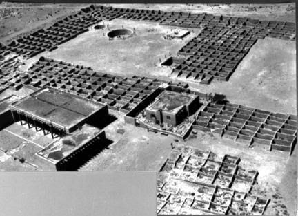
    <summary type="html"><![CDATA[<p><strong><em>During Francisco Vasquez de Coronado’s expedition to New Mexico in the 1540s, he came into contact with the Tiwa people who lived in pueblos near modern-day Albuquerque. In the 1930s, archaeologists excavated the ruins of Kuaua, one of the largest pueblos. These ruins currently constitute a large part of the Coronado Historic Site.</em></strong></p><img src="https://www.intermountainhistories.org/files/fullsize/abc8c5fc50ca9f4f5d8bae95e244cdb1.jpg" alt="Kuaua ruins, Coronado State Monument, 1940" /><br/><p>Archaeologists located the Kuaua Pueblo ruins just north of Albuquerque, New Mexico along the banks of the Rio Grande River. Created as part of the 400th anniversary of Francisco Vasquez de Coronado’s entry into New Mexico, the Coronado History Site references the expedition’s interactions with local Tiwa villages. Kuaua, a name meaning “evergreen” in Tiwa, was one of the largest of these villages and may have been the site of Coronado’s winter headquarters during the expedition. Archaeologists have estimated that the Tiwa settled this village in the fourteenth century and likely contained more than one thousand people when they came into contact with Coronado. However, conflict over the years with Coronado and other Spanish explorers eventually led to the Tiwa’s abandonment of Kuaua Pueblo in the sixteenth century.</p><p>When the archaeological team excavated the Kuaua Ruins in the 1930s, they uncovered more than 1,200 adobe rooms, three ceremonial rooms, and six kivas. Several of the kivas contained a series of murals that many revere today as some of the best examples of Pre-Columbian artwork in the United States. Kuaua religious murals flourished throughout the fourteenth, fifteenth, and sixteenth centuries, reflecting religious and cosmological iconography such as references to rain, rainbows, clouds, lightning, and ritual figures engaging in rain-making rituals. These rituals formed an important part of Pueblo culture and religion due to the region’s general climate of minimal precipitation. </p><p>Thanks to extensive conservation efforts since the 1930s, the murals have been preserved for modern viewing. The Coronado Historic Site includes a Visitor Center, which features fourteen examples of original mural artwork as well as Pueblo Indian and colonial Spanish artifacts. Several trails throughout the ruins of the pueblo and along the Rio Grande River provide exploration opportunities for visitors wishing to more authentically learn about the Tiwa Pueblo culture and lifestyle.</p><p><em><strong><a href="https://www.intermountainhistories.org/items/show/404">For more (including 3 images) view the original article</a></strong></em></p>]]></summary>
    <published>2020-03-11T22:43:42+00:00</published>
    <updated>2026-04-17T19:32:08+00:00</updated>
    <link rel="alternate" type="text/html" href="https://www.intermountainhistories.org/items/show/404"/>
    <id>https://www.intermountainhistories.org/items/show/404</id>
    <author>
      <name>Sarah Rounsville, Brigham Young University</name>
    </author>
  </entry>
  <entry>
    <title type="html"><![CDATA[Nine Mile Canyon]]></title>
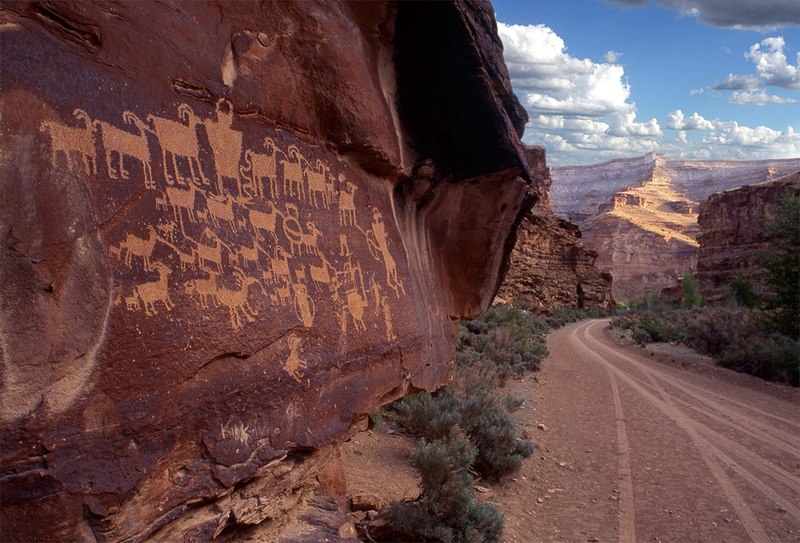
    <summary type="html"><![CDATA[<p><strong><em>With a length of more than 40 miles, the deceptively named Nine Mile Canyon is a tourist destination of eastern Utah that winds through Carbon and Duchene Counties. While the rock walls and greenery of the canyon can be breathtaking, the true pull for both archeologists and the average visitor is the clear evidence of an ancient civilization. The Fremont Indians left behind art on the rock walls of the canyon that has been remarkably well-preserved. This art provides a glimpse into an ancient culture that has left no written records.</p></strong></p><img src="https://www.intermountainhistories.org/files/fullsize/f5e88aaa9c609feed26e3dc94eb3e0d9.jpg" alt="The Great Hunt
" /><br/><p>Evidence of the Fremont culture is largely found in an area of land in eastern-central Utah about 200 miles long and 100 miles wide. The Fremont people lived in the area of Nine Mile Canyon between 900 and 1250 AD and subsisted off of a mixture of farming and a more traditional hunter-gatherer lifestyle. Because of this, the vast majority of the artifacts that have been found were located in areas with easy access to water for irrigation purposes. Nine Mile Canyon adequately served this purpose as it was formed by and still contains Nine Mile Creek, a minor water source that is nevertheless important as it is one of the only reliable, year-round sources of water in the region.</p><p>Some of the best examples of Fremont habitation sites that have been studied are located in Nine Mile Canyon. The villages were never large although they were often located close together. Many times, they were located on elevated sites close to farmable land. While the Fremont made several distinct types of buildings, the most common and representative is the pithouse. These houses which vary in size and depth were dug into the soil, walled up with adobe, and covered with a roof which also served as an entrance. Several examples of these houses are found along Minnie Maud Creek in Nine Mile Canyon.</p><p>The greatest attraction of Nine Mile Canyon, and what has caused it to be called “The World’s Largest Art Gallery”, is the abundance of petroglyphs carved and painted on the walls of the canyon. With over 1,000 rock art sites in the canyon and more than 10,000 individual images, the canyon is one of the most densely concentrated example of rock art in North America. Many of these petroglyphs are remarkably well preserved. The pictographs display a wide variety of figures and activities, including trapezoidal humanoid figures, hunting parties, snakes, and large animals. While the exact purpose of the art cannot be discerned, it is clear that there was a high degree of skill involved in creating the images. </p><p>Since the first settlement of the area by Euro Americans in the 1880s, the petroglyphs and archeological evidence of the Fremont culture have fascinated and amazed. Many of the first settlers in the region were Latter-day Saints. When seeing the petroglyphs for the first time, they were interpreted as evidence of peoples described in the Book of Mormon. In time, the analysis of the rock art has become more scientific and notable archeologists, such as John Gillin, have spent much of their life work analysing the slab and pit houses and other artifacts that the ancient culture left behind. The rock art, as well as the natural beauty of the area, has also attracted many amateur archeologists and tourists. While heavy dust from industrial traffic on unpaved roads has threatened the petroglyphs that set Nine Mile Canyon apart, a newly completed paving project has helped to ensure that the artifacts that have provided such a great opportunity to study will remain for future generations to admire and wonder at.</p><p><em><strong><a href="https://www.intermountainhistories.org/items/show/308">For more (including 3 images) view the original article</a></strong></em></p>]]></summary>
    <published>2019-02-22T07:59:49+00:00</published>
    <updated>2026-04-17T19:32:05+00:00</updated>
    <link rel="alternate" type="text/html" href="https://www.intermountainhistories.org/items/show/308"/>
    <id>https://www.intermountainhistories.org/items/show/308</id>
    <author>
      <name>Savannah Blau, Brigham Young University</name>
    </author>
  </entry>
  <entry>
    <title type="html"><![CDATA[Alkali Ridge<br />
]]></title>
    <summary type="html"><![CDATA[<p><strong><em>Alkali Ridge (Alkali Point) is a National Historic Landmark located in San Juan County near the city Blanding in the state of Utah. The site was found and dug by Archaeologist John O. Brew. The remains in the site show the transition of Ancestral-Pueblo culture from hunter-gatherer to a horticulture lifestyle. (c. 700 C.E – 1150 C.E.)</p></strong></p><img src="https://www.intermountainhistories.org/files/fullsize/2f709ec704253117e79d1bcda0af2973.jpg" alt="Alkali Ridge (Outer stone bricks of ruins)
" /><br/><p>Alkali Ridge (also known as Alkali Point), is one of the sites archaeologist John O. Brew excavated in Utah (1932-1934). The site is near the city Blanding, Utah in the San Juan county (consisting of the southeast corner of Utah). The Four Corners region of the southwest United States was where the ancestral Pueblo or “Anasazi” resided from c.1000 B.C. until c. 1300 A.D. when, for unknown reasons, they left Utah. The Alkali Ridge site contains the remains of a village full of ceramics and pottery pieces. The village spans an area of 240x500 feet and provides an average density of 200 remain sites (ruins, pottery) per square mile. </p><p>The site has a wide time range due to the ruins spanning from the Basketmaker III period (c.450 C.E.-750 C.E.) until the Pueblo II period (c.900 C.E.- 1150 C.E). The site shows the transition from pit dwellings, a time when the Anasazi culture were hunter and gatherers, to a change to surface homes and a horticultural lifestyle. Also found are several cliff dwellings, structures built into the sides of cliffs with walls and covers. The village consisted of about 185 units, situated in four rows. The older buildings and pit structures were built from mixtures of mud and water, formed into bricks. Newer buildings began using better stone masonry. Each group had a newer pit structure called a kiva, which served for ceremonial and communal purposes. These newer pit structures were often deeper than their predecessors and had a room that connected to the main chamber. Several rooms were used for the storage of corn. Ceramics of varying style can be found throughout the ruins. Roads (though worn terribly down by time) link the various cluster of villages in this area and are thought to have served the purpose of trade connections to the other scattered villages of the Puebloan I-II periods c.750 C.E. to c.1150 C.E. </p><p>Alkali Ridge was made a National Historic Landmark in 1964. It is under the jurisdiction of the Blanding Bureau of Land Management.</p><p><em><strong><a href="https://www.intermountainhistories.org/items/show/306">For more (including 3 images) view the original article</a></strong></em></p>]]></summary>
    <published>2019-02-15T09:54:52+00:00</published>
    <updated>2026-04-17T19:32:05+00:00</updated>
    <link rel="alternate" type="text/html" href="https://www.intermountainhistories.org/items/show/306"/>
    <id>https://www.intermountainhistories.org/items/show/306</id>
    <author>
      <name>McKay Morris, Brigham Young University</name>
    </author>
  </entry>
  <entry>
    <title type="html"><![CDATA[Chaco Canyon Overview]]></title>
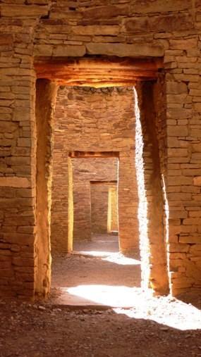
    <summary type="html"><![CDATA[<p><strong><em>Chaco Canyon bears evidence of a civilization that flourished between 9000 BC and 1300 AD.</em></strong></p><img src="https://www.intermountainhistories.org/files/fullsize/c8cb5ba557401e1c945009b3c16dbffe.jpg" alt="Doorways at Pueblo Bonito" /><br/><p>Chaco Canyon National Park is located in northwestern New Mexico. The area is open to the public to learn about the people who lived within the walls of Chaco Canyon thousands of years ago. In 9000 BC, the area was occupied by Paleo Indians and Archaic peoples. It was then occupied by Ancestral Puebloans from 1 AD to 1300 AD. Between 750 and 850 AD, much of the population of the central San Juan Basin moved to the Four Corners area, north of the San Juan River. Over 1.5 million artifacts have been documented from Chaco Canyon. In the middle of the New Mexico desert, Chaco Canyon housed hundreds of prehistoric peoples. </p><p>Early archaeologists recognized two types of structures and identified them as “great pitstructures” and “great kivas”. These structures “may represent two ways of organizing ritual, or perhaps even two ethnicities.” </p><p>Chaco Canyon was pre-planned rather than annexed; the roads were laid out in straight lines and astronomical orientation would have necessitated a certain amount of planning, skill, and leadership. People lived in the canyon in eleven “great houses”, each one of them big enough to provide homes for an entire village. Inside the great houses, there are approximately 1,133 rooms, and the average size of 1,133 rooms at Chacoan buildings is 11. 97 meters squared. </p><p>Chaco Canyon is evidence of a civilization that flourished between the ninth century BC and thirteenth century AD and attained remarkable achievements in architecture, agriculture, social complexity, engineering, astronomy, and economic organization. </p><p><em><strong><a href="https://www.intermountainhistories.org/items/show/187">For more (including 2 images) view the original article</a></strong></em></p>]]></summary>
    <published>2018-05-28T17:18:16+00:00</published>
    <updated>2026-04-17T19:32:02+00:00</updated>
    <link rel="alternate" type="text/html" href="https://www.intermountainhistories.org/items/show/187"/>
    <id>https://www.intermountainhistories.org/items/show/187</id>
    <author>
      <name>Erin Tapahe, Brigham Young University</name>
    </author>
  </entry>
  <entry>
    <title type="html"><![CDATA[Sego Canyon Fremont Culture Rock Art]]></title>
    <summary type="html"><![CDATA[<p><strong><em>Sego Canyon in Utah has rock art that dates back thousands of years. Four distinct time periods are represented in this collage of ancient artwork. </em></strong></p><img src="https://www.intermountainhistories.org/files/fullsize/3e11325fe3310d6ae0aa0d5b082a1295.jpg" alt="Sego Canyon Rock Art" /><br/><p>One of the most unique and easily accessible locations of ancient rock art in Utah is the Sego Canyon site near Thompson Springs in eastern Utah. Encompassing only three panels of rock art, four successive and distinct periods of human use are illustrated: Archaic, Fremont, Ute, and Anglo-American. Archaic, or Barrier Canyon style. The last of these styles may date as far back as 7000 BC and often features pictographs of large, rounded anthropomorphic figures. Fremont style paintings, dating from 600 AD to around 1250 AD, are pecked into the rock and depict angled anthropomorphic figures and abstract shapes. Ute style dates from 1300 AD to the mid-1800s and depicts animals, war figures, and shields painted in red and white. As American settlers arrived in the late nineteenth century, many sheepherders and cattlemen added their own additions to the artwork.</p><p>The site sits halfway between Thompson Springs, a center of ranching and railroading on the Denver & Rio Grande Western Railway, and the current ghost town of Sego, built to extract coal from the mines in the Book Cliffs first explored by Henry Ballard in 1881. G.K. Gilbert of the U.S. Geological Survey described the rock art in his 1883 report. In 1911, construction began on a railroad called the Ballard & Thompson Railway, which ran right in front of the largest of the three panels. After decades of vandalism by railroaders, miners, and ranchers, including a period where the cliff face was quarried out for building-stone, the BLM acquired the site in 1988. A restoration effort began in 1993 wherein they removed modern graffiti and patched the bullet holes to make the panels more visible.</p><p><em><strong><a href="https://www.intermountainhistories.org/items/show/182">For more (including 2 images) view the original article</a></strong></em></p>]]></summary>
    <published>2018-05-26T00:16:38+00:00</published>
    <updated>2026-04-17T19:32:02+00:00</updated>
    <link rel="alternate" type="text/html" href="https://www.intermountainhistories.org/items/show/182"/>
    <id>https://www.intermountainhistories.org/items/show/182</id>
    <author>
      <name>Joshua Bernhard, Brigham Young University</name>
    </author>
  </entry>
  <entry>
    <title type="html"><![CDATA[The Great Gallery: Defining Barrier Canyon Rock Art]]></title>
    <summary type="html"><![CDATA[<p><strong><em>Hidden within the confines of Horseshoe Canyon, vestiges of an ancient people from 7,000 years ago repose on the canyon wall. The figures, as large as 7 feet tall, tantalize historians today with the mystery of their purpose and meaning, defining an entire style of indigenous American rock art.  </em></strong></p><img src="https://www.intermountainhistories.org/files/fullsize/267e4d38115d6911f57060ea9fd0cbc5.jpg" alt="Discovery of the Great Gallery" /><br/><p>The Great Gallery itself consists of a ~200-300 foot stretch of a rock wall on the side of Horseshoe Canyon in Canyonlands National Park in southeastern Utah. It features approximately 80 figures created with a red ocher-tinted paint. The pictographs and petroglyphs have been attributed to the Archaic people, a civilization that lived in Horseshoe Canyon over 7,000 years ago.  These pictographs are similar to a variety of other rock art found in the Four Corners region but their influence and prominence in studies as well as the multitude of similar artwork in the canyon led Polly Schaafsma in the 1970s to name this entire strain of rock art the Barrier Canyon Style (as Horseshoe Canyon was previously named).</p><p>Due to the ancient nature of the rock art, no single interpretation of the Great Gallery is guaranteed to be true. Many ethnographers have suggested that these murals were created for a variety of purposes such as hunting rituals, illustrating myths and traditions, recreation, or shamanistic magic.  As for what the symbols themselves mean, the majority of the tall angular figures without appendages are thought to represent people. Some of the larger, more decorative figures are understood to be shamans. Their special decorative heads represent either the headdresses the shamans wore or the spiritual power these shamans possessed. Other figures included are those of animals or plants important to the Archaic people.  </p><p>Evidence of the Archaic people has been found in Utah dating back to 6,500 BC. They were a hunter-gatherer culture that migrated throughout the desert climate of the Colorado Plateau. This culture’s most recognizable and distinctive features include their rock art, twig figurines similar to the figures seen in the Great Gallery, and the baskets they wove. They used a spear thrower called an atlatl in order to hunt down their food and grinding stones to crush seeds to eat, allowing for a varied diet.</p><p>As stated before, the Great Gallery is a particularly important selection of Barrier Canyon Style rock art. In fact, the Great Gallery pictographs were deemed so important, that a faithful replica was commissioned in the 1940s under Franklin D. Roosevelt’s New Deal program the Works Progress Administration. The mural, created by prominent Utah artist Lynn Fausett, was originally placed in the Museum of Modern Art in New York City before being moved to Denver during WWII for safe keeping and then traveling around the country until it finally settled at the Utah Museum of Natural History in 1969.  A variety of methods have been used to date the art including radiocarbon dating and superposition, but these often do not help form a consensus.  For instance, in 2014, a team of scientists led by geologist Joel Pederson used a method of rock dating called optically stimulated luminescence (OSL) used damage from a rock slide to determine that this section of the Great Gallery must have been created between 900 and 2,000 years ago.  Other scientists maintain that radiocarbon dating of other artifacts in the area that look almost exactly like those in the pictographs support a much earlier dating.  Time will reveal the answers to these mysteries as we understand more about the Great Gallery.</p><p><em><strong><a href="https://www.intermountainhistories.org/items/show/97">For more (including 3 images) view the original article</a></strong></em></p>]]></summary>
    <published>2018-01-16T19:51:49+00:00</published>
    <updated>2026-04-17T19:31:59+00:00</updated>
    <link rel="alternate" type="text/html" href="https://www.intermountainhistories.org/items/show/97"/>
    <id>https://www.intermountainhistories.org/items/show/97</id>
    <author>
      <name>Brandon Sheeder, Brigham Young University</name>
    </author>
  </entry>
  <entry>
    <title type="html"><![CDATA[Danger Cave]]></title>
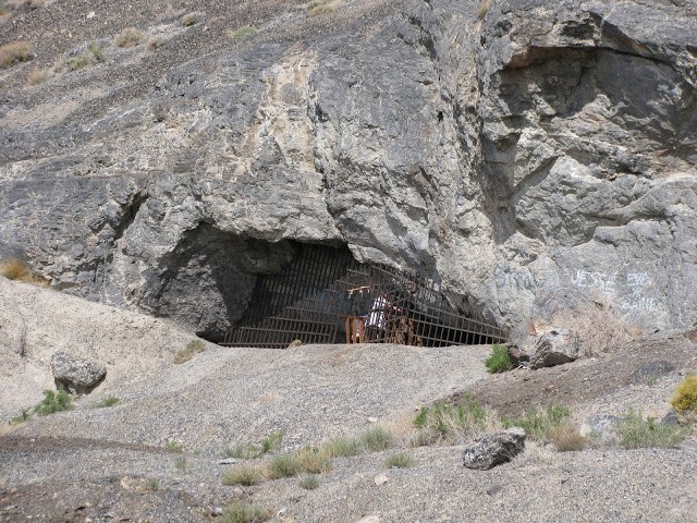
    <summary type="html"><![CDATA[<p><strong><em>Formed by the waves of Lake Bonneville, Danger Cave served as the home to Native American as far back as 11,000 years.  The excavation of Danger Cave by a University of Utah archaeological team in the mid-20th century has given us unique insight to the lives of those Native people who survived in the harsh desert climate of the Great Basin.</em></strong></p><img src="https://www.intermountainhistories.org/files/fullsize/10c11ecad6c13f685f449f95dfb39142.jpg" alt="Danger Cave Fenced Off" /><br/><p>The barren deserts of North America have always been viewed with fascination due to the lack of natural resources. Early human survival in this region was extremely hard, and the mid-20th century excavation of Danger Cave greatly expanded understanding of regional history. Danger cave is an archaeological site located in the Bonneville Basin of western Utah, north of Wendover and west of the Bonneville Salt Flats. Danger Cave State Park Heritage Area became a National Historic Landmark in 1961 and a state park in 1968. This cave is one of the most significant archaeological sites in North America because it reshaped the way that we think about Utah’s Native peoples.</p><p>Danger Cave was formed about 13,000 years ago under the waves of Lake Bonneville. When the water levels of the lake lowered, people began living in the cave. Native Americans are thought to have begun living inside of this cave about 11,000 years ago, right after the end of the Ice Age. It had been inhabited by different native people consistently after that, so archaeologists discovered layers and layers of artifacts in this cave. These native people left behind fascinating evidence of their existence inside of Danger Cave. </p><p>Despite the challenging working conditions in the cave, which included dust and heat, the cave was excavated throughout the 1940s and 1950s by anthropology students attending the University of Utah. Jesse Jennings was a faculty member at the University who led the exaction project that has reshaped the way we think of the early people of the Great Basin. The large amount of artifacts found makes it one of the most important sites in North American history and gives us a better idea of how early Native Americans survived in the barren desert of western Utah. </p><p>The extremely dry climate in the cave made it a perfect place to store artifacts and human remains for over 11,000 years. Inside of the cave textiles, baskets, pottery, animal bones, plant remains, weapons, chipped stones, and leather scraps were all found. Radio-carbon dating proved this site to be one of the oldest known Native American sites in North America. </p><p>The artifacts and data collected from Danger Cave taught us about the previously unknown ancient cultures of the western deserts. Findings in the cave suggest that these people lived in relatively small groups of 15-30 individuals, that consist mostly of extended families. The search for food was what dictated their lives, and these groups moved around constantly searching and they had little time for leisure activities. They had no building projects and no complicated rituals. The main focus of their lives were to survive and to have enough food. </p><p><em><strong><a href="https://www.intermountainhistories.org/items/show/95">For more (including 4 images) view the original article</a></strong></em></p>]]></summary>
    <published>2018-01-16T18:22:15+00:00</published>
    <updated>2026-04-17T19:31:59+00:00</updated>
    <link rel="alternate" type="text/html" href="https://www.intermountainhistories.org/items/show/95"/>
    <id>https://www.intermountainhistories.org/items/show/95</id>
    <author>
      <name>Ashley Olson, Brigham Young University</name>
    </author>
  </entry>
  <entry>
    <title type="html"><![CDATA[Mesa Verde and the Evolution of Site Preservation and Protection]]></title>
    <summary type="html"><![CDATA[<p><strong><em>Pot Hunting at Mesa Verde led to several important laws being put into place to protect artifacts from pothunters and the public. These laws are still in place today.</em></strong></p><img src="https://www.intermountainhistories.org/files/fullsize/1c4a0c97b4698f6bd9de9101aa831e6f.jpg" alt="Cliff Dwellings" /><br/><p> President Theodore Roosevelt created Mesa Verde National Monument on June 29, 1906. The monument is located near Cortez and Mancos, Colorado. Ancestral Puebloans inhabited Mesa Verde from 6000 BCE. to about 1300 CE. Their broader cultural group encompassed most of northern Arizona, northern New Mexico, southwestern Colorado and southern Utah. </p><p>Fathers Escalante and Dominguez were the first Europeans to record seeing Mesa Verde on their way to what is now California. The ruins then went unnoticed until geologist Ferdinand V. Hayden led an expedition across southern Colorado in 1874. When he heard about cliff houses nearby, instead of going to the ruins himself, Hayden sent his expedition photographer, William H. Jackson, to photograph them. Stunned by what he saw in the photographs, Hayden returned the next year to document the ruins and the artifacts inside them.</p><p>In 1888, Richard Wetherill and his brothers who lived in the area found the ruins while looking for lost cattle; they explored them and began collecting artifacts. By 1890 Wetherill had built a substantial collection from all over Mesa Verde and began to sell to collectors and museums. Also during this time, Wetherill started taking tourists to Mesa Verde. In 1891, he led a Swedish scientist, Gustav Nordenskiöld, to the ruins. During his time exploring the ruins, Nordenskiöld developed a systematic method for excavating the ruins and how to record artifacts. Afterwards, Nordenskiöld removed the objects from the site. During his excavation, the Swede noticed the pottery went from painted black- on- white, refined pottery to simple and crude pottery. This pattern led Nordenskiöld to notice how the Anasazi changed over time through their pottery. </p><p>When Nordenskiöld tried to return to Sweden with his large collection, customs agents stopped and detained him. Undeterred, Nordenskiöld negotiated his release when he pointed out that the US did not have any laws preventing him from taking the objects out of the country. After Nordenskiöld returned to Sweden, Wetherill stopped taking tourists to Mesa Verde to focus on his excavation at Chaco Canyon. Tourists continued to visit the sites for the next decade until archaeologist and preservationist Edgar Lee Hewitt fought to make Mesa Verde a national monument. Hewett was instrumental in lobbying congress to create  the Antiquities Act of 1906 which led to President Roosevelt’s declaration of Mesa Verde a national monument.</p><p>Although the Antiquities Act was the first step in protecting artifacts in national monuments, pot hunting continued at Mesa Verde as well as at other sites such as Canyon de Chelly and Chaco Canyon. The punishment of taking a pot or artifact from federal lands today is punishable by a year in jail and up $10,000 in fines.</p><p><em><strong><a href="https://www.intermountainhistories.org/items/show/64">For more (including 3 images) view the original article</a></strong></em></p>]]></summary>
    <published>2017-06-06T21:33:44+00:00</published>
    <updated>2026-04-17T19:31:59+00:00</updated>
    <link rel="alternate" type="text/html" href="https://www.intermountainhistories.org/items/show/64"/>
    <id>https://www.intermountainhistories.org/items/show/64</id>
    <author>
      <name>Alexandria O&amp;#039;Hara, Northern Arizona University</name>
    </author>
  </entry>
  <entry>
    <title type="html"><![CDATA[Preserving Mesa Verde: Mesa Verde Perservation]]></title>
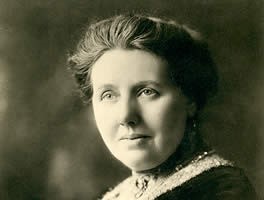
    <summary type="html"><![CDATA[<p><strong><em>The creation of Mesa Verde National Park was a struggle that required the combined efforts of thousands of people who truly believed in the conservation of our nation’s cultural heritage.</em></strong></p><img src="https://www.intermountainhistories.org/files/fullsize/5ac1d1e97033cd5d423891c8f45fd6d5.jpg" alt="Virginia McClurg" /><br/><p>The Ancestral Puebloans</p><p>Mesa Verde National Park is a world heritage site located in Montezuma County, Colorado. Among these ruins lived the Ancestral Puebloan Native Americans. Though historians disagree as to when this culture emerged, the common belief is that the first traces of this culture were seen around the 12th century B.C.E. However, by the time the Spanish made the first explorations into the region, they had migrated southward and no longer inhabited the cliff dwellings at Mesa Verde. The most famous structures of the site are Cliff Palace and Spruce Tree House, containing many dwellings, ladders, and kivas (circular pits used for ceremonial purposes). </p><p>The Importance of Preservation</p><p>While the culture and lifestyle of these people is both fascinating and shrouded in mystery, the purpose of this writeup will be to analyze the history of those who fought to preserve these ruins, as their efforts should not go unnoticed. Mesa Verde National Park was officially founded in 1906, and contains some of the best-preserved Ancestral Puebloan ruins that are in existence. Containing what is generally thought to be the largest cliff dwelling in North America, this site is a favorite for people who have interest in the ancient cliff-dwelling peoples of the region. The site has become a favorite of thousands of people who live in the American West, though this has not happened without much struggle and difficulty. The preservation of archeological remains is a highly controversial topic in American politics and history, and Mesa Verde is no exception. Through the tireless efforts of various archeological organizations, government agencies, and private citizens, this historical gem has been preserved. While there is widespread belief that president Theodore Roosevelt was the driving force behind the preservation of Mesa Verde, there were many unsung heroes who strove to make the ruins a national park and to keep it alive, vibrant, and intact for the benefit of people today.</p><p>The Unheard Crusaders</p><p>Virginia McClurg, a correspondent for the New York Daily Graphic, moved to Colorado Springs, Colorado in 1877 and began to take interest in the ruins. She organized thousands of women and founded the Colorado Cliff Dwellings Association which fought for the preservation of the ruins at Mesa Verde. While many of her goals were not realized, she was able to raise national and international interest in the site and facilitated the passing of the bill that officially designated Mesa Verde as a national park. However, the war was not yet won. The ruins were still only that: ruins. Jesse Walter Fewkes soon stepped in and began to survey the park in order for repairs to be made and the park to be put in working condition. During the Great Depression, the CCC was an essential force in making repairs and building roads. In more modern times, Mesa Verde joined UNESCO in 1978 as a world heritage cultural site.</p><p>Overall, the struggle to preserve Mesa Verde cannot be attributed to one person alone. While many recognize Theodore Roosevelt as the driving force behind preserving the park, there are many others who gave themselves to the effort. Their contributions should not go unrecognized, but should be celebrated. </p><p><em><strong><a href="https://www.intermountainhistories.org/items/show/46">For more (including 2 images) view the original article</a></strong></em></p>]]></summary>
    <published>2017-05-22T18:05:07+00:00</published>
    <updated>2026-04-17T19:31:58+00:00</updated>
    <link rel="alternate" type="text/html" href="https://www.intermountainhistories.org/items/show/46"/>
    <id>https://www.intermountainhistories.org/items/show/46</id>
    <author>
      <name>Nathan K. May, Brigham Young University</name>
    </author>
  </entry>
</feed>