<?xml version="1.0" encoding="UTF-8"?>
<feed xmlns="http://www.w3.org/2005/Atom">
  <title type="text">Intermountain Histories</title>
  <updated>2026-04-17T19:32:00+00:00</updated>
  <generator uri="http://framework.zend.com" version="1.12.20">Zend_Feed_Writer</generator>
  <link rel="alternate" type="text/html" href="https://www.intermountainhistories.org/"/>
  <link rel="self" type="application/atom+xml" href="https://www.intermountainhistories.org/items/browse?output=rss2"/>
  <id>https://www.intermountainhistories.org/</id>
  <author>
    <name>Intermountain Histories</name>
    <uri>https://www.intermountainhistories.org</uri>
  </author>
  <link rel="hub" href="https://pubsubhubbub.appspot.com/"/>
  <entry>
    <title type="html"><![CDATA[Koyle Dream Mine ]]></title>
    <summary type="html"><![CDATA[<p><strong><em>Nestled in the foothills to the southeast of Spanish Fork, Utah, the old Koyle “Dream Mine” is a stark contrast to the otherwise natural landscape; its off-white, tiered structure is visible from miles away, though today the mine lies abandoned. While it’s no longer in operation, the Dream Mine has a long and storied history for Spanish Fork and Salem inhabitants, and even today the mine’s stockholders hold an annual meeting that attracts hundreds of local residents. Ancient civilizations, scripture, and catastrophic visions all play an important role in the dynamic mythology of this apocalyptic landmark. </em></strong></p><img src="https://www.intermountainhistories.org/files/fullsize/6f6c9783750f2fc83528155b209ce9c8.jpg" alt="View of the Mine " /><br/><p>John Hyrum Koyle was born in Spanish Fork, Utah in 1864. Like many of the residents of rural Utah County, Koyle and his family maintained a modest farming enterprise and kept livestock. During his life on the farm Koyle claimed to experience visions and dreams of calamitous future events, and gradually gained the reputation as a local visionary.  Koyle was a faithful member of the Church of Jesus Christ of Latter-day Saints, and served in a variety of ecclesiastical leadership positions including a full-time missionary and Bishop. </p><p>In the summer of 1894, Koyle claimed to have received an angelic visitation from an ancient Nephite messenger (Nephites are allegedly an ancient American civilization that plays a central role in the Book of Mormon, a text sacred to members of the LDS Church). According to Koyle, the messenger showed him in vision a massive depository of gold ore in the hills near his home. He was also told that the mine would produce financial relief, in the form of gold coins, after a future economic collapse. The sacred treasure would benefit the people by keeping alive the local economy during the financial crisis and other devastating calamities.    </p><p>Prompted by his vision, Koyle set out to make the mine a reality. Spreading the news of his vision to his friends and neighbors, the Koyle Mining Company was formed in 1909 with 114,000 shares of stock issued at $1.00 per share. The influx of capital from local “dream miners” allowed the current structure to be built, and after some rudimentary mechanics were in place the company started extracting ore from the mountain. By the mid 1910s Koyle’s mine caught the attention of LDS Church leaders in Salt Lake City, who dispatched Apostle James E. Talmage (a Johns Hopkins trained geologist) to investigate the claims and inspect the mine. Talmage left his visit skeptical of Koyle’s claims and the mine’s potential for profit; in addition, this skepticism was exacerbated by Koyle’s emerging reputation as a visionary who had attracted the attention of his own set of acolytes that raised him up to be a prophet. Despite their misgivings, LDS Church leadership initially chose to allow the mine to continue. </p><p>Koyle never ceased his visionary activities, going on to predict nationwide famine, drought, the collapse of the LDS church, earthquakes, and other apocalyptic catastrophes. As a result, he continued to attract opposition from the church for the rest of his life.  By 1947, Church leadership felt that his activities had gone too far and negotiated a repudiation of his claims. Though he signed the agreement at first, Koyle soon reversed his position and was immediately excommunicated from the church in April of 1948. John H. Koyle died on May 17th, 1949 in Payson, UT. Despite his death, the legacy of the dream mine persisted. The mine continued under the leadership of Quayle Dixon for another twenty-three years. In 1961, a new company, The Relief Mine Company, succeeded the Koyle Mining Company as the administrators of the mine and its operations. Though no gold was ever discovered before the mine closed down, annual stockholders meetings continue to take place as believers and observers debate the veracity of Koyle’s extravagant claims.  </p><p><em><strong><a href="https://www.intermountainhistories.org/items/show/32">For more (including 3 images) view the original article</a></strong></em></p>]]></summary>
    <published>2017-03-20T16:26:26+00:00</published>
    <updated>2026-04-17T19:31:58+00:00</updated>
    <link rel="alternate" type="text/html" href="https://www.intermountainhistories.org/items/show/32"/>
    <id>https://www.intermountainhistories.org/items/show/32</id>
    <author>
      <name>Addison Blair, Brigham Young University </name>
    </author>
  </entry>
  <entry>
    <title type="html"><![CDATA[Spanish Fork Sugar Beet Factory ]]></title>
    <summary type="html"><![CDATA[<p><strong><em>The tall smokestack of the (mostly) abandoned sugar beet factory is impossible to miss on the interstate between Spanish Fork and Payson. In it’s heyday, the factory operated as a critical lynchpin in a thriving sugar beet economy that stretched across the valley. Now serving as a little more than a warehouse for a pallet business and a popular shooting location for local photographers, the factory remains one of Spanish Fork’s most recognizable landmarks. </em></strong></p><img src="https://www.intermountainhistories.org/files/fullsize/f1e3387a4003d356d99ff14012de03cd.jpg" alt="Sugar Factory Exterior " /><br/><p>While it may seem odd to anybody familiar with Utah Valley, the corridor of towns from Spanish Fork to Lehi operated as one of the most productive sugar beet processing operations in the country. In it’s early days, it was widely sponsored by the Church of Jesus Christ of Latter-day Saints to help the Church generate an alternative source of income through which they could fund other projects. To this end, they put up a significant amount of money towards the construction of a factory in Lehi, Utah that acted as the “hub” of the regional sugar industry. </p><p>For a time, sugar beets provided a substantial source of income for the valley. The success of the Lehi plant led to the construction of several other plants in Utah and a couple in Idaho; eventually, these factories would come together to form the Utah-Idaho Sugar Company, the business entity that controlled most of the sugar beet industry in the intermountain west. Business was good until the end of World War I, when a catastrophic combination of plummeting crop prices and widespread agricultural blight dealt sever damage to the industry. As a result, factories were dismantled or moved to new locations; the Nampa, Idaho infrastructure was effectively moved to the current Spanish Fork Location.</p><p>The Spanish Fork factory functioned for almost 50 years (from 1916-1952) until broader changes in the sugar industry—especially the rise of cheap and more widely produced cane sugar—brought the relevance of Utah’s sugar beet project to a halt. Today, Wasatch Pallet owns the factory, which uses it as a warehouse, repair facility, and construction area for their business. The company still allows guests to tour certain areas of the factory, though sections of the facility have been condemned and aren’t safe for observation. It’s become a popular spot for local photographers and history buffs who want to see up close a relic of Utah’s early economic history.        </p><p><em><strong><a href="https://www.intermountainhistories.org/items/show/33">For more (including 3 images) view the original article</a></strong></em></p>]]></summary>
    <published>2017-03-20T16:36:34+00:00</published>
    <updated>2026-04-17T19:31:58+00:00</updated>
    <link rel="alternate" type="text/html" href="https://www.intermountainhistories.org/items/show/33"/>
    <id>https://www.intermountainhistories.org/items/show/33</id>
    <author>
      <name>Addison Blair, Brigham Young University </name>
    </author>
  </entry>
  <entry>
    <title type="html"><![CDATA[Thistle, Utah: Spanish Fork Canyon&#039;s Ghost Town ]]></title>
    <summary type="html"><![CDATA[<p><strong><em>Driving down US Highway 6, it’s still easy to point out the exact location of the massive landslide that led to the destruction of Thistle, a small railroad town in Spanish Fork Canyon. The landslide caused a natural dam that caused the Spanish Fork River to pool up, eventually flooding the town. While most of the town was destroyed in the flood, the skeletal structures of several buildings are still visible from US-6, a haunting reminder of nature’s awesome power. </em></strong></p><img src="https://www.intermountainhistories.org/files/fullsize/ea288ebbd8f7fa1ceb39f597f007fea2.jpg" alt="Thistle Station, Spanish Fork Canon. R.G.W.Ry. (Rio Grande Western Railway)" /><br/><p>Thistle got its start as a railroad resupply town. In fact, most of the early settlers were there on assignment from railroad companies to provide some rudimentary services to help out trains as they passed through town. Mormon settlers also made up a small part of the early population. </p><p>As rail traffic became more important in the West, Thistle’s role as a supply town grew: they provided a dining service for passing trains before the advent of dining cars, supplied helper engines for trains traveling up the mountains, and had extensive coal and water resupply facilities. The growth of the rail industry also resulted in the growth of the town. At its highest point in the late 1970s, Thistle had around 600 residents, and several other structures were built to accommodate its growing numbers, including bakeries, restaurants, saloons, and a two-floor schoolhouse. </p><p>In 1983, railway surveyors were the first to notice the changing geographical landscape. Their biggest worry was that the shifting earth would warp the rails, and they worked tirelessly with many different crews to try and keep the tracks in line. Their effort was to no avail, however, as the entire mountainside appeared to be slipping away. Rail officials eventually decided to abandon the line that ran through Thistle, and the State of Utah put out an evacuation notice to all Thistle residents to save what belongings they could and leave the town. The landslide ended up creating a natural dam that backed up the Spanish Fork River, and just a few days after the evacuation notice the flood destroyed basically the whole town. </p><p>While there weren’t any reported causalities from the landslide and flood, the economic consequences were large. Two trucking companies laid off workers, cancelled contracts, and even suspended operations. Most of the area's coal mines laid off miners, cancelled contracts, and experienced shut downs. Due to market conditions and the Thistle landslide, coal production dropped nearly 30 percent in 1983. Tourism in the area, particularly in-state tourism, was greatly reduced due to lack of access. To the south, the blockage of Highway 89 and the rail line hurt coal companies, turkey and feed operations, and gypsum, cement, and clay shipments. In total, the Thistle landslide caused total estimated capital losses of $48 million and revenue losses of $87 million.</p><p>Today, only the scattered remains of the town are visible. Half-submerged buildings, the old school house, and the occasional home are all that remains of this old railway town. It still serves as a stark symbol of nature’s power.   </p><p><em><strong><a href="https://www.intermountainhistories.org/items/show/34">For more (including 7 images) view the original article</a></strong></em></p>]]></summary>
    <published>2017-03-20T16:42:11+00:00</published>
    <updated>2026-04-17T19:31:58+00:00</updated>
    <link rel="alternate" type="text/html" href="https://www.intermountainhistories.org/items/show/34"/>
    <id>https://www.intermountainhistories.org/items/show/34</id>
    <author>
      <name>Addison Blair, Brigham Young University </name>
    </author>
  </entry>
  <entry>
    <title type="html"><![CDATA[The Dominguez-Escalante Expedition Reaches Utah Valley]]></title>
    <summary type="html"><![CDATA[<p><strong><em>In 1776, a pair of Spanish Franciscan friars set out to find an overland route from New Mexico to California. Their hope was to find a safe path between the difference Catholic missions in the southwestern United States. While they were never able to reach California, their expedition provided valuable map information for future travelers and part of their documented route became part of the Old Spanish Trail, a trade route that was frequently used for years afterwards. They were also the first of European ancestry to set eyes on the Utah Valley. </em></strong></p><img src="https://www.intermountainhistories.org/files/fullsize/a55569ce8c30b3a800d575dcaea85131.jpg" alt="Escalante Etching " /><br/><p>In the summer of 1776, Atanasio Domínguez and Silvestre Vélez de Escalante (along with a team of other men and Native American guides that would join them later) set out from Santa Fe, New Mexico to find an alternative route to the other Spanish missions in California along the Monterey coast. The local settlers already knew a path through modern-day Arizona, but the Grand Canyon and hostile native tribes forced the Spanish to look for an alternative route. Their trip through the southwest was carefully documented, and they often refer to the rugged landscape, local plant and animal life, and the potential for settlement by anybody who chose to follow them. </p><p>By September of 1776 the party reached Utah Valley where the mouth of Spanish Fork Canyon opens up to the wider valley. One of their native guides, Silvestre, was a member of a local tribe and this connection provided the party with safe passage and a small opportunity for trade. While this moment was important (as they were the first Europeans to see the valley), it wasn’t the end goal of their expedition. A few days later, the party continued their journey to the southwest, but not before they made the observation that, “[the area consists] of flat meadows with good land for farming; it carries more water than the foregoing two, has a larger poplar grove and meadows of good soil which can be irrigated—all good for two or even three good settlements.” Dominguez and Escalante would later encounter trouble on their journey and have to return early to New Mexico, never reaching California.  </p><p>In the 1920s, residents of Spanish Fork wanted to commemorate the arrival of the expedition to Utah Valley. A monument was erected and later dedicated in January of 1923. The Bronze tablet that accompanies it is inscribed with further information from the expedition’s visit to the valley. In 1981 a large white cross was constructed overlooking the valley, a symbolic representation of the arrival of the Spanish friars to the area. The site is accessible by hiking trail above the Spanish Fork reservoir.     </p><p><em><strong><a href="https://www.intermountainhistories.org/items/show/35">For more (including 5 images) view the original article</a></strong></em></p>]]></summary>
    <published>2017-03-20T16:43:17+00:00</published>
    <updated>2026-04-17T19:31:58+00:00</updated>
    <link rel="alternate" type="text/html" href="https://www.intermountainhistories.org/items/show/35"/>
    <id>https://www.intermountainhistories.org/items/show/35</id>
    <author>
      <name>Addison Blair, Brigham Young University </name>
    </author>
  </entry>
  <entry>
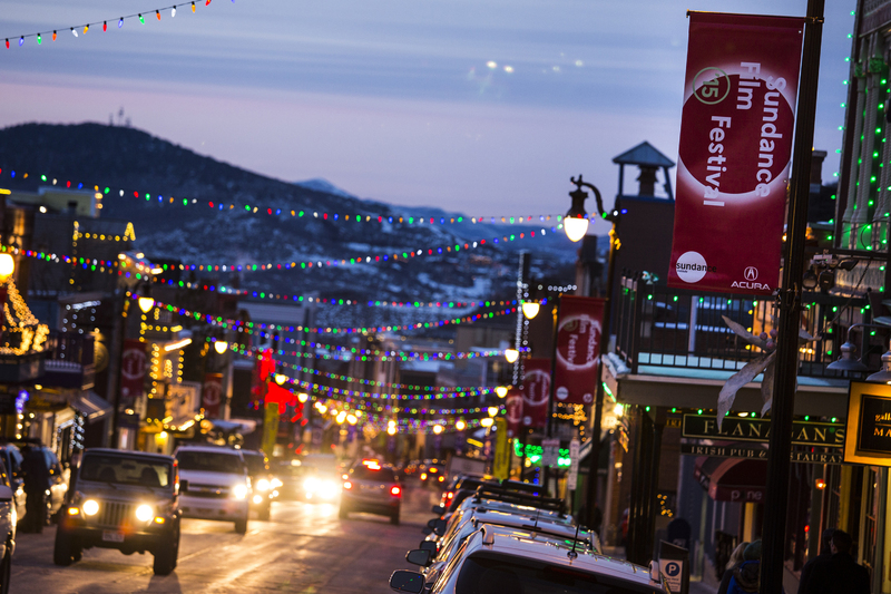
    <title type="html"><![CDATA[Silver, Snow, and Cinema: Park City, Utah ]]></title>
    <summary type="html"><![CDATA[<p><strong><em>High in the Wasatch Mountains sits one of Utah’s true cultural jewels: Park City. Though it started as a simple mining community, Park City experienced explosive growth with the rise of the recreational winter sports industry in the mid 20th century. Currently, Park City is most well-known for hosting the Sundance Film Festival, the largest independent film festival in the United States. </em></strong></p><img src="https://www.intermountainhistories.org/files/fullsize/d8d1e857bfa049169bf789d8c5baa41a.jpg" alt="Park City Street " /><br/><p>The discovery of the Ontario silver deposit is what first put Park City on the map. A joint claim filed in 1872 by Herman Buden, James Kane, Rector Steen, and Augustus Dawell was the beginning of a very productive mining operation that ran up until the mid-20th century. The productivity of the mine attracted the attention of other investors. George Hearst (a mining magnate from San Francisco) purchased control on the mining operation and passed off the day-to-day management to his friend, R.C. Chambers. Under their management the mining operation flourished, and Park City experienced an economic boom as a result. </p><p>The early 20th century saw the decline of the mining industry in Park City. The multiple economic recessions and the Great Depression dealt a deadly blow to operations, and Park City was looking more and more like so many other mining boom towns in the Rocky Mountains. Park City’s savior ended up being its ideal location as a winter sport resort town. It’s unique geographical location made it a gateway to resorts in the west, and skiers and snowboarders flocked to the town. This revitalized the dying community and turned Park City into one of Utah’s premier snow sports destinations. </p><p>Today, Park City remains a staple of the winter sports industry, but its most recent claim to fame is as the host of the Sundance Film Festival. Sterling van Wagenen (a Brigham Young University film graduate) and John Earle (the head of the Utah State Film Commission) collaborated to create the festival in order to attract the film industry to Utah, bring famous filmmakers to the area, and provide a place for smaller films to reach an audience. The first festival took place in 1978, and with the help of Hollywood star Robert Redford spreading the word, its notoriety increased dramatically. Today it remains among the top worldwide film festivals, often placed together with Cannes, Venice, and Toronto in terms of importance. It’s success has significantly changed Park City from its early days as a mining capital to a hub for Hollywood elites and aspiring filmmakers. </p><p><em><strong><a href="https://www.intermountainhistories.org/items/show/36">For more (including 5 images) view the original article</a></strong></em></p>]]></summary>
    <published>2017-03-27T20:17:32+00:00</published>
    <updated>2026-04-17T19:31:58+00:00</updated>
    <link rel="alternate" type="text/html" href="https://www.intermountainhistories.org/items/show/36"/>
    <id>https://www.intermountainhistories.org/items/show/36</id>
    <author>
      <name>Addison Blair, Brigham Young University </name>
    </author>
  </entry>
  <entry>
    <title type="html"><![CDATA[Freemasonry in Utah ]]></title>
    <summary type="html"><![CDATA[<p><strong><em>For centuries, the fraternity of Freemasonry has united men across the world in self-improvement through ritual, philanthropy, and community involvement. In the 19th century, Freemasonry found its way to Utah, though its growth was stunted by an antagonistic relationship with the LDS Church. This mutual distrust continued for nearly 75 years, until 1984 when the Grand Lodge of Utah rescinded its prohibition against Mormons joining the group. Today, the Grand Lodge of Utah counts itself as one of the many Masonic organizations that continue the tradition of community service, donating in excess of $150,000 per year to various charity organizations. </em></strong></p><img src="https://www.intermountainhistories.org/files/fullsize/532313bcc676f63393c5b8f17d64d085.jpg" alt="Masonic Temple Exterior " /><br/><p>In 1858, long before the extensive row between the LDS Church and the Masonic fraternity, soldiers from Johnston’s army, which had been dispatched to put down the perceived Mormon uprising in the Great Basin, rallied together to create a small Masonic lodge at Camp Floyd (near modern-day Fairfield, UT), the first in the state. The structure was simple and their resources were meager, but they managed to construct a rudimentary building and provide some assistance to wagon trains and other settlers making their way through the territory. At the end of the occupation of the territory, however, Johnston’s army dismantled the camp, selling what they could to the locals, and left town. The masonic lodge they established (Rocky Mountain No. 205) was disbanded in 1861. </p><p>Two smaller lodges in Utah cropped up in the 1860s, though disagreement both between themselves and with masonic jurisdictions from other states over the admittance of Mormons into the fraternity prevented them from creating a cohesive masonic body. After hearing that the very insulated Mormon community was considering petitioning for their own lodge, these two smaller lodges joined together (albeit reluctantly) and officially formed the Grand Lodge of Utah in 1872. Masonic growth in Utah was relatively slow because of the prohibitions in place against Mormons joining: although Brigham Young, Joseph Smith, and most other early church leaders were Masons, animosity developed between the two groups anyway. For almost sixty years, members of the LDS Church were prohibited from joining under the Utah Grand Lodge, a prohibition that wasn’t rescinded until 1984. </p><p>Freemasonry in Utah is still among the smallest of all Masonic jurisdictions nationwide (Alaska is the only one smaller), falling in with roughly 1,900 members as of 2013 within 34 lodges. The group continues their tradition of ritual, fraternal brotherhood, and service in Utah’s communities.         </p><p><em><strong><a href="https://www.intermountainhistories.org/items/show/37">For more (including 4 images) view the original article</a></strong></em></p>]]></summary>
    <published>2017-03-27T20:20:01+00:00</published>
    <updated>2026-04-17T19:31:58+00:00</updated>
    <link rel="alternate" type="text/html" href="https://www.intermountainhistories.org/items/show/37"/>
    <id>https://www.intermountainhistories.org/items/show/37</id>
    <author>
      <name>Addison Blair, Brigham Young University </name>
    </author>
  </entry>
  <entry>
    <title type="html"><![CDATA[Saltair: The Coney Island of the West ]]></title>
    <summary type="html"><![CDATA[<p><strong><em>Though it seems almost inconceivable today, the Great Salt Lake was once a popular vacation and recreational site. It was so popular with many of the early settlers that several resort complexes were constructed in order to satisfy the recreational demand. Of the many resort edifices built during this time, the most famous and lasting is the Saltair palace. While it no longer functions as a lake resort, the Saltair palace has found new life as a popular venue for music acts and other events. </em></strong></p><img src="https://www.intermountainhistories.org/files/fullsize/5206c4ea343c0a6ec7ca3a7a718747f6.jpg" alt="Saltair Beach
" /><br/><p>While early Mormon settlers often talked about building resorts along the Great Salt Lake, recreation along the salty shores wasn’t able to take off until completion of the Utah Central railroad in 1869, which made journeys to the lake much quicker and more convenient.  In 1870 the first two resorts were constructed, one of the east part of the lake and one on the south. Several others were constructed in the 19th century and they became popular destinations for the mostly Mormon community that lived in the area. </p><p>In 1893 the first complex known as the “Saltair Palace” was constructed. It was advertised as the “Coney Island of the West”, and its remarkable architecture was an impressive sight. It was more than 1,100 feet from tip to tip, and the pavilion itself was more than one hundred feet high. Over three hundred tons of steel girders were used in total, and there were four domes (one on each corner of the central complex.) There were picnic and luncheon areas as well as general use rooms for parties and other events. The Saltair palace enjoyed enormous success until 1925, when a fire broke out and destroyed the entire complex. Because of its popularity, a second complex was built in its place. The “Saltair II”, or second pavilion, was finished in 1926. </p><p>Saltair Palace continued to be a popular tourist destination and a local favorite, but a second fire in 1931 caused significant damage to the complex. While the structure wasn’t completely destroyed, attendance at the resort dropped dramatically (the Great Depression and World War II were also factors in Saltair’s decline). The salvageable portions of the structure were still used from time to time to host a variety of smaller shows, but it never regained its status as popular beach resort location. </p><p>An arsonist’s fire in 1970 destroyed what was left of Saltair II. In 1981, local investors pooled their resources to try and build a new resort (named Saltair III), but an extremely wet year caused the lake water levels to rise above their historic limits, flooding the new complex. In the early 2000s new investors (many from the music industry) set out to renovate Saltair III and turn it into the popular music venue, it’s main function to this day.  </p><p><em><strong><a href="https://www.intermountainhistories.org/items/show/38">For more (including 6 images) view the original article</a></strong></em></p>]]></summary>
    <published>2017-04-03T16:54:05+00:00</published>
    <updated>2026-04-17T19:31:58+00:00</updated>
    <link rel="alternate" type="text/html" href="https://www.intermountainhistories.org/items/show/38"/>
    <id>https://www.intermountainhistories.org/items/show/38</id>
    <author>
      <name>Addison Blair, Brigham Young University </name>
    </author>
  </entry>
  <entry>
    <title type="html"><![CDATA[Pond Town Fort of Salem]]></title>
    <summary type="html"><![CDATA[<p><strong><em>Settled primarily by Mormons in 1851, Salem, Utah, is a quaint village just south of Spanish Fork. Even though it has a convenient location off of Interstate 15 with for potential development, Salem has retained a lot of its small town charm. One of its earliest landmarks was a small fort on the banks of Salem Pond, which for many years acted as the nucleus of the town. </em></strong></p><img src="https://www.intermountainhistories.org/files/fullsize/09ff65675d152834a363bfb1ed677850.jpg" alt="New Monument " /><br/><p>“Pond Town”, as Salem was originally known, was settled primary by Mormons who moved from nearby Payson, Utah, in 1851 in a search of more viable farmland. David Fairbanks and David Crocket, two of the earliest settlers, led the project by constructing a dam on a stream near Salem to help with irrigation for the crops they hoped to grow. Fortunately for them, the soil was fertile and they had a successful harvest in 1851. The Crocket and Fairbanks families, however, were discouraged from spending the winter in Salem for fear of Indian attacks. They temporarily left their fledgling community for the safety in numbers offered by Payson. </p><p>Crocket and Fairbanks returned in 1852 to continue the work of building up their community. The next year could be considered “frontier typical:” the settlers lived a simple but difficult life of planting crops, building new homes, and expanding the dam. There were little to no issues with the Indians until the Walker War started in 1853. The Walker War, a small-scale conflict between Mormon settlers and Ute Indians, caused problems in the Salem community. Indians launched raids on the nascent community and they were forced to retreat to small forts built in Payson. As a means to defend their community from the perceived threat, Salem resident began to construct their homes in a fort-like position in 1856. A mix of adobe brink and lumber, all of the eventual structures (including homes and a store) faced inward. The fort became the focus of settlement for Salem residents, and the extension of the dam turned the area near the fort extremely fertile. The fort was finished in 1858, and was used regularly until 1870. </p><p>After 1870 the fort fell into disuse as other, sturdier forms of lodging became available. In addition, as conflicts with the Indians subsided residents of Salem felt safer expanding their settlement. The constant stench of manure from the fort (which often doubled as a corral for local livestock) was also an impetus for relocation away from the fort. The home of the Durfey family, the last family to reside in the old fort complex, was left standing until well after 1900.               </p><p>The Pond Town fort was an essential edifice for Salem’s early settlement and expansion. The protection it offered and community it fostered acted as a catalyst for more settlers to reside in Salem and gave it the foundation it needed to become the town it is today. 	 </p><p><em><strong><a href="https://www.intermountainhistories.org/items/show/39">For more (including 2 images) view the original article</a></strong></em></p>]]></summary>
    <published>2017-04-03T17:22:17+00:00</published>
    <updated>2026-04-17T19:31:58+00:00</updated>
    <link rel="alternate" type="text/html" href="https://www.intermountainhistories.org/items/show/39"/>
    <id>https://www.intermountainhistories.org/items/show/39</id>
    <author>
      <name>Addison Blair, Brigham Young University </name>
    </author>
  </entry>
  <entry>
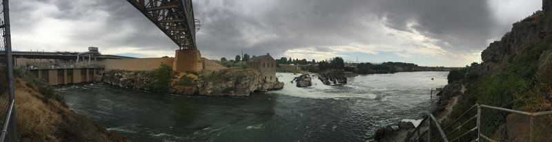
    <title type="html"><![CDATA[The American Falls Dam and Moving a Town]]></title>
    <summary type="html"><![CDATA[<p><strong><em>Underneath this massive reservoir lies the remains of the original town of American Falls.  Located in the best spot for a dam, the entire town had to be moved by cart uphill.  The cement grain silo deemed too difficult to move can still be seen poking out of the dam, and during an extremely low tide, you can walk on the old sidewalks where the city used to be.</em></strong></p><img src="https://www.intermountainhistories.org/files/fullsize/66c6dffe0a8292ec8c6e28060087c6d2.jpg" alt="The American Falls Dam Today" /><br/><p>The idea for the American Falls dam began after the success of the nearby Minidoka Dam led to better farmland and increased population.  In 1908, limited testing of a dam site began, and a decade later, in 1918, geological investigations began that led to the proposal of a dam in 1919.  This proposal presented a controversial issue, as it claimed that the best place for a dam and subsequent reservoir would be right where the town was located.  The authors of the proposal called for the relocation of a large section of American falls, a massive undertaking for a city that was starving from the falling crop prices of the post WW1 era.  Deliberations on both the federal and local level took years to conclude that the dam was necessary and to finally begin the process of moving.</p><p>The Bureau of Reclamation purchased many of the properties that would soon be flooded by the dam, and helped to clear the sagebrush to make new properties for these relocated homeowners.  They would eventually buy 329 properties in the area, while some homeowners decided to keep their claim on the land soon to be flooded.  However, by the end of 1921, the head of the Reclamation Service decided that this project was too costly and ordered it ended.  This alarmed many local farmers, who depended on dams and irrigation for water.  A group of local businesspeople and farmers raised enough money to cover the additional costs and petitioned  the Bureau to resume construction on the dam.  With half of the financial cost covered by the local community, the head of the Bureau of Reclamation acquiesced and resumed planning to move the city.</p><p>In 1925, construction began.  Old power lines and railroads had to be relocated around the dam, and the monumental task of moving the entire city had to be undertaken.  Most of the buildings in the city were moved by horses pulling large wheeled carts.  Famously, one particular Sunday, the St. John Lutheran Church was in transit and several worshipers attended their service in the church while it was on wheels.  By the end of 1925, all the buildings and markings from the former town site had been moved, with some exceptions.  All that remained were a few foundations, some sidewalks, and the giant concrete grain silo that was deemed too difficult to move.  The dam was finished in 1926, and local banks began opening up and expanding services, hopeful for the economic boost that this dam would bring.</p><p>The dam held more than 1.7 acre-feet of water and stretched for miles along the Snake river.  However, by 1973, it became evident that weathering and wear on the dam necessitated complete replacement of the structure.  The new dam, finished in 1978, was built downstream of the old dam, and actually lowered the amount of water that could be held.  Today, it supplies thousands of farms with water.  The cement grain silo can still be seen from the dam, as well as the old powerhouse.  This building was built two decades before the dam was made, utilizing the natural waterfall to generate power, which was sent via power lines to Pocatello.  The generator that was originally installed is still located within the dilapidated building, though it is impossible to reach.</p><p><em><strong><a href="https://www.intermountainhistories.org/items/show/77">For more (including 4 images) view the original article</a></strong></em></p>]]></summary>
    <published>2017-08-11T11:01:50+00:00</published>
    <updated>2026-04-17T19:31:59+00:00</updated>
    <link rel="alternate" type="text/html" href="https://www.intermountainhistories.org/items/show/77"/>
    <id>https://www.intermountainhistories.org/items/show/77</id>
    <author>
      <name>Josh Franzen, Brigham Young University</name>
    </author>
  </entry>
  <entry>
    <title type="html"><![CDATA[The Grassy Lake Dam and Casualty of Compromise]]></title>
    <summary type="html"><![CDATA[<p><strong><em>The debate between conservation and reclamation postponed the creation of this dam.  The original dam site was going to be off the Yellowstone Lake, but was split into two separate dams.  One, the Grassy Lakes Dam, is the smallest reservoir created by the Minidoka Project.  While is it very close to the Jackson Lake, it is uphill from the other lake and provides water to farmers whose fields are uphill from the other lakes in the area.</em></strong></p><img src="https://www.intermountainhistories.org/files/fullsize/53a68faaadbe553af6085669b614d733.jpg" alt="Grassy Lake Dam" /><br/><p>While this dam is fairly small compared to the nearby Jackson Lake, the creation of this dam was quite dramatic.  In 1919, after working on the Jackson Lake dam, proposals were made for another dam in the Bechler Meadows.  This was an attempt to use the local water for irrigation and farming.  No real action was undertaken for some time, but within a few years, conservationists became alarmed that this dam (along with a few other dam proposals in the area) would recreate the infamous Hetch Hetchy project in Yosemite National Park.  </p><p>In 1919, construction began on the O'Shaughnessy Dam, which created the Hetch Hetchy Reservoir.  This dam was constructed inside a National Park and required special legislation for approval.  The legislation decided that public lands should be used for public benefit and that the scenic valley would be of more use to the community of California as a dam than a place for sightseeing.  By the time of the dam's completion, many groups had already begun calling for the removal and prevention of dams in the name of conservation, the idea that the natural landscape should be preserved.  The Grassy Lake dam fell victim to the backlash against the flooding of the Hetch Hetchy Valley and was postponed.</p><p>After two decades of political debates, a compromise between local irrigators and conservationists in Congress allowed for the creation of two dams, both added to the Minidoka Project.  The Grassy Lake dam was to be created at the head of Cascade Creek, near the Fall river and close to the southern edge of Yellowstone.  This would prevent Yellowstone Lake from being diverted for irrigation, preserving it for future generations.  It would still allow farmers in the area to have access to water during especially dry seasons.  In 1937, construction began and by 1939, the dam was completed.  It is an earth fill dam and can hold 15,000 acre-feet of water.  It is a little over a mile in length and less than half a mile wide.  Recently, in both 1996 and 2004, the Reclamation Bureau modified and replaced some worn out sections of the dam. </p><p><em><strong><a href="https://www.intermountainhistories.org/items/show/78">For more (including 3 images) view the original article</a></strong></em></p>]]></summary>
    <published>2017-08-11T12:06:42+00:00</published>
    <updated>2026-04-17T19:31:59+00:00</updated>
    <link rel="alternate" type="text/html" href="https://www.intermountainhistories.org/items/show/78"/>
    <id>https://www.intermountainhistories.org/items/show/78</id>
    <author>
      <name>Josh Franzen, Brigham Young University</name>
    </author>
  </entry>
  <entry>
    <title type="html"><![CDATA[The Island Park Dam and Compromise of Conservation]]></title>
    <summary type="html"><![CDATA[<p><strong><em>After two decades of fighting between local farmers and national conservationists, this dam served as a compromise between the desire to settle Idaho and the need to preserve the natural beauty of Yellowstone.   Its unique location also experiences some of the most drastic temperature changes in the state of Idaho.</em></strong></p><img src="https://www.intermountainhistories.org/files/fullsize/e711672041baa5ebaf63dd6b7f1c3608.jpg" alt="Island Park Preparation" /><br/><p>Located on the western edge of Yellowstone, this dam had a very controversial beginning.  A few dams in this area had been planned in the late 1910's, after the success of the Minidoka Dam.  However, these plans were put on hold as conservationists in the area successfully lobbied Congress into stalling these projects.  They argued that by virtue of being on federal land, the area should be protected and preserved by the Federal Government.  This came as a backlash against the flooding of the Hetch Hetchy Valley in Yosemite National Park through the creation of the O'Shaughnessy Dam.</p><p>Similar requests by farmers in California led to the creation of the O'Shaughnessy Dam in 1919 and was soon denounced by conservationists.  Special legislation had been passed to allow the creation of a dam in a federal park, which required that the dam is held in public hands.  The dam was soon sold to a private company, which further angered the conservationists, who saw this as an attack on the entire idea of the federal park system.  They were successful as they lobbied congressmen to stall the authorization of the proposed.  Even President Franklin D. Roosevelt opposed the creation of a dam on the Yellowstone Lake, the site of the most controversial dam proposal.  However, by 1937, it was apparent that local farmers were running out of irrigable waters and a compromise between the two factions was reached.  Two dams would be created near the confines of Yellowstone: the Island Park Dam and the Grassy Lake Dam.  However, they were to be much smaller than the proposals had called for and would be planned to minimize their effect on the national park.  Farmers would be able to access the water stored in the dam, especially during particularly dry seasons.</p><p>Construction of this dam began in 1937 and was completed in 1939.  Much like the Grassy Lake Dam, this is an earth fill dam.  Its corresponding reservoir holds 135,000-acre feet of water, making it smaller than the Jackson Lake and American Falls, though larger than Lake Walcott and Grassy Lake.  It is located in the Caribou-Targhee National Forest and supplies most of the nearby towns in Idaho with irrigation water.  This dam also boasts the eighth coldest temperature ever recorded in the United States.  On January 18, 1943, this dam reached -60 degrees Fahrenheit, the coldest temperature recorded in Idaho.</p><p><em><strong><a href="https://www.intermountainhistories.org/items/show/79">For more (including 4 images) view the original article</a></strong></em></p>]]></summary>
    <published>2017-08-12T01:12:04+00:00</published>
    <updated>2026-04-17T19:31:59+00:00</updated>
    <link rel="alternate" type="text/html" href="https://www.intermountainhistories.org/items/show/79"/>
    <id>https://www.intermountainhistories.org/items/show/79</id>
    <author>
      <name>Josh Franzen, Brigham Young University</name>
    </author>
  </entry>
  <entry>
    <title type="html"><![CDATA[The Jackson Lake Dam and Creating a Community]]></title>
    <summary type="html"><![CDATA[<p><strong><em>When the temporary dam burst, and lake water flooded the plains, construction began in earnest on the Jackson Lake Dam.  It expanded the natural Jackson Lake and harnessed the water to be used for agriculture in the area.  The creation of this dam brought thousands of people into the surrounding area who were attracted by the new farming opportunities. A previously uninhabited area of Wyoming began to be settled. </em></strong></p><img src="https://www.intermountainhistories.org/files/fullsize/ab8da304d0354201f98b28a1198397d1.jpg" alt="Temporary Jackson Dam" /><br/><p>In 1907, after the success of the Minidoka Dam, construction began for a new dam on the Snake River in Wyoming.  Benjamin Sheffield, who ran the Teton Lodge near where the dam is presently located, suggested the dam to the reclamation service to help limit spring runoff and to allow him to build more lodges for travelers and wealthy hunters.  A temporary dam was constructed to hold water until other water storage needs for facilities could be calculated.  This temporary dam was inefficient for agriculture, as it made the bottom lands too wet to build and for agriculture.  In 1910, due to rot and poor maintenance, the temporary dam failed, flooding the nearby area.  Workers of the Minidoka project filled the broken parts of the dam with dirt to mitigate the flow of water.  Soon after, concrete was added to help strengthen the dam. Finally, it was determined necessary to build the planned permanent structure quickly to save money on upkeep.</p><p>The construction of this dam led to the development of the surrounding area.  The nearby city of Moran exploded with activity, filled with workers, engineers, and tourists, who came to see the engineering spectacle and to enjoy local hunting and visiting Yellowstone.  Small towns popped up along the roads used by the construction crew that would help the progress of settling this area of Wyoming.  Within the next decade, over 30,000 visitors a year came through this area, stabilizing the local economy.</p><p>The purpose of this dam was to regulate the water level in the lake, in order to help promote farming in Idaho through irrigation.  It was meant to ease pressure on the local homesteaders who were struggling to maintain their 160-acre farms without sufficient water.  These homesteaders would be expected to pay back the cost of the dam within 10 years of its completion.  It was completed in 1916, creating a lake capable of storing 847,000 acre-feet of water.  In 1977, the Bureau of Reclamation began renovations on the dam to strengthen the foundation in case of an earthquake.  Most of the dam was completely replaced.  This dam has no hydroelectric capabilities, although some recent proposals have called for the addition of a power plant to supply the nearby cities with cheaper electricity.  The dam is about 8 miles long and over two miles long at its widest, including two large islands, Elk Island and Donoho point, and a number of smaller islands near the coast.  It is stocked with many different breeds of trout as well as the native Snake River cutthroat trout and the mountain whitefish.  It is one of the few lakes allowed for motorboat use, and the largest close to the Grand Teton.</p><p><em><strong><a href="https://www.intermountainhistories.org/items/show/80">For more (including 5 images) view the original article</a></strong></em></p>]]></summary>
    <published>2017-08-12T13:10:12+00:00</published>
    <updated>2026-04-17T19:31:59+00:00</updated>
    <link rel="alternate" type="text/html" href="https://www.intermountainhistories.org/items/show/80"/>
    <id>https://www.intermountainhistories.org/items/show/80</id>
    <author>
      <name>Josh Franzen, Brigham Young University</name>
    </author>
  </entry>
  <entry>
    <title type="html"><![CDATA[Women at Geneva Steel]]></title>
    <summary type="html"><![CDATA[<p><strong><em>Though the women were always outnumbered at the plant, they made no small contribution to Geneva Steel.</em></strong></p><img src="https://www.intermountainhistories.org/files/fullsize/76415ffad4a19bc31b74f31037481888.jpg" alt="Provo/Orem Aerial view, ca. 1950" /><br/><p>Geneva Steel was a wartime steel plant built for World War II that continued operation until 2002. After more than doubling the population of Orem in the 1940s, Geneva remained an important part of Utah Valley’s silhouette for decades. It replaced agriculture with industry and farmland with subdivisions. Most of all, it was appreciated as a much-needed source of employment in a Depression-ravaged country. Over the years, Geneva provided jobs to tens of thousands of people. While steel-working was traditionally a male-dominated industry, many women were employed at the plant as well in its 60 years of operation. </p><p>Women were employed at the plant during World War II simply because there was such high demand for workers. Many of them didn’t stay in their positions after the war, and went back to more traditionally accepted women’s roles. However, several women did stay working there and many others would follow in coming years. Patty Ivie is one former worker who is still in close contact with the other female laborers that worked beside her. She was raised doing hard work on a ranch, and it wasn’t hard for her to prove herself as an equal to the men working at the plant. “Once the guys knew that we were going to do the job, they were fine with us.” One of her former coworkers reflected, “We might have done things a little differently, but we got them done.” </p><p>While Geneva would always be a male-dominated environment, the women who worked there played a valuable role, both inside and outside the factory. Many of them were single mothers or helping support their families, and were glad to find a job that paid more than traditionally female-dominated positions. One woman reflects on her time as a young, single mother—she would commute to Salt Lake City from Orem to get to her minimum wage job in a restaurant. Once she found the much higher wages available to her if she took a job at Geneva, “I just couldn’t pass it up.”</p><p>The reasons for taking jobs at Geneva in the 40s and afterward are varied. Some just wanted the experience of working while abundant openings arose during the war; for others, it was a matter of supporting their families. Just as these women forged strong steel behind Geneva’s walls, Geneva forged these individuals into strong, hard-working women.</p><p><em><strong><a href="https://www.intermountainhistories.org/items/show/81">For more (including 2 images) view the original article</a></strong></em></p>]]></summary>
    <published>2017-08-14T22:41:45+00:00</published>
    <updated>2026-04-17T19:31:59+00:00</updated>
    <link rel="alternate" type="text/html" href="https://www.intermountainhistories.org/items/show/81"/>
    <id>https://www.intermountainhistories.org/items/show/81</id>
    <author>
      <name>Aubrey Glazier, Brigham Young University</name>
    </author>
  </entry>
  <entry>
    <title type="html"><![CDATA[United States Geneva Works<br />
]]></title>
    <summary type="html"><![CDATA[<p><strong><em> “In that maelstrom of dust, noise and menacing machinery it was like standing at the gates of hell.” -Mark Johnson</em></strong></p><img src="https://www.intermountainhistories.org/files/fullsize/ac548ab4e5ef31f5610bba09bd1afadb.jpg" alt="Provo/Orem Aerial view, ca. 1950" /><br/><p>Heading South on Interstate 15 towards Orem, UT, it’s hard to miss the massive, industrial-themed Harley-Davidson dealership, situated just across the street from where the colossal Geneva Steel Plant once stood. Much of the exterior material used to build the dealership was salvaged from the rubble of Geneva—one of Utah’s largest employers for decades—in an effort to preserve its memory. Since demolition in 2002, Geneva’s smokestacks no longer dominate the horizon, but its impact on Utah Valley’s fate remains profound. </p><p>In 1940, Orem had 2,914 inhabitants, most of whom lived on farms. Geneva Steel would drastically change Orem’s demographics within only a few years. As the United States’ involvement in World War II escalated, the US Federal government began sponsoring new steel mills to accelerate production. Orem was considered the perfect location, because not only was it far enough inland to be safe from foreign invasion, but it was also situated near deposits of coal and other natural resources essential for steel-making. </p><p>Columbia Steel constructed the plant and began operation in 1944, bringing thousands to the valley. By the end of the war, Orem’s population had more than doubled; the 1945 US Census reported a population of 8,351. The Great Depression had hit hard in Utah, and the prospect of over 4,000 new jobs at Geneva was a powerful beckoning call. One former Geneva worker, Ken Jolley, who was a young man at the time, recalls expanding his paper route to hundreds of people camped out in trailer homes, as there wasn’t enough permanent housing available to accommodate the dramatic influx of families to the valley. </p><p>Geneva’s operation continued long after the war, though it wouldn’t last forever. In 1946, U.S. Steel bought Geneva, and after 40 years, sold it to Utah investors. Many factors worked against Geneva—newer and more cost-effective technology was being used elsewhere, foreign competition was replacing American-made steel consumption, and heightened environmental awareness was lowering public approval of the plant. Eventually, Geneva was sold for the last time. Between 2002-2004, some of the equipment was shipped overseas to other steel mills, and the rest of the factory was demolished. </p><p>Today, all that physically remains of what was once an operation stretching over 1,750 acres is a motorcycle dealership using Geneva’s remains as its exterior. However, the impacts of Geneva’s steel production, both negative and positive, are still visible. Decades of air pollution and discharge of heavy metals into Utah Lake have been cause for scrutiny, and whether Geneva was detrimental to Utahns’ health has been a pivotal public debate.  However, the thousands of people who migrated to Utah Valley and stayed there have made it what it is today. Orem’s rapid shift from agricultural to residential, as well as much of its economic success, is attributable to the plant—born out of wartime necessity and years of labor by thousands of hard-working individuals. </p><p><em><strong><a href="https://www.intermountainhistories.org/items/show/82">For more (including 9 images) view the original article</a></strong></em></p>]]></summary>
    <published>2017-08-15T00:27:15+00:00</published>
    <updated>2026-04-17T19:31:59+00:00</updated>
    <link rel="alternate" type="text/html" href="https://www.intermountainhistories.org/items/show/82"/>
    <id>https://www.intermountainhistories.org/items/show/82</id>
    <author>
      <name>Aubrey Glazier, Brigham Young University</name>
    </author>
  </entry>
  <entry>
    <title type="html"><![CDATA[ The Utah Minute Women]]></title>
    <summary type="html"><![CDATA[<p><strong><em>From painting their legs instead of wearing nylons to collecting “household fats,” the Minute Women aided in the World War II effort in Utah by creatively promoting the salvage and rationing efforts.</em></strong></p><img src="https://www.intermountainhistories.org/files/fullsize/335f44dd095c08beea9e74d628496e92.jpg" alt="Bushnell Military Hospital" /><br/><p>In a world that had begun to globalize and where many resources were traded internationally, World War II wreaked havoc on market stability. Materials such as steel, rubber, nylon, and silk were suddenly made scarce across the United States in the early 1940s. Utah was no exception to the rapid decline of available materials, and the Minute Women were organized to aid in the salvage effort. Over the course of the War, they would help in educating Utah citizens about which materials were needed, collecting those materials, and distributing them to specific locations. They would provide support for the war effort without ever having to travel overseas. </p><p>The Minute Women were part of the Volunteer Salvage Corps, a division under the federal War Production Board. When first recruiting women, letters were sent from Washington, D.C. making it sound like a competition, asking, “Which state could organize first with a woman on every block?” Each Minute Woman would be in charge of educating her neighbors about new salvage initiatives. Her responsibilities were numerous, but passing along communication and supporting American troops through salvage was her primary purpose. The chairmen of the Salvage Division in Utah sent letters to potential members, saying that if they were unable to serve, they should pass the baton to someone else on their block. The Utah Minute Women’s Organization was serious about meeting the expectations of the federal government, and worked hard over the next few years to meet the harsh demands of the war.</p><p>The Minute Women, as well as women in the United States in general, were creative in their efforts to support the war. One of the first materials requiring rationing was silk (and later nylon) because military parachutes were made out of them. When they couldn’t purchase silk or nylon stockings, some women would paint their legs to make them look like they were wearing nylons. They would even take an eyebrow pencil and draw a “seam” on the back to make the effect more convincing. Another sought-after resource was fat and oil, which many would save from their kitchens (leftovers from cooking). In Utah, hunting has always been a common pastime, and they also set up stations where hunters could leave deer and elk fats. They collected tin cans at grocery stores and schools, coordinated paper drives, and recruited dry cleaners to clean donated clothing. They aided in countless other war programs, such as bond drives, surveys, footwear exchanges, bottle collections, and volunteer recruitment. </p><p>The Minute Women also worked closely with the Bushnell Military Hospital in Brigham City, UT. They collected and donated needed materials, and on one occasion, donated trees for beautifying the area. The hospital no longer stands, but at the time it employed and serviced thousands of Americans. </p><p>Utah’s Minute Women never saw combat, but they fought and gave everything they had for what they believed to be a noble cause. Their efforts supported a national effort that was pivotal in the US military’s success in World War II. </p><p><em><strong><a href="https://www.intermountainhistories.org/items/show/83">For more (including 8 images) view the original article</a></strong></em></p>]]></summary>
    <published>2017-08-16T20:55:12+00:00</published>
    <updated>2026-04-17T19:31:59+00:00</updated>
    <link rel="alternate" type="text/html" href="https://www.intermountainhistories.org/items/show/83"/>
    <id>https://www.intermountainhistories.org/items/show/83</id>
    <author>
      <name>Aubrey Glazier, Brigham Young University</name>
    </author>
  </entry>
  <entry>
    <title type="html"><![CDATA[Manti Parachute Plant]]></title>
    <summary type="html"><![CDATA[<img src="https://www.intermountainhistories.org/files/fullsize/428b82833cf91f3bd017e1f392fcf453.jpg" alt="Sewing a Parachute" /><br/><p>Between the years 1940-1944, the percentage of Utah’s workforce made up of women more than doubled—but where did all those women find employment? Many inhabitants of Sanpete county and surrounding areas worked at the Manti parachute plant, which was built exclusively for World War II and employed hundreds of women. </p><p>The plant was created by the Standard Parachute Company of San Diego in 1942, and was converted into a factory from an old armory. Workers at the plant sewed and packaged parachutes for American soldiers overseas, carefully inspecting each one to ensure its reliability.</p><p>Whether it was to support their families financially, assert female independence, or support the war effort, many Utah women were employed for the first time at this factory. Some workers came straight out of high school; others came from homes where they were raising children. </p><p>One woman who worked there, Maurine Braithwaite Draper, lived on a farm with her husband. Her main reason for working there was “to have something to do.” Aside from a newfound pastime, Maurine left her factory job with increased confidence and independence as a woman. This was helpful when she later found herself divorced and caring for children on her own. </p><p>Another worker, Zola Anderson Ruesch, had a different reason for taking a job at the plant. She had previously been working for a family in Ephraim, UT, and discovered she could make better wages sewing parachutes. Aside from financial compensation, Zola felt a sense of patriotism through her contributions to the war effort. “I felt like I was doing some good for the men in the war. This way, we could help out too.” </p><p>Zola wasn’t the only one who was financially motivated to begin work at the factory—the Great Depression had left many families destitute, and jobs were so scarce that many Utah inhabitants jumped at the new employment opportunities provided by the war. Alice Frederickson Clark, who hadn’t finished her high school education, was excited at the opportunity for work. She recalled, “I needed the money. We didn’t have lights, water, a bathroom, or anything. I was anxious to get to work.” </p><p>Alice didn’t just do the minimum to get a little extra cash—she would spend time on weekends repairing parachutes that hadn’t been sent out due to minor defects. She remembered, “I’d go in on my own time [on Saturday] and catch up on those repairs because it made me sick to see them all piled up.”</p><p>In addition to financial benefits and sense of patriotism, these women also enjoyed strong friendships with their coworkers. Alice stated, “I never worked at a place where people got along as well. It just was kind of a happy family.” While most of the young men were off at war, the young women working at the plant would spend weekends and evenings socializing together. Many of them remained friends throughout their lives. </p><p>Whether they worked somewhere else after the war ended and the factory closed, or whether they opted to be stay-home mothers, these working women and this factory made an important contribution to the USA’s involvement in World War II. </p><p><em><strong><a href="https://www.intermountainhistories.org/items/show/84">For more view the original article</a></strong></em></p>]]></summary>
    <published>2017-08-16T21:13:07+00:00</published>
    <updated>2026-04-17T19:31:59+00:00</updated>
    <link rel="alternate" type="text/html" href="https://www.intermountainhistories.org/items/show/84"/>
    <id>https://www.intermountainhistories.org/items/show/84</id>
    <author>
      <name>Aubrey Glazier, Brigham Young University</name>
    </author>
  </entry>
  <entry>
    <title type="html"><![CDATA[Lagoon’s Desegregation]]></title>
    <summary type="html"><![CDATA[<p><strong><em>Lagoon was a place of tradition turned trailblazer when its owner, Robert E. Freed, was one of the first venue owners to invite racial integration.</em></strong></p><img src="https://www.intermountainhistories.org/files/fullsize/86424cbc29d3496eff31b25048b983a3.jpg" alt="Colossus Roller Coaster" /><br/><p>Originally situated on the shores of the Great Salt Lake and later relocating to Farmington, UT, Lagoon was (and still is) a constantly evolving business. It began as Lake Park, offering a mule-drawn carousel, roller skating, and bowling, and today is a large amusement park with record-breaking multi-million-dollar steel roller coasters and over a million visitors every year. While Lagoon has evolved economically, perhaps even more significant is its demonstration of social progress. Lagoon set the stage when it officially desegregated in the 1940s, and many other public venues followed. </p><p>Unlike some of the states where the Civil Rights movement of the mid-20th century was intensely focused, Utah never had Jim Crow laws or other legislation explicitly forcing white and black people to stay separated. However, racial minorities in Utah were victim to de facto segregation (which was often due indirectly to legislation, whether intentional or not). Though Utah wasn’t on the forefront of national civil rights news, the issues were pertinent and pressing in Utah cities as well. Between 1940 and 1950, the Black population in Utah more than doubled, and tensions between the white majority and marginalized minorities continued to rise.</p><p>Without official segregation laws and few cities with more than one school, it was up to business owners to change the public’s mind about who was allowed where. After World War II, some businesses began to desegregate. One of the first was Lagoon. Lagoon had been closed during the war, and was reopened and revamped in 1946-1947. Then, Robert E. Freed, one of the owners, made the attractions at Lagoon, as well as his Rainbow Rendezvous Ballroom in Salt Lake City, available to all races. After this bold move, it didn’t take long for other businesses and city pools to open their doors to minorities as well. </p><p>Appropriately-named Robert Freed made a pivotal move when he integrated his park in the 1940s, and Utah has been working for racial equality ever since.</p><p><em><strong><a href="https://www.intermountainhistories.org/items/show/85">For more (including 5 images) view the original article</a></strong></em></p>]]></summary>
    <published>2017-08-16T21:20:56+00:00</published>
    <updated>2026-04-17T19:31:59+00:00</updated>
    <link rel="alternate" type="text/html" href="https://www.intermountainhistories.org/items/show/85"/>
    <id>https://www.intermountainhistories.org/items/show/85</id>
    <author>
      <name>Aubrey Glazier, Brigham Young University</name>
    </author>
  </entry>
  <entry>
    <title type="html"><![CDATA[Bushnell Military Hospital]]></title>
    <summary type="html"><![CDATA[<p><strong><em>From a hospital to a school, to nothing—the Bushnell Military Hospital wasn’t in operation for long, but it had a lasting impact. </em></strong></p><img src="https://www.intermountainhistories.org/files/fullsize/fd74574b5e34696aec898ecd1a809b0e.jpg" alt="Bushnell Military Hospital Aerial View" /><br/><p>World War II took the lives of approximately 3% of the entire world’s population in the 1940s—so it’s no surprise that life-saving efforts became a top priority at the time. Military hospitals were built throughout the war front as well as the home front. Brigham City, UT became home to one: Bushnell General Military Hospital. The hospital impacted Brigham City in various ways, including the lives of many individuals who served and were served there.</p><p>Many employees at the facility were locals, which boosted Brigham City’s economy. They needed the skills that varying individuals possessed because Bushnell was innovative in their patient care. Just one of many examples is their developing a new type of prosthetic limb that used plastic instead of metal, which soon spread to other amputation centers and became more commonplace in the medical field.</p><p>They were also innovative in their treatment procedures. Bushnell had a significantly low death rate, which is accredited in part to their experimental use of penicillin. Penicillin was new to the medical world and proved effective for many patients, allowing doctors at Bushnell to save many more lives and limbs than they would have been permitted under other circumstances. </p><p>Once soldiers were healed, the focus shifted to rehabilitation. They had band performances by amputees, visits from celebrities such as Helen Keller to boost morale, and a general sense of community involvement to aid in all steps of this process. </p><p>The hospital also provided facilities for mental health treatment. The psychiatrists were well-trained and used the best and newest treatments they had at the time. However, many patients had already suffered from mental and emotional illness before the war, and seeing combat brought them to severe extremes. The psychological knowledge of the time was not sufficient to help many of them, and they ended up in hospitals for extended periods of time. However, due to many experimental treatments, they made advancements in psychiatric treatment that continued to be implemented afterward.</p><p>After the war, the hospital was closed in 1946. The buildings were remodeled and turned into the Intermountain Indian School: a boarding school for Native American children. It was successful for several years but was closed in 1984 and the land was given back to the city. The buildings have mostly been demolished now, but Brigham City has experienced the long-lasting effects of the hospital’s influence. Bushnell brought the community together in a way nothing else could—it was a chance for a small town to band together for a good cause in a troubling time. </p><p><em><strong><a href="https://www.intermountainhistories.org/items/show/86">For more (including 5 images) view the original article</a></strong></em></p>]]></summary>
    <published>2017-08-18T20:26:36+00:00</published>
    <updated>2026-04-17T19:31:59+00:00</updated>
    <link rel="alternate" type="text/html" href="https://www.intermountainhistories.org/items/show/86"/>
    <id>https://www.intermountainhistories.org/items/show/86</id>
    <author>
      <name>Aubrey Glazier, Brigham Young University</name>
    </author>
  </entry>
  <entry>
    <title type="html"><![CDATA[Minidoka Dam and Lake Walcott]]></title>
    <summary type="html"><![CDATA[<p><strong><em>Helping to turn a desert into farmland, this dam is an important element of the modern ecosystem of the area. It provides a home for much of the local wildlife, as well as life-giving water for farmers who rely on the water stored here to irrigate their fields. It was an important pioneer in hydroelectricity and spurred the creation of thousands of miles of irrigation canals throughout the state.</em></strong></p><img src="https://www.intermountainhistories.org/files/fullsize/2c84fcebd589e8eb43e9768273660053.jpg" alt="Minidoka Dam" /><br/><p>Located between the city of Minidoka and Highway 86, this dam and its corresponding lake provide water for most of the surrounding area. It serves as an oasis for nearby fauna and provides fishing and boating for local residents. The small island inside the reservoir is called Bird Island, as it is a popular roost for many different species of local birds. According to the Fish and Wildlife Center, there have been over 235 different species of birds observed in this area. Fishermen can find various species of trout and catfish, as well as steelhead, white sturgeon, and both small and large mouth bass.</p><p>The construction of this mile-long dam began in 1904 as the first major reclamation project in Idaho. The dam ended up being about 86 feet high and was originally made with compacted earth.  Later, parts would be reinforced with concrete as various sections of the dam began to erode away. The lake that was created by stopping the Snake River was named Lake Walcott, after a member of the construction crew. The lake has a 210,200 acre-feet storage capacity, and is about 8 miles long and about a mile wide, at the larger points. This dam cost $5.8 million to construct, which would be about $156 million today.</p><p>Originally, the dam was only intended to provide water for irrigation and agriculture. However, engineers soon realized the potential for hydroelectric power provided by the dam. In 1909, they began construction on the power plant that now provides electricity for many of the surrounding cities. The city of Rupert was one of the first cities in the US to be completely powered by electricity, drawing its power from the dam’s storage. Similarly, the addition of the power plants allowed for the diversion of water uphill, using electricity, which provided water to land at a higher elevation than the dam. Additional units were added to the power plant in 1927 and 1942 as the nearby cities grew and the demand for water and electricity increased. In 2011, workers began to replace many of the outdated aspects of the dam and installed new and more efficient technology, making the dam more effective and much safer.  </p><p>This dam led to the irrigating of many of the nearby farms, which quickly brought farmers and entrepreneurs to the area. Within a decade, a formerly-barren wasteland, filled with tumbleweeds and desert, was filled with 17,000 people, thousands of green farms, and several new, small cities. The creation of this dam spurred enormous population growth and led to the creation of other dam and irrigation projects in the area.</p><p><em><strong><a href="https://www.intermountainhistories.org/items/show/90">For more (including 4 images) view the original article</a></strong></em></p>]]></summary>
    <published>2017-09-03T03:38:02+00:00</published>
    <updated>2026-04-17T19:31:59+00:00</updated>
    <link rel="alternate" type="text/html" href="https://www.intermountainhistories.org/items/show/90"/>
    <id>https://www.intermountainhistories.org/items/show/90</id>
    <author>
      <name>Josh Franzen, Brigham Young University</name>
    </author>
  </entry>
  <entry>
    <title type="html"><![CDATA[Japanese American Internment in the Minidoka Camp]]></title>
    <summary type="html"><![CDATA[<p><strong><em>During the Second World War, thousands of Japanese Americans were imprisoned in camps, suspected of forming a fifth column of Japanese soldiers within the US. The vast majority of these people were completely innocent and loyal citizens of the country, but were interned in these camps regardless. This camp housed thousands of people during its 3 years of existence, and illustrates a painful moment of US history.</em></strong></p><img src="https://www.intermountainhistories.org/files/fullsize/88711a1f7d97d92e9c22fa861459c1fc.jpg" alt="Aerial View of Camp" /><br/><p>On February 19, 1942, in response to Pearl Harbor and rising anti-Japanese sentiments in the United States, US President Franklin D. Roosevelt signed Executive Order 9066, which allowed the creation of military exclusion zones and to relocate all persons who were to be excluded from such zones. This meant that all Japanese Americans living in places like California were to be forcibly removed from their homes and sent to special camps created throughout the United States. One such camp was created in the middle of Idaho. Named the Minidoka Relocation Center, this camp housed approximately 10,000 people throughout the course of the war.  It cost over $5 million to construct.</p><p>Before being relocated, each family had to report and register themselves.  Tags identified families and luggage alike. Suitcases stretched, filled with entire family histories and traditions. Tarpapered barracks and a landscape of dust and sagebrush welcomed the first arrivals to Minidoka, remembered one internee at Minidoka. The executive order only required the most basic essentials be provided. </p><p>The camp itself was kept in better condition than many other camps of the sort. It served as a pseudo-town, with a small governing body (comprised of military personnel), two elementary schools, a high school, a gym, a skating rink, many baseball diamonds, farms, livestock, stores, a hospital, salons, a library, a fire station, and various other types of employment. Internees generally got along well with their captors, though as the war continued, tensions rose as the reintroduction of the draft troubled many residents. Sports were popular to help relieve stress, especially baseball and basketball. While not as luxurious as their previous homes, the Minidoka camp provided for most of the basic needs and the camp administration attempted to create an environment that still felt like a normal town.</p><p>Suspicions festered and discouraged “enemy language” journalism. Paranoia surrounded any individual with Japanese heritage without regard to their civil liberties. To attempt a semblance of normalcy, the camp produced a weekly newsletter, the Minidoka Irrigator, to inform and update detainees on camp activities. Detainees performed weddings, graduation ceremonies and created their own sports teams inside barricaded walls topped with barbed-wire. War hysteria played a dominant role in the actions of camp authorities in charge of producing camp newsletters. </p><p>Baseball provided a popular distraction, and helped to maintain a sense of normalcy in the unusual circumstance. Children attended school, often taught by people who had attended college, and teenagers graduated from high school. Adults worked and farmed, though almost always for much lower pay than the accepted minimum wage of the time. The internees farmed and tried to help end the agriculture shortage. Coupled with Mexican braceros, they comprised the majority of the labor force in the state of Idaho during the war. Most of the people living there were US citizens and had lived most of their lives in the U.S.  This contrasted to the older generation, called the Issei, who felt betrayed and humiliated by the country that they had grown to love.  However, the Nisei, the first-generation Americans, felt obligated to prove their loyalty by joining the armed forces when called to fight against the land of the fathers.  Thus, in 1944, the War Department began the draft and allowed interned Japanese Americans to serve.  Many of them would form the 442nd Regiment, which would become an “all Nisei unit.”  1,000 people from this camp served in the World War and 87 died in combat, representing one of the highest rates of service in the various internment camps and the highest number of casualties from all the internment camps. These soldiers generally served exceptionally, and were valuable assets to the US military corps. </p><p>The end of the war eliminated the need for the camp, and it was closed on October 23, 1945. The government removed most of the buildings in the camp quickly, and the land was granted to returning veterans in a post war lottery. In 1952, the Soil Conservation District organized a “Farm-in-a-Day” experiment, designed to demonstrate the most efficient farming techniques and to create more interest by homesteaders in the surrounding farmland. The land was used mainly for agriculture for the next few decades before being remade into a historical site, recognizing the poor treatment of Japanese-Americans. Today, only a few remade buildings and some signs commemorate this episode in Idaho’s history.</p><p><em><strong><a href="https://www.intermountainhistories.org/items/show/91">For more (including 5 images&#32;&amp;&#32;1 video) view the original article</a></strong></em></p>]]></summary>
    <published>2017-09-06T02:18:10+00:00</published>
    <updated>2026-04-17T19:31:59+00:00</updated>
    <link rel="alternate" type="text/html" href="https://www.intermountainhistories.org/items/show/91"/>
    <id>https://www.intermountainhistories.org/items/show/91</id>
    <author>
      <name>Josh Franzen, Brigham Young UniversityKelsey Lavelle, Brigham Young University</name>
    </author>
  </entry>
  <entry>
    <title type="html"><![CDATA[The Palisades Dam: Irrigation of the Snake River]]></title>
    <summary type="html"><![CDATA[<p><strong><em>This giant dam is an important structure in the economy of this area.  It prevents millions of dollars of flood damage every year and provides water for the farmers in the area.  It also fosters the recreation industry that is very strong in this area.  It is both an incredible landmark and a symbol for the success of the region. </em></strong></p><img src="https://www.intermountainhistories.org/files/fullsize/f8198694e23134cf593e29d52881c413.jpg" alt="Valley Before the Dam" /><br/><p>The largest dam in the area, the Palisades dam was build long after the other dams were completed.  After the success of the American Falls, Minidoka, and Jackson Dam, the Bureau of Reclamation realized that most of the dams supplied water to farmers in the lower area of the valley, while those in the upper valley struggled to find access to enough water, especially during drought years.  The Bureau began investigating new sites for one more dam in the area.  A number of surveyed sites were dismissed due to poor geology, and surveyors looked for a site that would create a sufficiently high reservoir while not being extremely high, to minimize the risk of failure.  Eventually, the Grand Valley site was selected, and renamed the Palisade site to avoid confusion with other projects in Colorado.</p><p>Construction began in 1946 and was finished by 1957.  The reservoir holds over a million acre feet of water, making it the second largest reservoir in the region, following the American Falls reservoir.  It provides water to about 650,000 acres of farm land, helping to grow grain, beans, potatoes, sugar beets, other vegetables, and many other seeds.  It serves as a home to many cutthroat trout, as well as other species of fish found in the area.  The power plant installed inside the dam generates a total of 176,600 kilowatt hours, enough to power a few hundred homes.  According to estimates by the Bureau of Reclamation, this dam helps produce almost $1 billion of services, accounting for the irrigation to crops, livestock fed, and recreation on the reservoir and the river.</p><p>One of the main purposes of the dam is flood control, helping to keep the amount of water steady throughout the year.  The Bureau estimates that this dam has prevented over $250 million of damages to farms and property, making it the largest contribution of a single dam to the prevention of flood damage.  One of its most well-known uses is for recreation.  The reservoir itself has over 70 miles of shore line and has become a popular fishing spot for local anglers.</p><p><em><strong><a href="https://www.intermountainhistories.org/items/show/92">For more (including 4 images) view the original article</a></strong></em></p>]]></summary>
    <published>2017-09-06T03:15:02+00:00</published>
    <updated>2026-04-17T19:31:59+00:00</updated>
    <link rel="alternate" type="text/html" href="https://www.intermountainhistories.org/items/show/92"/>
    <id>https://www.intermountainhistories.org/items/show/92</id>
    <author>
      <name>Josh Franzen, Brigham Young University</name>
    </author>
  </entry>
  <entry>
    <title type="html"><![CDATA[The Bursting of the Teton Dam]]></title>
    <summary type="html"><![CDATA[<p><strong><em>Erupting one peaceful Saturday morning, the failure of this dam destroyed several towns, killed 11 people, drowned over 15,000 heads of livestock, and damaged over $2 billion of property in the area.  The fallout of this disaster led to the creation of many oversight groups and committees, dedicated to maintaining the integrity of dams all across the country to ensure that tragedies of this magnitude would never happen again.</em></strong></p><img src="https://www.intermountainhistories.org/files/fullsize/436df6764eb24d21f6563169ea341a43.jpg" alt="Teton Dam Schematics" /><br/><p>Finished in 1976, this dam is well known for its catastrophic failure and the subsequent flooding of Eastern Idaho.  Following years of alternating droughts and flooding, the Bureau of Reclamation proposed the created of a dam in 1963 to help regulate the water.  It was planned to be over 300 feet tall and would create a reservoir over 17 miles long.  Power turbines implanted in the dam would generate hydroelectric power to be sent to the nearby communities.  However, in 1971, conservationists and environmentalists began objecting to the dam, arguing that it would disrupt the habitat for trout and other local wildlife.  After a few years of complaints and a trial, construction on the dam began, which was finished in 1976, despite more legal complaints from conservationists and a brief labor strike.</p><p>On June 3, 1976, only a few months after completion, workers found two small leaks in the dam, followed by a smaller one found the next day.  By Saturday, June 5, a worker found more water leaking through the dam, and alerted the supervisors.  Soon, a second leak sprung, this one much higher than the last.  2 hours after the discovery, a wet spot appeared on the right side of the dam.  Bulldozers were called in to replace washed out material, but it was soon clear that the leak was much larger than they could repair.  Preparations soon began for the flooding and local Sheriffs were called to begin the evacuation.  By noon, the dam broke and water flooded the area downstream.  Cities in the area were soon hit with a massive wall of water.  A 15-foot-high wall of water destroyed the town of Wilford, and seriously impacted Sugar City and Rexburg.  Other nearby towns, like Teton and St. Anthony, were mostly unaffected due to higher elevation.</p><p>The nearby American Falls dam had been scheduled for much needed renovations and the flooding water threatened the integrity of this dam, as well as the safety of the people in the area.  The dam was quickly emptied in preparation for the coming of the water from the broken Teton Dam.  Water, spreading at over 10 miles an hour, from the broken Teton dam reached American Falls on the 7th of June, were the now empty American Falls dam was able to contain it and end the immediate emergency.  11 people died because of the dam and the flood caused over $2 billion of damages to local business and farm and livestock owners.  While legal experts found that the government was not liable for the damages caused, President Ford requested funds to help the people affected, and eventually the government paid over $300 million in claims to people who had lost property during the flood.</p><p>Due to the original failure, the dam was never fully reused.  It was the first of all the dams made by the Bureau of Reclamation to collapse, and left a bad mark on their record.  The dam was soon repaired and by January of the following year, repairs were completed.  Studies and expert testimony believed that one of the two big problems with this dam was poor placement.  Due to the porosity of local rock and the geological instability of the area, many geologists concluded that this was not a good site for a dam.  The second discovered problem was poor techniques used in the construction of the dam and poor oversight over some of the aspects of construction.  This led to the creation of the SEED, the Safety Evaluation of Existing Dams program, which inspected dams to ensure safety and other legislation to help prevent the reoccurrence of tragedies like this.  While the dam was repaired, it was never reused on the same scale that it was originally planned and some have made propositions for its reuse and for its destruction in the last few years.</p><p><em><strong><a href="https://www.intermountainhistories.org/items/show/93">For more (including 4 images) view the original article</a></strong></em></p>]]></summary>
    <published>2017-09-06T04:03:41+00:00</published>
    <updated>2026-04-17T19:31:59+00:00</updated>
    <link rel="alternate" type="text/html" href="https://www.intermountainhistories.org/items/show/93"/>
    <id>https://www.intermountainhistories.org/items/show/93</id>
    <author>
      <name>Josh Franzen, Brigham Young University</name>
    </author>
  </entry>
  <entry>
    <title type="html"><![CDATA[Golden Spike National Historic Site and the Chinese Arch]]></title>
    <summary type="html"><![CDATA[<p><strong><em>On May 10, 1869 the Central Pacific’s Jupiter and Union Pacific’s No. 119 locomotive trains triumphantly met in Promontory Point, Utah. Railroad officials hammered the final spike—a 17.6 karat gold spike—into the track. Photographers snapped an official picture of the sensational moment and newspapers across the country reported that, finally, the dream of a great American transcontinental railroad had been realized. Unrepresented in the famous photographs, however, are the Chinese laborers who toiled to complete the railroad throughout the American West.</em></strong></p><img src="https://www.intermountainhistories.org/files/fullsize/3610cbd1221092d8a32bac234dc459d6.jpg" alt="Chinese Arch" /><br/><p>Today, sightseers can visit the Golden Spike National Historic Site and see the exact point where the Central Pacific and Union Pacific railroad companies converged. Two jauntily painted trains both replicate and celebrate this important moment in America’s western history. However, to the east of the site is a small, yet unique formation of rocks—a green-tinted rock arch. A plaque next to the rocks identifies it as the “Chinese Arch.” First called “Chinamen’s Arch” by 19th century railroad passengers who simultaneously saw the arch and Chinese railroad worker camps as they rounded a bend in the tracks, today the arch pays homage to the thousands of Chinese workers who helped build the railroad. </p><p>Building the railroad was a grueling and nearly impossible task. The Central Pacific railroad company, in particular, struggled finding a reliable labor force willing to challenge the formidable Sierra Nevada. Desperate, railroad executive Charles Crocker turned to Chinese immigrants as an experiment. Doubtful at first of the ability of the Chinese to perform such backbreaking labor, Crocker was soon impressed with his new workers’ diligence and he began hiring the Chinese in earnest. At first recruited from California and then as demand increased, from China, soon 4 out of every 5 hired railroad workers were Chinese. </p><p>Paid at a lower rate than their white counterparts and often facing racial discrimination, the Chinese workforce courageously blasted, shoveled, drilled, picked, and hammered their way through the Sierra Nevada and Great Basin regions. Largely in charge of leveling the earth into the correct grading for the tracklayers, the Chinese were also given the more dangerous tasks, such as dynamiting. Hanging precariously from ropes, the workers would set the dynamite in the rockface and then get pulled to safety by their coworkers. Faulty dynamite explosions, avalanches, and sicknesses claimed the lives of many, although the exact number is unknown. </p><p>While the Chinese contribution to the transcontinental railroad has historically been overlooked, the “Chinese Arch” reminds us of the once-invisible workforce that made the railroad possible. It was only through their efforts that allowed the lagging Central Pacific to meet with the Union Pacific in Promontory Point, Utah and their overall impact on the building of the great transcontinental railroad is immeasurable. </p><p><em><strong><a href="https://www.intermountainhistories.org/items/show/123">For more (including 6 images) view the original article</a></strong></em></p>]]></summary>
    <published>2018-02-01T04:08:34+00:00</published>
    <updated>2026-04-17T19:32:00+00:00</updated>
    <link rel="alternate" type="text/html" href="https://www.intermountainhistories.org/items/show/123"/>
    <id>https://www.intermountainhistories.org/items/show/123</id>
    <author>
      <name>Dani Carmack, Brigham Young University</name>
    </author>
  </entry>
  <entry>
    <title type="html"><![CDATA[St. Peter&#039;s Mission]]></title>
    <summary type="html"><![CDATA[<p><strong><em>During the nineteenth century, Catholic priests and Ursuline nuns traveled to the Western United States in order to preach their religion to Native peoples. Facing many challenges, they often found the West’s landscape unforgiving. St. Peter’s Mission was no different. One of Montana’s first Catholic missions built for the Native Americans, St. Peter’s was plagued by problems from the beginning. </em></strong></p><img src="https://www.intermountainhistories.org/files/fullsize/3eb0db3e0c69bf1926957146bfd43c69.jpg" alt="Ursuline Academy" /><br/><p>While only a small, white wooden frame church is all that remains of the St. Peter’s Mission today, when it was first built, the Mission was an arresting stone structure bustling with students, nuns, and priests. Constructed under the direction of Father DeSmet—who is believed to have baptized the first Blackfoot in the area—St. Peter’s mission faced severe trials almost instantly. In order to survive, the Jesuits and Blackfoot had to rely on farming. The Blackfoot agreed to move their lodges nearer to the mission to farm, but never received the agricultural supplies they were promised. The Jesuits lacked supplies as well. Some have described St. Peter’s early years as a lingering existence of a prolonged agony. </p><p>After a decade of trying to survive, the Jesuits regrouped and decided to focus their efforts on growing the mission. They built a school for white and Native American boys and tried more earnestly to conquer the landscape. However, a deadly winter famine brought starvation and hardships. Despite the harsh conditions, the boys’ schools began to be successful, and the Jesuit priests resolved to begin a girl’s school as well. Calling on the formidable and admirable Ursuline Mother Amadeus Dunne for help, soon the Ursulines had created a small school for young Indian girls. </p><p>The Ursuline nuns were not immune to the difficult environment, and they too struggled between survival and trying to make the mission prosper. Receiving little to no financial help from their eastern counterparts, the Ursulines were barely subsisting when the Jesuit priests decided to abandon the Mission. The Ursulines then had a choice on whether or not they too would abandon the mission. When two ravaging fires destroyed many of the buildings, the decision was made for them. St. Peter’s Mission was abandoned—a stark reminder of the Catholic missionaries’ lonely battles with the Western terrain.  </p><p><em><strong><a href="https://www.intermountainhistories.org/items/show/124">For more (including 6 images) view the original article</a></strong></em></p>]]></summary>
    <published>2018-02-01T04:24:16+00:00</published>
    <updated>2026-04-17T19:32:00+00:00</updated>
    <link rel="alternate" type="text/html" href="https://www.intermountainhistories.org/items/show/124"/>
    <id>https://www.intermountainhistories.org/items/show/124</id>
    <author>
      <name>Dani Carmack, Brigham Young University</name>
    </author>
  </entry>
</feed>