<?xml version="1.0" encoding="UTF-8"?>
<feed xmlns="http://www.w3.org/2005/Atom">
  <title type="text">Intermountain Histories</title>
  <updated>2026-04-17T19:31:59+00:00</updated>
  <generator uri="http://framework.zend.com" version="1.12.20">Zend_Feed_Writer</generator>
  <link rel="alternate" type="text/html" href="https://www.intermountainhistories.org/"/>
  <link rel="self" type="application/atom+xml" href="https://www.intermountainhistories.org/items/browse?output=rss2"/>
  <id>https://www.intermountainhistories.org/</id>
  <author>
    <name>Intermountain Histories</name>
    <uri>https://www.intermountainhistories.org</uri>
  </author>
  <link rel="hub" href="https://pubsubhubbub.appspot.com/"/>
  <entry>
    <title type="html"><![CDATA[War Training in the Rocky Mountains: Camp Hale, Colorado, WWII in the Intermountain West]]></title>
    <summary type="html"><![CDATA[<p><strong><em>During World War II, the American Army chose the towering Rockies in Colorado to train mountain soldiers for combat. </em></strong></p><img src="https://www.intermountainhistories.org/files/fullsize/87daa8b9d6640d59e1fc357025f99f71.jpg" alt="Camp Hale Ruins" /><br/><p>The United States Army created Camp Hale specifically to train soldiers in mountain warfare. In 1939 the idea of creating a unit of mountain troops in the American Army originated with Charles Minot “Minnie” Dole, president of the National Ski Patrol. Impressed by the exploits of the Finnish ski troops in the ongoing Russo-Finish War against the numerically superior Soviet forces, he made it his mission for United States Army to create ski troops. After Dole’s successful campaign, the Army Chief of Staff General George S. Marshall approved the formation of the 87th Mountain Regiment, which began training in Washington State. However, the Army eventually decided to expand the regiment into a full division. In April 1941, the Army selected a site near Leadville, Colorado, because it proved open enough to support a growing base while still accessible during winter. In 1942 construction began. The Army named the site after Irving G. Hale, a Coloradoan veteran of the Spanish-American War and a founder of the Veterans of Foreign Wars. Aside from its primary mission as a training camp, Camp Hale served as both a dog training center and a P.O.W. camp for German soldiers. </p><p>The training of mountain troops remained the main purpose of the institution. While it had begun as a single regiment, by 1942 the unit grew into the three regiment 10th Infantry Division (Alpine), later named the 10th Mountain Infantry Division. The 87th was joined by the 85th and 86th regiments, where the military trained the units together as a division. The 87th regiment consisted of the army’s ski troops, men who had become veterans during the Kiska campaign in the Aleutian Islands. The men of the other two regiments, however, had no previous training or experience in mountain warfare. Indeed, the 10th Cavalry from South Dakota served as one source of recruits while the 31st Infantry Division, composed of National Guardsmen from the southern United States, served as another. This unit, the only one in the American Army trained for mountain warfare, participated in the Mediterranean Theater of Operations from 1944 until the end of the conflict. After the war, the Army reassigned the division to Fort Benning, Georgia. In 1958, the government decommissioned the division after its use in the Korean War.  </p><p>While the unit only saw a year’s service in Italy during WWII, it had a lasting impact on the state of Colorado. After the end of the war, many of the veterans trained at Camp Hale returned to the state, where they became the core of the expanding skiing industry. They not only became mountaineering and skiing guides and instructors, but they also formed clubs and started enthusiast magazines. Although no longer the base camp of the 10th Mountain Division, Camp Hale continued to see service as an active military training compound after the war, training Tibetan troops in 1959. However, in the 1960s, the Army closed the base and turned the land over to the U.S. Forest Service. </p><p><em><strong><a href="https://www.intermountainhistories.org/items/show/51">For more (including 4 images) view the original article</a></strong></em></p>]]></summary>
    <published>2017-06-01T19:10:28+00:00</published>
    <updated>2026-04-17T19:31:58+00:00</updated>
    <link rel="alternate" type="text/html" href="https://www.intermountainhistories.org/items/show/51"/>
    <id>https://www.intermountainhistories.org/items/show/51</id>
    <author>
      <name>Christian Flanders, Northern Arizona University</name>
    </author>
  </entry>
  <entry>
    <title type="html"><![CDATA[Japanese Interment in Camp Leupp]]></title>
    <summary type="html"><![CDATA[<p><strong><em>With the internment of Japanese Americans, it became necessary to create isolation centers for internees deemed “troublemakers.” One such center was in Leupp, Arizona, on the Navajo Nation.</em></strong></p><img src="https://www.intermountainhistories.org/files/fullsize/6d4d049482ed5b81b478f2e269a9c6a3.jpg" alt="Leupp Indian School. " /><br/><p>The Leupp Isolation Center’s creation was the result of events that happened thousands of miles away. On December 7, 1941, the Imperial Japanese Navy attacked the American naval base at Pearl Harbor, beginning a surprise blitz throughout the Pacific. Many in the nation, including government officials, feared a Japanese invasion of the West Coast. In this climate, on February 19, 1942, President Franklin Delano Roosevelt signed Executive Order 9066, which created zones of military exclusions and enforcement of military decrees, including the internment of American citizens of Italian, German or Japanese descent. Federal officials placed 120,000 citizens and residents of Japanese descent from the West Coast into ten camps, located in western states. </p><p>The government created the War Relocation Authority(WRA) to govern the internment camps. Naturally, the uprooting and imprisonment of so many people, including American citizens, resulted in troubles in the new camps. Resentful of the extralegal imprisonment, many of the relocated citizens rebelled against camp authorities. Many of the camps experienced a degree of civil disturbances. In December of 1942, a clash between inmates and guards at Manzanar Camp in California resulted in two deaths and several injuries. Such disturbances led officials to create separate penal camps for such “troublemakers.” Although originally meant to deal with the supposed ringleaders of the riot, the camp’s population expanded as the WRA did not tolerate any opposition from the prisoners. Thus, authorities could send dissenters to a camp for infractions that ranged from organizing inmate protests to calling a white nurse “old maid.” In 1943, the government held such “security risks” in an old Civilian Conservation Corps camp in Moab, Utah. </p><p>However, officials decided to later move the group to Leupp, Arizona, and house them in an abandoned Bureau of Indian Affairs (BIA) boarding school. The BIA named the school after Francis Leupp, Theodore Roosevelt’s head of the BIA. Originally built in the 1920s, the school had housed 500 students, though in 1942 it closed because it sat on a floodplain. Renovated in April of 1943, 150 military policemen staffed the camp, guarding a peak population of around eighty prisoners. </p><p>The camp proved short-lived. In late July 1943 Camp Administrator Paul Robertson replaced Ray Best. Robertson recognized the illegality of the incarceration of the internees. Thus, he immediately began the process to close the camp. By December 1943, the penal camp shut down and the prisoners relocated to Tule Lake Isolation Center, a new isolation center. In 1944, the WRA returned the land to the Department of the Interior. In 1945, authorities eventually released Japanese internees, after the end of the war. Little remains of the camp today beyond the ruins of the school building. The guard towers, fence, and other school buildings no longer stand.</p><p><em><strong><a href="https://www.intermountainhistories.org/items/show/52">For more (including 4 images) view the original article</a></strong></em></p>]]></summary>
    <published>2017-06-01T22:30:42+00:00</published>
    <updated>2026-04-17T19:31:58+00:00</updated>
    <link rel="alternate" type="text/html" href="https://www.intermountainhistories.org/items/show/52"/>
    <id>https://www.intermountainhistories.org/items/show/52</id>
    <author>
      <name>Christian Flanders, Northern Arizona University</name>
    </author>
  </entry>
  <entry>
    <title type="html"><![CDATA[The P.O.W. Camp at Salina, Utah]]></title>
    <summary type="html"><![CDATA[<p><strong><em>In 1945 a little-known massacre took place in Salina, Utah, proving to be the largest killing of enemy prisoners on American soil during World War II.</em></strong></p><img src="https://www.intermountainhistories.org/files/fullsize/316d40cb056cebab9674e39e0f95bb89.jpg" alt="Camp Salina" /><br/><p>In Salina, Utah, the United States Government created a Prisoner of War camp to house around 250 German in an old Civilian Conservation Corps facility. Operated from 1944 to 1945, the military established the site as a subordinate institution to Fort Douglas in Salt Lake City to temporarily house overflow prisoners. Among P.O.W. camps it was unique for its location inside a town. Axis troops in the camp worked as agricultural laborers in the surrounding farms. In 1944, the Salt Lake Tribune reported the men to be peaceful, friendly and willing to work. </p><p>The need for such P.O.W. camps dated to 1943 with the defeat of the German Afrika Korps. Allied forces sent many of the 100,000 men captured with the surrender to the United States, to relieve the pressure of housing them in Great Britain. The government spread these camps throughout the United States. </p><p>After 1944, with the rapid advance of Allied forces in Western Europe after the invasion of Normandy, the need for more space to house the influx of Axis P.O.W.s grew exponentially. Across the nation the military and federal government created more and more camps to house the growing population, which reached 425,871 nationwide. Utah alone eventually held 15,000 German and Italian soldiers. Considering that the majority of young men in the United States had entered military service, the federal government instituted a program to use German and Italian prisoners for agricultural labor. Thus, the government sent out prisoners to agricultural areas to work in the fields. Such was the case in Salina, where the prisoners helped to harvest produce, such as sugar beets, on the surrounding farms. </p><p>The Army selected soldiers considered unfit for frontline service, such as men with discipline problems, or those physically unfit, to guard the camp. One such soldier assigned to guard duty was Army Private Clarence V. Bertucci. Although Bertucci had enlisted in 1940, a series of discipline infractions meant that he remained a private after five years of service. While Bertucci had been overseas in England with an artillery unit, he had not seen frontline action. </p><p>Shortly after midnight, July 8, 1945, the private went to his midnight post, manning one of the watch towers that overlooked the camp. Once there, he loaded a 250 round belt of .30 caliber ammunition into a 1919 Browning machine gun and proceeded to fire into the tents housing the sleeping prisoners. The attack ended in under a minute, killing eight and mortally wounding a ninth, who died a few days later in the hospital, Bertucci also wounded twenty other German P.O.Ws. After arresting Private Bertucci, the military investigation judged him mentally incompetent and thus remitted him to a mental institution. He remained institutionalized until his death in 1969. Not until 1948 did the American government inform the families of the slain prisoners about their deaths. In the 1960s, the American government built a memorial in the Fort Douglas cemetery.  This remains the largest massacre of P.O.W.s on American soil during WWII.</p><p><em><strong><a href="https://www.intermountainhistories.org/items/show/53">For more (including 3 images) view the original article</a></strong></em></p>]]></summary>
    <published>2017-06-03T15:17:14+00:00</published>
    <updated>2026-04-17T19:31:58+00:00</updated>
    <link rel="alternate" type="text/html" href="https://www.intermountainhistories.org/items/show/53"/>
    <id>https://www.intermountainhistories.org/items/show/53</id>
    <author>
      <name>Christian Flanders, Northern Arizona University</name>
    </author>
  </entry>
  <entry>
    <title type="html"><![CDATA[Uranium Mining in Uravan, Colorado]]></title>
    <summary type="html"><![CDATA[<p><strong><em>The Colorado Plateau holds the richest uranium deposits in the United States. During World War II, the small uranium mining town of Uravan, Colorado helped to provide the Manhattan Project with uranium for the construction of the first atomic bombs.</em></strong></p><img src="https://www.intermountainhistories.org/files/fullsize/57eb547504641f0a8262e75aacb9e276.jpg" alt="Uranium Mill at Uravan" /><br/><p>Mining for uranium in Colorado started in the late-nineteenth century with the search for radium. Uravan started as a Standard Chemical Company mining camp named after the company chairman’s son, Joe Junior. From 1914-1923, miners at the Joe Junior Camp mined carnotite. Carnotite was a source of radium, although it required 300 tons to create a gram of radium. This material was an important ingredient in creating luminescent paint used for watches and instruments. In 1923, production of radium slowed in the United States with the discovery of rich deposits of radioactive pitchblende in the Belgian Congo. This material, pitchblende, proved much richer in radium than American carnotite. This allowed the Belgian mining companies to corner the radium market and end the American carnonite boom.</p><p>Between 1923 and 1936, the United States Vanadium (USV) Company operated the camp. In 1936, USV renamed the site after the two principle elements it intended to mine: uranium and vanadium. The company expanded the camp to house the 250 workers who moved there, many from the USV refinery at Rifle, Colorado. USV built frame houses, a mill, three power plants, along with amenities such as a swimming pool and a community hall that included a pharmacy and theater.  Men sometimes worked sixteen hours a day in the mines and mill. The residents had great pride in their town and felt appreciative of the company’s efforts to make life livable.</p><p>World War II proved a major boom to the mining of uranium and vanadium. With the outbreak of war, the United States Government started to increase purchasing of vanadium and uranium for alloy production as hardening agents in steel. During the 1940s, much of the uranium came either from the Belgian Congo or the Northwest Territories of Canada. While both of these regions proved richer than the Colorado Plateau, both were located outside of American control. The location of a uranium region in the continental United States meant that the area became vital to the war effort. With the work brought by the war, the community expanded, with the population growing to over 400 workers and their families. Under the control of the top-secret Manhattan Engineering District, the project used the uranium from Uravan in the creation of the atomic bomb, making the town a key provider. The mill at the town produced three tons of uranium sludge per day to help fuel the creation of the atomic bomb. </p><p>After the war, Uravan continued as a small mining town. Until the 1970s, the town prospered as demand for uranium remained high for Cold War defense and the growing nuclear power industry. However, changes in public attitudes to nuclear power and acceptable radiation levels affected production.  Eventually, the State of Colorado closed the town for safety reasons, residents moved away, and the town died.  In 1986, reclamation efforts began to reduce the radioactivity of the region. Today none of the buildings remain standing as reclamation efforts continue. </p><p><em><strong><a href="https://www.intermountainhistories.org/items/show/54">For more (including 4 images) view the original article</a></strong></em></p>]]></summary>
    <published>2017-06-03T15:34:16+00:00</published>
    <updated>2026-04-17T19:31:58+00:00</updated>
    <link rel="alternate" type="text/html" href="https://www.intermountainhistories.org/items/show/54"/>
    <id>https://www.intermountainhistories.org/items/show/54</id>
    <author>
      <name>Christian Flanders, Northern Arizona University</name>
    </author>
  </entry>
  <entry>
    <title type="html"><![CDATA[World War II Navy Education at Flagstaff&#039;s Arizona State Teachers College]]></title>
    <summary type="html"><![CDATA[<p><strong><em>During World War II, many colleges became training centers for the expanding American military. Northern Arizona University in Flagstaff, then known as Arizona State Teachers College, was one such school.</em></strong></p><img src="https://www.intermountainhistories.org/files/fullsize/f3847859071276dfb9a409f1dfad01ac.jpg" alt="The V12 Program" /><br/><p>World War II affected many aspects of American life. The enlistment and drafting of so many young men after America’s entry into the war caused the college-enrolled population to rapidly decrease. Almost every institution of higher learning in the United States saw its student body shrink, though smaller state institutions, with their significantly lower funding and already small student bodies, were particularly affected. One such institution hard hit by the loss of so many young men to the military was Arizona State Teacher’s College (ASTC) in Flagstaff, now Northern Arizona University. The school lost so many students to the war effort that by the 1943-44 school year, the institution had shrunk to a student body of eighty-four, compared to a 1940 enrollment of 535 students. This reduction led many of the educators at the school, including President Thomas J. Tormey, to fear that the Arizona Board of Regents would shut the college down.</p><p>However, while the civilian educational institutes faced a dwindling population, the armed forces faced an opposite problem. The pre-war Army and Navy of the United States had been a small, underfunded force. With the declaration of war, the size of the United States Navy increased by seventy percent compared to its pre-war strength. This massive influx of new recruits overwhelmed the armed services pre-war training institutions. To address both of these problems, President Franklin Roosevelt encouraged the Departments of War and Navy to conduct the necessary training on the nation’s college campuses. </p><p>In 1942 the Navy selected ASTC as a site for the Navy College Training Program, designated the V-12 program. The Department of the Navy designed this program to train the swelling officer corps that would command the new two–ocean navy. The Navy chose enlisted men who had some college education for officer training. While ASTC effectively became a Navy base, the Navy allowed civilian students and teachers to remain on campus and to enroll in V-12 classes. </p><p>The institution became a strange intermediary between a naval base and a college. A geography class offered to sailors and regular students organized a Grand Canyon trip. When the program ended in October of 1945, 1,025 marines and sailors had passed through Flagstaff, 400 at a time. The influx of men and government funds kept the college afloat, with the Navy rental of dorm rooms bringing in an estimated $24,848 in profit, about $800,000 in current currency. Beyond the financial aspects, the influx of so many young servicemen changed life on the campus, turning it into a military institution. Many of the female students welcomed the influx of so many young and eligible men into the institution, with the local sororities often holding dances. After the war, many of the veterans returned to colleges on the G.I. Bill. In 1966, ASTC became Northern Arizona University. </p><p><em><strong><a href="https://www.intermountainhistories.org/items/show/55">For more (including 4 images) view the original article</a></strong></em></p>]]></summary>
    <published>2017-06-03T15:41:56+00:00</published>
    <updated>2026-04-17T19:31:58+00:00</updated>
    <link rel="alternate" type="text/html" href="https://www.intermountainhistories.org/items/show/55"/>
    <id>https://www.intermountainhistories.org/items/show/55</id>
    <author>
      <name>Christian Flanders, Northern Arizona University</name>
    </author>
  </entry>
  <entry>
    <title type="html"><![CDATA[Echo Park Dam and the Early Environmental Movement]]></title>
    <summary type="html"><![CDATA[<p><strong><em>In the 1950s the Environmentalism Movement was only just beginning. For the early movement the battle over Echo Park was significant. </em></strong></p><img src="https://www.intermountainhistories.org/files/fullsize/f436051c94ca67ab4a6e1b81e422a860.jpg" alt="U.S. Geological Survey, 1871" /><br/><p>The Colorado River Storage Project (CRSP) planned for comprehensive development of the Colorado River. By damming the river the Bureau of Reclamation hoped the water could be managed efficiently. At the center of this project would be a dam at Echo Park within Dinosaur National Monument. Echo Park Dam, announced in 1953 by Interior Secretary Douglas McKay, was meant to fulfill multiple purposes. Under the Colorado River Compact of 1922, the Upper Basin states had to provide 7.5 million acre-feet of water to the Lower Basin. Echo Park Dam would be a water storage facility to ensure this obligation could be met. Additionally, the dam would provide water for irrigation and a cheap source of hydroelectricity. This power would, in turn, be used in part to fund other development projects. </p><p>In the 1950s, most Americans understood conservation to mean the efficient use of resources. The Bureau of Reclamation pushed heavily for the development of the Colorado River to fuel the growth of the southwest. CRSP would ensure that the Upper Basin states got all of their allotted water, under the 1922 compact, before it flowed away to California. Even environmentalists at this time saw the build-up of the Colorado Plateau as inevitable: some even welcomed it. However, they were also concerned about preserving areas of particular significance, which is what made the dam a contentious issue. </p><p>Environmentalists believed that it set a dangerous precedent to let Dinosaur National Monument be flooded. In fighting against the dam, environmental leaders, including David Brower of the Sierra Club, argued that a dam at Glen Canyon would satisfy the demand for a dam while saving a national monument. Many were inspired by the columnist Bernard DeVoto who wrote in the Saturday Evening Post that the dam must be stopped to save Dinosaur and its unique natural beauty. DeVoto warned that the Echo Park Dam would set an example that put every national park and monument at risk. This desire to preserve national monuments, not stop dams, motivated many environmentalists. </p><p>In a defining moment, Brower corrected evaporation statistics put forward by the Department of Reclamation in front of a congressional subcommittee. Not only did Brower discredit the department but he also proved that Glen Canyon would make for a suitable replacement, as water loss through evaporation there would not be much greater. Environmentalists employed a successful campaign that became the basis of the movement. New techniques such as the publishing of books known as coffee-table propaganda, added to their arsenal. At the last moment, David Brower tried to convince the Sierra Club to oppose CRSP but failed. The fate of Glen Canyon and Echo Park was sealed. In 1956 Congress passed an amended Colorado River Storage Project Act which now stated that no dam should be built in a national park or monument. The environmental movement had however won a major victory and now had validation of its objectives to preserve the land.</p><p><em><strong><a href="https://www.intermountainhistories.org/items/show/56">For more (including 4 images) view the original article</a></strong></em></p>]]></summary>
    <published>2017-06-03T16:22:52+00:00</published>
    <updated>2026-04-17T19:31:58+00:00</updated>
    <link rel="alternate" type="text/html" href="https://www.intermountainhistories.org/items/show/56"/>
    <id>https://www.intermountainhistories.org/items/show/56</id>
    <author>
      <name>George Mumford, Northern Arizona University</name>
    </author>
  </entry>
  <entry>
    <title type="html"><![CDATA[The 1911 Kolb Expedition in Glen Canyon: Part 4 of 5 of the 1911 Kolb Expedition Tour]]></title>
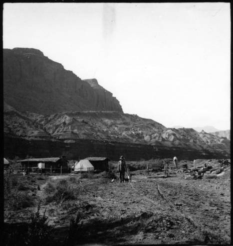
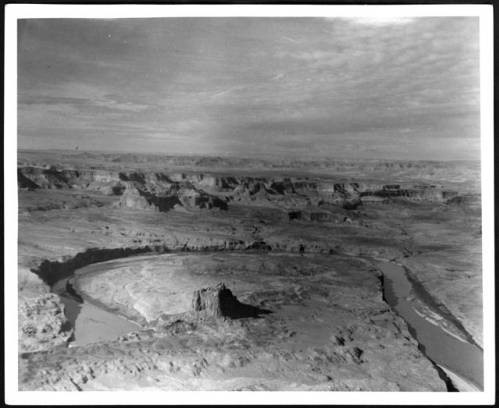
    <summary type="html"><![CDATA[<p><strong><em>A detailed account of two photographers’ river trip through Glen Canyon, a land of amphitheaters, arches, and ruins.</em></strong></p><img src="https://www.intermountainhistories.org/files/fullsize/746512ee18801850746c8da7638e720b.jpg" alt="Hite Ranch in Utah, 1911" /><br/><p>Emery and Ellsworth Kolb’s experience in Glen Canyon began at the remote settlement of Hite, Utah. There, the two brothers recovered from the previous trials of Cataract Canyon and wrote home to their families. Staying only a night, the duo waved goodbye to local legend Cass Hite and began the next leg of their trip to Bright Angel, a four- day journey to Lee’s Ferry. From November 3rd  to November 6th, 1911, the brothers became some of the only people to photograph the original landscapes in Glen Canyon, which is noted for ancestral native ruins, arches, amphitheaters, domes, and hieroglyphics. This area is now inundated by Lake Powell, and modern boat access is much easier and more comfortable than negotiating the river in an early 20th century Racine Co. wooden craft used by the brothers. Emery’s and Ellsworth’s primary motive for the expedition was to capture material for their photography business, and they took full advantage of Glen Canyon’s steady waters and picturesque views to obtain film that would captivate the public for decades to come. </p><p>The brothers enjoyed exploring the region’s cliff dwellings and natural stone bridges. Ellsworth described in his book a fascination with those near the confluence of the Escalante River, remarking, “What a story these cliffs could tell!” He then likened the tribes of the Southwest to European factions, making their last stand on the cliffs, and comparing the Colorado to the other great desert river - the Nile. At Deep Canyon, the brothers refocused on the river as it meandered through a sheer, narrow gorge. They had trouble finding a suitable campsite above the confluence with the San Juan; the few banks consisted of quicksand and mud. Under a full moon they drifted past the San Juan and into a black gorge where no moonlight entered. When they heard roaring water, the brothers scrambled out of their boats onto the bank for the night. The next morning they discovered the rapid they had heard was nothing more than swift water, and were astounded by the ominous Navajo Mountain towering above. This sighting marked a sort of premature homecoming, as they had often seen the rounded peak from their home at the Grand Canyon. After spending a day searching unsuccessfully for Rainbow Bridge, the brothers set their final camp in Glen Canyon at Ute Ford, otherwise known as the Crossing of the Fathers. Using a swift current and some hard paddling, Emery and Ellsworth floated into Lee’s Ferry the evening of November 6th. They got a hot meal and made boat repairs before taking on the last leg of their journey - into the Grand Canyon. </p><p>Without the constant demands of whitewater, Glen Canyon gave the two photographers much-welcomed free time to explore the river and its tributaries. The brothers had no way of knowing it at the time, but their careful descriptions and photography still provide a rare look into a lost canyon.</p><p><em><strong><a href="https://www.intermountainhistories.org/items/show/57">For more (including 4 images) view the original article</a></strong></em></p>]]></summary>
    <published>2017-06-05T17:07:20+00:00</published>
    <updated>2026-04-17T19:31:58+00:00</updated>
    <link rel="alternate" type="text/html" href="https://www.intermountainhistories.org/items/show/57"/>
    <id>https://www.intermountainhistories.org/items/show/57</id>
    <author>
      <name>Jonas Dunlap, Northern Arizona University</name>
    </author>
  </entry>
  <entry>
    <title type="html"><![CDATA[The Glen Canyon Dam, Environmentalists, and Recreation]]></title>
    <summary type="html"><![CDATA[<p><strong><em>Since the decision to dam Glen Canyon in 1956, it has become a symbol of loss and sacrifice on the Colorado River to preservationists.</em></strong></p><img src="https://www.intermountainhistories.org/files/fullsize/274cbd373fe29102b3ac5c579702dae7.jpg" alt="Glen Canyon Dam from the Air" /><br/><p>Successful in his fight against Echo Park Dam David Brower came to regret his strategy of supporting a dam at Glen Canyon. In the late 1950s, the Sierra Club took trips to the canyon. In was only then that its members understood the natural beauty and scenery it had to offer. Brower’s friends feared for him as he grew depressed over the loss. Those that knew the canyon, such as pioneer river guide Norman Nevills and ferry operator Art Chaffin, loved the canyon but their voices were few in the crowded political debate. As if to rub salt into David Brower’s wounds, Luna Leopold of the U.S. Geological Survey waited until after construction of the dam had started to write a report which stated that Hoover Dam sufficiently stored water for the Colorado River and that therefore Glen Canyon Dam was unnecessary. Preservationists now consider Glen Canyon a symbol of loss. </p><p>Brower recovered from his initial depression and continued to fight for the preservation of the Colorado Plateau. He helped produce the publication of The Place No One Knew: Glen Canyon on the Colorado River, which brought the canyon to the public in vivid color. It was a piece of nostalgia looking back at Glen Canyon, rather than an attack on dam building. Dams flooded other canyons such as Flaming Gorge, Horseshoe and Kingfisher yet they did not receive the level of attention that Glen Canyon did. During the 1950s environmentalists did not have the political strength to oppose all dam building. Glen Canyon Dam was elevated to notable significance because of the scale of damage it did. </p><p>Lake Powell came into existence in 1966 as construction workers closed the tunnels that had previously rerouted the Colorado River around the unfinished dam. Beautiful in its own way, Lake Powell is a popular tourist destination. It now sits within the 1.25 million-acre Glen Canyon National Recreation Area. Elaborate houseboats accommodate the two million annual visitors who come to relax, drink, and have fun. For the local tourism industry, the lake has been a huge economic boost. The National Park Service reported that in 2011, 2.3 million visitors spent $238 million in nearby communities. This spending supported 2819 jobs. Lake Powell is now a vital part of the local community. </p><p>Many things were lost to the waters of Lake Powell. These include prehistoric ruins, unique geological features that went unstudied, and native fish populations that were unable to cope with the change of habitat, as well as distinctive beauty unknown to the modern day. The rising waters of Lake Powell created a time limit for archaeologists who had to rush to retrieve as much information as possible. To help, inexperienced workers joined the digging but large areas were not reached before they were flooded.  It is unlikely that Lake Powell will ever be drained. Despite this, a lot can be learned from how the attitude of the environmentalist movement facilitated the damming of Glen Canyon to save Dinosaur National Monument. </p><p><em><strong><a href="https://www.intermountainhistories.org/items/show/58">For more (including 6 images) view the original article</a></strong></em></p>]]></summary>
    <published>2017-06-05T17:59:09+00:00</published>
    <updated>2026-04-17T19:31:59+00:00</updated>
    <link rel="alternate" type="text/html" href="https://www.intermountainhistories.org/items/show/58"/>
    <id>https://www.intermountainhistories.org/items/show/58</id>
    <author>
      <name>George Mumford, Northern Arizona University</name>
    </author>
  </entry>
  <entry>
    <title type="html"><![CDATA[The 1911 Kolb Expedition in Cataract Canyon: Part 3 of 5 of the 1911 Kolb Expedition Tour]]></title>
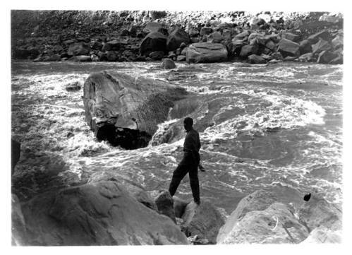
    <summary type="html"><![CDATA[<p><strong><em>An account of the 1911 Kolb expedition through the Canyonlands, which was one segment on their way from Wyoming to the Grand Canyon.</em></strong></p><img src="https://www.intermountainhistories.org/files/fullsize/63f1b60851aed0c6604d6b24c4c70d45.jpg" alt="Rapid #22 Little Niagara" /><br/><p>The two intermountain rivers, the Green and the Grand, combined to form the Colorado River. The first canyon of the unified river is so incredibly wild, that when Major John Wesley Powell first descended it, he deemed that these were not ordinary rapids but cataracts or waterfalls. Emery and Ellsworth Kolb sought not only to navigate its tumultuous waters, but photograph and film their exploits as well. They hoped to provide material to show at their photography studio on the Grand Canyon rim, and in a traveling motion picture show. Prior to their 1911 expedition, there were only four known successful voyages through Cataract Canyon, and seven earlier parties that had attempted it were presumed lost. The brothers would attempt to run it in their wooden boats, The Defiance and The Edith that had been repaired many times over. From October 26th to November 2nd, 1911, the brothers negotiated some of the roughest water in the entire watershed, nearly losing their lives several times. </p><p>In a river over a hundred yards wide and with rapids a third of a mile in length, the brothers took advantage of the huge waves to obtain some excellent film in the twelve miles following the confluence. Moving into the center of Cataract Canyon, the channel narrowed and the thrills increased for the river-runners.  Nearly every rapid attempted by the brothers left them soaked and their boats swamped, but each time they passed one without major injury, the brothers’ confidence grew as well. Worsening their troubles, several rapids—21,22, and 23—brought the greatest descent on the whole river, plunging seventy-five feet in three-quarters of a mile. Rapid #22 in particular tested their resolves, when the river threw both their boats against the rocks, causing minor damage. Emery developed a minor sickness as a result of persistent rain, leaving it up to Ellsworth to run both boats through the larger rapids. The benefit to this illness was that it freed Emery to work the camera in dramatic canyons. Continuing through Big Drop Three, a notorious rapid near the end of the cataracts, the brothers came to the confluence of Dark Canyon. Here, they observed above them a cliff-dwelling, pictographs and pinecones—all signs of the heavily forested Bears Ears Mountains, rich with the treasures of native antiquity. </p><p>Despite many scares, the brothers made it out of Cataract Canyon in only four days, and filmed much of the journey. They shot the first motion picture footage of the region, along with some of the earliest photography. The experiences exposed on glass-plates and film by their cameras would strike awe into audiences for decades to come. The brothers were now more than prepared for a journey through Glen Canyon, the second to last major stretch before getting home to Bright Angel, Arizona.</p><p><em><strong><a href="https://www.intermountainhistories.org/items/show/59">For more (including 4 images) view the original article</a></strong></em></p>]]></summary>
    <published>2017-06-05T18:48:30+00:00</published>
    <updated>2026-04-17T19:31:59+00:00</updated>
    <link rel="alternate" type="text/html" href="https://www.intermountainhistories.org/items/show/59"/>
    <id>https://www.intermountainhistories.org/items/show/59</id>
    <author>
      <name>Jonas Dunlap, Northern Arizona University</name>
    </author>
  </entry>
  <entry>
    <title type="html"><![CDATA[The 1911 Kolb Expedition at Green River, Utah: Part 2 of 5 of the 1911 Kolb Expedition Tour]]></title>
    <summary type="html"><![CDATA[<p><strong><em>The city of Green River, Utah, was a welcome respite along an otherwise inhospitable river for two photographers on their way from Wyoming to California.</em></strong></p><img src="https://www.intermountainhistories.org/files/fullsize/60a0f7bf9c130b9a08fb00fa95c7126e.jpg" alt="Map of Southwestern United States" /><br/><p>This tiny Utah outpost along the Green River has long served as a stopping point for travelers. Initially a ferrying point for the United States Postal Service, the Denver and Rio Grande railroad connected to the town in 1883. However, Ellsworth and Emery Kolb did not enter the community via train; arrived by boat, ragged and tired. Their previous ordeal in Lodore Canyon had been so intense that their hired assistant left the trip early. Staying only three nights, October 16th-20th, the brothers may have recovered physically, but did not have much time for a leisurely break from their expedition. Instead, these pioneering photographers had work to be done, developing plates, repairing boats, and corresponding with the outside world. They were among the first to photograph and film the rivers, which would provide material for a traveling motion-picture show. </p><p>After a tumultuous journey through Desolation Canyon some twenty miles north of the town, the brothers’ first taste of Green River hospitality came at the McPherson Ranch. Cattleman Jim McPherson had a certain understanding of the perils that both the river and an adventuresome spirit could incur; his father drowned in the Green and he had hosted the infamous Butch Cassidy. Once inside the town, Emery and Ellsworth sought proper beds and meals at the historic Metropole Hotel. </p><p>Here, in one of only a few momentary excursions into civilization, the brothers reconnected with the outside world and the families they left behind. The letters they wrote highlight some of the personality differences between the caring family man Emery, and the practical but restless Ellsworth. While Emery recounted the trip and expressed homesickness to his wife and daughter, Ellsworth wrote to comfort his sister Blanche who was worried about finances. The following year Ellsworth would go on to navigate the Colorado River to its delta in the Gulf of California, Emery accompanying him as far as Needles, California. The Flagstaff, Arizona, Coconino Sun ran an article describing their expedition thus far on October 20th, 1911. The paper likened the brothers to the great John Wesley Powell, and the article doubted their chances of survival. That same morning the brothers pushed off into the river, for the three-hundred and twenty mile paddle to the next swift water, Cataract Canyon. </p><p>The town of Green River offered Emery and Ellsworth Kolb a much appreciated break from the physical demands of river running. Their primary duties as self-sufficient photographers kept them quite busy, developing glass plates, fixing boats, and reconnecting with the outside world. As they continued to descend south into the Colorado Plateau, periods of isolation grew longer, rapids more treacherous, and film more astounding. </p><p><em><strong><a href="https://www.intermountainhistories.org/items/show/60">For more (including 3 images) view the original article</a></strong></em></p>]]></summary>
    <published>2017-06-06T19:04:07+00:00</published>
    <updated>2026-04-17T19:31:59+00:00</updated>
    <link rel="alternate" type="text/html" href="https://www.intermountainhistories.org/items/show/60"/>
    <id>https://www.intermountainhistories.org/items/show/60</id>
    <author>
      <name>Jonas Dunlap, Northern Arizona University </name>
    </author>
  </entry>
  <entry>
    <title type="html"><![CDATA[The Navajo Generating Station and Environmental Debates]]></title>
    <summary type="html"><![CDATA[<p><strong><em>The Navajo Generating Station was a solution to the damming of the Colorado River within the Grand Canyon, although many questions exist over its future. Environmentalists wish for the station to close but the Navajo and Hopi tribes hope that the federal government will support it to keep it open.</em></strong></p><img src="https://www.intermountainhistories.org/files/fullsize/e9a0d1548358ae0f96978bb0c2ef9f07.jpg" alt="The Station in Operation" /><br/><p>Stewart Udall served as Secretary of the Interior for both President John Kennedy and Lyndon Johnson. Udall, a westerner, believed that he could leave his mark on the West, in the style championed by Franklin Roosevelt during the New Deal. In part, this meant utilizing the West’s natural resources. Udall fought for Echo Park Dam, and later Glen Canyon Dam; in 1964 he also proposed dams under the Pacific Southwest Water Plan. The dams would provide electricity for the Central Arizona Project (CAP) and subsidize the project’s cost. They would be located on the upper and lower ends of the Grand Canyon. </p><p>Environmentalists, led by David Brower and the Sierra Club, launched a successful campaign to stop the dams. One advertisement famously asked the reader, “Should We Also Flood the Sistine Chapel So Tourists Can Get Nearer the Ceiling?” The Navajo Generating Station replaced the power produced by the lost dams and in 1968 President Johnson signed the Colorado River Basin Project Bill, effectively  launching CAP.</p><p>The station is fueled by a coal strip mine at Black Mesa called Kayenta Mine. Combined, the power plant and mine currently employ 935 people, in addition to contractors. Ninety percent of its employees are Native American. Originally the Hopi and Navajo tribes had terrible royalty deals but renegotiation has made the plant worth millions to the tribes. The station is set to close in 2019 due to rising costs. Native tribes will lose the most from its closure; the Hopi themselves rely on the plant for eighty percent of their income. As of April 2017 the station’s owners, Peabody Energy, hope to sell the station and then sell coal from Kayenta Mine at a lower price. Both the Bureau of Reclamation and the Navajo and Hopi tribes hope to see the plant remain open. Navajo Nation officials are looking to President Donald Trump in the hope that his administration will support federal subsidies to keep the site open.</p><p>Environmentalists have campaigned for regulation of the plant due to the pollution it emits. This pollution affects the atmosphere and the Grand Canyon. This is ironic considering the original campaign for its existence was to save the Grand Canyon. The 1977 Clean Air Act paved the way for environmental regulation but the Environmental Protection Agency (EPA) did not implement it to curtail regional pollution. Environmentalists campaigned and filed lawsuits pushing the EPA in 1991 to create new regulations specifically for Navajo Generating Station’s pollution; yet this did not solve the problem. Working with the EPA, the Grand Canyon Trust, and the Environmental Defense Fund, the station committed to severe cuts to sulfur emissions by 1999.</p><p>The station is still a large source of pollution and smog. The plant discharges 11.4 million metric tons a year; more greenhouse gases than a natural gas plant of equal size. It also releases 472 pounds of mercury, 4370 pounds of selenium, and 259 pounds of arsenic into the environment each year. These toxic chemicals contaminate the water affecting fish populations and our drinking water.</p><p><em><strong><a href="https://www.intermountainhistories.org/items/show/61">For more (including 4 images) view the original article</a></strong></em></p>]]></summary>
    <published>2017-06-06T19:06:55+00:00</published>
    <updated>2026-04-17T19:31:59+00:00</updated>
    <link rel="alternate" type="text/html" href="https://www.intermountainhistories.org/items/show/61"/>
    <id>https://www.intermountainhistories.org/items/show/61</id>
    <author>
      <name>George Mumford, Northern Arizona University</name>
    </author>
  </entry>
  <entry>
    <title type="html"><![CDATA[The Orphan Lode Uranium Mine in the Grand Canyon]]></title>
    <summary type="html"><![CDATA[<p><strong><em>The Lost Orphan Uranium Mine sat on the south rim of the Grand Canyon. In the 1960s Congress approved plans to extend the mine into Grand Canyon National Park. </em></strong></p><img src="https://www.intermountainhistories.org/files/fullsize/ebce618a9a71827de049d920e948b978.jpg" alt="Orphan Mine headframe " /><br/><p>The Lost Orphan Mine started as a copper claim by Daniel Hogan in 1906. The mine, on the southern rim of the Grand Canyon, found itself within the Grand Canyon National Park upon the latter’s creation in 1919. Hogan invested in an inn called the Kachina Lodge in 1936 as he realized the potential for tourists was far greater than the mining prospects. However, World War Two led to a decline in interest. Hogan sold the mine in 1946 and the property went through multiple owners until in 1951 prospectors discovered uranium at the site.  The Golden Crown Mining Company bought the mine as it was willing to invest to make the location profitable. Golden Crown’s parent company, Western Gold, took over, and until 1969 shipped uranium through the park to a uranium mill in Tuba City, Arizona. </p><p>In 1958 the Atomic Energy Commission (AEC) issued a new policy limiting purchased ore to only previously developed mines. Western Gold argued that its claim, which extended into the national park, was protected by apex rights, the miner’s right to follow a claim into other’s property. The AEC disagreed and the issue went to Congress. Nether the AEC nor Western Gold wanted to lose in court. Both believed that a congressional compromise was the best way to achieve a solution. </p><p>The debate centered on a number of issues. The United States valued uranium as important during the Cold War for protection, but likewise the Grand Canyon represented the American values being defended. Northern Arizona business leaders and the Navajo Tribal Council had an economic interest in the extension of the mine as it provided jobs. Proponents of the mine also used classic conservationist arguments in stating that the uranium was useless if left in the ground.</p><p>By May 1961 the issue was unresolved, so the Western Gold chairman announced that instead of a mine the company was going to build a 400 room hotel that descended the southern rim of the Grand Canyon. Western Gold then stirred public disapproval for the hotel through an advertising campaign. The gargantuan concrete hotel was considered to be far more of an eyesore than a bigger uranium mine. A year later, and after much debate, the House passed a bill detailing the compromise and Western Gold expanded its mining operation into the Grand Canyon. By 1967 the Westec Corporation owned the mine. Westec went bankrupt in 1967, and the Cotter Corporation took over mining but could not make it profitable due to rising production costs.</p><p>The Orphan Mine closed in 1969. It had produced 495,107 tons of ore which was processed into 4,257,571 pounds of uranium oxide. In June 2016 the Sierra Club and Native American tribal leaders pushed for a 1.7 million acre national monument around the Grand Canyon in order to protect it from further mining or logging in the area. Opponents of the proposal have expressed concerns over the economic impact of the restrictive monument. However, the Orphan Mine has already cost U.S. tax payers an estimated $15 million to clean up.</p><p><em><strong><a href="https://www.intermountainhistories.org/items/show/62">For more (including 4 images) view the original article</a></strong></em></p>]]></summary>
    <published>2017-06-06T19:17:20+00:00</published>
    <updated>2026-04-17T19:31:59+00:00</updated>
    <link rel="alternate" type="text/html" href="https://www.intermountainhistories.org/items/show/62"/>
    <id>https://www.intermountainhistories.org/items/show/62</id>
    <author>
      <name>George Mumford, Northern Arizona University</name>
    </author>
  </entry>
  <entry>
    <title type="html"><![CDATA[Rainbow Bridge, Native Peoples, and Tourism]]></title>
    <summary type="html"><![CDATA[<p><strong><em>Rainbow Bridge stands as one of the largest natural bridges in the world. It is sacred to six Native American tribes who successfully contested that behavior at the bridge should be respectful because of it’s great cultural importance.</em></strong></p><img src="https://www.intermountainhistories.org/files/fullsize/307a02a0fb0c0964a02078db1b9bb84b.jpg" alt="The Discoverer&#039;s View" /><br/><p>Rainbow Bridge sits at the southern edge of Lake Powell at the tip of Forbidding Canyon, which extends out from Glen Canyon. It stands at 290 feet tall and 275 wide, making it one of the largest natural bridges in the world. In 1909 Byron Cummings and W.B. Douglass publicized the bridge to the world after they saw it with the help of Paiute guides. For centuries Native Americans have known about the bridge and have incorporated it into their spiritual understanding. President William H. Taft designated the bridge a national monument in 1910, and visitors included Teddy Roosevelt who considered the bridge as one of the wonders of the world. </p><p>The waters of Lake Powell rose up to and under the bridge due to flooding from the Glen Canyon Dam, despite the fact that the Colorado River Storage Project Act of 1956 included provisions to protect the monument. Environmentalists took this to heart and there was a new zeal to stop such a thing happening again. The lake changed the accessibility of the bridge as the water allowed tourists to travel by boat to the arc, taking away from the challenging and adventurous journey experienced before.</p><p>For Native American tribes, this new accessibility presented new problems. Rainbow Bridge is an important religious site for the Navajo, Hopi, Ute Mountain Ute, San Juan Southern Paiute, Zuni, and Kaibab Paiute. These tribes felt that Lake Powell was tarnishing their sacred sites and Rainbow Bridge was their biggest concern. Lake Powell attracted tourists who considered the bridge a part of their vacation experience without respecting its religious significance. By the mid-1970s visitors to the bridge were demanding that drinking fountains be installed alongside trash cans for the waste. The bridge had become a part of the party and vacation atmosphere that surrounded Lake Powell. </p><p>In 1974 members of the Navajo tribe filed suit against the Bureau of Reclamation, as well as the Director of the National Park Service and the Secretary of the Interior, in an attempt to preserve their religious site. They lost when the district court of Utah ruled that the Navajo did not have a claim to the land the bridge was on. They also lost their 1980 appeal, as the Tenth Circuit Court of Appeals argued that in this case water storage was more important than religious rights.  </p><p>In April 2017, the National Park Service recognized Rainbow Bridge’s significance to Native Americans by designating it a Traditional Cultural Property. The national monument is the first site in Utah to receive such designation. The hope is that such designation can better preserve Rainbow Bridge for years to come; now any federal project that could impact it has to undergo a vigorous review. For example, geologists have been measuring the vibrations felt by the bridge. Certain actions such as drilling and construction cause vibrations that put strain on the bridge.  Most importantly, the designation is a vital step in recognizing the bridge’s cultural and religious significance to many Native Americans. </p><p><em><strong><a href="https://www.intermountainhistories.org/items/show/63">For more (including 5 images) view the original article</a></strong></em></p>]]></summary>
    <published>2017-06-06T20:09:49+00:00</published>
    <updated>2026-04-17T19:31:59+00:00</updated>
    <link rel="alternate" type="text/html" href="https://www.intermountainhistories.org/items/show/63"/>
    <id>https://www.intermountainhistories.org/items/show/63</id>
    <author>
      <name>George Mumford, Northern Arizona University</name>
    </author>
  </entry>
  <entry>
    <title type="html"><![CDATA[Mesa Verde and the Evolution of Site Preservation and Protection]]></title>
    <summary type="html"><![CDATA[<p><strong><em>Pot Hunting at Mesa Verde led to several important laws being put into place to protect artifacts from pothunters and the public. These laws are still in place today.</em></strong></p><img src="https://www.intermountainhistories.org/files/fullsize/1c4a0c97b4698f6bd9de9101aa831e6f.jpg" alt="Cliff Dwellings" /><br/><p> President Theodore Roosevelt created Mesa Verde National Monument on June 29, 1906. The monument is located near Cortez and Mancos, Colorado. Ancestral Puebloans inhabited Mesa Verde from 6000 BCE. to about 1300 CE. Their broader cultural group encompassed most of northern Arizona, northern New Mexico, southwestern Colorado and southern Utah. </p><p>Fathers Escalante and Dominguez were the first Europeans to record seeing Mesa Verde on their way to what is now California. The ruins then went unnoticed until geologist Ferdinand V. Hayden led an expedition across southern Colorado in 1874. When he heard about cliff houses nearby, instead of going to the ruins himself, Hayden sent his expedition photographer, William H. Jackson, to photograph them. Stunned by what he saw in the photographs, Hayden returned the next year to document the ruins and the artifacts inside them.</p><p>In 1888, Richard Wetherill and his brothers who lived in the area found the ruins while looking for lost cattle; they explored them and began collecting artifacts. By 1890 Wetherill had built a substantial collection from all over Mesa Verde and began to sell to collectors and museums. Also during this time, Wetherill started taking tourists to Mesa Verde. In 1891, he led a Swedish scientist, Gustav Nordenskiöld, to the ruins. During his time exploring the ruins, Nordenskiöld developed a systematic method for excavating the ruins and how to record artifacts. Afterwards, Nordenskiöld removed the objects from the site. During his excavation, the Swede noticed the pottery went from painted black- on- white, refined pottery to simple and crude pottery. This pattern led Nordenskiöld to notice how the Anasazi changed over time through their pottery. </p><p>When Nordenskiöld tried to return to Sweden with his large collection, customs agents stopped and detained him. Undeterred, Nordenskiöld negotiated his release when he pointed out that the US did not have any laws preventing him from taking the objects out of the country. After Nordenskiöld returned to Sweden, Wetherill stopped taking tourists to Mesa Verde to focus on his excavation at Chaco Canyon. Tourists continued to visit the sites for the next decade until archaeologist and preservationist Edgar Lee Hewitt fought to make Mesa Verde a national monument. Hewett was instrumental in lobbying congress to create  the Antiquities Act of 1906 which led to President Roosevelt’s declaration of Mesa Verde a national monument.</p><p>Although the Antiquities Act was the first step in protecting artifacts in national monuments, pot hunting continued at Mesa Verde as well as at other sites such as Canyon de Chelly and Chaco Canyon. The punishment of taking a pot or artifact from federal lands today is punishable by a year in jail and up $10,000 in fines.</p><p><em><strong><a href="https://www.intermountainhistories.org/items/show/64">For more (including 3 images) view the original article</a></strong></em></p>]]></summary>
    <published>2017-06-06T21:33:44+00:00</published>
    <updated>2026-04-17T19:31:59+00:00</updated>
    <link rel="alternate" type="text/html" href="https://www.intermountainhistories.org/items/show/64"/>
    <id>https://www.intermountainhistories.org/items/show/64</id>
    <author>
      <name>Alexandria O&amp;#039;Hara, Northern Arizona University</name>
    </author>
  </entry>
  <entry>
    <title type="html"><![CDATA[Crossing of the Fathers]]></title>
    <summary type="html"><![CDATA[<p><strong><em>With the help of their Native American guides, Spanish Franciscan priests Atanasio Domínguez and Silvestre Vélez de Escalante made a difficult crossing of the Colorado River.</em></strong></p><img src="https://www.intermountainhistories.org/files/fullsize/4f0aa82a81d59c00ca9a695cdd884141.jpg" alt="Canyon Country" /><br/><p>In 1776 an expedition left from Santa Fe, New Mexico, to find an overland route to the Catholic Mission in Monterrey, California.  Native Americans guided Franciscan priests, Fathers Escalante and Dominguez through the Colorado Plateau.  Their journey consisted of crossing through vast canyon lands and fording many rivers.  They took a large number of horses, mules, and donkeys to pack goods and to trade with Native Americans.  Their journey lasted for just over a year. </p><p>They traveled from Santa Fe north into Colorado’s Western Slope to present day Grand Junction.  Then they headed west past Green River, Utah, towards the Wasatch Front.  They ended their journey at Utah Lake near Provo.  Disappointed in their pace and failure to find an easy route to California, they began a return journey on an alternate route. They traveled south to present-day Cedar City, Utah, and then cut east along the edges of the Grand Staircase region towards Glen Canyon and the Colorado River.  </p><p>The Crossing of the Fathers is where Native guides led the expedition across the Colorado River. It was difficult to find a safe crossing of the river in the Glen Canyon region. After a thorough search, they came to a narrow spot.  In a translated journal, the Fathers described their difficult situation, “in order to have the mounts [mules, donkeys, and horses] led down to the canyon mentioned, it became necessary to cut steps with axes on a stone cliff.”  After safely taking the animals down the stairs, they next looked for a safe crossing of the river. They found a relatively easy spot to swim across that had little flow.  On November 7, 1776, they crossed the Colorado River to continue their journey back to Santa Fe.</p><p>In the ensuing 200 years few followed that specific crossing location.  Native peoples of the region knew and used many other crossings.  In fact, the Escalante and Dominguez route is one of the only mentioned crossings of this section of the Colorado.  Farther north there were easier cliffs to descend and a slower meandering river section that Native Americans used.  Today the Crossing of the Fathers lies underneath Lake Powell.  Many amateur explorers have tried to find the route the Spanish Fathers took and have searched for the original staircase that was carved into the side of the cliff. Today, the site is most likely covered by the waters of Lake Powell., though falling water levels may someday reveal its location.</p><p><em><strong><a href="https://www.intermountainhistories.org/items/show/65">For more (including 3 images) view the original article</a></strong></em></p>]]></summary>
    <published>2017-06-07T06:21:57+00:00</published>
    <updated>2026-04-17T19:31:59+00:00</updated>
    <link rel="alternate" type="text/html" href="https://www.intermountainhistories.org/items/show/65"/>
    <id>https://www.intermountainhistories.org/items/show/65</id>
    <author>
      <name>Alex Anthony, Northern Arizona University</name>
    </author>
  </entry>
  <entry>
    <title type="html"><![CDATA[The 1911 Kolb Expedition Enters the Grand Canyon: Part 5 of 5 of the 1911 Kolb Expedition Tour]]></title>
    <summary type="html"><![CDATA[<p><strong><em>A detailed account of two photographer’s river trip from Marble Canyon to Bright Angel, the last stretch of their expedition which originated in Wyoming.</em></strong></p><img src="https://www.intermountainhistories.org/files/fullsize/ff7247700c6c25328a4acd3e1e34906b.jpg" alt="Arrival at Bright Angel" /><br/><p>Leaving Lee’s Ferry, only a hundred miles separated Emery and Ellsworth Kolb from their home and studio on the Grand Canyon rim. To reach it they would have to take on the formidable rapids in the canyons of the Marble and Grand, trapped on either side by the steep walls of the inner gorge. Once across the fault line which exposed the Vermillion Cliffs, the designated end of Glen Canyon, the Colorado River drops 2,300 feet to the end of the Grand Canyon. For comparison, the entire length of their journey thus far from Wyoming had only descended 2,900 feet. Producing quality photography and motion picture film while piloting wooden boats in continuous rapids is one of the greatest feats ever attempted in the Grand Canyon. At Soap Creek Rapid, where Frank Mason Brown, a river-runner, and railroad tycoon drowned in 1889, they contended with exposed rocks and twelve-foot waves. Ellsworth attempted this first in his boat The Defiance, while Emery filmed with a hand-cranked motion picture camera from shore. Ellsworth struck a rock and was thrown out of the boat, but managed to hang on the side and quickly climb back in. On a second attempt, Ellsworth piloted Emery’s boat The Edith over the falls. Again he struck a rock, this time capsizing and being thrown into the water. While the brothers were spared injury, the soaked plates and cameras were not so lucky. As they went deeper into Marble Canyon, the gorge narrowed to just over a hundred yards with walls of smooth limestone. There they made camp in a cave carved out by the river in perfect ledges. </p><p>Now into the Grand Canyon proper, the brothers’ journals reveal familiarity with the rock units and landmarks. Although comforted by the sights of home, they could not yet relax, as the most difficult and powerful rapids lay ahead. An unnamed rapid near the Nancoweep Valley broke a rowlock, line, and flooded both boats. Reaching the Little Colorado they began to see places they had previously visited. They made their final camp under a magnificent sunset, only fourteen miles from home. The next day saw “good rapids,” large and powerful but with only a few rocks. Emery’s momentary fall into the water is the only minor accident recorded. Now in the enigmatic Vishnu Schist of the inner gorge, the brothers looked up over a billion years of geologic time, 5,000 feet to the rim. </p><p>November 16th, 1911, marked the conclusion of a two- month and eight-day journey from Green River, Wyoming, to Bright Angel, Arizona. Emery and Ellsworth photographed and filmed the last bastion of the frontier in America. The Grand Canyon section provided for their most visually striking and popular work. The brothers were wildly successful; their studio became a popular tourist destination and they traveled the country with a motion-picture show. Emery and Ellsworth survived over a thousand miles in the canyon depths of the Intermountain West and soon brought that experience to the American people. </p><p>In December, they returned to the river and followed it to Needles, California.</p><p><em><strong><a href="https://www.intermountainhistories.org/items/show/66">For more (including 6 images) view the original article</a></strong></em></p>]]></summary>
    <published>2017-06-07T23:56:01+00:00</published>
    <updated>2026-04-17T19:31:59+00:00</updated>
    <link rel="alternate" type="text/html" href="https://www.intermountainhistories.org/items/show/66"/>
    <id>https://www.intermountainhistories.org/items/show/66</id>
    <author>
      <name>Jonas Dunlap, Northern Arizona University</name>
    </author>
  </entry>
  <entry>
    <title type="html"><![CDATA[The 1911 Kolb Expedition through the Gates of Lodore: Part 1 of 5 of the 1911 Kolb Expedition Tour]]></title>
    <summary type="html"><![CDATA[<p><strong><em>A description of the Kolb Brothers’ experience river-running the Green River through Lodore Canyon in late September, 1911.</em></strong></p><img src="https://www.intermountainhistories.org/files/fullsize/98349df75c8b2578410ce6bfc853a5b0.jpg" alt="The Edith" /><br/><p>In Lodore Canyon Emery and Ellsworth Kolb quickly learned that a wild river made for a perilous journey. The Green River in this section is noted for its narrow channel, abundant boulders, and difficult rapids. Dropping 420 feet in twelve miles, the hydrologic forces funneled through this cut in the Uintah mountains are immense, measured at 9,000 cubic feet per second. At any moment, their wooden boats, laden heavy with supplies, were subjected to a force comparable to releasing five Olympic-sized swimming pools into a typical bedroom. Not only did several hundred rolls of motion picture film add weight, they were a logistical nightmare as they had to be kept secure and dry. The brothers hoped this added burden would pay out in years to come with a motion picture and photography show covering their exploits. The cold and rainy weather added to the difficulties of the trip. The arduous task of filming the journey compounded the typical trials of an already challenging whitewater expedition.</p><p>On September 22nd, 1911, Emery and Ellsworth entered Lodore Canyon, a remote and rough stretch of river. The next day Emery’s boat, The Edith, struck a boulder and began filling with water, forcing them to unload supplies and make an emergency camp. Discouraged by the blunder and damaged plates, the brothers lined their boats —pulled them by rope— down Lower Disaster Rapid. Considering the canyon is only twenty-one feet wide and the river drops fifty feet into an undercut bank, Emery was probably correct in stating later in his book about the trip, that it “would be certain death to try and run it.” Disaster struck on September 27th, when the river pinned Ellsworth’s boat against a rock and ejected him from the craft as it filled with water. Their assistant, James Fagan, retrieved the soaked gear downstream while Emery rescued his brother. As they waited for gear to dry, the brothers tried their luck fishing. Surprisingly, the cold muddy Green sustained an abundant population of fish, and the trio reeled in fourteen in under half an hour. They needed those calories shortly, as the final and largest hurdle in Lodore lay just around the bend; the notorious rapids of Triplet Falls and Hell’s Half Mile. Despite wisely choosing to line their boats and portage their gear through this stretch, it was by no means easy. In the depths of the 2,800 ft. gorge, it took them nearly three hours, nine trips, and a 100-foot climb just to move The Edith and its gear. More rain followed, leading Fagan to break down in tears.</p><p>Having successfully negotiated their first test of will power and technical skill, Ellsworth and Emery proved themselves to be competent rivermen. The fruit of their labor was the finest and earliest film ever produced of Lodore Canyon, and confidence that would be necessary for the many miles ahead. </p><p><em><strong><a href="https://www.intermountainhistories.org/items/show/67">For more (including 5 images) view the original article</a></strong></em></p>]]></summary>
    <published>2017-06-08T00:35:43+00:00</published>
    <updated>2026-04-17T19:31:59+00:00</updated>
    <link rel="alternate" type="text/html" href="https://www.intermountainhistories.org/items/show/67"/>
    <id>https://www.intermountainhistories.org/items/show/67</id>
    <author>
      <name>Jonas Dunlap, Northern Arizona University</name>
    </author>
  </entry>
  <entry>
    <title type="html"><![CDATA[Hite Ferry at Dandy Crossing]]></title>
    <summary type="html"><![CDATA[<p><strong><em>For the first half of the 20th century, Hite Ferry at Dandy Crossing was the only way across the Colorado River along hundreds of miles along the northern edge of Glen Canyon.</em></strong></p><img src="https://www.intermountainhistories.org/files/fullsize/05e035156d59c2bf0307855ed580ed45.jpg" alt="Hite Bridge, 1960s" /><br/><p>Hite, Utah is located on the northern end of Lake Powell along the Colorado River. It was named after Cass Hite who came to Glen Canyon in 1883. He came after Navajo associates told him there was gold in the Colorado River. Soon, a small ‘Gold Rush’ ensued and prospectors and others settled at Hite, Utah. It served as a small trading outpost on a river bar of the Colorado. Since Hite was located in an easily navigable part of the river, it received another name - Dandy Crossing. After the gold was deemed too fine to be profitable, the outpost went quiet but by 1900, Hite evolved into an important crossing point of the Colorado River. </p><p>In the late 1890s, Arthur Chaffin came to Hite with his father and brothers looking for gold. After little luck with placer mining they gave up and went their separate ways. Chaffin traveled across the West, eventually returning to Utah in the 1920s and to Hite by the early 1930s.  At times Chaffin hay have been the only permanent resident in Hite, operating the “tent motel,” post office, and ferry. In the 1930s as the automobile came more into use, Chaffin began a life-long quest to make Hite accessible to cars. As other mineral booms occurred in the region, Chaffin took advantage of the largest  - the uranium boom. He requested that local city councils help build better roads to Hite. Then, since Hite was situated at an important Colorado River crossing, he established a ferry.  His ferry operated from the 1946 to 1964, when Lake Powell was filled.  </p><p>The ferry was small and operated using the engine of a small car.  The small-scale nature of the ferry meant that it was slow and could only support one large truck or maybe two small vehicles at a time.  Large commercial vehicles were not able to cross, forcing companies to lobby government officials into building a large bridge.  That was the least of Arthur Chaffin’s worries. Located at the northern end of Glen Canyon, the construction of Glen Canyon Dam and filling of Lake Powell left his residence underwater and the ferry unusable. He successfully sued the federal government for his impending losses, won $8,000, and left the area.</p><p>Today the site is under water, and the ferry is no longer used.  A highway and bridge cross nearby with a marker commemorating Hite ferry. The construction of a large highway and bridge made the region much more accessible, but came at the cost of Hite’s ferry.</p><p><em><strong><a href="https://www.intermountainhistories.org/items/show/68">For more (including 4 images) view the original article</a></strong></em></p>]]></summary>
    <published>2017-06-08T18:14:45+00:00</published>
    <updated>2026-04-17T19:31:59+00:00</updated>
    <link rel="alternate" type="text/html" href="https://www.intermountainhistories.org/items/show/68"/>
    <id>https://www.intermountainhistories.org/items/show/68</id>
    <author>
      <name>Alex Anthony, Northern Arizona University</name>
    </author>
  </entry>
  <entry>
    <title type="html"><![CDATA[Hole-in-the-Rock]]></title>
    <summary type="html"><![CDATA[<p><strong><em>Mormon pioneers settled Bluff, Utah, from 1879-1880.  To reach their destination they chose a ‘short cut’ through Hole-in-the-Rock.  Traveling through the passage proved much more difficult and time-consuming than anticipated.</em></strong></p><img src="https://www.intermountainhistories.org/files/fullsize/c8c36b21f93fc9ce2adb1e9eb3fd3246.jpg" alt="Dugway Remnants" /><br/><p>Mormon settlers of Bluff, Utah, crossed the high desert of the Colorado Plateau and the Colorado River in 1879 on what is now known as the Hole-In-the-Rock trail. Brigham Young had called a group of southern Utah Mormons to settle southeastern Utah because few Mormon families lived east of the Colorado River. The Mormons organized quickly and decided on a route from Escalante, Utah, to a remote section of southeastern Utah. Desert terrain, canyon country, and the Colorado River all made the journey difficult..</p><p>After a relatively easy journey south of Escalante towards the Colorado River, they ran into trouble. The canyon country surrounding the Colorado River had sheer cliffs that were difficult to descend. They sent out scouts and chose a ‘short cut’ through an actual hole, they dubbed Hole-in-the-Rock. At the top of a canyon that descended to the Colorado River, there was a relatively large navigable passageway. The trail was marked by a large hole that was wide and tall enough for a few men, but not wide enough for a wagon to pull through. They sent a group back to obtain dynamite and other equipment. With great effort they blasted away the edges of the hole. The gap opened wide enough for the wagons to travel through.</p><p>However, the descent down from the top of the cliff was difficult. The hole opened to a sheer cliff far from the river below. To descend to the canyon floor, they built a ‘floating’ road called a dugway. They bored holes into the cliff to drive metal spikes into the wall, then placed strong tree branches over the spikes and piled up rocks underneath to finish the road. Eventually they made it far enough down the side of the cliff that a dugway was no longer needed, but the terrain was still too difficult for the animals to safely walk over. They carved stairs into the solid rock to make it easier for their horses and cattle to maneuver. The rock stairway was the last part of the trail that led to the water’s edge.</p><p>Once the party made it to the bottom of the canyon, they had to cross the Colorado River.  Using a ferry that could fit two wagons at a time, they managed to get everyone across. Their journey was not over, but the most difficult phase was done. They proceeded through more canyon country and settled Bluff, Utah.</p><p>Today, some of the staircase is under Lake Powell, but most of the dugway along the cliff is still visible. One can hike down the trail from the top of the canyon through the Hole-in-the-Rock. The trail is also accessible below by boat from Lake Powell. </p><p><em><strong><a href="https://www.intermountainhistories.org/items/show/69">For more (including 4 images) view the original article</a></strong></em></p>]]></summary>
    <published>2017-06-09T19:23:54+00:00</published>
    <updated>2026-04-17T19:31:59+00:00</updated>
    <link rel="alternate" type="text/html" href="https://www.intermountainhistories.org/items/show/69"/>
    <id>https://www.intermountainhistories.org/items/show/69</id>
    <author>
      <name>Alex Anthony, Northern Arizona University</name>
    </author>
  </entry>
  <entry>
    <title type="html"><![CDATA[Kaibab Bridge (Black Bridge)]]></title>
    <summary type="html"><![CDATA[<p><strong><em>Kaibab or Black Bridge crosses the Colorado River at the bottom of the Grand Canyon, connecting South Kaibab Trail to the North Kaibab Trail. The bridge makes the crossing of the Colorado River safe and possible for hikers and mules headed for Phantom Ranch.</em></strong></p><img src="https://www.intermountainhistories.org/files/fullsize/b51db70dc54d643167aa7515e5af586e.jpg" alt="Arial View of Suspension Bridge" /><br/><p>Kaibab or Black Bridge has been a valuable crossing for miners, ranchers - its intended users - as well as hikers and tourists. The bridge is wide enough for a couple of people, and strong enough for a whole team of mules. Hikers eventually overtook those who used the bridge as tourism to the Grand Canyon became more popular.  </p><p>The construction of the suspension bridge was difficult. Once designated a National Park in 1919, rangers tried to make the canyon more accessible. They created trails from both rims to allow people to hike to the inner canyon. However, there was only a crossing of the Colorado River by way of a large cableway. The cableway could fit one mule (and a person) at a time. The route had been in use since the mid 1800’s by miners and ranchers going to Phantom Ranch. It was so old by the time the Grand Canyon became a park it needed to be replaced or fixed.  </p><p>Since tourist traffic was increasing through the Grand Canyon, a larger, more accessible crossing was needed. The Colorado River’s swift current in the Grand Canyon was too strong for a ferry. Instead, the National Park Service (NPS) chose a spot to build a suspension bridge that would connect the North and South Kaibab Trails at the Colorado River. The NPS began work on the bridge in the early 1920s. The construction was dangerous because workers faced precarious routes. They used mules to carry heavy loads down to the river and then, once there, had to dangle from saddle-like bags over the river to connect the large pieces of metal cable. Havasupai laborers completed much of the most difficult work, including carrying large wires down switch backs for nine miles to the river’s edge. The suspension bridge was complete in 1928.</p><p>Today Kaibab Bridge is part of the South Kaibab Trail in the Grand Canyon. The trail starts at either rim of the Grand Canyon and goes all the way down to the Colorado River. Kaibab Bridge allows hikers to get to rim to rim easily and safely. The views taken from the bridge make the long difficult descent worth it. </p><p><em><strong><a href="https://www.intermountainhistories.org/items/show/70">For more (including 4 images) view the original article</a></strong></em></p>]]></summary>
    <published>2017-06-10T18:18:45+00:00</published>
    <updated>2026-04-17T19:31:59+00:00</updated>
    <link rel="alternate" type="text/html" href="https://www.intermountainhistories.org/items/show/70"/>
    <id>https://www.intermountainhistories.org/items/show/70</id>
    <author>
      <name>Alex Anthony, Northern Arizona University</name>
    </author>
  </entry>
  <entry>
    <title type="html"><![CDATA[Navajo Bridge]]></title>
    <summary type="html"><![CDATA[<p><strong><em>Navajo Bridge is one of the architectural wonders of modern Arizona.  It encouraged tourism in northern Arizona and southern Utah.</em></strong></p><img src="https://www.intermountainhistories.org/files/fullsize/bb53c166ff429b49cd6b6785080d4448.jpg" alt="Construction of Navajo Bridge, 1928" /><br/><p>Navajo Bridge spans the width of Marble Canyon along the Colorado River. Constructed of concrete and steel, the bridge is tied for ninth highest in the United States. Ralf Hoffman of the Arizona Highway Department (AHD) designed it, and in June of 1927, AHD contracted Kansas City Structural Steel Company to build the structure. Funding for the bridge came from the State of Arizona and the Navajo Tribal Fund. After completing the bridge in 1929, its architects dubbed it Lee’s Ferry Bridge or Grand Canyon Bridge. Both names did not last long; Navajo leaders and others asked to change it to Navajo Bridge. The State of Arizona agreed to reflect the monetary donations made by the Navajo Nation. Navajo Bridge has been nominated as “Arizona’s most technologically significant highway bridge,” because it reflects the ingenuity of the time in building something that crossed such a deep canyon.</p><p>The bridge made a modern connection between the north and south sides of the Colorado River and made US highway 89 possible, encouraging tourism in northern Arizona and southern Utah. There were only ferry crossings hours to the north or south, and often quite limited. The bridge shortened travel time between southern Utah and northern Arizona for both tourism and commerce.  </p><p>Navajo Bridge remained the only highway crossing of the Colorado for approximately 400 miles in either direction until the 1960s. As traffic and tourism increased, Arizona and Utah constructed new bridges at Glen Canyon and Hite. As the years went by, Navajo Bridge needed repairs and was too narrow for modern vehicles. In 1995, Arizona constructed a New Navajo Bridge to replace the old one. Today, the old bridge is no longer used for vehicle traffic, but is open for tourists and pedestrians. </p><p><em><strong><a href="https://www.intermountainhistories.org/items/show/71">For more (including 3 images) view the original article</a></strong></em></p>]]></summary>
    <published>2017-06-10T19:19:18+00:00</published>
    <updated>2026-04-17T19:31:59+00:00</updated>
    <link rel="alternate" type="text/html" href="https://www.intermountainhistories.org/items/show/71"/>
    <id>https://www.intermountainhistories.org/items/show/71</id>
    <author>
      <name>Alex Anthony, Northern Arizona University</name>
    </author>
  </entry>
  <entry>
    <title type="html"><![CDATA[The CCC &amp; Arches National Monument and Park]]></title>
    <summary type="html"><![CDATA[<p><strong><em>Between the years 1938-1942 the Civilian Conservation Corps (CCC) completed an impressive amount of work building bridges, trails, and roads in Arches National Monument.</em></strong></p><img src="https://www.intermountainhistories.org/files/fullsize/4d4bd60d7e1db17da38aa27f1a6dbf34.jpg" alt="Moab Canyon Wash Culvert" /><br/><p>The area which is now Arches National Park first came to the attention of the government in the early part of the 20th century. In 1929, President Herbert Hoover designated 4,500 acres of the region a National Monument and in 1938 President Franklin Roosevelt enlarged it substantially to 33,000 acres. This was the size of the area when the CCC worked there, making it a challenge to create roads, trails, bridges, and other infrastructure projects over such a vast area. In 1969, President Richard Nixon granted the area National Park status.</p><p>In nearby Moab, Utah, the government created CCC camp NP-7 in 1940 with the aim of improving the infrastructure of Arches National Monument. The men of the CCC were the first people to attempt projects such as trail building in this remote area. Their efforts in the 1940’s helped the area to become more accessible when tourism boomed during the post-World War II period. This growth, caused predominantly by increased leisure time and money along with access to automobiles, has continued to this day with Arches National Park becoming an increasingly popular choice for tourists of all types visiting the Southwest. </p><p>Those in the NP-7 camp, one of the last CCC camps in America to close down, had completed an impressive amount of work when it closed in 1942. One of the most distinctive CCC projects to look for in the park is an impressive red sandstone building near the visitor center. Other remnants include many of the trails leading to key attractions in the park, including the ones leading to Delicate Arch and Landscape Arch. In addition to this the CCC completed work on the headquarters buildings, drainage culverts and a scenic park road. </p><p>Today Arches National Park is popular with all types of tourists, from avid mountain bike enthusiasts attracted by the surrounding region's trails to curious sightseers simply wishing to take in the stunning natural beauty of the park. </p><p><em><strong><a href="https://www.intermountainhistories.org/items/show/72">For more (including 3 images) view the original article</a></strong></em></p>]]></summary>
    <published>2017-06-12T22:22:32+00:00</published>
    <updated>2026-04-17T19:31:59+00:00</updated>
    <link rel="alternate" type="text/html" href="https://www.intermountainhistories.org/items/show/72"/>
    <id>https://www.intermountainhistories.org/items/show/72</id>
    <author>
      <name>Sarah Birt, Northern Arizona University and Hull University </name>
    </author>
  </entry>
  <entry>
    <title type="html"><![CDATA[The CCC &amp; Capitol Reef National Monument: Creating Roads in the Wilderness]]></title>
    <summary type="html"><![CDATA[<p><strong><em>At Capitol Reef National Monument, Utah, the Civilian Conservation Corps (CCC) worked tirelessly to build roads making this remote area accessible for visitors to the National Monument.</em></strong></p><img src="https://www.intermountainhistories.org/files/fullsize/8f699dd386756fc441762e509c2267b9.jpg" alt="Torrey-Boulder Road" /><br/><p>In 1937, President Franklin Roosevelt designated 37,711 acres of land in Utah as Capitol Reef National Monument. The new monument was under the jurisdiction of Zion National Park until becoming its own National Park in 1971 under President Richard Nixon. The area was also expanded to 241,000 acres, a very considerable increase in size. However, during the New Deal era of the late 1930s to early 1940s Capitol Reef was simply a small National Monument, remote, with very little infrastructure. Members of the Civilian Conservation Corps camp NM-2 (later renamed NP-6) took on the task of bringing improving infrastructure in the Monument. These men were based west of Fruita, close to Chimney Rock. </p><p>Much of what the CCC men built remains visible within Capitol Reef National Park. Two examples of this are the Fruita ranger station and a powder magazine built into the hillside. The CCC constructed the powder magazine to store the large supply of explosives they needed to quarry sandstone slabs for construction of roads, trails, and buildings within the monument. It is now listed on the National Register of Historic Places and can be seen by the many people who visit Capitol Reef. </p><p>One of the roads built by the CCC to increase access to Capitol Reef National Monument and the surrounding area was the Torrey-Boulder Road, which allowed access to the isolated town of Boulder for the first time. Except for a few scattered lodges and the small Native American population of Havasupai in the Grand Canyon, Boulder had been the last place in the United States to receive its mail by mule—as late as 1940. The road built by the CCC climbs up to 9,000 feet at points, winding its way through thick forests of Aspen and is now a part of Highway 12. The CCC built two similar roads in the area which are colloquially referred to as ‘The Million Dollar Road’ and ‘Hells Backbone Road’, names which imply their construction difficulties.</p><p><em><strong><a href="https://www.intermountainhistories.org/items/show/73">For more (including 3 images) view the original article</a></strong></em></p>]]></summary>
    <published>2017-06-12T22:55:53+00:00</published>
    <updated>2026-04-17T19:31:59+00:00</updated>
    <link rel="alternate" type="text/html" href="https://www.intermountainhistories.org/items/show/73"/>
    <id>https://www.intermountainhistories.org/items/show/73</id>
    <author>
      <name>Sarah Birt, Northern Arizona University and Hull University </name>
    </author>
  </entry>
  <entry>
    <title type="html"><![CDATA[The CCC &amp; the Painted Desert Inn: A Pueblo Revival Building in the Petrified Forest ]]></title>
    <summary type="html"><![CDATA[<p><strong><em>Overlooking the Petrified Forest National Park, the Painted Desert Inn is widely recognized as a masterpiece in Pueblo Revival Style. The inn is significant to the Southwest, recognizable for its flat roofs and protruding beams. The Civilian Conservation Corps (CCC) reconstructed this beautiful and unusual building in 1937.</em></strong></p><img src="https://www.intermountainhistories.org/files/fullsize/aa741af9a69ca39cf5c47112e611fe4f.jpg" alt="Painted Desert Inn (westward view)" /><br/><p>A building known as ‘The Stone Treehouse’ stood in 1924 on the site where today the Painted Desert Inn stands. This building, in the style known architecturally as ‘National Park Rustic,’ looked strikingly different from what visitors to the Petrified National Park see today. In 1936 the National Park Service purchased the building and began a complete renovation, pretty much taking the building apart and beginning again on the same site. The reason for total renovation was twofold: first, many saw the building’s style as outdated, and second, the National Park Service determined the foundations of ‘The Stone Treehouse’ to be slowly sinking into the soft clay soil they had been built on.</p><p>The Painted Desert Inn was built in the years 1937-1939 by the Civilian Conservation Corps (CCC) with funds from the Public Works Administration. Its history is one of constant renovation. The adobe walls of the building are over two feet thick showing the labor-intensive work of the CCC.  However, the Inn was not operated for long by the National Park Service, who sold it to the Fred Harvey Company in 1947. It then went through a dazzling renovation, this time, centered on the interior. Fred Harvey brought in renowned designer Mary Coulter to spruce up the decade-old inn for new visitors travelling the increasingly popular Route 66. However, the inn never generated the amount of interest hoped for by the Harvey Company, and by the late 1950s had ceased to function. It then began to serve simply as a stop-off point for tourists to dine and shop as they took in the wonders of Petrified Forest National Monument (designated a National Park in 1962). </p><p>Over the next two decades the Inn began to fall into disrepair, and by the 1980s this state of disrepair had become exceedingly noticeable. Fortunately, at that point the National Park Service intervened and began both internal and external repairs to the structure. The building that visitors see today is the result of the hard work of many different sources including the CCC, Fred Harvey and most recently the National Park Service. Today the Painted Desert Inn serves as the visitor center for the Petrified Forest National Park, attracting thousands of visitors each year. </p><p><em><strong><a href="https://www.intermountainhistories.org/items/show/74">For more (including 3 images) view the original article</a></strong></em></p>]]></summary>
    <published>2017-06-13T03:56:45+00:00</published>
    <updated>2026-04-17T19:31:59+00:00</updated>
    <link rel="alternate" type="text/html" href="https://www.intermountainhistories.org/items/show/74"/>
    <id>https://www.intermountainhistories.org/items/show/74</id>
    <author>
      <name>Sarah Birt, Northern Arizona University and Hull University </name>
    </author>
  </entry>
</feed>